

Gash-Barka Region Travel Guide - Free Web & App
Your ultimate guide to Gash-Barka Region. Discover top landmarks, proposed trips, and local tips. Free on the web or via the Evendo companion app.


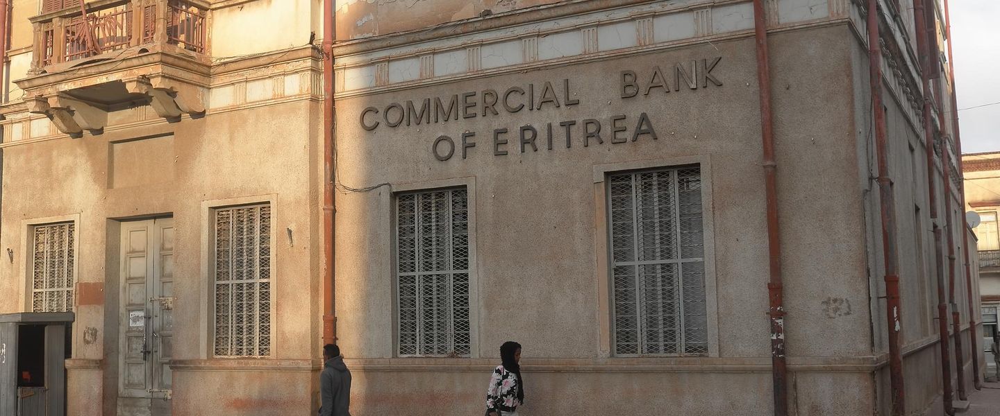


Explore Gash-Barka, Eritrea, for seasonal rivers, western lowland landscapes, rural markets, diverse communities and a rarely visited frontier region.
Landscape and Regional Character
Gash-Barka occupies much of western Eritrea, stretching across a broad lowland landscape towards the borders with Sudan and Ethiopia. Its name reflects two important rivers: the Gash, which flows north-westwards through the region, and the Barka, whose seasonal waters support cultivation and pastoral life. The terrain changes from dry plains and thorn scrub to riverine vegetation, cultivated fields and low escarpments. Rainfall is strongly seasonal, and the appearance of the countryside can alter considerably between the dry months and the brief rains.Read more about Gash-Barka Region
Communities and History
Visiting the Western Lowlands
When is the best time to visit Gash-Barka Region?
Best: March, October–November · 24–27°C| Month | High (°C) | Rainfall (mm) |
|---|---|---|
| January | 21 | 1 |
| February | 22 | 1 |
| March (best) | 25 | 2 |
| April | 27 | 2 |
| May | 28 | 3 |
| June | 29 | 4 |
| July | 30 | 3 |
| August | 30 | 3 |
| September | 29 | 2 |
| October (best) | 27 | 2 |
| November (best) | 24 | 1 |
| December | 21 | 1 |
Getting to and around Gash-Barka Region
How to get there
Transportation
Best attractions in Gash-Barka Region
Gash-Barka’s attractions are primarily landscapes, settlements and living cultural environments rather than built visitor sites. The seasonal Gash and Barka river valleys provide the region’s defining scenery, with cultivated floodplains, rough grassland, thorn scrub and broad, intensely open horizons that change after the rains. Barentu offers the most practical introduction to the region’s communities, markets and administrative life, while Agordat is associated with the historic inland railway route and the agricultural landscape around the Barka valley. Tessenei, farther west, is an important commercial settlement near the Sudanese frontier, although travel towards border areas requires careful attention to authorisation and current security advice. Rural journeys may reveal traditional compounds, livestock movements, wells and cultivation, but these are working environments rather than formal attractions. Visitors should arrange local guidance before exploring outside the main towns and should not assume that riverbanks, roads, borderlands or community areas are freely accessible.
-
Tourist attraction
Fiat Tagliero ፡ፍያት ታሌሮ
Explore the architectural gem of Fiat Tagliero in Asmara, Eritrea, where modernism meets historical significance.
-
Tourist attraction
ኣስመራ ካቴድራል | Cathedral Our Lady of the Rosary
Experience the architectural splendor and spiritual tranquility of Cathedral Our Lady of the Rosary, a must-see attraction in Asmara, Eritrea.
-
Tourist attraction
Akria
Explore Akria in Asmara, Eritrea – a stunning tourist attraction showcasing unique architecture and rich cultural heritage.
-
Tourist attraction
ዲጋ ሰሞሞ(Semomo Dam)
Explore the beauty of Semomo Dam in Adi Kuala, Eritrea, where nature and tranquility meet in a stunning landscape.


Best landmarks in Gash-Barka Region
The Gash and Barka rivers are Gash-Barka’s principal natural landmarks, not because they are continuously flowing waterways but because their seasonal channels and floodplains have shaped settlement, cultivation and movement across the western lowlands. Agordat’s historic railway connection is the region’s most recognisable transport heritage, recalling the line that once linked Eritrea’s interior with Keren, Asmara and the Red Sea coast, although surviving railway infrastructure should be viewed cautiously and not assumed to be maintained as a visitor site. Barentu and Tessenei are significant regional landmarks in a broader cultural and geographic sense: both represent the importance of market towns in a sparsely serviced frontier landscape. Wells, cultivated river margins, traditional compounds and seasonal grazing routes are also meaningful features, but they remain working places where access and photography require local permission.
-
Historical landmark
Fiat Tagliero ፡ፍያት ታሌሮ
Explore the Fiat Tagliero in Asmara, Eritrea – a stunning modernist architectural landmark that embodies the spirit of innovation and history.
-
Catholic cathedral
ኣስመራ ካቴድራል | Cathedral Our Lady of the Rosary
Experience the architectural beauty and serene ambiance of Cathedral Our Lady of the Rosary in Asmara, a must-visit cultural landmark in Eritrea.
-
Museum
National Museum of Eritrea
Uncover the rich history and culture of Eritrea at the National Museum of Eritrea, a must-visit destination in Asmara for all history enthusiasts.
-
Promenade
Mai jah jah
Explore the beauty of Eritrea at Mai jah jah Promenade, a scenic pathway in Asmara that blends nature, culture, and tranquility.


Explore Gash-Barka Region on the map
Plan your trip on one map. See where the top attractions, landmarks, restaurants and hotels are, and book hotels and experiences in a few clicks.
Best hotels in Gash-Barka Region
Best restaurants in Gash-Barka Region
Dining in Gash-Barka is modest and concentrated in Barentu, Agordat, Tessenei and other larger settlements rather than distributed through the countryside. Local meals commonly reflect Eritrea’s wider culinary traditions, including injera served with stews, pulses, vegetables or meat, as well as bread, tea and coffee. The western lowlands also have foodways shaped by pastoralism, seasonal cultivation and cross-border exchange, although the availability of particular dishes varies between communities and markets. Simple cafés and locally run eateries are more realistic expectations than a developed restaurant scene, and supplies may be limited outside the main towns. Travellers undertaking long road journeys should carry dependable provisions and drinking water rather than relying on finding food at isolated points. Visitors should follow local customs around communal meals, fasting periods and eating with the right hand where appropriate.
-
Restaurant
Ghibabo Restaurant And Pizzeria
Discover authentic Eritrean flavors and delightful pizzas at Ghibabo Restaurant And Pizzeria in Asmara – a true culinary treasure.
-
Restaurant
Spaghetti And Pizza House
Experience the best of Eritrean and Italian cuisine at Spaghetti And Pizza House in Asmara - a culinary delight not to be missed.
-
Eritrean
Golden Fork Fast Food
Experience authentic Eritrean cuisine at Golden Fork Fast Food in Asmara - where every dish is packed with flavor.
-
Italian
Al Sicomoro Restaurant
Experience authentic Italian cuisine at Al Sicomoro Restaurant in Asmara, Eritrea - where every meal is a celebration of flavor.


Best bars in Gash-Barka Region
Gash-Barka has little conventional nightlife, and visitors should not expect nightclubs, entertainment districts or a dependable programme of evening performances. In Barentu, Agordat and Tessenei, evenings are more likely to centre on quiet cafés, tea and coffee gatherings, informal conversation and the social life of local streets, subject to local custom and current conditions. Some accommodation or town establishments may provide a simple place to sit, but opening arrangements and alcohol availability should never be assumed. Outside the main settlements, darkness, limited transport and sparse services make evening movement impractical, while border and official areas require particular caution. Cultural events, weddings and community occasions may be important locally, but they are private or occasional rather than scheduled tourist entertainment and should only be attended by invitation.
-
 Bar
Bar selam ባር ሰላም ( እንዳ ሳባ)
Experience the vibrant nightlife of Eritrea at Bar Selam, a beloved bar in Adi Kontsi known for its welcoming atmosphere and local drinks.
-
Bar
Goitom's Bar and Restaurant
Discover the vibrant taste of Eritrea at Goitom's Bar and Restaurant, a lively spot in Asmara for local cuisine and delightful drinks.
-
Bar
Bar Kebedesh
Discover the vibrant atmosphere of Bar Kebedesh in Asmara, where local flavors and lively culture come together in an unforgettable bar experience.
-
Bar
Awtisti
Experience the vibrant nightlife at Awtisti, Barentu's premier bar for drinks, music, and local culture!

Best nightclubs in Gash-Barka Region
Gash-Barka has little conventional nightlife, and visitors should not expect nightclubs, entertainment districts or a dependable programme of evening performances. In Barentu, Agordat and Tessenei, evenings are more likely to centre on quiet cafés, tea and coffee gatherings, informal conversation and the social life of local streets, subject to local custom and current conditions. Some accommodation or town establishments may provide a simple place to sit, but opening arrangements and alcohol availability should never be assumed. Outside the main settlements, darkness, limited transport and sparse services make evening movement impractical, while border and official areas require particular caution. Cultural events, weddings and community occasions may be important locally, but they are private or occasional rather than scheduled tourist entertainment and should only be attended by invitation.
-
Bar
Bar Jima
Discover the lively atmosphere of Bar Jima, a premier bar in Asmara, Eritrea, offering an eclectic drink selection and vibrant nightlife.
-
Bar
Bar Zara
Discover the vibrant atmosphere and local flavors at Bar Zara, the heart of Asmara's nightlife, where every sip tells a story.
-
Bar
Awtisti
Discover the vibrant atmosphere and local flavors at Awtisti in Barentu, Eritrea – your perfect bar getaway for relaxation and cultural immersion.
-
Bar
Itaro club
Discover the lively atmosphere of Itaro Club in Asmara, Eritrea, where local culture meets vibrant nightlife in an unforgettable bar experience.

Best shops in Gash-Barka Region
Shopping in Gash-Barka is concentrated in town markets and small commercial streets rather than formal retail districts. Barentu, Agordat and Tessenei are the most useful places to look for everyday goods, food supplies, clothing, household items and locally traded agricultural or livestock products. Markets also provide an opportunity to observe the region’s cultural diversity, although photography and close attention to traders require permission and sensitivity. Visitors may encounter regional textiles, woven items, leather goods or handmade household objects, but availability varies and products should not be presented as standardised souvenirs. Remote villages have few dedicated shops, so travellers should buy fuel-related necessities, water, medicines and provisions in larger settlements where possible. Bargaining customs differ, and respectful, unhurried transactions are more appropriate than treating working markets as staged tourist displays.
-
Electronics store
Akile Shop
Explore the latest electronics at Akile Shop in Barentu, Eritrea – a top destination for tech enthusiasts and travelers alike.
-
Bakery
Koyta Bakery
Discover the authentic flavors of Eritrea at Koyta Bakery in Barentu, where every bite tells a story of tradition and culture.
-
Shopping mall
Dukan gal TaLa
Discover the vibrant shopping experience at Dukan gal TaLa, where local culture meets modern retail in Shambiko, Eritrea.
-
Home goods store
Every Thing For The House
Explore a diverse range of local home goods, from textiles to pottery, at Every Thing For The House in Asmara, Eritrea.

Get your free copy of our complete guide to Gash-Barka Region, delivered straight to you.
Everything on this page, from attractions and restaurants to essentials and local phrases, in one PDF you can read offline, print or share.
Already have an account? Sign in
Your Gash-Barka Region guide is ready.
We'll send it to · Not you? Sign out

Getting your guide ready…
We are putting together a fresh copy of the Gash-Barka Region guide. This can take up to a minute.
This can take a few moments. If your browser asks, choose Allow so the download can start. You'll find the guide in your Downloads folder.
Nothing happened? Download it again
Sorry, the guide is taking longer than usual. Please try again in a minute, or get it by email instead.
Gash-Barka Region essentials
Currency and Payment
Safety
Emergency Situations
Do's and Don'ts
Local Tips
From Eve
Local phrases worth knowing
You don't need to get them perfect. A few words go a long way, and locals appreciate the effort.
Basics
| English | Local | Say it |
|---|---|---|
| Hello | ሰላም | [selam] |
| Goodbye | ዝንቅብ | [zenkib] |
| Yes | እወ | [ew] |
| No | ኣይ | [ay] |
| Please/You're welcome | እንፈልጥ/እወ ነገር ክሳብ | [enflet/ew negere kisab] |
| Thank you | ኣመሰግና | [amesegnna] |
| Excuse me/Sorry | ኣስሓሕካ/ስእል፡ወልደር። | [ashahka/sel weleder] |
| How are you? | እንቋዕ ናብ እዩ? | [enkhaa nab eyu] |
| Fine. And you? | ኣለኹን። እዩ። | [alekun. eyu] |
| Do you speak English? | ናብዚም እንግሊዝ እዩ? | [nabzim engliz eyu] |
| I don't understand | ኣንቓዕ፡ኣብዚም | [ankaa abzim] |
Eating & Drinking
| English | Local | Say it |
|---|---|---|
| I'd like to see the menu, please | ናሕበት ምእታይ እዩ ሓንቲ። | [nahbet me'etay eyu hanti] |
| I don't eat meat | ምምልካ ኣምላኽ መስከረ። | [mmelka amlak mesker] |
| Cheers! | ብደምሳይ! | [bdamsey] |
| I would like to pay, please | ናሕበት ክሳብ እዩ ሓንቲ። | [nahbet kisab eyu hanti] |
Emergencies
| English | Local | Say it |
|---|---|---|
| Help! | እውን! | [ewen] |
| Go away! | በባሕ! | [bebah] |
| Call the Police! | ክብርቲ ፖለስ እዩ! | [kiberti polis eyu] |
| Call a doctor! | ክብርቲ ሜድር እዩ! | [kiberti medir eyu] |
| I'm lost | እፍላለን። | [eflalen] |
| I'm ill | እንዲያ ኣምሕ። | [endia amh] |
Shopping
| English | Local | Say it |
|---|---|---|
| I'd like to buy... | ናሕበት ገብረ። | [nahbet gaber] |
| I'm just looking | ብርጭሓት ክምረጽ፡ካብታል። | [bruchaht kemerets kabtal] |
| How much is it? | በዚ መብርሂ? | [bezi mabrihi] |
| That's too expensive | እንቓዕ ብርሂ ነገር። | [enkhaa b'ri negere] |
| Can you lower the price? | ይብሉኽ ክሳብ እዩ። | [yebeluk kisab eyu] |
Time & Numbers
| English | Local | Say it |
|---|---|---|
| What time is it? | ስእለት ኣብዚ መቐለ? | [sellet abzi meqle] |
| It's one o'clock | ኣነ ሰንበት ክሳብ። | [an s'nbet kisab] |
| Half past (10) | ሰላም ኣብዚ ትንሽ። | [selam abzi t'ensh] |
| Morning | መወዳእታት | [mewdattat] |
| Afternoon | ምቅዝጢ | [mekzi] |
| Evening | ምሕተታት | [mhetetat] |
| Yesterday | ትሽነራት | [tishenrat] |
| Today | እምነት | [emnet] |
| Tomorrow | ስምንት | [semnet] |
| 1 | ኣነ | [an] |
| 2 | ርብዒ | [r'bi] |
| 3 | ሥጋሕ | [s'gah] |
| 4 | ኣሕሽ | [ahsh] |
| 5 | ሓምለ | [hamel] |
| 6 | ሕሙም | [h'mum] |
| 7 | ሰብሓ | [sebha] |
| 8 | ሰርባ | [serba] |
| 9 | አስር | [asra] |
| 10 | ሰንበት | [s'nbet] |
Transport & Directions
| English | Local | Say it |
|---|---|---|
| Where's a/the...? | ብዝሒ ኣብዚ ወጻኢ። | [bezhi abzi wets'ai] |
| What's the address? | ብዝሒ ኣብዚ ኣዳል። | [bezhi abzi adal] |
| Can you show me (on the map)? | ይብሎ ክንሓቐስ ኣበይ። | [yeblo knhakhes abay] |
| When's the next (bus)? | እቲ ቅረብ ኣብዚ ወጻኢ። | [eti k'erb abzi wets'ai] |
| A ticket (to ....) | ትክብሳቲ እዩ። | [tkbsati eyu] |
History of Gash-Barka Region
Rivers, Plains and Early Settlement
The historical character of Gash-Barka has always been shaped by water in an otherwise dry western lowland environment. The Gash and Barka rivers are largely seasonal, but their floodplains and associated wells have supported cultivation, grazing and settlement for generations. Communities including the Kunama, Nara, Tigre and Bilen developed different ways of using the plains, river margins and surrounding grazing areas. Long before modern borders, the region formed part of a wider corridor linking the Eritrean highlands and Red Sea coast with the Sudanese and Ethiopian lowlands. Movement through this zone was influenced by rainfall, livestock, trade and access to reliable water rather than by the fixed boundaries that define it today.
Islamic Sultanates and Regional Networks
During the medieval and early modern periods, western Eritrea was connected to the political and commercial networks of the eastern Sudan, the northern Ethiopian borderlands and the Red Sea hinterland. Authority was often distributed through local rulers, pastoral communities and wider Islamic or Christian polities rather than exercised uniformly across the region. Trade in livestock, grain and other goods followed routes between market settlements and seasonal sources of water. The frontier character of Gash-Barka therefore predates the modern state: its communities were linked by commerce and migration while retaining strong local identities and distinct cultural traditions.
Italian Rule and the Agordat Railway
Italian colonial rule brought new administrative boundaries, roads and commercial priorities to the western lowlands. Agordat became particularly important as the inland terminus of the railway from Massawa through Asmara and Keren, completed during the colonial period and used to move people and goods between the coast, highlands and western interior. The railway’s decline and eventual closure changed the region’s transport pattern, leaving roads as the principal means of overland connection. Colonial development also encouraged agricultural and administrative schemes that altered land use, although their benefits and burdens were experienced unevenly by local communities.
War, Independence and Contemporary Gash-Barka
Gash-Barka was deeply affected by Eritrea’s long struggle for independence from Ethiopia, including military campaigns, displacement and disruption to agriculture and transport. After independence in 1993, the region became one of Eritrea’s administrative regions and was associated with efforts to restore farming, livestock production, roads and water infrastructure. Its location beside international borders has continued to give it strategic importance, while periodic tensions in the wider Horn of Africa have influenced access and movement. Today, the region’s historical landscape is expressed less through a concentration of monuments than through settlement patterns, working river valleys, market towns and living cultural traditions.
Gash-Barka Region in Photos
Browse through our photo collection highlighting the charm and character of the destination.
Cities in Gash-Barka Region
The towns and cities of Gash-Barka Region, and the easiest places to base yourself.
-

-

-

-
-

-


Swipe for more cities
Neighbouring destination travel guides
The closest destinations to Gash-Barka Region, if you have time for more than one.
-

-

-

-

-


Swipe for more destinations
Explore more
Explore more of Gash-Barka
Explore Gash-Barka’s seasonal rivers, western lowlands, market towns and diverse cultures through carefully planned overland travel in Eritrea.
Explore Gash-Barka
Explore more of Eritrea
Discover Eritrea: A land of ancient history, stunning coastlines, and vibrant cultures nestled in the heart of the Horn of Africa.
Explore Eritrea