
Chemin des Muletiers: A Volcanic Ascent
Hike the historic Chemin des Muletiers to the summit of Puy de Dôme for panoramic views of Auvergne's volcanic landscape and a glimpse into Gallo-Roman history.
The Chemin des Muletiers, or muleteers' path, is a historic trail ascending the Puy de Dôme, the highest volcano in the Chaîne des Puys in France's Auvergne region. Dating back to Gallo-Roman times, this path was once used by pilgrims journeying to the Temple of Mercury at the summit. Today, it offers hikers a moderately challenging but rewarding climb with panoramic views of the surrounding volcanic landscape. The well-maintained path winds through forests and open slopes, providing a unique opportunity to experience the natural beauty and geological significance of this UNESCO World Heritage site. Be prepared for a steep ascent and changing weather conditions, but the stunning vistas from the top are well worth the effort. The path is a testament to the region's rich history and geological wonders, making it a must-do for any visitor to the Auvergne.
A brief summary to Chemin Des Muletiers
- Ceyssat, 63870, FR
Local tips
- Wear sturdy hiking boots as the path is steep and can be slippery, especially after rain.
- Bring layers of clothing, as the weather at the summit can change quickly and be significantly cooler than at the base.
- Start your hike early in the morning to avoid crowds, especially during peak season (summer months).
Getting There
-
Driving
From Ceyssat, follow the D68 road towards the Col de Ceyssat. The Chemin des Muletiers trailhead is located at the Col de Ceyssat parking area. Parking is free but can be limited during peak season; arrive early. Overflow parking is available along the D68, but avoid obstructing traffic. Note that parking overnight is prohibited.
-
Public Transport
From Clermont-Ferrand, take the shuttle bus to the Panoramique des Dômes station. From there, you can walk to the Col de Ceyssat (approximately 6km) to access the Chemin des Muletiers trailhead. The shuttle bus operates from April to October and is free on weekends. A regular bus ticket is required on weekdays.
-
Walking
From the Panoramique des Dômes station, follow the signs towards the Col de Ceyssat. The walk is approximately 6km and takes around 1.5 to 2 hours. Be prepared for a gradual incline along the road.
Discover more about Chemin Des Muletiers
Iconic landmarks you can’t miss
Creux de la Berté
0.9 km
Discover the dramatic landscapes of Creux de la Berté, a volcanic crater in Ceyssat offering panoramic views and unique geological experiences.
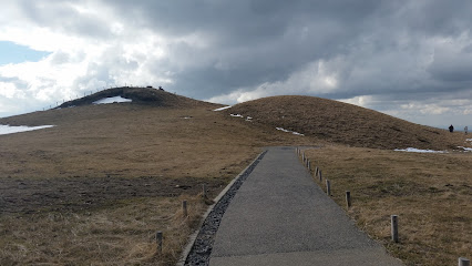
Puy des Goules
4.6 km
Discover the breathtaking landscapes and scenic trails of Puy des Goules, a mountain peak perfect for outdoor adventures in Orcines, France.
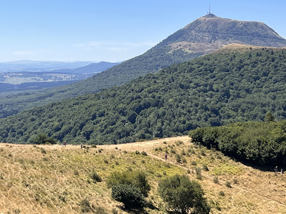
Statue of Vercingetorix
9.5 km
A bronze equestrian statue in Clermont-Ferrand's Place de Jaude, honoring Vercingetorix, the Gallic leader who defied Julius Caesar.

Cathedral of Our Lady of the Assumption
9.8 km
Discover Clermont-Ferrand's iconic Gothic cathedral, a striking masterpiece built from black lava stone with soaring spires and stunning stained glass.

Frac Auvergne
9.9 km
Explore contemporary art at FRAC Auvergne in Clermont-Ferrand: exhibitions, workshops, and a diverse collection await!

Route Historique des Châteaux d'Auvergne
10.1 km
Discover the historical and architectural treasures of Auvergne through its magnificent châteaux and fortresses. Explore themed routes and experience French history.

L'Aventure Michelin
11.6 km
Discover over 130 years of innovation at L'Aventure Michelin, exploring the history, technology, and cultural impact of the iconic Michelin brand.

Basilica of Notre-Dame in Orcival
13.3 km
Discover the spiritual and architectural grandeur of the Basilica of Notre-Dame in Orcival, a Romanesque treasure in the heart of Auvergne.

Vierge de Monton
18.3 km
Majestic Virgin Mary statue overlooking the Auvergne landscape, offering panoramic views and a rich history.

Auvergnetournage
32.8 km
Explore the artistic heart of Auvergne at Auvergnetournage, a unique destination blending local craftsmanship and culture in a picturesque setting.

Abbatiale Saint Austremoine
33.7 km
Discover the Romanesque splendor of Abbatiale Saint-Austremoine in Issoire, a vibrant testament to Auvergne's rich history and artistic heritage.
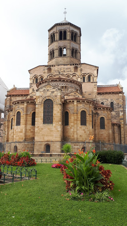
Château de Parentignat
36.8 km
Discover the 'Little Versailles of Auvergne' at Château de Parentignat, a preserved 18th-century estate with master paintings and English gardens.

Château d'Aulteribe
41.8 km
Discover a treasure trove of French history and artistry at Château d'Aulteribe, one of France's best-furnished castles in the heart of Auvergne.
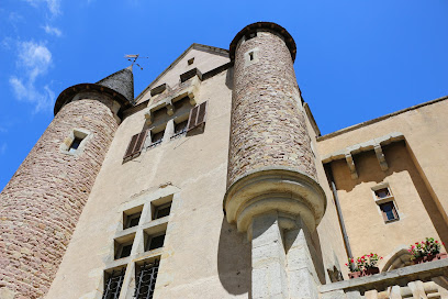
Abbaye de la Chaise-Dieu
76.0 km
Discover a medieval architectural gem in the heart of Auvergne, France, with Gothic art, a rich history, and a serene atmosphere.
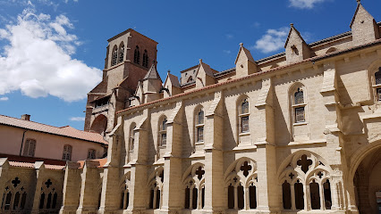
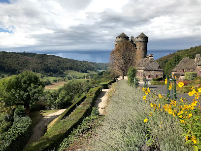
Anjony Castle
88.0 km
Explore Anjony Castle: A majestic medieval fortress with stunning frescoes and rich history in the heart of the Cantal region of France.
Unmissable attractions to see
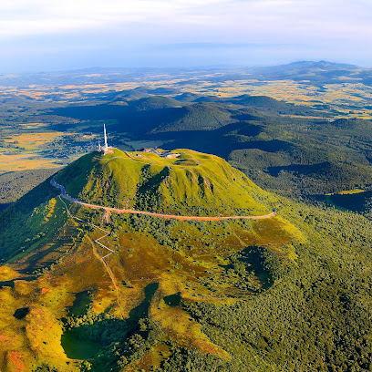
Puy de Dôme
0.4 km
Ascend to the summit of Puy de Dôme for breathtaking panoramic views of the Chaîne des Puys, a UNESCO World Heritage site, and explore the rich history and natural beauty of this iconic volcano.
Temple of Mercury
0.4 km
Explore the ruins of the Gallo-Roman Temple of Mercury atop Puy de Dôme, offering panoramic views of the Chaîne des Puys and a glimpse into ancient history.
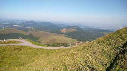
Panoramic Domes
2.1 km
Ascend to the summit of Puy de Dôme via an electric rack railway for breathtaking panoramic views of the Chaîne des Puys, a UNESCO World Heritage site, and explore Roman ruins.

Escalier Puy Pariou
2.7 km
Hike to the summit of Puy Pariou, an iconic volcano in Auvergne, and witness breathtaking panoramic views from its crater rim, a symbol of the region's volcanic heritage.
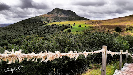
Puy Pariou
3.2 km
Hike to the summit of Puy Pariou, an iconic volcano in Auvergne's Chaîne des Puys, and witness breathtaking panoramic views of this UNESCO World Heritage landscape.

Vulcania
5.1 km
Explore the thrilling world of volcanoes and Earth's natural wonders at Vulcania, an unforgettable science and amusement park nestled in the heart of the Auvergne Volcanoes.

Dragon Ride 2 à Vulcania
5.2 km
Explore the thrilling world of volcanoes, natural phenomena, and planet Earth at Vulcania, an immersive amusement park in the heart of the Auvergne Volcanoes Regional Natural Park.

Planetarium De Vulcania
5.2 km
Embark on an unforgettable cosmic journey at Planetarium De Vulcania, France's largest planetarium, offering immersive shows, interactive exhibits, and a deep dive into the wonders of space and Earth.

Volcan de Lemptégy
5.3 km
Explore the stunning Volcan de Lemptégy in the heart of France's volcanic landscape, offering adventure and education for all ages.

Namazu à Vulcania
5.3 km
Explore the mysteries of volcanoes, natural phenomena, and planet Earth at Vulcania, an immersive amusement park in the heart of the Auvergne volcanoes, a UNESCO World Heritage site.
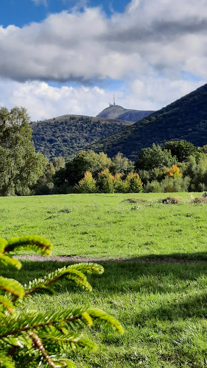
Puy de Lemptégy
5.5 km
Explore the heart of a real volcano at Puy de Lemptégy in Auvergne, France. Discover its geological secrets and industrial past on guided tours and immersive experiences within a UNESCO World Heritage site.
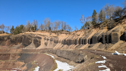
Puy de Gravenoire
7.2 km
Hike to the summit of Puy de Gravenoire near Royat for panoramic views of Clermont-Ferrand, the Chaîne des Puys, and the Limagne Fault, experiencing Auvergne's volcanic landscape.
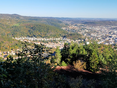
Parc naturel régional des Volcans d'Auvergne
8.4 km
Discover the breathtaking volcanic landscapes of Auvergne, France. Hike dormant peaks, explore serene lakes, and immerse yourself in the region's rich history and culture.
Parc Montjuzet
9.0 km
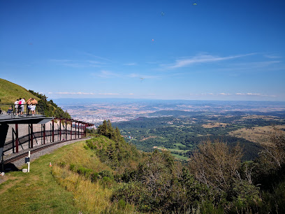
Discover panoramic views and lush gardens at Parc Montjuzet in Clermont-Ferrand, a historic park offering a green escape with recreational activities and artistic treasures for all ages.

Ruine Du Chateau De Montrognon
10.2 km
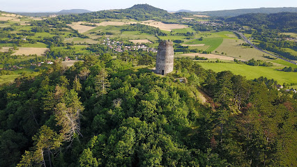
Explore the historic Ruine du Château de Montrognon in Ceyrat for panoramic views of Clermont-Ferrand and a glimpse into Auvergne's medieval past, offering a tranquil escape.
Essential places to dine
Le Resto d'Epicure
0.2 km
Discover gourmet dining with breathtaking views at Le Resto d'Epicure on Puy de Dôme - where every bite celebrates local flavors.

Archipel Volcans
2.8 km
Experience comfort and exquisite French cuisine at Archipel Volcans in Saint-Gènes-Champanelle - your gateway to nature's beauty.

Auberge de la moreno
3.2 km
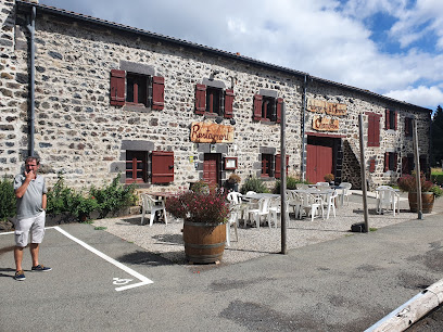
Experience authentic French cuisine in the stunning surroundings of Saint-Gènes-Champanelle at Auberge de la Moreno.
Logis Auberge de la Moréno
3.2 km
Discover the charm of Logis Auberge de la Moréno - your gateway to exploring the stunning Auvergne region with comfort and style.

ESPACE VOLCAN
3.3 km
Explore Auvergne's stunning volcanic landscapes from ESPACE VOLCAN - your comfortable base for adventure and relaxation.

Le Village Auvergnat
3.4 km
Savor authentic French cuisine in Orcines at Le Village Auvergnat – where tradition meets flavor in every dish.

Le Petit Casse Graine
3.8 km
Experience authentic French cuisine at Le Petit Casse Graine in Orcines, where local flavors meet traditional recipes for an unforgettable meal.
Auberge de la Baraque
4.9 km
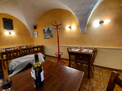
Discover exquisite Haute French cuisine at Auberge de la Baraque in Orcines, where every meal is a celebration of local flavors and culinary excellence.

Le Relais des Puys, Logis
4.9 km
Experience authentic French hospitality at Le Relais des Puys in Orcines—your perfect blend of comfort and exquisite dining awaits.

Comptoir du cratère
5.2 km
Enjoy delicious fast food amidst breathtaking landscapes at Comptoir du Cratère in Saint-Ours.

Restaurant du Volcan de Lemptégy
5.3 km
Experience authentic French cuisine amidst stunning volcanic landscapes at Restaurant du Volcan de Lemptégy.

Hôtel Restaurant Volcan Sancy
7.1 km
Discover comfort and exceptional cuisine at Hôtel Restaurant Volcan Sancy in scenic Nébouzat, surrounded by stunning volcanic landscapes.
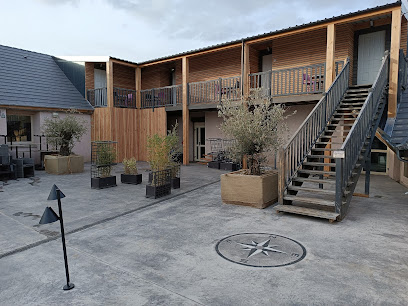
La Belle Meunière Hôtel & Restaurant Gastronomique
7.2 km
Discover La Belle Meunière: An exquisite hotel and gastronomic experience in Royat offering haute French cuisine and elegant accommodations.

La Flèche d'Argent
7.4 km
Experience modern French haute cuisine at La Flèche d'Argent in Royat – where culinary artistry meets exquisite dining.

Restaurant Le Pré
7.5 km
Experience culinary artistry at Restaurant Le Pré in Durtol—where exquisite flavors meet elegant ambiance for an unforgettable dining experience.

Markets, malls and hidden boutiques
Boutiques du puy de Dôme
2.2 km
Explore Boutiques du Puy de Dôme for exquisite gift baskets filled with local delicacies, perfect for souvenirs or a personal treat.

Boutique Auvergne à Vulcania
5.2 km
Explore Boutique Auvergne for authentic local souvenirs and crafts within the enchanting Vulcania amusement park, a must-visit for every traveler.

Le Comptoir Irlandais Clermont-Ferrand
9.2 km
Discover the heart of Irish culture at Le Comptoir Irlandais in Clermont-Ferrand, a unique gift shop offering clothing, gourmet foods, and more.

L'Adresse Boutique
9.3 km
Explore L'Adresse Boutique in Clermont-Ferrand for unique women's fashion that blends elegance and contemporary style, perfect for any occasion.

Nos belles choses
9.4 km
Discover the charm of vintage elegance at Nos Belles Choses, Clermont-Ferrand's premier antique furniture store, where each piece tells a story.

Centre Jaude
9.5 km
Experience shopping, dining, and entertainment at Centre Jaude, the vibrant heart of Clermont-Ferrand's retail scene.

Galeries Lafayette Clermont
9.5 km
Discover the charm of Galeries Lafayette Clermont, a shopping paradise offering fashion, beauty, and unique finds in the heart of Clermont-Ferrand.

Very Nice Things
9.8 km
Discover the perfect blend of fashion and interior design at Very Nice Things, a stylish women's clothing store in Clermont-Ferrand.

AFK Shopping
9.8 km
Discover unique gifts and local treasures at AFK Shopping in Clermont-Ferrand, a delightful gift shop filled with charm and creativity.

Clermont Auvergne Volcanoes Office De Clermont-Ferrand
9.8 km
Discover the Clermont Auvergne Volcanoes Office, your gateway to exploring breathtaking volcanic landscapes and rich cultural heritage in the heart of Auvergne.

La Galerie Nacarat
12.6 km
Explore La Galerie Nacarat in Clermont-Ferrand, a shopping mall featuring diverse boutiques, dining options, and entertainment for an unforgettable experience.

La Coop des Dômes
12.9 km
Experience the essence of Auvergne at La Coop des Dômes, your one-stop destination for local flavors and artisanal products.

VOLCANIC CYCLES
15.5 km
Experience the beauty of Enval with Volcanic Cycles, your go-to bicycle store for thrilling biking adventures in France's stunning landscapes.

Le Store Auvergnat
17.1 km
Elevate your living spaces with exquisite window treatments at Le Store Auvergnat in Tallende, France.

Stores de France
17.4 km
Explore the exquisite window treatments at Stores de France, Cournon-d'Auvergne, where elegance meets functionality.

Essential bars & hidden hideouts
Mojitos bar
9.2 km
Experience the vibrant nightlife at Mojitos Bar in Clermont-Ferrand, where fresh mojitos and lively atmosphere await you.

The Viking Pub Counter
9.3 km
Experience the vibrant ambiance of The Viking Pub Counter, Clermont-Ferrand's charming destination for local brews and hearty meals.

Un Singe en Hiver
9.3 km
Experience the charm of Clermont-Ferrand at Un Singe en Hiver, a delightful wine bar and bistro offering a curated selection of local wines and exquisite cuisine.

Les BerThoM
9.5 km
Experience the vibrant nightlife of Clermont-Ferrand at Les BerThoM, a bar that combines charm, great drinks, and a lively atmosphere.

LA BAMBOCHE - BAR CLERMONT-FERRAND
9.5 km
Discover the lively ambiance of La Bamboche in Clermont-Ferrand, where drinks flow and karaoke lights up the night!

Le Coq Argenté
9.6 km
Discover the essence of Clermont-Ferrand at Le Coq Argenté, a vibrant bar offering exquisite drinks and a lively local atmosphere.

Delirium Café
9.6 km
Discover Delirium Café in Clermont-Ferrand, a vibrant beer hall offering an extensive selection of brews in a lively and welcoming atmosphere.

Le Distil
9.6 km
Discover Le Distil, Clermont-Ferrand's charming wine bar, where exquisite local and international wines await in a cozy, inviting atmosphere.

Le Chapelier Toqué
9.6 km
Experience the vibrant atmosphere of Le Chapelier Toqué, a beloved bar in Clermont-Ferrand offering a delightful selection of beverages.

Le Sankito
9.6 km
Experience the excitement of darts and vibrant nightlife at Le Sankito, the premier dart bar in Clermont-Ferrand.

L’Arrozoir
9.6 km
Experience the vibrant nightlife at L'Arrozoir, Clermont-Ferrand's premier cocktail bar, offering creative drinks and a lively atmosphere.

Le Charleston
9.6 km
Experience vibrant nightlife at Le Charleston, Clermont-Ferrand’s top cocktail bar offering innovative drinks in a lively atmosphere.

Le Bacchus
9.7 km
Experience the vibrant nightlife of Clermont-Ferrand at Le Bacchus, a cozy bar known for its exquisite drinks and lively ambiance.

The Salvation Jane Pub
9.7 km
Discover the lively ambiance and unique craft beers at The Salvation Jane Pub in Clermont-Ferrand, a perfect spot for tourists seeking local culture.

Les canailles
9.8 km
Discover the exquisite world of wines at Les Canailles, a charming wine bar in Clermont-Ferrand offering a delightful selection and warm ambiance.

Nightclubs & after hour spots
Modjo Club
9.3 km
Discover the vibrant nightlife of Clermont-Ferrand at Modjo Club, where music, dance, and excitement await every night.

Bombshell
9.4 km
Discover Clermont-Ferrand's nightlife at Bombshell, an electrifying night club perfect for dancing, drinks, and unforgettable memories.

Otherside
9.4 km
Discover the vibrant nightlife of Clermont-Ferrand at Otherside Night Club, where music and energy create an unforgettable experience.

Le them's
9.4 km
Dive into the vibrant nightlife at Le Them's, Clermont-Ferrand's must-visit disco club for an unforgettable party experience.

Le Middle Night
9.4 km
Discover the electric nightlife of Clermont-Ferrand at Le Middle Night, the ultimate disco club for music lovers and party enthusiasts.

Private Club
9.6 km
Experience the vibrant nightlife at Private Club, Clermont-Ferrand's premier destination for dancing, drinks, and unforgettable memories.

One o One 101
9.6 km
Dive into the heart of Clermont-Ferrand's nightlife at One o One 101, where dance, music, and unforgettable moments await.

LE FROG
9.6 km
Discover the vibrant nightlife at Le Frog in Clermont-Ferrand, a disco club where you can dance, socialize, and enjoy great music until dawn.

The Baraka Club
10.1 km
Discover Clermont-Ferrand's nightlife at The Baraka Club, where vibrant beats and fun times come together in a lively disco atmosphere.

Zyzy Folies
11.3 km
Experience the vibrant nightlife of Clermont-Ferrand at Zyzy Folies, where music, cocktails, and fun come together for an unforgettable evening.

L'Usine
12.8 km
Discover the vibrant nightlife of Clermont-Ferrand at L'Usine, a premier disco club with electrifying music and a lively atmosphere.

Cap Club
13.7 km
Experience the vibrant nightlife at Cap Club in Aubière, where music and dance come together for a memorable night out.

Taverne de la chienne
45.5 km
Discover the vibrant nightlife of Puy-Guillaume at Taverne de la Chienne, a lively night club perfect for dancing and socializing.

Discothèque La Prade
58.5 km
Discover the vibrant nightlife at Discothèque La Prade in Champagnat, France—a must-visit for tourists seeking an unforgettable clubbing experience.

Le Number NightClub
63.4 km
Unleash your energy at Le Number NightClub in Aubusson, where the nightlife pulses with rhythm and excitement until dawn.


