

Hells Canyon National Recreation Area Travel Guide - Free Web & App
Your ultimate guide to Hells Canyon National Recreation Area. Discover top landmarks, proposed trips, and local tips. Free on the web or via the Evendo companion app.


Hells Canyon National Recreation Area in Idaho offers deep river scenery, Seven Devils hiking, wildlife, boating and rugged Western history.
A Canyon of Exceptional Scale
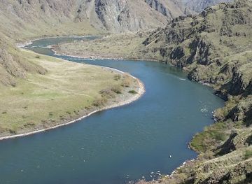
Hells Canyon National Recreation Area occupies a remote stretch of the Snake River along the Idaho–Oregon border, with the Idaho side rising towards the Seven Devils Mountains. The river has cut deeply through dark volcanic rock, creating a long, convoluted gorge whose walls descend from high mountain ridges to the water below. Although the recreation area crosses the state line, Idaho provides the defining eastern rim, river access points and mountain approaches. Roads are widely dispersed, and the landscape feels more like a broad backcountry region than a single attraction.Read more about Hells Canyon National Recreation Area
River, Mountains and Human History
Gateway Settlements and Access
When is the best time to visit Hells Canyon National Recreation Area?
Best: May–June, September · 22–29°C| Month | High (°C) | Rainfall (mm) |
|---|---|---|
| January | 6 | 40 |
| February | 10 | 35 |
| March | 13 | 31 |
| April | 18 | 26 |
| May (best) | 22 | 21 |
| June (best) | 29 | 15 |
| July | 33 | 11 |
| August | 32 | 12 |
| September (best) | 26 | 18 |
| October | 19 | 25 |
| November | 11 | 35 |
| December | 6 | 39 |
Getting to and around Hells Canyon National Recreation Area
How to get there
Transportation
Best attractions in Hells Canyon National Recreation Area
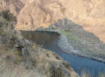
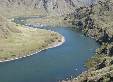
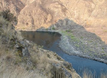
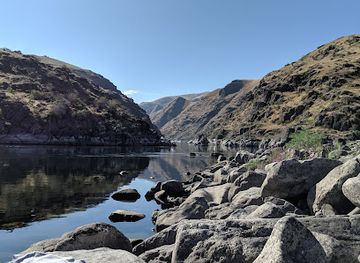
The Snake River is the central attraction, flowing through the canyon between high Idaho and Oregon walls and creating opportunities for boating, fishing, wildlife observation and scenic river travel. On the Idaho side, Pittsburg Landing provides access to the river corridor and the lower reaches of the recreation area, while roads and trails lead towards the Seven Devils, whose high ridges and glacially shaped terrain contrast with the dry canyon floor. Hells Canyon Wilderness offers remote hiking country rather than developed roadside sightseeing, and historic ranches, cabins and mining traces reveal how isolated communities once used the landscape. Reservoir scenery is associated with the Hells Canyon Complex, whose dams and impounded waters form a modern counterpoint to wilder stretches of river. In the north, Lewiston and Clarkston serve as practical gateways, while Riggins and White Bird provide access to different Idaho approaches; viewpoints and attractions on the Oregon rim should be treated as separate excursions rather than assumed to be reachable directly from Idaho.
-
Vista point
Hells Canyon Overlook
Discover the breathtaking vistas and rugged beauty of Hells Canyon Overlook, a must-visit destination for nature lovers and adventure seekers in Oregon.
-
Tourist attraction
Hells Canyon Adventures Lodge, Warehouse, & Gift Shop
Explore the breathtaking beauty of Hells Canyon with adventure tours, fishing charters, and the warm hospitality of Hells Canyon Adventures Lodge.
-
Tourist information center
Hells Canyon Creek Visitor Center
Explore the stunning Hells Canyon Creek Visitor Center in Oregon, your gateway to adventure in North America's deepest gorge, filled with breathtaking scenery.
-
Park
Hells Canyon National Rec Area
Discover the stunning landscapes and rich wildlife of Hells Canyon National Recreation Area, a premier destination for outdoor adventures in Oregon.
Best landmarks in Hells Canyon National Recreation Area
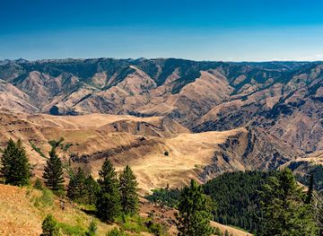
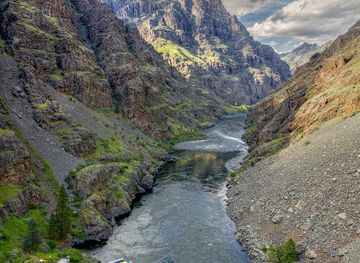
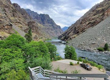
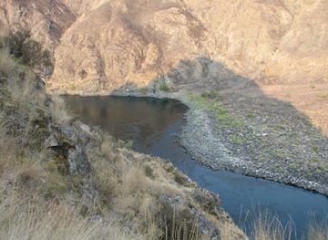
The defining natural landmark is Hells Canyon, the deeply incised Snake River gorge whose walls rise towards Idaho’s Seven Devils and Oregon’s Wallowa Mountains. Its greatest vertical relief is associated with the Seven Devils’ He Devil peak and the river below, although the gorge’s depth and character vary along its considerable length. The Snake River itself is both a geological feature and a cultural corridor, while the Hells Canyon and Oxbow dams mark the major twentieth-century transformation of its lower course. Idaho-side landmarks also include Pittsburg Landing, a long-established river access point, and historic cabins and ranch sites preserved within the wider public-land landscape. The high country of Hells Canyon Wilderness provides a contrasting landmark system of ridges, alpine basins and remote trails, while celebrated viewpoints such as Hat Point belong to the Oregon rim and should be identified as outside Idaho rather than treated as Idaho attractions.
-
Park
Hells Canyon National Rec Area
Explore Hells Canyon National Recreation Area, a stunning natural wonder in Oregon, offering breathtaking landscapes, wildlife, and outdoor adventures.
-
Tourist attraction
Hells Canyon Wilderness
Discover the unmatched beauty and adventure awaiting you in Hells Canyon Wilderness, the deepest canyon in North America, near Riggins, Idaho.
-
 Recreation
Hells Canyon National Recreation Area-Idaho
Explore Hells Canyon National Recreation Area, Idaho's stunning wilderness, featuring breathtaking landscapes, rich wildlife, and diverse outdoor activities for all adventurers.
-
Recreation
Hells Canyon National Recreation Area-Snake River
Explore Hells Canyon National Recreation Area's stunning landscapes, outdoor adventures, and rich wildlife, making it a must-visit for nature lovers.
Explore Hells Canyon National Recreation Area on the map
Plan your trip on one map. See where the top attractions, landmarks, restaurants and hotels are, and book hotels and experiences in a few clicks.
Best hotels in Hells Canyon National Recreation Area
Best restaurants in Hells Canyon National Recreation Area
There is no concentrated restaurant district within Hells Canyon National Recreation Area, and visitors exploring the Idaho side should plan meals, fuel and provisions in advance. Lewiston and Clarkston provide the broadest choice of restaurants, cafés, supermarkets and takeaway food, while Riggins and White Bird serve travellers approaching the northern and central canyon. Cambridge, Council and smaller communities towards the southern and eastern approaches offer more limited but useful places to eat, depending on the season and current opening arrangements. Regional dining reflects inland Idaho rather than a single canyon cuisine, with ranching traditions, locally sourced beef, trout and other freshwater fish where available, potatoes, berries and straightforward American café and pub cooking. Packed lunches are sensible for long road journeys, hikes and river outings, since facilities within the recreation area are dispersed and not reliably positioned near trailheads or landings.
-
Recreation
Hells Canyon National Recreation Area-Idaho
Explore Hells Canyon National Recreation Area: Idaho's breathtaking wilderness with deep gorges, abundant wildlife & endless outdoor adventures.
-
Recreation
Hells Canyon National Recreation Area-Snake River
Discover breathtaking landscapes and endless outdoor adventures at Hells Canyon National Recreation Area along the scenic Snake River.
Best bars in Hells Canyon National Recreation Area
Evening entertainment in Hells Canyon is quiet and outdoors-oriented rather than club-based. Within the recreation area, darkness, distance and limited infrastructure mean that evenings are generally spent at a campsite, cabin, river camp or rural lodging area, subject to local rules and fire restrictions. Traditional pubs, bars and casual evening venues are more likely in gateway communities such as Lewiston, Clarkston and Riggins, with smaller establishments in other approach towns offering a local, informal atmosphere rather than a late-night scene. Seasonal community events may add music or social activity, but schedules vary and should not be assumed. Visitors staying near the canyon often prioritise stargazing, listening to the river and preparing for an early trail or boating start; mobile coverage and transport options can be limited after dark.
-
Park
Hells Canyon National Recreation Area
Unveil the natural wonders of Hells Canyon National Recreation Area, a breathtaking park known for its stunning landscapes and adventurous outdoor activities.
-
Campground
Big Bar Camping Area
Discover the beauty of Idaho at Big Bar Camping Area, where adventure and tranquility meet in the heart of nature.
-
Park
Hells Canyon National Rec Area
Discover the breathtaking landscapes and thrilling adventures at Hells Canyon National Recreation Area, Oregon's premier natural wonder.
-
Historical landmark
Dug Bar
Explore Dug Bar, a historical landmark in Oregon, where nature meets the rich history of the American West. Discover your adventure today!
Best nightclubs in Hells Canyon National Recreation Area
Evening entertainment in Hells Canyon is quiet and outdoors-oriented rather than club-based. Within the recreation area, darkness, distance and limited infrastructure mean that evenings are generally spent at a campsite, cabin, river camp or rural lodging area, subject to local rules and fire restrictions. Traditional pubs, bars and casual evening venues are more likely in gateway communities such as Lewiston, Clarkston and Riggins, with smaller establishments in other approach towns offering a local, informal atmosphere rather than a late-night scene. Seasonal community events may add music or social activity, but schedules vary and should not be assumed. Visitors staying near the canyon often prioritise stargazing, listening to the river and preparing for an early trail or boating start; mobile coverage and transport options can be limited after dark.
-
Tourist attraction
Hells Canyon Wilderness
Explore Hells Canyon Wilderness, a stunning natural wonder in Idaho featuring dramatic landscapes, rich wildlife, and endless outdoor adventures.
-
Recreation
Hells Canyon National Recreation Area-Idaho
Discover the breathtaking landscapes and thrilling adventures at Hells Canyon National Recreation Area in Idaho, a must-visit for nature lovers and outdoor enthusiasts.
-
Recreation
Hells Canyon National Recreation Area-Snake River
Discover the breathtaking beauty and adventure awaiting you at Hells Canyon National Recreation Area along the stunning Snake River in Idaho.
Best shops in Hells Canyon National Recreation Area
Shopping inside Hells Canyon National Recreation Area is limited, so visitors should obtain groceries, fuel, maps, outdoor equipment and camping supplies in gateway communities. Lewiston and Clarkston have the widest range of general retail and specialist services, while Riggins, White Bird, Cambridge and Council can be useful for more local provisions depending on the route and season. Rural shops and trading posts in approach communities may carry practical supplies, regional food products, artwork and outdoor essentials rather than a large selection of souvenirs. Idaho products associated with the wider region include potatoes, locally made foods, Western-style crafts, artworks and goods produced by small farms or ranches. Visitors should not expect continuous retail facilities near remote landings or trailheads, and it is sensible to treat shopping as part of the preparation stage rather than an activity within the canyon itself.
-
Park
Hells Canyon National Recreation Area
Explore Hells Canyon National Recreation Area: A breathtaking blend of adventure, wildlife, and stunning landscapes in Oregon.
-
Recreation
Hells Canyon National Recreation Area-Idaho
Discover the breathtaking landscapes and adventure-filled activities at Hells Canyon National Recreation Area in Idaho.
-
Recreation
Hells Canyon National Recreation Area-Snake River
Discover the breathtaking beauty and adventure of Hells Canyon National Recreation Area in Idaho, where outdoor enthusiasts can explore nature's wonders.
Get your free copy of our complete guide to Hells Canyon National Recreation Area, delivered straight to you.
Everything on this page, from attractions and restaurants to essentials and local phrases, in one PDF you can read offline, print or share.
Already have an account? Sign in
Your Hells Canyon National Recreation Area guide is ready.
We'll send it to · Not you? Sign out

Getting your guide ready…
We are putting together a fresh copy of the Hells Canyon National Recreation Area guide. This can take up to a minute.
This can take a few moments. If your browser asks, choose Allow so the download can start. You'll find the guide in your Downloads folder.
Nothing happened? Download it again
Sorry, the guide is taking longer than usual. Please try again in a minute, or get it by email instead.
Hells Canyon National Recreation Area essentials
Currency and Payment
Safety
Emergency Situations
Do's and Don'ts
Local Tips
From Eve
Local phrases worth knowing
You don't need to get them perfect. A few words go a long way, and locals appreciate the effort.
Basics
| English | Local | Say it |
|---|---|---|
| Hello | Howdy | [haw-dee] |
| Goodbye | See ya | [see yah] |
| Yes | Yessir | [yes-sir] |
| No | Nah | [nah] |
| Please/You're welcome | Please and thank ya kindly | [pleez and thank yah kine-lee] |
| Thank you | Much obliged | [muhch uh-blahy-jed] |
| Excuse me/Sorry | Pardon me | [par-dn mee] |
| How are you? | Howdy | [haw-dee] |
| Fine. And you? | Just fine. How 'bout you? | [just fahyn. how bout yah] |
| Do you speak English? | Ya speak English? | [yah speak ing-glish] |
| I don't understand | I ain't catchin' yer drift | [i aint kach-in yer drift] |
Eating & Drinking
| English | Local | Say it |
|---|---|---|
| I'd like to see the menu, please | Can I take a gander at the grub list? | [can i take uh gan-der at the gruhb list] |
| I don't eat meat | I don't fancy no meat | [i dont fan-see no meat] |
| Cheers! | Bottoms up! | [bot-ums up] |
| I would like to pay, please | I reckon it's time to settle up | [i reh-kin its tahm to set-l up] |
Emergencies
| English | Local | Say it |
|---|---|---|
| Help! | Git some help! | [git sum help] |
| Go away! | Skedaddle! | [sked-uh-dl] |
| Call the Police! | Ring up the Sheriff! | [ring up the sher-iff] |
| Call a doctor! | Holler for the Doc! | [hol-er for the dok] |
| I'm lost | Done gone and lost myself | [done gone and lost myself] |
| I'm ill | Feelin' poorly | [feel-in poor-lee] |
Shopping
| English | Local | Say it |
|---|---|---|
| I'd like to buy... | I reckon I'll take... | [i reh-kin ill take] |
| I'm just looking | I'm just browsin' | [im just brow-sin] |
| How much is it? | What's the damage? | [whats the dam-ij] |
| That's too expensive | That's a might pricey | [thats a mite prahy-see] |
| Can you lower the price? | Can ya do me a solid on the cost? | [can yah do me a sah-lid on the cost] |
Time & Numbers
| English | Local | Say it |
|---|---|---|
| What time is it? | What's the hour? | [whats the ahr] |
| It's one o'clock | It's high noon | [its high noon] |
| Half past (10) | Half-past ten | [half-past ten] |
| Morning | Mornin' | [morn-in] |
| Afternoon | Afternoon | [after-noon] |
| Evening | Evenin' | [even-in] |
| Yesterday | Yest'day | [yest-day] |
| Today | Today | [to-day] |
| Tomorrow | Tomorra | [tom-or-rah] |
| 1 | One | [wun] |
| 2 | Two | [too] |
| 3 | Three | [three] |
| 4 | Four | [for] |
| 5 | Five | [fahyv] |
| 6 | Six | [siks] |
| 7 | Seven | [sev-uhn] |
| 8 | Eight | [eyt] |
| 9 | Nine | [nahyn] |
| 10 | Ten | [ten] |
Transport & Directions
| English | Local | Say it |
|---|---|---|
| Where's a/the...? | Where's the... | [wheres the] |
| What's the address? | What's the location? | [whats the loh-kay-shun] |
| Can you show me (on the map)? | Can ya point me the way? | [can yah point me the way] |
| When's the next (bus)? | When's the next ride comin'? | [whens the next rahyd com-in] |
| A ticket (to ....) | A pass (to ...) | [a pass to] |
History of Hells Canyon National Recreation Area
A River Landscape Before Modern Settlement
The Snake River and its tributaries shaped Hells Canyon over immense geological timescales, cutting through volcanic terrain and exposing layers of the region’s complex bedrock. Long before the area was mapped by American settlers, Indigenous peoples travelled through the canyon, river corridor and adjoining mountains. The Nez Perce, known as the Nimiipuu, have enduring cultural ties to the broader Snake River country, while other Indigenous communities, including Shoshone and Bannock peoples, used interconnected landscapes across present-day Idaho and Oregon. Fishing, hunting, gathering and seasonal movement formed part of a relationship with the river that continues in the present.
Exploration, Trails and Early Industries
During the nineteenth century, fur traders, miners, ranchers and government surveyors entered the canyon and its surrounding uplands. Steep terrain limited settlement along the river, but gold and other mineral prospects encouraged mining activity in parts of the region. Ranching developed on more accessible benches and valleys, while pack trails connected isolated homesteads, mines and river landings. Several surviving cabins, ranch sites and historic routes reflect this period, although the canyon never became a densely settled industrial district. Its remoteness preserved much of the dramatic relationship between the river and the mountain walls.
Dams and a Changing River
The lower Snake River was transformed in the twentieth century by the construction of the Hells Canyon Complex, a series of hydroelectric dams built by Idaho Power. Brownlee Dam was completed in 1959, Oxbow Dam in 1961 and Hells Canyon Dam in 1967. The dams created reservoirs and altered water flow, navigation and fish passage while bringing electricity and new recreational possibilities. They also changed the conditions experienced by native fish and other river-dependent species. The resulting reservoirs and roads remain important features of the modern landscape, alongside stretches of river with a more remote character.
Conservation and National Recreation
Growing concern about the canyon’s scenery, wilderness character and recreational value led to stronger federal protection in the 1970s. Hells Canyon National Recreation Area was established in 1975, incorporating extensive lands in Idaho and Oregon, while Hells Canyon Wilderness protects especially remote mountain country within the wider area. The Snake River’s protected corridor and surrounding public lands are now managed for recreation, habitat, cultural resources and working landscapes. Modern visitors therefore encounter a destination shaped by both infrastructure and restraint: dams and access roads occupy parts of the canyon, while large upland areas remain difficult to reach and lightly developed.
Hells Canyon National Recreation Area in Photos
Browse through our photo collection highlighting the charm and character of the destination.
Neighbouring destination travel guides
The closest destinations to Hells Canyon National Recreation Area, if you have time for more than one.
-

-

-

-
-


Swipe for more destinations
Explore more

Explore more of Clearwater
Explore Clearwater County, Idaho, for forested river valleys, Dworshak Reservoir, Nez Perce heritage and far-reaching outdoor recreation.
Explore Clearwater
Explore more of Idaho
Idaho: Discover the Gem State's stunning landscapes, vibrant cities, and outdoor adventures. From majestic mountains to serene lakes, experience the natural wonders of Idaho.
Explore Idaho