

Free County Westmeath Travel Guide & Mobile App
Explore County Westmeath with free travel guides. Discover regional history, expert tips, proposed trips, and audio guides on web or mobile app.


Explore County Westmeath for Athlone’s riverside history, ancient Uisneach, lake landscapes, heritage estates and relaxed Midlands towns.
Read more about County Westmeath
When is the best time to visit County Westmeath?
Best: June–August · 20–21°C| Month | High (°C) | Rainfall (mm) |
|---|---|---|
| January | 8 | 80 |
| February | 8 | 60 |
| March | 11 | 70 |
| April | 14 | 60 |
| May | 17 | 60 |
| June (best) | 20 | 60 |
| July (best) | 21 | 60 |
| August (best) | 21 | 70 |
| September | 18 | 70 |
| October | 14 | 80 |
| November | 10 | 80 |
| December | 8 | 80 |
Getting to and around County Westmeath
How to get there
Transportation
Top city travel guides in County Westmeath
The cities of County Westmeath, and the easiest places to base yourself.

Swipe for more cities
Best attractions in County Westmeath
County Westmeath’s attractions combine inland waters, ancient sites, historic estates and accessible town culture. Athlone Castle and the nearby riverside area introduce the county’s strategic role on the Shannon, while boat trips and water-based activities around Lough Ree give the western landscape a distinctly maritime feel despite Westmeath’s inland location. Around Mullingar, Lough Ennell and Lough Owel support walking, angling, birdwatching and quiet lakeside exploration. Belvedere House, Gardens and Park offers a substantial estate landscape, with formal grounds and woodland walks surrounding an important eighteenth-century house. The Hill of Uisneach provides an evocative archaeological and mythological setting, and Fore offers medieval monastic ruins in a rural valley. Kilbeggan Distillery connects visitors with Irish whiskey-making and the commercial history of the Midlands, while the Royal Canal supplies a long, level corridor for walking and cycling. Smaller attractions include local museums, heritage centres, gardens, churches and cultural venues in Athlone, Mullingar and Moate. The county’s appeal lies less in a single monumental attraction than in the way water, farmland, historic houses and archaeological landscapes can be combined across a compact central-Irish itinerary.
-
Monastery
Clonmacnoise
Explore Clonmacnoise: a historic monastic site on the River Shannon, County Offaly, offering a glimpse into Ireland's rich Christian heritage.
-
Tourist attraction
Belvedere House Gardens & Park
Explore the stunning Belvedere House Gardens & Park, a historical estate combining beautiful landscapes with rich Irish heritage.
-
History museum
Athlone Castle Visitor Centre
Explore the historic Athlone Castle Visitor Centre, a captivating blend of heritage, stunning views, and engaging exhibitions along the River Shannon.
-
Historical landmark
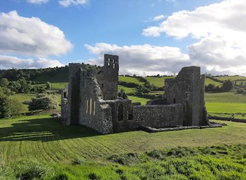
Fore Abbey
Explore the rich history and stunning ruins of Fore Abbey, an essential destination for tourists in County Westmeath, Ireland.

Best landmarks in County Westmeath
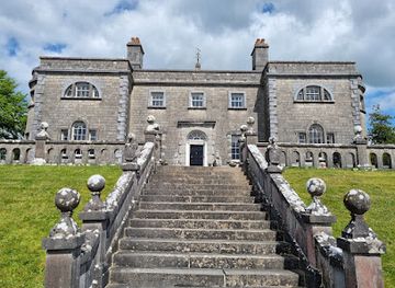
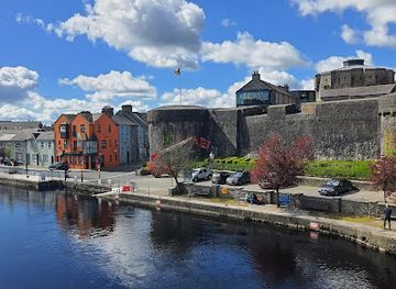
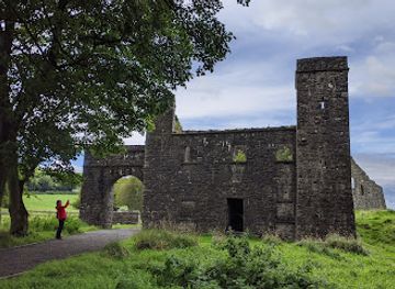
Athlone Castle is County Westmeath’s most recognisable historic structure, standing beside the Shannon at a crossing whose military importance shaped the town for centuries. The River Shannon itself is a defining natural landmark, giving Athlone a strong visual identity and linking the town to Lough Ree. The Hill of Uisneach is important on a different scale: its prehistoric earthworks, elevated position and associations with ancient assemblies make it one of the county’s most significant cultural landscapes. Fore Abbey, with its substantial medieval ruins set beneath the surrounding hills, preserves the architectural presence of a major religious foundation. Near Mullingar, Belvedere House and its designed landscape represent the Georgian estate world, while the Royal Canal’s locks, bridges and towpaths record the engineering history of inland transport. Kilbeggan Distillery is a landmark of working industrial heritage, associated with the long continuity of whiskey production in the Midlands. In the towns, churches, civic buildings, old streets and river crossings provide a quieter architectural record of Westmeath’s development as an administrative, commercial and transport centre.
-
Tourist attraction
Belvedere House Gardens & Park
Explore the enchanting beauty of Belvedere House Gardens & Park, a serene escape in Co. Westmeath filled with history, nature, and stunning landscapes.
-
Historical landmark
Fore Abbey
Explore the enchanting ruins of Fore Abbey, a historical gem in Co. Westmeath, where Ireland's rich monastic heritage comes alive amidst stunning landscapes.
-
Tourist attraction
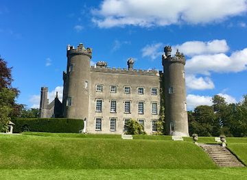
Tullynally Castle & Gardens
Experience the beauty and history of Tullynally Castle & Gardens, a captivating tourist attraction in County Westmeath, Ireland.
-
National park
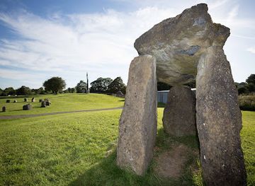
Dún Na Sí Amenity & Heritage Park
Explore the enchanting Dún Na Sí Amenity & Heritage Park, where nature meets culture in the heart of Westmeath, Ireland.
Explore County Westmeath on the map
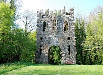
Plan your trip on one map. See where the top cities, national parks and sights are, and book hotels and experiences in a few clicks.
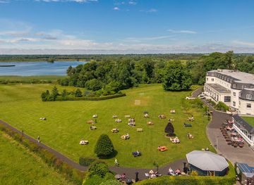
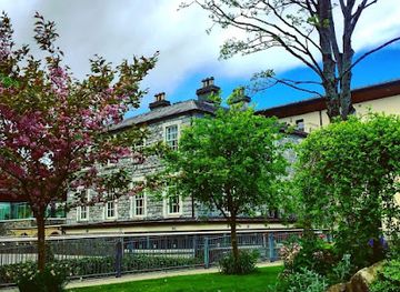
Best hotels in County Westmeath
Best restaurants in County Westmeath
Westmeath’s dining scene reflects the agricultural Midlands and the social life of its market towns. Athlone has the broadest choice, with restaurants and cafés around the historic centre and riverside offering Irish cooking alongside international menus. Mullingar provides a similar mix, while smaller towns and villages rely more on traditional pubs, cafés, bakeries and restaurants serving straightforward local produce. Beef, lamb, dairy products, seasonal vegetables, soups, brown bread and hearty stews are familiar features of regional Irish cooking, and freshwater surroundings support an interest in angling and lake landscapes rather than a major seafood tradition. Farmers’ markets and independent food shops can be useful places to find cheeses, breads, preserves and other Irish-made products, although market schedules vary. Kilbeggan whiskey is an important local reference in the drinks culture, and pubs often provide a more authentic setting for regional conversation and simple meals than formal dining rooms. Visitors should expect menus to change seasonally and should reserve ahead when seeking dining in smaller settlements or at busy times.
-
Irish pub
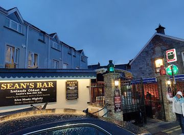
Sean's Bar
Experience timeless charm at Sean's Bar - Ireland's oldest pub in Athlone offering traditional music, hearty food, and unforgettable moments.
-
Hotel
Bloomfield House Hotel, Leisure Club & Spa
Discover luxury and tranquility at Bloomfield House Hotel, Leisure Club & Spa – your gateway to the heart of Westmeath's beauty.
-
Hotel
Annebrook House Hotel
Discover the charm of Mullingar at Annebrook House Hotel—your perfect blend of comfort, fine dining, and local culture.
-
 Hotel
Greville Arms Hotel
Discover comfort and charm at Greville Arms Hotel in Mullingar - your perfect base for exploring Ireland's scenic midlands.
Best bars in County Westmeath
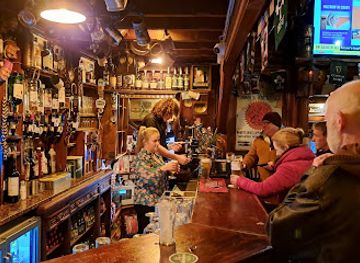
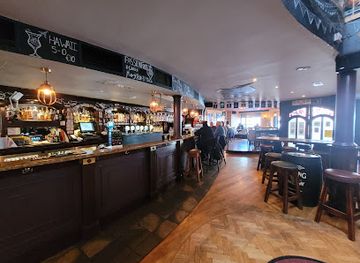
Nightlife in County Westmeath is concentrated in Athlone and Mullingar, with smaller towns offering a quieter evening based on pubs, restaurants and occasional live music. Athlone has the most varied choice, ranging from traditional pubs and historic town-centre venues to contemporary bars, music settings and late-night establishments. Mullingar’s evening scene is similarly centred on pubs, cafés, restaurants and live performances rather than a large club district. In Moate, Kilbeggan and other smaller communities, the pace is generally more local and social, with conversation, sport on television and traditional music often more important than fixed entertainment programmes. The county’s pubs are places to eat and meet as well as drink, and visitors do not need to consume alcohol to participate in the atmosphere. Venue opening times, live music and seasonal events change, so checking locally is sensible, particularly outside the principal towns.
-
Gastropub
Gertie Brownes Bar & Bistro
Discover the vibrant flavors and warm hospitality of Gertie Brownes Bar & Bistro, a must-visit gastropub in Athlone, Ireland.
-
Pub
The Dark Horse Bar & Kitchen
Experience the best of Irish hospitality at The Dark Horse Bar & Kitchen, a perfect blend of pub charm and gourmet cuisine in Athlone.
-
Pub
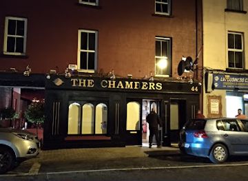
The Chambers Bar Mullingar
Discover the warmth of Irish hospitality at The Chambers Bar in Mullingar, where great drinks and local culture come together.
-
Bar
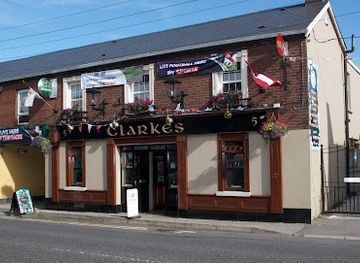
Clarkes Bar
Experience the heart of Mullingar's nightlife at Clarkes Bar, a beloved local pub offering great drinks and live Irish music.
Best nightclubs in County Westmeath
Nightlife in County Westmeath is concentrated in Athlone and Mullingar, with smaller towns offering a quieter evening based on pubs, restaurants and occasional live music. Athlone has the most varied choice, ranging from traditional pubs and historic town-centre venues to contemporary bars, music settings and late-night establishments. Mullingar’s evening scene is similarly centred on pubs, cafés, restaurants and live performances rather than a large club district. In Moate, Kilbeggan and other smaller communities, the pace is generally more local and social, with conversation, sport on television and traditional music often more important than fixed entertainment programmes. The county’s pubs are places to eat and meet as well as drink, and visitors do not need to consume alcohol to participate in the atmosphere. Venue opening times, live music and seasonal events change, so checking locally is sensible, particularly outside the principal towns.
-
Bar
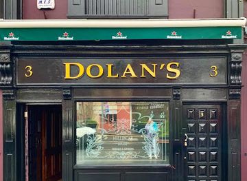
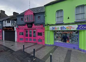
Dolan's Bar / Mojo's Niteclub
Dolan's Bar / Mojo's Niteclub: Mullingar's ultimate fusion of traditional bar charm and electrifying nightlife, perfect for tourists seeking vibrant entertainment.
-
Night club
The Fence Nightclub & Cocktail Bar
Unleash your night at The Fence Nightclub & Cocktail Bar, where live music, crafted cocktails, and vibrant energy await in Mullingar's nightlife scene.
-
Night club
Ozone Nightclub
Experience the electric nightlife of Athlone at Ozone Nightclub, where dance and music unite for an unforgettable night out.
-
Night club
The Final Fence Mullingar
Discover the vibrant nightlife of Mullingar at The Final Fence, where music, dance, and fun come together for an unforgettable experience.
Best shops in County Westmeath
Shopping in County Westmeath is focused on the traditional high streets and independent businesses of Athlone and Mullingar, supported by smaller town centres in places such as Moate, Kinnegad and Kilbeggan. Athlone offers the broadest urban choice, with mainstream retailers, cafés and independent shops in and around the central area, while Mullingar combines everyday shopping with boutiques, cafés, antiques and service businesses connected to its market-town role. Rural and village shops are useful for locally made food, gifts and practical supplies rather than extensive designer retail. Look for Irish cheeses, baking, preserves, whiskey-related products, woollens, crafts, ceramics, art and books when choosing distinctive souvenirs. Farmers’ markets and seasonal craft events can provide direct access to regional produce, but their days and locations are not always permanent. Westmeath is better suited to browsing independent shops, galleries, estate-area gift outlets and food producers than to luxury shopping, with the strongest contrast between the larger town centres and the more occasional rural retail scene.
-
Shopping mall
Athlone Towncentre
Explore Athlone Towncentre, a vibrant shopping mall offering diverse retail options, dining experiences, and community events in the heart of Athlone.
-
Shopping mall
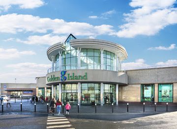
Golden Island Shopping Centre
Experience the ultimate shopping and dining adventure at Golden Island Shopping Centre in Athlone, Co. Westmeath.
-
Shopping mall
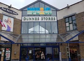
Harbour Place Shopping Centre
Explore Mullingar's Harbour Place Shopping Centre for an exciting shopping experience with diverse shops, dining, and a lively atmosphere.
-
Shopping mall
FairGreen Shopping Centre
Explore the FairGreen Shopping Centre in Mullingar, a vibrant shopping oasis with diverse stores, delightful dining, and a welcoming atmosphere for all.

Get your free copy of our complete guide to County Westmeath, delivered straight to you.
Everything on this page, from attractions and restaurants to essentials and local phrases, in one PDF you can read offline, print or share.
Already have an account? Sign in
Your County Westmeath guide is ready.
We'll send it to · Not you? Sign out

Getting your guide ready…
We are putting together a fresh copy of the County Westmeath guide. This can take up to a minute.
This can take a few moments. If your browser asks, choose Allow so the download can start. You'll find the guide in your Downloads folder.
Nothing happened? Download it again
Sorry, the guide is taking longer than usual. Please try again in a minute, or get it by email instead.
County Westmeath essentials
Currency and Payment
Safety
Emergency Situations
Do's and Don'ts
Local Tips
From Eve
Local phrases worth knowing
You don't need to get them perfect. A few words go a long way, and locals appreciate the effort.
Basics
| English | Local | Say it |
|---|---|---|
| Hello | Hello | [Helo] |
| Goodbye | Goodbye | [Guhd-bye] |
| Yes | Yes | [Yes] |
| No | No | [No] |
| Please/You're welcome | Please/You're welcome | [Pleez/Yer welcum] |
| Thank you | Thank you | [Thank yew] |
| Excuse me/Sorry | Excuse me/Sorry | [Ex-kyoos mee/Sor-ee] |
| How are you? | How are you? | [How ar yew?] |
| Fine. And you? | Fine. And you? | [Fine. An yew?] |
| Do you speak English? | Do you speak English? | [Doo yew speek English?] |
| I don't understand | I don't understand | [I don't undurstand] |
Eating & Drinking
| English | Local | Say it |
|---|---|---|
| I'd like to see the menu, please | I'd like to see the menu, please | [Id laik to see the meny, pleez] |
| I don't eat meat | I don't eat meat | [I don't eet meet] |
| Cheers! | Cheers! | [Cheerz] |
| I would like to pay, please | I would like to pay, please | [I wud laik to pay, pleez] |
Emergencies
| English | Local | Say it |
|---|---|---|
| Help! | Help! | [Help] |
| Go away! | Go away! | [Go awey] |
| Call the Police! | Call the Police! | [Call the Po-lees] |
| Call a doctor! | Call a doctor! | [Call a dok-tor] |
| I'm lost | I'm lost | [Im lost] |
| I'm ill | I'm ill | [Im il] |
Shopping
| English | Local | Say it |
|---|---|---|
| I'd like to buy... | I'd like to buy... | [Id laik to buy...] |
| I'm just looking | I'm just looking | [Im just luking] |
| How much is it? | How much is it? | [How much iz it?] |
| That's too expensive | That's too expensive | [Thats too expensiv] |
| Can you lower the price? | Can you lower the price? | [Can yew lower the pryce?] |
Time & Numbers
| English | Local | Say it |
|---|---|---|
| What time is it? | What time is it? | [What tym iz it?] |
| It's one o'clock | It's one o'clock | [Its wun o'clock] |
| Half past (10) | Half past (10) | [Half past (ten)] |
| Morning | Morning | [Mornin] |
| Afternoon | Afternoon | [Aftur-noon] |
| Evening | Evening | [Eve-ning] |
| Yesterday | Yesterday | [Yesturday] |
| Today | Today | [Tuday] |
| Tomorrow | Tomorrow | [Tomorow] |
| 1 | 1 | [Wun] |
| 2 | 2 | [Too] |
| 3 | 3 | [Three] |
| 4 | 4 | [Four] |
| 5 | 5 | [Five] |
| 6 | 6 | [Six] |
| 7 | 7 | [Seven] |
| 8 | 8 | [Eight] |
| 9 | 9 | [Nine] |
| 10 | 10 | [Ten] |
Transport & Directions
| English | Local | Say it |
|---|---|---|
| Where's a/the...? | Where's a/the...? | [Wher's a/the...?] |
| What's the address? | What's the address? | [What's the ad-dress?] |
| Can you show me (on the map)? | Can you show me (on the map)? | [Can yew sho mee (on the map)?] |
| When's the next (bus)? | When's the next (bus)? | [Wen's the next (bus)?] |
| A ticket (to ....) | A ticket (to ....) | [A tik-it (to ....)] |
History of County Westmeath
Prehistoric Uisneach and the Sacred Centre of Ireland
The Hill of Uisneach, in the west of County Westmeath, is one of Ireland’s most resonant prehistoric and early historic landscapes. Archaeological remains and later literary traditions associate the hill with assemblies, inauguration rituals and the symbolic meeting of Ireland’s provinces. Its importance was cultural and political as well as religious: gatherings at such prominent sites helped connect communities across the island. The hill’s surviving earthworks, broad views and associations with seasonal festivals preserve an enduring sense of Westmeath as a central meeting place, although many later stories combine historical memory with mythology.
Early Christian Monasticism at Fore
Fore became an important early Christian monastic centre before developing into a medieval settlement. Its foundation is traditionally associated with Saint Féichín, who is said to have established a religious community in the seventh century. The monastery occupied a strategic landscape near Lough Lene and later attracted the attention of Anglo-Norman builders. The ruins visible today belong largely to the medieval priory and include substantial church and domestic remains. They demonstrate how religious institutions shaped settlement, learning and landholding in Westmeath long before the county acquired its modern boundaries.
Norman Expansion and the Medieval Lordship of Meath
Following the Anglo-Norman intervention in Ireland in the late twelfth century, Westmeath formed part of the broad Lordship of Meath. Norman and later settler families established castles, manors and religious foundations across the region, while existing Gaelic communities continued to influence local society and landholding. Athlone’s position on the Shannon gave it particular strategic value, and fortified sites around the county reflected the contested nature of medieval power. The period left a complex architectural and political legacy rather than a simple replacement of one culture by another.
Athlone and the Wars of the Seventeenth Century
Athlone became one of Ireland’s most important military positions because it controlled a major crossing of the River Shannon. Its castle and bridge were repeatedly involved in conflict during the Cromwellian wars and the Williamite War. The most famous episode came in 1691, when Williamite forces eventually captured the town after intense fighting and a bombardment that damaged the medieval settlement. The strategic importance of Athlone declined after the wars, but its surviving fortifications and riverside setting still reveal why control of the crossing mattered so greatly.
Estates, Agriculture and Georgian Westmeath
During the eighteenth and nineteenth centuries, much of Westmeath’s countryside was organised through large landed estates alongside small farms, tenant holdings and market towns. Houses such as Belvedere, Tullynally and Killua reflected the wealth and social authority of estate families, while demesne walls, avenues, gardens and managed farmland shaped the surrounding landscape. Mullingar and Athlone expanded as administrative and commercial centres, serving agricultural districts whose economies depended on livestock, grain, fairs and regional trade. Waterways and roads gradually linked these local economies more closely with Dublin and the western counties.
Canals, Railways and the Industrial Midlands
The Royal Canal, opened to navigation in the early nineteenth century, connected Dublin with the Shannon and passed through eastern and central Westmeath. Its towpaths, locks and bridges remain visible evidence of an era when inland waterways carried passengers, fuel and agricultural goods. Railway development later transformed travel and trade, with lines serving towns including Mullingar and Athlone and linking the Midlands to Dublin, Galway and the northwest. Kilbeggan’s distilling tradition also belongs to this wider commercial history, showing how local production could survive through changing transport networks and markets.
Famine, Emigration and Twentieth-Century Change
The Great Famine of the 1840s affected Westmeath through hunger, disease, evictions, workhouse dependence and heavy emigration, as it did communities throughout Ireland. Population decline and changes in landholding continued to influence rural society after independence. During the twentieth century, improved roads, new public services and the growth of Athlone and Mullingar altered the balance between farming and town-based employment. Westmeath’s central location later encouraged logistics, manufacturing, education and commuting, while its historic landscapes and waterways gained increasing importance for heritage and recreation.
County Westmeath in Photos
Browse through our photo collection highlighting the charm and character of the destination.
Neighbouring regions of County Westmeath
The closest regions to County Westmeath, if you have time for more than one.
-
-

-

-

-


Swipe for more regions
Explore more
Explore more of Ireland
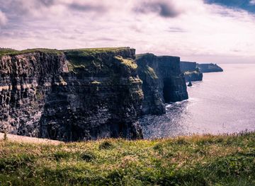
Discover Ireland: A land of enchanting landscapes, rich history, and vibrant culture, where every corner tells a story and every visit feels like coming home.
Explore Ireland