

Mourne Mountains Travel Guide - Free Web & App
Your ultimate guide to Mourne Mountains. Discover top landmarks, proposed trips, and local tips. Free on the web or via the Evendo companion app.


Mourne Mountains in Northern Ireland offer granite peaks, coastal views, forest walks, reservoirs, heritage trails and challenging hiking near Newcastle and Down.
Mountain Landscape
The Mourne Mountains rise from County Down in Northern Ireland, forming a compact granite range between the Irish Sea and the inland drumlin country. Their best-known summit, Slieve Donard, reaches 853 metres and is the highest mountain in Northern Ireland and the province of Ulster. The range is crossed by broad valleys, rocky ridges, reservoirs and upland paths, with the coastal town of Newcastle providing the most familiar seaward approach. Further west, the landscape extends towards Silent Valley and Spelga Dam, while Tollymore Forest Park occupies the wooded foothills near Bryansford.Read more about Mourne Mountains
Heritage and Character
Exploring the Range
When is the best time to visit Mourne Mountains?
Best: June–August · 19–21°C| Month | High (°C) | Rainfall (mm) |
|---|---|---|
| January | 8 | 100 |
| February | 7 | 90 |
| March | 9 | 90 |
| April | 12 | 80 |
| May | 16 | 70 |
| June (best) | 19 | 70 |
| July (best) | 21 | 70 |
| August (best) | 21 | 80 |
| September | 19 | 90 |
| October | 16 | 100 |
| November | 12 | 100 |
| December | 9 | 110 |
Getting to and around Mourne Mountains
How to get there
Transportation
Best attractions in Mourne Mountains
The Mourne Mountains offer a varied sequence of landscapes within a relatively compact area. Slieve Donard rises behind Newcastle and provides the range's most famous summit walk, while nearby Slieve Commedagh and Slieve Bearnagh create a more demanding high-level landscape. Slieve Binnian is noted for its distinctive granite tors and broad views across the Silent Valley and the Irish Sea. Silent Valley Mountain Park combines reservoirs, mountain scenery and paths within the historic water-supply landscape, while Spelga Dam and the surrounding valley provide a dramatic western viewpoint. Tollymore Forest Park, near Bryansford, adds riverside paths, bridges, woodland and designed estate features below the open mountains. Bloody Bridge and Annalong offer eastern approaches shaped by coast, river and industrial history. Around the edges of the range, Newcastle's seafront, the fishing heritage of Annalong and the rural villages towards Hilltown and Kilkeel broaden the experience beyond summit walking.
-
Park and Garden
Tollymore Forest Park
Explore Tollymore Forest Park: A stunning natural retreat in Northern Ireland with breathtaking landscapes, diverse wildlife, and scenic trails perfect for all.
-
Park
Silent Valley Mountain Park
Explore the serene landscapes of Silent Valley Mountain Park, a tranquil retreat in Northern Ireland rich in natural beauty and outdoor adventures.
-
National forest
Castlewellan Forest Park
Discover the breathtaking beauty of Castlewellan Forest Park, a national forest filled with stunning landscapes and endless outdoor adventures.
-
Park
The Peace Maze
Discover the serene beauty of The Peace Maze in Castlewellan Forest Park, an inspiring journey through one of the largest hedge mazes in the world.


Best landmarks in Mourne Mountains
The Mourne Wall is the range's defining historic landmark, a long granite boundary built around the Belfast water catchment and carried across ridges, valleys and open moorland. Natural landmarks include Slieve Donard, the highest summit in Northern Ireland, and Slieve Binnian, whose granite tors give it a particularly recognisable outline. Silent Valley's reservoirs represent a major feat of water engineering and have altered, while preserving, the character of the mountain valleys. Spelga Dam is another prominent piece of twentieth-century infrastructure set among high ground. At lower elevations, Tollymore Forest Park contains designed woodland features, bridges and riverside scenery associated with the former estate. The granite walls, quarries, cottages and harbour landscapes around Annalong and Newcastle extend the landmark story from the uplands to the coast.
-
Island
Ireland
Explore the enchanting landscapes, rich heritage, and vibrant culture of Ireland, the Emerald Isle, a paradise for every traveler.
-
Park
Tollymore Forest Park
Explore the breathtaking landscapes of Tollymore Forest Park, a tranquil escape nestled at the foothills of the Mourne Mountains in Northern Ireland.
-
Park
Silent Valley Mountain Park
Discover the breathtaking landscapes and serene atmosphere of Silent Valley Mountain Park, a must-visit destination for nature lovers in Northern Ireland.
-
National forest
Castlewellan Forest Park
Explore the serene landscapes and rich biodiversity of Castlewellan Forest Park, a must-visit national forest in Northern Ireland.


Explore Mourne Mountains on the map
Plan your trip on one map. See where the top attractions, landmarks, restaurants and hotels are, and book hotels and experiences in a few clicks.
Best hotels in Mourne Mountains
Best restaurants in Mourne Mountains
Dining is concentrated in Newcastle and the surrounding villages rather than on the high mountains. Newcastle provides the widest choice, including cafés, restaurants, takeaways and traditional pubs serving familiar Northern Irish fare, while Annalong, Bryansford and other settlements offer smaller local establishments whose opening patterns can be seasonal. Seafood reflects the County Down coast, with fish and shellfish associated with working harbours such as Annalong and Kilkeel, while local dairy, meat, baking and farm produce appear in everyday menus and food shops. In the inland villages, cafés, country inns and community-oriented pubs are useful after walks, although options become sparse near remote trailheads, Silent Valley and Spelga. Walkers should not expect refreshments on the summits or along most upland routes, so carrying water and food is sensible. Farm shops and accommodation providers can also be useful sources of regional produce.
-
Family-friendly
Diamonds Restaurant
Discover family-friendly dining at Diamonds Restaurant in Warrenpoint, offering delectable breakfast and modern European cuisine in a cozy atmosphere.
-
Italian
Villa Vinci
Experience authentic Italian cuisine at Villa Vinci in Newcastle - where each dish celebrates the rich flavors of Italy.
-
Irish pub
Quinns Bar
Experience authentic Irish hospitality at Quinns Bar in Newcastle with delightful cuisine and an extensive drink selection.
-
Restaurant
The Maghera Inn.
Discover The Maghera Inn in Castlewellan – where traditional Irish cuisine meets modern comfort in a welcoming pub atmosphere.


Best bars in Mourne Mountains
The Mourne Mountains are not a nightlife destination, and evening activity is generally quiet and local rather than centred on clubs. Newcastle has the broadest choice of pubs and hotel bars, with a seasonal coastal atmosphere and occasional live entertainment, while traditional pubs in villages such as Annalong, Bryansford and Hilltown provide more intimate settings for conversation, local drinks and music when arranged. In the western Mournes, evening venues are dispersed and visitors usually return to a rural inn, guesthouse or self-catering base rather than move between bars. Cultural events, local music sessions and community gatherings may occur at particular times of year, but should be checked locally rather than assumed. Remote valleys and mountain access points have no evening entertainment infrastructure, and driving after drinking is especially unsuitable on narrow rural roads.
-
Irish pub
Quinns Bar
Discover the heart of Irish culture at Quinn's Bar in Newcastle, with traditional dishes, local brews, and a lively ambiance inviting you to unwind.
-
Pub
The Maghera Inn.
Discover The Maghera Inn, a delightful pub and restaurant in Castlewellan, offering local cuisine and a cozy atmosphere for travelers.
-
Pub
Maginns
Discover Maginns, a cozy pub in Castlewellan offering traditional Irish cuisine, local beers, and a vibrant atmosphere for a memorable experience.
-
Grill
The Brass Monkey
Experience the vibrant flavors of The Brass Monkey, a premier grill in Newry offering delicious dishes and a lively atmosphere for every occasion.


Best nightclubs in Mourne Mountains
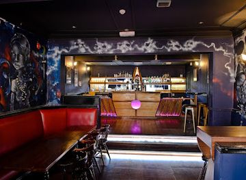
The Mourne Mountains are not a nightlife destination, and evening activity is generally quiet and local rather than centred on clubs. Newcastle has the broadest choice of pubs and hotel bars, with a seasonal coastal atmosphere and occasional live entertainment, while traditional pubs in villages such as Annalong, Bryansford and Hilltown provide more intimate settings for conversation, local drinks and music when arranged. In the western Mournes, evening venues are dispersed and visitors usually return to a rural inn, guesthouse or self-catering base rather than move between bars. Cultural events, local music sessions and community gatherings may occur at particular times of year, but should be checked locally rather than assumed. Remote valleys and mountain access points have no evening entertainment infrastructure, and driving after drinking is especially unsuitable on narrow rural roads.
-
Live Music
Voodoo
Experience the vibrant nightlife of Belfast at Voodoo, where live music and a lively bar atmosphere create unforgettable moments.
-
Lodge
Flagstaff Lodge
Discover the rustic charm of Flagstaff Lodge, a perfect retreat in Newry with cozy accommodations, dining, and stunning views of Northern Ireland's landscapes.
-
Cabaret club
Cabaret Supper Club
Discover the vibrant nightlife of Belfast at Cabaret Supper Club, where exquisite dining meets captivating performances for an unforgettable experience.
-
Irish pub
O'Hares Lounge Bars
Discover the heart of Newcastle at O'Hares Lounge Bars, where Irish hospitality meets vibrant dining and entertainment options.


Best shops in Mourne Mountains
Shopping in the Mourne region is practical and locally focused, with the greatest concentration in Newcastle and the larger settlements around the foothills. Visitors can find walking equipment, everyday provisions, cafés and independent businesses in Newcastle, while village shops and service outlets supply smaller communities such as Annalong and Hilltown. Local food is a useful purchase, including regional baking, dairy products, meat and seafood from the County Down coast, subject to the businesses operating at the time of visit. Craft and artwork inspired by the mountains may be found through local galleries, studios, visitor-oriented businesses and seasonal events, but the area does not contain an extensive commercial craft district. Farm shops and producers around the wider Mourne countryside offer opportunities to buy regional goods directly, whereas remote valleys and mountain parks have limited retail facilities.
-
Shopping mall
The Quays Shopping Centre
Explore The Quays Shopping Centre in Newry for an unforgettable retail experience featuring top brands, dining, and entertainment options.
-
Shopping mall
Buttercrane Shopping Centre
Discover a vibrant shopping experience at Buttercrane Shopping Centre, Newry, featuring diverse shops, dining options, and a lively atmosphere.
-
Bridal shop
The White Gallery
Discover your dream wedding dress at The White Gallery, Warrenpoint's top bridal boutique offering exquisite gowns and personalized service.
-
Convenience store
EUROSPAR Newcastle Road
Discover convenience and local flavors at EUROSPAR Newcastle Road in Kilkeel, your one-stop shop for all essentials during your travels.


Get your free copy of our complete guide to Mourne Mountains, delivered straight to you.
Everything on this page, from attractions and restaurants to essentials and local phrases, in one PDF you can read offline, print or share.
Already have an account? Sign in
Your Mourne Mountains guide is ready.
We'll send it to · Not you? Sign out

Getting your guide ready…
We are putting together a fresh copy of the Mourne Mountains guide. This can take up to a minute.
This can take a few moments. If your browser asks, choose Allow so the download can start. You'll find the guide in your Downloads folder.
Nothing happened? Download it again
Sorry, the guide is taking longer than usual. Please try again in a minute, or get it by email instead.
Mourne Mountains essentials
Currency and Payment
Safety
Emergency Situations
Do's and Don'ts
Local Tips
From Eve
Local phrases worth knowing
You don't need to get them perfect. A few words go a long way, and locals appreciate the effort.
Basics
| English | Local | Say it |
|---|---|---|
| Hello | Dia duit | [dee-uh gwitch] |
| Goodbye | Slán | [slawn] |
| Yes | Tá | [taw] |
| No | Níl | [neel] |
| Please/You're welcome | Le do thoil | [leh duh hull] |
| Thank you | Go raibh maith agat | [guh rev mah agut] |
| Excuse me/Sorry | Tá brón orm | [taw broan orum] |
| How are you? | Conas atá tú? | [kun-us ah-taw too] |
| Fine. And you? | Tá mé go maith. Agus tú? | [taw may guh mah. Ah-gus too] |
| Do you speak English? | An labhraíonn tú Béarla? | [ahn law-ree-un too bayr-lah] |
| I don't understand | Ní thuigim | [nee hig-im] |
Eating & Drinking
| English | Local | Say it |
|---|---|---|
| I'd like to see the menu, please | Ba mhaith liom an mianu a fheiceáil, le do thoil | [bah wah lum on mee-an-oo ah ek-ah-leh, leh duh hull] |
| I don't eat meat | Ní ithim feoil | [nee ih-him foh-il] |
| Cheers! | Sláinte! | [slawn-cheh] |
| I would like to pay, please | Ba mhaith liom íoc, le do thoil | [bah wah lum ee-uck, leh duh hull] |
Emergencies
| English | Local | Say it |
|---|---|---|
| Help! | Cabhair! | [cah-wir] |
| Go away! | Imigh uaim! | [ih-mee oo-im] |
| Call the Police! | Glan an Gharda! | [glan on gahr-duh] |
| Call a doctor! | Glan dochtúir! | [glan dohk-too-err] |
| I'm lost | Tá mé caillte | [taw may kye-el-teh] |
| I'm ill | Táim tinn | [taw-im chin] |
Shopping
| English | Local | Say it |
|---|---|---|
| I'd like to buy... | Ba mhaith liom ceannach... | [bah wah lum can-uck] |
| I'm just looking | Níl mé ach ag breathnú | [neel may ohk egg brann-oo] |
| How much is it? | Cé mhéad é? | [kay vayd ay] |
| That's too expensive | Tá sé ró-dhaor | [taw shay row-yoor] |
| Can you lower the price? | An féidir leat an praghas a ísliú? | [ahn fay-dur lat on prah-guss ah eesh-loo] |
Time & Numbers
| English | Local | Say it |
|---|---|---|
| What time is it? | Cén t-am é? | [kayn tahm ay] |
| It's one o'clock | Tá sé a haon a chlog | [taw shay ah hayn ah khlog] |
| Half past (10) | Leathuair tar éis a deich | [lah-hoo-ir tar es ah deh] |
| Morning | Maidin | [mah-deen] |
| Afternoon | Tráthnóna | [traw-noh-nah] |
| Evening | Tráthnóna | [traw-noh-nah] |
| Yesterday | Inné | [in-ay] |
| Today | Inniu | [in-yoo] |
| Tomorrow | Amárach | [ah-mar-ahk] |
| 1 | Aon | [ayn] |
| 2 | Dó | [doh] |
| 3 | Trí | [tree] |
| 4 | Ceathair | [cah-her] |
| 5 | Cúig | [koo-ig] |
| 6 | Sé | [shay] |
| 7 | Seacht | [shakht] |
| 8 | Ocht | [ukht] |
| 9 | Naoi | [nee] |
| 10 | Deich | [deh] |
Transport & Directions
| English | Local | Say it |
|---|---|---|
| Where's a/the...? | Cá bhfuil...? | [kaw vil] |
| What's the address? | Céard atá ar an seoladh? | [kay-ard ah-taw air on shoh-lah] |
| Can you show me (on the map)? | An bhfuil tú in ann mé a thaispeáint (ar an léarscáil)? | [ahn vil too in on may ah hah-sh-paynt (ar on lay-ars-kawl)] |
| When's the next (bus)? | Cathain a bheidh an chéad iarsma? | [kah-hin ah veh on khayd eer-smah] |
| A ticket (to ....) | Ticéad (go dtí ....) | [tick-ayd (guh dee)] |
History of Mourne Mountains
Granite Foundations and Glacial Valleys
The Mournes are a granite mountain massif formed when molten rock cooled beneath the earth's surface during the Palaeozoic era. Later erosion and glacial action shaped the rounded summits, steep corries, valleys and large boulder-strewn slopes visible today. Ice also helped create the broad depressions and drainage patterns that influenced later settlement and reservoir construction. The contrast between exposed granite uplands, wooded lower slopes and the nearby coast is central to the range's geographical character.
Early Settlement and Mountain Farming
People have used the Mourne foothills and surrounding valleys since prehistoric times, although the surviving evidence is often dispersed rather than concentrated in a single monumental site. Communities developed a mixed economy based on small-scale farming, grazing, fishing and coastal trade. The mountains formed a practical backdrop to local life rather than an isolated wilderness, with routes through passes linking settlements on the eastern and western sides. Field boundaries, cottages, churches and townlands continue to reflect this long relationship between people and upland land.
Granite, Quarries and Local Industry
Mourne granite became an important local building material, quarried around several parts of the range and used for walls, houses, churches and civic structures. Stoneworking supported skilled employment and influenced the appearance of nearby settlements. The coastal communities of Annalong, Newcastle and Kilkeel also developed through fishing, seafaring and trade, while farming remained important inland. These industries connected the mountains to markets beyond County Down and helped create the distinctive combination of rural, maritime and industrial heritage found around the range.
Water Supply and the Mourne Wall
The modern history of the mountains was strongly shaped by Belfast's need for a dependable water supply. Reservoirs were developed in the Mourne catchments during the nineteenth and early twentieth centuries, including the Silent Valley system and associated works. The Mourne Wall was built between 1904 and 1922 to enclose and protect the catchment, using locally quarried granite and skilled dry-stone construction. It remains both working infrastructure and a major cultural landscape feature, crossing high ground between many of the range's best-known summits.
Tourism, Conservation and Outdoor Recreation
The Mournes became increasingly important to walkers, climbers, artists and day visitors during the growth of leisure travel in the nineteenth and twentieth centuries. Tollymore Forest Park, opened to the public in the twentieth century, added designed woodland landscapes and recreational paths to the region's attractions. Today the mountains are part of a protected landscape recognised as an Area of Outstanding Natural Beauty, while land managers balance recreation, farming, water infrastructure, erosion control and the conservation of upland habitats.
Mourne Mountains in Photos
Browse through our photo collection highlighting the charm and character of the destination.
Cities in Mourne Mountains
The towns and cities of Mourne Mountains, and the easiest places to base yourself.
-

-

-

-

-

-


Swipe for more cities
Neighbouring destination travel guides
The closest destinations to Mourne Mountains, if you have time for more than one.
-
-

-

-

-


Swipe for more destinations
Explore more

Explore more of Leinster
Discover Leinster: A perfect blend of history, culture, and natural beauty in Ireland's heartland, from Dublin's vibrancy to the serene Wicklow Mountains.
Explore Leinster
Explore more of Ireland
Discover Ireland: A land of enchanting landscapes, rich history, and vibrant culture, where every corner tells a story and every visit feels like coming home.
Explore Ireland