

Slea Head Drive Travel Guide - Free Web & App
Your ultimate guide to Slea Head Drive. Discover top landmarks, proposed trips, and local tips. Free on the web or via the Evendo companion app.


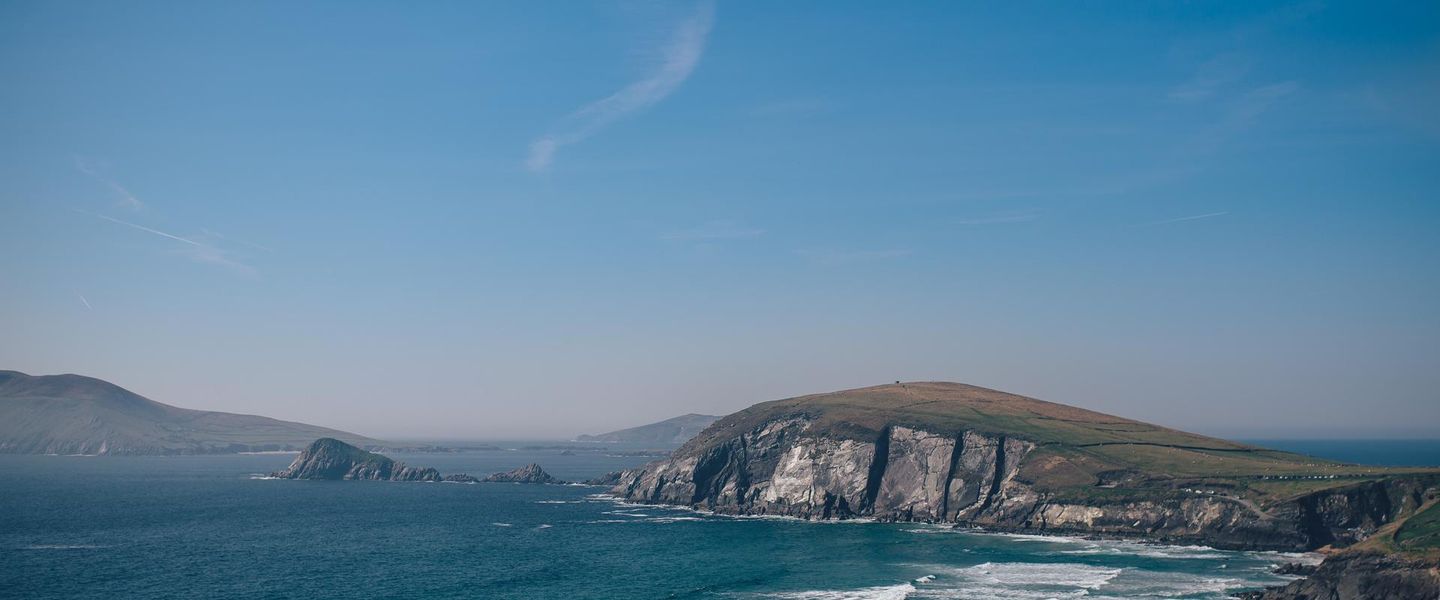


Slea Head Drive in Ireland combines Atlantic cliffs, beaches, Blasket Island views, ancient monuments, Irish-speaking communities and memorable coastal walks.
Atlantic Landscapes
Slea Head Drive is a scenic circular route on the western tip of the Dingle Peninsula in County Kerry, linking Dingle town with a coastline of headlands, sandy coves, offshore islands and rugged uplands. The route generally follows the R559 for roughly 47 kilometres, although visits to beaches, viewpoints and heritage sites make the excursion considerably longer. Its western section faces the Blasket Islands across the Atlantic, while Mount Brandon and the distinctive peaks of the central peninsula form a dramatic inland backdrop.Read more about Slea Head Drive
Gaelic Heritage and Maritime History
Exploring the Route
When is the best time to visit Slea Head Drive?
Best: June–August · 17–19°C| Month | High (°C) | Rainfall (mm) |
|---|---|---|
| January | 11 | 110 |
| February | 11 | 93 |
| March | 12 | 95 |
| April | 13 | 80 |
| May | 15 | 79 |
| June (best) | 17 | 75 |
| July (best) | 19 | 74 |
| August (best) | 18 | 76 |
| September | 17 | 88 |
| October | 15 | 98 |
| November | 13 | 107 |
| December | 12 | 112 |
Getting to and around Slea Head Drive
How to get there
Transportation
Best attractions in Slea Head Drive
The principal attractions of Slea Head Drive are the Atlantic landscapes and the heritage sites scattered across the western Dingle Peninsula. Ventry’s broad bay provides a gentler opening to the coastal journey, while the road towards Slea Head reaches viewpoints over the Blasket Islands and the rugged coastline. Coumeenoole Beach is one of the route’s most recognisable settings, backed by steep slopes and exposed to Atlantic conditions. At Dunquin, the Blasket Centre tells the story of the island community that lived offshore until 1953, and the nearby pier offers a striking view across the water. Gallarus Oratory, a carefully built early Christian stone structure near the route, is among the peninsula’s most important historic sights. Clogher Head, Clogher Strand, Dun Chaoin and the surrounding lanes reveal a landscape of fields, stone walls and scattered archaeological remains, while Dingle provides museums, harbour scenery and practical facilities at the eastern end of the circuit.
-
Golf course
Ceann Sibéal Golf Club
Experience the breathtaking beauty of Ceann Sibéal Golf Club in Dingle, where golf meets the stunning landscapes of the Irish coast.
-
Tourist attraction
Dingle Lighthouse (Teach Solais an Daingin)
Explore Dingle Lighthouse, an iconic historical landmark offering stunning views of the Atlantic and a glimpse into maritime heritage.
-
Canoe & kayak tour agency
Irish Adventures
Experience the breathtaking beauty of Dingle Bay through adventurous canoeing and kayaking with Irish Adventures – a must-visit for nature lovers.
-
Tourist attraction
St Mary's Church
Experience the tranquil beauty and rich heritage of St. Mary's Church, a must-see Catholic landmark in Dingle, County Kerry.


Best landmarks in Slea Head Drive
Slea Head’s defining landmark is the headland itself, a prominent Atlantic promontory facing the Blasket Islands and marking the western character of the Dingle Peninsula. Across the water, the Blaskets form a powerful natural and cultural presence, associated with the Irish-speaking island community whose history is interpreted at the Blasket Centre near Dunquin. Coumeenoole Beach, Clogher Head and Dun Chaoin are important coastal features, shaped by exposed shorelines, cliffs and changing marine conditions. Gallarus Oratory, near the route, is a notable early Christian dry-stone building, while nearby clocháns and other archaeological remains demonstrate the long settlement history of the peninsula. Stone walls, field boundaries, isolated farmsteads and Irish-language place names are also landmarks of a lived cultural landscape rather than merely scenic decoration. Together, these features connect geology, seafaring, religion, farming and community history.
-
Aquarium
Dingle Oceanworld Aquarium
Explore the only aquarium in Ireland at Dingle Oceanworld, where marine life comes alive in an unforgettable adventure for all ages.
-
Tourist attraction
Conor Pass
Explore Conor Pass, where rugged mountains meet stunning vistas in County Kerry, making it a must-see destination for nature lovers and photographers alike.
-
Tourist attraction
Coumeenoole Beach
Explore the stunning Coumeenoole Beach on Ireland's Dingle Peninsula, where dramatic cliffs meet golden sands and breathtaking ocean views await.
-
Scenic spot
Cé Dhún Chaoin / Dunquin Pier
Discover the breathtaking beauty of Dunquin Pier, a scenic spot in County Kerry, Ireland, offering stunning views and a glimpse into rich cultural heritage.


Explore Slea Head Drive on the map
Plan your trip on one map. See where the top attractions, landmarks, restaurants and hotels are, and book hotels and experiences in a few clicks.
Best hotels in Slea Head Drive
Best restaurants in Slea Head Drive
Dining opportunities are concentrated in Dingle, where visitors can find restaurants, cafés, bakeries, pubs serving food and shops selling provisions for a day on the road. The town’s food culture reflects the peninsula’s maritime setting, with seafood commonly featuring alongside Irish produce, bread, dairy products and vegetables, although menus and availability vary. Smaller villages and rural areas around the route have a more limited choice, with occasional pubs, cafés or seasonal facilities rather than a continuous restaurant scene. Dunquin and other western settlements should not be assumed to provide extensive dining, so a picnic or supplies from Dingle can be useful for a full circuit. Farm shops and local producers around the wider peninsula may offer regional foods, while visitors should respect the working character of businesses and check current opening arrangements before relying on a particular stop.
-
Seafood
The Fish Box / Flannery's Seafood Bar
Experience Dingle's culinary treasure at The Fish Box - savor fresh seafood in a warm, welcoming atmosphere.
-
Restaurant
John Benny's Pub
Discover John Benny's Pub in Dingle - A vibrant spot for live music and traditional Irish cuisine amidst stunning coastal scenery.
-
Restaurant
Out of the Blue
Experience exquisite seafood dining at Out of the Blue in Dingle, where fresh flavors meet stunning coastal views.
-
Grill
Paul Geaney's Bar & Restaurant
Discover the heart of Dingle at Paul Geaney's Bar & Restaurant - where Irish hospitality meets culinary excellence.


Best bars in Slea Head Drive
Slea Head itself is a quiet rural and coastal route rather than a nightlife destination. Evening options are mainly found in Dingle, where traditional pubs provide conversation, local hospitality and, at times, Irish music or other live performance, subject to the character and schedule of individual venues. A small number of pubs and accommodation-based bars in villages around the peninsula may offer a more local, low-key evening, but the western section has no concentrated club district or late-night entertainment infrastructure. Visitors staying near Dunquin, Ventry or the coast should expect dark roads, limited transport and an early, quiet atmosphere after daytime sightseeing. Dingle is therefore the most practical base for combining the drive with an evening meal and a traditional pub visit, while seasonal cultural events should be checked locally rather than assumed.
-
Pub
Dick Mack's Pub
Experience the heart of Dingle at Dick Mack's Pub - a historic Irish treasure with craft brews and live music.
-
Pub
Foxy John's
Discover Foxy John's in Dingle, where traditional Irish hospitality and vibrant culture meet in a cozy pub atmosphere.
-
Pub
Murphy's Pub, Bed & Breakfast
Discover the heart of Dingle at Murphy's Pub, where authentic Irish cuisine and warm hospitality create unforgettable memories.
-
Pub
John Benny's Pub
Discover the vibrant atmosphere of John Benny's Pub in Dingle, where traditional Irish cuisine and live music create an unforgettable experience.


Best nightclubs in Slea Head Drive
Slea Head itself is a quiet rural and coastal route rather than a nightlife destination. Evening options are mainly found in Dingle, where traditional pubs provide conversation, local hospitality and, at times, Irish music or other live performance, subject to the character and schedule of individual venues. A small number of pubs and accommodation-based bars in villages around the peninsula may offer a more local, low-key evening, but the western section has no concentrated club district or late-night entertainment infrastructure. Visitors staying near Dunquin, Ventry or the coast should expect dark roads, limited transport and an early, quiet atmosphere after daytime sightseeing. Dingle is therefore the most practical base for combining the drive with an evening meal and a traditional pub visit, while seasonal cultural events should be checked locally rather than assumed.
-
Pub
Foxy John's
Discover the heart of Dingle at Foxy John's Pub, where traditional Irish music, hearty cuisine, and friendly locals await in a charming setting.
-
Grill
James Long Gastro Pub
Savor the best of Irish grill cuisine at James Long Gastro Pub, where vibrant atmosphere meets delicious local flavors.
-
Pub
O'Flaherty's Bar
Discover the spirit of Ireland at O'Flaherty's Bar in Dingle, where tradition meets hospitality in a lively pub atmosphere.
-
Pub
Paudie's Bar
Discover the heart of Dingle at Paudie's Bar, where Irish culture, live music, and warm hospitality come together in a cozy pub setting.


Best shops in Slea Head Drive
Shopping on Slea Head Drive is modest and locally focused, with the widest choice in Dingle. The town has independent food shops, galleries, craft outlets, bookshops and retailers associated with the peninsula’s artistic and maritime identity, while visitors may also find regional produce and practical supplies for a day outdoors. Around the route, village shops and small businesses are limited, and opening arrangements can vary, particularly outside the main visitor season. The Blasket Centre includes interpretation and locally relevant items connected with the island community, while craft and food producers in the wider Dingle Peninsula offer opportunities to buy Irish-made goods, artwork and regional specialities when open to visitors. Shopping is not a defining feature of the coastal circuit, so provisions, cash and outdoor essentials are best obtained in Dingle before departure.
-
Clothing store
Strand House Dingle
Discover fashion and local cuisine at Strand House Dingle, your ultimate shopping and dining destination in the heart of Dingle, County Kerry.
-
Craft store
Dingle Crystal
Discover exquisite handcrafted crystal at Dingle Crystal, where Irish artistry shines in every beautiful piece.
-
Cell phone store
UNIQUE IRELAND PHONE & GIFT SHOP
Explore Unique Ireland Phone & Gift Shop in Dingle for quality phones, accessories, and authentic Irish gifts that capture the essence of your travels.
-
Gift shop
The Dingle Woollen Company - Gift/Knitwear Shop
Discover authentic Irish knitwear and handmade gifts at Dingle Woollen Company, a treasure trove of local craftsmanship in the heart of Dingle.


Get your free copy of our complete guide to Slea Head Drive, delivered straight to you.
Everything on this page, from attractions and restaurants to essentials and local phrases, in one PDF you can read offline, print or share.
Already have an account? Sign in
Your Slea Head Drive guide is ready.
We'll send it to · Not you? Sign out

Getting your guide ready…
We are putting together a fresh copy of the Slea Head Drive guide. This can take up to a minute.
This can take a few moments. If your browser asks, choose Allow so the download can start. You'll find the guide in your Downloads folder.
Nothing happened? Download it again
Sorry, the guide is taking longer than usual. Please try again in a minute, or get it by email instead.
Slea Head Drive essentials
Currency and Payment
Safety
Emergency Situations
Do's and Don'ts
Local Tips
From Eve
Local phrases worth knowing
You don't need to get them perfect. A few words go a long way, and locals appreciate the effort.
Basics
| English | Local | Say it |
|---|---|---|
| Hello | Dia dhuit | [dee-ah gwit] |
| Goodbye | Slán | [slawn] |
| Yes | Tá | [taw] |
| No | Níl | [neel] |
| Please/You're welcome | Le do thoil | [leh duh hull] |
| Thank you | Go raibh maith agat | [guh rev mah agut] |
| Excuse me/Sorry | Tá brón orm | [taw bron orum] |
| How are you? | Conas atá tú? | [kun-us ah-taw too] |
| Fine. And you? | Tá mé go maith. Agus tú? | [taw may goh mah. ah-gus too] |
| Do you speak English? | An bhfuil Béarla agat? | [ahn will bayr-lah ah-gut] |
| I don't understand | Ní thuigim | [nee hug-im] |
Eating & Drinking
| English | Local | Say it |
|---|---|---|
| I'd like to see the menu, please | Ba mhaith liom breathnú ar an mhinu, le do thoil | [bah wah lyum brah-noo air un min-oo, leh duh hull] |
| I don't eat meat | Ní ithim feoil | [nee ih-him foh-il] |
| Cheers! | Sláinte! | [slawn-cheh] |
| I would like to pay, please | Ba mhaith liom íoc, le do thoil | [bah wah lyum eek, leh duh hull] |
Emergencies
| English | Local | Say it |
|---|---|---|
| Help! | Cabhraigh! | [kow-ree] |
| Go away! | Imigh uaim! | [ih-mee oow-um] |
| Call the Police! | Glan an Garda! | [glawn on gahr-dah] |
| Call a doctor! | Glan dochtúir! | [glawn dohk-too-ir] |
| I'm lost | Tá mé caillte | [taw may kahl-cheh] |
| I'm ill | Tá mé tinn | [taw may tin] |
Shopping
| English | Local | Say it |
|---|---|---|
| I'd like to buy... | Ba mhaith liom ceannach... | [bah wah lyum can-ukh...] |
| I'm just looking | Níl ach ag faire | [neel okh eg fah-reh] |
| How much is it? | Cé mhéad atá air? | [kay vayd ah-taw air] |
| That's too expensive | Tá sé ró-dháiríre | [taw shay row-daw-ree-reh] |
| Can you lower the price? | An féidir leat an praghas a laghdú? | [ahn fay-dir lat an prah-gus ah lah-goo] |
Time & Numbers
| English | Local | Say it |
|---|---|---|
| What time is it? | Cén t-am é? | [kayn tahm ay] |
| It's one o'clock | Tá sé a haon a chlog | [taw shay ah hayn ah khlog] |
| Half past (10) | Leathuair tar éis a deich | [lah-hoo-ir tar aysh ah deh] |
| Morning | Maidin | [mah-jin] |
| Afternoon | Tráthnóna | [traw-noh-nah] |
| Evening | Tráthnóna | [traw-noh-nah] |
| Yesterday | Inné | [in-ay] |
| Today | Inniu | [in-yoo] |
| Tomorrow | Amárach | [ah-maw-rahk] |
| 1 | A haon | [ah hayn] |
| 2 | A dó | [ah doh] |
| 3 | A trí | [ah tree] |
| 4 | A ceathair | [ah kah-her] |
| 5 | A cúig | [ah koo-ig] |
| 6 | A sé | [ah shay] |
| 7 | A seacht | [ah shokht] |
| 8 | A hocht | [ah hukht] |
| 9 | A naoi | [ah knee] |
| 10 | A deich | [ah deh] |
Transport & Directions
| English | Local | Say it |
|---|---|---|
| Where's a/the...? | Cá bhfuil a... | [kah will ah] |
| What's the address? | Céard an seoladh? | [kay-ard on shoh-lah] |
| Can you show me (on the map)? | An féidir leat taispeáint dom (ar an léarscáil)? | [ahn fay-dir lat tash-paynt dum (ar un layr-skawl)] |
| When's the next (bus)? | Cathain atá an chéad (bus) eile? | [kaw-hin ah-taw on khay-ad bus el-eh] |
| A ticket (to ....) | Ticéad (go dtí ....) | [tick-ayd (goh dee)] |
History of Slea Head Drive
A Peninsula Shaped by Sea and Ice
The Dingle Peninsula’s mountains, valleys and deeply indented coast were shaped over geological time by tectonic forces, erosion and changes associated with successive glacial periods. Around Slea Head, the Atlantic continues to work on cliffs, headlands and beaches, while the exposed western setting has limited the size of settlements and encouraged dispersed farming. The peninsula’s physical geography also influenced travel: sheltered eastern areas were easier to cultivate and connect, whereas the western coast remained more isolated and closely dependent on local resources.
Early Settlement and Christian Sites
Human settlement on the peninsula reaches back into prehistory, represented by standing stones, burial monuments and other archaeological remains. Later communities left particularly notable early Christian structures, including the beehive-shaped clocháns found in the wider Slea Head area. Gallarus Oratory, just beyond the immediate line of the drive near Baile na nGall, is the best-known example of this architectural tradition. Built from carefully laid dry stone, it reflects the religious and practical culture of communities that occupied the peninsula during Ireland’s early medieval period.
Gaelic Communities and Rural Life
For centuries, families around the western peninsula combined small-scale farming with fishing, seafaring and seasonal work. Irish remained the dominant language in many communities, and Slea Head still forms part of the Corca Dhuibhne Gaeltacht, an officially recognised Irish-speaking area. Townlands, field patterns, stone walls and isolated farmsteads reveal how people adapted to thin soils, strong winds and limited transport links. Catholic churches, holy wells and local traditions added further layers to a landscape in which cultural identity was closely tied to place and language.
The Blasket Islands Community
The Blasket Islands, visible west of Slea Head, supported a small Irish-speaking population whose life became known through memoirs and recorded oral traditions. Islanders depended on fishing, farming and close community cooperation in an environment exposed to Atlantic weather. Economic hardship, declining population and the difficulty of maintaining services led to the evacuation of the remaining residents in 1953. The Blasket Centre at Dunquin, on the mainland, interprets this history and preserves the connection between the island community, its language and the surrounding peninsula.
Roads, Tourism and Conservation
Improved roads gradually connected the western peninsula more closely with Dingle and the wider county, allowing Slea Head to develop as one of Ireland’s best-known scenic drives. Tourism brought new attention to archaeological sites, coastal scenery, the Blasket story and the peninsula’s Irish-language culture, while farming and fishing continued alongside visitor activity. Modern travel has also increased pressure on narrow roads, beaches and fragile sites. Responsible access, protection of archaeological remains and respect for residents remain important parts of experiencing the route.
Slea Head Drive in Photos
Browse through our photo collection highlighting the charm and character of the destination.
Cities in Slea Head Drive
The towns and cities of Slea Head Drive, and the easiest places to base yourself.
-

-

-


Swipe for more cities
Neighbouring destination travel guides
The closest destinations to Slea Head Drive, if you have time for more than one.
-

-

-

-

-


Swipe for more destinations
Explore more

Explore more of County Kerry
Explore the breathtaking landscapes, rich history, and vibrant culture of County Kerry, Ireland's jewel of natural beauty and charm.
Explore County Kerry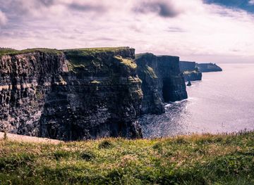
Explore more of Ireland
Discover Ireland: A land of enchanting landscapes, rich history, and vibrant culture, where every corner tells a story and every visit feels like coming home.
Explore Ireland