

The Kerry Way Travel Guide - Free Web & App
Your ultimate guide to The Kerry Way. Discover top landmarks, proposed trips, and local tips. Free on the web or via the Evendo companion app.


The Kerry Way in Ireland crosses mountain, coast and woodland around the Iveragh Peninsula, linking Killarney, villages, heritage and wild views.
A Long-Distance Route Through Iveragh
The Kerry Way is a long-distance walking route of approximately 214 kilometres around the Iveragh Peninsula in south-west Ireland. It begins and ends in Killarney, passing through the landscapes that have made County Kerry famous: wooded lake shores, glacial valleys, open moorland, mountain passes, quiet boreens, coastal hills and villages with strong connections to farming, fishing and emigration. Although usually walked in stages, the route is not a single uniform experience. The trails around Killarney have well-used paths and major heritage attractions, while sections through the Black Valley, Glenbeigh and the hills above the Atlantic feel considerably more remote.Read more about The Kerry Way
Landscape, Heritage and Wayfaring
The Character of the Walk
When is the best time to visit The Kerry Way?
Best: June–August · 20–21°C| Month | High (°C) | Rainfall (mm) |
|---|---|---|
| January | 10 | 100 |
| February | 11 | 90 |
| March | 12 | 80 |
| April | 15 | 70 |
| May | 18 | 60 |
| June (best) | 20 | 50 |
| July (best) | 21 | 50 |
| August (best) | 21 | 60 |
| September | 19 | 70 |
| October | 16 | 80 |
| November | 13 | 90 |
| December | 11 | 100 |
Getting to and around The Kerry Way
How to get there
Transportation
Best attractions in The Kerry Way
The Kerry Way’s attractions unfold as a sequence of landscapes rather than a collection of enclosed visitor sites. Around Killarney, walkers can explore the lakes, woodlands and mountain scenery of Killarney National Park, with Muckross House, Muckross Abbey and Torc Waterfall providing major cultural and natural highlights. The route then enters the Black Valley, one of its most remote-feeling sections, before crossing upland ground towards Glenbeigh and the northern coast of Iveragh. Farther west, views open towards Dingle Bay, the Atlantic and the Skellig Coast, with Cahersiveen and Waterville offering useful pauses in the journey. The southern stages through Caherdaniel, Sneem and the hills approaching Kenmare combine coastal panoramas with stone walls, small farms and quiet rural roads. Nearby attractions such as Staigue Fort and Cahergall Stone Fort can be visited as local excursions, but they are not directly on every walking stage.
-
Tourist attraction
Killarney National Park
Discover the breathtaking beauty and rich wildlife of Killarney National Park, a must-visit destination for nature lovers in County Kerry.
-
Tourist attraction
Muckross House
Discover the enchanting Muckross House in Killarney, a historical gem surrounded by stunning gardens and rich Irish heritage.
-
 Tourist attraction
Ross Castle
Explore the historic charm of Ross Castle, a stunning 15th-century fortress on the shores of Lough Leane in Killarney National Park, Ireland.
-
Tourist attraction
Torc Waterfall
Experience the breathtaking beauty of Torc Waterfall in Killarney National Park, a stunning natural attraction perfect for outdoor enthusiasts.
Best landmarks in The Kerry Way
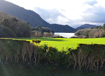
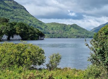
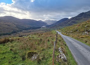
The Kerry Way is marked by a combination of natural and human landmarks. Lough Leane and the wooded shores of Killarney National Park establish the route’s eastern character, while Torc Waterfall and the slopes of Torc Mountain provide prominent features near Killarney. Muckross House and the ruins of Muckross Abbey connect the landscape with estate history and medieval religious heritage. Farther west, the Black Valley, mountain passes and the coastal heights above Iveragh are landmarks in their own right, defined by glacial valleys, open moorland and Atlantic views. Cahergall Stone Fort and Staigue Fort, reached by local detours near Cahersiveen and Caherdaniel respectively, represent the peninsula’s earlier archaeology. The route’s smaller landmarks—stone walls, field patterns, bridges, church ruins and old farm tracks—show how closely Kerry’s scenery is tied to human settlement.
-
Park
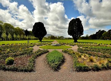
Killarney House and Gardens
Explore the stunning Killarney House and Gardens, a perfect blend of nature, history, and serenity in the heart of Co. Kerry.
Explore The Kerry Way on the map
Plan your trip on one map. See where the top attractions, landmarks, restaurants and hotels are, and book hotels and experiences in a few clicks.
Best hotels in The Kerry Way
Best restaurants in The Kerry Way
Dining along the Kerry Way is shaped by the route’s dispersed settlements rather than by a continuous restaurant scene. Killarney and Kenmare offer the widest choice, including restaurants, cafés, hotel dining rooms, bakeries and traditional pubs, while Glenbeigh, Cahersiveen, Waterville, Caherdaniel and Sneem provide more modest village-based options. Menus commonly draw on Irish and European cooking, with seafood, lamb, beef, farmhouse cheeses, breads and locally produced vegetables reflecting Kerry’s farming and coastal setting. In remote sections, walkers should not assume that food can be bought between stages; accommodation providers may offer meals or packed lunches when arranged in advance. Pubs often combine simple food with local company, while cafés are useful for daytime stops. Booking or checking arrangements ahead is particularly sensible outside the main towns and during quieter seasons.
-
Irish
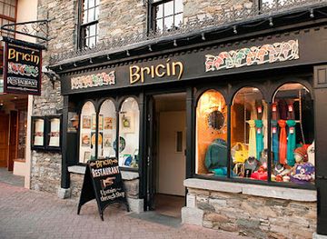
Bricín Restaurant and Boxty House
Savor traditional Irish flavors at Bricín Restaurant in Killarney – home to delicious boxty pancakes & warm hospitality.
-
Restaurant
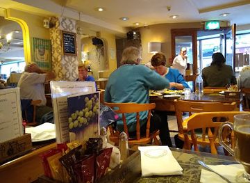
Caragh Restaurant & Lounge Bar
Experience the best of Irish cuisine at Caragh Restaurant & Lounge Bar in Killarney – where every meal is a delightful adventure.
-
Restaurant
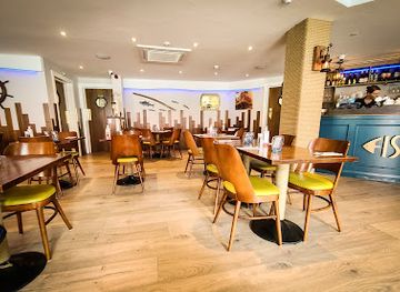
Kitty O’Se’s Seafood and Grill Restaurant
Experience exquisite seafood dining at Kitty O’Se’s Seafood and Grill Restaurant in Killarney - where fresh flavors meet Irish hospitality.
-
Restaurant
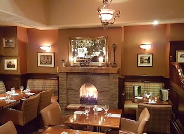
Hannigans Bar, Restaurant & Terrace
Discover Hannigans Bar & Restaurant in Killarney – where Irish flavors meet warm hospitality amidst stunning surroundings.
Best bars in The Kerry Way
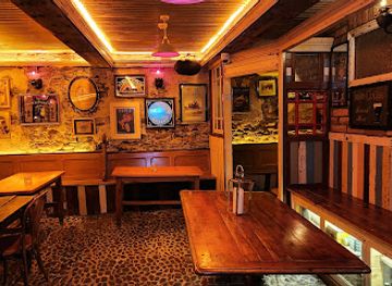
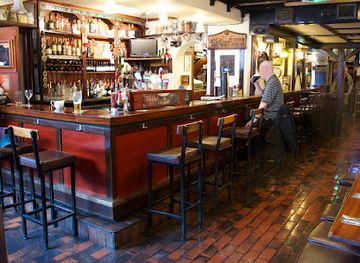
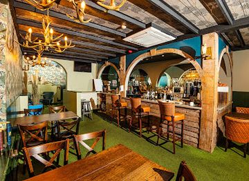
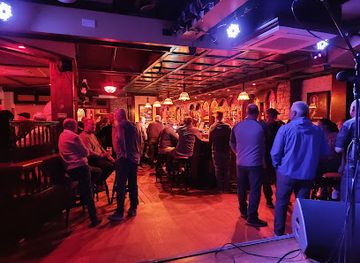
Evenings on the Kerry Way are generally quiet and social rather than club-oriented. Killarney and Kenmare have the broadest choice of traditional pubs, hotel bars and occasional live music, while village pubs in Glenbeigh, Cahersiveen, Waterville, Caherdaniel and Sneem provide more local-scale opportunities for conversation, drinks and, at times, traditional Irish music. In smaller settlements, the evening atmosphere depends on the day, season and individual venue, so visitors should not expect a fixed programme of entertainment. Remote stages through the Black Valley and upland country have little nightlife infrastructure beyond accommodation and isolated rural hospitality. The most characteristic evening experience is an unhurried pub visit after walking, with local music and storytelling possible but never guaranteed.
-
Irish pub
J.M. Reidy's
Discover the vibrant spirit of Killarney at J.M. Reidy's - a beloved Irish pub offering traditional fare, lively music, and warm hospitality.
-
Bar
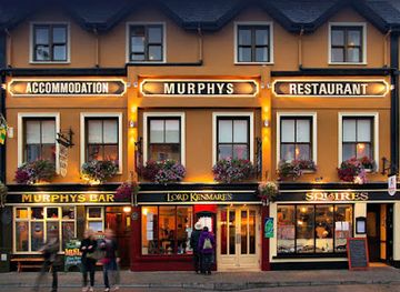
Murphys Bar, Restaurant & Townhouse Killarney
Discover the essence of Irish hospitality at Murphys Bar, Restaurant & Townhouse Killarney - where traditional cuisine meets a vibrant pub atmosphere.
-
Pub
The Laurels Pub & Restaurant
Discover the heart of Killarney at The Laurels Pub & Restaurant, where Irish hospitality meets delicious cuisine in a warm, inviting setting.
-
Irish pub
The Shire Bar & Cafe
Discover The Shire Bar & Cafe in Killarney, where traditional Irish hospitality meets lively entertainment and delicious cuisine for an unforgettable experience.
Best nightclubs in The Kerry Way
Evenings on the Kerry Way are generally quiet and social rather than club-oriented. Killarney and Kenmare have the broadest choice of traditional pubs, hotel bars and occasional live music, while village pubs in Glenbeigh, Cahersiveen, Waterville, Caherdaniel and Sneem provide more local-scale opportunities for conversation, drinks and, at times, traditional Irish music. In smaller settlements, the evening atmosphere depends on the day, season and individual venue, so visitors should not expect a fixed programme of entertainment. Remote stages through the Black Valley and upland country have little nightlife infrastructure beyond accommodation and isolated rural hospitality. The most characteristic evening experience is an unhurried pub visit after walking, with local music and storytelling possible but never guaranteed.
-
Pub
The Killarney Grand
Discover the lively atmosphere of The Killarney Grand, a must-visit pub in the heart of Killarney, full of music, drinks, and unforgettable experiences.
-
Sports bar
Jimmy Brien's Bar
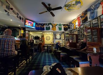
Experience the vibrant atmosphere of Jimmy Brien's Bar in Killarney, where sports, local brews, and hearty meals come together in a warm, inviting setting.
-
Bar
Social 15
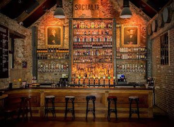
Discover the lively atmosphere of Social 15 in Killarney, where unforgettable nights of music, drinks, and fun await every visitor.
-
Bar
Sully's Bar Killarney
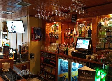
Discover the vibrant atmosphere and authentic Irish hospitality at Sully's Bar, a must-visit spot in Killarney, County Kerry.
Best shops in The Kerry Way
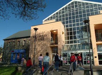
Shopping on the Kerry Way is concentrated in Killarney, Kenmare and the larger villages rather than along the remote walking sections. These centres provide supermarkets, pharmacies, outdoor equipment, cafés and independent shops where walkers can replenish supplies. Visitors may also find Irish knitwear, woollen goods, pottery, paintings, books, crafts and locally produced food, although selection varies between settlements and seasons. Farm shops and small food businesses can offer regional cheeses, breads, preserves and other provisions where available, while village shops are particularly useful for practical purchases before a rural stage. Cahersiveen and Waterville serve as important western supply points, but carrying enough food for long sections remains sensible. The most useful purchases are often functional—waterproofing, maps, snacks and walking supplies—rather than a large-scale souvenir collection.
-
Shopping mall
Killarney Outlet Centre
Discover unbeatable deals and charming cafes at Killarney Outlet Centre, your premier shopping destination in the heart of Killarney.
-
Department store
Dunnes Stores
Discover the vibrant shopping experience at Dunnes Stores in Killarney, where quality clothing meets a diverse grocery selection.
-
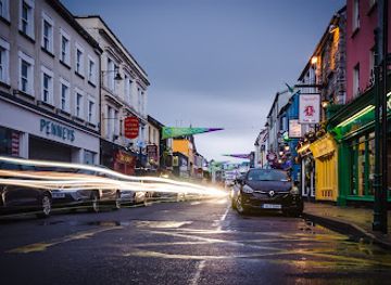
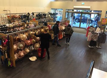
Clothing store
Penneys
Discover trendy and affordable fashion at Penneys in Killarney, the ultimate shopping destination for tourists seeking stylish apparel.
-
Department store
TK Maxx
Explore TK Maxx in Killarney for unbeatable deals on fashion, home goods, and hidden gems in a vibrant shopping atmosphere.

Get your free copy of our complete guide to The Kerry Way, delivered straight to you.
Everything on this page, from attractions and restaurants to essentials and local phrases, in one PDF you can read offline, print or share.
Already have an account? Sign in
Your The Kerry Way guide is ready.
We'll send it to · Not you? Sign out

Getting your guide ready…
We are putting together a fresh copy of the The Kerry Way guide. This can take up to a minute.
This can take a few moments. If your browser asks, choose Allow so the download can start. You'll find the guide in your Downloads folder.
Nothing happened? Download it again
Sorry, the guide is taking longer than usual. Please try again in a minute, or get it by email instead.
The Kerry Way essentials
Currency and Payment
Safety
Emergency Situations
Do's and Don'ts
Local Tips
From Eve
Local phrases worth knowing
You don't need to get them perfect. A few words go a long way, and locals appreciate the effort.
Basics
| English | Local | Say it |
|---|---|---|
| Hello | Dia dhuit | [dee-ah gwitch] |
| Goodbye | Slán | [slawn] |
| Yes | Is ea | [iss ay-ah] |
| No | Níl | [neel] |
| Please/You're welcome | Le do thoil/Tá fáilte romhat | [leh duh hull/tah fawl-cheh row-at] |
| Thank you | Go raibh maith agat | [goh rive mah ag-ut] |
| Excuse me/Sorry | Maith thú/Truaillithe | [mah hoo/troo-ah-lee-ha] |
| How are you? | Conas atá tú? | [kun-us ah-taw too] |
| Fine. And you? | Tá mé go breá. Agus tú? | [taw may goh brah. ag-us too] |
| Do you speak English? | An labhraíonn tú Béarla? | [ahn law-vree-un too bayr-la] |
| I don't understand | Ní thuigim | [nee hug-im] |
Eating & Drinking
| English | Local | Say it |
|---|---|---|
| I'd like to see the menu, please | Ba mhaith liom an mianu a fheiceáil, le do thoil | [bah wah lyum on me-an-oo ah eck-ah-il, leh duh hull] |
| I don't eat meat | Ní ithim feoil | [nee ih-im feh-il] |
| Cheers! | Sláinte! | [slawn-cheh] |
| I would like to pay, please | Ba mhaith liom íoc, le do thoil | [bah wah lyum ee-uk, leh duh hull] |
Emergencies
| English | Local | Say it |
|---|---|---|
| Help! | Cabhraigh! | [coh-ray] |
| Go away! | Imigh uaim! | [ih-mig oo-im] |
| Call the Police! | Glan an Gharda! | [glahn ahn gard-ah] |
| Call a doctor! | Glaoigh ar dochtúir! | [gwee-ahg air duck-too-ir] |
| I'm lost | Tá mé caillte | [taw may kahl-cheh] |
| I'm ill | Tá mé tinn | [taw may chin] |
Shopping
| English | Local | Say it |
|---|---|---|
| I'd like to buy... | Ba mhaith liom ceannach... | [bah wah lyum can-uk] |
| I'm just looking | Níl mé ach ag féachaint | [neel may akh eg fay-uk-int] |
| How much is it? | Cé mhéad atá air? | [kay vayd ah-taw air] |
| That's too expensive | Tá sé ró-dhaor | [taw shay row-gweer] |
| Can you lower the price? | An féidir leat an praghas a laghdú? | [ahn fay-dir lat on prah-gus ah lay-goo] |
Time & Numbers
| English | Local | Say it |
|---|---|---|
| What time is it? | Cén t-am é? | [kayn tahm ay] |
| It's one o'clock | Tá sé a haon | [taw shay ah hayn] |
| Half past (10) | Leathuair tar éis a deich | [lah-hoo-ir tahr aysh ah deh] |
| Morning | Maidin | [mah-jin] |
| Afternoon | Tráthnóna | [traw-noh-nah] |
| Evening | Tráthnóna | [traw-noh-nah] |
| Yesterday | Inné | [in-ay] |
| Today | Inniu | [in-yoo] |
| Tomorrow | Amárach | [ah-maw-rakh] |
| 1 | Aon | [ayn] |
| 2 | Dó | [doh] |
| 3 | Trí | [tree] |
| 4 | Ceathair | [cah-hir] |
| 5 | Cúig | [koo-ig] |
| 6 | Sé | [shay] |
| 7 | Seacht | [shah-kt] |
| 8 | Ocht | [ukht] |
| 9 | Naoi | [nee] |
| 10 | Deich | [deh] |
Transport & Directions
| English | Local | Say it |
|---|---|---|
| Where's a/the...? | Cá bhfuil...? | [kaw wil] |
| What's the address? | Cad é an seoladh? | [kahd ay ahn shoh-lah] |
| Can you show me (on the map)? | An féidir leat é a léiriú (ar an léarscáil)? | [ahn fay-dir lat ay ah layr-oo (er ahn layr-skawl)] |
| When's the next (bus)? | Cathain atá an chéad (bus)? | [kah-hin ah-taw ahn khayd (bus)] |
| A ticket (to ....) | Ticéad (go dtí ....) | [tick-ayd (goh dee)] |
History of The Kerry Way
Glacial Foundations of Iveragh
The landscapes crossed by the Kerry Way were shaped over geological timescales by long periods of erosion, including glaciation. Ice carved valleys and hollows, leaving mountain ridges, corries, lakes and deposits that influence the route’s most recognisable scenery. The valleys around Killarney and the Black Valley, together with the peninsula’s steep coastal slopes, reflect this interaction between high ground, moving ice and the Atlantic climate. Peatlands, heath and rough grassland developed over these underlying forms, while streams and rivers continued to modify the terrain. This geological inheritance explains why the walk alternates between enclosed valleys, open uplands and high coastal viewpoints rather than following a simple lowland corridor.
Early Communities and Stone Forts
Iveragh has been settled and worked for many centuries, and its archaeological remains reveal a landscape organised around small communities, farming and seasonal movement. Stone forts, standing stones, early Christian sites and field boundaries survive in parts of the peninsula, including the broader countryside near the Kerry Way. Cahergall Stone Fort outside Cahersiveen is among the area’s notable archaeological monuments, although it lies away from the route itself. The evidence is not a continuous historical narrative, but it demonstrates that the hills and coastal margins were not empty wilderness. Their use depended on grazing, cultivation, shelter and access to the sea, producing the layered rural landscape visible today.
Medieval and Gaelic Kerry
During the medieval period, Iveragh was shaped by Gaelic lordships, ecclesiastical foundations and connections across the peninsula and its neighbouring coast. Cahersiveen and the surrounding area preserve links with the wider MacCarthy tradition, while later castles, churches and fortified sites reflect the political instability of the region. Rural communities relied heavily on mixed farming, fishing and local exchange, with isolated valleys connected by tracks rather than modern roads. Many surviving walls and small fields are products of this long interaction between people and difficult terrain. The Kerry Way follows several modernised or waymarked paths through countryside whose broad pattern still reflects those older systems of settlement and land use.
Estate Landscapes and Victorian Tourism
Killarney became an important destination for visitors during the eighteenth and nineteenth centuries, when its lakes, mountains and waterfalls were increasingly promoted as scenic attractions. Muckross House, completed in the nineteenth century, represents the estate culture that shaped part of the landscape south of Killarney. The arrival of improved roads and rail connections made the area more accessible, while landscaped grounds and excursions around the lakes helped establish the foundations of modern tourism. Elsewhere on the Iveragh Peninsula, life remained predominantly rural, but coastal villages and scenic viewpoints gradually entered the itineraries of travellers exploring the south-west. The contrast between designed estate scenery and working countryside remains evident along the route.
Conservation and the Waymarked Trail
Killarney National Park was established in 1932 after the transfer of the Muckross Estate to the Irish state, creating a protected setting for lakes, woodland, mountains and important habitats. Conservation in and around the park has since had to balance recreation, farming, forestry, landscape character and the protection of wildlife. The development of Ireland’s waymarked walking routes in the late twentieth century provided a more coherent way to cross the Iveragh Peninsula on foot. The Kerry Way brought together existing tracks, minor roads and upland paths rather than creating a wholly engineered trail. Its continuing character therefore depends on responsible walking, maintenance and cooperation with landowners and local communities.
The Kerry Way in Photos
Browse through our photo collection highlighting the charm and character of the destination.
Cities in The Kerry Way
The towns and cities of The Kerry Way, and the easiest places to base yourself.
-

-


Swipe for more cities
Neighbouring destination travel guides
The closest destinations to The Kerry Way, if you have time for more than one.
-

-

-

-

-


Swipe for more destinations
Explore more

Explore more of County Kerry
Explore the breathtaking landscapes, rich history, and vibrant culture of County Kerry, Ireland's jewel of natural beauty and charm.
Explore County Kerry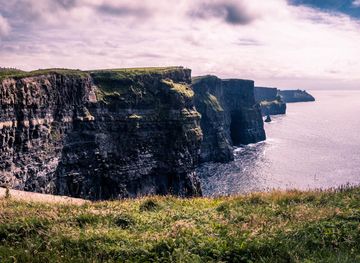
Explore more of Ireland
Discover Ireland: A land of enchanting landscapes, rich history, and vibrant culture, where every corner tells a story and every visit feels like coming home.
Explore Ireland