Free Elgeyo Escarpment Travel Guide & Mobile App
Explore Elgeyo Escarpment with free travel guides. Discover regional history, expert tips, proposed trips, and audio guides on web or mobile app.


Explore Kenya’s Elgeyo Escarpment for Rift Valley views, highland running culture, rural landscapes and guided walks above the Kerio Valley.
Read more about Elgeyo Escarpment
When is the best time to visit Elgeyo Escarpment?
Best: January–February, August · 23°C| Month | High (°C) | Rainfall (mm) |
|---|---|---|
| January (best) | 23 | 60 |
| February (best) | 23 | 80 |
| March | 24 | 120 |
| April | 25 | 160 |
| May | 25 | 180 |
| June | 24 | 160 |
| July | 23 | 120 |
| August (best) | 23 | 100 |
| September | 23 | 120 |
| October | 24 | 140 |
| November | 23 | 120 |
| December | 23 | 100 |
Getting to and around Elgeyo Escarpment
How to get there
Transportation
Top city travel guides in Elgeyo Escarpment
The cities of Elgeyo Escarpment, and the easiest places to base yourself.
-

-


Swipe for more cities
Destinations in Elgeyo Escarpment
Resorts, valleys and scenic spots worth a trip of their own.
-

-

-


Swipe for more destinations
Best attractions in Elgeyo Escarpment
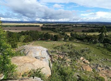
The Elgeyo Escarpment’s attractions are primarily geographic, cultural and outdoor rather than centred on a dense collection of ticketed sites. Viewpoints around the highlands near Iten reveal the abrupt descent into the Kerio Valley, with layered hills, dry-season colours and changing light across the Rift Valley. Rural drives combine cultivated uplands, scattered settlements, wooded ravines and roads tracing the escarpment edge. Guided walks provide a closer look at local farming, footpaths and the contrast between highland and valley environments, while longer descents require preparation and should not be attempted casually. Iten’s distance-running culture is another important attraction, with training roads and an athletics identity that have made the area known well beyond Kenya. In the wider Elgeyo-Marakwet landscape, visitors may also find opportunities for birdwatching, landscape photography and community-based cultural interpretation. The region is less suited to hurried sightseeing than to a slow itinerary combining scenery, conversations, rural observation and carefully planned outdoor activity. Exact access to paths and viewpoints can change with weather, land use and road conditions, so local guidance is valuable.
-
Tourist attraction
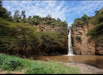
Lake Nakuru National Park
Explore the stunning landscapes, diverse wildlife, and vibrant birdlife of Lake Nakuru National Park, a true gem in Kenya's national parks.
-
 National park
Amboseli National Park
Discover the breathtaking Amboseli National Park, renowned for its stunning views of Mount Kilimanjaro and abundant wildlife, including Africa's largest elephant herds.
-
Tourist attraction
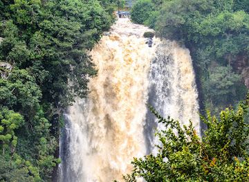
Thompson Falls Nyahururu
Explore the stunning Thompson Falls in Nyahururu, a breathtaking natural park featuring majestic waterfalls and rich biodiversity.
-
National park
Hells Gate National Park
Explore the dramatic landscapes and diverse wildlife of Hell's Gate National Park, a must-visit destination in Kenya for nature lovers and adventure seekers.
Best landmarks in Elgeyo Escarpment
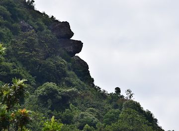
The defining landmark of the region is the escarpment itself: a long, abrupt highland edge overlooking the Kerio Valley and forming one of the most recognisable relief changes in this part of Kenya. Its viewpoints are natural rather than monumental structures, but the scale of the cliffs, ravines and valley floor gives them strong geographic significance. Iten is another important regional landmark in a cultural sense, representing Kenya’s high-altitude distance-running world and the training landscape associated with international athletics. On the valley side, the Kerio River and surrounding dry hills provide a contrasting natural setting to the cultivated, cooler rim. Traditional irrigation channels in the wider Marakwet highlands are significant living landmarks, showing how communities have carried water across difficult terrain for farming. Rural churches, schools, homesteads and market centres are locally meaningful but are not conventional sightseeing monuments; visitors should enter such places respectfully and with permission. Because the escarpment is a lived and working landscape, its most important landmarks are best understood through their relationship to geology, agriculture, transport and community life rather than viewed as isolated photographic stops.
-
Historical landmark
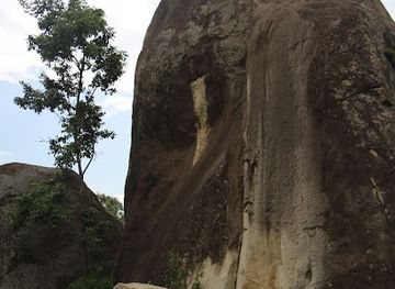
The Crying Stone of Illesi
Explore the Crying Stone of Illesi, a captivating historical landmark in Kenya, rich in culture and natural beauty, perfect for reflection and discovery.
-
Environment renewable natural resources
Torok Waterfalls
Experience the serene beauty and natural splendor of Torok Waterfalls in Biretwo, a must-visit destination for nature lovers and adventure seekers.
-
Environment renewable natural resources
Kessup Falls
Discover the serene beauty of Kessup Falls, a hidden natural treasure in Kessup village, perfect for relaxation and exploration amidst lush landscapes.
-
Tourist attraction
Kessup Forest
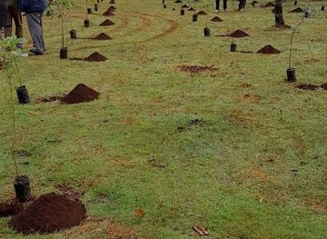
Explore the tranquil beauty of Kessup Forest, a serene escape in Kenya, perfect for nature walks, picnics, and wildlife observation.

Explore Elgeyo Escarpment on the map
Plan your trip on one map. See where the top cities, national parks and sights are, and book hotels and experiences in a few clicks.
Best hotels in Elgeyo Escarpment
Best restaurants in Elgeyo Escarpment
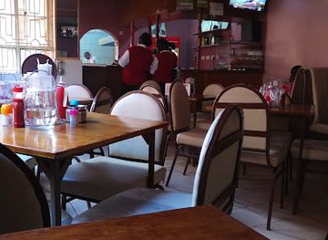
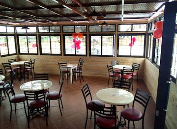
Dining on the Elgeyo Escarpment is generally informal and closely connected to everyday Kenyan food rather than a specialised tourist restaurant scene. In Iten and other established centres, visitors can expect cafés, small restaurants and hotels serving dishes such as ugali, sukuma wiki, beans, rice, chapati, nyama choma and stewed meat, alongside tea and simple breakfast foods. The highland farming environment contributes maize, beans, vegetables, fruit and dairy products, while foods available in the Kerio Valley may differ with altitude and local supply. Rural food is often prepared simply, and advance notice is sensible when requesting meals at smaller guesthouses or community-run accommodation. Markets and roadside stalls can offer seasonal produce, but hygiene and storage standards vary, so choose busy outlets with good turnover and carry drinking water. Tea is widely enjoyed, particularly in the cool highlands, while Kenyan coffee may be available in better-equipped cafés. Dining is usually earlier and quieter outside busy towns, and visitors should confirm payment methods before ordering in rural areas.
-
Restaurant
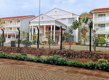
Rift Valley Hills Resort
Discover exquisite dining at Rift Valley Hills Resort amidst stunning landscapes in Kabarnet.
-
Restaurant
Aya Inn Restaurant
Experience authentic Kenyan cuisine at Aya Inn Restaurant in Eldoret, where every meal tells a story.
-
African
Kerio Dreams Restaurant
Experience authentic African cuisine at Kerio Dreams Restaurant in Eldoret – where every dish tells a story.
-
Restaurant
Elgon Valley Resort
Experience tranquility and adventure at Elgon Valley Resort - where comfort meets nature in Kenya's stunning highlands.
Best bars in Elgeyo Escarpment
Evening life on the Elgeyo Escarpment is modest and concentrated mainly in Iten and other larger settlements. Local hotels, pubs and restaurants provide places for conversation, televised sport, tea or a beer, while some venues may offer music at weekends; the atmosphere is generally more social than club-focused. Rural evenings are quiet, and visitors staying outside town should expect limited entertainment after dark rather than a dedicated nightlife district. Iten’s identity as a running centre brings a mixed community of athletes, coaches and residents, but it does not make the area a major party destination. Alcohol is available in licensed premises, yet visitors should drink responsibly, avoid walking isolated roads at night and arrange transport in advance. Travellers seeking a wider selection of late-night venues will generally find more choice in larger Kenyan cities outside the escarpment. Local accommodation can advise which establishments are currently operating, as small businesses and entertainment arrangements change.
-
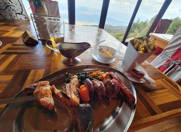
Restaurant
High Altitude Training Restaurant
Discover the perfect blend of nutrition and local flavors at High Altitude Training Restaurant in Kamariny, ideal for athletes and food lovers.
-
Sports bar
Infinity Tavern
Discover the excitement of sports and nightlife at Infinity Tavern, a must-visit sports bar in Eldoret offering great food and entertainment.
-
Restaurant
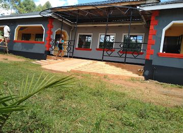
Dining
Experience the best of Kerio View's culinary scene with diverse dishes, stunning views, and exceptional service, perfect for every dining occasion.
-
Grill
Roots Riverside bar and restaurant
Discover the vibrant culinary scene at Roots Riverside Bar and Restaurant, where local flavors meet a lively atmosphere in Nabiswa.

Best nightclubs in Elgeyo Escarpment
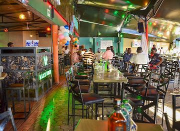
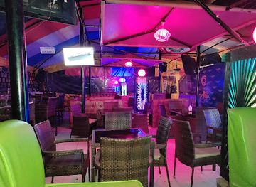
Evening life on the Elgeyo Escarpment is modest and concentrated mainly in Iten and other larger settlements. Local hotels, pubs and restaurants provide places for conversation, televised sport, tea or a beer, while some venues may offer music at weekends; the atmosphere is generally more social than club-focused. Rural evenings are quiet, and visitors staying outside town should expect limited entertainment after dark rather than a dedicated nightlife district. Iten’s identity as a running centre brings a mixed community of athletes, coaches and residents, but it does not make the area a major party destination. Alcohol is available in licensed premises, yet visitors should drink responsibly, avoid walking isolated roads at night and arrange transport in advance. Travellers seeking a wider selection of late-night venues will generally find more choice in larger Kenyan cities outside the escarpment. Local accommodation can advise which establishments are currently operating, as small businesses and entertainment arrangements change.
-
Disco club
Makuti Restraunt
Dive into Kitale's nightlife at Makuti Restaurant, a lively disco club offering vibrant music and a welcoming atmosphere.
-
Night club
Vaxx 1000 Lounge And Grill
Experience the vibrant nightlife at Vaxx 1000 Lounge And Grill, Eldoret's premier venue for music, dance, and culinary delights.
-
Disco club
Cloud 9 Lounge
Discover the vibrant nightlife of Eldoret at Cloud 9 Lounge, a premier disco and sports bar offering exquisite dining and entertainment.
-
Night club
TERRA Marurà
Discover the vibrant nightlife at TERRA Marurà, Eldoret's premier night club, where music, dance, and fun come together for an unforgettable experience.

Best shops in Elgeyo Escarpment
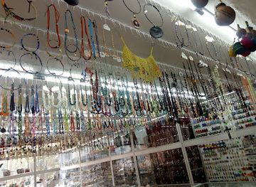
Shopping on the Elgeyo Escarpment is centred on local markets, small high-street businesses and everyday supplies rather than large retail complexes. Iten is the most practical place for basic provisions, outdoor necessities and locally produced food, while market centres along the roads serve surrounding farming communities. Visitors may find seasonal vegetables, fruit, grains, honey and other agricultural products, although availability changes with harvests and transport. Small shops may also sell Kenyan tea, coffee and packaged foods suitable for a road journey. Handicrafts and woven items can sometimes be sourced through community contacts, but quality, provenance and prices vary, so buy respectfully and ask before photographing makers or their work. The region is not primarily a luxury-shopping destination, and specialist equipment or a wide choice of clothing is more easily found in larger towns outside the escarpment. Carry reusable bags, use local currency for small purchases and compare prices courteously rather than treating rural markets as fixed tourist attractions.
-
Shopping mall
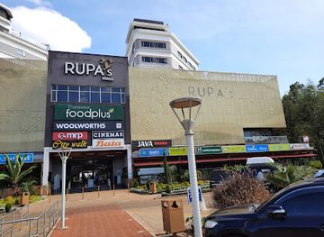
Rupa's Mall
Explore Rupa's Mall in Eldoret for a unique shopping experience with diverse brands, delicious dining, and exciting entertainment options.
-
Shopping mall
Kaptuli
Explore Kaptuli, the vibrant shopping mall in Sergoit, where local culture meets a world of retail adventures.
-
Gift shop
Warembo Gift Shop
Discover unique gifts and authentic Kenyan souvenirs at Warembo Gift Shop in Eldoret, a treasure trove for every traveler.
-
Shopping mall
Shop
Explore the vibrant shopping landscape of Iten, where local crafts and flavors come together in a unique cultural experience.
Get your free copy of our complete guide to Elgeyo Escarpment, delivered straight to you.
Everything on this page, from attractions and restaurants to essentials and local phrases, in one PDF you can read offline, print or share.
Already have an account? Sign in
Your Elgeyo Escarpment guide is ready.
We'll send it to · Not you? Sign out

Getting your guide ready…
We are putting together a fresh copy of the Elgeyo Escarpment guide. This can take up to a minute.
This can take a few moments. If your browser asks, choose Allow so the download can start. You'll find the guide in your Downloads folder.
Nothing happened? Download it again
Sorry, the guide is taking longer than usual. Please try again in a minute, or get it by email instead.
Elgeyo Escarpment essentials
Currency and Payment
Safety
Emergency Situations
Do's and Don'ts
Local Tips
From Eve
Local phrases worth knowing
You don't need to get them perfect. A few words go a long way, and locals appreciate the effort.
Basics
| English | Local | Say it |
|---|---|---|
| Hello | Naki | [Nah-kee] |
| Goodbye | Kipkoech | [Keep-koh-ehch] |
| Yes | Eeh | [Eh-eh] |
| No | Aye | [Ah-yeh] |
| Please/You're welcome | Ng'ot | [Ngot] |
| Thank you | Asante | [Ah-sahn-teh] |
| Excuse me/Sorry | Samahani | [Sah-mah-hah-nee] |
| How are you? | Ong'ete? | [Ohng-eh-teh] |
| Fine. And you? | Naki, na wewe? | [Nah-kee, nah weh-weh?] |
| Do you speak English? | Unaongea Kiingereza? | [Oo-nah-on-geh-rah Kee-in-ge-reh-zah?] |
| I don't understand | Sielewi | [See-eh-leh-wee] |
Eating & Drinking
| English | Local | Say it |
|---|---|---|
| I'd like to see the menu, please | Ningependa kuona orodha ya chakula, tafadhali | [Nin-geh-pen-dah koo-nah oh-roh-dhah yah chah-koo-lah, tah-fah-dhah-lee] |
| I don't eat meat | Sili nyama | [See-lee nyah-mah] |
| Cheers! | Afya! | [Ah-fyah] |
| I would like to pay, please | Ningependa kulipa, tafadhali | [Nin-geh-pen-dah koo-lee-pah, tah-fah-dhah-lee] |
Emergencies
| English | Local | Say it |
|---|---|---|
| Help! | Saidia! | [Sah-ee-dee-ah] |
| Go away! | Nenda mbali! | [Nehn-dah m-bah-lee] |
| Call the Police! | Piga simu polisi! | [Pee-gah see-moo poh-lee-see] |
| Call a doctor! | Piga simu daktari! | [Pee-gah see-moo dahk-tah-ree] |
| I'm lost | Nimepotea | [Nee-meh-poh-teh-ah] |
| I'm ill | Nina ugonjwa | [Nee-nah oo-gon-jwah] |
Shopping
| English | Local | Say it |
|---|---|---|
| I'd like to buy... | Ningependa kununua... | [Nin-geh-pen-dah koo-noo-nuah] |
| I'm just looking | Natazama tu | [Nah-tah-zah-mah too] |
| How much is it? | Ni pesa ngapi? | [Nee peh-sah ngah-pee?] |
| That's too expensive | Hiyo ni ghali sana | [Hee-yoh nee gah-lee sah-nah] |
| Can you lower the price? | Unaweza kupunguza bei? | [Oo-nah-weh-zah koo-poon-guh-zah beh-ee?] |
Time & Numbers
| English | Local | Say it |
|---|---|---|
| What time is it? | Ni saa ngapi? | [Nee sah ngah-pee?] |
| It's one o'clock | Ni saa moja | [Nee sah moh-jah] |
| Half past (10) | Nusu ya kumi | [Noo-soo yah koo-mee] |
| Morning | Asubuhi | [Ah-soo-boo-hee] |
| Afternoon | Mchana | [M-chah-nah] |
| Evening | Jioni | [Jee-oh-nee] |
| Yesterday | Jana | [Jah-nah] |
| Today | Leo | [Leh-oh] |
| Tomorrow | Kesho | [Keh-shoh] |
| 1 | Moja | [Moh-jah] |
| 2 | Mbili | [M-bee-lee] |
| 3 | Tatu | [Tah-too] |
| 4 | Nne | [N-ne] |
| 5 | Tano | [Tah-noh] |
| 6 | Sita | [See-tah] |
| 7 | Saba | [Sah-bah] |
| 8 | Nane | [Nah-neh] |
| 9 | Tisa | [Tee-sah] |
| 10 | Kumi | [Koo-mee] |
Transport & Directions
| English | Local | Say it |
|---|---|---|
| Where's a/the...? | Iko wapi...? | [Ee-koh wah-pee?] |
| What's the address? | Nini ni anwani? | [Nee-nee nee ahn-wah-nee?] |
| Can you show me (on the map)? | Unaweza kunionyesha (katika ramani)? | [Oo-nah-weh-zah koo-nee-oh-nyes-ah (kah-tee-kah rah-mah-nee)?] |
| When's the next (bus)? | Basi inayofuata ni lini? | [Bah-see ee-nah-yoh-foo-ah-tah nee lee-nee?] |
| A ticket (to ....) | Tiketi (kuenda ....) | [Tee-keh-tee (koo-en-dah ....)] |
History of Elgeyo Escarpment
Early Settlement and Rift Valley Landscapes
The escarpment’s history begins with the wider human story of the Great Rift Valley, where changing climates, grasslands and watercourses supported communities over many thousands of years. Archaeological work across Kenya has established the importance of the Rift Valley as a route of human movement and settlement, although individual sites on the Elgeyo Escarpment are not always developed for visitors. The steep divide between the highlands and Kerio Valley influenced where people farmed, grazed animals and travelled. The landscape’s geology remains visible in cliff faces, ravines and exposed strata, providing a physical record of the forces that shaped the Rift Valley.
Keiyo and Marakwet Communities
The modern cultural landscape is strongly associated with Keiyo and Marakwet communities, both part of the wider Kalenjin-speaking peoples of western Kenya. Settlement, age-set traditions, livestock keeping and farming developed in response to sharply differing conditions between the cool uplands and the warmer valley. Local knowledge of paths, springs, soils and seasonal weather has long been essential for movement across the escarpment. Community identity remains expressed through language, family networks, ceremonies, foodways and agricultural practice. Visitors should understand the region as a lived rural landscape rather than an empty wilderness or merely a scenic viewpoint.
Traditional Irrigation and Highland Agriculture
In the wider Kerio highlands, Marakwet communities developed and maintained gravity-fed irrigation channels that carried water from streams across slopes and cultivated areas. These systems supported crops in terrain where rainfall is seasonal and helped communities make productive use of narrow terraces and valley-side land. Their significance is both practical and cultural: maintenance depends on shared knowledge, labour and agreed access to water. Agriculture has changed with population growth, markets and modern infrastructure, but traditional water management remains an important part of the region’s heritage and illustrates the environmental adaptation of communities living along the escarpment.
Colonial Rule and Administrative Change
British colonial rule brought new administrative boundaries, taxation, roads, schools and Christian missions to the wider western Kenyan highlands during the twentieth century. These changes altered patterns of authority, education, land use and trade, while colonial classifications often simplified older local identities and relationships. The escarpment’s difficult terrain limited large-scale development compared with some Kenyan farming districts, but roads linking the highlands with the Kerio Valley strengthened connections to markets and administrative centres. The area later became part of successive post-independence administrative arrangements, with Elgeyo-Marakwet County established under Kenya’s current devolved system.
Independence and County Identity
Kenya’s independence in 1963 ushered in new national institutions, expanded education and changing economic opportunities across the escarpment. Rural communities continued to depend heavily on agriculture and livestock, while public roads, health services and local administration gradually connected more settlements to the wider country. Under devolution, Elgeyo-Marakwet County gained a stronger administrative identity and responsibility for local development. The escarpment remains closely linked to neighbouring counties through trade, family networks and transport, but its combination of Keiyo and Marakwet cultural landscapes, dramatic relief and Kerio Valley geography gives it a recognisable regional character.
Iten and the Rise of Distance Running
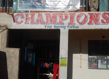
During the late twentieth century, Iten and nearby highland settlements became associated with Kenya’s international distance-running success. The altitude, undulating roads, training culture and strong local participation in athletics helped attract runners and coaches, while successful Kenyan athletes raised the profile of the area worldwide. Running is now part of the region’s contemporary identity, visible in early-morning training and local athletics facilities, although it sits alongside farming, education and ordinary community life. The running story has brought visitors and sports-related investment, but it should not obscure the escarpment’s broader cultural and environmental history.
Elgeyo Escarpment in Photos
Browse through our photo collection highlighting the charm and character of the destination.
Neighbouring regions of Elgeyo Escarpment
The closest regions to Elgeyo Escarpment, if you have time for more than one.
-

-

-

-

-


Swipe for more regions