
Breathtaking Adventures Await at Mt Longonot Hiking Trail
Discover the stunning beauty and adventure of Mt Longonot Hiking Trail in the Great Rift Valley, perfect for nature lovers and outdoor enthusiasts.
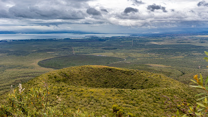
Nestled in the heart of Kenya, the Mt Longonot hiking trail offers an exhilarating experience for adventure seekers. This stunning location features a dormant volcano surrounded by lush landscapes and breathtaking views that stretch as far as the eye can see. Ideal for both novice and experienced hikers, the trail promises an unforgettable journey through nature's beauty.
A brief summary to Mt Longonot hiking trail
- Longonot, KE
Local tips
- Start your hike early in the morning to enjoy cooler temperatures and stunning sunrise views.
- Bring plenty of water and snacks to stay hydrated and energized during your hike.
- Wear sturdy hiking shoes for better grip and support on the rocky terrain.
- Don't forget your camera to capture the stunning landscapes and wildlife along the trail.
- Respect the environment by staying on marked trails and carrying out any litter.
Getting There
-
Car
If you are driving to the Mt Longonot hiking trail, start by entering 'Longonot' into your GPS or navigation app. The coordinates for the trailhead are approximately -0.8908 latitude and 36.4732 longitude. From Nairobi, take the Nakuru Highway (A104), and follow signs to Naivasha. After about 90 km, take the exit towards Longonot. Follow the road signs that lead you to the Mt Longonot National Park entrance. There is a parking area at the entrance, where you can leave your car for a small fee (around KES 300).
-
Public Transportation
To reach Mt Longonot by public transport, you can take a matatu (shared taxi) from Nairobi to Naivasha. The matatus leave from the Nairobi CBD (commonly from the Kencom area) and the fare is around KES 200-300. Once you arrive in Naivasha, you can catch another matatu heading to Longonot. Inform the driver that you are going to the Mt Longonot National Park entrance. The fare for this leg is typically around KES 50-100. Once you arrive at the entrance, there may be a short walk to the park gate where you will need to pay an entry fee of approximately KES 300.
-
Bicycle
If you're feeling adventurous and want to bike to the Mt Longonot hiking trail, you can rent a bicycle in Naivasha or Longonot. The trailhead is about 13 km from Naivasha town. Follow the road signs to Longonot, and then to Mt Longonot National Park. It is a relatively flat route, but be cautious of traffic. Ensure you have enough water and snacks for the ride, as there are limited stops along the way.
Discover more about Mt Longonot hiking trail
Iconic landmarks you can’t miss
Mt Longonot National Park
0.2 km
Discover the breathtaking beauty and adventure of Mt Longonot National Park, a top hiking destination in Kenya's Great Rift Valley.
Lake Naivasha Sopa Resort
12.7 km
Discover serenity at Lake Naivasha Sopa Resort, a perfect blend of luxury, natural beauty, and adventure amidst Kenya's stunning landscapes.

Acacia Campsite Sanctuary Farm
12.7 km
Discover the tranquility of Acacia Campsite Sanctuary Farm in Karagita, where nature meets adventure in the heart of Kenya.

Lake Naivasha Simba Lodge
13.0 km
Discover the tranquility of Lake Naivasha Simba Lodge, where nature meets luxury in a stunning lakeside setting.

Enashipai Resort & Spa
14.2 km
Experience unparalleled luxury and natural beauty at Enashipai Resort & Spa, the ultimate retreat on the shores of Lake Naivasha.

Lake Naivasha Country Club
14.4 km
Experience the beauty and tranquility of Lake Naivasha at the Lake Naivasha Country Club, where relaxation meets adventure in a stunning natural setting.
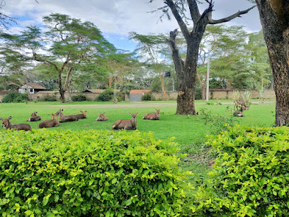
Dea's Gardens
14.6 km
Discover tranquility and natural beauty at Dea's Gardens, a serene homestay in Karagita, Kenya, perfect for nature lovers and explorers.

Naivasha Yacht Club
14.7 km
Discover the beauty and adventure at Naivasha Yacht Club, a serene getaway on the shores of Lake Naivasha, perfect for sailing and nature exploration.
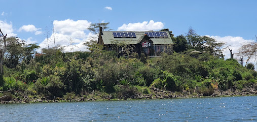
Lake Naivasha Crescent Camp
15.0 km
Experience the wonders of nature at Lake Naivasha Crescent Camp, a family-friendly retreat with adventure and relaxation by the serene lake.

Burch's Resort Naivasha
15.0 km
Experience the tranquility of Burch's Resort Naivasha, where luxury meets nature on the shores of Lake Naivasha, ideal for relaxation and adventure.

Cresent Island
15.4 km
Discover the enchanting Crescent Island in Lake Naivasha, Kenya - a wildlife paradise with breathtaking views and serene landscapes.

Enkapune Resort Naivasha
16.1 km
Discover tranquility at Enkapune Resort Naivasha, a lakeside retreat that blends comfort with nature in the heart of Kenya's Great Rift Valley.
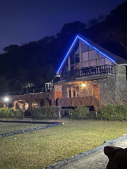
The Log Inn Camp Grounds - Naivasha
16.2 km
Discover the natural beauty of Naivasha at The Log Inn Camp Grounds, an ideal haven for camping, hiking, and wildlife exploration.

Naivasha Rocky Eco Lodge (Rocky Resort)
16.3 km
Discover tranquility and adventure at Naivasha Rocky Eco Lodge, a resort hotel harmonizing with nature for the perfect Kenyan getaway.
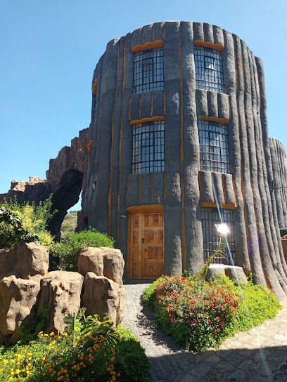
Fisherman's Camp
17.0 km
Experience the natural beauty and family-friendly atmosphere of Fisherman's Camp at Lake Naivasha, the perfect destination for unforgettable camping adventures.

Unmissable attractions to see
Kwa Gitonga Bk
2.4 km
Discover Kwa Gitonga Bk in Longonot, Kenya: A breathtaking hiking area filled with scenic trails, lush landscapes, and vibrant wildlife waiting to be explored.

Longonot Volcano crater
3.4 km
Experience breathtaking views and thrilling hikes at Longonot Volcano Crater, a stunning gem in Kenya's Great Rift Valley.
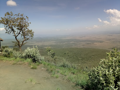
Mount Longonot National Park
4.1 km
Discover the stunning landscapes and rich biodiversity of Mount Longonot National Park, a must-visit destination for nature lovers and adventurers in Kenya.
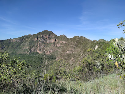
Kilele Ngamia - Longot Summit
4.4 km
Discover the breathtaking beauty and adventure of Kilele Ngamia - Longot Summit, a premier hiking destination in Kenya's stunning landscapes.
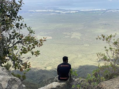
Mount Longonot
4.4 km
Explore the stunning landscapes and diverse wildlife of Mount Longonot, a must-visit hiking destination in the Great Rift Valley of Kenya.
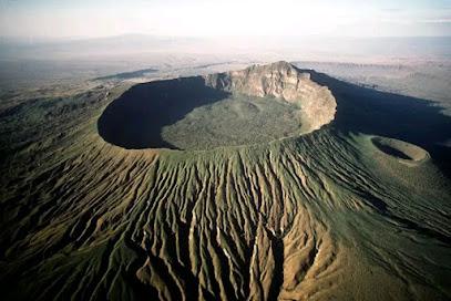
Salvon Africa
5.1 km
Explore the tranquil beauty of Salvon Africa, a stunning garden oasis in Longonot, perfect for relaxation and nature appreciation.

Kelvin one
6.9 km
Discover the enchanting Kelvin One garden in Naivasha, a peaceful retreat brimming with vibrant flora and serene landscapes perfect for relaxation.

Mawingu Camp Kenya
8.4 km
Discover the natural beauty and cultural richness of Mawingu Camp, a serene retreat in Kenya's breathtaking Rift Valley region.
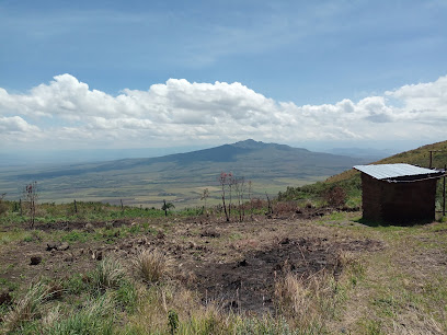
Elwai Centre Cottages, Wood Cabins, Picnic and Serviced Campsite
8.8 km
Experience the serene beauty of Naivasha at Elwai Centre, featuring cozy cottages, wood cabins, and a picturesque campsite for nature lovers.

Oasis Park Naivasha
9.4 km
Discover the serene beauty of Oasis Park Naivasha, a perfect campground for nature lovers and adventure seekers in Kenya's stunning landscapes.

Nakuru County Entry/Exit Signboard
9.5 km
Explore Nakuru County: Your adventure begins here at the iconic Entry/Exit Signboard, gateway to breathtaking landscapes and rich wildlife.
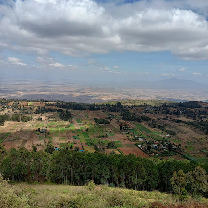
Gitwe Viewpoint
10.0 km
Discover the breathtaking views and serene hiking trails at Gitwe Viewpoint in Heni Village, a must-visit destination for nature lovers in Kenya.

Obsidian Caves
10.9 km
Discover the breathtaking beauty and geological significance of the Obsidian Caves in Nakuru, a must-visit destination for nature lovers and adventurers.

Olkaria geomothamol spa
11.3 km
Experience the healing power of nature at Olkaria Geothermal Spa, where relaxation meets the beauty of Kenya's geothermal wonders.

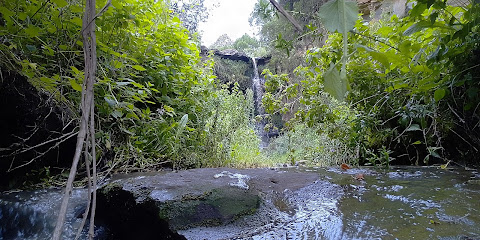
KINUNGI WATERFALLS(Seasonal)
12.0 km
Discover the serene beauty of Kinungi Waterfalls in Kenya, a seasonal spectacle that captivates with its stunning cascades and lush surroundings.
Essential places to dine
Weekend Inn Restaurant
0.2 km
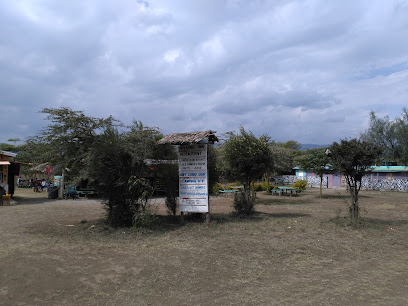
Experience authentic Kenyan cuisine at Weekend Inn Restaurant in Longonot – where every meal is a celebration of local flavors.
Pizza Inn Kobil View Point
9.4 km
Discover delicious pizzas with stunning views at Pizza Inn Kobil View Point - perfect for dining in or takeaway while exploring Naivasha.

Matteo's Italian restaurant and bar
12.3 km
Experience authentic Italian flavors at Matteo's Italian Restaurant and Bar in Karagita – where every meal is a culinary adventure.

Kijiko
12.8 km
Discover Kijiko - A Family-Friendly Restaurant Offering Authentic Kenyan Cuisine Amidst Breathtaking Natural Beauty.

Crayfish Restaurant Naivasha
15.1 km
Experience authentic African cuisine at Crayfish Restaurant Naivasha amidst stunning natural beauty.

Artcaffé
15.1 km
Discover delicious local and international cuisine at Artcaffé in Naivasha - a culinary gem offering comfort food with stunning surroundings.

Pazuri Garden Restaurant
15.3 km
Experience the tranquility and culinary delights at Pazuri Garden Restaurant in Kijabe – where every meal is a celebration of local flavors amidst nature's beauty.

The Hook Lakefront Lounge
16.0 km
Discover exquisite dining with stunning lake views at The Hook Lakefront Lounge in Naivasha.

Under the Swahili Tree Naivasha
16.2 km
Discover authentic Kenyan cuisine at Under the Swahili Tree in Naivasha, where nature meets culinary excellence.

Camp Carnelley's Bar And Restaurant
16.6 km
Experience authentic Kenyan cuisine amidst nature at Camp Carnelley's Bar and Restaurant in Nakuru.

Camp carnellys restaurant
16.6 km
Discover tranquility at Camp Carnellys Restaurant by Lake Naivasha – where culinary delights meet breathtaking scenery.

Fisherman's Camp Restaurant
17.0 km
Experience delightful dining at Fisherman's Camp Restaurant with stunning lake views and fresh local cuisine in Naivasha.

Garden Villa Annex Naivasha
18.1 km
Experience delightful dining at Garden Villa Annex Naivasha, where local flavors meet stunning natural beauty for an unforgettable culinary journey.

Willybears Grill
18.2 km
Experience authentic Kenyan cuisine at Willybears Grill in Naivasha—where flavor meets hospitality in every bite.

Konnect and Dine
18.4 km
Experience delightful brunch offerings at Konnect and Dine in Naivasha - where local flavors meet international cuisine!

Markets, malls and hidden boutiques
Naivasha Prison Comrades Homes
1.9 km
Explore the heart of Kenyan craftsmanship at Naivasha Prison Comrades Homes, a unique destination for authentic home goods and local artistry.

Poapoa Safepack Sale Point
2.6 km
Explore unique handcrafted home goods at Poapoa Safepack Sale Point along Old Naivasha Road, a true reflection of Kenyan culture and craftsmanship.

Jikaze Hardware
2.6 km
Discover the heart of Longonot at Jikaze Hardware, where local craftsmanship meets everyday needs in a unique shopping experience.

Wamukami Cereals.
2.7 km
Discover the authentic flavors of Kenya at Wamukami Cereals, where local agriculture meets community spirit.

Kamiru mini supermarket
2.7 km
Discover local flavors and essential supplies at Kamiru Mini Supermarket in Longonot, a must-visit for every traveler.

Longonot
2.8 km
Experience the best of shopping and dining at Longonot, a vibrant mall with diverse stores and eateries perfect for tourists seeking excitement.

Dreams Wines & Spirits
2.8 km
Discover a world of exquisite wines and spirits at Dreams Wines & Spirits, your go-to destination for beverage exploration and enjoyment.

Gee Mali Mali shop
2.8 km
Explore unique home goods and local crafts at Gee Mali Mali Shop in Longonot, where tradition meets modern design.

Salem Gen shop
2.9 km
Explore Salem Gen Shop in Longonot for unique local products and a taste of the vibrant community spirit.

OLD HOUSE SHOP & HOTEL
4.1 km
Experience the essence of Kenyan hospitality at Old House Shop & Hotel, where delicious cuisine meets the stunning landscape of Mt. Longonot.

Salome mwgemne
5.0 km
Explore the best electronics at Salome mwgemne in Sulmac Village, your ultimate destination for the latest tech gadgets and accessories.

Kariuki Muchiri
6.7 km
Explore Kariuki Muchiri, a home goods store in Longonot, Kenya, offering unique local crafts and authentic souvenirs that reflect Kenyan culture.

Stand Out Decor
8.1 km
Explore your creativity at Stand Out Decor, the ultimate do-it-yourself shop offering a wide range of crafting supplies and local artisan goods.

Mwiciringiri Shopping Center
10.0 km
Discover the heart of Longonot at Mwiciringiri Shopping Center – a lively destination for shopping, dining, and local culture.
Timeless Shop
11.4 km
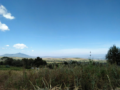
Explore Timeless Shop in Longonot for a taste of local Kenyan flavors and a charming grocery shopping experience.

Essential bars & hidden hideouts
The Weekend Inn Bar
0.3 km
Unwind at The Weekend Inn Bar in Longonot, where vibrant atmosphere meets refreshing drinks and local camaraderie.
Red Eagle Super Bar
2.6 km
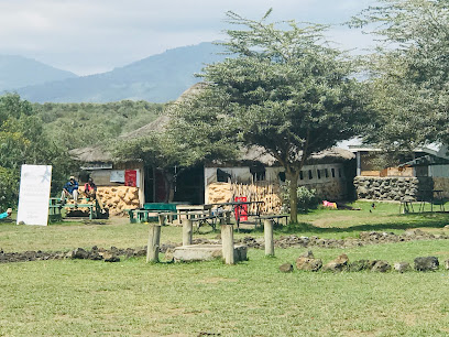
Discover the lively atmosphere of Red Eagle Super Bar in Longonot, offering a diverse drink menu and a welcoming ambiance for all visitors.

Double M Bar
2.7 km
Experience the lively charm of Double M Bar in Longonot, where refreshing drinks and friendly vibes await every traveler.

Eldama Bar & Restaurant Longonot
2.7 km
Eldama Bar & Restaurant Longonot: Experience the vibrant tastes and lively atmosphere of Kenya in a charming setting.

Leenas Pub
2.7 km
Discover the lively ambiance of Leenas Pub in Longonot, a hotspot for socializing and enjoying refreshing drinks in a friendly atmosphere.

Kindaruma Bar & Restaurant
2.9 km
Discover the vibrant flavors of Kenya at Kindaruma Bar & Restaurant, where grilled delights and local hospitality come together.

LOCUS BAR
10.1 km
Discover Locus Bar in Kenya - a lively destination for cocktails, local brews, and unforgettable nightlife experiences.

Ngurunga Bar
10.4 km
Discover the vibrant atmosphere of Ngurunga Bar in Kenya, where local culture and refreshing drinks come together for an unforgettable night.

Red Rose Bar & Accomodation
11.6 km
Experience the vibrant nightlife and warm hospitality at Red Rose Bar & Accommodation in Longonot, Kenya.

Harmony Highway Pub
11.6 km
Discover the vibrant atmosphere of Harmony Highway Pub, a local favorite for drinks and entertainment in the heart of Kenya.

Phasebook bar
11.7 km
Discover the cozy charm of Phasebook Bar in Naivasha, where relaxation meets vibrant local culture and refreshing drinks.

Valleyspree lounge kinungi
11.7 km
Experience the best of local cuisine at Valleyspree Lounge Kinungi, where authentic flavors meet breathtaking views in Naivasha, Kenya.

Lucky Bar 1
12.0 km
Discover the lively atmosphere and diverse drink selection at Lucky Bar 1, a vibrant bar in the heart of Kenya's nightlife.

Mombasa Raha Bar and Restaurant!
12.6 km
Experience the authentic taste of Kenya at Mombasa Raha Bar and Restaurant, where every meal is a celebration of flavor and culture.

Party Island Lounge - Naivasha
15.4 km
Experience the vibrant nightlife at Party Island Lounge in Naivasha, where the music is loud, and the dance floor is calling your name!

Nightclubs & after hour spots
Dancehall artists
15.3 km
Vibrant nightlife awaits in Naivasha, where local dancehall artists set the stage for an unforgettable experience.

Offroad Tavern Naivasha
16.0 km
Experience the vibrant nightlife of Naivasha at Offroad Tavern, a lively night club perfect for dancing, drinks, and making unforgettable memories.

Astro Lounge and Grill
17.5 km
Experience the vibrant nightlife at Astro Lounge and Grill, a disco club in Sokoni offering music, dancing, and delicious cuisine for all visitors.

Vapour Lounge & Grill , Naivasha
17.5 km
Discover the lively Vapour Lounge & Grill in Naivasha, where vibrant nightlife meets delicious cuisine and refreshing drinks for an unforgettable experience.

Naivasha, Kihoto
18.8 km
Discover the electrifying nightlife of Naivasha, Kihoto, where music, dancing, and unforgettable memories await.

Astrol lounge and grill
19.7 km
Experience the vibrant nightlife of Naivasha at Astrol Lounge and Grill, where great food, lively music, and unforgettable moments await.

Dck
19.9 km
Discover the vibrant nightlife at Dck Night Club in Naivasha, where music and social vibes create unforgettable experiences.

Moonlight Bar and Night Club
20.1 km
Experience the vibrant nightlife at Moonlight Bar and Night Club in Kimende, where music, drinks, and fun come together for an unforgettable night out.

Club Olympus
20.4 km
Discover the lively nightlife of Naivasha at Club Olympus, where music and dance come alive in a vibrant atmosphere.
The Craft Yard
20.5 km
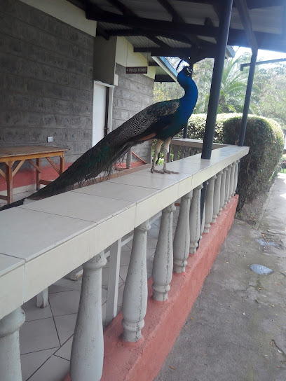
Discover the vibrant nightlife at The Craft Yard in Naivasha, where music and dance create unforgettable memories.

Double Dreamz Lounge & Grill
21.3 km
Experience the vibrant nightlife at Double Dreamz Lounge & Grill in Naivasha, where delicious cuisine and electrifying music create unforgettable memories.

Kentucky Lounge
40.5 km
Discover the vibrant nightlife at Kentucky Lounge in Nyathuna, where great music meets a lively atmosphere for an unforgettable evening.

Serena Sports Klub and Restaurant
46.8 km
Discover the heartbeat of Miharati's nightlife at Serena Sports Klub, where delicious food, vibrant music, and unforgettable experiences await.

Bistro@fun site
51.1 km
Discover the heartbeat of Nairobi's nightlife at Bistro@fun site, where music, dance, and culinary delights unite for an unforgettable experience.

Club Bonanza
52.0 km
Discover the vibrant flavors of Kenyan cuisine at Club Bonanza, the perfect grill spot for tourists seeking great food and lively ambiance in Nairobi.


