

Riviera Maya Travel Guide - Free Web & App
Your ultimate guide to Riviera Maya. Discover top landmarks, proposed trips, and local tips. Free on the web or via the Evendo companion app.


Riviera Maya, Mexico, pairs Caribbean beaches with Maya ruins, cenotes, reefs and jungle near Playa del Carmen, Akumal and Tulum for rich coastal escapes.
A Limestone Coast and Turquoise Sea
Riviera Maya follows Mexico’s Caribbean shoreline through the eastern part of Quintana Roo, generally from Puerto Morelos southwards to Tulum. It is a region rather than a single municipality, combining long beaches, mangrove wetlands, tropical forest, coral reefs and a porous limestone landscape threaded with cenotes. The best-known visitor centres are Playa del Carmen, a lively coastal city; Akumal, associated with protected marine habitats; and Tulum, where archaeological heritage, beaches and rapidly expanding development meet. Inland, smaller communities and rural roads lead towards cenotes, jungle and the Maya settlements of the Yucatán Peninsula.Read more about Riviera Maya
Maya Heritage and Living Landscapes
Resorts, Towns and Outdoor Exploration
When is the best time to visit Riviera Maya?
Best: May–July · 33°C| Month | High (°C) | Rainfall (mm) |
|---|---|---|
| January | 30 | 75 |
| February | 31 | 65 |
| March | 31 | 55 |
| April | 32 | 45 |
| May (best) | 33 | 35 |
| June (best) | 33 | 25 |
| July (best) | 33 | 25 |
| August | 33 | 30 |
| September | 33 | 35 |
| October | 32 | 45 |
| November | 31 | 55 |
| December | 30 | 65 |
Getting to and around Riviera Maya
How to get there
Transportation
Best attractions in Riviera Maya
Riviera Maya’s attractions range from internationally recognised Maya sites to water-filled caves and protected coastal ecosystems. Tulum Archaeological Zone stands on a sea-facing cliff, with preserved monumental buildings and a distinctive position above the Caribbean, while Cobá lies inland among forest and is known for its extensive ancient road network. Cenotes near Playa del Carmen, Tulum and the interior offer opportunities for swimming, snorkelling or guided exploration where local conditions permit. Akumal’s coastal waters support regulated wildlife experiences, and the reef environment attracts snorkellers and divers. South of Tulum, the Sian Ka’an Biosphere Reserve encompasses beaches, lagoons, tropical forest, mangroves and wetlands, best explored through authorised access or guided excursions. Xcaret and other established ecological and cultural parks provide organised interpretations of regional nature and heritage, while Puerto Morelos retains a smaller coastal character and access to reef-based activities.
-
Tourist attraction
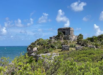
Tulum
Explore the ancient Mayan ruins of Tulum, a stunning coastal paradise where history meets the beauty of the Caribbean.
-
Shopping mall
Paseo del Carmen Shopping Mall
Explore the vibrant Paseo del Carmen Shopping Mall in Playa del Carmen, where shopping meets culture in a tropical paradise.
-
Tourist attraction
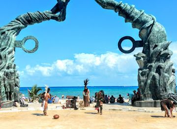
Portal Maya
Discover the historical charm of Portal Maya, a stunning monument in Playa del Carmen that celebrates Mayan heritage and offers breathtaking ocean views.
-
Tourist attraction
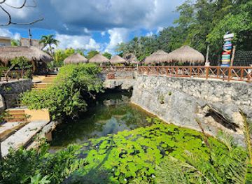
Río Secreto
Discover the hidden beauty of Río Secreto, an ecological park with stunning underground rivers and breathtaking rock formations near Playa del Carmen.


Best landmarks in Riviera Maya
Tulum’s fortified Maya city is Riviera Maya’s defining historic landmark, distinguished by its elevated coastal setting and buildings such as El Castillo and the Temple of the Frescoes. Inland, Cobá’s archaeological remains reveal the scale of Maya settlement in the forest and its network of sacbeob, or raised roads. Natural landmarks are equally central to the region’s identity: cenotes mark the underground limestone water system, while the Caribbean shoreline, beaches, mangroves and lagoons form a changing coastal landscape. The Sian Ka’an Biosphere Reserve is a major ecological landmark south of Tulum, protecting an extensive transition between forest, wetland, reef and sea. The Mesoamerican Barrier Reef, although a regional marine system rather than a single site, gives the coast its importance for snorkelling, diving and conservation. Puerto Morelos’s historic lighthouse is a recognisable local feature, but the area’s most significant landmarks remain its archaeological and natural environments.
-
Tourist attraction
Portal Maya
Explore Portal Maya, a stunning monument in Playa del Carmen that embodies the rich heritage of the Mayan civilization, perfect for cultural enthusiasts and photographers alike.
-
Archaeological site
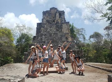
Zona Arqueológica de Muyil
Explore the magnificent ruins of Zona Arqueológica de Muyil, a hidden gem of ancient Maya heritage surrounded by breathtaking natural beauty.
-
Tourist attraction
Old Lady Statue
Experience the charm and cultural significance of the Old Lady Statue in Playacar, Playa del Carmen—a must-see for art and history enthusiasts.
Explore Riviera Maya on the map
Plan your trip on one map. See where the top attractions, landmarks, restaurants and hotels are, and book hotels and experiences in a few clicks.
Best hotels in Riviera Maya
Best restaurants in Riviera Maya
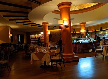
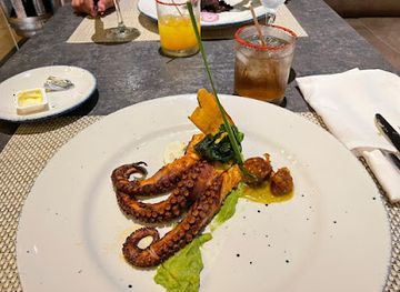
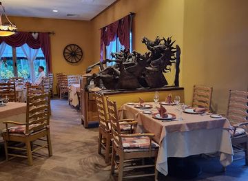
Riviera Maya’s dining culture reflects the flavours of the Yucatán Peninsula, Caribbean seafood traditions and a cosmopolitan tourism economy. Regional specialities may include cochinita pibil, sopa de lima, papadzules, freshly prepared salsas and dishes using achiote and citrus, while coastal towns and resort areas offer fish and seafood alongside Mexican and international menus. Playa del Carmen has the broadest concentration of restaurants, cafés, markets and informal food stalls, and Tulum combines local eateries with a sizeable international dining scene. Puerto Morelos and Akumal provide more modest coastal options, while hotels and all-inclusive resorts supply much of the food service along the developed shoreline. Inland cenote and archaeological excursions may pass through small communities where simple Yucatecan meals, snacks and drinks are available, though visitors should not expect extensive choice away from the main towns.
-
Restaurant
Rodizio Restaurant
Experience authentic Brazilian cuisine at Rodizio Restaurant in Riviera Maya – where flavor meets tradition in a vibrant atmosphere.
-
Restaurant
Agave
Experience authentic Mexican cuisine at Agave in Riviera Maya – where every dish tells a story of tradition and flavor.
-
Restaurant
Brasserie
Experience fine French dining at Brasserie in Riviera Maya; where culinary art meets paradise in an unforgettable setting.
-
Restaurant
Santa fe
Experience exquisite dining at Santa Fe in Playa del Carmen; where local flavors meet tropical charm within the Barceló Maya resort.
Best bars in Riviera Maya
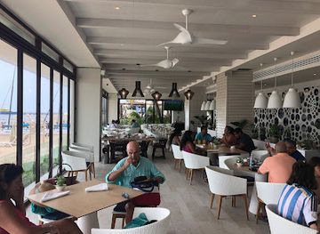
Evening entertainment varies sharply along the Riviera Maya. Playa del Carmen has the region’s most concentrated nightlife, with bars, music venues, clubs and late-opening establishments around its central pedestrian and coastal areas, although the character and operating pattern of venues can change. Tulum offers bars, restaurants and music-led evenings spread between the town and beach zones rather than one compact nightlife district. Puerto Morelos and Akumal are quieter, with evenings generally centred on restaurants, hotel bars and traditional local establishments. Resort areas provide their own entertainment programmes, while smaller communities retain a more relaxed atmosphere. Visitors should arrange transport carefully after dark, particularly when staying away from main settlements, and check current local conditions rather than assuming that every venue or event operates throughout the year.
-
Restaurant
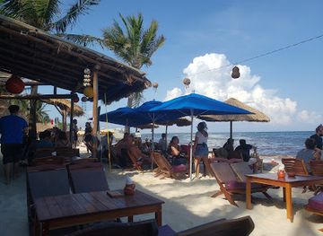
Mamita's Beach Club
Experience the vibrant atmosphere of Mamita's Beach Club, where sun-kissed beaches meet delicious cuisine and thrilling entertainment in Playa del Carmen.
-
Bar
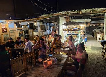
Batey Mojito and Guarapo Bar
Experience the vibrant nightlife and refreshing cocktails at Batey Mojito and Guarapo Bar in the heart of Tulum.
-
Bar
Fusion Beach Bar Cuisine
Experience the vibrant flavors of local and international cuisine at Fusion Beach Bar Cuisine in Playa del Carmen, a perfect beachside dining escape.
-
Grill
The Pub
Discover The Pub in Puerto Aventuras - your go-to spot for delicious grill dishes, breakfast favorites, and live music in a vibrant atmosphere.
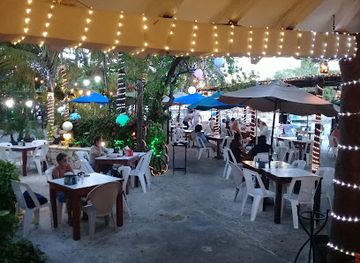
Best nightclubs in Riviera Maya
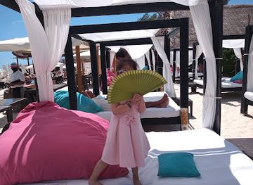
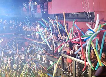
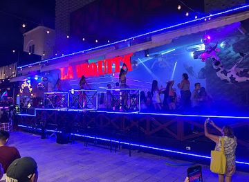
Evening entertainment varies sharply along the Riviera Maya. Playa del Carmen has the region’s most concentrated nightlife, with bars, music venues, clubs and late-opening establishments around its central pedestrian and coastal areas, although the character and operating pattern of venues can change. Tulum offers bars, restaurants and music-led evenings spread between the town and beach zones rather than one compact nightlife district. Puerto Morelos and Akumal are quieter, with evenings generally centred on restaurants, hotel bars and traditional local establishments. Resort areas provide their own entertainment programmes, while smaller communities retain a more relaxed atmosphere. Visitors should arrange transport carefully after dark, particularly when staying away from main settlements, and check current local conditions rather than assuming that every venue or event operates throughout the year.
-
Night club
Martina Beach Club
Discover the vibrant Martina Beach Club, a top destination in Playa del Carmen for sun, fun, and unforgettable beach experiences.
-
Night club
Coco Bongo
Experience the electrifying atmosphere of Coco Bongo, Playa del Carmen's premier night club with thrilling shows and unforgettable nightlife.
-
Night club
La Vaquita Playa Del Carmen
Discover the energetic nightlife at La Vaquita Playa Del Carmen, where vibrant music and lively atmosphere create unforgettable evenings in paradise.
-
Night club
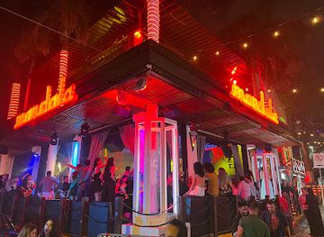
Mandala Playa del Carmen
Discover the electrifying nightlife of Mandala Playa del Carmen, a premier nightclub offering unforgettable dance experiences and vibrant entertainment.
Best shops in Riviera Maya
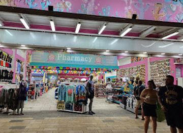
Shopping is concentrated in Playa del Carmen, Tulum, Puerto Morelos and the commercial areas attached to larger resorts. Visitors can find Mexican textiles, embroidered garments, ceramics, jewellery, decorative objects, regional food products and souvenirs inspired by Maya design, although quality and provenance vary considerably. Playa del Carmen offers the widest mixture of independent shops, market stalls, galleries and international retail, while Tulum has craft and design businesses distributed between the town and beach areas. Puerto Morelos is associated with a smaller-scale waterfront and village shopping scene, and resort complexes provide convenient but often more limited retail. In inland communities, locally produced food, honey, handicrafts and modest market goods may be available, particularly near visitor routes. Ask about the origin and materials of crafts, respect cultural designs and avoid purchasing archaeological objects or products made from protected wildlife.
-
Shopping mall
Quinta Alegría Shopping Mall
Explore an eclectic mix of international and local shops, dining, and entertainment at Playa del Carmen's Quinta Alegría Shopping Mall.
-
Shopping mall
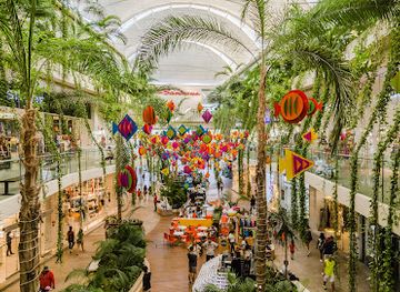
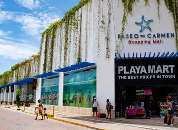
Paseo del Carmen Shopping Mall
Explore the vibrant Paseo del Carmen Shopping Mall in Playa del Carmen, your ultimate destination for shopping, dining, and entertainment under the sun.
-
Souvenir store
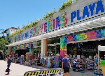
Souvenirs Playa
Discover unique local crafts and authentic mementos at Souvenirs Playa in the heart of Playa del Carmen, a must-visit for every tourist.
-
Gift shop
Playa Mart Paseo del Carmen zum zum
Discover Playa Mart, a vibrant gift shop in Playa del Carmen offering unique souvenirs and local crafts that capture the spirit of the Riviera Maya.
Get your free copy of our complete guide to Riviera Maya, delivered straight to you.
Everything on this page, from attractions and restaurants to essentials and local phrases, in one PDF you can read offline, print or share.
Already have an account? Sign in
Your Riviera Maya guide is ready.
We'll send it to · Not you? Sign out

Getting your guide ready…
We are putting together a fresh copy of the Riviera Maya guide. This can take up to a minute.
This can take a few moments. If your browser asks, choose Allow so the download can start. You'll find the guide in your Downloads folder.
Nothing happened? Download it again
Sorry, the guide is taking longer than usual. Please try again in a minute, or get it by email instead.
Riviera Maya essentials
Currency and Payment
Safety
Emergency Situations
Do's and Don'ts
Local Tips
From Eve
Local phrases worth knowing
You don't need to get them perfect. A few words go a long way, and locals appreciate the effort.
Basics
| English | Local | Say it |
|---|---|---|
| Hello | Hola | [oh-lah] |
| Goodbye | Adiós | [ah-dee-ohs] |
| Yes | Sí | [see] |
| No | No | [noh] |
| Please/You're welcome | Por favor/De nada | [por fah-vor/deh nah-dah] |
| Thank you | Gracias | [grah-see-ahs] |
| Excuse me/Sorry | Perdón/Lo siento | [pair-dohn/loh see-ehn-toh] |
| How are you? | ¿Cómo estás? | [koh-moh ehs-tahs] |
| Fine. And you? | Bien. ¿Y tú? | [byen. ee too] |
| Do you speak English? | ¿Hablas inglés? | [ah-blahs een-glehs] |
| I don't understand | No entiendo | [noh ehn-tee-ehn-doh] |
Eating & Drinking
| English | Local | Say it |
|---|---|---|
| I'd like to see the menu, please | Me gustaría ver el menú, por favor | [may goo-stah-ree-ah vehr ehl meh-noo, poor fah-vor] |
| I don't eat meat | No como carne | [noh koh-moh kahr-neh] |
| Cheers! | ¡Salud! | [sah-lood] |
| I would like to pay, please | Me gustaría pagar, por favor | [may goo-stah-ree-ah pah-gahr, poor fah-vor] |
Emergencies
| English | Local | Say it |
|---|---|---|
| Help! | ¡Ayuda! | [ah-yoo-dah] |
| Go away! | ¡Vete! | [veh-teh] |
| Call the Police! | ¡Llama a la Policía! | [yah-mah ah lah poh-lee-see-ah] |
| Call a doctor! | ¡Llama a un doctor! | [yah-mah ah oon dohk-tohr] |
| I'm lost | Estoy perdido | [ehs-toy pair-dee-doh] |
| I'm ill | Estoy enfermo | [ehs-toy ehn-fehr-moh] |
Shopping
| English | Local | Say it |
|---|---|---|
| I'd like to buy... | Me gustaría comprar... | [may goo-stah-ree-ah kohm-prahr] |
| I'm just looking | Sólo estoy mirando | [soh-loh ehs-toy mee-rahn-doh] |
| How much is it? | ¿Cuánto cuesta? | [kwan-toh kwehs-tah] |
| That's too expensive | Esto es demasiado caro | [ehs-toh ehs deh-mah-syah-doh kahr-oh] |
| Can you lower the price? | ¿Puedes bajar el precio? | [pweh-dehs bah-hahr ehl preh-syoh] |
Time & Numbers
| English | Local | Say it |
|---|---|---|
| What time is it? | ¿Qué hora es? | [keh oh-rah ehs] |
| It's one o'clock | Es la una | [ehs lah oo-nah] |
| Half past (10) | Las diez y media | [lahs dyehs ee meh-dee-ah] |
| Morning | Mañana | [mah-nyah-nah] |
| Afternoon | Tarde | [tahr-deh] |
| Evening | Noche | [noh-cheh] |
| Yesterday | Ayer | [ah-yehr] |
| Today | Hoy | [oy] |
| Tomorrow | Mañana | [mah-nyah-nah] |
| 1 | Uno | [oo-noh] |
| 2 | Dos | [dohs] |
| 3 | Tres | [trehs] |
| 4 | Cuatro | [kwah-troh] |
| 5 | Cinco | [seen-koh] |
| 6 | Seis | [says] |
| 7 | Siete | [syeh-teh] |
| 8 | Ocho | [oh-choh] |
| 9 | Nueve | [nweh-veh] |
| 10 | Diez | [dyehs] |
Transport & Directions
| English | Local | Say it |
|---|---|---|
| Where's a/the...? | ¿Dónde está un/el...? | [dohn-deh ehs-tah oon/ehl] |
| What's the address? | ¿Cuál es la dirección? | [kwahl ehs lah dee-rehk-syohn] |
| Can you show me (on the map)? | ¿Puedes mostrarme (en el mapa)? | [pweh-dehs mohs-trar-meh (ehn ehl mah-pah)] |
| When's the next (bus)? | ¿Cuándo es el próximo (autobús)? | [kwan-doh ehs ehl proh-ksy-moh (ow-toh-boos)] |
| A ticket (to ....) | Un boleto (a ...) | [oon boh-leh-toh (ah ...)] |
History of Riviera Maya
Limestone Foundations and Underground Water
Riviera Maya’s physical setting was formed over geological timescales from marine limestone deposited across the Yucatán Peninsula. Because the rock is highly porous, surface rivers are scarce and rainwater moves underground, producing caves, flooded passages and cenotes where the roof of a cavity has collapsed. This hydrological system shaped Maya settlement, agriculture and ritual life, while the low coastal terrain created lagoons, wetlands and beaches along the Caribbean. The region’s modern attractions are therefore closely connected to geological processes that long predate human occupation.
The Maya Coastal Trading World
Maya communities occupied and cultivated the eastern Yucatán for centuries, developing settlements connected by roads and maritime routes. Tulum, known in its Maya period as Zamá, flourished during the Late Postclassic era and occupied a strategic position overlooking the Caribbean. Its defensive walls, ceremonial buildings and coastal location reflect a settlement involved in regional exchange. Inland Cobá grew as a major centre connected to neighbouring communities by raised roads known as sacbeob. These archaeological sites belong to a wider Maya civilisation whose descendants continue to live across Quintana Roo and the Yucatán Peninsula.
Spanish Conquest and Colonial Change
Spanish expeditions reached the peninsula during the sixteenth century, but the eastern lowlands remained difficult for colonial authorities to control. Maya communities resisted outside rule, and the coast’s wetlands, forests and limited surface water restricted large-scale settlement. Colonial influence nevertheless altered political structures, religion, trade and patterns of land use. For long periods, the area that is now Riviera Maya remained far less urbanised than western and northern parts of the peninsula, with communities relying on agriculture, fishing, forest resources and coastal exchange.
Forests, Cattle and Chicle
During the nineteenth and early twentieth centuries, economic activity in Quintana Roo included fishing, forestry, agriculture and the harvesting of chicle, the natural latex traditionally used in chewing gum. The forest industry and the trade in tropical products connected remote settlements to wider markets, while Maya communities retained strong local identities and knowledge of the terrain. Transportation remained limited, and the coast did not yet resemble the resort corridor known today. These earlier industries left a historical background of movement through forest and wetland landscapes rather than dense permanent development.
From Frontier Coast to Tourism Corridor
Modern Riviera Maya developed rapidly from the late twentieth century as roads, air links and international tourism transformed the Caribbean coast. Playa del Carmen expanded from a small coastal settlement into a major visitor centre, while resort development spread along the shoreline and Tulum became a prominent archaeological and leisure destination. Tourism brought employment, infrastructure and international investment, but also placed pressure on groundwater, reefs, mangroves, beaches and local communities. Protected areas, including the Sian Ka’an Biosphere Reserve, represent efforts to conserve important ecosystems while the region continues to manage intense development.
Riviera Maya in Photos
Browse through our photo collection highlighting the charm and character of the destination.
Cities in Riviera Maya
The towns and cities of Riviera Maya, and the easiest places to base yourself.
-

-

-

-


Swipe for more cities
Neighbouring destination travel guides
The closest destinations to Riviera Maya, if you have time for more than one.
-

-

-

-

-


Swipe for more destinations
Explore more

Explore more of Yucatan Peninsula
Discover the Yucatan Peninsula in Mexico: A tropical paradise with ancient Mayan ruins, crystal-clear cenotes, stunning beaches, and vibrant cultural experiences.
Explore Yucatan Peninsula
Explore more of Mexico
Discover Mexico: A land of ancient ruins, vibrant culture, and stunning natural landscapes. Experience diverse cuisine, rich traditions, and warm hospitality.
Explore Mexico