

DeSoto National Forest Travel Guide - Free Web & App
Your ultimate guide to DeSoto National Forest. Discover top landmarks, proposed trips, and local tips. Free on the web or via the Evendo companion app.


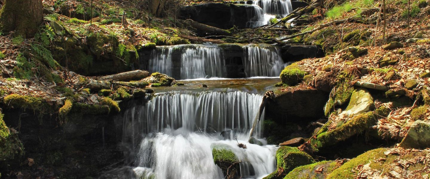


DeSoto National Forest in Mississippi offers pine woods, Black Creek Wilderness, scenic trails, lakes, wildlife and quiet outdoor recreation.
A Forest of Southern Mississippi
DeSoto National Forest occupies more than half a million acres across south-eastern Mississippi, stretching from the pine-covered interior towards the Gulf Coast. Rather than forming one continuous wilderness, it is a broad mosaic of public forest, streams, wetlands, wildlife habitats and rural communities. Longleaf and loblolly pine landscapes dominate many upland areas, while bottomland hardwoods follow the Black Creek, Leaf River and other waterways. Sandy soils, gently rolling terrain and humid subtropical weather give the forest a character distinct from Mississippi's more developed coastal resorts and larger towns.Read more about DeSoto National Forest
Water, Wildlife and Open Country
Gateway Communities and Forest Culture
When is the best time to visit DeSoto National Forest?
Best: April, October–November · 20–27°C| Month | High (°C) | Rainfall (mm) |
|---|---|---|
| January | 15 | 114 |
| February | 17 | 120 |
| March | 22 | 130 |
| April (best) | 26 | 112 |
| May | 30 | 111 |
| June | 33 | 130 |
| July | 34 | 156 |
| August | 34 | 148 |
| September | 31 | 120 |
| October (best) | 27 | 100 |
| November (best) | 20 | 110 |
| December | 15 | 130 |
Getting to and around DeSoto National Forest
How to get there
Transportation
Best attractions in DeSoto National Forest
DeSoto National Forest's attractions are dispersed across a large landscape of pine uplands, hardwood bottoms, creeks and managed lakes. Black Creek is the defining waterway, flowing through Black Creek Wilderness and offering a setting for paddling, fishing and hiking where conditions permit. The Tuxachanie Trail, near the southern part of the forest, crosses longleaf-pine country, wetlands and small streams on a route that gives a fuller sense of the forest's varied habitats. Recreation areas around sites such as Big Biloxi, Turkey Fork, Flint Creek and Airey Lake provide different combinations of boating, fishing, picnicking, swimming where authorised and camping, although facilities and seasonal access should be checked in advance. Wildlife observation is possible throughout the forest, particularly around water and open habitat, with opportunities to see deer, wild turkey and waterfowl. Nearby communities and rural roads also reveal the continuing relationship between public forest, timber production and south Mississippi settlement.
-
State park
Paul B Johnson State Park
Experience the serene beauty of Paul B Johnson State Park, a natural retreat in Mississippi for hiking, fishing, and family fun.
-
Tourist attraction
Tuxachanie Hiking Trail (West End Trailhead)
Discover the Tuxachanie Hiking Trail, a tranquil escape in Mississippi's natural beauty, perfect for hiking and wildlife observation.
-
Tourist attraction
Big Creek Landing Recreation Area
Discover the breathtaking beauty and outdoor adventures at Big Creek Landing Recreation Area in Hattiesburg, Mississippi.
-
Campground
Janice Landing/ US Forest Service
Experience the beauty of nature at Janice Landing Campground, where adventure meets tranquility in the heart of Mississippi.


Best landmarks in DeSoto National Forest
Black Creek is DeSoto National Forest's most important natural landmark, a free-flowing Mississippi waterway recognised within the National Wild and Scenic Rivers System. Its wooded banks and associated Black Creek Wilderness provide a rare protected river landscape in a state otherwise heavily shaped by working forests, farms and settlements. The Tuxachanie Trail is another defining feature, linking the forest's southern pine country with wet ground and stream corridors rather than leading to a single monumental viewpoint. Longleaf-pine stands, cypress-influenced wetlands and the broad reservoirs at recreation areas such as Turkey Fork and Flint Creek express the region's ecological variety. The forest's landmarks are therefore principally natural and landscape-scale; its historical significance lies in the relationship between timber communities, public conservation, Civilian Conservation Corps work and continuing forest management rather than in a concentration of grand buildings or monuments.
-
National forest
De Soto National Forest
Discover the enchanting landscapes and rich biodiversity of De Soto National Forest in Mississippi, a paradise for outdoor lovers and adventure seekers.

Explore DeSoto National Forest on the map
Plan your trip on one map. See where the top attractions, landmarks, restaurants and hotels are, and book hotels and experiences in a few clicks.
Best hotels in DeSoto National Forest
Best bars in DeSoto National Forest
Evenings in DeSoto National Forest are generally quiet and rural, with darkness, campfires where permitted and the sounds of woodland replacing a conventional nightlife scene. Traditional bars, casual restaurants and local music can be found in surrounding towns, particularly Hattiesburg, Laurel, Gulfport and other regional centres, but entertainment is dispersed and depends on the community and day of the week. Smaller settlements near the forest may have a limited number of neighbourhood drinking places rather than dedicated nightlife districts. Visitors staying at a remote campsite or cabin should plan to bring suitable provisions and should never drink before driving on forest roads or operating boats. Seasonal community events and live music may occur in gateway towns, but schedules and venues change, so current local information is essential.
-
Chicken
Zaxby's Chicken Fingers & Buffalo Wings
Experience the best of Southern comfort food at Zaxby's Chicken Fingers & Buffalo Wings in Petal, MS, with delicious chicken and a friendly atmosphere.
-
Bar
Toots County Line Sports Pub
Experience the vibrant atmosphere and delicious comfort food at Toots County Line Sports Pub in Wiggins, MS – your local haven for fun and relaxation.
-
Campground
Janice Landing/ US Forest Service
Experience the tranquility of Janice Landing in Mississippi: a prime campground and hiking destination surrounded by nature's beauty.
-
Bar
Dominickers Bar and Grill
Discover the vibrant atmosphere and delicious menu at Dominickers Bar and Grill, a must-visit spot in Wiggins, Mississippi for an unforgettable night out.


Best shops in DeSoto National Forest
Shopping within DeSoto National Forest is limited and practical, with no single high street or major retail centre inside the forest. Visitors generally buy food, fuel, camping supplies and outdoor equipment in Hattiesburg, Laurel, Gulfport, Wiggins or smaller gateway communities before heading to remote recreation areas. Independent shops and regional retailers in these towns may provide fishing, boating, hunting and hiking supplies, while farm shops and local food businesses offer opportunities to purchase Mississippi-produced goods where available. Souvenirs are more likely to be found in gateway towns, museums or tourism businesses than at isolated trailheads. Regional products may include preserved foods, barbecue ingredients, honey, handmade work and items connected with the pine-forest economy, but selection varies. Plan carefully for wilderness or multi-day visits, since forest recreation sites should not be treated as dependable shopping locations.
-
Outlet mall
Gulfport Premium Outlets
Discover unbeatable deals and a diverse array of brand-name stores at Gulfport Premium Outlets, the ultimate shopping destination in Mississippi.
-
National forest
De Soto National Forest
Explore De Soto National Forest: A stunning natural retreat in Mississippi filled with adventure, wildlife, and breathtaking landscapes.
-
Shopping mall
Turtle Creek Mall
Discover a shopping paradise at Turtle Creek Mall, featuring diverse stores, delightful dining, and a vibrant atmosphere in Hattiesburg, Mississippi.
-
Book store
Books-A-Million
Explore a literary paradise at Books-A-Million in Hattiesburg, MS, where literature meets collectibles and unique gifts.


Get your free copy of our complete guide to DeSoto National Forest, delivered straight to you.
Everything on this page, from attractions and restaurants to essentials and local phrases, in one PDF you can read offline, print or share.
Already have an account? Sign in
Your DeSoto National Forest guide is ready.
We'll send it to · Not you? Sign out

Getting your guide ready…
We are putting together a fresh copy of the DeSoto National Forest guide. This can take up to a minute.
This can take a few moments. If your browser asks, choose Allow so the download can start. You'll find the guide in your Downloads folder.
Nothing happened? Download it again
Sorry, the guide is taking longer than usual. Please try again in a minute, or get it by email instead.
DeSoto National Forest essentials
Currency and Payment
Safety
Emergency Situations
Do's and Don'ts
Local Tips
From Eve
Local phrases worth knowing
You don't need to get them perfect. A few words go a long way, and locals appreciate the effort.
Basics
| English | Local | Say it |
|---|---|---|
| Hello | Howdy | [hah-dee] |
| Goodbye | See ya later | [see yuh lay-tur] |
| Yes | Yep | [yep] |
| No | Nah | [nah] |
| Please/You're welcome | Please/No problem | [pleez/no prob-lem] |
| Thank you | Thanks | [thanks] |
| Excuse me/Sorry | Pardon me/My bad | [par-dun me/my bad] |
| How are you? | How y'all doin'? | [how y'all doin'] |
| Fine. And you? | Fine. How 'bout you? | [fine. how 'bout yuh?] |
| Do you speak English? | Y'all speak English? | [y'all speak ing-glish?] |
| I don't understand | I ain't catchin' on | [I ain't catch-in' on] |
Eating & Drinking
| English | Local | Say it |
|---|---|---|
| I'd like to see the menu, please | I wanna check out the menu, please | [I wanna check out the menu, please] |
| I don't eat meat | I don't eat no meat | [I don't eat no meat] |
| Cheers! | Cheers! | [Cheers!] |
| I would like to pay, please | I wanna settle up, please | [I wanna settle up, please] |
Emergencies
| English | Local | Say it |
|---|---|---|
| Help! | Help! | [Help!] |
| Go away! | Git! | [Git!] |
| Call the Police! | Call the Sheriff! | [Call the Sheriff!] |
| Call a doctor! | Call a doc! | [Call a doc!] |
| I'm lost | I'm turned around | [I'm turned around] |
| I'm ill | I'm feelin' poorly | [I'm feelin' poorly] |
Shopping
| English | Local | Say it |
|---|---|---|
| I'd like to buy... | I'm fixin' to purchase... | [I'm fixin' to purchase...] |
| I'm just looking | Just browsin' | [Just browsin'] |
| How much is it? | How much y'all want for it? | [How much y'all want for it?] |
| That's too expensive | That's mighty pricey | [That's mighty pricey] |
| Can you lower the price? | Can y'all do better on the price? | [Can y'all do better on the price?] |
Time & Numbers
| English | Local | Say it |
|---|---|---|
| What time is it? | What time we got? | [What time we got?] |
| It's one o'clock | It's one | [It's one] |
| Half past (10) | Ten-thirty | [Ten-thur-tee] |
| Morning | Mornin' | [Mornin'] |
| Afternoon | Afternoon | [Afternoon] |
| Evening | Evenin' | [Evenin'] |
| Yesterday | Yestidy | [Yestidy] |
| Today | Today | [Today] |
| Tomorrow | Tomorra | [Tomorra] |
| 1 | One | [One] |
| 2 | Two | [Two] |
| 3 | Three | [Three] |
| 4 | Four | [Four] |
| 5 | Five | [Five] |
| 6 | Six | [Six] |
| 7 | Seven | [Seven] |
| 8 | Eight | [Eight] |
| 9 | Nine | [Nine] |
| 10 | Ten | [Ten] |
Transport & Directions
| English | Local | Say it |
|---|---|---|
| Where's a/the...? | Where's the... | [Where's the...] |
| What's the address? | What's the address? | [What's the address?] |
| Can you show me (on the map)? | Can you show me (on the map)? | [Can you show me (on the map)?] |
| When's the next (bus)? | When's the next (bus)? | [When's the next (bus)?] |
| A ticket (to ....) | A ticket (to ....) | [A ticket (to ....)] |
History of DeSoto National Forest
Pine Landscapes Before the Forest
The land now managed as DeSoto National Forest has long been shaped by the ecology of the southern pine belt, its waterways and the people who used them. Indigenous communities lived throughout the wider region before European colonisation, relying on forests, rivers and fertile lowlands for transport, hunting and settlement. During the nineteenth and early twentieth centuries, expanding agricultural settlement and commercial timber cutting altered large areas of south Mississippi. Pine resources became central to local economies, while streams and rivers supported movement and small-scale industry. The modern forest therefore represents both a surviving natural landscape and a region transformed by generations of human use.
Timber, Railways and Rural Settlement
The growth of the timber industry brought sawmills, rail connections and new settlements to south Mississippi from the late nineteenth century into the early twentieth century. Extensive stands of pine encouraged commercial harvesting, and rail transport enabled timber to reach mills and markets beyond the region. Much of the original forest was cut or modified, leaving a landscape in need of more systematic management. Rural communities continued to depend on forestry, farming and natural resources, and many of the roads and settlement patterns around the present forest reflect this economic history. The legacy of the timber era remains visible in the working character of the surrounding counties.
The New Deal and Public Forest Management
DeSoto National Forest was established in 1936 during a period when the United States was expanding public ownership and conservation management. Civilian Conservation Corps crews worked across the national forests of the South, developing roads, trails, erosion-control measures and recreation facilities while providing employment during the Great Depression. Public management gradually shifted the emphasis from uncontrolled timber exploitation towards sustained forestry, watershed protection, habitat management and public recreation. The work of this period helped establish the infrastructure and management traditions that still influence access to DeSoto's forests, lakes and stream corridors.
Wilderness and River Conservation
Later conservation policy gave particular protection to some of DeSoto's least developed landscapes. Black Creek Wilderness preserves a wooded river environment within the forest, while Black Creek itself became Mississippi's first and only river included in the National Wild and Scenic Rivers System. These designations recognise the stream's free-flowing character, recreational value and surrounding landscape, while placing responsible use and conservation at the centre of management. Elsewhere, prescribed fire, longleaf-pine restoration, wildlife habitat work and controlled timber operations reflect the continuing effort to maintain healthy southern forest ecosystems in a landscape that remains both ecologically valuable and commercially important.
DeSoto National Forest in Photos
Browse through our photo collection highlighting the charm and character of the destination.
Cities in DeSoto National Forest
The towns and cities of DeSoto National Forest, and the easiest places to base yourself.
-

-

-


Swipe for more cities
Neighbouring destination travel guides
The closest destinations to DeSoto National Forest, if you have time for more than one.
-

-

-

-

-


Swipe for more destinations
Explore more

Explore more of The Pine Belt
Explore Mississippi's Pine Belt for longleaf forests, rail-town heritage, Hattiesburg culture, Laurel design and cycling on the Longleaf Trace.
Explore The Pine Belt
Explore more of Mississippi
Discover Mississippi: A treasure trove of Southern culture, blues music heritage, and stunning natural landscapes perfect for every kind of traveler.
Explore Mississippi