

Free Kuneneland Travel Guide & Mobile App
Explore Kuneneland with free travel guides. Discover regional history, expert tips, proposed trips, and audio guides on web or mobile app.


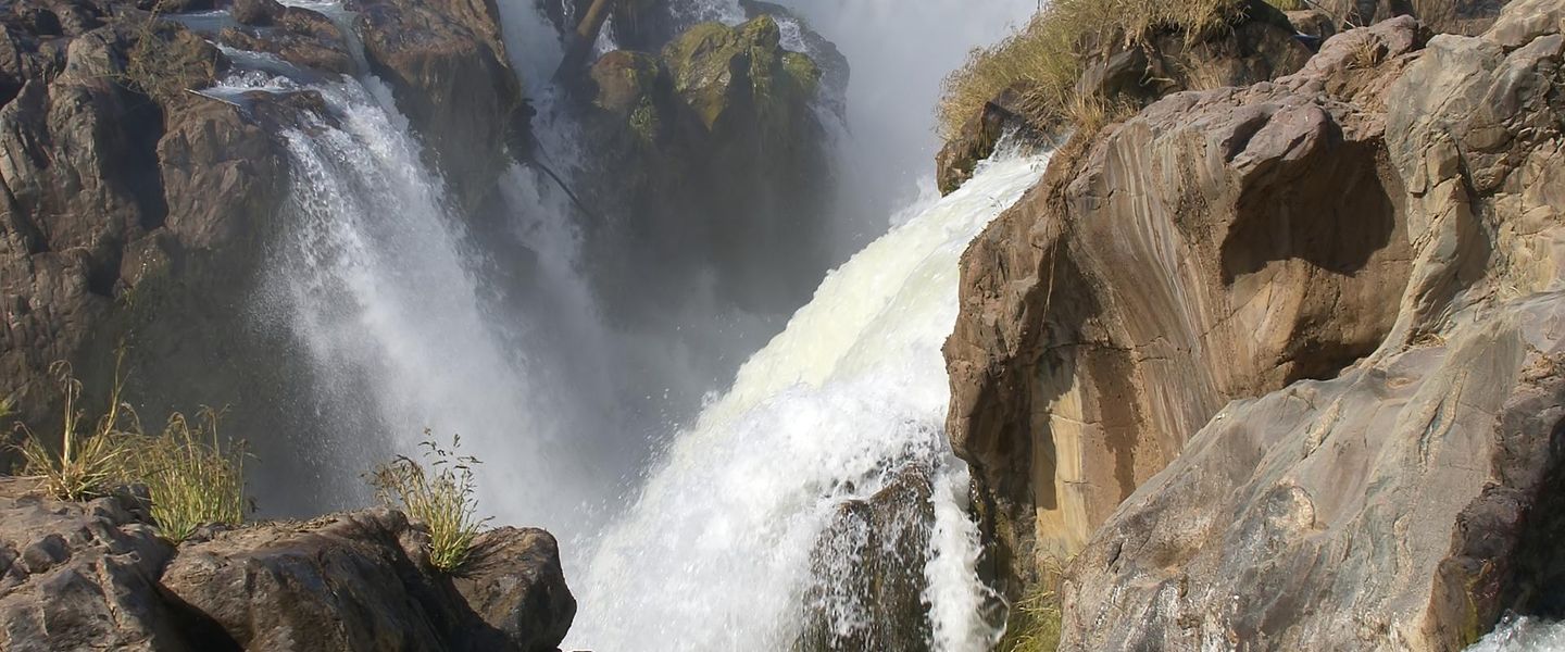


Explore Kuneneland in Namibia for desert wildlife, ancient rock art, Himba culture, remote mountains, Epupa Falls and the stark Skeleton Coast.
Read more about Kuneneland
When is the best time to visit Kuneneland?
Best: April–May, September · 22–26°C| Month | High (°C) | Rainfall (mm) |
|---|---|---|
| January | 29 | 30 |
| February | 29 | 25 |
| March | 29 | 20 |
| April (best) | 26 | 10 |
| May (best) | 22 | 5 |
| June | 19 | 1 |
| July | 18 | 1 |
| August | 21 | 2 |
| September (best) | 25 | 7 |
| October | 28 | 10 |
| November | 29 | 15 |
| December | 29 | 25 |
Getting to and around Kuneneland
How to get there
Transportation
Top city travel guides in Kuneneland
The cities of Kuneneland, and the easiest places to base yourself.
-

-

-

-

-
-


Swipe for more cities
Destinations in Kuneneland
Resorts, valleys and scenic spots worth a trip of their own.
-

-

-


Swipe for more destinations
Best attractions in Kuneneland
Kuneneland’s attractions are spread across a vast, sparsely settled landscape rather than concentrated in one town. Twyfelfontein provides the region’s strongest archaeological experience, with guided walks among prehistoric engravings and nearby geological formations including the Organ Pipes and Burnt Mountain. Around Khorixas, the Petrified Forest offers a look at ancient fossilised tree trunks in a dry setting. Farther west, the Skeleton Coast National Park combines desert scenery, Atlantic surf, fog, shipwreck history and highly specialised wildlife, although access to some areas is controlled and remote. In the north-west, Epupa Falls is reached for its broad river cascades, palms and dramatic gorge scenery, while surrounding conservancies offer guided encounters with desert-adapted elephants, black rhinoceroses and other wildlife. Opuwo and the surrounding Kaokoveld provide opportunities for carefully arranged cultural visits with Himba and Herero communities, alongside journeys through rugged mountain country. The region also appeals to photographers, birdwatchers, overland travellers and experienced 4WD enthusiasts, but many activities depend on seasonal roads, local permissions and specialist guiding. Kunene is best understood as a landscape for slow, well-prepared exploration rather than a sequence of easily accessible day trips.
-
Resort hotel
Gross Barmen Hot Springs Resort
Experience ultimate relaxation at Gross Barmen Hot Springs Resort, where natural hot springs meet luxurious spa treatments in a stunning Namibian setting.
-
National park
Skeleton Coast National Park
Discover the haunting beauty and unique wildlife of Skeleton Coast National Park, a must-visit destination on Namibia's breathtaking coastline.
-
Tourist attraction
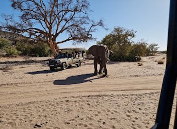
Twyfelfontein Elephant Drives & Campsite
Discover the enchanting experience of elephant drives and the serene beauty of Twyfelfontein Campsite in Namibia's stunning wilderness.
-
Organ Pipes
Explore the Organ Pipes, a stunning natural attraction in Namibia, featuring breathtaking basalt formations and serene landscapes perfect for nature lovers.


Best landmarks in Kuneneland
Twyfelfontein is Kuneneland’s most internationally recognised cultural landmark, where engraved sandstone panels preserve images made by prehistoric hunter-gatherers and provide an exceptional record of ancient life and belief. The surrounding Huab Valley is marked by the Organ Pipes, a striking group of near-vertical basalt columns, and Burnt Mountain, whose dark geological layers take on dramatic colour in changing light. In the north-west, Epupa Falls is both a natural landmark and a defining feature of the Kunene River, where water drops through a rugged landscape close to the Angolan border. Along the Atlantic margin, the Skeleton Coast represents a different kind of landmark: a severe meeting of ocean, fog, dunes and shipwreck-strewn desert, protected within the national park. The Petrified Forest near Khorixas adds a deep-time dimension, preserving fossilised tree trunks transported into the region millions of years ago. Rather than monumental urban architecture, Kunene’s visual identity lies in geological formations, river corridors, archaeological surfaces and immense open horizons.
-
National park
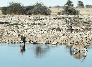
Etosha National Park
Explore the breathtaking landscapes and abundant wildlife of Etosha National Park, a premier safari destination in Namibia.
-
Self-catering accommodation
Arebbusch Travel Lodge
Discover the tranquility of Arebbusch Travel Lodge in Windhoek, where nature meets comfort in a serene self-catering accommodation.
-
Tourist attraction
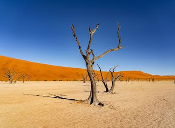
Deadvlei
Explore Deadvlei, a breathtaking natural wonder in the Namib Desert, where ancient trees meet stunning sand dunes and a striking clay pan.
-
 Lodge
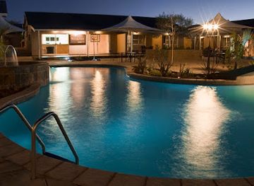
LodgeCanyon Roadhouse, Gondwana Collection Namibia
Discover the unique charm of Canyon Roadhouse in Namibia, where vintage decor meets modern comfort and delicious local cuisine awaits.
Explore Kuneneland on the map
Plan your trip on one map. See where the top cities, national parks and sights are, and book hotels and experiences in a few clicks.
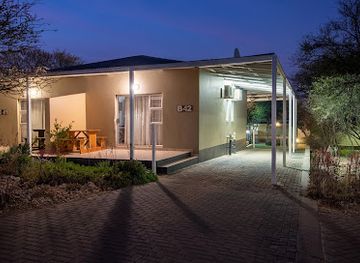
Best hotels in Kuneneland
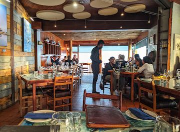
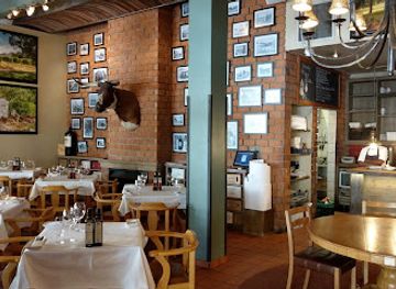
Best restaurants in Kuneneland
Dining in Kuneneland is shaped by distance, supplies and the rhythms of lodge and camp life. Opuwo and Khorixas provide the broadest choice of everyday restaurants, cafés and food shops, while smaller settlements offer simpler meals and limited opening arrangements. Lodges and guest farms commonly serve practical Namibian and international dishes, with menus influenced by available meat, vegetables, bread and preserved supplies rather than a single formal regional cuisine. Visitors may encounter game meat, beef, lamb, kapana-style grilled meat and hearty stews, though dishes vary by establishment and should not automatically be treated as exclusively Kunene traditions. In remote camps, meals are often pre-arranged and communal, making advance dietary communication important. Community camps and conservancy operations may provide locally prepared food when booked ahead. Water and provisions should be purchased before long excursions, as roadside food opportunities are sparse. South African and Namibian beers, soft drinks and basic wines are widely encountered, while breakfast and picnic provisions are particularly useful for long drives between attractions.
-
Restaurant
Joe's Beerhouse
Discover authentic Namibian flavors and vibrant nightlife at Joe's Beerhouse in Windhoek.
-
Restaurant
The Tug Restaurant
Experience exquisite seafood dining with breathtaking ocean views at The Tug Restaurant in Swakopmund.
-
Restaurant
Arebbusch Travel Lodge
Experience comfort and convenience at Arebbusch Travel Lodge in Windhoek - your perfect base for exploring Namibia's rich culture.
-
Restaurant
The Stellenbosch Wine Bar and Bistro
Experience exquisite local cuisine paired with exceptional wines at The Stellenbosch Wine Bar and Bistro in Windhoek.
Best bars in Kuneneland
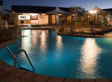
Kuneneland has little of the concentrated nightclub culture associated with larger Namibian towns. Evening social life is centred on bars, informal shebeens, restaurants and hotel lounges in Opuwo and Khorixas, with music and conversation often more important than late-night clubbing. In rural areas, lodge dining rooms, campfire gatherings and quiet evenings under exceptionally dark skies are more typical than organised entertainment. A few town venues may offer dancing or live music, but schedules and opening arrangements are changeable, so visitors should ask locally rather than rely on old listings. Alcohol is available in established businesses, yet remote journeys require responsible planning because driving distances are long and roadside services are limited. Lodges may offer a small bar and a chance to sample Namibian or South African beer, wine and spirits, while cultural visits should not be reduced to nightlife experiences or organised around drinking.
-
Hotel
Hilton Windhoek
Discover the elegance and comfort of Hilton Windhoek, your luxury retreat in the heart of Namibia's vibrant capital.
-
Self-catering accommodation
Arebbusch Travel Lodge
Discover comfort and convenience at Arebbusch Travel Lodge, your ideal self-catering accommodation in Windhoek, Namibia.
-
Hotel
Avani Windhoek Hotel & Casino
Experience luxury and vibrant entertainment at Avani Windhoek Hotel & Casino, your perfect retreat in the heart of Namibia’s capital.
-
Hotel
Hotel Thule
Discover unparalleled luxury and breathtaking views at Hotel Thule, the premier hotel destination in Windhoek, Namibia.
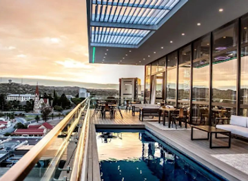
Best nightclubs in Kuneneland
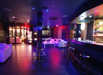
Kuneneland has little of the concentrated nightclub culture associated with larger Namibian towns. Evening social life is centred on bars, informal shebeens, restaurants and hotel lounges in Opuwo and Khorixas, with music and conversation often more important than late-night clubbing. In rural areas, lodge dining rooms, campfire gatherings and quiet evenings under exceptionally dark skies are more typical than organised entertainment. A few town venues may offer dancing or live music, but schedules and opening arrangements are changeable, so visitors should ask locally rather than rely on old listings. Alcohol is available in established businesses, yet remote journeys require responsible planning because driving distances are long and roadside services are limited. Lodges may offer a small bar and a chance to sample Namibian or South African beer, wine and spirits, while cultural visits should not be reduced to nightlife experiences or organised around drinking.
-
Disco club
Infinity Lounge Swakopmund
Discover the vibrant nightlife at Infinity Lounge Swakopmund, the ultimate disco club for an unforgettable evening of music and dance.
-
Disco club
Kings Lounge
Experience the vibrant nightlife at Kings Lounge in Windhoek, the ultimate destination for dancing, cocktails, and unforgettable evenings.
-
Night club
MYNT Nightclub and Lounge
Discover the heart of Windhoek's nightlife at MYNT Nightclub and Lounge, where music, dance, and good vibes meet.
-
Bar
Pharaohs Lounge
Experience the vibrant nightlife of Windhoek at Pharaohs Lounge, where great drinks and lively music come together for an unforgettable evening.



Best shops in Kuneneland
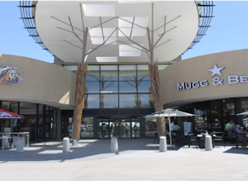
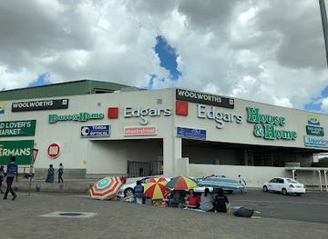
Shopping in Kuneneland is practical and locally focused, with the widest choice in Opuwo and Khorixas. Small shops and supermarkets supply food, water, fuel-related provisions and basic travel necessities, but remote routes should never depend on finding a fully stocked store. Craft stalls, community projects and cultural markets may offer woven goods, beadwork, leather items, wood carvings and jewellery, with styles varying between communities and sellers. Buy directly and respectfully, ask about prices before agreeing to a purchase, and avoid objects made from protected wildlife products or archaeological material. Lodges and conservancy camps may sell locally produced crafts, printed textiles or small souvenirs, while roadside stalls sometimes offer handmade items when travelling between settlements. Regional food products are generally more useful than elaborate souvenirs because distances and luggage limits make carrying supplies a practical consideration. There is no major luxury-shopping district in Kunene; its retail character reflects dispersed settlements, local enterprise and the needs of long-distance travellers.
-
Shopping mall
Wernhil
Discover Wernhil in Windhoek: A vibrant shopping mall offering diverse brands, delicious dining, and exciting entertainment for every traveler.
-
Shopping mall
The Grove Mall of Namibia
Discover the vibrant shopping and dining experience at The Grove Mall of Namibia in Windhoek, where culture meets modernity.
-
Shopping mall
Maerua Mall
Discover Maerua Mall: Windhoek's ultimate shopping destination with local crafts, international brands, and delightful dining options.
-
Shopping mall
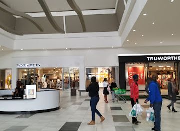
Dunes Mall
Discover shopping and dining bliss at Dunes Mall in Walvis Bay—your ultimate destination for retail therapy and local culture.

Get your free copy of our complete guide to Kuneneland, delivered straight to you.
Everything on this page, from attractions and restaurants to essentials and local phrases, in one PDF you can read offline, print or share.
Already have an account? Sign in
Your Kuneneland guide is ready.
We'll send it to · Not you? Sign out

Getting your guide ready…
We are putting together a fresh copy of the Kuneneland guide. This can take up to a minute.
This can take a few moments. If your browser asks, choose Allow so the download can start. You'll find the guide in your Downloads folder.
Nothing happened? Download it again
Sorry, the guide is taking longer than usual. Please try again in a minute, or get it by email instead.
Kuneneland essentials
Currency and Payment
Safety
Emergency Situations
Do's and Don'ts
Local Tips
From Eve
Local phrases worth knowing
You don't need to get them perfect. A few words go a long way, and locals appreciate the effort.
Basics
| English | Local | Say it |
|---|---|---|
| Hello | Hallo | [Hah-loh] |
| Goodbye | Totsiens | [Tot-seens] |
| Yes | Ja | [Yah] |
| No | Nee | [Nay] |
| Please/You're welcome | Asseblief | [Ah-seh-bleef] |
| Thank you | Dankie | [Dahn-kee] |
| Excuse me/Sorry | Verskoon my | [Ver-skoon my] |
| How are you? | Hoe gaan dit? | [Hoo gahn dit] |
| Fine. And you? | Goed. En jy? | [Hood. En yay] |
| Do you speak English? | Praat jy Engels? | [Praat yay Eng-els] |
| I don't understand | Ek verstaan nie | [Ek fer-stahn nee] |
Eating & Drinking
| English | Local | Say it |
|---|---|---|
| I'd like to see the menu, please | Ek wil die spyskaart sien, asseblief | [Ek vil dee spys-kart seen, ah-seh-bleef] |
| I don't eat meat | Ek eet nie vleis nie | [Ek eet nee flays nee] |
| Cheers! | Gesondheid! | [Geh-son-dahyt] |
| I would like to pay, please | Ek wil betaal, asseblief | [Ek vil beh-tal, ah-seh-bleef] |
Emergencies
| English | Local | Say it |
|---|---|---|
| Help! | Help! | [Help!] |
| Go away! | Gaan weg! | [Gahn vehg] |
| Call the Police! | Bel die polisie! | [Bel dee poh-li-see] |
| Call a doctor! | Bel 'n dokter! | [Bel 'n dok-ter] |
| I'm lost | Ek is verlore | [Ek is fer-lor-eh] |
| I'm ill | Ek is siek | [Ek is seek] |
Shopping
| English | Local | Say it |
|---|---|---|
| I'd like to buy... | Ek wil koop... | [Ek vil koop...] |
| I'm just looking | Ek kyk net | [Ek kike net] |
| How much is it? | Hoeveel kos dit? | [Hoo-feel kos dit] |
| That's too expensive | Dit is te duur | [Dit is te dur] |
| Can you lower the price? | Kan jy die prys verlaag? | [Kan yay dee prys fer-lahg] |
Time & Numbers
| English | Local | Say it |
|---|---|---|
| What time is it? | Hoe laat is dit? | [Hoo laht is dit] |
| It's one o'clock | Dit is een uur | [Dit is een oor] |
| Half past (10) | Half 10 | [Half tien] |
| Morning | Oggend | [Okkh-end] |
| Afternoon | Namiddag | [Nah-mid-dahg] |
| Evening | Aand | [Aand] |
| Yesterday | Gister | [Gis-ter] |
| Today | Vandag | [Vahn-dahg] |
| Tomorrow | Môre | [Mor-eh] |
| 1 | Een | [Ean] |
| 2 | Twee | [Tway] |
| 3 | Drie | [Dree] |
| 4 | Vier | [Veer] |
| 5 | Vyf | [Fife] |
| 6 | Ses | [Ses] |
| 7 | Sewe | [Seh-weh] |
| 8 | Agt | [Aht] |
| 9 | Nege | [Neh-heh] |
| 10 | Tien | [Teen] |
Transport & Directions
| English | Local | Say it |
|---|---|---|
| Where's a/the...? | Waar is 'n ...? | [Vahr is 'n ...?] |
| What's the address? | Wat is die adres? | [Vah is dee ah-dres?] |
| Can you show me (on the map)? | Kan jy my wys (op die kaart)? | [Kan yay my vice (op dee kart)?] |
| When's the next (bus)? | Wanneer is die volgende (bus)? | [Vah-neer is dee fol-gen-de (bus)?] |
| A ticket (to ....) | ‘n kaartjie (na ...) | [‘n kart-kee (nah ...)] |
History of Kuneneland
Early hunter-gatherer heritage
The oldest human history in Kuneneland is preserved through archaeological remains, stone tools and rock art. San-speaking hunter-gatherer communities and their predecessors used the region’s water sources, valleys and seasonal wildlife routes, leaving engravings and paintings that record animals, tracks, hunting scenes and symbolic imagery. Twyfelfontein is the best-known concentration, but rock art and archaeological traces occur more widely across the dry north-west. These works are not simply decorative illustrations: they offer evidence of changing relationships between people, animals and the landscape, although many individual images remain difficult to interpret with certainty.
Pastoral communities and regional movement
Over many centuries, pastoral societies adapted to Kuneneland’s sparse water and grazing resources. The ancestors of today’s Himba and Herero communities developed mobile cattle-keeping traditions suited to the dry north-west, while other groups used complementary forms of herding, hunting and trade. Movement across what is now the Namibia–Angola border was historically common, and modern national boundaries cut through older cultural and economic networks. Seasonal mobility remains important in parts of the region, even as schooling, wage employment, conservation and changing access to land influence contemporary life.
European intrusion and colonial rule
German colonial rule in South West Africa expanded into north-western Namibia during the late nineteenth and early twentieth centuries, though effective control over remote Kunene was limited for long periods. Colonial boundaries, military expeditions and administrative stations disrupted established political relationships and movement. Mission stations and trading routes later became important points of contact, while the wider territory was governed through systems that marginalised African communities and restricted land and cattle access. The legacy of this period can still be seen in settlement patterns, administrative borders and the region’s cautious relationship with outside authority.
South African administration and the northern borderland
After the First World War, South Africa administered Namibia under a League of Nations mandate and later retained control despite international opposition. Kunene’s remoteness and proximity to Angola gave it strategic importance during the Angolan War of Independence and the subsequent regional conflict. Military activity, restricted movement and insecurity affected communities, roads and access to the northern borderlands. The end of South African rule and Namibia’s independence in 1990 created the political conditions for new approaches to regional development, community participation and cross-border conservation.
Twyfelfontein and the recognition of heritage
Twyfelfontein’s extensive collection of prehistoric engravings became a focus of archaeological research and heritage protection during the twentieth century. The site was designated Namibia’s first UNESCO World Heritage Site in 2007, recognising the quality and concentration of its rock art as well as the information it provides about hunter-gatherer spiritual and material life. Visitor management, marked routes and interpretation now help protect the sandstone panels. Its importance also encouraged wider recognition of Kunene as a region where geological, archaeological and living cultural heritage are closely connected.
Communal conservancies and conservation tourism
From the 1990s, Namibia developed communal conservancies that gave local communities a formal role in managing wildlife and benefiting from tourism. In Kunene, conservancies helped support the recovery and protection of desert-adapted black rhinoceroses, elephants and other wildlife outside conventional national parks. The model has not removed every challenge, including human–wildlife conflict and uneven economic returns, but it represents a significant transformation in land management. Tourism in parts of Kuneneland is therefore linked not only to scenery and wildlife but also to a continuing experiment in community-based conservation.
Kuneneland in Photos
Browse through our photo collection highlighting the charm and character of the destination.
Neighbouring regions of Kuneneland
The closest regions to Kuneneland, if you have time for more than one.
-

-

-

-

-


Swipe for more regions
Explore more

Explore more of Namibia
Discover Namibia: A land of towering dunes, ancient deserts, and vibrant cultures. Perfect for adventurers and nature lovers seeking an unparalleled African experience.
Explore Namibia