

Free Mount Pitt Travel Guide & Mobile App
Explore Mount Pitt with free travel guides. Discover regional history, expert tips, proposed trips, and audio guides on web or mobile app.


Mount Pitt, Norfolk Island, combines summit views, native forest walks and a clear perspective on the island’s compact Pacific landscape.
Read more about Mount Pitt
When is the best time to visit Mount Pitt?
Best: February–March, December · 25–26°C| Month | High (°C) | Rainfall (mm) |
|---|---|---|
| January | 26 | 100 |
| February (best) | 26 | 90 |
| March (best) | 26 | 100 |
| April | 24 | 110 |
| May | 22 | 120 |
| June | 20 | 130 |
| July | 19 | 140 |
| August | 19 | 130 |
| September | 20 | 120 |
| October | 22 | 110 |
| November | 24 | 100 |
| December (best) | 25 | 90 |
Getting to and around Mount Pitt
How to get there
Transportation
Top city travel guides in Mount Pitt
The cities of Mount Pitt, and the easiest places to base yourself.
-

-

-


Swipe for more cities
Destinations in Mount Pitt
Resorts, valleys and scenic spots worth a trip of their own.
-

-

-

-

-

-


Swipe for more destinations
Best attractions in Mount Pitt
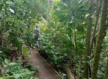
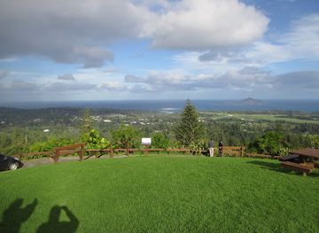
Mount Pitt’s principal attraction is the summit lookout, where a short stop provides a broad view over Norfolk Island’s interior, settlements, forested ridges and surrounding Pacific waters. The area also acts as an access point to the natural environments protected within Norfolk Island National Park. Walkers can explore native forest and look for the island’s distinctive plant and bird life, while the higher ground gives useful perspective on how compact yet varied Norfolk Island is. Conditions change quickly, so the experience depends heavily on visibility and wind. The Mount Pitt area is not a large entertainment district and has few built attractions of its own. Its appeal lies in combining a high viewpoint with conservation landscapes and then travelling onwards to other parts of the island. Visitors interested in history should continue separately to the Kingston and Arthur’s Vale Historic Area, outside Mount Pitt, where the principal convict-era buildings and ruins are found. Coastal scenery, secluded bays, additional national-park walks and agricultural landscapes complete the wider island attraction offering. Mount Pitt is therefore best understood as a natural orientation point rather than a self-contained resort destination.
-
Club
Norfolk Island RSL Memorial Club
Experience the warm community spirit of Norfolk Island at the RSL Memorial Club, where relaxation, entertainment, and great food await you.
-
Bottle Shop and Liquor Store
Norfolk Island Liquor Bond Store
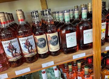
Explore the Norfolk Island Liquor Bond Store for a delightful selection of local and imported spirits in Burnt Pine.
-
 Heritage museum
Fletcher’s Mutiny Cyclorama
Explore the captivating history of Fletcher's Mutiny Cyclorama on Norfolk Island, where art and storytelling combine in a stunning 360-degree experience.
-
Botanical garden
Botantic Gardens
Explore the serene Botanic Gardens on Norfolk Island, a lush retreat showcasing diverse plant species in a tranquil setting perfect for relaxation.

Best landmarks in Mount Pitt
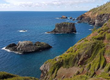
Mount Pitt’s defining landmark is its elevated lookout, a simple but memorable point from which Norfolk Island’s geography can be read at a glance. The summit’s importance is visual rather than architectural: it reveals the relationship between the central ridges, Norfolk Island pines, farmland, settlements and the surrounding ocean. The adjoining forested landscape forms part of the wider protected environment of Norfolk Island National Park, whose conservation value gives the hill more significance than a viewpoint alone. Mount Pitt’s landmark character becomes clearer when contrasted with sites elsewhere on the island. The Kingston and Arthur’s Vale Historic Area, outside Mount Pitt, contains the most concentrated group of convict-era structures and ruins, while the island’s coastline supplies natural landmarks of a different scale. Mount Pitt is not a cathedral, fort or monumental civic building; it is a geographic marker and orientation point. Its open position, changing cloud and broad outlook make it one of the places where Norfolk Island’s natural isolation and layered settlement history can be understood together.
-
Restaurant
The Olive
Experience the exquisite flavors of Norfolk Island at The Olive, where fresh local ingredients meet exceptional culinary artistry.
-
Vista point
Captain Cook Lookout
Experience breathtaking views and rich history at Captain Cook Lookout on Norfolk Island, a picturesque destination for nature lovers and explorers.
-
Holiday apartment rental
Channers On Norfolk - Norfolk Island Holiday Packages, Tours, Accommodation | Travel to Norfolk Island
Experience the beauty of Norfolk Island with Channers On Norfolk, offering cozy self-catering accommodations amidst stunning landscapes.
-
Resort hotel
Castaway Norfolk Island & Norfolk Island Brewing
Discover the perfect blend of relaxation and local culture at Castaway Norfolk Island, featuring stunning views and handcrafted brews.


Explore Mount Pitt on the map
Plan your trip on one map. See where the top cities, national parks and sights are, and book hotels and experiences in a few clicks.
Best hotels in Mount Pitt
Best restaurants in Mount Pitt
Mount Pitt itself has no substantial restaurant district, so dining is generally arranged in Burnt Pine and other settled areas elsewhere on Norfolk Island. The island’s food culture reflects its farming landscape, Pacific location and Australian connections, with locally grown produce, seafood, meat, baked goods and home-style cooking appearing alongside contemporary café and restaurant menus. Fresh fish is a natural choice, while Norfolk Island produce and locally made items may feature in seasonal offerings. Pubs, cafés, restaurants and accommodation dining provide the main options, but opening arrangements can vary and reservations are sensible for popular periods. Farmers’ markets and local food outlets are useful for picnic supplies before a day of walking, although visitors should avoid taking food into protected areas if it could attract wildlife. For a Mount Pitt visit, carry water and any provisions needed rather than expecting to find refreshments at the summit.
-
Restaurant
The Olive
Experience authentic Norfolk Island cuisine at The Olive - where fresh ingredients meet friendly service in a charming setting.
-
Restaurant
Hilli Restaurant & Cafe
Experience exquisite local cuisine at Hilli Restaurant & Cafe on Norfolk Island - where every meal becomes a cherished memory.
-
Restaurant
The Bowlo Bistro
Experience exceptional dining at The Bowlo Bistro - where local flavors meet warm hospitality on Norfolk Island.
-
Western
Bounty Bar & Grill
Experience exquisite Western cuisine at Bounty Bar & Grill on Norfolk Island—where every meal is a celebration of local flavors.


Best bars in Mount Pitt
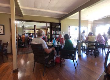
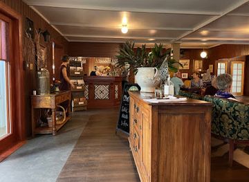
Mount Pitt is a daytime viewpoint rather than a nightlife centre, and there are no clubs or late-night venues at the summit. Evening activity on Norfolk Island is concentrated in Burnt Pine and other settled areas, with traditional pubs, hotel bars, restaurants and occasional live entertainment providing a relaxed social scene. The character is more suited to conversation, dinner and local events than to a large nightclub circuit. Visitors may find opportunities to try Australian beers, wines and spirits, but drinking is not necessary to engage with the island’s evening culture. Because the population is small and distances are short but facilities limited, check current arrangements locally and pre-arrange transport if planning to dine or drink away from your accommodation.
-
Restaurant
The Olive
Experience the authentic flavors of Norfolk Island at The Olive, where local ingredients and a warm atmosphere create unforgettable meals.
-
Restaurant
Hilli Restaurant & Cafe
Experience the flavors of Norfolk Island at Hilli Restaurant & Cafe, where fresh ingredients meet warm hospitality in a beautiful setting.
-
Restaurant
The Bowlo Bistro
Discover the flavors of Norfolk Island at The Bowlo Bistro, where local ingredients meet warm hospitality in a charming dining atmosphere.
-
Resort hotel
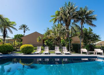
Governor's Lodge
Discover the enchanting beauty and rich history of Norfolk Island at Governor's Lodge, your perfect resort getaway.
Best nightclubs in Mount Pitt
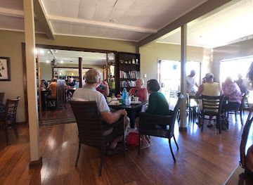
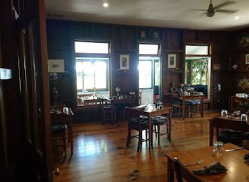
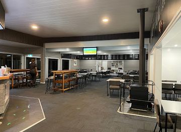
Mount Pitt is a daytime viewpoint rather than a nightlife centre, and there are no clubs or late-night venues at the summit. Evening activity on Norfolk Island is concentrated in Burnt Pine and other settled areas, with traditional pubs, hotel bars, restaurants and occasional live entertainment providing a relaxed social scene. The character is more suited to conversation, dinner and local events than to a large nightclub circuit. Visitors may find opportunities to try Australian beers, wines and spirits, but drinking is not necessary to engage with the island’s evening culture. Because the population is small and distances are short but facilities limited, check current arrangements locally and pre-arrange transport if planning to dine or drink away from your accommodation.
-
Restaurant
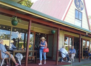
The Olive
Experience the flavors of Norfolk Island at The Olive, a charming restaurant in Burnt Pine, offering fresh, local dishes in a cozy setting.
-
Restaurant
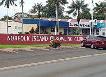
The Bowlo Bistro
Discover The Bowlo Bistro, where Norfolk Island's culinary delights meet warm hospitality in a picturesque setting.
-
Resort hotel
Castaway Norfolk Island & Norfolk Island Brewing
Discover the beauty of Norfolk Island at Castaway, a unique resort blending relaxation and craft brewing in a tropical paradise.
-
Club
Norfolk Island RSL Memorial Club
Experience camaraderie and cultural heritage at the Norfolk Island RSL Memorial Club, a vibrant hub for locals and visitors with great entertainment and delicious food.

Best shops in Mount Pitt
Mount Pitt has no dedicated shopping area, so visitors normally shop in Burnt Pine, the island’s main commercial centre, or at small outlets elsewhere on Norfolk Island. Local shopping is modest rather than mall-based, with groceries, practical supplies, gifts, books, artwork, crafts and locally produced food found through independent businesses and seasonal markets. Norfolk Island pine products, island-themed art and handmade items can make more meaningful souvenirs than generic merchandise, provided materials have been legally sourced and are not taken from protected areas. Visitors planning a walk should buy food, water and other essentials before travelling to the summit, as there are no shops at Mount Pitt. Retail hours and market arrangements can change, particularly outside busier travel periods, so confirm details locally rather than relying on mainland-style opening expectations.
-
Restaurant
The Olive
Discover the culinary delights of The Olive on Norfolk Island, where fresh ingredients meet island charm in a welcoming atmosphere.
-
Holiday apartment rental
Channers On Norfolk - Norfolk Island Holiday Packages, Tours, Accommodation | Travel to Norfolk Island
Discover the charm of Norfolk Island while enjoying the comfort of Channers On Norfolk, your perfect self-catering holiday apartment.
-
Resort hotel
Castaway Norfolk Island & Norfolk Island Brewing
Experience the perfect blend of relaxation and local craft brewing at Castaway Norfolk Island, your ideal getaway in paradise.
-
Park
Mount Pitt Lookout
Discover the stunning 360-degree views and serene nature at Mount Pitt Lookout, a must-visit attraction on Norfolk Island.
Get your free copy of our complete guide to Mount Pitt, delivered straight to you.
Everything on this page, from attractions and restaurants to essentials and local phrases, in one PDF you can read offline, print or share.
Already have an account? Sign in
Your Mount Pitt guide is ready.
We'll send it to · Not you? Sign out

Getting your guide ready…
We are putting together a fresh copy of the Mount Pitt guide. This can take up to a minute.
This can take a few moments. If your browser asks, choose Allow so the download can start. You'll find the guide in your Downloads folder.
Nothing happened? Download it again
Sorry, the guide is taking longer than usual. Please try again in a minute, or get it by email instead.
Mount Pitt essentials
Currency and Payment
Safety
Emergency Situations
Do's and Don'ts
Local Tips
From Eve
Local phrases worth knowing
You don't need to get them perfect. A few words go a long way, and locals appreciate the effort.
Basics
| English | Local | Say it |
|---|---|---|
| Hello | G'day | [g'day] |
| Goodbye | See ya | [see ya] |
| Yes | Yeah | [yeah] |
| No | Nah | [nah] |
| Please/You're welcome | No worries | [no worries] |
| Thank you | Thanks | [thanks] |
| Excuse me/Sorry | Sorry | [sorry] |
| How are you? | How's it going? | [how's it going?] |
| Fine. And you? | Good, you? | [good, you?] |
| Do you speak English? | You speak English? | [you speak English?] |
| I don't understand | I don’t get it | [I don’t get it] |
Eating & Drinking
| English | Local | Say it |
|---|---|---|
| I'd like to see the menu, please | Can I see the menu? | [can I see the menu?] |
| I don't eat meat | I’m a vegetarian | [I’m a vegetarian] |
| Cheers! | Cheers! | [cheers!] |
| I would like to pay, please | Can I get the bill? | [can I get the bill?] |
Emergencies
| English | Local | Say it |
|---|---|---|
| Help! | Help! | [help!] |
| Go away! | Leave me alone! | [leave me alone!] |
| Call the Police! | Call the cops! | [call the cops!] |
| Call a doctor! | Get a doctor! | [get a doctor!] |
| I'm lost | I’m lost | [I’m lost] |
| I'm ill | I’m not well | [I’m not well] |
Shopping
| English | Local | Say it |
|---|---|---|
| I'd like to buy... | I want to buy... | [I want to buy...] |
| I'm just looking | Just browsing | [just browsing] |
| How much is it? | What’s the price? | [what’s the price?] |
| That's too expensive | That’s pricey | [that’s pricey] |
| Can you lower the price? | Can you do a better price? | [can you do a better price?] |
Time & Numbers
| English | Local | Say it |
|---|---|---|
| What time is it? | What’s the time? | [what’s the time?] |
| It's one o'clock | It’s one | [it’s one] |
| Half past (10) | Half past ten | [half past ten] |
| Morning | Morning | [morning] |
| Afternoon | Arvo | [arvo] |
| Evening | Evening | [evening] |
| Yesterday | Yesterday | [yesterday] |
| Today | Today | [today] |
| Tomorrow | Tomorrow | [tomorrow] |
| 1 | One | [one] |
| 2 | Two | [two] |
| 3 | Three | [three] |
| 4 | Four | [four] |
| 5 | Five | [five] |
| 6 | Six | [six] |
| 7 | Seven | [seven] |
| 8 | Eight | [eight] |
| 9 | Nine | [nine] |
| 10 | Ten | [ten] |
Transport & Directions
| English | Local | Say it |
|---|---|---|
| Where's a/the...? | Where’s the...? | [where’s the...?] |
| What's the address? | What’s the address? | [what’s the address?] |
| Can you show me (on the map)? | Can you show me on the map? | [can you show me on the map?] |
| When's the next (bus)? | When’s the next bus? | [when’s the next bus?] |
| A ticket (to ....) | A ticket to... | [a ticket to...] |
History of Mount Pitt
Polynesian Settlement Before European Contact
Norfolk Island was settled by Polynesian voyagers centuries before Europeans arrived, probably during the period when seafaring communities were expanding across the south-west Pacific. Archaeological evidence, including artefacts and settlement remains, shows that the island was connected to wider Polynesian voyaging networks, although permanent occupation ended before the eighteenth century. The Mount Pitt area forms part of the island landscape in which these early communities lived, travelled and gathered resources. The surviving forest and terrain provide environmental context for this earlier history, even though the most visible archaeological evidence is not concentrated at the summit itself.
European Sightings and Cook’s 1774 Visit
Captain James Cook sighted Norfolk Island in 1774 during his second Pacific voyage and reported its tall Norfolk Island pines, which later became important to British imperial planning. European interest focused on the island’s strategic position and natural resources rather than on Mount Pitt as a separate settlement. The elevated interior, including the Mount Pitt ridge, would eventually offer useful views over the coast and surrounding waters, but the first lasting colonial developments were established elsewhere on the island.
The First British Penal Settlement, 1788–1814
Britain established a penal settlement on Norfolk Island in 1788, shortly after the founding of New South Wales. The colony was intended to secure the island, cultivate food and exploit its timber and flax resources. Convict labour transformed the landscape and created roads, farms and buildings, while the principal administrative and industrial centre developed around Kingston rather than Mount Pitt. The settlement was abandoned in 1814 after British authorities judged the island difficult to maintain, leaving archaeological traces that are now most evident in the Kingston historic area.
The Second Penal Settlement, 1825–1855
A second British penal settlement operated from 1825 until 1855, and Norfolk Island gained a reputation as one of the harshest places in the Australian colonial penal system. The administration again centred on Kingston, where gaol structures, officers’ buildings, roads and ruins survive within the Kingston and Arthur’s Vale Historic Area. Mount Pitt belongs to the wider landscape shaped by this period: forests were cleared, food was produced and routes connected the settled districts. The elevated interior also became part of the island’s practical geography, although it was not the main penal administrative centre.
The Pitcairn Community Arrives in 1856
In 1856, most of the population of Pitcairn Island moved to Norfolk Island because Pitcairn could no longer support the growing community. These settlers were descendants of the Bounty mutineers and their Tahitian companions, and they brought distinctive family histories, religious traditions and a creole language known as Norf’k. Their arrival reshaped Norfolk Island’s society after the penal era. The community settled across the island rather than in one isolated district, so Mount Pitt’s modern cultural setting is linked to the wider island community, while the strongest historic buildings from this transition remain around Kingston.
War, Aviation and Modern Connections
Norfolk Island’s strategic location became important again during the twentieth century, particularly during the Second World War, when the island supported communications, aviation and regional defence arrangements. The construction and use of improved transport and communications infrastructure increased links with Australia and the wider Pacific. Mount Pitt’s high position has long made it significant for outlook and communications, although the island’s major aviation facilities are located away from the summit area. These developments helped move Norfolk Island from a largely isolated colonial outpost towards a more connected territory.
National Park Protection and Conservation
Norfolk Island National Park was created to protect the island’s remaining native forests, endemic species and significant landscapes, including areas around Mount Pitt and Mount Bates. Conservation has become increasingly important because the island’s plants and animals evolved in isolation and are vulnerable to introduced species, habitat loss and other pressures. Today, the Mount Pitt area is valued less as a developed attraction than as a viewpoint and access point within a protected natural setting. Its forested slopes show why Norfolk Island’s environmental history is inseparable from its human history.
Mount Pitt in Photos
Browse through our photo collection highlighting the charm and character of the destination.
Neighbouring regions of Mount Pitt
The closest regions to Mount Pitt, if you have time for more than one.
-

-

-

-

-


Swipe for more regions
Explore more

Explore more of Norfolk Island
Discover Norfolk Island, a serene and historic gem in the South Pacific, known for its stunning landscapes, rich cultural heritage, and abundant natural beauty.
Explore Norfolk Island