

Jotunheimen National Park Travel Guide - Free Web & App
Your ultimate guide to Jotunheimen National Park. Discover top landmarks, proposed trips, and local tips. Free on the web or via the Evendo companion app.


Jotunheimen National Park in Norway offers Galdhøpiggen, Besseggen, glacial valleys, mountain huts and world-class hiking amid high Nordic peaks.
High Peaks and Glacial Valleys
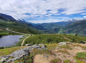
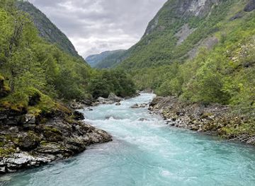
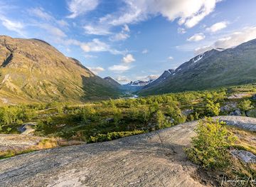
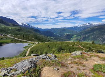
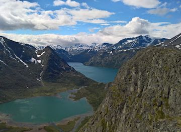
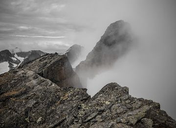
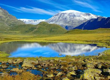
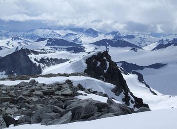
Jotunheimen National Park occupies about 1,151 square kilometres of rugged mountain country in central Norway, between the valleys of Gudbrandsdalen, Ottadalen and Valdres and close to the Sognefjord region. Its name means “Home of the Giants”, an apt reference to the concentration of Norway’s highest summits, including Galdhøpiggen at 2,469 metres and Glittertind at 2,452 metres. The landscape is shaped by sharp ridges, broad plateaux, glacial valleys, snowfields, rushing rivers and mountain lakes, with Gjende’s green water forming one of its most recognisable natural features.Read more about Jotunheimen National Park
Walking Country and Mountain Bases
Landscape, Wildlife and Mountain Culture
When is the best time to visit Jotunheimen National Park?
Best: June–August · 20–21°C| Month | High (°C) | Rainfall (mm) |
|---|---|---|
| January | 0 | 49 |
| February | 1 | 40 |
| March | 4 | 36 |
| April | 9 | 30 |
| May | 15 | 27 |
| June (best) | 20 | 26 |
| July (best) | 21 | 28 |
| August (best) | 20 | 30 |
| September | 14 | 32 |
| October | 9 | 36 |
| November | 3 | 42 |
| December | 1 | 47 |
Getting to and around Jotunheimen National Park
How to get there
Transportation
Best attractions in Jotunheimen National Park
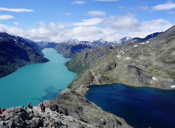
Jotunheimen’s attractions are primarily its mountain landscapes and the routes that connect them. The Besseggen ridge offers a celebrated traverse between Gjende and the darker lake Bessvatnet, while Gjende itself forms a striking base for boat-supported walks towards Memurubu and Gjendebu. Galdhøpiggen, Norway’s highest summit, is approached by different routes with varying technical and seasonal demands, and Glittertind provides another major high-mountain objective. Around the park, valleys such as Leirungsdalen and Utladalen reveal contrasting scenery, although Utladalen lies outside the national park boundary. The mountain road over Valdresflye and the Sognefjellsvegen provide broad views into the massif when open. Lower-complexity experiences include walks from Gjendesheim, mountain-farm landscapes near the approaches and visits to Lom’s cultural attractions outside the park itself.
-
Tourist attraction
Galdhøpiggen
Discover Galdhøpiggen, the highest peak in Northern Europe, and experience breathtaking views and unforgettable hiking adventures in Jotunheimen National Park.
-
Tourist attraction
Vettisfossen
Discover the breathtaking Vettisfossen, one of Norway's tallest and most beautiful waterfalls, surrounded by stunning landscapes and hiking trails.
-
Rock climbing
Besseggen
Experience the breathtaking beauty of Besseggen, a premier hiking destination in Norway’s Jotunheimen National Park, perfect for outdoor enthusiasts.
-
Mountain range
Jotunheimen
Explore the breathtaking beauty of Jotunheimen, Norway's majestic mountain range, perfect for adventures, hiking, and stunning landscapes.
Best landmarks in Jotunheimen National Park
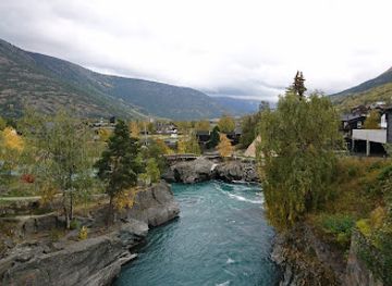
Galdhøpiggen is Jotunheimen’s defining summit and Norway’s highest point, while Glittertind forms another prominent high peak in the massif. The Besseggen ridge is a major natural landmark because its narrow, elevated line separates the green waters of Gjende from Bessvatnet, creating one of the region’s most recognisable mountain views. Gjende’s elongated lake, glacial valleys and steep enclosing slopes express the power of ice and meltwater in shaping the landscape. The national park’s marked routes, mountain huts and historic travel corridors are cultural landmarks of Norway’s outdoor tradition, although individual huts lie in different settings and may have distinct ownership and access arrangements. Nearby Lom stave church, a notable medieval wooden church, is an important regional landmark outside the national park rather than a feature within its protected boundary.
-
Protestant church
Lom stavkyrkje
Explore the stunning Lom Stave Church, a 12th-century architectural treasure nestled in Norway's breathtaking landscapes, rich in history and culture.
-
Landmark
Galdhøpiggen
Discover Galdhøpiggen, Norway's highest peak, where stunning landscapes and unforgettable adventures await in the heart of Jotunheimen National Park.
-
Indoor lodging
Juvasshytta
Experience the beauty of Norway at Juvasshytta, your perfect indoor lodging near breathtaking mountains and hiking adventures.
-
Mountain cabin
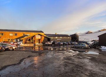
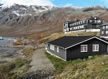
Gjendesheim DNT Cabin
Discover the stunning natural beauty of Norway at Gjendesheim DNT Cabin—your gateway to adventure and relaxation in the heart of the mountains.
Explore Jotunheimen National Park on the map
Plan your trip on one map. See where the top attractions, landmarks, restaurants and hotels are, and book hotels and experiences in a few clicks.
Best hotels in Jotunheimen National Park
Best restaurants in Jotunheimen National Park
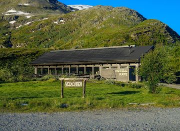
Dining in Jotunheimen is closely tied to mountain lodges, seasonal visitor centres and the gateway settlements rather than to a concentrated restaurant scene inside the park. DNT huts and privately run mountain lodges commonly provide meals for guests, with food designed for walkers and shaped by Norwegian traditions of hearty soups, bread, dairy products, potatoes and preserved or locally sourced ingredients. In Lom, Vågå, Fagernes and other approach towns, visitors can find cafés, bakeries, hotels and restaurants serving broader regional menus; Lom is particularly useful for combining mountain travel with provisions and a meal. Farm shops and local producers around the surrounding valleys may offer cheese, meat, baked goods and other Norwegian specialities, but opening patterns vary. Remote trailheads generally have few or no independent dining options, so packed food and hut arrangements are important parts of itinerary planning.
-
National park
Jotunheimen National Park
Explore Jotunheimen National Park: Norway’s stunning wilderness with majestic mountains, pristine lakes & diverse wildlife awaits every adventurer.
-
Norwegian
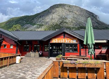
Skeid Kro
Discover authentic Norwegian cuisine at Skeid Kro in Skjåk – where tradition meets flavor in every bite.
-
Hotel
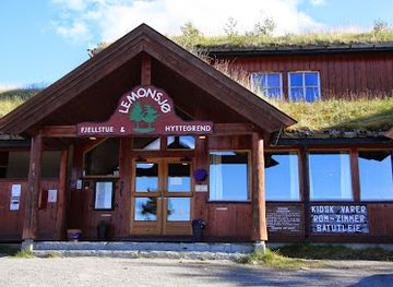
Lemonsjøen Fjellstue & Hyttegrend
Experience authentic Norwegian hospitality at Lemonsjøen Fjellstue & Hyttegrend amidst breathtaking landscapes.
-
 Restaurant
Bessheim Fjellstue og Hytter
Experience authentic Norwegian hospitality at Bessheim Fjellstue og Hytter while exploring the majestic Jotunheimen National Park.
Best bars in Jotunheimen National Park
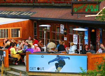
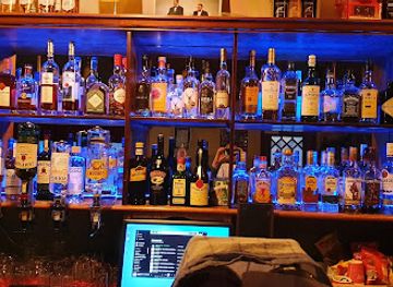
Jotunheimen has no established nightlife district or significant concentration of nightclubs. Evenings are generally quiet and centred on the common rooms, dining areas and outdoor settings of mountain lodges, where walkers may share route information over a meal or a drink. Traditional hotel bars and pubs can be found in gateway settlements such as Lom, Vågå and Fagernes, while some accommodation around the approach roads provides a more sociable evening atmosphere during the walking season. In smaller villages, entertainment may depend on local cultural events rather than a regular programme. Mountain weather, early starts and the distances between settlements make late-night travel impractical in much of the region, and remote huts should be treated as places for rest rather than guaranteed licensed entertainment.
-
Bar
Bryggerihuset AS (Brew House)
Discover Bryggerihuset AS in Beitostølen: A delightful brew house offering local beers, hearty dishes, and lively entertainment.
-
Restaurant
Jotunheimen Fjellstue
Experience the stunning beauty of Jotunheimen Fjellstue, where exquisite cuisine meets breathtaking nature in Norway's majestic national park.
-
Bar
Svingen Pub
Experience the warmth and charm of Svingen Pub, Beitostølen's favorite bar for locals and tourists alike, offering a delightful selection of beverages.
-
Pub
Postaabneriet pub & cafe AS
Experience the warmth of Norwegian hospitality at Postaabneriet pub & cafe AS, where local flavors and vibrant atmosphere await.
Best nightclubs in Jotunheimen National Park
Jotunheimen has no established nightlife district or significant concentration of nightclubs. Evenings are generally quiet and centred on the common rooms, dining areas and outdoor settings of mountain lodges, where walkers may share route information over a meal or a drink. Traditional hotel bars and pubs can be found in gateway settlements such as Lom, Vågå and Fagernes, while some accommodation around the approach roads provides a more sociable evening atmosphere during the walking season. In smaller villages, entertainment may depend on local cultural events rather than a regular programme. Mountain weather, early starts and the distances between settlements make late-night travel impractical in much of the region, and remote huts should be treated as places for rest rather than guaranteed licensed entertainment.
-
Cabin rental agency
DNT Fondsbu
Discover the enchanting DNT Fondsbu, your ideal base for exploring the breathtaking landscapes of Norway's Jotunheimen National Park.
-
Mountain range
Jotunheimen
Explore Jotunheimen, Norway's stunning mountain range, where breathtaking views and thrilling outdoor adventures await every traveler.
-
Hotel
Jotunheimen Fjellstue
Experience the serene beauty and outdoor adventures at Jotunheimen Fjellstue, your gateway to Norway's majestic landscapes.
-
Museum
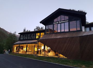
Norwegian fjellsenter
Discover the Norwegian Fjellsenter: Your gateway to the stunning landscapes of Jotunheimen National Park in Norway.
Best shops in Jotunheimen National Park
Shopping within Jotunheimen is limited and practical, with opportunities concentrated in mountain lodges, seasonal visitor facilities and the gateway settlements rather than in a dedicated retail district. Lom, Vågå and Fagernes are useful places for provisions, walking equipment, maps and locally produced goods before entering the mountains. Visitors may encounter Norwegian knitwear, woodcraft, pottery, artwork, farm products, baked goods and regional foods through independent shops, farm outlets and craft businesses in the surrounding valleys, although the range varies by settlement and season. Mountain lodges may sell basic supplies or souvenirs, but remote trailheads should not be treated as shopping centres. Visitors travelling the Sognefjellsvegen or Valdresflye should obtain essential food, fuel and equipment in advance, particularly outside the main summer period.
-
Grocery store
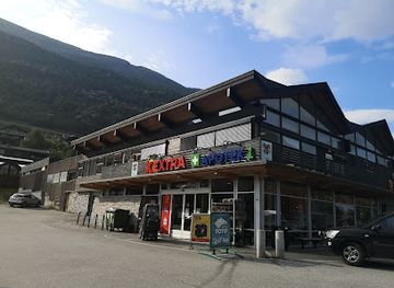
Extra Lom
Discover the heart of local life at Extra Lom, a grocery store offering fresh produce and unique Norwegian delicacies in Fossbergom.
-
Museum
Norwegian fjellsenter
Uncover Norway's natural beauty and cultural heritage at the Norwegian Fjellsenter, a must-visit museum and visitor center in Fossbergom.
-
Grocery store
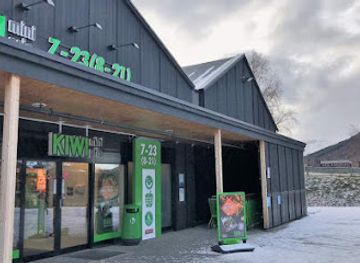
KIWI Lom
Explore KIWI Lom in Fossbergom, Norway – your go-to grocery store for local flavors and essential supplies during your travels.
-
National park
Jotunheimen National Park
Discover the breathtaking landscapes and rich biodiversity of Jotunheimen National Park, Norway's premier destination for adventure and natural beauty.
Get your free copy of our complete guide to Jotunheimen National Park, delivered straight to you.
Everything on this page, from attractions and restaurants to essentials and local phrases, in one PDF you can read offline, print or share.
Already have an account? Sign in
Your Jotunheimen National Park guide is ready.
We'll send it to · Not you? Sign out

Getting your guide ready…
We are putting together a fresh copy of the Jotunheimen National Park guide. This can take up to a minute.
This can take a few moments. If your browser asks, choose Allow so the download can start. You'll find the guide in your Downloads folder.
Nothing happened? Download it again
Sorry, the guide is taking longer than usual. Please try again in a minute, or get it by email instead.
Jotunheimen National Park essentials
Currency and Payment
Safety
Emergency Situations
Do's and Don'ts
Local Tips
From Eve
Local phrases worth knowing
You don't need to get them perfect. A few words go a long way, and locals appreciate the effort.
Basics
| English | Local | Say it |
|---|---|---|
| Hello | Hei | [hay] |
| Goodbye | Ha det | [ha deh] |
| Yes | Ja | [yah] |
| No | Nei | [nay] |
| Please/You're welcome | Vær så god | [ver sa goh] |
| Thank you | Takk | [tahk] |
| Excuse me/Sorry | Unnskyld | [oon-shield] |
| How are you? | Hvordan har du det? | [vohr-dan har doo deh] |
| Fine. And you? | Bra. Og du? | [bra oh doo] |
| Do you speak English? | Snakker du engelsk? | [snah-ker doo engelsk] |
| I don't understand | Jeg forstår ikke | [yay for-stor ee-neh] |
Eating & Drinking
| English | Local | Say it |
|---|---|---|
| I'd like to see the menu, please | Jeg vil gjerne se menyen, takk | [yay veal yer-neh se meh-nyen tahk] |
| I don't eat meat | Jeg spiser ikke kjøtt | [yay spee-ser ee-keh shøt] |
| Cheers! | Skål! | [skohl] |
| I would like to pay, please | Jeg vil gjerne betale, takk | [yay veal yer-neh beh-tah-leh tahk] |
Emergencies
| English | Local | Say it |
|---|---|---|
| Help! | Hjelp! | [yelp] |
| Go away! | Gå vekk! | [goh vehk] |
| Call the Police! | Ring politiet! | [ring poh-lee-tee-eh] |
| Call a doctor! | Ring en lege! | [ring en lay-geh] |
| I'm lost | Jeg er borte | [yay air bohr-teh] |
| I'm ill | Jeg er syk | [yay air sook] |
Shopping
| English | Local | Say it |
|---|---|---|
| I'd like to buy... | Jeg vil kjøpe... | [yay veal shyoo-peh] |
| I'm just looking | Jeg bare ser | [yay bah-reh sair] |
| How much is it? | Hvor mye koster det? | [vor meh-eh kohs-ter deh] |
| That's too expensive | Det er for dyrt | [deh air for deert] |
| Can you lower the price? | Kan du senke prisen? | [kahn doo seh-nkeh pree-sen] |
Time & Numbers
| English | Local | Say it |
|---|---|---|
| What time is it? | Hva er klokka? | [vah air kloh-kah] |
| It's one o'clock | Klokka er ett | [kloh-kah air eht] |
| Half past (10) | Halv ti | [hahlv tee] |
| Morning | Morgen | [mohr-gehn] |
| Afternoon | Ettermiddag | [et-ehr-mee-dahg] |
| Evening | Kveld | [kvehld] |
| Yesterday | I går | [ee gohr] |
| Today | I dag | [ee dahg] |
| Tomorrow | I morgen | [ee mohr-gehn] |
| 1 | En | [ehn] |
| 2 | To | [too] |
| 3 | Tre | [treh] |
| 4 | Fire | [fee-reh] |
| 5 | Fem | [fehm] |
| 6 | Seks | [sehks] |
| 7 | Sju | [shoo] |
| 8 | Åtte | [oht-teh] |
| 9 | Ni | [nee] |
| 10 | Ti | [tee] |
Transport & Directions
| English | Local | Say it |
|---|---|---|
| Where's a/the...? | Hvor er... | [vor air] |
| What's the address? | Hva er adressen? | [vah air ah-dress-en] |
| Can you show me (on the map)? | Kan du vise meg (på kartet)? | [kahn doo vee-seh may (poh kahr-teh)] |
| When's the next (bus)? | Når går neste (buss)? | [nahr gohr neh-steh (booss)] |
| A ticket (to ....) | En billett (til ....) | [ehn bee-leht (teel)] |
History of Jotunheimen National Park
A Landscape Shaped by Ice
Jotunheimen’s present character reflects long geological processes and repeated glaciation rather than a single historical event. Ancient bedrock, uplift and erosion produced the high mountain massif, while glaciers carved deep valleys, cirques and sharp ridges. Ice and meltwater continue to influence the terrain, leaving snowfields, moraines, glacial streams and lakes such as Gjende. These physical features explain both the region’s concentration of high summits and the demanding character of its passes and valleys.
Mountain Use and Summer Pastures
People have long used the valleys and lower mountain slopes surrounding Jotunheimen for farming, hunting, fishing and seasonal grazing. The tradition of seter life, in which livestock was moved to summer mountain farms, helped shape open pastures and routes through the landscape. Mountain travel also linked communities on opposite sides of the massif, although the high terrain remained a formidable barrier. The cultural landscape around the park therefore reflects a continuing relationship between settlement, livestock and seasonal use of upland resources.
Exploration and Early Tourism
Jotunheimen became increasingly known to mountaineers and travellers during the nineteenth century, when improved roads, guidebooks and organised exploration brought wider attention to Norway’s highest mountains. The Norwegian Trekking Association was founded in 1868 and played an important role in marking routes, developing mountain accommodation and making longer walks more practicable. Early visitors were drawn to summits such as Galdhøpiggen and to dramatic routes around Gjende, establishing the foundations of the region’s modern walking culture.
A National Park for the High Mountains
Jotunheimen National Park was established in 1980 to protect a large representative area of Norway’s central high-mountain landscape, including important habitats, geological features and traditional travel routes. Conservation management has had to balance growing recreational use with the security of wildlife, vegetation and water environments. The park remains closely connected to surrounding valleys and communities, so its history is not simply one of wilderness preservation: roads, mountain lodges, grazing traditions and tourism continue to shape how visitors encounter the protected area.
Jotunheimen National Park in Photos
Browse through our photo collection highlighting the charm and character of the destination.
Neighbouring destination travel guides
The closest destinations to Jotunheimen National Park, if you have time for more than one.
-

-

-

-

-


Swipe for more destinations
Explore more
Explore more of Oppland
Discover Oppland: A blend of breathtaking nature, rich history, and vibrant culture in the heart of Norway.
Explore Oppland
Explore more of Norway
Explore Norway's spectacular fjords, vibrant cities, and natural wonders. Experience the Northern Lights, Midnight Sun, and rich cultural heritage in this Scandinavian gem.
Explore Norway