

Trolltunga Travel Guide - Free Web & App
Your ultimate guide to Trolltunga. Discover top landmarks, proposed trips, and local tips. Free on the web or via the Evendo companion app.


Trolltunga, Norway: hike to the iconic cliff above Ringedalsvatnet, with mountain scenery, fjord views and practical access from Odda for experienced walkers.
The Rock and the Landscape
Trolltunga, meaning ‘Troll’s Tongue’, is a narrow rock ledge projecting horizontally from a mountain above Ringedalsvatnet in western Norway. It lies near the town of Odda and the village of Tyssedal, within the mountainous Hardanger region. The cliff’s distinctive shape, sheer drop and elevated position have made it one of Norway’s most recognisable natural landmarks, but the setting is far more extensive than the photograph usually suggests: high plateaux, steep valleys, snow patches, bare rock and distant peaks surround the route.Read more about Trolltunga
Walking to Trolltunga
Odda and the Hardanger Setting
When is the best time to visit Trolltunga?
Best: June–August · 21–23°C| Month | High (°C) | Rainfall (mm) |
|---|---|---|
| January | -1 | 70 |
| February | 0 | 60 |
| March | 4 | 55 |
| April | 10 | 45 |
| May | 16 | 50 |
| June (best) | 21 | 60 |
| July (best) | 23 | 70 |
| August (best) | 22 | 70 |
| September | 17 | 60 |
| October | 11 | 60 |
| November | 5 | 60 |
| December | 1 | 70 |
Getting to and around Trolltunga
How to get there
Transportation
Best attractions in Trolltunga
The principal attraction is Trolltunga itself, the flat rock projection suspended above Ringedalsvatnet and reached by a demanding mountain route from Skjeggedal or, when available, the higher access point at Mågelitopp. The walk traverses changing terrain of forest edge, steep slopes, open plateau, rock and snow, with broad views across the Ringedalen landscape. Ringedalsvatnet provides the defining visual setting below the cliff, although its position in a steep valley makes the scale easy to underestimate. Nearby Tyssedal adds a contrasting cultural attraction through its hydroelectric and industrial heritage, while Odda provides access to the wider Sørfjorden and Hardanger scenery. The region’s waterfalls, mountain valleys and fjord landscapes are best understood as part of a wider excursion rather than as minor features on the Trolltunga trail. Conditions and access vary seasonally, and the mountain route remains the central visitor experience.
-
Scenic spot
Trolltunga "Troll's Tongue"
Discover the breathtaking beauty of Trolltunga, Norway's iconic rock formation offering stunning views and an unforgettable hiking experience.
-
Tourist attraction
Agatunet
Explore Agatunet, a cultural gem in Norway, showcasing traditional architecture and the rich heritage of rural life amidst stunning natural beauty.
-
Tourist attraction
Opo River Viewpoint
Discover the stunning vistas of Opo River Viewpoint, a serene retreat in Norway showcasing breathtaking landscapes and tranquil river views.
-
Tourist attraction
Espelandsfossen
Experience the breathtaking beauty of Espelandsfossen, a stunning waterfall in Norway that captivates nature lovers and photographers with its serene landscapes.



Best landmarks in Trolltunga
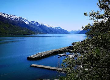
Trolltunga is the defining natural landmark: a narrow, horizontal rock ledge projecting from the mountain above Ringedalsvatnet, whose form reflects the glacial shaping of western Norway. Ringedalsvatnet is itself a major landscape feature, occupying a deep mountain valley beneath the cliff and reinforcing the impression of height and exposure. The steep slopes and open plateaux around the route form a continuous geological setting rather than a collection of separate monuments. In the settled area below, Tyssedal’s hydroelectric power heritage is an important man-made landmark, illustrating how local waterfalls and watercourses supported industrial expansion. Odda’s position at the head of Sørfjorden connects the Trolltunga area with Hardanger’s wider fjord, orchard and mountain landscape.
-
Tour agency
Trolltunga Active
Experience the thrill of adventure in Norway with Trolltunga Active, your gateway to breathtaking hikes and unforgettable outdoor activities.
-
Hiking area
Old Trolltunga Starting Point
Explore the breathtaking landscapes from the Old Trolltunga Starting Point, the gateway to Norway's iconic Trolltunga hike, surrounded by stunning fjords.
-
Tourist attraction
Lilletopp (Hardanger)
Explore the breathtaking hiking trails of Lilletopp in Hardanger, where stunning nature meets adventure for all outdoor enthusiasts.
-
Tourist attraction
Opo River Viewpoint
Discover the stunning Opo River Viewpoint in Odda, Norway, a breathtaking tourist attraction offering panoramic views of the majestic fjord and surrounding landscapes.


Explore Trolltunga on the map
Plan your trip on one map. See where the top attractions, landmarks, restaurants and hotels are, and book hotels and experiences in a few clicks.
Best hotels in Trolltunga
Best restaurants in Trolltunga
Dining is concentrated in Odda and Tyssedal rather than on the mountain, where visitors must carry their own food and water. Restaurants, cafés, bakeries, supermarkets and accommodation dining rooms in the two settlements provide the practical choice for hikers before or after the walk, while the wider Hardanger region is associated with orchard produce, berries, dairy products, lamb and seafood from the fjords and coast. Apple growing is particularly important to the cultural landscape around Hardanger, with local cider and juice among the region’s best-known products, although availability varies by season and venue. Traditional Norwegian meals, packed lunches and simple café food are useful for visitors preparing for a long day outdoors. In smaller settlements, opening patterns and choice can be limited, so supplies should not be left until the final stage of the journey.
-
Restaurant
Smeltehuset Mat Prat Bar
Experience authentic Norwegian cuisine and delicious pizzas at Smeltehuset Mat Prat Bar in Odda – where tradition meets modern taste.
-
Grill
Odda-Grillen
Experience the best of grilled cuisine at Odda-Grillen in Norway - where delicious flavors meet welcoming hospitality.
-
Hotel
Tyssedal Hotel
Experience unparalleled comfort and stunning views at Tyssedal Hotel, your perfect retreat in the heart of Norway's natural beauty.
-
Restaurant
Glacier Restaurant, Bar & Cafe
Savor exquisite flavors at Glacier Restaurant in Odda - where culinary diversity meets Norwegian hospitality.


Best bars in Trolltunga
Trolltunga itself has no nightlife infrastructure, and evenings are generally quiet once visitors return from the mountain. Odda offers the broadest choice of pubs, hotel bars, cafés and informal places to meet, while Tyssedal has a smaller settlement atmosphere shaped by its industrial heritage and proximity to the trailhead. Entertainment is more likely to centre on conversation, local hospitality and seasonal community events than on nightclubs or a concentrated late-night scene. Accommodation venues may provide an evening drink or meal, but opening arrangements vary. Visitors staying in the area generally use the evening to prepare equipment, review weather conditions and recover from the hike rather than seeking a large commercial entertainment district.
-
Restaurant
Smeltehuset Mat Prat Bar
Discover the flavors of Norway at Smeltehuset Mat Prat Bar, where traditional dishes meet modern culinary creativity in a cozy setting.
-
Grill
Odda-Grillen
Experience the best of Norwegian grilled cuisine at Odda-Grillen, a local favorite in the heart of Odda, perfect for food lovers and travelers.
-
Bar
Glacier Restaurant, Bar & Cafe
Experience the flavors of Europe, India, and the Middle East at Glacier Restaurant, Bar & Cafe in Odda, Norway, where culinary diversity meets stunning natural beauty.
-
Restaurant
Thai Take Away Odda AS
Discover a taste of Thailand in Odda with authentic dishes and a vibrant atmosphere at Thai Take Away Odda.


Best nightclubs in Trolltunga
Trolltunga itself has no nightlife infrastructure, and evenings are generally quiet once visitors return from the mountain. Odda offers the broadest choice of pubs, hotel bars, cafés and informal places to meet, while Tyssedal has a smaller settlement atmosphere shaped by its industrial heritage and proximity to the trailhead. Entertainment is more likely to centre on conversation, local hospitality and seasonal community events than on nightclubs or a concentrated late-night scene. Accommodation venues may provide an evening drink or meal, but opening arrangements vary. Visitors staying in the area generally use the evening to prepare equipment, review weather conditions and recover from the hike rather than seeking a large commercial entertainment district.
-
Mountain peak
Trolltunga
Discover the breathtaking beauty of Trolltunga, Norway's iconic mountain peak offering stunning views and unforgettable hiking experiences.
-
Tour agency
Trolltunga Active
Discover Norway’s stunning landscapes with Trolltunga Active, your premier tour agency for extraordinary outdoor adventures.
-
Bar
Vertshuset
Discover the lively atmosphere of Vertshuset, a must-visit bar in Odda, offering a selection of beverages and a taste of local nightlife.
-
Civic center
Sentralbadet litteraturhus, Odda
Discover the vibrant cultural scene at Sentralbadet Litteraturhus in Odda, Norway, a perfect blend of literature, art, and local community.


Best shops in Trolltunga
Shopping around Trolltunga is practical and locally focused, with the main choice found in Odda and, on a smaller scale, Tyssedal. Visitors can obtain hiking food, clothing and outdoor essentials in the gateway settlements, while supermarkets and local food retailers provide supplies for the mountain route. Regional products associated with Hardanger include apples, apple juice, cider, preserves and other foods from the fjord-side farming landscape; specialist availability depends on the season and individual producer. Small independent shops and craft outlets may offer local art, souvenirs or regionally made goods, but Trolltunga should not be approached as a shopping destination. There are no shops on the trail, and visitors should buy provisions before travelling to the access points.
-
Scenic spot
Trolltunga
Explore the breathtaking Trolltunga, an iconic rock formation in Norway offering stunning views and an unforgettable hiking experience in nature's paradise.
-
Grocery store
Extra Odda
Discover fresh produce and local delicacies at Extra Odda, the vibrant grocery store in the heart of Odda, Norway.
-
Grocery store
Spar
Discover the best of Norwegian flavors at Spar, your trusted grocery store in the heart of Odda, offering fresh produce and local delicacies.
-
Men's clothing store
Terje Storhaug
Discover unique men's fashion at Terje Storhaug in Odda, where style meets quality in a welcoming atmosphere.


Get your free copy of our complete guide to Trolltunga, delivered straight to you.
Everything on this page, from attractions and restaurants to essentials and local phrases, in one PDF you can read offline, print or share.
Already have an account? Sign in
Your Trolltunga guide is ready.
We'll send it to · Not you? Sign out

Getting your guide ready…
We are putting together a fresh copy of the Trolltunga guide. This can take up to a minute.
This can take a few moments. If your browser asks, choose Allow so the download can start. You'll find the guide in your Downloads folder.
Nothing happened? Download it again
Sorry, the guide is taking longer than usual. Please try again in a minute, or get it by email instead.
Trolltunga essentials
Currency and Payment
Safety
Emergency Situations
Do's and Don'ts
Local Tips
From Eve
Local phrases worth knowing
You don't need to get them perfect. A few words go a long way, and locals appreciate the effort.
Basics
| English | Local | Say it |
|---|---|---|
| Hello | Hei | [hay] |
| Goodbye | Ha det | [hah deh] |
| Yes | Ja | [ya] |
| No | Nei | [nay] |
| Please/You're welcome | Vær så god | [vair saw goh] |
| Thank you | Takk | [tahk] |
| Excuse me/Sorry | Unnskyld | [oon-skuld] |
| How are you? | Hvordan har du det? | [vor-dan har doo deh] |
| Fine. And you? | Bra. Og du? | [bra oh doo] |
| Do you speak English? | Snakker du engelsk? | [snah-ker doo eng-elsk] |
| I don't understand | Jeg forstår ikke | [yay for-stor ee-teh] |
Eating & Drinking
| English | Local | Say it |
|---|---|---|
| I'd like to see the menu, please | Jeg vil gjerne se menyen, takk | [yay vil yern-eh seh men-yen tahk] |
| I don't eat meat | Jeg spiser ikke kjøtt | [yay spee-ser ee-teh shøt] |
| Cheers! | Skål! | [skohl] |
| I would like to pay, please | Jeg vil gjerne betale, takk | [yay vil yern-eh beh-tah-leh tahk] |
Emergencies
| English | Local | Say it |
|---|---|---|
| Help! | Hjelp! | [yelp] |
| Go away! | Gå vekk! | [gow vehk] |
| Call the Police! | Ring politiet! | [ring poh-lee-tee-et] |
| Call a doctor! | Ring en lege! | [ring en lay-geh] |
| I'm lost | Jeg er borte | [yay air bor-teh] |
| I'm ill | Jeg er syk | [yay air sook] |
Shopping
| English | Local | Say it |
|---|---|---|
| I'd like to buy... | Jeg vil kjøpe... | [yay vil shø-peh] |
| I'm just looking | Jeg ser bare | [yay sair bah-reh] |
| How much is it? | Hvor mye koster det? | [vor myeh kost-er deh] |
| That's too expensive | Det er for dyrt | [deh er for deert] |
| Can you lower the price? | Kan du senke prisen? | [kan doo sen-keh prees-en] |
Time & Numbers
| English | Local | Say it |
|---|---|---|
| What time is it? | Hva er klokka? | [vah air klok-kah] |
| It's one o'clock | Klokka er ett | [klok-kah er et] |
| Half past (10) | Halv ti | [hahlv tee] |
| Morning | Morgen | [mor-genn] |
| Afternoon | Ettermiddag | [et-er-meed-dahg] |
| Evening | Kveld | [kvehld] |
| Yesterday | I går | [ee gor] |
| Today | I dag | [ee dahg] |
| Tomorrow | I morgen | [ee mor-genn] |
| 1 | En | [en] |
| 2 | To | [too] |
| 3 | Tre | [treh] |
| 4 | Fire | [feer-eh] |
| 5 | Fem | [fem] |
| 6 | Seks | [seks] |
| 7 | Syv | [siv] |
| 8 | Åtte | [oh-teh] |
| 9 | Ni | [nee] |
| 10 | Ti | [tee] |
Transport & Directions
| English | Local | Say it |
|---|---|---|
| Where's a/the...? | Hvor er en/et...? | [vor air en/et] |
| What's the address? | Hva er adressen? | [vah air a-dress-en] |
| Can you show me (on the map)? | Kan du vise meg (på kartet)? | [kan doo vee-seh may (poh kart-et)] |
| When's the next (bus)? | Når går neste (buss)? | [norr gor nes-teh (boos)] |
| A ticket (to ....) | En billett (til ....) | [en beel-let (teel)] |
History of Trolltunga
A Landscape Shaped by Ice
Trolltunga is a product of the long geological history of western Norway and the powerful erosion of later ice ages. Glaciers carved the valleys and deep basins of the Hardanger landscape, leaving steep mountains and exposed rock around the modern Ringedalsvatnet reservoir. The ledge itself is a projecting section of bedrock left prominent above the valley. Its form is geological rather than architectural or archaeological, and its significance comes from the way glacially shaped terrain creates a dramatic meeting of horizontal rock, vertical space and mountain water.
Early Settlement in Hardanger
The wider Hardanger region has long supported farming and settlement in sheltered valleys and along the fjords, where communities combined agriculture, livestock keeping, fishing and seasonal use of upland pastures. Around Sørfjorden, the landscape was traditionally organised between productive lower slopes and more demanding mountain areas. Trolltunga was part of this upland environment rather than a separate historic settlement. The routes and valleys around Odda and Tyssedal reflect the practical relationship between communities, waterways and high mountain terrain.
Hydropower and Industrial Tyssedal
The development of hydroelectric power transformed the settlements near Trolltunga during the late nineteenth and early twentieth centuries. Tyssedal became an important industrial community after the harnessing of local water resources, while Odda grew as a centre of industrial production and regional commerce. The power station and industrial heritage associated with Tyssedal demonstrate how waterfalls, lakes and steep valleys were incorporated into Norway’s modern economy. This history contrasts with the apparently wild mountain setting above Ringedalsvatnet, linking the hike to a wider story of engineering and industrialisation.
From Local Landscape to International Attraction
Trolltunga was known locally long before it became an international destination, but improved roads, mountain access and the spread of travel photography brought it far greater attention. Visitor numbers increased markedly during the twenty-first century, creating pressure on paths, parking, rescue resources and the surrounding environment. Local authorities and tourism organisations have responded through improved information, managed parking and transport arrangements, route maintenance and stronger emphasis on preparation. The attraction’s modern history is therefore also a story of how a demanding natural site has had to adapt to global popularity.
Trolltunga in Photos
Browse through our photo collection highlighting the charm and character of the destination.
Neighbouring destination travel guides
The closest destinations to Trolltunga, if you have time for more than one.
-

-

-
-

-


Swipe for more destinations
Explore more

Explore more of Hordaland
Discover Hordaland: Norway's enchanting region of fjords, mountains, and cultural treasures, where nature and tradition meet in perfect harmony.
Explore Hordaland
Explore more of Norway
Explore Norway's spectacular fjords, vibrant cities, and natural wonders. Experience the Northern Lights, Midnight Sun, and rich cultural heritage in this Scandinavian gem.
Explore Norway