

Spearfish Canyon Travel Guide - Free Web & App
Your ultimate guide to Spearfish Canyon. Discover top landmarks, proposed trips, and local tips. Free on the web or via the Evendo companion app.


Spearfish Canyon, South Dakota, pairs limestone cliffs, waterfalls, forested trails and Black Hills wildlife along a celebrated scenic byway near Deadwood.
A Forested Limestone Canyon
Spearfish Canyon cuts through the northern Black Hills of South Dakota, following Spearfish Creek between the historic town of Spearfish and the high-country junction at Cheyenne Crossing. The approximately 22-mile Spearfish Canyon Scenic Byway, designated US Highway 14A, is the destination's defining route, winding beneath pale limestone walls and through dense forests of ponderosa pine, spruce, birch and aspen. Roadside pull-offs reveal a landscape shaped by water, weather and uplift rather than by a conventional mountain pass, with the creek threading through a narrow valley below cliffs and wooded slopes.Read more about Spearfish Canyon
Waterfalls, Wildlife and Seasonal Colour
Gateway Communities and Outdoor Access
When is the best time to visit Spearfish Canyon?
Best: June, August–September · 21–27°C| Month | High (°C) | Rainfall (mm) |
|---|---|---|
| January | 1 | 15 |
| February | 4 | 20 |
| March | 9 | 30 |
| April | 15 | 40 |
| May | 21 | 60 |
| June (best) | 26 | 70 |
| July | 29 | 60 |
| August (best) | 27 | 50 |
| September (best) | 21 | 40 |
| October | 16 | 30 |
| November | 7 | 20 |
| December | 1 | 15 |
Getting to and around Spearfish Canyon
How to get there
Transportation
Best attractions in Spearfish Canyon
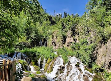
The Spearfish Canyon Scenic Byway is the principal attraction, carrying visitors through a narrow corridor of limestone cliffs, coniferous forest and Spearfish Creek. Bridal Veil Falls drops beside the highway and is one of the easiest sights to appreciate from the road, while Spearfish Falls is reached from the area around the Latchstring Village and offers a closer waterfall experience subject to current access conditions. Roughlock Falls, near Savoy, is approached by a short walk and is particularly attractive when the creek is flowing strongly. Pull-offs along US 14A provide changing views of the canyon walls and wooded slopes, and trails lead into the surrounding Black Hills National Forest. Wildlife observation may reveal deer and forest birds, with other sightings dependent on season and luck. Nearby Savoy provides a small historic visitor centre and lodging presence, while Spearfish, Lead and Deadwood offer additional heritage attractions and services outside the canyon itself.
-
Park
Spearfish Canyon State Nature Area
Discover the breathtaking beauty and outdoor adventures awaiting you at Spearfish Canyon State Nature Area in South Dakota's Black Hills.
Explore Spearfish Canyon on the map
Plan your trip on one map. See where the top attractions, landmarks, restaurants and hotels are, and book hotels and experiences in a few clicks.
Best hotels in Spearfish Canyon
Get your free copy of our complete guide to Spearfish Canyon, delivered straight to you.
Everything on this page, from attractions and restaurants to essentials and local phrases, in one PDF you can read offline, print or share.
Already have an account? Sign in
Your Spearfish Canyon guide is ready.
We'll send it to · Not you? Sign out

Getting your guide ready…
We are putting together a fresh copy of the Spearfish Canyon guide. This can take up to a minute.
This can take a few moments. If your browser asks, choose Allow so the download can start. You'll find the guide in your Downloads folder.
Nothing happened? Download it again
Sorry, the guide is taking longer than usual. Please try again in a minute, or get it by email instead.
Spearfish Canyon essentials
Currency and Payment
Safety
Emergency Situations
Do's and Don'ts
Local Tips
From Eve
Local phrases worth knowing
You don't need to get them perfect. A few words go a long way, and locals appreciate the effort.
Basics
| English | Local | Say it |
|---|---|---|
| Hello | Howdy | [haw-dee] |
| Goodbye | See ya | [see yah] |
| Yes | Yah | [yah] |
| No | Nah | [nah] |
| Please/You're welcome | Please and thank ya | [pleez and thank yah] |
| Thank you | Thanks a bunch | [thanks uh bunch] |
| Excuse me/Sorry | Pardon | [par-dun] |
| How are you? | Howdy, doin' alright? | [haw-dee, doin' alright?] |
| Fine. And you? | Just fine, thanks | [just fine, thanks] |
| Do you speak English? | Ya speak English? | [yah speak ing-glish?] |
| I don't understand | Don't get it | [dunt get it] |
Eating & Drinking
| English | Local | Say it |
|---|---|---|
| I'd like to see the menu, please | Menu, if ya don't mind | [men-yoo, if yah dunt mind] |
| I don't eat meat | No meat for me | [no meat for me] |
| Cheers! | Bottoms up! | [bot-ums up!] |
| I would like to pay, please | Check, please | [check, please] |
Emergencies
| English | Local | Say it |
|---|---|---|
| Help! | Help! | [help!] |
| Go away! | Git! | [git!] |
| Call the Police! | Call the Sheriff! | [call the shur-iff!] |
| Call a doctor! | Get the doc! | [get the doc!] |
| I'm lost | Lost | [lost] |
| I'm ill | Sick | [sick] |
Shopping
| English | Local | Say it |
|---|---|---|
| I'd like to buy... | Gonna buy... | [gon-na buy] |
| I'm just looking | Just lookin' | [just look-in'] |
| How much is it? | How much? | [how much?] |
| That's too expensive | Too pricey | [too pry-see] |
| Can you lower the price? | Can ya do better? | [can yah do bet-ter?] |
Time & Numbers
| English | Local | Say it |
|---|---|---|
| What time is it? | What's the time? | [whats the time?] |
| It's one o'clock | It's one | [its one] |
| Half past (10) | Ten-thirty | [ten-thur-tee] |
| Morning | Mornin' | [morn-in'] |
| Afternoon | Afternoon | [after-noon] |
| Evening | Evenin' | [even-in'] |
| Yesterday | Yest'day | [yes-t-day] |
| Today | Today | [to-day] |
| Tomorrow | Tomorrah | [tom-or-rah] |
| 1 | One | [wun] |
| 2 | Two | [too] |
| 3 | Three | [three] |
| 4 | Four | [fore] |
| 5 | Five | [fiv] |
| 6 | Six | [siks] |
| 7 | Seven | [sev-en] |
| 8 | Eight | [ate] |
| 9 | Nine | [nyn] |
| 10 | Ten | [ten] |
Transport & Directions
| English | Local | Say it |
|---|---|---|
| Where's a/the...? | Where's the...? | [wheres the...?] |
| What's the address? | What's the addy? | [whats the addy?] |
| Can you show me (on the map)? | Show me on the map | [show me on the map] |
| When's the next (bus)? | Next bus? | [next bus?] |
| A ticket (to ....) | Ticket (to ...) | [ticket (to ...)] |
History of Spearfish Canyon
An Ancient Black Hills Landscape
Spearfish Canyon's story begins with the geological history of the Black Hills, an uplifted mountain region whose exposed layers include the pale Pahasapa Limestone forming the canyon walls. Over a very long period, Spearfish Creek eroded a route through these rocks, producing the narrow gorge, shelves and cliffs visible along the modern highway. The canyon's geology is part of a wider Black Hills structure in which older rocks are exposed towards the central uplift and younger sedimentary layers appear around its margins. Water, frost and rockfall continue to alter the walls and creek corridor, so the landscape is both ancient in origin and actively changing.
Lakota Connections to the Black Hills
The Black Hills, known to the Lakota as Paha Sapa, hold profound cultural and spiritual significance for the Lakota and other Indigenous peoples of the northern Plains. Spearfish Canyon forms part of that broader Black Hills landscape, which was travelled, used and understood long before modern roads and tourism. The region's history cannot be separated from the displacement of Indigenous communities and the contested nineteenth-century expansion of the United States into the Black Hills. Visitors should regard the canyon not simply as scenery, but as part of a living cultural landscape whose meaning extends beyond its geological features.
Mining and Settlement in the Northern Hills
The discovery of gold in the Black Hills during the 1870s accelerated non-Indigenous settlement, mining and road building across the northern Hills. Nearby Deadwood and Lead developed as mining centres, while Spearfish grew as an important settlement and agricultural community at the northern edge of the range. Spearfish Canyon itself remained more lightly settled because of its steep terrain and narrow valley, but its creek, timber and route through the Hills connected it to the surrounding economy. The remains of mining-era activity are more prominent in nearby towns than along the protected canyon corridor.
From Rough Route to Scenic Highway
Travel through the canyon gradually became easier as roads were improved to connect communities and mining districts within the Black Hills. The present US 14A corridor follows the natural line of Spearfish Creek while providing access to waterfalls, trailheads and viewpoints. Improvements to the route made the canyon more accessible to motorists without turning it into a continuous settlement, preserving the contrast between the road and the largely forested valley. The historic character of nearby Spearfish, Lead and Deadwood helps place the scenic route within the wider story of northern Black Hills transport and development.
Scenic Protection and Modern Recreation
As the canyon became increasingly valued for its scenery, forests, waterfalls and geological formations, land and visitor management focused on balancing access with protection of a sensitive mountain environment. The Spearfish Canyon Scenic Byway is now recognised as a nationally significant scenic route, and much of the surrounding land is managed within the Black Hills National Forest. Modern recreation centres on driving, walking, photography, wildlife observation and seasonal visits to the waterfalls. Conditions such as snow, ice, runoff and rockfall remain part of the canyon's natural character, making responsible access and ongoing stewardship essential.
Spearfish Canyon in Photos
Browse through our photo collection highlighting the charm and character of the destination.
Neighbouring destination travel guides
The closest destinations to Spearfish Canyon, if you have time for more than one.
-

-

-

-
-


Swipe for more destinations
Explore more

Explore more of Black Hills
Discover the Black Hills in South Dakota: A land of majestic mountains, rich history, and thrilling outdoor adventures. Explore iconic monuments, scenic parks, and historic towns.
Explore Black Hills
Explore more of South Dakota
Discover South Dakota: From the iconic Mount Rushmore and Crazy Horse Memorial to the stunning Badlands and charming small towns, it's a land of history and natural beauty.
Explore South Dakota