

Free Doi Inthanon Travel Guide & Mobile App
Explore Doi Inthanon with free travel guides. Discover regional history, expert tips, proposed trips, and audio guides on web or mobile app.


Explore Doi Inthanon in northern Thailand for cloud forests, waterfalls, royal chedis, Karen culture and the country’s highest mountain summit.
Read more about Doi Inthanon
When is the best time to visit Doi Inthanon?
Best: April–May, July · 24–26°C| Month | High (°C) | Rainfall (mm) |
|---|---|---|
| January | 19 | 2 |
| February | 21 | 3 |
| March | 23 | 4 |
| April (best) | 24 | 6 |
| May (best) | 26 | 15 |
| June | 26 | 20 |
| July (best) | 25 | 25 |
| August | 25 | 30 |
| September | 24 | 25 |
| October | 22 | 20 |
| November | 18 | 10 |
| December | 18 | 4 |
Getting to and around Doi Inthanon
How to get there
Transportation
Destinations in Doi Inthanon
Resorts, valleys and scenic spots worth a trip of their own.
-

-


Swipe for more destinations
Best attractions in Doi Inthanon
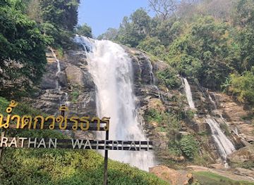
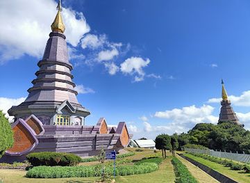
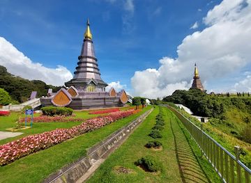
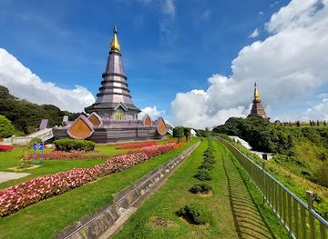
Doi Inthanon’s attractions unfold along the road from warm foothills to the cold summit zone. The highest point itself is reached by a short walk through dense high-altitude forest, while the Ang Ka Luang Nature Trail offers an easy boardwalk through mossy vegetation and cloud-forest habitat. The Royal Twin Chedis combine formal gardens, contemporary Thai architecture and elevated mountain views, although mist can obscure the panorama. Lower down, Wachirathan Waterfall is readily accessible and plunges over a dark rock face, while Mae Ya Waterfall forms a broad, powerful cascade in the park’s southern area. Several nature trails provide opportunities for birdwatching and forest walks, with conditions ranging from gentle boardwalks to damp, more demanding paths. The wider landscape includes Karen and Hmong communities, highland farms, coffee-growing areas and roadside viewpoints, but community visits should be arranged respectfully rather than treated as staged stops. Doi Inthanon is especially rewarding for visitors interested in ecology, waterfalls, photography and mountain culture rather than a dense concentration of built attractions.
-
Tourist attraction
Wachirathan Waterfall
Discover the breathtaking beauty of Wachirathan Waterfall in Chiang Mai, a must-visit destination for nature enthusiasts and adventure seekers.
-
Tourist attraction
Kew Mae Pan nature trail
Explore the breathtaking Kew Mae Pan Nature Trail in Chiang Mai, Thailand, a paradise for hikers and nature lovers amidst stunning mountain vistas.
-
Tourist attraction
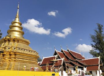
Wat Phra That Si Chom Thong Worawihan
Experience the spiritual tranquility of Wat Phra That Si Chom Thong Worawihan, a stunning Buddhist temple in Chiang Mai, rich in heritage and beauty.
-
National park
Doi Inthanon National Park
Explore the breathtaking beauty of Doi Inthanon National Park, Thailand's highest peak, with stunning waterfalls and diverse wildlife.

Best landmarks in Doi Inthanon
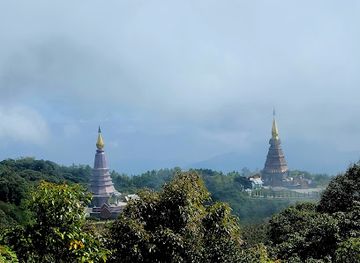
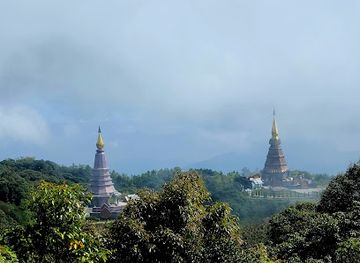
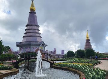
Doi Inthanon’s most important natural landmark is the summit of Doi Inthanon, Thailand’s highest mountain, although dense forest rather than a sweeping exposed peak defines the immediate top. The Ang Ka forest and its boardwalk are significant for the visual character of this high, wet environment. Nearby, Naphamethinidon and Naphaphonphumisiri, known together as the Royal Twin Chedis, form the area’s best-known architectural landmark; their elevated terraces and gardens commemorate the birthdays of King Bhumibol Adulyadej and Queen Sirikit. Wachirathan Waterfall is a striking roadside feature where water drops over a steep escarpment, while Mae Ya Waterfall is notable for the breadth of its descending streams. These places express different aspects of Doi Inthanon: national symbolism, royal-era architecture, high-altitude ecology and the force of seasonal water. Their character changes considerably with weather, from clear mountain horizons to rain-darkened rock and cloud-filled forest.
-
National park
Kew Mae Pan nature trail
Explore the breathtaking Kew Mae Pan Nature Trail in Chiang Mai, Thailand - a hikers' paradise with stunning views and rich biodiversity.
-
National park
Doi Inthanon Summit
Discover the breathtaking beauty and cultural richness of Doi Inthanon Summit, Thailand's highest point, nestled within a stunning national park.
-
Tourist attraction
Pagoda Noppamethanedon & Pagoda Nopphonphusiri: The Royal Pagodas of Mount Inthanon Summit
Discover the breathtaking Royal Pagodas of Mount Inthanon, a perfect blend of Thai culture and stunning natural beauty at Thailand's highest peak.
-
National park
Doi Inthanon National Park
Explore the breathtaking beauty of Doi Inthanon National Park, Thailand's highest peak, renowned for its stunning landscapes and rich biodiversity.

Explore Doi Inthanon on the map
Plan your trip on one map. See where the top cities, national parks and sights are, and book hotels and experiences in a few clicks.
Best hotels in Doi Inthanon
Best restaurants in Doi Inthanon
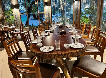
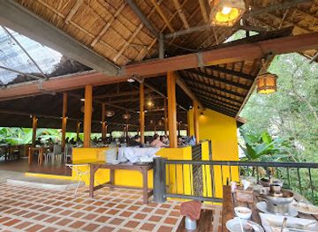
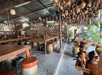
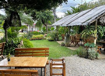
Dining around Doi Inthanon is rural and practical, centred on small restaurants, simple cafés, food stalls and eateries near park entrances, waterfalls and villages rather than a formal restaurant district. Menus commonly draw on northern Thai cooking, with dishes such as khao soi, nam prik ong, sai ua sausage and grilled meats available in the wider Chiang Mai area, while local meals may also include vegetables grown in the highlands. Fresh produce, strawberries in suitable growing areas, coffee and seasonal fruit are sold by roadside farmers and community stalls. Rice dishes, noodle soups and hot drinks are useful choices in the cool summit climate. Dining options become more limited away from Chom Thong and the main approach road, so carry water and snacks for longer park circuits. Visitors should regard food sold by local communities as part of the mountain economy and buy respectfully without assuming every product is available year-round.
-
Thai
Khaomao-Khaofang Imaginary Jungle
Experience the magic of Thai cuisine in an enchanting jungle setting at Khaomao-Khaofang Imaginary Jungle.
-
Restaurant
Inthanon Restaurant Chom Thong Chiang Mai ร้านอาหารสวัสดิการโครงการหลวงอินทนนท์
Experience authentic Northern Thai cuisine at Inthanon Restaurant in Chom Thong, featuring fresh trout and stunning views.
-
Restaurant
Khao Soi Kalong Coconutland Restaurant
Experience authentic Northern Thai cuisine at Khao Soi Kalong Coconutland Restaurant in Chiang Mai - home of the best Khao Soi!
-
Restaurant
Mae Chaem Gate Restaurant
Discover authentic Thai flavors and Western cuisine at Mae Chaem Gate Restaurant in Chiang Mai's picturesque district.
Best bars in Doi Inthanon
Doi Inthanon has no significant nightclub scene, and evenings are generally quiet once day visitors have left. Nightlife centres on simple restaurants, cafés, guesthouse dining areas and local gatherings around Chom Thong and villages on the approaches rather than purpose-built entertainment districts. Some accommodation may provide a place for an evening meal or drink, but facilities are modest and opening arrangements vary. The cooler uplands are better suited to early nights, stargazing and preparing for a dawn departure than to late socialising. Travellers seeking cocktails, live music or a broad choice of bars will find those options in Chiang Mai, outside the Doi Inthanon area. Alcohol should be consumed discreetly and never combined with driving on the mountain roads.
-
Bar
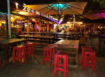
Zoe in Yellow
Experience the vibrant nightlife of Chiang Mai at Zoe in Yellow, where great drinks, music, and atmosphere come together for an unforgettable evening.
-
National park
Doi Inthanon Summit
Explore the breathtaking Doi Inthanon Summit, Thailand's highest peak, where stunning landscapes and rich biodiversity await your discovery.
-
National park
Doi Inthanon National Park
Discover the breathtaking beauty and rich biodiversity of Doi Inthanon National Park, Thailand's highest national park, a paradise for nature lovers.
-
Grill
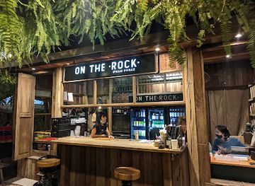
On The Rock @NamPhrae
Experience the best grilled dishes in Chiang Mai at On The Rock @NamPhrae, where flavor meets stunning scenery.
Best nightclubs in Doi Inthanon
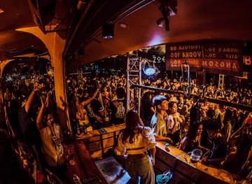
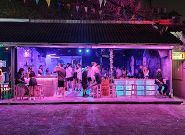
Doi Inthanon has no significant nightclub scene, and evenings are generally quiet once day visitors have left. Nightlife centres on simple restaurants, cafés, guesthouse dining areas and local gatherings around Chom Thong and villages on the approaches rather than purpose-built entertainment districts. Some accommodation may provide a place for an evening meal or drink, but facilities are modest and opening arrangements vary. The cooler uplands are better suited to early nights, stargazing and preparing for a dawn departure than to late socialising. Travellers seeking cocktails, live music or a broad choice of bars will find those options in Chiang Mai, outside the Doi Inthanon area. Alcohol should be consumed discreetly and never combined with driving on the mountain roads.
-
Night club
Zoe in Yellow
Discover Chiang Mai's nightlife at Zoe in Yellow, a vibrant night club featuring electrifying music, refreshing drinks, and a lively atmosphere.
-
Night club
BlackLight CNX
Experience the vibrant nightlife of Chiang Mai at BlackLight CNX, where electrifying music and a lively atmosphere await every night.
-
Gay night club
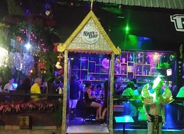
Ram Bar Chiangmai
Discover Ram Bar Chiangmai, where vibrant cabaret performances and a welcoming atmosphere create unforgettable nightlife experiences in Chiang Mai.
-
Night club
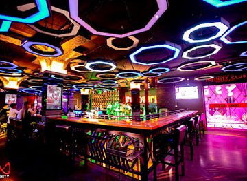
infinity club
Dive into the electrifying nightlife of Chiang Mai at Infinity Club, where music, dining, and dancing come together.
Best shops in Doi Inthanon
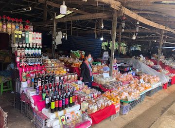
Shopping in Doi Inthanon is mainly local and agricultural rather than centred on large retail areas. Roadside stalls and village markets sell seasonal fruit, vegetables, flowers, coffee, tea, honey and preserved foods produced in the cooler mountain districts. Around the park approaches, visitors may find woven textiles, handicrafts and small locally made souvenirs associated with Karen or Hmong communities, although products and sellers vary by location and season. Chom Thong provides more everyday provisions and food shopping than the upper mountain, while Chiang Mai, outside the region, offers the widest choice of crafts, design goods and established markets. Buy directly from producers where possible, ask about prices before purchasing and avoid treating cultural textiles or objects as anonymous curiosities. Fresh produce, locally grown coffee and packaged regional foods are generally more practical souvenirs than fragile items carried from high-altitude stalls.
-
Shopping mall
MAYA Lifestyle Shopping Center Chiangmai
Discover the best of shopping, dining, and entertainment at MAYA Lifestyle Shopping Center in Chiang Mai, a vibrant hub of modern Thai culture.
-
National park
Doi Inthanon Summit
Explore Doi Inthanon Summit, Thailand's highest peak, where breathtaking landscapes, rich culture, and adventure await every traveler.
-
National park
Doi Inthanon National Park
Discover the breathtaking landscapes and diverse wildlife of Doi Inthanon National Park, Thailand's highest peak and a nature lover's paradise.
-
Tourist attraction
Ang Ka Nature Trail
Explore the Ang Ka Nature Trail: A tranquil escape into the stunning landscapes and rich biodiversity of Chiang Mai's Doi Inthanon National Park.



Get your free copy of our complete guide to Doi Inthanon, delivered straight to you.
Everything on this page, from attractions and restaurants to essentials and local phrases, in one PDF you can read offline, print or share.
Already have an account? Sign in
Your Doi Inthanon guide is ready.
We'll send it to · Not you? Sign out

Getting your guide ready…
We are putting together a fresh copy of the Doi Inthanon guide. This can take up to a minute.
This can take a few moments. If your browser asks, choose Allow so the download can start. You'll find the guide in your Downloads folder.
Nothing happened? Download it again
Sorry, the guide is taking longer than usual. Please try again in a minute, or get it by email instead.
Doi Inthanon essentials
Currency and Payment
Safety
Emergency Situations
Do's and Don'ts
Local Tips
From Eve
Local phrases worth knowing
You don't need to get them perfect. A few words go a long way, and locals appreciate the effort.
Basics
| English | Local | Say it |
|---|---|---|
| Hello | สวัสดี | [sawasdee] |
| Goodbye | ลาก่อน | [la-gorn] |
| Yes | ใช่ | [chai] |
| No | ไม่ | [mai] |
| Please/You're welcome | กรุณา/ยินดีต้อนรับ | [karuna/yindi ton rap] |
| Thank you | ขอบคุณ | [khob khun] |
| Excuse me/Sorry | ขอโทษ | [kho thot] |
| How are you? | สบายดีไหม | [sabai dee mai] |
| Fine. And you? | สบายดี แล้วคุณล่ะ | [sabai dee laeo khun la] |
| Do you speak English? | คุณพูดภาษาอังกฤษได้ไหม | [khun phut phasa angkrit dai mai] |
| I don't understand | ฉันไม่เข้าใจ | [chan mai khao jai] |
Eating & Drinking
| English | Local | Say it |
|---|---|---|
| I'd like to see the menu, please | ขอดูเมนูหน่อยได้ไหม | [kho du menu noi dai mai] |
| I don't eat meat | ฉันไม่กินเนื้อ | [chan mai gin nuea] |
| Cheers! | ชนแก้ว! | [chon kaew] |
| I would like to pay, please | ขอชำระเงินหน่อย | [kho chamra nguen noi] |
Emergencies
| English | Local | Say it |
|---|---|---|
| Help! | ช่วยด้วย! | [chuai duay] |
| Go away! | ไปให้พ้น! | [pai hai phon] |
| Call the Police! | เรียกตำรวจ! | [riak tamruat] |
| Call a doctor! | เรียกหมอ! | [riak mor] |
| I'm lost | ฉันหลงทาง | [chan long thang] |
| I'm ill | ฉันป่วย | [chan puai] |
Shopping
| English | Local | Say it |
|---|---|---|
| I'd like to buy... | ฉันอยากซื้อ... | [chan yak sue] |
| I'm just looking | ฉันแค่ดู | [chan khae du] |
| How much is it? | ราคาเท่าไหร่ | [rakha thao rai] |
| That's too expensive | แพงเกินไป | [paeng koen pai] |
| Can you lower the price? | ลดราคาได้ไหม | [lot rakha dai mai] |
Time & Numbers
| English | Local | Say it |
|---|---|---|
| What time is it? | ตอนนี้กี่โมง | [ton ni kii mong] |
| It's one o'clock | ตอนนี้หนึ่งโมง | [ton ni neung mong] |
| Half past (10) | สิบโมงครึ่ง | [sip mong khrung] |
| Morning | เช้า | [chao] |
| Afternoon | บ่าย | [bai] |
| Evening | เย็น | [yen] |
| Yesterday | เมื่อวาน | [meu-wan] |
| Today | วันนี้ | [wan-ni] |
| Tomorrow | วันพรุ่งนี้ | [wan phrung ni] |
| 1 | หนึ่ง | [neung] |
| 2 | สอง | [song] |
| 3 | สาม | [sam] |
| 4 | สี่ | [si] |
| 5 | ห้า | [ha] |
| 6 | หก | [hok] |
| 7 | เจ็ด | [jed] |
| 8 | แปด | [paet] |
| 9 | เก้า | [kao] |
| 10 | สิบ | [sip] |
Transport & Directions
| English | Local | Say it |
|---|---|---|
| Where's a/the...? | ที่ไหนมี...? | [thi nai mee] |
| What's the address? | ที่อยู่ไหน | [thi yuu nai] |
| Can you show me (on the map)? | ช่วยแสดงให้ฉันดู (บนแผนที่) | [chuai sa daeng hai chan du (bon phaen thi)] |
| When's the next (bus)? | รถบัสคันถัดไปเมื่อไหร่ | [rot bus khan that pai meu rai] |
| A ticket (to ....) | ตั๋วไป... | [tua pai] |
History of Doi Inthanon
Lanna Mountain Communities
The valleys and uplands around present-day Doi Inthanon have long been inhabited by communities associated with the wider Lanna cultural world. Karen communities have maintained settlements and agricultural landscapes in the mountain area, while Hmong communities became established in parts of the highlands later, cultivating crops suited to cooler conditions. These histories are still visible in village landscapes, farming practices and local craft traditions. The mountain should therefore not be regarded as untouched wilderness alone: its forests and watersheds exist alongside longstanding communities whose livelihoods have been shaped by altitude, rainfall and access to the surrounding valleys.
Doi Luang and King Inthawichayanon
The mountain was historically known as Doi Luang, meaning the great mountain, and was also associated with Doi Ang Ka. It later became Doi Inthanon in honour of King Inthawichayanon, the seventh ruler of Chiang Mai, who was concerned with the preservation of northern forests and water sources. Following his death in the early twentieth century, part of his cremated remains was placed near the summit. The name reflects the mountain’s connection with the former Lanna kingdom and its eventual incorporation into the modern Thai state.
Forest Conservation and National Park Creation
Doi Inthanon National Park was established in 1972 as Thailand’s 14th national park. Its creation recognised the importance of the mountain’s forests, headwaters and high-altitude habitats, as well as their scientific and scenic value. The park extends from warmer lower valleys to the summit zone, creating pronounced ecological variation over a relatively short distance. National park management has since shaped access, trail use and protection of sensitive environments, although conservation remains balanced with the presence of resident communities and agricultural areas around and within the wider mountain landscape.
Royal Agricultural Development
During the later twentieth century, agricultural development programmes in the northern highlands encouraged alternatives to opium cultivation and supported crops suited to mountain conditions. Around Doi Inthanon, vegetables, flowers, fruit and coffee became important parts of the rural economy, with some farms supplying markets beyond the immediate area. The result is a landscape in which forest, terraced or sloping cultivation and village settlements occur close together. Visitors encounter this history through roadside farms, produce stalls and community tourism, though agricultural areas should be visited with permission and without disrupting work.
The Royal Twin Chedis
The two prominent chedis near the summit were built to commemorate the sixtieth birthdays of King Bhumibol Adulyadej and Queen Sirikit. Naphamethinidon was completed in 1987, while Naphaphonphumisiri followed in 1992. Their landscaped grounds and elevated position have become among Doi Inthanon’s most recognisable cultural landmarks. The complex represents a modern royal legacy rather than an ancient monument, and its gardens, stairways and views provide a formal architectural contrast to the surrounding cloud forest.
Doi Inthanon as a Contemporary Nature Destination
Improved roads, domestic tourism and growing interest in birdwatching, forest walks and cooler mountain climates have made Doi Inthanon one of northern Thailand’s best-known nature destinations. Most visits are linked to Chiang Mai, but the park also supports local guides, accommodation, food sellers and agricultural communities in the surrounding districts. Contemporary tourism brings income and wider appreciation of the mountain, while visitor numbers and litter, traffic and trail pressure underline the importance of low-impact travel in a fragile high-altitude environment.
Doi Inthanon in Photos
Browse through our photo collection highlighting the charm and character of the destination.
Neighbouring regions of Doi Inthanon
The closest regions to Doi Inthanon, if you have time for more than one.
-

-

-

-

-


Swipe for more regions
Explore more
Explore more of Thailand
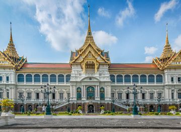
Discover Thailand: A land of diverse landscapes, rich culture, and warm hospitality, where ancient traditions blend seamlessly with modern attractions.
Explore Thailand