

Inagua Islands Travel Guide - Free Web & App
Your ultimate guide to Inagua Islands. Discover top landmarks, proposed trips, and local tips. Free on the web or via the Evendo companion app.


Inagua Islands, The Bahamas, offer flamingo-filled wetlands, salt ponds, remote beaches and wildlife experiences around Matthew Town and Lake Rosa.
Landscape and Wildlife
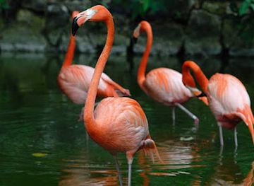
The Inagua Islands occupy the southern edge of The Bahamas, close to the routes linking the archipelago with the Caribbean. The destination consists chiefly of Great Inagua, the country's third-largest island, and uninhabited Little Inagua to the north-east. Great Inagua is low-lying and dry, with limestone terrain, scrub, woodland, coastal flats and extensive salt ponds. Its defining natural feature is Lake Rosa, a large hypersaline lake within Inagua National Park and one of the most important breeding areas for Caribbean flamingos. Thousands of birds may gather here, although numbers and visibility vary with season, weather and water conditions.Read more about Inagua Islands
A Remote Island Community
Exploring Inagua
When is the best time to visit Inagua Islands?
Best: February–April · 27–28°C| Month | High (°C) | Rainfall (mm) |
|---|---|---|
| January | 28 | 40 |
| February (best) | 27 | 30 |
| March (best) | 27 | 30 |
| April (best) | 28 | 20 |
| May | 29 | 20 |
| June | 30 | 20 |
| July | 31 | 20 |
| August | 31 | 20 |
| September | 31 | 20 |
| October | 30 | 20 |
| November | 29 | 30 |
| December | 28 | 40 |
Getting to and around Inagua Islands
How to get there
Transportation
Best attractions in Inagua Islands
The principal attraction of the Inagua Islands is the concentration of wildlife and wetlands around Great Inagua's Lake Rosa and the wider Inagua National Park. Flamingos are the signature sight, joined by other waterbirds and coastal species whose presence changes with season and conditions. The park's shallow ponds, limestone scrub and open horizons offer scope for birdwatching and photography rather than conventional resort sightseeing. Around Matthew Town, visitors can see the settlement's modest streets, harbour atmosphere and the working landscape associated with salt production. The Morton Salt operation, viewed only from appropriate public areas or with permission, gives context to the island's economy and engineered evaporation ponds. Coastal excursions may reveal beaches, mangrove-fringed areas and marine habitats, while Little Inagua offers a more remote, uninhabited setting reachable only by boat and suitable arrangements. Distances, access permissions and weather make local planning essential.
-
Historical landmark
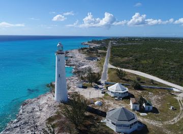
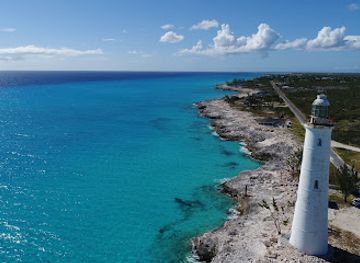
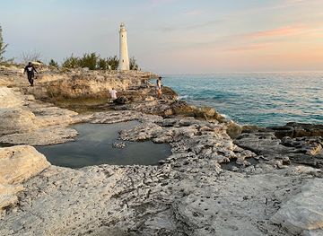
Great Inagua Lighthouse
Explore the Great Inagua Lighthouse, a historic gem in the Bahamas, offering stunning views and a glimpse into maritime history.
-
National park
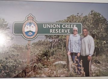
Bahamas National Trust Office
Explore the Bahamas National Trust Office to learn about the nation's conservation efforts and experience the rich biodiversity of the beautiful Bahamas.
-
National park
Inagua National Park
Immerse yourself in the breathtaking landscapes and unique wildlife of Inagua National Park, the Bahamas' largest natural sanctuary.
-
Beach
Farquharson Beach
Discover the tranquility and beauty of Farquharson Beach, a hidden gem in the Bahamas, perfect for relaxation and adventure enthusiasts alike.
Best landmarks in Inagua Islands
Lake Rosa is Inagua's defining natural landmark, a broad hypersaline lake whose shallow waters and surrounding wetlands support the island's celebrated flamingo population. The associated ponds, limestone flats and low scrub form a landscape that is as significant ecologically as it is visually. Inagua National Park protects much of this environmental setting, while Little Inagua represents a contrasting landmark of undeveloped island habitat across the water. Matthew Town is the principal human landmark, embodying the community that developed around maritime links and salt production. The Morton Salt works, with its extensive evaporation ponds and industrial infrastructure, is an important modern feature of Great Inagua's cultural landscape, although it remains a working operation rather than a conventional visitor attraction. Beaches, mangroves and isolated coastal edges complete the island's distinctive physical identity.
-
Grill
S Sin L
Experience the vibrant flavors of Caribbean cuisine at S Sin L, a grill restaurant in Matthew Town offering fresh seafood and grilled specialties.
-
Historical landmark
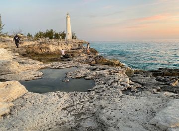
Great Inagua Lighthouse
Explore the Great Inagua Lighthouse, a historic beacon in the Bahamas offering stunning views and a rich maritime heritage.
-
Island
Little Inagua Island
Experience the tranquil beauty of Little Inagua Island, a hidden gem in the Bahamas, perfect for birdwatching, snorkeling, and nature exploration.
-
Corporate office
Morton Salt, Great Inagua
Explore the fascinating world of salt production at Morton Salt on Great Inagua, an industrial marvel set in a stunning Bahamian landscape.
Explore Inagua Islands on the map
Plan your trip on one map. See where the top attractions, landmarks, restaurants and hotels are, and book hotels and experiences in a few clicks.
Best hotels in Inagua Islands
Best restaurants in Inagua Islands
Dining on the Inagua Islands is modest and closely tied to the small population of Matthew Town rather than to a developed restaurant industry. Visitors should expect a limited choice of local eateries, home-style cooking and provisions obtained through shops or accommodation arrangements, with opening patterns and menus best confirmed locally. Bahamian staples such as rice and peas, peas soup, stewed or grilled meats, fish and conch may appear where supplies and cooking facilities permit, while seafood reflects the island's maritime setting. Fresh ingredients can be affected by transport and weather, so self-catering visitors should plan carefully and avoid assuming that every item will be available. The most dependable approach is to arrange meals with accommodation providers or local contacts before travelling beyond Matthew Town, particularly for full-day wildlife outings.
-
Island
Inagua Islands
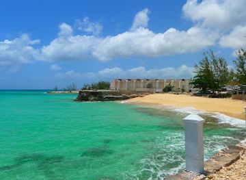
Explore Inagua Islands: A breathtaking Bahamian paradise known for its stunning landscapes, unique wildlife experiences, and serene beaches.
-
Grill
S Sin L
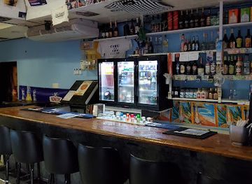
Discover the flavors of Bahamas at S Sin L in Matthew Town - where grilled delights meet local charm.
-
Hotel
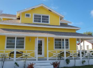
Enrica's Inn
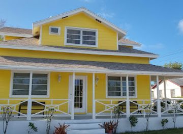
Discover comfort and local charm at Enrica's Inn in Matthew Town - your perfect getaway destination.
-
Restaurant
Lighthouse Restaurant Bar & Grill
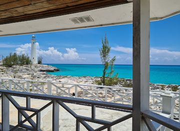
Experience authentic Bahamian flavors at Lighthouse Restaurant Bar & Grill in Matthew Town—where delicious food meets stunning ocean views.
Best bars in Inagua Islands
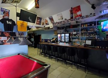
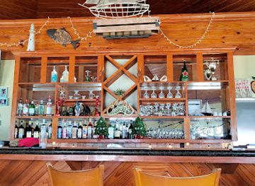
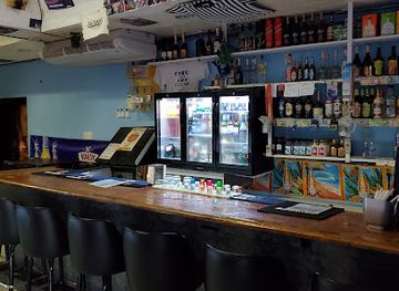
Inagua has no established nightlife district or cluster of nightclubs, and evenings are generally quiet after the day's heat and outdoor activities. Matthew Town may offer informal socialising in local bars or community venues, but availability, opening patterns and the atmosphere can change, so visitors should ask locally rather than expect a scheduled entertainment programme. The more characteristic evening experience is a relaxed meal, conversation with island residents, or observing the dark sky away from unnecessary lights, provided local access and safety advice are followed. Seasonal community occasions may bring music or gatherings, although these should not be treated as permanent attractions. Travellers staying outside Matthew Town will find even fewer evening facilities and should arrange food, transport and drinks in advance.
-
Grill
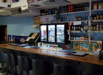
S Sin L
Discover the flavors of the Bahamas at S Sin L, a top grill restaurant in Matthew Town with a vibrant atmosphere and delicious grilled specialties.
-
Island
Inagua Islands
Explore the pristine landscapes and rich biodiversity of the Inagua Islands, a tranquil Bahamian paradise for nature enthusiasts and adventurers.
-
Hotel
Enrica's Inn
Discover the tranquil beauty of Matthew Town at Enrica's Inn, your home away from home in the Bahamas, where comfort and hospitality await.
-
Restaurant
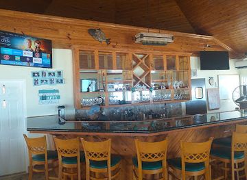
Lighthouse Restaurant Bar & Grill
Experience exquisite seafood and vibrant atmosphere at Lighthouse Restaurant Bar & Grill in Matthew Town, the perfect dining destination for travelers.
Best nightclubs in Inagua Islands
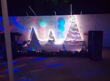
Inagua has no established nightlife district or cluster of nightclubs, and evenings are generally quiet after the day's heat and outdoor activities. Matthew Town may offer informal socialising in local bars or community venues, but availability, opening patterns and the atmosphere can change, so visitors should ask locally rather than expect a scheduled entertainment programme. The more characteristic evening experience is a relaxed meal, conversation with island residents, or observing the dark sky away from unnecessary lights, provided local access and safety advice are followed. Seasonal community occasions may bring music or gatherings, although these should not be treated as permanent attractions. Travellers staying outside Matthew Town will find even fewer evening facilities and should arrange food, transport and drinks in advance.
-
Grill
S Sin L
Discover the flavors of Matthew Town at S Sin L, where exceptional grilled dishes and a lively atmosphere await.
-
Restaurant
Lighthouse Restaurant Bar & Grill
Experience the flavors of the Bahamas at Lighthouse Restaurant Bar & Grill, where fresh seafood and stunning views create an unforgettable dining experience.
-
Restaurant
Cepigel
Experience the best of Bahamian cuisine at Cepigel, a must-visit restaurant in Matthew Town, famous for its fresh local flavors and inviting atmosphere.
-
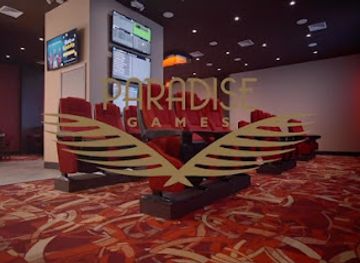
Casino
Paradise Games (Inagua)
Discover the vibrant thrill of gaming and entertainment at Paradise Games in Inagua, where excitement awaits every visitor.

Best shops in Inagua Islands
Shopping on Great Inagua is concentrated in Matthew Town and is primarily practical rather than geared towards extensive souvenir retail. Small shops and local suppliers may provide food, drinks, household necessities and basic travel items, but stock can be limited and replenishment depends on transport links. Visitors may find locally made crafts or small island-themed goods through community contacts, although there is no large permanent craft market or dedicated shopping district to rely on. Bahamian products, packaged foods and handmade items may offer more meaningful purchases than imported resort merchandise when available. Because facilities are sparse beyond the settlement, travellers should buy essential supplies in Matthew Town before heading to remote ponds, coastal areas or boat departure points, and should not assume that every payment facility or product category will be available.
-
Grill
S Sin L
Experience the vibrant flavors of S Sin L in Matthew Town, where delicious grilled dishes meet Bahamian hospitality in a lively setting.
-
Island
Inagua Islands
Explore the pristine charm of Inagua Islands, a hidden paradise in the Bahamas, renowned for its breathtaking landscapes and rich wildlife.
-
Restaurant
Cepigel
Experience authentic Bahamian flavors at Cepigel, a cozy restaurant in Matthew Town offering a delightful culinary journey.
-
Bakery
Anyee Bread Bakery
Experience the charm of Anyee Bread Bakery, where freshly baked delights meet local flavor in Matthew Town.
Get your free copy of our complete guide to Inagua Islands, delivered straight to you.
Everything on this page, from attractions and restaurants to essentials and local phrases, in one PDF you can read offline, print or share.
Already have an account? Sign in
Your Inagua Islands guide is ready.
We'll send it to · Not you? Sign out

Getting your guide ready…
We are putting together a fresh copy of the Inagua Islands guide. This can take up to a minute.
This can take a few moments. If your browser asks, choose Allow so the download can start. You'll find the guide in your Downloads folder.
Nothing happened? Download it again
Sorry, the guide is taking longer than usual. Please try again in a minute, or get it by email instead.
Inagua Islands essentials
Currency and Payment
Safety
Emergency Situations
Do's and Don'ts
Local Tips
From Eve
Local phrases worth knowing
You don't need to get them perfect. A few words go a long way, and locals appreciate the effort.
Basics
| English | Local | Say it |
|---|---|---|
| Hello | Hey | [Hey] |
| Goodbye | Goodbye | [Goodbye] |
| Yes | Yeah | [Yeah] |
| No | No | [No] |
| Please/You're welcome | Please/You're welcome | [Please/You're welcome] |
| Thank you | Thank you | [Thank you] |
| Excuse me/Sorry | Excuse me/Sorry | [Excuse me/Sorry] |
| How are you? | How you doin? | [How you doin?] |
| Fine. And you? | Fine. An you? | [Fine. An you?] |
| Do you speak English? | Ya speak English? | [Ya speak English?] |
| I don't understand | I don't get it | [I don't get it] |
Eating & Drinking
| English | Local | Say it |
|---|---|---|
| I'd like to see the menu, please | Lemme see da menu, please | [Lemme see da menu, please] |
| I don't eat meat | I don't eat meat | [I don't eat meat] |
| Cheers! | Cheers! | [Cheers!] |
| I would like to pay, please | I wan pay, please | [I wan pay, please] |
Emergencies
| English | Local | Say it |
|---|---|---|
| Help! | Help! | [Help!] |
| Go away! | Go way! | [Go way!] |
| Call the Police! | Call da Police! | [Call da Police!] |
| Call a doctor! | Call a doctor! | [Call a doctor!] |
| I'm lost | I lost | [I lost] |
| I'm ill | I sick | [I sick] |
Shopping
| English | Local | Say it |
|---|---|---|
| I'd like to buy... | I wan buy... | [I wan buy...] |
| I'm just looking | I jus lookin | [I jus lookin] |
| How much is it? | How much dis is? | [How much dis is?] |
| That's too expensive | Dat too much | [Dat too much] |
| Can you lower the price? | Can ya drop da price? | [Can ya drop da price?] |
Time & Numbers
| English | Local | Say it |
|---|---|---|
| What time is it? | Wa time it be? | [Wa time it be?] |
| It's one o'clock | It one o'clock | [It one o'clock] |
| Half past (10) | Half past (10) | [Half past (10)] |
| Morning | Mornin | [Mornin] |
| Afternoon | Afternoon | [Afternoon] |
| Evening | Evenin | [Evenin] |
| Yesterday | Yestadey | [Yestadey] |
| Today | Today | [Today] |
| Tomorrow | Tomara | [Tomara] |
| 1 | 1 | [1] |
| 2 | 2 | [2] |
| 3 | 3 | [3] |
| 4 | 4 | [4] |
| 5 | 5 | [5] |
| 6 | 6 | [6] |
| 7 | 7 | [7] |
| 8 | 8 | [8] |
| 9 | 9 | [9] |
| 10 | 10 | [10] |
Transport & Directions
| English | Local | Say it |
|---|---|---|
| Where's a/the...? | Where dat...? | [Where dat...?] |
| What's the address? | Wat be da address? | [Wat be da address?] |
| Can you show me (on the map)? | Can ya show me (on da map)? | [Can ya show me (on da map)?] |
| When's the next (bus)? | When da next (bus) be? | [When da next (bus) be?] |
| A ticket (to ....) | A ticket (to ....) | [A ticket (to ....)] |
History of Inagua Islands
Limestone Islands and Saltwater Wetlands
Great Inagua and Little Inagua are low-lying Bahamian islands formed from limestone landscapes shaped by marine processes, solution weathering and changing sea levels over geological time. On Great Inagua, shallow depressions collect seawater and rainwater, creating the salt ponds and wetland habitats for which the island is known. Lake Rosa's hypersaline environment reflects the balance between evaporation, rainfall and restricted drainage. These physical conditions have influenced every later phase of human use, from settlement and salt harvesting to modern conservation.
Lucayan and Later Settlement
The Lucayan people occupied islands across The Bahamas before European colonisation, and archaeological evidence from the wider archipelago records their seafaring, fishing and use of coastal resources. European arrival brought profound disruption, including disease, enslavement and the collapse of Lucayan society. Great Inagua was subsequently used by later colonial communities drawn by its strategic position and natural salt resources. The island's sparse settlement pattern reflects both its dry environment and its distance from the more populous northern Bahamian islands.
The Growth of Salt Production
Salt has long been central to Great Inagua's economy because seawater can be concentrated naturally in the island's shallow ponds. Commercial salt production developed during the nineteenth century and eventually became associated with the Morton Salt operation, which remains one of the island's best-known industries. Evaporation ponds, raised embankments and industrial works have altered parts of the coastal landscape, while also existing alongside natural wetland systems. Salt production provided employment and helped sustain Matthew Town as the island's principal community.
Matthew Town and Island Life
Matthew Town developed as Great Inagua's main settlement and centre of administration, maritime activity and commerce. Its history is tied to the practical movement of people and goods through the southern Bahamas, as well as to salt harvesting, fishing and subsistence activities. The settlement remains small in comparison with Nassau or the principal resort islands, and its cultural character is shaped by close community connections and the realities of living far from major services. The surrounding ponds and coast continue to influence work, travel and local identity.
Conservation and the Inagua National Park
The exceptional concentration of Caribbean flamingos and other wetland birds led to increasing recognition of Great Inagua's ecological importance. Inagua National Park protects a substantial area of the island, including Lake Rosa and associated habitats, while Little Inagua is also valued for its largely undeveloped environment and wildlife. Conservation has required a balance between safeguarding sensitive wetlands, maintaining traditional and industrial activity, and allowing carefully managed nature tourism. Today, the islands are particularly significant for flamingo conservation, birdwatching and the protection of southern Bahamian habitats.
Inagua Islands in Photos
Browse through our photo collection highlighting the charm and character of the destination.
Neighbouring destination travel guides
The closest destinations to Inagua Islands, if you have time for more than one.
-

-
-
-

-


Swipe for more destinations
Explore more

Explore more of Inagua
Discover Inagua in The Bahamas: A sanctuary for wildlife enthusiasts and nature lovers, boasting pristine beaches, vibrant birdlife, and stunning natural landscapes.
Explore Inagua
Explore more of The Bahamas
Discover The Bahamas: A Caribbean getaway with stunning beaches, vibrant culture, and endless adventures. Perfect for relaxation, exploration, and unforgettable memories.
Explore The Bahamas