From Eve
Know before you go
Hi, I'm Eve. Here are a few practical things to know before exploring The Quay Trail.
Local know-how to help you travel smarter and make the most of every moment.

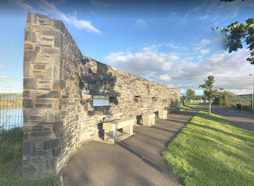
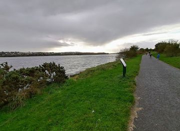
A tranquil, scenic riverside trail weaving through Londonderry’s historic heart with stunning river and city skyline views.
The Quay Trail in Londonderry, UK, is a scenic riverside path along the west bank of the River Foyle. Stretching over 6 miles, it offers tranquil waterside views, city skyline panoramas, and access to key landmarks like the Peace Bridge. Popular for walking, running, and cycling, the trail blends urban energy with natural beauty, making it a peaceful retreat in the heart of the historic city.
Opening times, essentials, and a few local tips gathered into one calmer, easier-to-scan planning section.
Hi, I'm Eve. Here are a few practical things to know before exploring The Quay Trail.
Local know-how to help you travel smarter and make the most of every moment.
Bus
Local bus services connect Londonderry city center with stops near the Quay Trail, with journey times from central points around 10-20 minutes. Buses run frequently during the day with fares typically between £2-£4. Check local timetables for exact routes and times.
Taxi
Taxis from Londonderry city center to the Quay Trail area take approximately 5-10 minutes, depending on traffic. Fares generally range from £5-£10. Taxis are readily available but may have limited service late at night.
Walking
The Quay Trail is accessible on foot from central Londonderry, with a walk of about 15-25 minutes over mostly flat, paved terrain. The route is suitable for most fitness levels and offers scenic views en route.
Cycling
Cyclists can reach the Quay Trail easily via dedicated bike lanes from the city center. Bike rentals are available locally, and the trail itself is well-paved and suitable for riders of all skill levels.
Catch the right light and the right mood, whether you want a bright city moment or a more cinematic evening visit.


Use Tower Bridge as your starting point for nearby food, family ideas, nightlife, and more local discoveries.
A quick look at seasonal patterns and peak visiting hours.

Explore expert travel guides, compare and book tours, experiences, hotels, and more—all from the palm of your hand. Download now for seamless trip planning wherever your wanderlust takes you.

Explore Derry, a city steeped in history with its iconic walls, vibrant festivals, and stunning landscapes. Immerse yourself in the cultural heart of Northern Ireland.
Tell me more about Derry