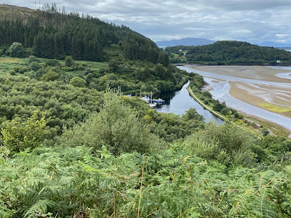
River Lussa: A Serene Highland Waterway on the Isle of Mull
Discover the tranquil beauty and rugged charm of River Lussa, a serene Highland river winding through the Isle of Mull’s dramatic landscapes.
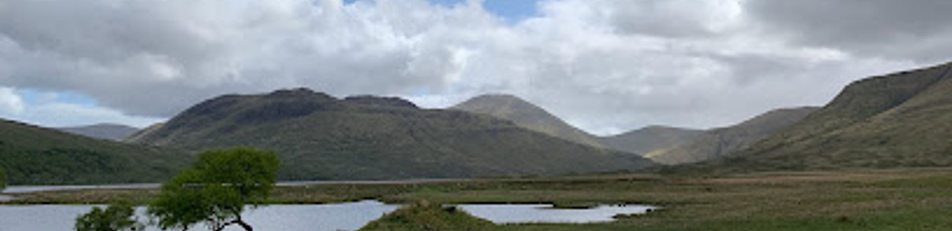
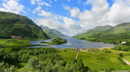
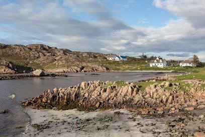
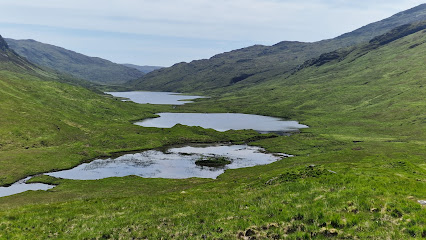
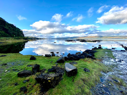
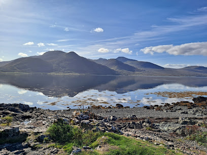
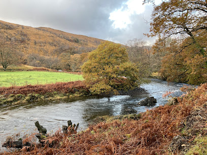
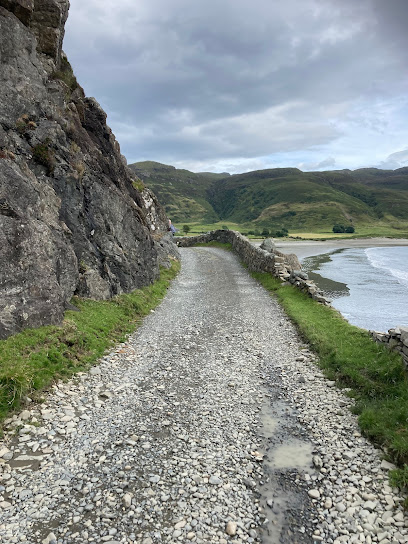
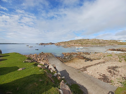
River Lussa is a tranquil and scenic river flowing through the northeastern part of the Isle of Mull, Scotland. Stretching about six miles, it winds through a narrow valley hemmed by steep hills before emptying into Loch Spelve. Known for its natural beauty, diverse wildlife, and peaceful surroundings, the river offers a picturesque escape into the island’s rugged landscape, ideal for nature lovers and walkers seeking quiet Highland charm.
A brief summary to River Lussa
- Unnamed Road, Isle of Mull, Isle of Mull, GB
- Duration: 1 to 3 hours
- Free
-
 Outdoor
- Mobile reception: 3 out of 5
Local tips
- Wear sturdy footwear and be prepared for uneven terrain when exploring the river valley.
- Bring binoculars and a camera to enjoy wildlife watching and scenic photography.
- Respect local access guidelines and follow the Scottish Outdoor Access Code to protect the natural environment.
- Fishing enthusiasts should check local regulations and obtain necessary permits before angling.
For the on-the-go comforts that matter to you
- Restrooms
- Seating Areas
- Information Boards
Getting There
-
Bus and Taxi
Take a local bus service from Tobermory to the nearest stop on the Isle of Mull’s northeastern area, then a taxi for the final 5-7 km to River Lussa. Total travel time is approximately 1.5 to 2 hours. Bus fares range around £5-£8, with taxi costs depending on distance.
-
Car
Driving from Tobermory or Craignure, the journey to River Lussa takes about 40-60 minutes via local roads. Parking is limited near the river, so plan to park safely and walk the last stretch. No parking fees apply.
-
Walking
Experienced walkers can approach River Lussa on foot from nearby settlements such as Croggan or Torosay, with walks ranging from 2 to 5 hours depending on the route. Terrain is uneven and includes some steep sections, suitable for those with good fitness and navigation skills.
River Lussa location weather suitability
-
 Any Weather
-
 Rain / Wet Weather
-
 Clear Skies
-
 Windy Conditions
-
 Mild Temperatures
Discover more about River Lussa
Geographical Setting and Natural Features
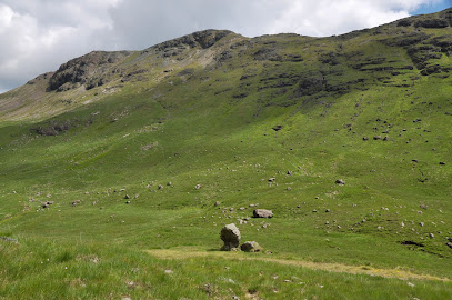
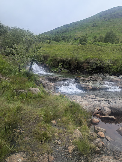
River Lussa flows through the northeastern region of the Isle of Mull, a rugged island off Scotland’s west coast. The river spans roughly six miles, beginning near Loch Sguabain and meandering through a narrow, steep-sided valley before reaching its mouth at Loch Spelve. This valley is deeply incised, with sides rising up to 300 feet, creating a dramatic natural corridor hemmed in by the surrounding hills. The river’s course is marked by clear waters and a mix of rocky and wooded banks, contributing to its scenic appeal.Ecological and Wildlife Significance
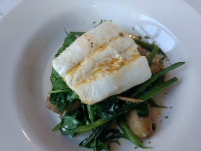
The River Lussa area supports diverse wildlife typical of the Scottish Highlands. Its clean waters are home to fish species such as salmon and trout, making it a valued spot for angling enthusiasts. The surrounding woodlands and moorlands provide habitat for birds, mammals, and a variety of plant life, contributing to the river’s role as an important ecological corridor on Mull. The tranquility and relatively undisturbed nature of the river environment make it a haven for nature observation.Historical and Cultural Context
The river is situated within the historical landscape of Mull, an island rich in Gaelic heritage and Highland traditions. The valley through which River Lussa flows has long been part of local farming and fishing life, with the river itself playing a role in the island’s natural economy. Nearby features such as Loch Spelve and the surrounding glens add to the cultural tapestry of the region, linking the river to the broader story of Mull’s landscape and communities.Visitor Experience and Activities
Visitors to River Lussa can enjoy peaceful walks along its banks, with opportunities to explore the valley’s natural beauty and wildlife. The terrain can be challenging in places, with some paths less defined, so appropriate footwear and navigational skills are recommended. Anglers may find the river rewarding for fishing, while photographers and nature lovers appreciate the serene vistas and the chance to encounter Highland flora and fauna. The river’s quiet atmosphere offers a retreat from busier tourist spots on the island.Surrounding Landscape and Nearby Attractions
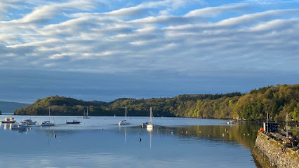
The river’s mouth at Loch Spelve opens into a sea loch framed by hills and scattered settlements, providing a striking coastal backdrop. Nearby, the Isle of Mull’s mountainous core, including Ben More, offers further exploration for hikers and adventurers. The region is also known for its rich biodiversity and geological features, making River Lussa a gateway to the island’s broader natural heritage. The proximity to other scenic rivers and glens enhances the appeal for visitors seeking varied outdoor experiences.Conservation and Access Considerations
River Lussa lies within a largely unspoiled natural environment, with efforts to maintain its ecological integrity. Visitors are encouraged to follow the Scottish Outdoor Access Code, respecting the land and wildlife. Access to the river valley involves walking over uneven terrain, and while the area is accessible year-round, weather conditions can affect safety and ease of movement. The river and its surroundings exemplify the quiet, wild character of Mull’s landscape, inviting responsible exploration and appreciation.Iconic landmarks you can’t miss
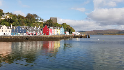
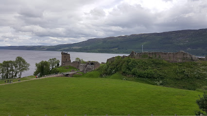
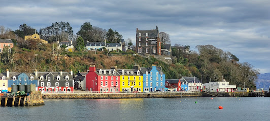
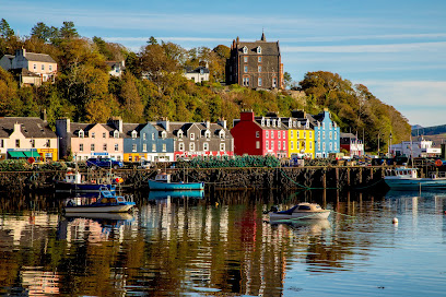
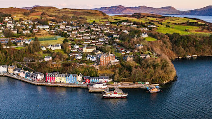
Tobermory Clock Tower
21.0 km
Historic granite clock tower memorializing local heritage, standing proudly by Tobermory’s colourful harbour on the Isle of Mull.
St John's Scottish Episcopal Cathedral : Oban
27.5 km
An unfinished masterpiece where Gothic ambition meets industrial-age engineering in Scotland's most unusual cathedral.
McCaig's Tower & Battery Hill
27.7 km
Explore Oban’s iconic McCaig's Tower, a Colosseum-inspired folly with stunning views and tranquil gardens atop Battery Hill.

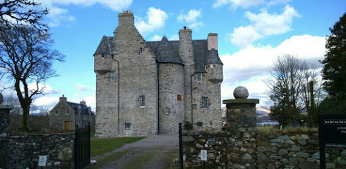
Barcaldine Castle
32.1 km
Experience the haunting beauty and rich history of Barcaldine Castle, a 17th-century Scottish fortress overlooking Loch Creran.
Kilmartin Museum
44.4 km
Discover 12,000 years of history at Kilmartin Museum, where ancient artefacts meet the stunning prehistoric landscape of Kilmartin Glen.
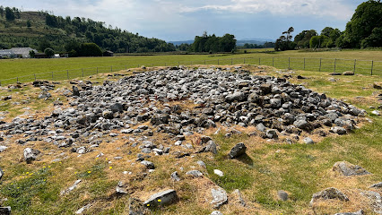
Nether Largie Mid Cairn
44.6 km
Bronze Age burial cairn at the heart of Scotland's most significant prehistoric landscape, carved with rare axehead symbols.
Knapdale Scottish Beaver Trail
49.1 km
Discover the Knapdale Scottish Beaver Trail, a nature lover's paradise where you can observe beavers in their natural habitat amidst stunning Scottish landscapes.
Wild About Argyll
51.9 km
Explore the stunning landscapes and rich biodiversity of Wild About Argyll, a must-visit destination for nature lovers and adventure seekers in Scotland.
Cairn from Auchoish
52.8 km
Explore the ancient wonders of the Cairn from Auchoish, a historical monument in Lochgilphead, revealing Scotland's rich archaeological heritage.
St Conan’s Kirk
53.3 km
Discover St Conan’s Kirk, a unique architectural gem blending styles and history on the tranquil shores of Loch Awe.
Glenfinnan Monument - National Trust for Scotland
54.6 km
Explore the captivating Glenfinnan Monument, a historic tribute to Scotland's Jacobite heritage set in breathtaking Highland landscapes.
Auchindrain Historic Township
54.8 km
Explore Auchindrain Historic Township, a captivating museum showcasing Scotland's rural heritage through authentic buildings, exhibits, and a charming tea room.
Heart of Argyll Tourism Alliance
55.0 km
Explore the Heart of Argyll Tourism Alliance, your essential guide to breathtaking landscapes, rich history, and local culture in Scotland.
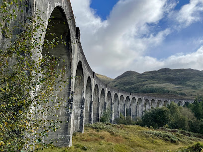
Glenfinnan Viaduct
55.5 km
Explore the enchanting Glenfinnan Viaduct, a marvel of engineering surrounded by stunning Scottish landscapes and rich history.
The Argyll Papers, Inveraray Castle
56.9 km
Explore over 700 years of Scottish history through the Campbell family’s extensive archive at Inveraray Castle.
Unmissable attractions to see
Benmore Estate Ltd
5.4 km
Experience luxurious Scottish country living and exclusive outdoor pursuits on the stunning Benmore Estate, Isle of Mull’s premier sporting retreat.
MacQuarie's Mausoleum
5.5 km
A serene Scottish mausoleum honoring Governor Lachlan Macquarie, bridging Scottish heritage and Australian colonial history.
Isle of Mull
5.5 km
Discover the Isle of Mull’s wild landscapes, rich wildlife, historic castles, and vibrant coastal charm on Scotland’s captivating west coast island.
Three Lochs Viewpoint
6.5 km
Breathtaking panoramic views over three serene lochs and Mull’s rugged mountains, a tranquil escape for nature lovers and wildlife watchers.
Stone Head
6.7 km
Discover the rugged coastal beauty and ancient mysteries of Stone Head and the Lochbuie Standing Stones on the Isle of Mull.
On Yer Bike Cycle
7.3 km
Explore the Isle of Mull’s stunning landscapes with ease by hiring from On Yer Bike Cycle, your trusted local bike hire in Salen.
Salens ships
7.7 km
Explore the evocative abandoned fishing boats of Salen, a haunting maritime relic site along the scenic Sound of Mull on the Isle of Mull.
Viewing area
8.0 km
A tranquil viewpoint offering breathtaking panoramas of Loch na Keal and the wild landscapes of the Isle of Mull.
Loch Beg Bridge
8.1 km
Experience the tranquil beauty of Loch Beg Bridge on the Isle of Mull, a picturesque spot for nature lovers and photographers.
Isle of Mull Rugby Club
9.6 km
A spirited community rugby club on the Isle of Mull, hosting the world-famous Mull Sevens amidst stunning Hebridean landscapes.
Forest & River Walk
10.7 km
A tranquil forest and river trail on the Isle of Mull, blending waterfalls, wildlife, and scenic views for a refreshing nature escape.
Waterfalls Scenic Walk
10.8 km
Discover tranquil waterfalls and rugged natural beauty on the Isle of Mull’s scenic hiking trail at Scallastle Farm.
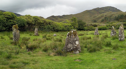
Lochbuie Standing Stones
11.2 km
Discover the Isle of Mull’s only stone circle, a Bronze Age monument aligned with ancient solar events, set beneath the majestic Ben Buie.
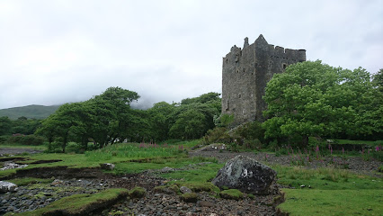
Moy Castle
11.5 km
Explore Moy Castle, a stunning historical gem in Lochbuie, offering rich heritage and breathtaking landscapes perfect for photography and exploration.
Laggan beach
12.3 km
Discover the serene silver sands of Laggan Beach, where stunning wildlife, historic landmarks, and sweeping views of Ben Buie await on the Isle of Mull.
Essential places to dine
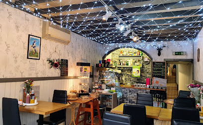
The Whitehouse Restaurant
12.4 km
An intimate fine dining haven in Lochaline serving innovative Scottish cuisine with fresh, local, and foraged ingredients in a historic coastal setting.
Hebridean Lodge
20.3 km
A charming coastal restaurant near Tobermory serving fresh local seafood with stunning island views and warm hospitality.
Macgochans
20.8 km
Waterfront gastropub with stunning bay views, fresh Scottish seafood, and warm Hebridean hospitality.
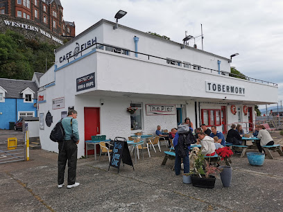
Cafe Fish, Upper Floor, The Pier, Tobermory
20.9 km
Experience Tobermory’s freshest seafood with stunning harbour views at the acclaimed Cafe Fish on the Isle of Mull.
An Cala Ciuin
20.9 km
Traditional Scottish hospitality with harbour views and hearty fare in the heart of Tobermory’s historic Mishnish Hotel.
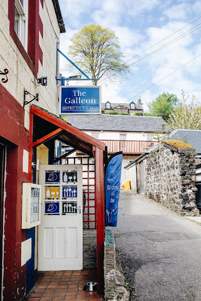
The Galleon Bistro Tobermory
21.0 km
Family-run harbour-side bistro in Tobermory offering fresh local seafood, Scottish classics, and a warm, accessible dining experience on the Isle of Mull.
Spice of Mull
21.0 km
Experience authentic Indian, Bangladeshi, Thai, and Chinese flavors in a cozy Tobermory setting with stunning harbor views.
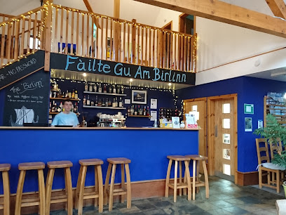
Am Birlinn
24.4 km
Rustic charm meets fresh seafood in a cozy, contemporary setting on the scenic Isle of Mull.
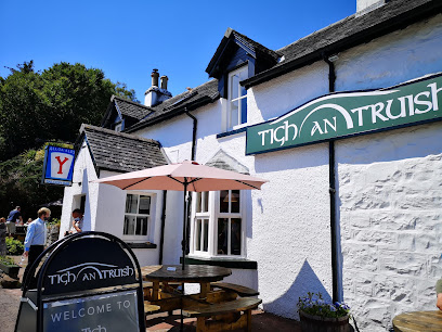
Tigh An Truish
25.4 km
Charming inn and acclaimed restaurant with stunning views of the iconic Clachan Bridge, offering exquisite local cuisine and cozy accommodations.
Food From Argyll at the Pier
27.4 km
A vibrant café at Oban’s ferry terminal serving fresh, locally sourced Argyll produce with stunning waterfront views.
EE-USK
27.4 km
Fresh, locally sourced seafood served with panoramic harbor views on Oban’s historic North Pier.
Taste of Argyll Kitchen
27.6 km
Cozy Scottish kitchen in Oban serving fresh, local dishes with a creative touch and warm hospitality.
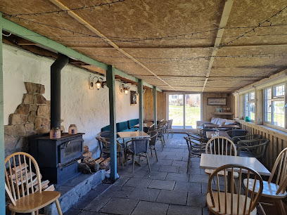
The Barn Bar
28.2 km
A rustic country pub at Cologin offering seasonal Scottish fare, cozy log fires, and lively local music near Oban.
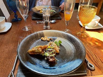
Ninth Wave Restaurant
30.7 km
Intimate seafood dining in a historic croft on the Isle of Mull, blending local flavors with refined culinary artistry.
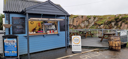
The Creel Seafood Bar
31.4 km
Fresh, locally caught seafood served with friendly charm near the ferry to Iona on the scenic Isle of Mull.
Markets, malls and hidden boutiques
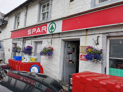
Craignure SPAR and Post Office
12.9 km
Discover the convenience of Craignure SPAR and Post Office, your one-stop shop for essentials and local delights on the Isle of Mull.
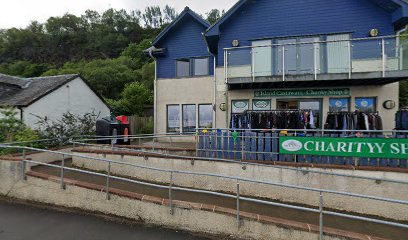
Island Castaways Within An Roth Community Centre
13.0 km
Discover unique preloved treasures and support local causes at Island Castaways, Craignure’s beloved charity shop on the Isle of Mull.
M E S S Charity Shop
13.5 km
Discover unique pre-loved treasures and support local sustainability at M E S S Charity Shop in Craignure’s community hub.
Hasn Candle Company
20.3 km
Discover handcrafted candles inspired by the natural beauty and seasonal scents of the Isle of Mull in Tobermory’s welcoming artisan shop.
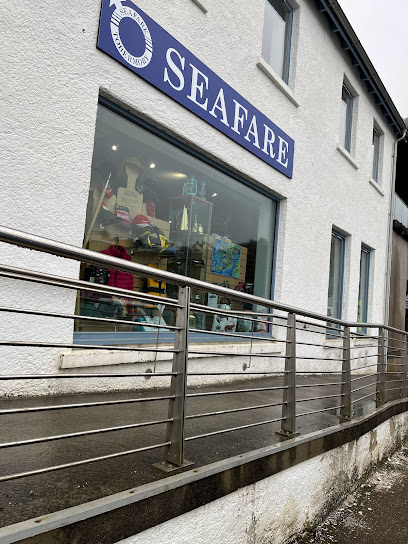
Seafare
20.7 km
Tobermory’s trusted chandlery since 1977, offering essential marine safety gear and supplies in the heart of the Isle of Mull’s harbor town.
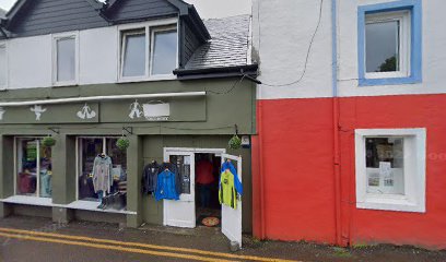
Trekomory Breeze
20.9 km
Trekomory Breeze offers practical outdoor clothing and accessories in Tobermory, blending local charm with quality gear for every adventurer.
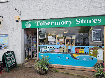
Tobermory Stores
20.9 km
Tobermory Stores offers essential shopping with local charm in the heart of Isle of Mull’s colorful main street.
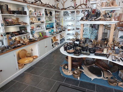
Island Crafts
20.9 km
Discover authentic Isle of Mull artistry and handcrafted treasures in the heart of Tobermory’s vibrant craft scene.
Isle Of Mull Soap Co Ltd
21.0 km
Discover handmade natural soaps and eco-friendly gifts crafted with care in the heart of Tobermory on the Isle of Mull.
Tobermory Corner Shop
21.0 km
Experience local charm and unique finds at Tobermory Corner Shop, your gateway to the Isle of Mull's treasures.
Island Blue Tobermory
21.0 km
Discover authentic Isle of Mull crafts and unique gifts in the heart of Tobermory’s vibrant Main Street.
Tobermory Antiques & Collectibles
21.0 km
Discover unique vintage treasures steeped in the heritage and charm of Tobermory’s colorful Isle of Mull harbor town.
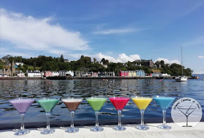
Glassy Candles of Mull
21.0 km
Discover handcrafted candles and local artisan treasures in the heart of Tobermory on the Isle of Mull.
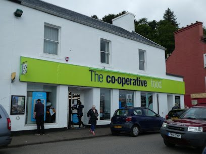
Co-op Food - Tobermory
21.0 km
Tobermory’s largest convenience store offering fresh island produce and everyday essentials in the heart of the Isle of Mull.
Hargreaves Bros
21.4 km
Discover timeless craftsmanship and expert clock repair at Hargreaves Bros, Tobermory’s cherished watch shop on the Isle of Mull.
Essential bars & hidden hideouts
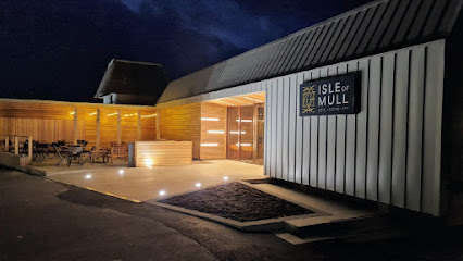
Isle of Mull Hotel & Spa
12.5 km
A welcoming coastal retreat on the Isle of Mull, blending scenic views, spa relaxation, and warm Scottish hospitality.
Craignure Inn
13.2 km
A cozy, dog-friendly pub and inn in Craignure offering hearty fare, comfortable rooms, and a warm welcome on the Isle of Mull.
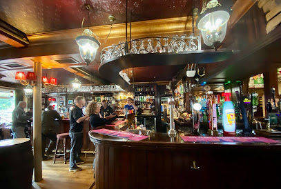
The Tobermory Hotel
20.9 km
Historic boutique hotel with stunning Tobermory Bay views, local cuisine, and warm Highland hospitality on the Isle of Mull’s vibrant waterfront.
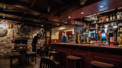
Mishnish
21.0 km
A traditional Scottish hotel and bar in Tobermory, famed for cosy harbour views, live folk music, and warm island hospitality.
Western Isles Hotel
21.0 km
Historic hotel with breathtaking Tobermory Bay views, classic charm, and warm hospitality on the scenic Isle of Mull.
Auld Mull Bar
21.0 km
Experience warm island hospitality and local flavors at Auld Mull Bar, a cozy family-run retreat in Tobermory’s charming harbor village.
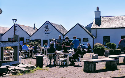
The Oyster Bar
24.1 km
A charming seafood haven in historic Ellenabeich, offering fresh oysters, scenic coastal views, and warm Scottish hospitality.
Bunessan Inn
25.0 km
Historic Isle of Mull pub and inn offering hearty food, local whiskies, cozy rooms, and stunning loch views in a warm community setting.
Markie Dans
27.3 km
Family-run pub in Oban offering vast single malts, hearty food, live music, and stunning bay views in a welcoming, lively atmosphere.
The Tartan Tavern
27.5 km
Experience authentic Scottish hospitality and traditional charm at The Tartan Tavern, a cozy and lively pub in the heart of Oban.
Cellar Bar
27.5 km
Cozy and traditional Scottish pub on Oban’s waterfront, famed for local whiskies, live music, and warm hospitality.
Lorne Bar
27.7 km
Experience authentic Scottish hospitality, fresh local seafood, and a warm, welcoming atmosphere in the heart of Oban at The Lorne Bar.
The Keel Row
31.2 km
Cozy pub and restaurant in Fionnphort offering hearty Scottish dishes, scenic bay views, and a warm, welcoming atmosphere on the Isle of Mull.
Snack Bar
31.4 km
Experience the charm of the Isle of Mull at the Snack Bar, where delightful bites and stunning views create unforgettable memories.
Colonsay Pub
46.2 km
Experience authentic island hospitality and local brews at Colonsay Pub, the vibrant social hub of the Isle of Colonsay.
Nightclubs & after hour spots
Roobarb
63.4 km
Experience Fort William’s vibrant nightlife at Roobarb, the welcoming nightclub where music and dancing light up weekend nights.

Jura Brewery
67.9 km
Discover Jura Brewery: A Craft Beer Experience in the Heart of the Isle of Jura, Where Tradition Meets Nature's Bounty.
Word Up
90.6 km
Experience Greenock's revitalized nightlife at Word Up, a modern nightclub with vibrant energy and a welcoming atmosphere.

Red
91.3 km
Experience Greenock’s vibrant nightlife at Red Nightclub, where intimate vibes meet lively dance floors and affordable fun every weekend.

The King Haakon Bar
91.8 km
Experience authentic Scottish hospitality at The King Haakon Bar on the Isle of Skye, where local ales and hearty meals await in a cozy atmosphere.
No. 1 Charlotte Street
93.1 km
Discover the cozy charm of No. 1 Charlotte Street, a perfect blend of bar, hotel, and local hospitality in Port Ellen, Isle of Islay.
The Ardview Inn
93.2 km
Experience the warm hospitality and local flavors at The Ardview Inn, a charming pub in Port Ellen, Isle of Islay, perfect for unwinding after your travels.
The Islay Hotel
93.2 km
Experience the charm of The Islay Hotel, where comfort meets local culture on the beautiful Isle of Islay.
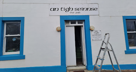
An Tigh Seinnse
93.6 km
Discover the charm of An Tigh Seinnse in Portnahaven, where local flavors and warm hospitality blend for an unforgettable pub experience.
Seumas' Bar
94.3 km
Experience the essence of the Isle of Skye at Seumas' Bar, where local flavors and stunning views come together for an unforgettable dining experience.
Great Scotts Bar
94.5 km
Experience the perfect blend of stunning loch views and a vibrant bar atmosphere at Great Scots Bar, your ideal retreat in Loch Lomond.
The Tavern
94.5 km
Discover The Tavern, a charming bar by Loch Lomond, perfect for unwinding with drinks amidst stunning natural beauty.
The Lobby Bar
94.6 km
Discover the perfect blend of relaxation and local charm at The Lobby Bar, nestled by the scenic shores of Loch Lomond.
Queen Of The Loch
96.1 km
A charming family and dog-friendly pub and lodge on Loch Lomond’s banks, serving hearty British classics in a warm, scenic setting.
Desire Nightclub
96.3 km
Experience Balloch’s vibrant nightlife at Desire Nightclub, where energetic music and welcoming vibes create unforgettable evenings.
For the vibe & atmosphere seeker
- Relaxing
- Tranquil
- Scenic
- Unique
- Casual
For the design and aesthetic lover
- Rustic Designs
For the architecture buff
- Historic
- Parks & Gardens
For the view chaser and sunset hunter
- Iconic Views
- Panoramas
- Waterfront
For the social media creator & influencer
- Instagrammable
- Photo Spots
- Selfie Spots
For the eco-conscious traveler
- Eco-Friendly
- Low Impact
- Leave-No-Trace Critical
- Public-Transport Accessible
- Locally Managed
- Wildlife Habitat
For the kind of experience you’re after
- Nature Escape
- Photowalk
- Day Trip
- Cultural Heritage
For how adventurous you want the journey to be
- Easy Access
- Requires Hike
Location Audience
- Family Friendly
- Senior Friendly
- Child Friendly
- Teen Friendly
- Solo Friendly
- Couple Friendly
- Pet Friendly


