

Free Londonderry Travel Guide & Mobile App
Explore Londonderry with free travel guides. Discover regional history, expert tips, proposed trips, and audio guides on web or mobile app.


Explore Londonderry for Derry's historic walls, Atlantic beaches, Binevenagh views, Roe Valley walks and Northern Irish food culture.
Read more about Londonderry
When is the best time to visit Londonderry?
Best: June–August · 19–20°C| Month | High (°C) | Rainfall (mm) |
|---|---|---|
| January | 8 | 90 |
| February | 8 | 70 |
| March | 10 | 80 |
| April | 13 | 70 |
| May | 16 | 70 |
| June (best) | 19 | 80 |
| July (best) | 20 | 80 |
| August (best) | 20 | 90 |
| September | 17 | 90 |
| October | 14 | 100 |
| November | 10 | 100 |
| December | 8 | 100 |
Getting to and around Londonderry
How to get there
Transportation
Top city travel guides in Londonderry
The cities of Londonderry, and the easiest places to base yourself.

Swipe for more cities
Best attractions in Londonderry
Londonderry's attractions range from the concentrated heritage of Derry to broad coastal and countryside landscapes. In the city, the walls, museums, cathedral, Guildhall and political murals provide different perspectives on medieval development, Plantation settlement, religious division, industrial life and the Troubles. The Museum of Free Derry is particularly important for understanding the civil-rights era and subsequent conflict. Along the north-west coast, Downhill Demesne and Mussenden Temple combine estate history with open views over the Atlantic, while nearby beaches at Castlerock and Benone suit walking, wildlife observation and spacious seaside recreation. Inland, Roe Valley Country Park follows a wooded river landscape with industrial associations, and Binevenagh offers upland scenery above Lough Foyle and the coastal plain. South-eastern districts bring historic houses, gardens and literary associations, including Springhill near Moneymore and the Seamus Heaney HomePlace at Bellaghy. Visitors should allow for different opening patterns between major city institutions, estate properties and rural sites, and should not underestimate journey times between the region's separate attractions.
-
National park
Glenveagh National Park
Explore rugged mountains, a Victorian castle, and enchanting gardens in Ireland’s wild Glenveagh National Park.
-
Shopping Centre
Foyleside Shopping Centre
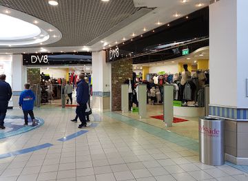
Derry’s vibrant shopping destination with over 50 stores, scenic river views, and a lively Food Quarter for a complete retail experience.
-
Tourist attraction
Fanad Head Lighthouse
Historic Fanad Head Lighthouse stands proudly on Donegal’s wild coast, offering panoramic Atlantic views, rich maritime history, and immersive tours.
-
Park and Garden
National Trust - Mussenden Temple and Downhill Demesne
A dramatic 18th-century clifftop temple and windswept estate on Northern Ireland’s wild Atlantic coast, offering iconic views and romantic ruins.



Best landmarks in Londonderry
Derry's seventeenth-century walls are Londonderry's defining historic landmark, forming a rare complete circuit of urban fortifications with gates, bastions and elevated views over the Foyle and the modern city. Within the walls, St Columb's Cathedral represents the city's Anglican historical tradition, while the Guildhall is a prominent civic building known for its red-sandstone architecture and stained glass. On the coast, Mussenden Temple stands on the cliff edge above Downhill Strand, an eighteenth-century library modelled on the Temple of Vesta at Tivoli; the surrounding estate ruins add to its architectural drama. Binevenagh is the region's major natural landmark, a basalt escarpment whose elevated plateau and cliffs overlook the Roe Valley, Lough Foyle and the coast. The Craigavon Bridge, spanning the Foyle in Derry, is an important piece of modern civic infrastructure and a familiar part of the city's visual identity. Together these places show the region's defensive, religious, estate, geological and urban histories.
-
Historical landmark
The Derry Walls
Explore the only fully intact 17th-century city walls in Ireland, a living monument to Derry’s rich history and resilience.
-
Historical landmark
Free Derry Corner
Historic Free Derry Corner stands as a powerful symbol of civil rights, resistance, and community spirit in the heart of Londonderry.
-
Historical landmark
Amazing Grace Viewing Point
Where a storm‑tossed sailor found grace and penned one of the world’s most beloved hymns, overlooking the waters of Lough Swilly in Buncrana.
-
Memorial
Bloody Sunday Monument
A solemn granite obelisk in Derry commemorating the 14 unarmed civilians killed on Bloody Sunday, symbolizing resilience and the fight for justice.


Explore Londonderry on the map
Plan your trip on one map. See where the top cities, national parks and sights are, and book hotels and experiences in a few clicks.
Best hotels in Londonderry
Best restaurants in Londonderry
Dining in Londonderry combines familiar Northern Irish cooking with a growing interest in seasonal and locally sourced food. Derry provides the widest choice, from cafés and bakeries to modern restaurants, traditional pubs and venues using local meat, dairy produce, vegetables and seafood. Potatoes, soda bread, wheaten bread, Ulster-style breakfasts and home baking remain part of the regional food vocabulary, while the north coast brings fresh fish and shellfish to coastal menus. Limavady, Coleraine, Castlerock and other towns offer cafés, takeaways, pubs and restaurants suited to walkers and beach visitors, though rural choice can be limited outside peak periods. Farmers' markets and food events provide opportunities to find breads, cakes, preserves, cheeses and other Northern Irish products. Menus change seasonally, and visitors should distinguish genuinely local produce from dishes simply associated with the wider island or the United Kingdom.
-
Modern European
The Tides Restaurant
Casual coastal dining with fresh British and European flavors, set against stunning Northern Ireland sea views.
-
Italian
Amici Ristorante
Experience authentic Neapolitan Italian cuisine with coastal views and charcoal-grilled specialties in the heart of Portstewart.
-
Restaurant
Quaywest Wine Bar & Restaurant
A vibrant riverside wine bar and steakhouse in Derry offering modern fusion cuisine, live music, and a welcoming atmosphere.
-
Bistro
Fitzroy's
A welcoming bistro in Londonderry offering diverse, flavorful dishes with great vegan and gluten-free options in a lively, casual setting.


Best bars in Londonderry
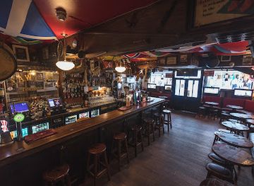
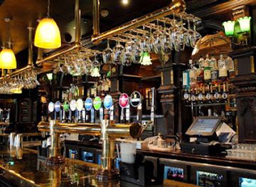
Evening life is concentrated principally in Derry, where traditional pubs, contemporary bars, live-music venues, restaurants and cultural performances create a fuller night-time scene than in the surrounding rural districts. Many venues are found in or near the historic centre, although the character ranges from quiet old pubs to busier late-evening locations. The city has a strong musical and theatrical culture, so checking current programmes can be more useful than seeking a large nightclub scene. Coleraine and Limavady provide additional pubs, cafés and occasional live entertainment, while coastal resorts become livelier during the main holiday season. Outside the towns, evenings generally revolve around village pubs, dining and community events rather than clubs. As elsewhere in Northern Ireland, opening arrangements and entry policies vary, so current local information is advisable.
-
Pub
Peadar O'Donnell's
Experience authentic Irish hospitality, lively music, and rich history at Peadar O'Donnell's, Londonderry’s beloved traditional pub.
-
Pub
Blackbird
A lively and welcoming pub in Londonderry offering freshly prepared dishes, local beers, and a cozy atmosphere for all occasions.
-
Pub
Badgers Bar and Restaurant
A lively, welcoming pub and restaurant in Londonderry serving fresh local fare with a friendly atmosphere and rich community ties.
-
Grill
The Bentley Bar
Experience award-winning pub fare, lively music, and warm Irish hospitality in the heart of Londonderry’s Market Street.


Best nightclubs in Londonderry
Evening life is concentrated principally in Derry, where traditional pubs, contemporary bars, live-music venues, restaurants and cultural performances create a fuller night-time scene than in the surrounding rural districts. Many venues are found in or near the historic centre, although the character ranges from quiet old pubs to busier late-evening locations. The city has a strong musical and theatrical culture, so checking current programmes can be more useful than seeking a large nightclub scene. Coleraine and Limavady provide additional pubs, cafés and occasional live entertainment, while coastal resorts become livelier during the main holiday season. Outside the towns, evenings generally revolve around village pubs, dining and community events rather than clubs. As elsewhere in Northern Ireland, opening arrangements and entry policies vary, so current local information is advisable.
-
Pub
Blackbird
Lively pub on Foyle Street serving fresh local dishes, live music, and excellent drinks in a warm, friendly atmosphere.
-
Nightclub
The Anchor Bar Complex
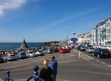
Historic Irish pub, lively nightclub, and cozy inn on Portstewart Promenade offering great food, live music, and warm hospitality since 1898.
-
Professional services
izudoo Derry Pub & Night Club Guide
Experience Londonderry’s vibrant nightlife at izudoo — a lively pub and nightclub with great music, drinks, and unforgettable nights out.


Best shops in Londonderry
Derry has the region's broadest shopping selection, with independent retailers, cafés, galleries and small craft businesses around the historic centre, alongside larger retail facilities and familiar high-street brands. The Craft Village offers a reconstructed historic setting for craft, food and visitor-oriented shopping, while the streets below the walls provide books, gifts, clothing and locally made products. Coleraine and Limavady function as practical market towns with everyday retail, cafés and smaller independent shops. In rural areas, farm shops, bakeries and food producers are more useful sources of regional purchases than specialist shopping districts, particularly for preserves, confectionery, breads, dairy products and Northern Irish produce. Art galleries and craft outlets may offer ceramics, textiles, jewellery and prints inspired by the coast or countryside. Opening days and seasonal availability vary, especially for smaller businesses, so shopping is best combined with a town visit rather than treated as a separate long-distance excursion.
-
Shopping Centre
Lisnagelvin Shopping Centre
A bustling shopping hub in Londonderry’s Waterside, offering diverse stores, extended hours, and family-friendly amenities.
-
Clothing Shop
Primark
Affordable fashion meets historic charm at Primark in Londonderry’s Former Rialto Theatre on Newmarket Street.
-
Gift shop
The Yellow Yard
Discover Londonderry’s vibrant hub for vintage clothes, vinyl records, and quirky collectibles in a welcoming, alternative shopping space.
-
Shopping Centre
Lisnagelvin Retail Park
Conveniently located retail park east of Londonderry city centre, featuring major high street brands and ample parking for a relaxed shopping experience.


Get your free copy of our complete guide to Londonderry, delivered straight to you.
Everything on this page, from attractions and restaurants to essentials and local phrases, in one PDF you can read offline, print or share.
Already have an account? Sign in
Your Londonderry guide is ready.
We'll send it to · Not you? Sign out

Getting your guide ready…
We are putting together a fresh copy of the Londonderry guide. This can take up to a minute.
This can take a few moments. If your browser asks, choose Allow so the download can start. You'll find the guide in your Downloads folder.
Nothing happened? Download it again
Sorry, the guide is taking longer than usual. Please try again in a minute, or get it by email instead.
Londonderry essentials
Currency and Payment
Safety
Emergency Situations
Do's and Don'ts
Local Tips
From Eve
Local phrases worth knowing
You don't need to get them perfect. A few words go a long way, and locals appreciate the effort.
Basics
| English | Local | Say it |
|---|---|---|
| Hello | Hiya | [hɪjə] |
| Goodbye | See ya | [si jə] |
| Yes | Aye | [aɪ] |
| No | Naw | [nɔ] |
| Please/You're welcome | Please/No bother | [pliz/nəʊ ˈbɒtə] |
| Thank you | Cheers | [tʃɪəz] |
| Excuse me/Sorry | Sorry | [ˈsɒri] |
| How are you? | How's it going? | [haʊz ɪt ˈɡəʊɪŋ] |
| Fine. And you? | Grand. And you? | [ɡrænd ənd jə] |
| Do you speak English? | Do ya speak English? | [du jə spiːk ˈɪŋɡlɪʃ] |
| I don't understand | I dinnae get it | [aɪ ˈdɪnə ˈɡɛt ɪt] |
Eating & Drinking
| English | Local | Say it |
|---|---|---|
| I'd like to see the menu, please | Can I see the menu, please? | [kæn aɪ si ðə ˈmɛnjuː pliz] |
| I don't eat meat | I don't eat meat | [aɪ dəʊnt iːt miːt] |
| Cheers! | Cheers! | [tʃɪəz] |
| I would like to pay, please | Can I pay, please? | [kæn aɪ peɪ pliz] |
Emergencies
| English | Local | Say it |
|---|---|---|
| Help! | Help! | [hɛlp] |
| Go away! | Clear off! | [klɪə ɔf] |
| Call the Police! | Ring the cops! | [rɪŋ ðə kɒps] |
| Call a doctor! | Get a doctor! | [ɡɛt ə ˈdɒktə] |
| I'm lost | I’m lost | [aɪm lɒst] |
| I'm ill | I’m feeling poorly | [aɪm ˈfiːlɪŋ ˈpʊəli] |
Shopping
| English | Local | Say it |
|---|---|---|
| I'd like to buy... | I’d like to buy... | [aɪd laɪk tə baɪ...] |
| I'm just looking | I’m just browsing | [aɪm dʒʌst ˈbraʊzɪŋ] |
| How much is it? | How much is it? | [haʊ mʌtʃ ɪz ɪt] |
| That's too expensive | That’s too dear | [ðæts tuː dɪə] |
| Can you lower the price? | Can ye lower the price? | [kæn jə ˈləʊə ðə praɪs] |
Time & Numbers
| English | Local | Say it |
|---|---|---|
| What time is it? | What time is it? | [wɒt taɪm ɪz ɪt] |
| It's one o'clock | It’s one o’clock | [ɪts wʌn əˈklɒk] |
| Half past (10) | Half ten | [hɑːf tɛn] |
| Morning | Morning | [ˈmɔːnɪŋ] |
| Afternoon | Afternoon | [ˌɑːftəˈnuːn] |
| Evening | Evening | [ˈiːvnɪŋ] |
| Yesterday | Yesterday | [ˈjɛstədeɪ] |
| Today | Today | [təˈdeɪ] |
| Tomorrow | Tomorrow | [təˈmɒrəʊ] |
| 1 | One | [wʌn] |
| 2 | Two | [tuː] |
| 3 | Three | [θriː] |
| 4 | Four | [fɔː] |
| 5 | Five | [faɪv] |
| 6 | Six | [sɪks] |
| 7 | Seven | [ˈsɛvən] |
| 8 | Eight | [eɪt] |
| 9 | Nine | [naɪn] |
| 10 | Ten | [tɛn] |
Transport & Directions
| English | Local | Say it |
|---|---|---|
| Where's a/the...? | Where’s the...? | [wɛəz ðə] |
| What's the address? | What’s the address? | [wɒts ði əˈdrɛs] |
| Can you show me (on the map)? | Can ye show me (on the map)? | [kæn jə ʃoʊ mi (ɒn ðə mæp)] |
| When's the next (bus)? | When's the next (bus)? | [wɛn z ðə nɛkst (bʌs)] |
| A ticket (to ....) | A ticket (to ....) | [ə ˈtɪkɪt (tə ....)] |
History of Londonderry
Prehistoric Settlement and Early Agriculture
The lands around the Foyle, Bann and Roe have been occupied since prehistoric times, with archaeological evidence showing early farming, burial practices and long-established settlement across what is now Londonderry. The fertile river corridors and coastal plain supported cultivation and movement, while the uplands and wetlands provided pasture and natural resources. Although many ancient sites are modest in scale and not always arranged for tourism, the wider landscape preserves a pattern of prehistoric activity that helps explain the region's enduring importance as a place of communication between the north coast and the interior.
The Monastic Foundation of Derry
Derry's early Christian identity is traditionally associated with Saint Columba, who is said to have founded a monastic settlement at Doire in the sixth century. The name refers to an oak grove, and the religious foundation established a long-lasting association between the hill beside the Foyle and Christian learning. Later medieval development built upon this sacred geography. St Columb's Cathedral and other historic references in the city preserve aspects of that continuity, even though the visible urban fabric was substantially reshaped by later fortification and colonisation.
Medieval Gaelic Lordships and English Rule
Before the seventeenth-century Plantation, the wider region was shaped by Gaelic lordships, ecclesiastical estates and interaction with neighbouring territories. Derry's strategic position on the Foyle made it valuable to successive rulers, and English authority expanded through military and administrative intervention during the Tudor period. The changing balance between Gaelic political power and the English crown laid the foundations for the transformations that followed, including new patterns of landholding, settlement and town planning.
The Plantation and the Walled City
In the early seventeenth century, the Plantation of Ulster brought organised settlement and new landholding structures to the region. The London companies involved in developing Derry rebuilt and fortified the city, giving it the name Londonderry and creating the walls largely visible today. The regular streets and defensive circuit represent a major episode in the history of British colonisation in Ireland, while the changes displaced or marginalised earlier communities. The city's later political and cultural divisions cannot be understood without this contested foundation.
The Siege of 1688–1689
The siege of Londonderry during the Williamite conflict was a defining event in the city's history. The defended city resisted forces supporting James II for several months before relief arrived by river, with severe hardship and loss of life among those inside and outside the walls. The episode became central to Protestant unionist historical memory, while its wider context remains part of the complex history of Ireland's religious and political divisions. The walls, gates and river approach allow visitors to understand why Derry's location was so strategically important.
Linen, Shirtmaking and Industrial Growth
From the eighteenth century onwards, linen production and related manufacturing became important across Londonderry, supported by agriculture, waterpower, trade and the region's rivers. Derry later developed a major shirtmaking industry, employing large numbers of workers and connecting the city to international markets. Mills, warehouses, transport routes and industrial buildings transformed the urban economy, while rural districts remained closely tied to flax cultivation and textile supply. Although much of the traditional industry has disappeared, its story remains visible in local museums, architecture and family histories.
Partition, Conflict and the Peace Process
The twentieth century brought partition, economic change and deep political division. Derry became a major focus of the civil-rights movement in the late 1960s, followed by decades of conflict known as the Troubles. The city and surrounding communities experienced violence, militarisation, segregation and economic disruption, but also sustained civic and cultural life. The peace process and the 1998 Belfast Agreement altered the political landscape, and contemporary Derry contains museums, murals, memorials and cultural projects that interpret this recent past rather than presenting it as a closed chapter.
Londonderry in Photos
Browse through our photo collection highlighting the charm and character of the destination.
Neighbouring regions of Londonderry
The closest regions to Londonderry, if you have time for more than one.
-

-

-
-

-


Swipe for more regions
Explore more

Explore more of United Kingdom
Discover the United Kingdom: A blend of rich history, stunning landscapes, and vibrant cities, offering a unique travel experience for every visitor.
Explore United Kingdom