

Cerro Catedral Travel Guide - Free Web & App
Your ultimate guide to Cerro Catedral. Discover top landmarks, proposed trips, and local tips. Free on the web or via the Evendo companion app.


Cerro Catedral, Uruguay’s highest point, offers rural hill landscapes, rocky sierras and quiet outdoor exploration near Aiguá in Maldonado Department.
A Highland Landscape in Maldonado
Cerro Catedral rises to approximately 513 metres in Uruguay’s Sierra de Carapé, a rugged chain of hills extending across the interior of Maldonado Department towards Lavalleja. Although modest in elevation by international standards, it is the highest natural point in Uruguay and has a character very different from the country’s Atlantic beaches and resort towns. The summit belongs to a broad rural landscape of rocky hillsides, grasslands, streams and scattered woodland, shaped by the rolling topography of the sierras rather than by urban development.Read more about Cerro Catedral
Open Country and Granite Hills
Gateway Settlements and Exploration
Getting to and around Cerro Catedral
How to get there
Transportation
Best attractions in Cerro Catedral
The principal attraction is Cerro Catedral itself, Uruguay’s highest point at approximately 513 metres, set among the ridges and wooded folds of the Sierra Carapé in Maldonado Department. The surrounding countryside offers open pasture, rocky slopes, small watercourses and long rural views rather than a concentration of built sights or marked visitor facilities. Aiguá provides the nearest town-based context, with access to the landscapes and traditions of the northern Maldonado interior, while the approach from San Carlos and Maldonado passes through changing rural scenery. Visitors interested in geography can combine the summit area with a broader exploration of the Carapé hills, but routes and viewpoints should not be assumed to be public or formally signposted. The distinctive experience is one of quiet, open highland country and national geography, with the summit serving as a focal point within a much wider working landscape.
-
Museum
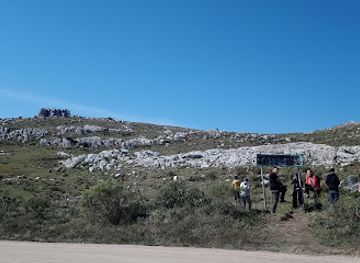
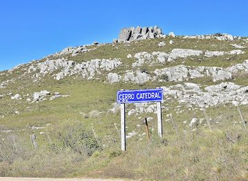
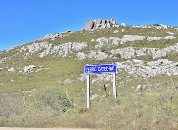
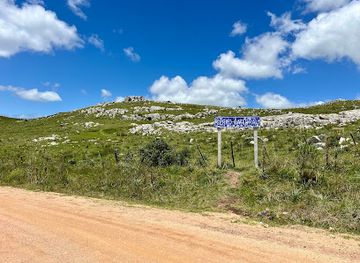
Cartel de acceso a cerro catedral
Discover the stunning beauty and adventure opportunities at Cerro Catedral, a premier ski resort in Uruguay's Maldonado Department.
-
Historical landmark
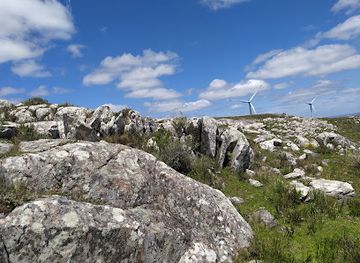
Pico Cerro Catedral
Discover the awe-inspiring natural beauty and rich history of Pico Cerro Catedral, a stunning landmark in Uruguay's Maldonado Department.
Best landmarks in Cerro Catedral
Cerro Catedral is the defining landmark, recognised as the highest natural point in Uruguay and rising above the surrounding Sierra Carapé. Its significance is geographical rather than architectural: the summit places the country’s generally low-relief landscape in a different perspective, with rocky hill country and open pasture extending across the Maldonado interior. The wider sierras contain ridges, stream valleys, native vegetation and rural properties that together form the setting of the landmark. Aiguá is the nearest settlement with a clear historical and practical relationship to this countryside, but it is not part of the summit itself. There are no major monuments, castle ruins or purpose-built mountain facilities on Cerro Catedral, and the landmark is best understood through its terrain, elevation, rural setting and relationship to Uruguay’s interior geography.
-
Museum
Cartel de acceso a cerro catedral
Discover the breathtaking beauty and adventure awaiting at Cerro Catedral Access Point, a must-visit destination in Uruguay's stunning Maldonado Department.
-
Historical landmark
Pico Cerro Catedral
Discover the breathtaking beauty and rich history of Pico Cerro Catedral, a must-visit landmark in Uruguay's stunning Maldonado Department.
Explore Cerro Catedral on the map
Plan your trip on one map. See where the top attractions, landmarks, restaurants and hotels are, and book hotels and experiences in a few clicks.
Best hotels in Cerro Catedral
Best restaurants in Cerro Catedral
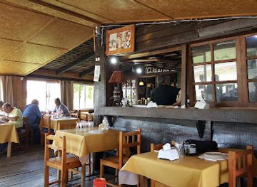
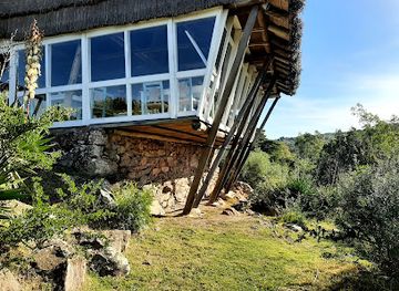
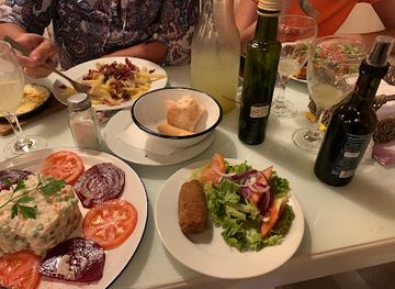
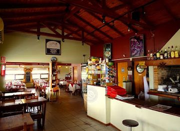
Cerro Catedral has no established dining scene at the summit, so visitors should plan meals and provisions before entering the rural hills. Aiguá is the most relevant nearby base for simple cafés, shops and local eating opportunities, while San Carlos, Maldonado and Punta del Este offer a much broader range of restaurants. The surrounding countryside reflects Uruguay’s rural food culture, particularly beef, grilled meats, empanadas, bread, dairy products and the social tradition of mate, although availability varies between businesses and settlements. Visitors may also encounter food associated with estancia life and regional small-scale producers, but should not expect farm-gate sales or open establishments along every rural road. Self-catering supplies, water and snacks are sensible for a journey to the summit area because there are no dependable refreshments on Cerro Catedral itself.
-
Fast Food
Lo De Homero Restaurante
Experience the heart of Uruguayan cuisine at Lo De Homero Restaurante - where fast food meets local tradition.
-
American
Ventorrillo de la Buena Vista
Experience delightful American cuisine amidst breathtaking views at Ventorrillo de la Buena Vista in Villa Serrana.
-
Restaurant
Parador Rocha
Savor authentic Uruguayan flavors at Parador Rocha, where local ingredients meet traditional recipes in a warm and welcoming setting.
-
Fast Food
Parador María Esther
Discover the flavors of Uruguay at Parador María Esther – where fast food meets local tradition in the heart of Rocha.
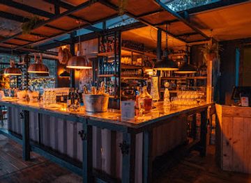
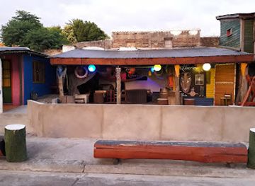
Best bars in Cerro Catedral
Evening entertainment around Cerro Catedral is limited because the destination is a rural summit rather than a resort or town. Aiguá offers the most relevant local atmosphere, with the possibility of traditional cafés, bars and social venues serving residents, although opening patterns and entertainment options can vary. San Carlos and Maldonado provide a wider choice of restaurants, pubs and evening hospitality, while Punta del Este is the nearest major destination for a developed nightlife scene; these places are outside Cerro Catedral and require a separate journey. In the immediate countryside, evenings are characterised by dark skies, quiet roads and rural stillness rather than clubs or organised nightlife. Visitors staying near the hills should arrange transport in advance and avoid assuming that late services or public transport will be available.
-
Tapas
Solera Wine & Tapas Bar
Discover the delightful fusion of tapas and wine at Solera Wine & Tapas Bar, a culinary haven in La Juanita, Maldonado, Uruguay.
-
Bar
Lo De Rúberico
Experience the vibrant nightlife at Lo De Rúberico in San Carlos, where great drinks and friendly vibes come together for an unforgettable evening.
-
 Bar
Bar del Cachango
Discover the vibrant atmosphere and authentic flavors at Bar del Cachango in Rocha, Uruguay – the perfect spot for relaxation and socializing.
-
Bar
El rincón de los negros
Explore San Carlos' vibrant nightlife at El rincón de los negros, a cozy bar offering a unique blend of local flavors and lively entertainment.
Best nightclubs in Cerro Catedral
Evening entertainment around Cerro Catedral is limited because the destination is a rural summit rather than a resort or town. Aiguá offers the most relevant local atmosphere, with the possibility of traditional cafés, bars and social venues serving residents, although opening patterns and entertainment options can vary. San Carlos and Maldonado provide a wider choice of restaurants, pubs and evening hospitality, while Punta del Este is the nearest major destination for a developed nightlife scene; these places are outside Cerro Catedral and require a separate journey. In the immediate countryside, evenings are characterised by dark skies, quiet roads and rural stillness rather than clubs or organised nightlife. Visitors staying near the hills should arrange transport in advance and avoid assuming that late services or public transport will be available.
-
Night club
FS producciones audio y luces
Discover the electrifying nightlife of Rocha at FS Producciones Audio y Luces, where unforgettable parties come to life with sensational music and stunning lights.
Best shops in Cerro Catedral
Shopping at Cerro Catedral is confined to practical preparation rather than destination retail. Visitors should obtain fuel, food, water, cash and outdoor essentials in Aiguá or in larger towns such as San Carlos and Maldonado before travelling into the hills. Aiguá is the most appropriate place to look for everyday supplies and locally made food products, while coastal centres provide a broader selection of shops, crafts and specialist outdoor goods. Regional purchases may include Uruguayan foodstuffs, leather goods, woollen textiles, mate-related items and small artisan products, although the range depends on the settlement and season. There is no shopping street, permanent craft market or cluster of souvenir shops at the summit, and rural properties should not be treated as retail outlets without clear permission or signage.
-
Mountain peak
Cerro Catedral
Discover the breathtaking beauty of Cerro Catedral, a majestic mountain peak in Maldonado, Uruguay, perfect for outdoor adventures and stunning views.
-
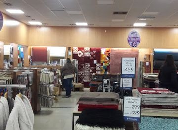
Home goods store
Tiendas Montevideo
Explore Tiendas Montevideo for unique home goods that reflect the charm of Uruguay, perfect for souvenirs and enhancing your travel experience.
-
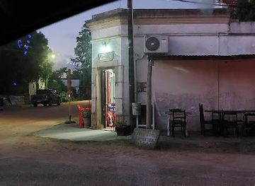
Grocery store
Almacén Garzón
Explore Almacén Garzón: Your gateway to authentic Uruguayan flavors and local delicacies in the heart of Garzón.
-
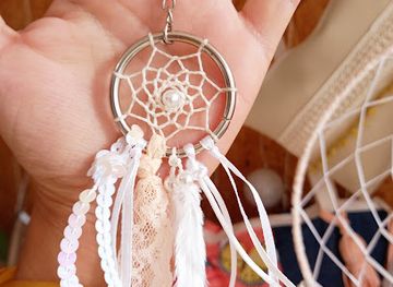
Gift shop
Luly Crea Para Ti
Explore Luly Crea Para Ti: A charming gift shop in Rocha, offering unique handmade treasures that capture the spirit of Uruguay.
Get your free copy of our complete guide to Cerro Catedral, delivered straight to you.
Everything on this page, from attractions and restaurants to essentials and local phrases, in one PDF you can read offline, print or share.
Already have an account? Sign in
Your Cerro Catedral guide is ready.
We'll send it to · Not you? Sign out

Getting your guide ready…
We are putting together a fresh copy of the Cerro Catedral guide. This can take up to a minute.
This can take a few moments. If your browser asks, choose Allow so the download can start. You'll find the guide in your Downloads folder.
Nothing happened? Download it again
Sorry, the guide is taking longer than usual. Please try again in a minute, or get it by email instead.
Cerro Catedral essentials
Currency and Payment
Safety
Emergency Situations
Do's and Don'ts
Local Tips
From Eve
Local phrases worth knowing
You don't need to get them perfect. A few words go a long way, and locals appreciate the effort.
Basics
| English | Local | Say it |
|---|---|---|
| Hello | Hola | [oh-lah] |
| Goodbye | Chau | [chow] |
| Yes | Sí | [see] |
| No | No | [noh] |
| Please/You're welcome | Por favor/De nada | [por fah-bor/deh nah-dah] |
| Thank you | Gracias | [grah-see-ahs] |
| Excuse me/Sorry | Disculpe/Perdón | [dees-cool-peh/pehr-dohn] |
| How are you? | ¿Cómo estás? | [koh-moh ehs-tahs] |
| Fine. And you? | Bien. ¿Y tú? | [byen. ee too] |
| Do you speak English? | ¿Hablas inglés? | [ah-blahs een-glehs] |
| I don't understand | No entiendo | [noh ehn-tee-ehn-doh] |
Eating & Drinking
| English | Local | Say it |
|---|---|---|
| I'd like to see the menu, please | Me gustaría ver el menú, por favor | [meh goo-stah-ree-ah behr ehl meh-noo, por fah-bor] |
| I don't eat meat | No como carne | [noh koh-moh kahr-neh] |
| Cheers! | ¡Salud! | [sah-lood] |
| I would like to pay, please | Me gustaría pagar, por favor | [meh goo-stah-ree-ah pah-gahr, por fah-bor] |
Emergencies
| English | Local | Say it |
|---|---|---|
| Help! | ¡Ayuda! | [ah-yoo-dah] |
| Go away! | ¡Vete! | [veh-teh] |
| Call the Police! | ¡Llama a la Policía! | [yah-mah ah lah poh-li-see-ah] |
| Call a doctor! | ¡Llama a un doctor! | [yah-mah ah oon dohk-tohr] |
| I'm lost | Estoy perdido | [ehs-toy pehr-dee-doh] |
| I'm ill | Estoy enfermo | [ehs-toy ehn-fehr-moh] |
Shopping
| English | Local | Say it |
|---|---|---|
| I'd like to buy... | Me gustaría comprar... | [meh goo-stah-ree-ah kohm-prahr] |
| I'm just looking | Solo estoy mirando | [soh-loh ehs-toy mee-rahn-doh] |
| How much is it? | ¿Cuánto cuesta? | [kwan-toh kwes-tah] |
| That's too expensive | Está demasiado caro | [ehs-tah de-mah-see-ah-doh kah-roh] |
| Can you lower the price? | ¿Puede bajar el precio? | [pweh-deh bah-har ehl pree-see-oh] |
Time & Numbers
| English | Local | Say it |
|---|---|---|
| What time is it? | ¿Qué hora es? | [keh oh-rah ehs] |
| It's one o'clock | Es la una | [ehs lah oo-nah] |
| Half past (10) | Las diez y media | [lahs dyehs ee meh-dee-ah] |
| Morning | Mañana | [mah-nyah-nah] |
| Afternoon | Tarde | [tahr-deh] |
| Evening | Noche | [noh-cheh] |
| Yesterday | Ayer | [ah-yehr] |
| Today | Hoy | [oy] |
| Tomorrow | Mañana | [mah-nyah-nah] |
| 1 | Uno | [oo-noh] |
| 2 | Dos | [dohs] |
| 3 | Tres | [trehs] |
| 4 | Cuatro | [kwah-troh] |
| 5 | Cinco | [seen-koh] |
| 6 | Seis | [say-ees] |
| 7 | Siete | [syeh-teh] |
| 8 | Ocho | [oh-choh] |
| 9 | Nueve | [nweh-veh] |
| 10 | Diez | [dyehs] |
Transport & Directions
| English | Local | Say it |
|---|---|---|
| Where's a/the...? | ¿Dónde está...? | [dohn-deh ehs-tah] |
| What's the address? | ¿Cuál es la dirección? | [kwal ehs lah dee-rehk-syohn] |
| Can you show me (on the map)? | ¿Puedes mostrarme (en el mapa)? | [pweh-dehs mohs-trar-meh (ehn ehl mah-pah)] |
| When's the next (bus)? | ¿Cuándo es el próximo (autobús)? | [kwan-doh ehs ehl proh-ksee-moh (ow-toh-boos)] |
| A ticket (to ....) | Un boleto (para ...) | [oon boh-leh-toh (pah-rah)] |
History of Cerro Catedral
The Sierra Carapé Landscape
Cerro Catedral forms part of the ancient hill country of the Sierra Carapé, a regional system of ridges and rocky elevations in eastern Uruguay. Its height is significant within the predominantly low-lying national landscape, but the summit is the product of long geological erosion rather than a recent volcanic or alpine event. The surrounding terrain of exposed rock, shallow soils, grassland and wooded stream valleys reflects the interaction of underlying geology, climate and prolonged weathering. This physical setting explains why the area is recognised geographically even though it has not developed as a large-scale mountain tourist resort.
Indigenous Country and Colonial Expansion
Before European settlement, eastern Uruguay was inhabited and travelled by Indigenous peoples, including communities associated with the wider Charrúa cultural world. The sierras, watercourses and open grasslands formed part of a mobile landscape rather than a territory divided into modern rural properties. During the colonial period and the formation of the Uruguayan state, European livestock, landholding and administrative control progressively reshaped the region. The hills around Cerro Catedral became part of the broader interior of Maldonado, where ranching and movement between settlements were more important than concentrated urban development.
Ranching and Rural Settlement
The modern character of the Cerro Catedral area is closely connected with Uruguay’s estancia economy. Extensive cattle ranching, fencing, rural tracks and dispersed farm properties have influenced the appearance and practical use of the hills. Towns such as Aiguá developed as service and exchange centres for the surrounding countryside, while larger settlements nearer the coast became more closely associated with tourism and commerce. Around the summit itself, the absence of a substantial permanent settlement has helped preserve its identity as a geographical feature within working rural land rather than as a built visitor attraction.
Recognition as Uruguay’s Highest Point
Cerro Catedral’s national importance rests on its status as the highest point in Uruguay, at approximately 513 metres above sea level. That distinction has given the summit a place in geographical descriptions, maps and journeys designed to understand the country beyond its coastal centres. Unlike a formally developed national park or mountain resort, however, its recognition has not necessarily brought extensive public infrastructure. Contemporary visits therefore depend on responsible route planning, respect for land access and an appreciation of the wider Sierra Carapé landscape, whose value lies in both its natural setting and its rural continuity.
Cerro Catedral in Photos
Browse through our photo collection highlighting the charm and character of the destination.
Neighbouring destination travel guides
The closest destinations to Cerro Catedral, if you have time for more than one.
-

-

-

-

-


Swipe for more destinations
Explore more

Explore more of East Coast
Discover the East Coast of Uruguay: From Glamorous Resorts to Pristine Beaches and Charming Villages, Experience the Best of South America's Hidden Gems.
Explore East Coast
Explore more of Uruguay
Discover Uruguay: Rich culture, stunning beaches, and a warm, welcoming atmosphere await in this hidden gem of South America.
Explore Uruguay