

Mount Aspiring National Park Travel Guide - Free Web & App
Your ultimate guide to Mount Aspiring National Park. Discover top landmarks, proposed trips, and local tips. Free on the web or via the Evendo companion app.


Mount Aspiring National Park, New Zealand, offers Southern Alps hikes, glaciers, beech forests, wild rivers and remote tramping from Wanaka and Haast.
Alpine Landscapes and Great Rivers
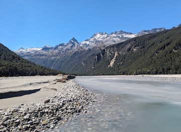
Mount Aspiring National Park occupies more than 3,500 square kilometres at the southern end of the Southern Alps, where Otago meets the West Coast. Its landscape rises dramatically from river valleys and beech forest to ice-carved basins, hanging glaciers, snowfields and sharp summits, including Mount Aspiring, also known as Tititea. The park is part of Te Wahipounamu – South West New Zealand World Heritage Area, recognised for its large-scale glacial landforms and comparatively intact ecosystems. Rivers such as the Matukituki, Dart, Route Burn and Haast drain a terrain shaped by movement, water and weather rather than roads or settlement.Read more about Mount Aspiring National Park
Gateways and Wilderness
Wildlife, Heritage and Experience
When is the best time to visit Mount Aspiring National Park?
Best: January–March · 20–22°C| Month | High (°C) | Rainfall (mm) |
|---|---|---|
| January (best) | 22 | 60 |
| February (best) | 22 | 55 |
| March (best) | 20 | 50 |
| April | 17 | 45 |
| May | 13 | 40 |
| June | 10 | 35 |
| July | 8 | 35 |
| August | 10 | 40 |
| September | 14 | 45 |
| October | 18 | 50 |
| November | 20 | 55 |
| December | 21 | 60 |
Getting to and around Mount Aspiring National Park
How to get there
Transportation
Best attractions in Mount Aspiring National Park
Mount Aspiring National Park's attractions are spread across several valleys rather than gathered around one visitor centre. From Wanaka, the Matukituki Valley leads towards the Rob Roy Track, where forest, river scenery and views towards Rob Roy Glacier form the focus of a demanding day walk, while Raspberry Creek provides an approach to longer routes in the valley. The Routeburn and Dart areas near Glenorchy offer celebrated multi-day landscapes of beech forest, alpine passes and river valleys, although the Routeburn Track continues into neighbouring Fiordland National Park. Makarora provides access towards the Blue Pools area and the Wilkin and Young valleys, subject to current track and road conditions. The Rees-Dart Track explores contrasting valleys near the head of Lake Wakatipu, while remote routes towards the Haast, Landsborough and Arawhata country reveal a wilder western character. Glacial rivers, hanging valleys, native forest and high passes are often the principal sights.
-
Tourist attraction
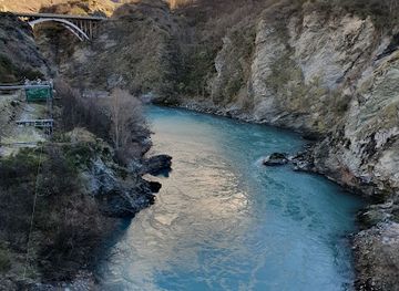
Puzzling World
Discover the magic of perception at Puzzling World, a unique tourist attraction in Wānaka, New Zealand, filled with puzzles, illusions, and loads of fun.
-
Tourist attraction
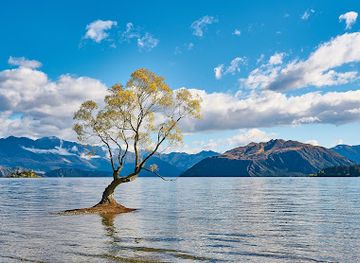
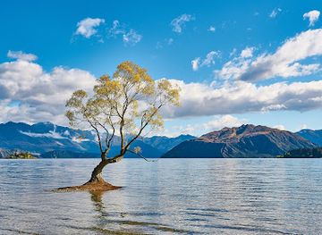
#ThatWanakaTree
#ThatWanakaTree: A breathtaking natural attraction on the shores of Lake Wanaka, perfect for photos and peaceful reflections amidst stunning scenery.
-
Tourist attraction
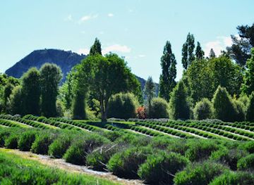
Wānaka Lavender Farm
Explore the enchanting Wānaka Lavender Farm, a floral haven offering stunning views, delightful treats, and a serene escape in New Zealand's breathtaking landscapes.
-
Tourist attraction
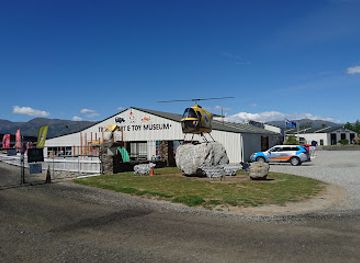
National Transport & Toy Museum
Explore the National Transport & Toy Museum in Wānaka, a captivating attraction featuring vintage vehicles and nostalgic toys for all ages.
Best landmarks in Mount Aspiring National Park
Mount Aspiring, or Tititea, is the park's defining summit and a prominent landmark of the southern Southern Alps, surrounded by ridges, glaciers and deeply incised valleys. The Matukituki Valley forms a major eastern landscape, with Rob Roy Glacier and the surrounding alpine relief visible from routes approaching the high country. The Dart and Rees valleys near Glenorchy are important natural corridors, while the Routeburn's passes and beech forests connect Mount Aspiring country with neighbouring Fiordland. On the western side, the Haast and Makarora valleys express the wetter character of the South Island's West Coast, with dense forest, powerful rivers and access towards remote glacial basins. The park's significance lies less in buildings than in this combination of tectonic mountains, ice-shaped landforms, braided waterways and native forest protected within Te Wahipounamu.
-
Scenic spot
#ThatWanakaTree
#ThatWanakaTree: An Unforgettable Scenic Experience in the Heart of New Zealand's Breathtaking Landscape.
-
Scenic spot
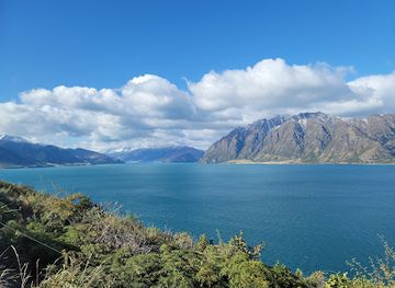
Lake Hawea Lookout
Experience breathtaking views at Lake Hawea Lookout, the scenic spot that captures the essence of New Zealand's natural beauty.
-
Scenic spot
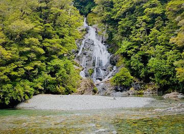
Fantail Falls
Discover the breathtaking beauty of Fantail Falls in Mount Aspiring National Park, a must-see natural wonder in New Zealand's stunning South Island.
-
Tourist attraction
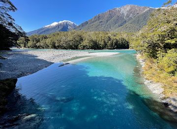
Blue Pools
Explore the stunning Blue Pools in Otago, New Zealand, where vibrant turquoise waters meet lush landscapes for an unforgettable nature experience.
Explore Mount Aspiring National Park on the map
Plan your trip on one map. See where the top attractions, landmarks, restaurants and hotels are, and book hotels and experiences in a few clicks.
Best hotels in Mount Aspiring National Park
Best restaurants in Mount Aspiring National Park
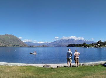
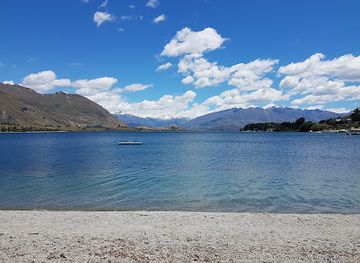
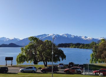
There is little dining infrastructure inside Mount Aspiring National Park, where visitors generally carry food for walks and tramps or use hut cooking facilities where available. The main choice of restaurants, cafés, bakeries and pubs is found in gateway settlements, particularly Wanaka, with further provisions and simple eating options in Makarora and Haast. Glenorchy also serves travellers entering the Dart and Routeburn area, though its services are those of a small rural community rather than a large resort. Wanaka is the most developed base for stocking up before entering the Matukituki Valley, while shops in smaller settlements should not be assumed to provide a full range of supplies at all times. Regional dining reflects New Zealand's farm, orchard and pastoral produce, with cafés and restaurants commonly offering seasonal local ingredients alongside familiar café and pub meals.
-
Restaurant
Big Fig Wanaka
Discover Big Fig Wanaka: A delightful dining experience featuring fresh local ingredients in a cozy atmosphere.
-
Italian
Francesca Wanaka
Experience authentic Italian flavors at Francesca Wanaka – where every meal is a celebration amidst stunning New Zealand landscapes.
-
Gastropub
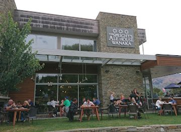
Speight's Ale House
Experience the essence of Wānaka at Speight's Ale House - where delicious food meets local craft beers in a stunning setting.
-
Indian
Bombay Palace Wanaka
Savor authentic Indian cuisine at Bombay Palace Wanaka – your gateway to flavorful dishes in a charming atmosphere.
Best bars in Mount Aspiring National Park
Evening entertainment is limited within Mount Aspiring National Park itself: remote valleys and backcountry huts offer quiet nights shaped by weather, darkness and the practical routines of tramping rather than bars or clubs. Wanaka provides the widest choice of pubs, wine bars, cafés and relaxed evening venues for visitors returning from the eastern park approaches, while Glenorchy, Makarora and Haast have a much smaller rural hospitality scene. These settlements are useful for a meal or drink before and after an excursion, but they should not be treated as continuous nightlife districts. Visitors staying in remote accommodation or preparing for a multi-day route will usually find that evening activities centre on cooking, planning, reading weather information and enjoying mountain views when conditions permit. Seasonal events may occur in gateway communities, but schedules and availability vary.
-
Bar
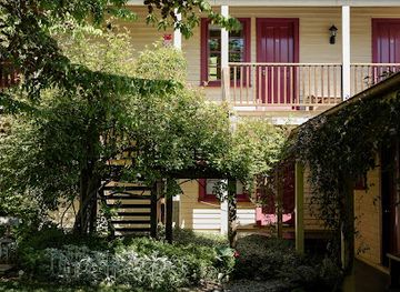
Cardrona Hotel
Discover the historic Cardrona Hotel, a charming retreat in the stunning Cardrona Valley, offering a cozy bar, delicious dining, and comfortable accommodations.
-
Restaurant
Big Fig Wanaka
Discover Big Fig Wanaka, a culinary hotspot offering delectable meals made from fresh, locally-sourced ingredients in a cozy atmosphere.
-
Gastropub
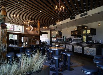
Speight's Ale House
Discover the heart of Wānaka at Speight's Ale House, where local craft beers meet delicious New Zealand cuisine in a vibrant gastropub setting.
-
Restaurant
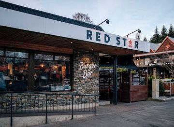
Red Star Burger Bar
Experience the best gourmet burgers in Wānaka at Red Star Burger Bar, where local ingredients come together for a delightful dining experience.

Best nightclubs in Mount Aspiring National Park
Evening entertainment is limited within Mount Aspiring National Park itself: remote valleys and backcountry huts offer quiet nights shaped by weather, darkness and the practical routines of tramping rather than bars or clubs. Wanaka provides the widest choice of pubs, wine bars, cafés and relaxed evening venues for visitors returning from the eastern park approaches, while Glenorchy, Makarora and Haast have a much smaller rural hospitality scene. These settlements are useful for a meal or drink before and after an excursion, but they should not be treated as continuous nightlife districts. Visitors staying in remote accommodation or preparing for a multi-day route will usually find that evening activities centre on cooking, planning, reading weather information and enjoying mountain views when conditions permit. Seasonal events may occur in gateway communities, but schedules and availability vary.
-
National park
Mount Aspiring National Park
Explore the breathtaking landscapes and rich biodiversity of Mount Aspiring National Park on New Zealand's stunning South Island.
-
Holiday park
Mt Aspiring Holiday Park
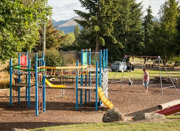
Discover the beauty of Wānaka at Mt Aspiring Holiday Park, your gateway to adventure amidst stunning mountain landscapes.
-
Visitor center
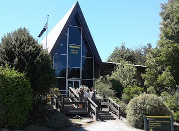
Tititea/Mount Aspiring National Park Visitor Centre
Explore the breathtaking Tititea/Mount Aspiring National Park Visitor Centre in Wānaka - your gateway to New Zealand's spectacular outdoor adventures.
-
Sports bar
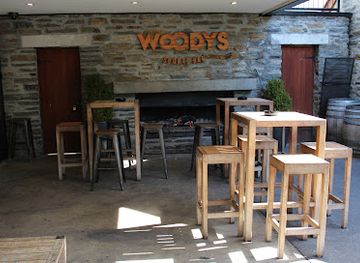
Woodys Sports Bar
Discover the lively ambiance of Woodys Sports Bar in Wānaka, where sports, drinks, and great food come together in a vibrant setting.
Best shops in Mount Aspiring National Park
Shopping within Mount Aspiring National Park is effectively limited to practical supplies, as the interior has no retail streets or permanent commercial centre. Wanaka is the principal place to purchase food, outdoor equipment and last-minute walking supplies before entering the Matukituki Valley or travelling towards Makarora. Smaller shops in Makarora, Haast and Glenorchy may provide essentials, but visitors should stock up in a larger town when preparing for a remote or multi-day journey. Souvenirs and locally made goods are more likely to be found in gateway settlements than inside the protected area, including regional food products, outdoor clothing, artwork and craft items where local businesses offer them. Retail provision is dispersed and seasonal rather than concentrated in a single market, so shopping should be treated as part of trip preparation rather than a principal park activity.
-
Gift shop
Puzzling World
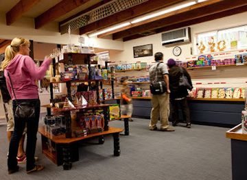
Discover the extraordinary at Puzzling World, Wānaka's premier amusement center filled with illusions and fun for all ages.
-
Clothing store
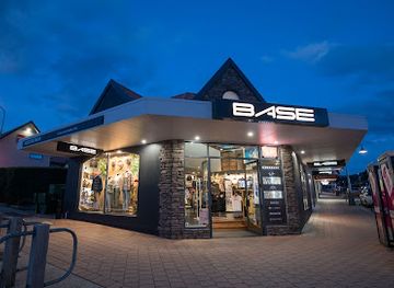
Base Streetwear
Discover stylish apparel and local flair at Base Streetwear, Wānaka's ultimate fashion destination for tourists seeking unique clothing.
-
Clothing store
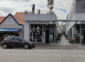
DEVàL Boutique
Discover stylish clothing and local craftsmanship at DEVàL Boutique, a premier shopping destination in Wānaka, New Zealand.
-
Charity
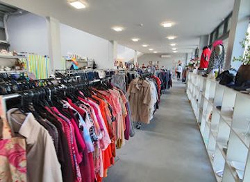
Salvation Army Family Store Wānaka
Explore the Salvation Army Family Store in Wānaka for unique second-hand treasures while supporting a great cause.
Get your free copy of our complete guide to Mount Aspiring National Park, delivered straight to you.
Everything on this page, from attractions and restaurants to essentials and local phrases, in one PDF you can read offline, print or share.
Already have an account? Sign in
Your Mount Aspiring National Park guide is ready.
We'll send it to · Not you? Sign out

Getting your guide ready…
We are putting together a fresh copy of the Mount Aspiring National Park guide. This can take up to a minute.
This can take a few moments. If your browser asks, choose Allow so the download can start. You'll find the guide in your Downloads folder.
Nothing happened? Download it again
Sorry, the guide is taking longer than usual. Please try again in a minute, or get it by email instead.
Mount Aspiring National Park essentials
Currency and Payment
Safety
Emergency Situations
Do's and Don'ts
Local Tips
From Eve
Local phrases worth knowing
You don't need to get them perfect. A few words go a long way, and locals appreciate the effort.
Basics
| English | Local | Say it |
|---|---|---|
| Hello | Kia ora | [kee-ah or-ah] |
| Goodbye | Haere rā | [high-reh rah] |
| Yes | Āe | [eye] |
| No | Kāo | [kah-oh] |
| Please/You're welcome | Mōrena | [moh-reh-nah] |
| Thank you | Kia ora | [kee-ah or-ah] |
| Excuse me/Sorry | Whakarongo mai | [fah-kah-rohn-goh my] |
| How are you? | Kei te pēhea koe? | [keh-ee teh pay-heh-ah koh-eh] |
| Fine. And you? | Kei te pai. Ā koe? | [keh-ee teh pie. eye koh-eh] |
| Do you speak English? | Kōrerotia koe i te reo Pākehā? | [koh-reh-roh-tee-ah koh-eh ee teh reh-oh pah-keh-hah] |
| I don't understand | Kāore au i te mārama | [kah-oh-reh oh-oo ee teh mah-rah-mah] |
Eating & Drinking
| English | Local | Say it |
|---|---|---|
| I'd like to see the menu, please | Me tirohia te whārangi kai, tēnā | [meh tee-roh-hee-ah teh fah-rang-ee kai, teh-nah] |
| I don't eat meat | Kāore au e kai mīti | [kah-oh-reh oh-oo eh kai mee-tee] |
| Cheers! | Āraha! | [eye-rah-hah] |
| I would like to pay, please | Me utu, tēnā | [meh oo-too, teh-nah] |
Emergencies
| English | Local | Say it |
|---|---|---|
| Help! | Āwhina! | [eye-fee-nah] |
| Go away! | Haere atu! | [high-reh ah-too] |
| Call the Police! | Karanga ki te Pirihimana! | [kah-rah-ngah kee teh pee-ree-hee-mah-nah] |
| Call a doctor! | Karanga ki te rata! | [kah-rah-ngah kee teh rah-tah] |
| I'm lost | I wareware au | [ee wah-reh-wah-reh oh-oo] |
| I'm ill | E mate au | [eh mah-teh oh-oo] |
Shopping
| English | Local | Say it |
|---|---|---|
| I'd like to buy... | Me hoko... | [meh hoh-koh] |
| I'm just looking | Ka titiro au | [kah tee-tee-roh oh-oo] |
| How much is it? | E hia te utu? | [eh hee-ah teh oo-too] |
| That's too expensive | He roa rawa atu te utu | [heh roh-ah rah-wah ah-too teh oo-too] |
| Can you lower the price? | Ka taea e koe te whakaiti i te utu? | [kah teh-ah eh koh-eh teh fah-kai-tee ee teh oo-too] |
Time & Numbers
| English | Local | Say it |
|---|---|---|
| What time is it? | He aha te wā? | [heh ah-hah teh wah] |
| It's one o'clock | Kotahi karaka | [koh-tah-hee kah-rah-kah] |
| Half past (10) | Tekau karaka | [teh-kow kah-rah-kah] |
| Morning | Ahiahi | [ah-hee-ah-hee] |
| Afternoon | Ahiahi | [ah-hee-ah-hee] |
| Evening | Pō | [poh] |
| Yesterday | Inānei | [ee-nah-nay] |
| Today | Āianei | [eye-ah-nay] |
| Tomorrow | Āpōpō | [eye-poh-poh] |
| 1 | Tahi | [tah-hee] |
| 2 | Rua | [roo-ah] |
| 3 | Toru | [toh-roo] |
| 4 | Whā | [fah] |
| 5 | Rima | [ree-mah] |
| 6 | Ono | [oh-no] |
| 7 | Whitu | [fee-too] |
| 8 | Waru | [wah-roo] |
| 9 | Iwa | [ee-wah] |
| 10 | Tekau | [teh-kow] |
Transport & Directions
| English | Local | Say it |
|---|---|---|
| Where's a/the...? | Kei hea te...? | [keh-ee heh-ah teh] |
| What's the address? | He aha te wāhitau? | [heh ah-hah teh wah-hee-tow] |
| Can you show me (on the map)? | Ka taea e koe te whakaatu mai ki ahau (i runga i te mahere)? | [kah teh-ah eh koh-eh teh fah-kah-ah-too my kee ah-how (ee roon-gah ee teh mah-heh-reh)] |
| When's the next (bus)? | Āhea te taha atu? | [eye-heh-ah teh tah-hah ah-too] |
| A ticket (to ....) | He tiki (ki ...) | [heh tee-kee kee] |
History of Mount Aspiring National Park
A Landscape Shaped by Ice and Faults
Mount Aspiring National Park's physical story belongs to geological timescales. The Southern Alps were uplifted along the Alpine Fault as the Australian and Pacific tectonic plates moved past one another, while successive glacial periods carved valleys, cirques, ridges and broad river corridors. Glaciers and rivers continue to modify the terrain, producing the stark contrast between forested lower valleys and high alpine rock and ice. This geological setting explains the park's steep relief, unstable mountain environment and dense network of waterways, all of which influence how visitors travel through it today.
Maori Connections and Seasonal Movement
Long before the park was established, Māori travelled through the wider South Island, using waterways, passes and coastal routes to move between resources and communities. The mountain now commonly called Mount Aspiring is also known as Tititea, and Māori place names across the region record enduring relationships with the landscape. The valleys were not an empty wilderness in cultural terms: travel, food gathering and knowledge of routes connected inland country with the wider southern South Island. These associations remain important when interpreting the park's mountains, rivers and passes.
Exploration, Surveying and Pastoral Change
European exploration and surveying increased during the nineteenth century as pastoral settlers, prospectors and government parties entered the remote valleys around Wanaka, the Dart and the Haast. Sheep farming developed particularly on more accessible lowland margins, while gold mining affected parts of the wider Otago region. Pack tracks and stock routes later became approaches for hunters, climbers and trampers. The difficulty of the terrain limited permanent settlement within the mountains, helping preserve extensive forests and alpine country even as surrounding valleys became linked by roads and rural communities.
From Forest Reserve to National Park
Growing recognition of the area's scenery, scientific value and recreational importance led to formal protection. Mount Aspiring National Park was established in 1964, bringing a large section of the southern Southern Alps under national-park management. The park later became part of Te Wahipounamu – South West New Zealand World Heritage Area, listed in 1990 for its outstanding natural landscapes, evolutionary history and relatively intact ecosystems. Conservation management now balances public access, biodiversity protection, track infrastructure and the protection of remote river and alpine environments.
Tramping and Modern Conservation
During the twentieth century, climbing, tramping and outdoor recreation grew from specialist pursuits into important parts of the region's visitor economy. Tracks such as the Routeburn, Rees-Dart, Matukituki and Wilkin routes introduced visitors to different parts of the park, although several remain demanding journeys rather than casual walks. Modern management is shaped by changing weather, natural hazards, visitor pressure and the protection of native species from introduced predators and browsers. The park's history is therefore still developing through the continuing relationship between recreation, local communities and conservation.
Mount Aspiring National Park in Photos
Browse through our photo collection highlighting the charm and character of the destination.
Cities in Mount Aspiring National Park
The towns and cities of Mount Aspiring National Park, and the easiest places to base yourself.
-

-


Swipe for more cities
Neighbouring destination travel guides
The closest destinations to Mount Aspiring National Park, if you have time for more than one.
-

-

-

-

-


Swipe for more destinations
Explore more

Explore more of Otago
Discover Otago: A land of stunning landscapes, vibrant cities, rich culture, and endless adventures in New Zealand's South Island.
Explore Otago
Explore more of New Zealand
New Zealand: Discover awe-inspiring landscapes, vibrant Maori culture, and thrilling adventures in a land of breathtaking natural beauty and welcoming locals.
Explore New Zealand