Magnolia Falls: A Hidden Gem in the Ozarks
Discover the serene beauty of Magnolia Falls, a hidden waterfall hike in the Ozark National Forest near Deer, Arkansas.
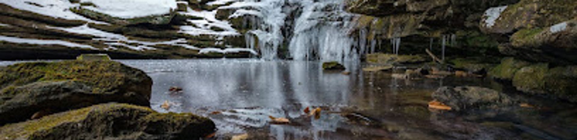
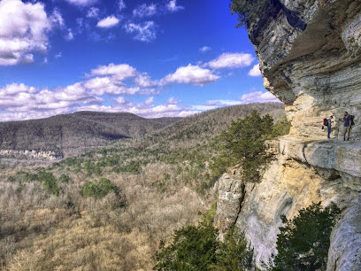
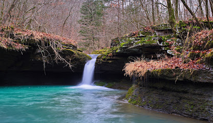
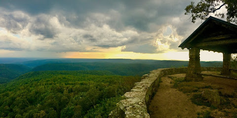
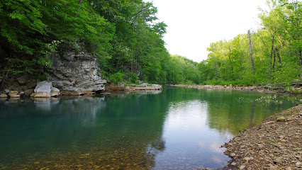
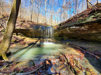
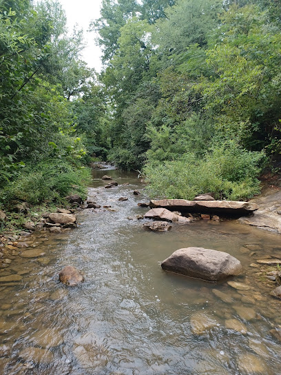
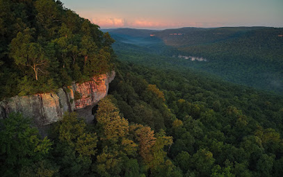
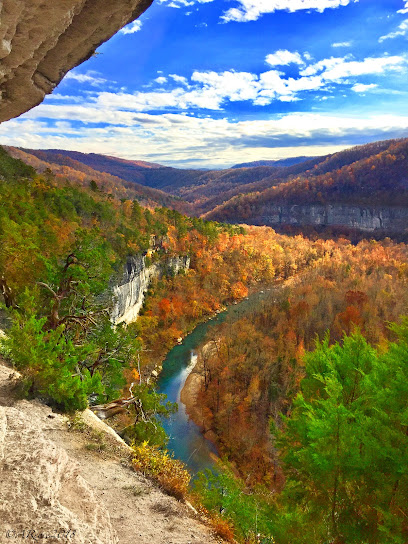
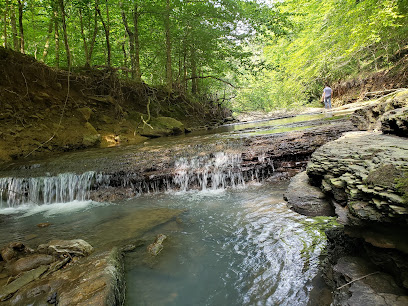
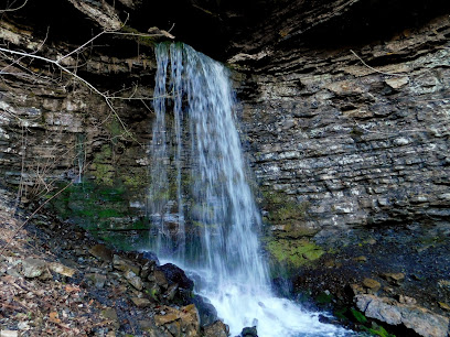
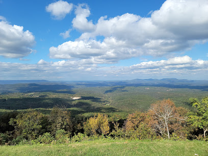
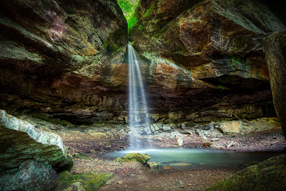
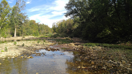
Magnolia Falls, nestled in the Upper Buffalo Wilderness near Deer, Arkansas, is a 26-foot waterfall cascading into a serene grotto. The moderate 2.1-mile roundtrip hike features a scenic creek, historic stone walls, and unique rock formations, offering a tranquil escape into nature.
A brief summary to Magnolia Falls
- Deer, Arkansas, 72628, US
Local tips
- Visit early in the morning or on weekdays to avoid crowds and enjoy a more peaceful experience.
- Download an offline map, as cell service can be unreliable in the area.
- Wear sturdy hiking shoes for the uneven terrain and potential rock scrambling.
- Bring water and snacks, especially during warmer months.
- Be cautious near the bluff edges and creek crossings, as they can be slippery.
Getting There
-
Driving
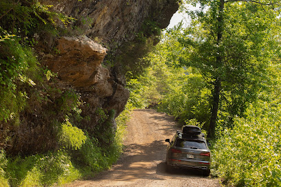
To reach Magnolia Falls, navigate to Highway 21 between Mossville and Edwards Junction. Approximately 2.5 miles south of Mossville Church (or 1.8 miles north of Edwards Junction), turn west onto County Road 6 (Forest Road 1462), a significant gravel road. Drive about 0.3 miles to a pull-off parking area across from a 'Wilderness Access' sign. Parking is free along the roadside. Be aware that the road can be muddy after rain.
-
Walking
From the parking area, the trailhead starts on the right side of the road, across from the 'Wilderness Access' sign. Follow the old jeep road, which narrows into a trail. After about 1 mile, cross a small creek and turn left at the fork to reach Magnolia Falls. The falls are a short distance from the split. The final approach involves a short, steeper scramble to the base of the falls.
Discover more about Magnolia Falls
Iconic landmarks you can’t miss
Centerpoint Trailhead
22.4 km
Explore the breathtaking trails and stunning vistas of Centerpoint Trailhead in the Ozark National Forest, perfect for hiking enthusiasts and nature lovers alike.
Granny Henderson Cabin
22.6 km
Explore the historical richness and natural beauty at Granny Henderson Cabin, a charming landmark in Compton, Arkansas.
Round Top Mountain Trail
23.8 km
Explore scenic trails, discover fascinating rock formations, and reflect on history at Round Top Mountain near Jasper, Arkansas.
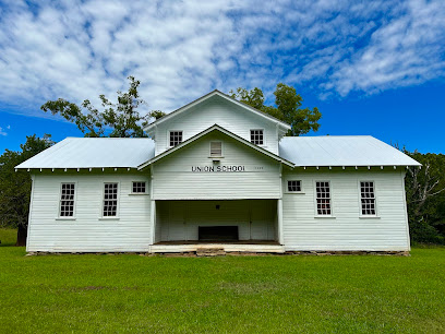
Union School House
26.4 km
Explore the Union School House in Hagarville, Arkansas, a historical landmark that captures the essence of early 20th-century education in a beautiful natural setting.
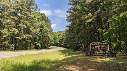
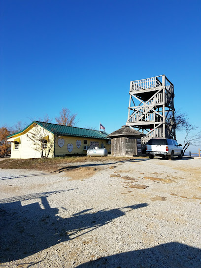
Ozark National Forest sign
32.6 km
Explore the natural wonders of Ozark National Forest, a scenic destination in Arkansas perfect for outdoor adventures and breathtaking landscapes.
Pedestal Rocks Scenic Area
38.2 km
Experience the breathtaking beauty and unique rock formations of Pedestal Rocks Scenic Area in the heart of Arkansas's Ozark National Forest.
Richland Creek Wilderness
39.4 km
Discover pristine waterfalls and rugged beauty in Arkansas's Richland Creek Wilderness, a haven for adventurous hikers and nature lovers.
Northwest Arkansas Travel Guide (Home of the Best of NWA Top 10 Lists)
43.7 km
Unlock the best of Northwest Arkansas! Your guide to top restaurants, hotels, activities, and hidden gems in the scenic Ozark Mountain region.
Harrison, Arkansas National Historic District
48.3 km
Explore the Harrison, Arkansas National Historic District, where history and charm blend seamlessly in a beautifully preserved setting.
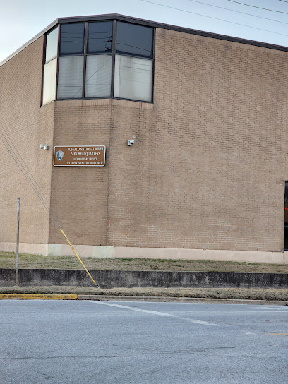
Buffalo National River Headquarters
48.6 km
Plan your Ozark adventure at the Buffalo National River Headquarters in Harrison, Arkansas. Explore America's first national river!
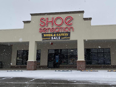
Shoe Sensation
49.6 km
Explore stylish footwear at Shoe Sensation in Harrison, Arkansas – your go-to shop for quality shoes, boots, and running gear.
White Rock Mountain
53.9 km
Discover breathtaking views, historic charm, and outdoor adventures in the heart of the Ozark National Forest at White Rock Mountain.
Valentine-Williams House
54.6 km
Discover the Valentine-Williams House in Arkansas: A beautifully preserved historical landmark offering a glimpse into the past.
US Forest Service Boston Mountain Ranger Station
56.7 km
Discover the breathtaking beauty of Ozark at the US Forest Service Boston Mountain Ranger Station, your gateway to adventure in the Boston Mountains.
Eureka springs
58.9 km
Explore the historic charm and natural beauty of Eureka Springs, a hidden gem in the Ozark Mountains with rich culture and vibrant arts.
Unmissable attractions to see
Upper Buffalo Wilderness
3.2 km
Discover Arkansas's wild side in the Upper Buffalo Wilderness: rugged trails, historic remnants, and unparalleled solitude await.
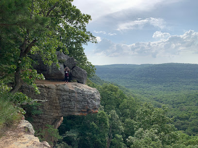
Hawksbill Crag/Whitaker Point
4.7 km
Experience breathtaking views and adventurous hikes at Hawksbill Crag, a must-visit scenic gem in the heart of Arkansas's stunning wilderness.
Glory Hole Falls
4.8 km
Hike to a natural wonder in Arkansas' Ozark National Forest, where a waterfall flows through a hole in a rock bluff.
Buffalo National Wild & Scenic River
5.2 km
Discover the untamed beauty of the Ozarks at Buffalo National River, America's first national river, offering pristine waters and rugged wilderness.
Ozarks
8.5 km
Discover the Ozarks: An ancient highland region offering outdoor adventures, rich culture, and stunning natural beauty across four states.
Kings River Falls Natural Area
16.4 km
Discover the natural beauty of Kings River Falls: hike to a scenic waterfall and swimming hole in the heart of the Ozark Mountains.
Boxley Valley Historic District
17.5 km
Explore the enchanting Boxley Valley Historic District, where history meets stunning natural landscapes in the heart of Arkansas.
Big Bluff Goat Trail
21.9 km
Experience breathtaking views from atop Big Bluff along the Goat Trail, a must-do hike in Arkansas' Buffalo National River.
Ozark Highlands Trail - Ozone Trailhead
21.9 km
Access the scenic Ozark Highlands Trail at the Ozone Trailhead for hiking and backpacking adventures in the heart of the Ozark Mountains.
Big Creek Cave Falls
22.0 km
Discover a hidden Ozark treasure: hike to a stunning waterfall emerging from a cave at Big Creek Cave Falls near Jasper, Arkansas.
Car Wash Falls
22.1 km
Experience Arkansas's only drive-through waterfall: a unique natural car wash nestled in the scenic Ozark Mountains near Hagarville.
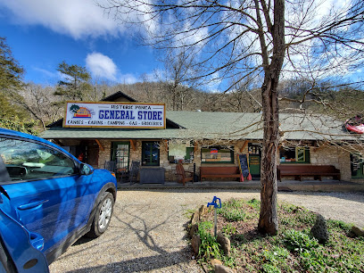
Buffalo National River Wilderness - Ponca Unit
22.5 km
Discover the wild beauty of Arkansas in the Ponca Unit: hiking, floating, and breathtaking views await in this natural paradise.
Arkansas Grand Canyon
23.0 km
Experience the breathtaking beauty of the Arkansas Grand Canyon, a stunning scenic spot perfect for outdoor adventures and tranquil escapes in the Ozark Mountains.
Pam's Grotto
24.0 km
Discover Pam's Grotto: A hidden waterfall oasis in the Ozark National Forest offering a short, scenic hike to a stunning natural grotto.
Hemmed-In Hollow Falls
24.4 km
Discover Arkansas's tallest waterfall: A challenging hike to the breathtaking Hemmed-In Hollow Falls in Buffalo National River's Ponca Wilderness.
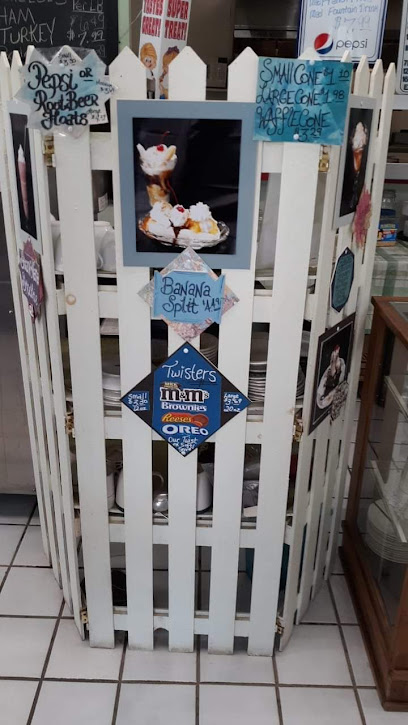
Essential places to dine
Cliff House Inn
23.1 km
Discover breathtaking views and rustic charm at Cliff House Inn – your gateway to the stunning Arkansas Grand Canyon.
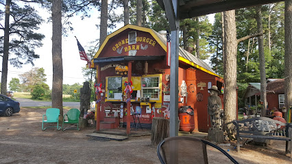
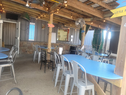
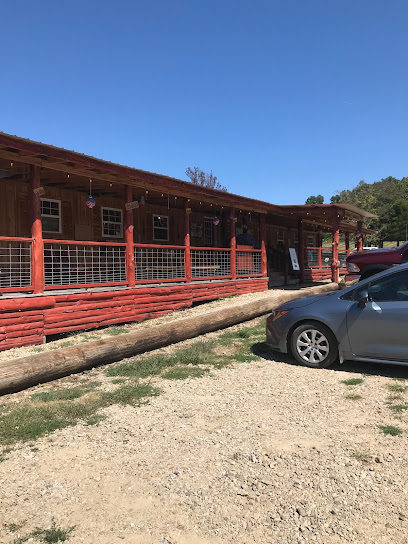
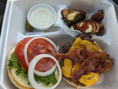
Ozone Burger Barn
25.0 km
Experience authentic Southern flavors at Ozone Burger Barn—home of mouthwatering burgers in the heart of Arkansas.
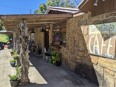
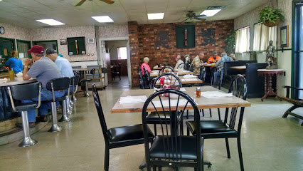
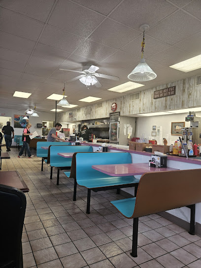
Low Gap Cafe
25.9 km
Discover culinary delights at Low Gap Cafe in Jasper - where American comfort meets Italian flair and fresh seafood in a charming setting.
Byrd's Mulberry Riverfront Restaurant
37.4 km
Experience exceptional American cuisine at Byrd's Mulberry Riverfront Restaurant with stunning views of the Mulberry River in Ozark, Arkansas.
Granny's Kitchen
38.9 km
Discover the heartwarming flavors of Southern cuisine at Granny's Kitchen in Huntsville, Arkansas - where every meal feels like home.
Crossbow Restaurant
39.1 km
Experience authentic American cuisine at Crossbow Restaurant in Huntsville - where flavor meets comfort in every dish.
Wrecked Canoe Bistro + Patio
44.1 km
Experience Southern hospitality at Wrecked Canoe Bistro + Patio with delicious cuisine and charming outdoor dining in Clarksville.
The Farmer’s Table Clarksville, AR
45.5 km
Experience authentic Southern flavors at The Farmer’s Table in Clarksville - where fresh ingredients meet cozy dining.
Slim's BBQ
45.6 km
Discover the authentic taste of Southern barbecue at Slim's BBQ in Witts Springs - where flavor meets tradition.
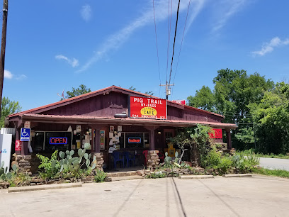
Pig Trail Bypass Country Cafe
46.3 km
Experience Southern hospitality at Pig Trail Bypass Country Cafe with mouthwatering hamburgers and charming ambiance in Elkins, Arkansas.
Paradise Pizza Pub
47.1 km
Discover mouthwatering pizzas and a cozy atmosphere at Paradise Pizza Pub in Ozark – perfect for families and friends alike.
Cattleman's Family Restaurant
52.5 km
Discover Cattleman's Family Restaurant: A cozy breakfast spot in Green Forest serving up delicious meals with local charm.
Subway
54.9 km
Experience fresh flavors and healthy fast food at Subway in Ozark - perfect for hungry travelers seeking quick satisfaction.

Wiederkehr Wine Cellar & Weinkeller Restaurant
55.3 km
Discover fine dining at Wiederkehr Wine Cellar & Weinkeller Restaurant in Arkansas, where local flavors meet exquisite wines amidst stunning Ozark scenery.
Ozark Food Mart
55.7 km
Savor delicious pizzas and local flavors at Ozark Food Mart – your go-to spot in Arkansas for quick bites and convenience.
Markets, malls and hidden boutiques
Rivendell Gardens
14.1 km
Explore Rivendell Gardens, a charming produce market in Parthenon, Arkansas, offering fresh local fruits and vegetables in a warm, inviting atmosphere.
Ozark National Forest
15.9 km
Discover the breathtaking beauty and endless adventures in the Ozark National Forest, Arkansas' natural treasure for hiking, camping, and wildlife exploration.
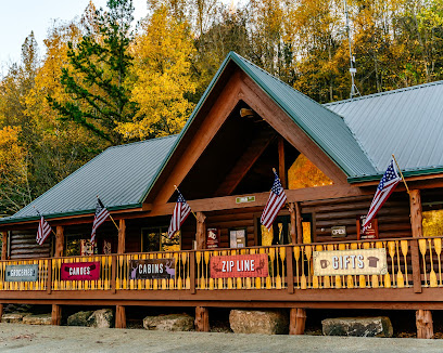
Lost Valley Canoe & Lodging
18.3 km
Discover the beauty of Arkansas at Lost Valley Canoe & Lodging, where adventure and nature come together for an unforgettable experience.
Scenic Point Gift Shop
23.8 km
Explore Scenic Point Gift Shop in Arkansas for unique souvenirs, local crafts, and a friendly shopping experience in a picturesque setting.
Wild Hare Gifts
24.7 km
Explore Wild Hare Gifts in Jasper, Arkansas, for unique, locally crafted souvenirs and delightful treasures that embody the spirit of the Ozarks.
The Crystal Cottage Rocks & Beads
24.7 km
Explore The Crystal Cottage Rocks & Beads for enchanting jewelry and unique natural stones in the heart of Jasper, Arkansas.
Bubba's Buffalo River Store
24.8 km
Discover unique souvenirs and local crafts at Bubba's Buffalo River Store in Jasper, Arkansas, your go-to shop for memorable keepsakes.
Paisley Sister llc
25.0 km
Explore unique gifts and local crafts at Paisley Sister LLC, a charming gift shop in Jasper, Arkansas, perfect for souvenirs and memorable finds.
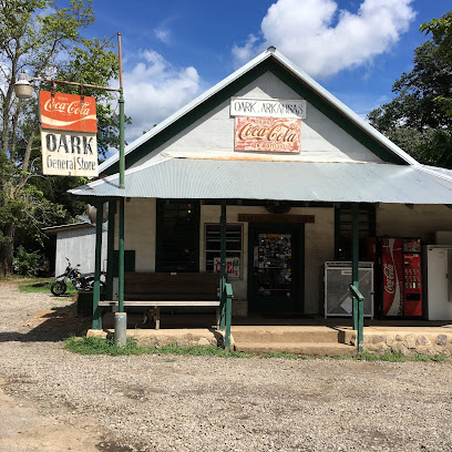
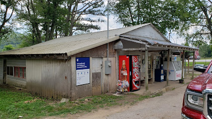
Oark General Store
25.1 km
Discover the charm of Oark General Store—where hearty meals and local treasures await in the scenic Arkansas Ozarks.
N.E. Dickerson Store
25.1 km
Explore the unique charm of N.E. Dickerson Store in Oark, Arkansas, where local goods and community spirit come together.
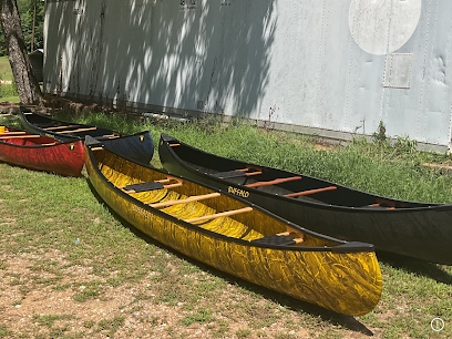
Buffalo Canoe Manufacturing
26.9 km
Discover Buffalo Canoe Manufacturing in Jasper, AR - your gateway to exceptional canoes, expert advice, and unforgettable outdoor adventures.
Mountainairdesignz
29.2 km
Shop, explore, and discover unbeatable deals at Mountainairdesignz, the ultimate outlet mall experience in Huntsville, Arkansas.

Little Mulberry Gallery
30.9 km
Explore the charm of the Ozarks at Little Mulberry Gallery, where unique handcrafted treasures and local artistry await every visitor.
Ahart's Grocery
33.7 km
Discover St. Paul through Ahart's Grocery, a community gem offering local goods, fresh produce, and the warmth of Southern hospitality.
Spyrock Graphics, Studio 5000 Gallery
33.9 km
Explore the unique charm of Spyrock Graphics, Studio 5000 Gallery, where local artistry meets delightful gift shopping in St. Paul, Arkansas.
Essential bars & hidden hideouts
Buffalo Outdoor Center
17.8 km
Experience the best of Arkansas at Buffalo Outdoor Center, where adventure meets nature in the stunning Ozark Mountains.
The Crooked Rooster Bar & Grill
39.1 km
Experience the vibrant flavors of The Crooked Rooster Bar & Grill, where local culinary delights meet a welcoming atmosphere in Huntsville, Arkansas.
Rooftop on Main
44.2 km
Discover Rooftop on Main in Clarksville, Arkansas - a premier American restaurant offering delicious food and stunning views in a vibrant atmosphere.
Crosswoods Restaurant & Sports Club
45.5 km
Discover the vibrant atmosphere at Crosswoods Restaurant & Sports Club, where delicious steaks meet lively sports entertainment in Clarksville, Arkansas.
The Oasis - Harrison's #1 Bar and Grill
45.8 km
Discover the vibrant atmosphere of The Oasis, Harrison's top bar and grill, featuring delicious food, live music, and a lively nightlife scene.
TallGrass Bar and Grill
48.6 km
Experience the delightful flavors and inviting atmosphere at TallGrass Bar and Grill in Harrison, Arkansas—your culinary oasis in the Ozarks.
Missouri Smoke, LLC
49.7 km
Experience the authentic taste of BBQ at Missouri Smoke, LLC in Everton, AR - a true gem for meat lovers seeking smoky satisfaction.
Buckets Sports Bar & Grill
50.4 km
Experience delicious grilled specialties and vibrant sports atmosphere at Buckets Sports Bar & Grill in Harrison, Arkansas, a top destination for food and fun.
Brew & Cue
52.3 km
Experience the vibrant nightlife of Green Forest, Arkansas at Brew & Cue, where great drinks and fun converge.
Bridget's Bigmouth Burgers
54.5 km
Experience the best of classic American burgers at Bridget's Bigmouth Burgers in Tilly, Arkansas, where flavor meets friendly service.
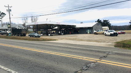
Haskel's
56.3 km
Discover Haskel's: A cozy gas station and restaurant in St. Joe, Arkansas, perfect for a hearty meal and convenient pit stop for travelers.
Tommy Deans
57.1 km
Experience the vibrant atmosphere of Tommy Deans, Altus' favorite bar offering affordable drinks and a welcoming community spirit.

Alligator Rays Cajun Sports Bar
57.1 km
Experience the vibrant Cajun cuisine and live music at Alligator Rays Cajun Sports Bar in Altus, Arkansas, where every meal is a celebration.

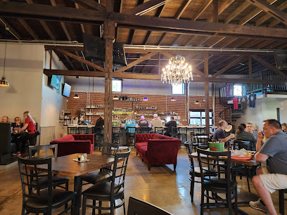
Arkansas Brewing Company
57.2 km
Experience the best of local craft beer and delectable cuisine at Arkansas Brewing Company in Ozark, Arkansas.
Jack's Sports Bar
57.3 km
Experience the vibrant nightlife at Jack's Sports Bar in Ozark, Arkansas, with delicious food, lively sports, and a welcoming atmosphere.

Nightclubs & after hour spots
Russellville Country Club - Public Welcome
63.0 km
Experience the beauty and camaraderie at Russellville Country Club, where golf and community meet in breathtaking Arkansas.

Club of the Ozarks
67.5 km
Experience tranquility and community at Club of the Ozarks, an adult day care center nestled in the beautiful Ozark Mountains of Eureka Springs, Arkansas.
IronGear Athletics
69.4 km
Experience the thrill of baseball and softball at IronGear Athletics, the premier batting cage center in Russellville, Arkansas.
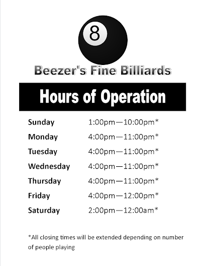
Beezer's Fine Billiards
70.9 km
Discover Beezer's Fine Billiards in Russellville, Arkansas - the ultimate pool hall experience for enthusiasts and newcomers alike, where fun meets community spirit.
H Club - Fayetteville
72.0 km
Discover H Club - Fayetteville, a chic lounge for signature cocktails and a lively atmosphere in the heart of Arkansas.
Fraternal Order of Eagles
72.2 km
Explore the Fraternal Order of Eagles in Russellville, AR, for a unique blend of fun, community, and local culture, perfect for every visitor.
The Piano Bar
72.3 km
Experience the vibrant nightlife at The Piano Bar in Fayetteville, where live music and delicious drinks create unforgettable moments.

Peppermint Hippo
72.5 km
Unleash your nightlife experience at Peppermint Hippo in Fayetteville, Arkansas, where entertainment, drinks, and vibrant performances await you.

Infusion Bar
72.5 km
Discover Fayetteville's premier karaoke and nightlife destination at Infusion Bar, where fun, music, and great drinks come together for an unforgettable night.

C4 Nightclub & Lounge
72.6 km
Discover Fayetteville's premier nightlife destination at C4 Nightclub & Lounge, where music, dance, and community come together for an unforgettable experience.

Vip Club
72.6 km
Discover Fayetteville's nightlife at Vip Club, where music, dancing, and vibrant energy create unforgettable nights out.

Crown Club
72.6 km
Experience the electrifying nightlife of Crown Club in Fayetteville, where unforgettable memories are made every night.
Zabana Night Club
72.9 km
Discover the electrifying atmosphere at Zabana Night Club in Springdale, Arkansas – where vibrant nights and lively crowds come together!
Bottoms Up Club
73.2 km
Experience the vibrant nightlife at Bottoms Up Club, Fayetteville's top destination for adult entertainment with thrilling performances and a welcoming atmosphere.
Pachanga Night Club
73.8 km
Pachanga Night Club: A vibrant nightlife escape in Springdale, Arkansas featuring energetic music and a lively dance scene for unforgettable evenings.