

Free Atherton Tablelands Travel Guide & Mobile App
Explore Atherton Tablelands with free travel guides. Discover regional history, expert tips, proposed trips, and audio guides on web or mobile app.


Explore the Atherton Tablelands for crater lakes, rainforest wildlife, waterfalls, cool-climate farms, coffee country and historic highland towns.
Read more about Atherton Tablelands
When is the best time to visit Atherton Tablelands?
Best: June, August–September · 20–23°C| Month | High (°C) | Rainfall (mm) |
|---|---|---|
| January | 28 | 220 |
| February | 27 | 200 |
| March | 27 | 180 |
| April | 25 | 140 |
| May | 22 | 100 |
| June (best) | 20 | 60 |
| July | 20 | 60 |
| August (best) | 20 | 60 |
| September (best) | 23 | 70 |
| October | 25 | 120 |
| November | 26 | 140 |
| December | 27 | 180 |
Getting to and around Atherton Tablelands
How to get there
Transportation
Top city travel guides in Atherton Tablelands
The cities of Atherton Tablelands, and the easiest places to base yourself.
-

-


Swipe for more cities
Destinations in Atherton Tablelands
Resorts, valleys and scenic spots worth a trip of their own.
-

-

-

-
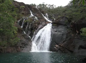


Swipe for more destinations
Best attractions in Atherton Tablelands
The Atherton Tablelands combine natural, agricultural and historical attractions across a substantial upland area. Around Yungaburra and Lake Eacham, rainforest walks, birdwatching and crater-lake scenery provide a gentle introduction to the Wet Tropics, while Lake Barrine offers another forest-fringed volcanic setting. Lake Tinaroo, near the central tablelands, is associated with boating, fishing, camping and water-based recreation, subject to local conditions and regulations. The waterfall country around Malanda and Millaa Millaa includes short walks, forest viewpoints and pastoral scenery. Around Mareeba, the climate becomes drier and sunnier, with coffee farms, orchards, wineries, the Mareeba Wetlands and Granite Gorge offering different landscapes and wildlife experiences. Atherton's museums and heritage sites explain the region's mining, farming, timber and Chinese-Australian history, while Herberton preserves a strong connection with the mining era. Outdoor activities range from birdwatching and wildlife observation to cycling, hiking, fishing and scenic driving. Attractions are dispersed, so the best itineraries group places by district rather than attempting to cover the entire plateau in one hurried circuit.
-
Scenic spot
Crystal Cascades
Discover a hidden paradise near Cairns: Crystal Cascades, where refreshing waterfalls meet lush rainforest. The perfect freshwater escape!
-
Tourist attraction
Historic Village Herberton
Explore Queensland's pioneering past at this expansive open-air museum with over 60 original buildings and thousands of authentic artifacts.
-
Tourist attraction
The Crystal Caves
Explore the magical world of crystals and minerals at The Crystal Caves in Atherton, Queensland, a must-visit destination for tourists seeking wonder and beauty.
-
Tourist attraction
Curtain Fig Tree
Explore the Curtain Fig Tree in East Barron - a stunning natural attraction showcasing the beauty of Australia's unique flora and fauna.
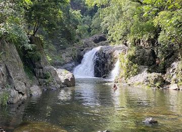


Best landmarks in Atherton Tablelands
The Curtain Fig Tree near Yungaburra is one of the Atherton Tablelands' most recognisable natural landmarks: its extensive aerial roots create a dramatic curtain-like form that illustrates the competitive life of rainforest trees. Lake Eacham and Lake Barrine are prominent volcanic crater lakes, surrounded by forest and valued for both their geological history and tranquil setting. Mount Hypipamee, within the Wet Tropics rainforest, combines a deep volcanic diatreme with the nearby Dinner Falls area and is an important landscape feature of the eastern tablelands. Atherton's Hou Wang Temple is a significant surviving reminder of the region's Chinese-Australian community, while the old mining town of Herberton preserves buildings and streetscapes connected with the tin-mining era. In Mareeba, the historic airfield represents the plateau's wartime aviation role. Lake Tinaroo is a major modern landmark, its broad waters occupying the Barron River valley and contrasting with the natural crater lakes farther east.
-
Park
Paronella Park
Uncover the history and beauty of Paronella Park, a stunning heritage site in Queensland with captivating gardens, waterfalls, and dramatic ruins.
-
Tourist attraction
Millaa Millaa Falls
Discover the beauty of Millaa Millaa Falls, a heritage-listed waterfall surrounded by lush rainforest in Queensland's Atherton Tablelands. Perfect for a refreshing swim!
-
Tourist attraction
Australian Butterfly Sanctuary
Explore the vibrant world of butterflies at the Australian Butterfly Sanctuary in Kuranda, Queensland - a must-visit wildlife haven for nature lovers.
-
Tourist attraction
Babinda Boulders
Discover the natural beauty and Aboriginal legends of Babinda Boulders, a refreshing rainforest escape just south of Cairns.


Explore Atherton Tablelands on the map
Plan your trip on one map. See where the top cities, national parks and sights are, and book hotels and experiences in a few clicks.
Best hotels in Atherton Tablelands
Best restaurants in Atherton Tablelands
Dining on the Atherton Tablelands reflects its agricultural diversity and cooler highland climate. Cafés and country restaurants use Queensland produce, while farm outlets and local markets provide opportunities to find tropical fruit, vegetables, coffee, macadamias, preserves and other regional products. Mareeba is particularly associated with coffee growing and dry-country orchards, whereas the wetter districts around Malanda and Millaa Millaa are strongly linked with dairy farming and pasture. Traditional hotels, bakeries and rural pubs remain useful for hearty meals, and Yungaburra has a concentration of cafés and restaurants serving visitors near the crater lakes. Menus are generally Australian and contemporary rather than based on one narrowly defined regional cuisine, with local produce appearing alongside familiar café dishes, seafood brought from the coast and multicultural influences from the tablelands' farming communities. Opening days and meal services can be limited outside the larger towns, so plan ahead when travelling between attractions.
-
Coffee shop
Whistle Stop Café on Louise
Experience local flavors at Whistle Stop Café on Louise - your go-to coffee shop in Atherton offering delightful brews and homemade treats.
-
 Pub
Atherton Hotel
Discover delightful dining at Atherton Hotel in Queensland – where local flavors meet a vibrant pub atmosphere.
-
Cafe
Gallo Dairyland
Explore Gallo Dairyland in East Barron: A hidden gem for cheese lovers and coffee enthusiasts amidst stunning Queensland scenery.
-
Cafe
Petals and Pinecones (P&P)
Discover the charm of Petals and Pinecones Cafe in Atherton—where delicious breakfasts meet aromatic coffee in a cozy setting.


Best bars in Atherton Tablelands
Evenings on the Atherton Tablelands are centred on traditional pubs, hotel dining rooms, cafés and occasional live-music or community events rather than a large nightclub scene. Atherton and Mareeba have the broadest choice of evening venues, while Yungaburra offers a quieter restaurant-and-pub atmosphere suited to visitors staying near the lakes. In smaller towns such as Malanda, Millaa Millaa and Herberton, nightlife is generally early and local, with social activity focused on pubs, clubs and seasonal gatherings. Some producers and hospitality businesses offer tastings during the day or early evening, but availability varies and responsible drinking is important on rural roads. Arrange a designated driver or local transport before sampling alcoholic drinks, as distances are considerable and late-night public transport is limited.
-
Coffee shop
Whistle Stop Café on Louise
Discover the cozy charm of Whistle Stop Café on Louise in Atherton, where delightful coffee and delicious food await every visitor.
-
Pub
Tolga Hotel
Experience the best of Queensland at Tolga Hotel, where local cuisine, refreshing drinks, and cozy accommodations await you.
-
Pub
Atherton Hotel
Discover the vibrant Atherton Hotel, a local pub offering exceptional food, drinks, and a lively atmosphere in the heart of Atherton, Queensland.
-
Cafe
Petals and Pinecones (P&P)
Discover the charm of Petals and Pinecones in Atherton, Queensland—a delightful café for breakfast and coffee lovers in a serene setting.


Best nightclubs in Atherton Tablelands
Evenings on the Atherton Tablelands are centred on traditional pubs, hotel dining rooms, cafés and occasional live-music or community events rather than a large nightclub scene. Atherton and Mareeba have the broadest choice of evening venues, while Yungaburra offers a quieter restaurant-and-pub atmosphere suited to visitors staying near the lakes. In smaller towns such as Malanda, Millaa Millaa and Herberton, nightlife is generally early and local, with social activity focused on pubs, clubs and seasonal gatherings. Some producers and hospitality businesses offer tastings during the day or early evening, but availability varies and responsible drinking is important on rural roads. Arrange a designated driver or local transport before sampling alcoholic drinks, as distances are considerable and late-night public transport is limited.
-
Pub
Atherton Hotel
Discover the charm of Atherton Hotel - a vibrant pub and bistro offering delicious food and drinks in the heart of Queensland's Atherton.
-
Bar
Barron Valley Hotel
Experience the charm of Atherton at Barron Valley Hotel, where history meets modern comfort in a welcoming atmosphere.
-
Bar
The Downunder Bar
Experience the vibrant nightlife at The Downunder Bar in Cairns, offering karaoke, delicious pub fare, and a lively atmosphere for all visitors.
-
Restaurant
The Cotton Club
Experience the vibrant fusion of dining and nightlife at The Cotton Club, Cairns' premier restaurant and entertainment venue.


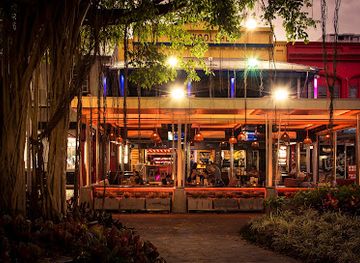
Best shops in Atherton Tablelands
Shopping across the Atherton Tablelands is practical, local and closely tied to farming. Atherton and Mareeba provide the broadest everyday choice, including supermarkets, independent retailers, cafés and services, while Yungaburra has a more visitor-oriented selection of galleries, craft outlets, books, antiques and small gift shops. Markets and farm stalls are good places to look for coffee, macadamias, tropical fruit, preserves, honey and handmade goods, although trading days and stock vary by season. Around the plateau, cellar doors and farm outlets may sell locally produced drinks, food and craft items, but it is wise to check opening arrangements before making a special journey. Heritage towns such as Herberton lend themselves to browsing for antiques and historically themed souvenirs. Regional purchases are most meaningful when they reflect the tablelands' agricultural and creative communities rather than generic Australian merchandise.
-
Gift shop
The Crystal Caves
Explore the stunning beauty of The Crystal Caves in Atherton, where nature's artistry meets unique treasures and unforgettable experiences.
-
Department store
BIG W Atherton
Discover a diverse range of products at BIG W Atherton, your go-to department store for all shopping needs in Queensland.
-
Shopping mall
Silo Central Shopping Centre
Explore the vibrant Silo Central Shopping Centre in Atherton, where shopping meets local culture and culinary delights.
-
Shopping mall
Atherton Square
Discover Atherton Square: a vibrant shopping mall in Queensland brimming with retail delights, dining, and community events for all ages.


Get your free copy of our complete guide to Atherton Tablelands, delivered straight to you.
Everything on this page, from attractions and restaurants to essentials and local phrases, in one PDF you can read offline, print or share.
Already have an account? Sign in
Your Atherton Tablelands guide is ready.
We'll send it to · Not you? Sign out

Getting your guide ready…
We are putting together a fresh copy of the Atherton Tablelands guide. This can take up to a minute.
This can take a few moments. If your browser asks, choose Allow so the download can start. You'll find the guide in your Downloads folder.
Nothing happened? Download it again
Sorry, the guide is taking longer than usual. Please try again in a minute, or get it by email instead.
Atherton Tablelands essentials
Currency and Payment
Safety
Emergency Situations
Do's and Don'ts
Local Tips
From Eve
Local phrases worth knowing
You don't need to get them perfect. A few words go a long way, and locals appreciate the effort.
Basics
| English | Local | Say it |
|---|---|---|
| Hello | G'day | [guh-day] |
| Goodbye | See ya | [see yah] |
| Yes | Yeah | [yeh] |
| No | Nah | [nah] |
| Please/You're welcome | No worries | [no wurries] |
| Thank you | Cheers | [cheers] |
| Excuse me/Sorry | Sorry mate | [sorry mate] |
| How are you? | How's it going? | [how's it goin'?] |
| Fine. And you? | Good, you? | [good, you?] |
| Do you speak English? | Do ya speak English? | [do ya speak English?] |
| I don't understand | I don't get it | [I don't get it] |
Eating & Drinking
| English | Local | Say it |
|---|---|---|
| I'd like to see the menu, please | Can I see the menu, please? | [can I see the menu, please?] |
| I don't eat meat | I'm a vegetarian | [I'm a vegetarian] |
| Cheers! | Cheers! | [cheers] |
| I would like to pay, please | Can I get the bill, please? | [can I get the bill, please?] |
Emergencies
| English | Local | Say it |
|---|---|---|
| Help! | Help! | [help] |
| Go away! | Get lost! | [get lost] |
| Call the Police! | Call the coppers! | [call the coppers] |
| Call a doctor! | Get a doctor! | [get a doctor] |
| I'm lost | I'm a bit lost | [I'm a bit lost] |
| I'm ill | I'm not feeling well | [I'm not feelin' well] |
Shopping
| English | Local | Say it |
|---|---|---|
| I'd like to buy... | I want to buy... | [I want to buy...] |
| I'm just looking | Just having a look | [just having a look] |
| How much is it? | How much is this? | [how much is this?] |
| That's too expensive | That's a bit pricey | [that's a bit pricey] |
| Can you lower the price? | Can you drop the price? | [can you drop the price?] |
Time & Numbers
| English | Local | Say it |
|---|---|---|
| What time is it? | What time is it? | [what time is it?] |
| It's one o'clock | It's one o'clock | [it's one o'clock] |
| Half past (10) | Half past ten | [half past ten] |
| Morning | Morning | [morning] |
| Afternoon | Arvo | [arvo] |
| Evening | Evening | [evening] |
| Yesterday | Yesterday | [yesterday] |
| Today | Today | [today] |
| Tomorrow | Tomorrow | [tomorrow] |
| 1 | One | [one] |
| 2 | Two | [two] |
| 3 | Three | [three] |
| 4 | Four | [four] |
| 5 | Five | [five] |
| 6 | Six | [six] |
| 7 | Seven | [seven] |
| 8 | Eight | [eight] |
| 9 | Nine | [nine] |
| 10 | Ten | [ten] |
Transport & Directions
| English | Local | Say it |
|---|---|---|
| Where's a/the...? | Where's the...? | [where's the...?] |
| What's the address? | What's the address? | [what's the address?] |
| Can you show me (on the map)? | Can you show me on the map? | [can you show me on the map?] |
| When's the next (bus)? | When's the next bus? | [when's the next bus?] |
| A ticket (to ....) | A ticket to... | [a ticket to...] |
History of Atherton Tablelands
First Peoples and Rainforest Country
The Atherton Tablelands are part of the traditional lands of several Aboriginal peoples, including the Ngadjonji, Djirribal, Mbabaram and associated communities. Their knowledge, movement through the landscape and continuing cultural connections pre-date European settlement by many thousands of years. Rainforest, volcanic lakes, rivers and highland resources were not isolated features but part of living cultural landscapes. Visitors should recognise that some places have specific cultural significance and that public access does not erase those connections. Contemporary interpretation and Indigenous-led experiences are important ways to approach the region with greater understanding.
Volcanic Landscapes and Early European Exploration
European exploration of the highlands increased during the nineteenth century as pastoralists, prospectors and surveyors moved inland from the coastal settlements. The plateau's fertile volcanic soils, cooler climate and reliable rainfall encouraged closer investigation, while the Great Dividing Range presented a substantial barrier between the coast and the interior. The crater lakes, basalt country and rainforest later became important to both scientific study and tourism. Roads and townships developed gradually, following routes that connected the mining fields and pastoral districts with Cairns and the coast.
Gold, Tin and the Growth of Highland Towns
Mining was a major force in the development of the tablelands during the late nineteenth and early twentieth centuries. Tin mining around Herberton and Irvinebank, together with gold and other mineral workings, brought prospectors, stores, transport services and government administration to the uplands. Herberton retains some of the clearest reminders of this era, while Atherton, Mareeba and surrounding settlements grew as commercial and agricultural centres. Mining declined in importance over time, but its roads, buildings, cemeteries and surviving machinery remain part of the region's historical landscape.
Chinese Settlement and Agricultural Enterprise
Chinese market gardeners and traders made an important contribution to the tablelands from the late nineteenth century, particularly around Atherton and other farming districts. They supplied fresh vegetables to growing mining and town populations and participated in regional commerce despite discriminatory laws and social restrictions. Atherton's Hou Wang Temple, associated with the area's Chinese community, is a significant surviving cultural landmark. Its presence helps explain how migration, farming and trade shaped the region beyond the more familiar stories of European pastoral settlement.
Timber, Railways and Dairy Farming
Timber harvesting and railway construction transformed the highlands in the late nineteenth and early twentieth centuries. Rail connections improved the movement of timber, minerals, livestock and farm produce, while mills and sidings supported new settlements. In the wetter districts, dairy farming expanded on fertile pasture, and the tablelands became an important supplier to North Queensland. Yungaburra, Malanda and Millaa Millaa retain buildings and streetscapes associated with this period of agricultural consolidation. The railway network later contracted, leaving roads as the principal means of exploring the region.
War, Aviation and Mareeba
The tablelands acquired strategic importance during the Second World War because of their elevation, relatively open terrain and position near the north Queensland coast. Mareeba Airfield became a major military aviation base, used by Australian and Allied forces, and the wider region supported training, logistics and accommodation. The former airfield remains part of Mareeba's identity and is associated with aviation history and local heritage interpretation. Wartime activity accelerated connections between the tablelands and Cairns while leaving a lasting imprint on the region's infrastructure and memories.
From Tobacco and Mixed Farming to Diversified Produce
After the war, tobacco became an important cash crop in parts of the Atherton Tablelands, alongside dairy, maize, timber and market gardening. Changes in agricultural economics and tobacco regulation eventually reduced its importance, prompting many growers to diversify. Coffee, mangoes, avocados, bananas, macadamias and other crops now contribute to the region's agricultural identity, with farm tourism and local food businesses adding new dimensions. This transition explains the striking variety of orchards, pasture, plantations and small-scale producers visible while travelling across the plateau.
Atherton Tablelands in Photos
Browse through our photo collection highlighting the charm and character of the destination.
Neighbouring regions of Atherton Tablelands
The closest regions to Atherton Tablelands, if you have time for more than one.
-

-

-

-

-


Swipe for more regions
Explore more

Explore more of Australia
Discover the diverse landscapes, vibrant cities, and unique wildlife of Australia, a captivating destination offering endless adventures and unforgettable experiences.
Explore Australia