

Jervis Bay Travel Guide - Free Web & App
Your ultimate guide to Jervis Bay. Discover top landmarks, proposed trips, and local tips. Free on the web or via the Evendo companion app.


Jervis Bay, Australia, combines turquoise waters, white-sand beaches, whale watching, Booderee National Park and coastal villages for memorable outdoor escapes.
A Sheltered Coastal Landscape
Jervis Bay curves around a broad, sheltered inlet on the south coast of New South Wales, about three hours' drive south of Sydney. Its clear waters, long beaches, rocky headlands and forested hinterland create a destination with several distinct identities: a seaside holiday area, a marine environment, an Aboriginal cultural landscape and a gateway to protected coastal country. The bay itself is shared between New South Wales and the separately administered Jervis Bay Territory, while the surrounding visitor region includes Huskisson, Vincentia, Hyams Beach, Currarong and the coastal settlements of the Shoalhaven.Read more about Jervis Bay
Protected Coast and Marine Life
Villages, Water and Country
When is the best time to visit Jervis Bay?
Best: April, September–October · 24–27°C| Month | High (°C) | Rainfall (mm) |
|---|---|---|
| January | 29 | 77 |
| February | 29 | 72 |
| March | 28 | 75 |
| April (best) | 25 | 74 |
| May | 22 | 78 |
| June | 20 | 76 |
| July | 19 | 71 |
| August | 21 | 74 |
| September (best) | 24 | 76 |
| October (best) | 27 | 73 |
| November | 28 | 69 |
| December | 29 | 73 |
Getting to and around Jervis Bay
How to get there
Transportation
Best attractions in Jervis Bay
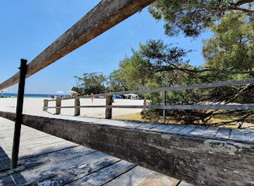
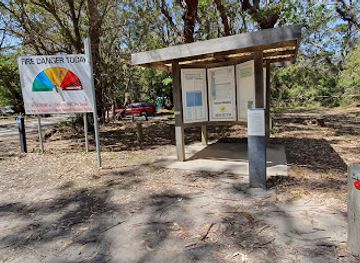
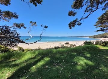
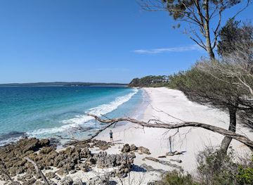
Booderee National Park is the principal attraction on Jervis Bay's southern peninsula, combining beaches, coastal heath, woodland, lagoons and Aboriginal cultural heritage. Murrays Beach is a popular access point for the park's sheltered southern coast, while Cave Beach offers a more exposed ocean setting and is associated with a nearby campground. Booderee Botanic Gardens provide an accessible introduction to the region's native flora and cultural landscape. Around the western shore, Hyams Beach, Chinamans Beach and Nelsons Beach offer different perspectives on the bay's clear, sheltered water, while Huskisson is the departure point for many marine excursions. The northern side leads towards Currarong and Abrahams Bosom Reserve, where coves, headlands and walking tracks create a rougher coastal character. Jervis Bay Marine Park adds opportunities for dolphin watching, snorkelling, diving and boating, subject to conditions and local rules, while whale watching is a seasonal activity rather than a guaranteed sighting.
-
National park
Green Patch Campsite
Discover Green Patch in Booderee National Park: pristine beaches, lush forests, and abundant wildlife await in this coastal camping paradise.
-
Camping Ground
Honeymoon Bay
Discover the tranquility of Honeymoon Bay, a camping ground surrounded by stunning landscapes and crystal-clear waters in Currarong, NSW.
-
Tourist attraction
Moona Moona Park
Experience the stunning beauty of Moona Moona Park in Huskisson, a perfect destination for families and nature lovers seeking outdoor adventures.
-
Tourist attraction
White Sands Park
Enjoy a serene escape at White Sands Park, a picturesque destination in Huskisson, New South Wales, perfect for relaxation and outdoor adventures.
Best landmarks in Jervis Bay
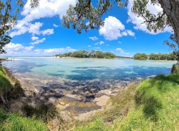
Jervis Bay's defining landmark is the broad, sheltered bay itself, framed by Beecroft Peninsula to the north and the Booderee peninsula to the south. Point Perpendicular, with its prominent cliffs and lighthouse, marks the northern entrance and has long served as a coastal navigation reference, although access to particular sites may be managed separately from the main visitor areas. Booderee National Park's beaches, headlands and coastal heath are significant both ecologically and culturally, while Booderee Botanic Gardens preserves and interprets native plant communities in the Jervis Bay Territory. Huskisson's maritime history is represented through its museum and surviving connections with shipbuilding and coastal transport. The marine park is an equally important natural landmark in practical terms, protecting the underwater landscapes and habitats that support the bay's dolphins, fish, seabirds and seasonal whales.
-
National park
Jervis Bay National Park
Explore the pristine beauty and diverse wildlife of Jervis Bay National Park, a coastal gem in New South Wales perfect for nature lovers and adventure seekers.
-
Camping Ground
Honeymoon Bay
Experience the breathtaking beauty of Honeymoon Bay in Currarong, NSW – a serene camping ground perfect for nature lovers and adventure seekers.
-
Park
Moona Moona Park
Experience the beauty of nature at Moona Moona Park, a lush oasis in Huskisson, perfect for relaxation, picnics, and family fun.
-
Park
White Sands Park
Experience the tranquil beauty of White Sands Park in Huskisson, where lush landscapes and stunning beaches create the perfect escape for tourists.

Explore Jervis Bay on the map
Plan your trip on one map. See where the top attractions, landmarks, restaurants and hotels are, and book hotels and experiences in a few clicks.
Best hotels in Jervis Bay
Best restaurants in Jervis Bay
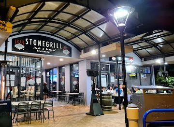
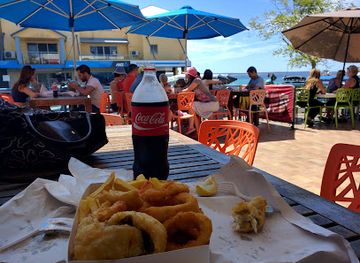
Jervis Bay's dining options are concentrated in the coastal settlements rather than inside its protected reserves. Huskisson has the broadest selection of cafés, casual restaurants, takeaway outlets and licensed venues, with the waterfront setting shaping much of the local eating experience. Vincentia and nearby villages provide further cafés and everyday dining, while holiday houses and self-catering accommodation make local shops useful for assembling meals. Menus commonly reflect the South Coast's relationship with the sea and surrounding agricultural country, including Australian café food, seafood when available, locally produced ingredients and contemporary pub-style dishes. Farm shops, bakeries and small food businesses can be useful stops on road trips, but remote beaches and park areas generally have no dependable food outlets, so visitors should carry supplies and check current opening arrangements in smaller settlements.
-
Restaurant
Huskisson Hotel
Experience coastal charm at Huskisson Hotel - where dining meets stunning views in New South Wales' beautiful Jervis Bay.
-
Cafe
5 Little Pigs
Experience delightful breakfasts and artisanal coffee at 5 Little Pigs in Huskisson - your perfect coastal cafe getaway.
-
Restaurant
Stonegrill Huskisson
Discover exquisite seafood and premium steaks at Stonegrill Huskisson - where every meal is an unforgettable culinary adventure.
-
Fish & Chips
World Famous Fish N Chips
Experience iconic Australian fish and chips at World Famous Fish N Chips in Huskisson - fresh flavors by the sea!

Best bars in Jervis Bay
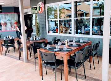
Jervis Bay is not a nightclub destination, and evening entertainment is centred on relaxed hospitality in the villages. Huskisson has the most developed evening scene, with pubs, licensed restaurants and casual bars where visitors can eat or have a drink after time on the water. Vincentia and other settlements offer a quieter selection of local venues, while accommodation in the surrounding area often provides the base for low-key evenings rather than late-night entertainment. Seasonal events, community gatherings and occasional live performances may add variety, but their timing and availability change. Outside the villages, darkness, wildlife protection and limited services shape the experience: Booderee National Park and the beaches are places for quiet observation of the night landscape, not for amplified entertainment or informal parties.
-
Bar
Huskisson Hotel
Discover the Huskisson Hotel: A coastal retreat blending bar, restaurant, and hotel experiences with stunning views and local flavors.
-
Cafe
5 Little Pigs
Savor fresh and delicious breakfast and lunch at 5 Little Pigs, a charming café in Huskisson known for its local produce and expertly brewed coffee.
-
Restaurant
Stonegrill Huskisson
Savor the unique dining experience at Stonegrill Huskisson, where fresh seafood and steaks are cooked to perfection on hot stones.
-
Italian
Pasta & Pizza Peter Eva Italian restaurant
Experience authentic Italian cuisine at Pasta & Pizza Peter Eva, where every bite takes you on a journey to Italy's culinary heart.


Best nightclubs in Jervis Bay
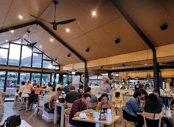
Jervis Bay is not a nightclub destination, and evening entertainment is centred on relaxed hospitality in the villages. Huskisson has the most developed evening scene, with pubs, licensed restaurants and casual bars where visitors can eat or have a drink after time on the water. Vincentia and other settlements offer a quieter selection of local venues, while accommodation in the surrounding area often provides the base for low-key evenings rather than late-night entertainment. Seasonal events, community gatherings and occasional live performances may add variety, but their timing and availability change. Outside the villages, darkness, wildlife protection and limited services shape the experience: Booderee National Park and the beaches are places for quiet observation of the night landscape, not for amplified entertainment or informal parties.
-
Bar
Huskisson Hotel
Discover the perfect blend of relaxation and excitement at Huskisson Hotel, a vibrant bar, restaurant, and hotel overlooking stunning bay views.
-
RSL Club
Club Jervis Bay
Discover the lively Club Jervis Bay, where local flavors and a friendly atmosphere create unforgettable dining experiences in Huskisson.
-
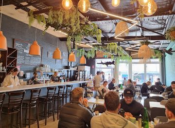
Bar
Salty Joe's
Discover the vibrant atmosphere and delicious coastal cuisine at Salty Joe's, the perfect spot for tourists in Huskisson.
-
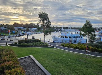
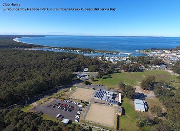
Club
Husky Sports
Discover the vibrant atmosphere of Husky Sports Club, a premier destination for dining, drinks, and unforgettable nightlife in Huskisson.
Best shops in Jervis Bay
Shopping in Jervis Bay is practical and locally scaled rather than centred on a large retail district. Huskisson provides the widest range of visitor-oriented businesses, including boutiques, galleries, small independent shops, food outlets and stores serving boating and beach activities. Vincentia and other nearby settlements supply everyday groceries, beach necessities and services, while local markets and seasonal community events may offer crafts, artwork, plants or regional produce when operating. Visitors can look for South Coast food products, locally made art and small-batch goods, but stock and opening arrangements vary. There are no extensive shopping facilities within Booderee National Park, so provisions, fuel, medication and specialist equipment should be arranged in the larger settlements before heading into the park or towards the more isolated northern and southern coastlines.
-
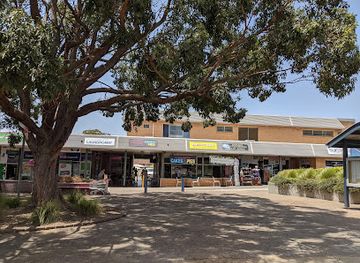
Shopping mall
Vincentia Shopping Village
Explore Vincentia Shopping Village, a charming hub of shopping and community spirit in New South Wales, offering a variety of unique shops and local events.
-
Supermarket
Jervis Bay Supermarket
Discover Jervis Bay Supermarket, your one-stop shop for local produce and essentials in the beautiful coastal region of Jervis Bay.
-
Coffee shop
Jervis Bay Coffee Co
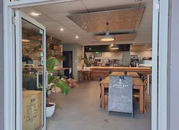
Experience the best of Jervis Bay at Jervis Bay Coffee Co, where quality coffee meets a charming coastal atmosphere.
-
Gift shop
Kiki - The Hippie Shop
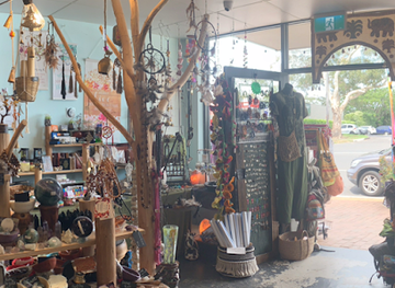
Discover a vibrant collection of unique gifts, clothing, and homewares at Kiki - The Hippie Shop in Huskisson, where bohemian spirit comes alive.

Get your free copy of our complete guide to Jervis Bay, delivered straight to you.
Everything on this page, from attractions and restaurants to essentials and local phrases, in one PDF you can read offline, print or share.
Already have an account? Sign in
Your Jervis Bay guide is ready.
We'll send it to · Not you? Sign out

Getting your guide ready…
We are putting together a fresh copy of the Jervis Bay guide. This can take up to a minute.
This can take a few moments. If your browser asks, choose Allow so the download can start. You'll find the guide in your Downloads folder.
Nothing happened? Download it again
Sorry, the guide is taking longer than usual. Please try again in a minute, or get it by email instead.
Jervis Bay essentials
Currency and Payment
Safety
Emergency Situations
Do's and Don'ts
Local Tips
From Eve
Local phrases worth knowing
You don't need to get them perfect. A few words go a long way, and locals appreciate the effort.
Basics
| English | Local | Say it |
|---|---|---|
| Hello | G'day | [g'day] |
| Goodbye | See ya | [see ya] |
| Yes | Yeah | [yeah] |
| No | Nah | [nah] |
| Please/You're welcome | No worries | [no worries] |
| Thank you | Cheers | [cheers] |
| Excuse me/Sorry | Sorry mate | [sorry mate] |
| How are you? | How ya goin'? | [how ya goin'] |
| Fine. And you? | Good. You? | [good. you?] |
| Do you speak English? | You speak English? | [you speak English?] |
| I don't understand | I'm lost mate | [I'm lost mate] |
Eating & Drinking
| English | Local | Say it |
|---|---|---|
| I'd like to see the menu, please | Can I check the menu? | [can I check the menu?] |
| I don't eat meat | I'm vego | [I'm vego] |
| Cheers! | Cheers! | [cheers!] |
| I would like to pay, please | Can I pay now, please | [can I pay now, please] |
Emergencies
| English | Local | Say it |
|---|---|---|
| Help! | Help! | [help!] |
| Go away! | Bugger off! | [bugger off!] |
| Call the Police! | Ring the cops! | [ring the cops!] |
| Call a doctor! | Get a doc! | [get a doc!] |
| I'm lost | I'm lost | [I'm lost] |
| I'm ill | I'm crook | [I'm crook] |
Shopping
| English | Local | Say it |
|---|---|---|
| I'd like to buy... | I'm keen to buy... | [I'm keen to buy...] |
| I'm just looking | Just browsing | [just browsing] |
| How much is it? | How much? | [how much?] |
| That's too expensive | Too dear mate | [too dear mate] |
| Can you lower the price? | Can you do a better price? | [can you do a better price?] |
Time & Numbers
| English | Local | Say it |
|---|---|---|
| What time is it? | What's the time? | [what's the time?] |
| It's one o'clock | It's one | [it's one] |
| Half past (10) | Half ten | [half ten] |
| Morning | Mornin' | [mornin'] |
| Afternoon | Arvo | [arvo] |
| Evening | Evenin' | [evenin'] |
| Yesterday | Yesty | [yesty] |
| Today | Today | [today] |
| Tomorrow | Tomorra | [tomorra] |
| 1 | One | [one] |
| 2 | Two | [two] |
| 3 | Three | [three] |
| 4 | Four | [four] |
| 5 | Five | [five] |
| 6 | Six | [six] |
| 7 | Seven | [seven] |
| 8 | Eight | [eight] |
| 9 | Nine | [nine] |
| 10 | Ten | [ten] |
Transport & Directions
| English | Local | Say it |
|---|---|---|
| Where's a/the...? | Where's the...? | [where's the...?] |
| What's the address? | What's the addy? | [what's the addy?] |
| Can you show me (on the map)? | Show me (on the map), please | [show me (on the map), please] |
| When's the next (bus)? | When's the next (bus)? | [when's the next (bus)?] |
| A ticket (to ....) | A ticket (to ....) | [a ticket (to ....)] |
History of Jervis Bay
Coastal Formation and Country
Jervis Bay is a drowned river valley formed as rising sea levels flooded a coastal valley after the last Ice Age. Its sheltered waters, sandy beaches, headlands and offshore marine habitats developed within this wider south-coast setting. Long before European arrival, the region was Aboriginal Country associated with Dharawal and Yuin peoples, whose cultural knowledge, seasonal movement and relationship with coastal resources remain central to the area's identity. Shellfish, fish, plant foods and other resources supported sustained cultural use of the shore, forest and waterways.
European Exploration and Settlement
European exploration of the bay occurred during the late eighteenth century, including the voyage of George Bass in 1797. Pastoral settlement and timber-getting later altered parts of the surrounding landscape, while the sheltered bay encouraged maritime activity. Huskisson developed as a port and shipbuilding centre, particularly during the nineteenth and early twentieth centuries, when local timber and coastal transport connected the settlement with wider markets. The surviving townscape and maritime associations help explain why Huskisson remains the area's principal service and boating hub.
Timber, Shipbuilding and Maritime Industry
The forests around Jervis Bay supplied valuable hardwood, and shipbuilding became an important local industry at Huskisson. Vessels were constructed and repaired there during the nineteenth century and into the early twentieth century, linking the community to coastal trade and transport. The industry declined as timber resources, technology and transport patterns changed, but maritime heritage continues through the Jervis Bay Maritime Museum and the area's working relationship with the water. Fishing, boating and tourism have subsequently become more visible parts of the local economy.
The Jervis Bay Territory
In 1915, the Commonwealth acquired land around the southern shore of Jervis Bay from New South Wales to provide the Australian Capital Territory with access to the coast. This created the Jervis Bay Territory, which is administered by the Australian Government rather than the New South Wales government. Its boundaries help explain the different management arrangements encountered by visitors: Booderee National Park is jointly managed by the Wreck Bay Aboriginal Community Council and Parks Australia, while nearby New South Wales reserves and settlements operate under state and local systems.
Conservation and Contemporary Tourism
Protection of the bay and peninsula has grown through the establishment of marine and terrestrial reserves, including Jervis Bay Marine Park and Booderee National Park. Conservation now encompasses beaches, coastal heath, woodland, wetlands, marine life and Aboriginal cultural heritage. Tourism has expanded around beach recreation, walking, boating and wildlife observation, but development remains interwoven with protected areas and residential communities. Visitors encounter a living coastal landscape rather than a single resort: access, ceremonies, habitat protection and local community needs all influence how the region is experienced.
Jervis Bay in Photos
Browse through our photo collection highlighting the charm and character of the destination.
Neighbouring destination travel guides
The closest destinations to Jervis Bay, if you have time for more than one.
-

-

-

-

-


Swipe for more destinations
Explore more

Explore more of Sydney Basin
Explore the Sydney Basin: A blend of natural wonders, vibrant city life, and rich history in New South Wales, Australia.
Explore Sydney Basin
Explore more of Australia
Discover the diverse landscapes, vibrant cities, and unique wildlife of Australia, a captivating destination offering endless adventures and unforgettable experiences.
Explore Australia