

Sundarbans National Park Travel Guide - Free Web & App
Your ultimate guide to Sundarbans National Park. Discover top landmarks, proposed trips, and local tips. Free on the web or via the Evendo companion app.


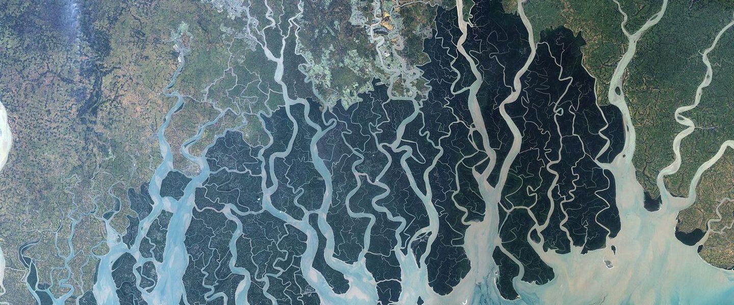


Sundarbans National Park in Bangladesh reveals mangrove waterways, Royal Bengal tigers, tidal wildlife and village life through guided river journeys.
A Forest Shaped by Water
In Bangladesh, the Sundarbans is a vast mangrove landscape spread across the rivers, creeks and tidal mudflats of the Ganges–Brahmaputra–Meghna delta. Although the name Sundarbans National Park officially refers to the Indian section in West Bengal, it is often used informally by travellers and tour operators for visits to Bangladesh’s Sundarbans Reserved Forest. The Bangladeshi portion is a protected wilderness rather than a conventional national park, and access is concentrated around guided boat journeys from Khulna, Mongla and nearby river ports.Read more about Sundarbans National Park
Wildlife and Mangrove Landscapes
Gateway Communities and Conservation
When is the best time to visit Sundarbans National Park?
Best: December–February · 32–33°C| Month | High (°C) | Rainfall (mm) |
|---|---|---|
| January (best) | 32 | 7 |
| February (best) | 33 | 6 |
| March | 36 | 4 |
| April | 39 | 5 |
| May | 40 | 7 |
| June | 38 | 12 |
| July | 38 | 18 |
| August | 38 | 16 |
| September | 38 | 13 |
| October | 37 | 9 |
| November | 35 | 6 |
| December (best) | 32 | 5 |
Getting to and around Sundarbans National Park
How to get there
Transportation
Best attractions in Sundarbans National Park
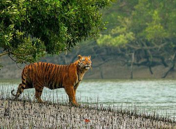
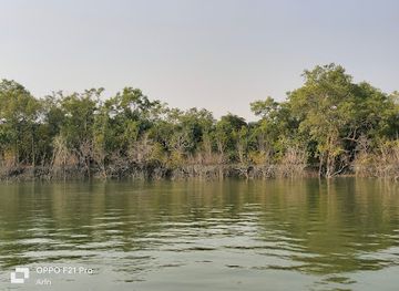
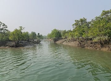
The principal attraction is the mangrove environment itself: a maze of tidal rivers, creeks, mudflats and forest islands viewed from a launch or smaller boat. Karamjol, near the Poshur River, is one of the more accessible visitor sites and introduces mangrove ecology through a short designated trail and observation areas. Harbaria offers another forest landing with boardwalk-style exploration and opportunities to see mudskippers, crabs, birds and other tidal wildlife. Farther south, Hiron Point, also known as Nilkamal, is associated with wildlife observation, while Katka and nearby Kochikhali combine forest, beach and creek landscapes. Dublar Char is a seasonal fishing settlement rather than a conventional attraction, and its character changes with fishing activity and conditions. Estuarine crocodiles, spotted deer, macaques, monitor lizards and birds may be seen, while tiger sightings remain exceptional and unpredictable.
-
Woods
Sundarbans
Explore the Sundarbans, the world's largest mangrove forest and home to the Royal Bengal Tiger, a UNESCO World Heritage Site.
-
Wildlife park
Sajnekhali Wildlife Sanctuary
Discover the wild beauty of the Sundarbans at Sajnekhali Wildlife Sanctuary, a birdwatcher's paradise and home to the Royal Bengal Tiger.
-
Bird watching area
Dobanki Watch Tower
Experience the thrill of a canopy walk and observe diverse wildlife at Dobanki Watch Tower in the heart of the Sundarbans.
-
Tourist attraction
Hiron Point
Discover Hiron Point: A serene sanctuary in the Sundarbans, offering unparalleled natural beauty and rich biodiversity.
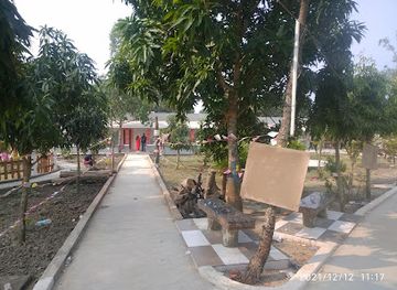
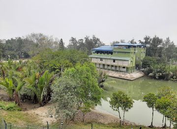
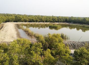
Best landmarks in Sundarbans National Park
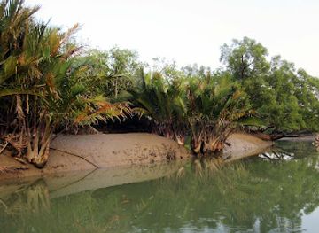
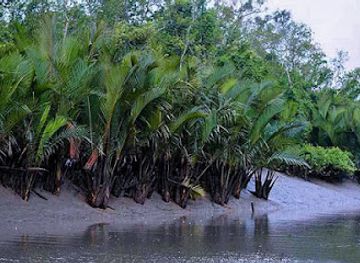
The Sundarbans’ most important landmarks are natural rather than architectural. Its tidal channels and mudflats form the visible framework of the delta, while the distinctive breathing roots of mangrove trees reveal how vegetation adapts to waterlogged, saline ground. The three protected wildlife sanctuaries—Sundarbans East, Sundarbans South and Sundarbans West—are significant conservation landmarks within the Bangladeshi forest, although they are extensive habitat zones rather than single monuments. Hiron Point, Katka and Kochikhali are recognised forest stations and observation areas, and Karamjol and Harbaria provide more accessible points for interpreting the ecosystem. The forest’s wider international significance is reflected in its UNESCO World Heritage status, shared with the Indian property across the international boundary but managed as a separate national site.
-
Nature preserve
Sundarban National Park (West Bengal)
Discover the enchanting Sundarban National Park, home to the Royal Bengal Tiger and the world's largest mangrove forests. A UNESCO World Heritage Site.
-
Woods
Sundarbans
Explore the Sundarbans, the world's largest mangrove forest and a UNESCO site, home to the Royal Bengal Tiger and unique biodiversity.
-
Historical landmark
Sundarban National Park - Bangladesh
Explore the Sundarban National Park, a UNESCO World Heritage Site and the world's largest mangrove forest, home to the Royal Bengal tiger and a unique ecosystem.
-
Tourist attraction
Sundarban Bangladesh Part
Explore the Sundarbans, the world's largest mangrove forest and a UNESCO World Heritage Site, home to the Royal Bengal tiger and a unique ecosystem in Bangladesh.
Explore Sundarbans National Park on the map
Plan your trip on one map. See where the top attractions, landmarks, restaurants and hotels are, and book hotels and experiences in a few clicks.
Best hotels in Sundarbans National Park
Best restaurants in Sundarbans National Park
Dining in the Sundarbans is primarily part of the boat expedition rather than a restaurant-based experience. Multi-day vessels generally provide simple Bengali meals, often centred on rice, lentils, vegetables, fish or chicken, with menus shaped by the boat’s facilities and provisions. In Khulna and Mongla, visitors can find a broader range of Bengali food, including rice dishes, freshwater fish, seasonal vegetables, snacks and sweetmeats, although the selection is more modest in Mongla than in the larger city. Seafood and river fish are part of the region’s food culture, but visitors should ask about sourcing and preparation rather than assuming every catch comes from the protected forest. Carrying sealed snacks and drinking water can be useful on longer journeys, while dietary requirements should be discussed with the operator before departure.
Best nightclubs in Sundarbans National Park
The Sundarbans has no conventional nightlife, and evenings are usually spent aboard a moored launch, listening to the forest, watching the changing light over the channels or discussing the day’s wildlife observations. Khulna offers the widest choice of ordinary evening restaurants, cafés and hotel-based social spaces, while Mongla has a quieter, practical atmosphere shaped by its port and river traffic. In smaller settlements near the forest, evening facilities are limited and should not be confused with a tourist entertainment district. Alcohol may be restricted or unavailable on many boats and in some accommodation settings, so visitors should check arrangements in advance and respect local customs. Noise, bright lights and loud music are particularly inappropriate near wildlife and forest stations.
Get your free copy of our complete guide to Sundarbans National Park, delivered straight to you.
Everything on this page, from attractions and restaurants to essentials and local phrases, in one PDF you can read offline, print or share.
Already have an account? Sign in
Your Sundarbans National Park guide is ready.
We'll send it to · Not you? Sign out

Getting your guide ready…
We are putting together a fresh copy of the Sundarbans National Park guide. This can take up to a minute.
This can take a few moments. If your browser asks, choose Allow so the download can start. You'll find the guide in your Downloads folder.
Nothing happened? Download it again
Sorry, the guide is taking longer than usual. Please try again in a minute, or get it by email instead.
Sundarbans National Park essentials
Currency and Payment
Safety
Emergency Situations
Do's and Don'ts
Local Tips
From Eve
Local phrases worth knowing
You don't need to get them perfect. A few words go a long way, and locals appreciate the effort.
Basics
| English | Local | Say it |
|---|---|---|
| Hello | নমস্কার | [nomoskar] |
| Goodbye | বিদায় | [bidae] |
| Yes | হ্যাঁ | [hyām̐] |
| No | না | [nā] |
| Please/You're welcome | অনুগ্রহ করে | [onugroh kore] |
| Thank you | ধন্যবাদ | [dhonno-bad] |
| Excuse me/Sorry | দুঃখিত | [dukhit] |
| How are you? | আপনি কেমন আছেন? | [apni kemon achhen?] |
| Fine. And you? | ভালো। আর আপনি? | [bhalo. ar apni?] |
| Do you speak English? | আপনি ইংরেজি কথা বলতে পারেন? | [apni ingreji kotha bolte paren?] |
| I don't understand | আমি বুঝতে পারছি না | [ami bujhte parchhi na] |
Eating & Drinking
| English | Local | Say it |
|---|---|---|
| I'd like to see the menu, please | মেনু দেখতে চাই | [menu dekhte chai] |
| I don't eat meat | আমি মাংস খাই না | [ami mangsh khai na] |
| Cheers! | চিয়ার্স! | [cheers!] |
| I would like to pay, please | দয়া করে টাকা দিতে চাই | [doya kore taka dite chai] |
Emergencies
| English | Local | Say it |
|---|---|---|
| Help! | সাহায্য! | [sahayyo!] |
| Go away! | চলে যান! | [chale yan!] |
| Call the Police! | পুলিশকে কল করুন! | [polishke kol korun!] |
| Call a doctor! | ডাক্তারকে কল করুন! | [daktarke kol korun!] |
| I'm lost | আমি হারানো গেছি | [ami harano geshi] |
| I'm ill | আমি অসুস্থ | [ami osustho] |
Shopping
| English | Local | Say it |
|---|---|---|
| I'd like to buy... | আমি ... কিনতে চাই | [ami ... kinte chai] |
| I'm just looking | আমি একটু দেখতেছি | [ami ekṭu dekhtechi] |
| How much is it? | এটা কত টাকা? | [eta kot taka?] |
| That's too expensive | এটা খুব মহঙ্গা | [eta khub mohonga] |
| Can you lower the price? | দাম কমাতে পারবেন? | [dam kamate parben?] |
Time & Numbers
| English | Local | Say it |
|---|---|---|
| What time is it? | এখন কতটা বাজে? | [ekhon kotta baje?] |
| It's one o'clock | একটা বাজে | [ekṭa baje] |
| Half past (10) | দশের অর্ধেক | [dasher ordhek] |
| Morning | সকাল | [shokal] |
| Afternoon | দুপুর | [dupur] |
| Evening | সন্ধ্যা | [shondhya] |
| Yesterday | গতকাল | [gotokal] |
| Today | আজ | [aj] |
| Tomorrow | আগামীকাল | [agamikal] |
| 1 | এক | [ek] |
| 2 | দুই | [dui] |
| 3 | তিন | [tin] |
| 4 | চার | [char] |
| 5 | পাঁচ | [pach] |
| 6 | ছয় | [chhoy] |
| 7 | সাত | [shat] |
| 8 | আট | [at] |
| 9 | নয় | [noy] |
| 10 | দশ | [dosh] |
Transport & Directions
| English | Local | Say it |
|---|---|---|
| Where's a/the...? | ...কুড়ি কোথায়? | [...kuri kothay?] |
| What's the address? | ঠিকানাটি কি? | [thikanati ki?] |
| Can you show me (on the map)? | আপনি আমাকে দেখাতে পারবেন? | [apni amake dekhate parben?] |
| When's the next (bus)? | পরের (বাস) কটায়? | [porer (bās) kotay?] |
| A ticket (to ....) | একটি টিকিট (...এ) | [ekti ticket (...e)] |
History of Sundarbans National Park
A Young Delta of Tidal Sediments
The Sundarbans occupies the seaward edge of the Ganges–Brahmaputra–Meghna delta, a landscape continually shaped by river-borne sediment, tidal exchange and coastal erosion. Its channels, mudflats and islands are not fixed features: banks are deposited, cut away and recolonised by salt-tolerant vegetation over time. Mangrove formation created a complex ecological barrier between the freshwater rivers of the interior and the Bay of Bengal. This geological and environmental setting explains both the forest’s extraordinary productivity and the practical difficulties of travelling through it, where distance is measured by winding waterways rather than straight roads.
Early Human Use of the Mangroves
Human communities have long used the margins of the Sundarbans for fishing, collecting fuel and timber, gathering honey and wax, and cultivating land on more stable islands and riverbanks. The forest itself has always been a demanding environment, with saline water, tigers, crocodiles and shifting channels limiting permanent settlement. Local knowledge of tides, creeks, seasons and forest resources became essential to survival. In the surrounding districts, livelihoods developed around rivers and estuaries, while the dense interior remained comparatively lightly inhabited. Many contemporary journeys into the forest still depend on boatmen and honey collectors familiar with these changing conditions.
Colonial Forest Administration
Under British rule, the mangrove tract was increasingly surveyed, mapped and administered as a forest resource. Formal forest management and revenue systems altered earlier patterns of use, while timber extraction, fishing and the reclamation of nearby land became more closely regulated or commercially organised. Embankments and agricultural expansion on the forest’s landward margins changed the relationship between human settlements and the tidal landscape. The Sundarbans nevertheless remained difficult to colonise extensively because of saline soils, flooding, disease and the instability of its waterways. This tension between commercial use, settlement and protection continued after the creation of Pakistan and later Bangladesh.
Protected Areas and International Recognition
Bangladesh’s post-independence conservation policy established three major wildlife sanctuaries in the southern Sundarbans: Sundarbans East, Sundarbans South and Sundarbans West Wildlife Sanctuaries, designated in 1977. Together with the wider Reserved Forest, they provide protection for mangrove habitats and wildlife including the Royal Bengal tiger. The Bangladeshi Sundarbans was inscribed as a UNESCO World Heritage Site in 1997, alongside the separately listed Indian Sundarbans National Park. Conservation has since had to balance biodiversity protection with regulated fishing, honey collection, tourism, shipping pressures, pollution risks and the growing effects of cyclones, sea-level change and coastal salinity.
Sundarbans National Park in Photos
Browse through our photo collection highlighting the charm and character of the destination.
Neighbouring destination travel guides
The closest destinations to Sundarbans National Park, if you have time for more than one.
-

-

-

-

-


Swipe for more destinations
Explore more

Explore more of Sundarbans
Explore Bangladesh’s Sundarbans by permit boat, following tidal waterways through mangroves, wildlife habitat and remote coastal communities.
Explore Sundarbans
Explore more of Bangladesh
Discover Bangladesh: A land of rivers, rich culture, and breathtaking landscapes. Explore ancient sites, vibrant cities, and the unique flavors of this South Asian gem.
Explore Bangladesh