

Free Southern Bhutan Travel Guide & Mobile App
Explore Southern Bhutan with free travel guides. Discover regional history, expert tips, proposed trips, and audio guides on web or mobile app.


Southern Bhutan combines subtropical forests, borderland towns, wildlife corridors and warm river valleys with access to Royal Manas National Park.
Read more about Southern Bhutan
When is the best time to visit Southern Bhutan?
Best: March, November–December · 22–25°C| Month | High (°C) | Rainfall (mm) |
|---|---|---|
| January | 21 | 15 |
| February | 21 | 20 |
| March (best) | 25 | 25 |
| April | 28 | 35 |
| May | 31 | 60 |
| June | 33 | 120 |
| July | 34 | 180 |
| August | 34 | 170 |
| September | 32 | 120 |
| October | 29 | 60 |
| November (best) | 25 | 25 |
| December (best) | 22 | 15 |
Getting to and around Southern Bhutan
How to get there
Transportation
Top city travel guides in Southern Bhutan
The cities of Southern Bhutan, and the easiest places to base yourself.
-

-

-

-

-
-


Swipe for more cities
Destinations in Southern Bhutan
Resorts, valleys and scenic spots worth a trip of their own.
-

-

-

-

-

-


Swipe for more destinations
Best attractions in Southern Bhutan
-
Tourist attraction
Buddha Dordenma Statue སྟོན་པ་རྡོར་གདན་མ།
Discover the grandeur of the Buddha Dordenma Statue, a monumental symbol of peace and spirituality in the heart of Thimphu, Bhutan.
-
Tourist attraction
Paro Taktsang
Discover the breathtaking beauty of Paro Taktsang, a sacred monastery perched on cliffs, offering spiritual insights and stunning vistas in Bhutan.
-
National museum
National Museum of Bhutan འབྲུག་གི་འགྲེམས་སྟོན་ཁང་།
Discover the National Museum of Bhutan, a cultural gem in Paro showcasing the rich heritage, artifacts, and art of the kingdom.
-
Buddhist temple
National Memorial Chorten རྒྱལ་ཡོངས་རྗེས་དྲན་མཆོད་རྟེན།
Explore the spiritual heart of Bhutan at the National Memorial Chorten, a stunning stupa filled with rich cultural significance and serene beauty.


Best landmarks in Southern Bhutan
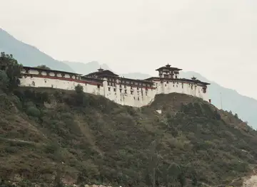
Phuentsholing's Zangto Pelri Lhakhang is one of the southern region's most recognisable religious buildings, its colourful design presenting a compact expression of Bhutanese Buddhist imagery within a busy border town. Karbandi Monastery, set on a wooded hillside above Phuentsholing, is significant both as a pilgrimage site and for its elevated views across the town and the Indian plains. The international boundary at Phuentsholing is also a defining civic landmark: unlike a remote mountain pass, it is embedded in an active urban and commercial landscape. Farther east, the forested valleys and river systems surrounding Royal Manas National Park form the region's most important natural landmark, marking the transition from cultivated foothills to protected lowland habitat. The broad Manas landscape is more visually expansive than monumental, with sal forests, grasslands and waterways carrying ecological importance across the Bhutan–India frontier. In Gelephu and Samdrup Jongkhar, market streets, administrative buildings and temples provide a contemporary architectural record of Bhutan's southern gateway towns rather than a single grand historic monument.
-
Buddhist temple
Buddha Dordenma Statue སྟོན་པ་རྡོར་གདན་མ།
Experience peace and tranquility at the Buddha Dordenma Statue, a monumental symbol of Bhutan's rich spiritual heritage and breathtaking views.
-
National museum
National Museum of Bhutan འབྲུག་གི་འགྲེམས་སྟོན་ཁང་།
Explore the National Museum of Bhutan in Paro, where history and culture come alive through captivating exhibits and stunning views.
-
Buddhist temple
National Memorial Chhorten རྒྱལ་ཡོངས་རྗེས་དྲན་མཆོད་རྟེན།
Discover tranquility and cultural depth at the National Memorial Chhorten, a stunning Buddhist temple in the heart of Thimphu, Bhutan.
-
Buddhist temple
Punakha Dzong སྤུ་ན་ཁ་རྫོང་།
Discover the beauty and history of Punakha Dzong, a breathtaking fortress and monastery at the heart of Bhutan's cultural heritage.


Explore Southern Bhutan on the map
Plan your trip on one map. See where the top cities, national parks and sights are, and book hotels and experiences in a few clicks.
Best hotels in Southern Bhutan
Best restaurants in Southern Bhutan
Southern Bhutan's food reflects the warmer climate and the region's close connections with the plains of India and neighbouring Himalayan communities. Rice is a daily staple, accompanied by vegetable curries, lentils, pickles, chilli-based dishes and preparations influenced by Nepali, Assamese and broader North Indian cooking. Ema datshi and other Bhutanese favourites are widely available, but southern tables may also feature stronger use of mustard greens, seasonal vegetables, freshwater fish in some areas and locally grown citrus, ginger, maize and chillies. In Phuentsholing, Gelephu and Samdrup Jongkhar, informal restaurants and cafés serve Indian, Bhutanese and Nepali meals, while market stalls provide tea, snacks and inexpensive breakfasts. Rural accommodation may offer simpler home-style menus based on seasonal produce. Hygiene standards and choice vary outside the main towns, so visitors with dietary restrictions should explain them clearly and carry suitable provisions during excursions into forest or remote valley areas.
-
Cafe
Ambient Cafe
Discover the heart of Bhutanese cuisine at Ambient Cafe in Thimphu - your go-to spot for breakfast and brunch delights.
-
Restaurant
Sonam trophel restaurant
Experience authentic Indian and Bhutanese cuisine at Sonam Trophel Restaurant in Paro - where flavor meets tradition.
-
Restaurant
Zombala Restaurant
Experience authentic Bhutanese cuisine at Zombala Restaurant in Thimphu - where every dish tells a story.
-
Korean
San Maru Restaurant
Experience authentic Korean flavors at San Maru Restaurant in Norzin - a culinary haven for food enthusiasts.


Best bars in Southern Bhutan
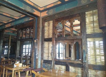
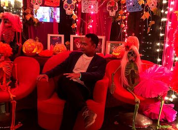
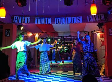
Evening life in southern Bhutan is concentrated in the larger border and commercial towns rather than in a dedicated club scene. Phuentsholing has the widest selection of cafés, restaurants, hotel lounges and informal bars, with activity reflecting its busy trading role and cross-border population. Gelephu and Samdrup Jongkhar offer smaller selections, while evenings in rural areas generally centre on family homes, local eateries, modest bars or the accommodation itself. Bhutanese beer and spirits are available where licensed, but alcohol is not necessary to experience the region's social life. Live music and late-night entertainment can be occasional and venue-dependent rather than a permanent feature, so visitors should rely on current local information instead of expecting fixed opening patterns. In wildlife areas, quiet nights are part of the experience and help avoid disturbing nearby communities and animals.
-
Bar
Mojo Park
Discover the vibrant nightlife of Thimphu at Mojo Park, a lively bar and restaurant offering great food, drinks, and live music in a welcoming atmosphere.
-
Brewpub
Namgay Artisanal Brewery
Experience the art of craft brewing in Bhutan at Namgay Artisanal Brewery, where tradition meets innovation in every sip.
-
Restaurant
The Zone
Discover the flavors of Bhutan at The Zone, a vibrant restaurant and pub in Thimphu, blending local and international cuisines in a cozy atmosphere.
-
Live music bar
PARK 76 Cafe & Pub
Discover the vibrant nightlife of Paro at PARK 76 Cafe & Pub, where live music and delicious food create an unforgettable experience.



Best nightclubs in Southern Bhutan
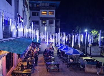
Evening life in southern Bhutan is concentrated in the larger border and commercial towns rather than in a dedicated club scene. Phuentsholing has the widest selection of cafés, restaurants, hotel lounges and informal bars, with activity reflecting its busy trading role and cross-border population. Gelephu and Samdrup Jongkhar offer smaller selections, while evenings in rural areas generally centre on family homes, local eateries, modest bars or the accommodation itself. Bhutanese beer and spirits are available where licensed, but alcohol is not necessary to experience the region's social life. Live music and late-night entertainment can be occasional and venue-dependent rather than a permanent feature, so visitors should rely on current local information instead of expecting fixed opening patterns. In wildlife areas, quiet nights are part of the experience and help avoid disturbing nearby communities and animals.
-
Night club
Viva City
Experience the vibrant nightlife of Thimphu at Viva City, where music, dance, and culture come together in a lively atmosphere.
-
Night club
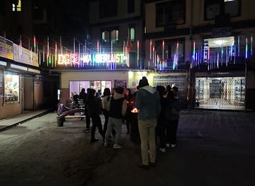
DG Wanderlust Club @Thimphu hongkong market/oppesite of Thimphu BOB main Branch office
Discover the vibrant nightlife of Thimphu at DG Wanderlust Club, where music, dance, and socializing come together for an unforgettable experience.
-
Night club
Space 34 DOS
Discover the chic nightlife at Space 34 DOS, Thimphu's premier night club with vibrant ambiance and exquisite drinks.
-
Night club
ACE CLUB, Thimphu
Discover the ultimate nightlife experience at ACE CLUB in Thimphu, where tradition meets modern entertainment in a vibrant setting.
Best shops in Southern Bhutan
Shopping in Southern Bhutan is strongest in the border towns, where local produce, household goods and imported merchandise circulate alongside Bhutanese handicrafts. Phuentsholing has the broadest practical choice, including clothing, textiles, small religious objects, packaged foods and everyday supplies, while Gelephu and Samdrup Jongkhar serve as smaller commercial centres for surrounding agricultural districts. Markets and independent shops are useful places to look for chillies, ginger, citrus, pickles, tea, rice products and seasonal fruit, although availability changes with harvests and transport. Bhutanese woven textiles, prayer items, handmade paper and carved or painted objects can be found in established craft outlets, but buyers should distinguish locally made work from factory-produced souvenirs and avoid purchasing anything made from protected wildlife. Rural shopping is limited, so stock up on medicines, snacks and cash before heading towards national parks or remote valleys.
-
Farmers' market
Centenary Farmers Market
Discover fresh produce, local crafts, and delicious flavors at Thimphu's vibrant Centenary Farmers Market, a cultural gem in Bhutan.
-
Artistic handicrafts
Jungshi handmade paper factory
Immerse yourself in the traditional craft of Bhutanese paper-making at Jungshi Handmade Paper Factory in Thimphu, a unique cultural experience.
-
 Cell phone store
iDesire, Thimphu
Explore Thimphu with iDesire - your go-to cell phone store for the latest gadgets and unbeatable customer service.
-
Grocery store
Samdrup jongkhar town
Experience the vibrant market life and natural beauty of Samdrup Jongkhar Town, a hidden gem in Bhutan.


Get your free copy of our complete guide to Southern Bhutan, delivered straight to you.
Everything on this page, from attractions and restaurants to essentials and local phrases, in one PDF you can read offline, print or share.
Already have an account? Sign in
Your Southern Bhutan guide is ready.
We'll send it to · Not you? Sign out

Getting your guide ready…
We are putting together a fresh copy of the Southern Bhutan guide. This can take up to a minute.
This can take a few moments. If your browser asks, choose Allow so the download can start. You'll find the guide in your Downloads folder.
Nothing happened? Download it again
Sorry, the guide is taking longer than usual. Please try again in a minute, or get it by email instead.
Southern Bhutan essentials
Currency and Payment
Safety
Emergency Situations
Do's and Don'ts
Local Tips
From Eve
Local phrases worth knowing
You don't need to get them perfect. A few words go a long way, and locals appreciate the effort.
Basics
| English | Local | Say it |
|---|---|---|
| Hello | བཀྲ་ཤིས་བདེ་ལགས། | [Kuzu zangpo] |
| Goodbye | གང་བཞིན་གནང་བ། | [Tshewa zhey] |
| Yes | ཨེ | [A] |
| No | མེད། | [Med] |
| Please/You're welcome | ཁྱེད་ལ་བསྟན་བརྗོད། | [Khyed la jamtsho] |
| Thank you | ཐུགས་རྗེ་ཆེ། | [Thukje che] |
| Excuse me/Sorry | ང་གིས་གནང་བ། | [Nga gi zhen] |
| How are you? | ཁྱེད་ལ་ངེས་གནང་བ། | [Khyed la nges zhen] |
| Fine. And you? | ང་གིས་བདེ་ཆེ། ཁྱེད་ལ་གང་བ། | [Nga gi de che. Khyed la gang zhen?] |
| Do you speak English? | ཁྱེད་ལ་དབྱངས་ཀྱི་སྐད་པ་བཤད་གི་ཡོད། | [Khyed la dzongkha khey gi yod?] |
| I don't understand | ང་གིས་མ་གཏོགས། | [Nga gi med] |
Eating & Drinking
| English | Local | Say it |
|---|---|---|
| I'd like to see the menu, please | ང་གིས་བསྐྱར་བའི་བསྡུར་མངོན་གནང་བ། | [Nga gi kyarey menu nang zhen] |
| I don't eat meat | ང་བྱ་བ་མེད། | [Nga ja med] |
| Cheers! | འབྲི་བཞིན། | [Tashi delek] |
| I would like to pay, please | ང་གིས་ཕོ་བྲལ་གནང་བ། | [Nga gi pay zhen] |
Emergencies
| English | Local | Say it |
|---|---|---|
| Help! | ཐུགས་རྗེ་ཆེ། | [Thukje che!] |
| Go away! | འགྲོ་བསྡོམས། | [Go away!] |
| Call the Police! | དངོས་ལམ་པ་གཞི་བརྗེད། | [Call the police!] |
| Call a doctor! | གསོ་བའི་མཁས་པ་བརྗེད། | [Call a doctor!] |
| I'm lost | ང་འགྲོ་གནང་མེད། | [Nga ngat] |
| I'm ill | ང་སྤྱི་འཕེལ་ཞིང་བཞིན། | [Nga ngat] |
Shopping
| English | Local | Say it |
|---|---|---|
| I'd like to buy... | ང་གིས་བདག་བསྐྱར། | [Nga gi ngul shong] |
| I'm just looking | ང་གིས་སྟོན་བའི་བསྟན་བོ་བཅོས། | [Nga gi tsering] |
| How much is it? | ང་གིས་ག་ཀྱི་འབྲེལ་བའི་ཡོད། | [Nga gi ga kyi zhen?] |
| That's too expensive | མི་བཀོད་ཅན། | [Med kony] |
| Can you lower the price? | ཁྱེད་ལ་མང་རྩིས་བཟོ་ན་ཡོད། | [Khyed la mang zhe?] |
Time & Numbers
| English | Local | Say it |
|---|---|---|
| What time is it? | དེ་རིང་རེ་བ་ག་རེ། | [De Rin re] |
| It's one o'clock | དངོས་འདུག་པ། | [Nga du] |
| Half past (10) | བཅོ་སྔོན། | [Bho] |
| Morning | དགོངས་ནོར། | [Dong] |
| Afternoon | དགོངས་བཞིན། | [Dong] |
| Evening | དགོངས་སངས། | [Dong] |
| Yesterday | དམིགས་ཤོམས་རང། | [Mik] |
| Today | དམིགས་ཤོམས་རང། | [Mik] |
| Tomorrow | དམིགས་ཤོམས་རང། | [Mik] |
| 1 | དངོས་ 1 | [Dug] |
| 2 | དངོས་ 2 | [Ney] |
| 3 | དངོས་ 3 | [Ney] |
| 4 | དངོས་ 4 | [Ney] |
| 5 | དངོས་ 5 | [Ney] |
| 6 | དངོས་ 6 | [Ney] |
| 7 | དངོས་ 7 | [Ney] |
| 8 | དངོས་ 8 | [Ney] |
| 9 | དངོས་ 9 | [Ney] |
| 10 | དངོས་ 10 | [Ney] |
Transport & Directions
| English | Local | Say it |
|---|---|---|
| Where's a/the...? | དངོས་ལམ་པ་ག་རེའི་ཡོད། | [Galu] |
| What's the address? | དངོས་ལམ་པ་ག་རེ་ལམ་ཡོད། | [Galu] |
| Can you show me (on the map)? | ཁྱེད་ལ་མི་སོག་འབྲེལ་བརྗེད། | [Khyed la zhen?] |
| When's the next (bus)? | དངོས་ལམ་པ་ག་རེ་ལམ་ཡོད། | [Galu] |
| A ticket (to ....) | དངོས་ལམ་པ་ག་རེའི་ཡོད། | [Galu] |
History of Southern Bhutan
Early Southern Settlements and Trans-Himalayan Trade
The southern foothills have long connected the Himalayan interior with the plains of present-day India. River valleys and forest tracks formed routes for movement, exchange and seasonal livelihoods, while the region's warmer climate supported crops that could not be grown easily in Bhutan's higher valleys. Archaeological evidence and local traditions point to long-established settlement across the broader foothill zone, although much of its early history is preserved through scattered sites and oral memory rather than monumental remains. The south's geography has consistently made it a meeting ground between Bhutanese mountain communities and the cultures of Assam, West Bengal and the eastern Himalayan borderlands.
The Drukpa State and Southern Dzongs
From the seventeenth century, the consolidation of the Drukpa state brought southern valleys more firmly within Bhutan's political and religious system. Dzongs and administrative centres served as seats of authority, repositories of grain and places from which officials managed routes towards the plains. In the south, these institutions were especially important because control of passes, rivers and trading corridors was closely tied to security and taxation. The landscape lacks the concentration of monumental dzongs found in some western valleys, but the political legacy of the Drukpa period remains visible in district administration, Buddhist institutions and the continued importance of routes linking the interior with the border.
The Duars and the Treaty of Sinchula, 1865
The southern foothills became central to nineteenth-century conflict between Bhutan and British India over the Duars, a belt of fertile lowland and forest at the Himalayan edge. Disputes over revenue collection, frontier authority and the conduct of local officials led to the Duar War of 1864–65. The Treaty of Sinchula, signed in 1865, transferred control of the Bhutan Duars and established a new political relationship with British India. Its consequences are still reflected in the international boundary and in the commercial importance of towns such as Phuentsholing, Gelephu and Samdrup Jongkhar, which stand near historic routes from the plains into Bhutan.
Nineteenth- and Twentieth-Century Migration
During the nineteenth and twentieth centuries, people from neighbouring parts of Nepal and India settled in Bhutan's southern districts, joining earlier communities and contributing to agriculture, trade and the development of market towns. Nepali-speaking Bhutanese, commonly known as Lhotshampa, became particularly numerous in the south and developed distinctive religious, linguistic and cultural institutions. This history is inseparable from the difficult citizenship and political disputes of the late twentieth century, when many people left Bhutan or were displaced after unrest and government measures in the 1980s and 1990s. The subject remains sensitive, and the south's present social landscape should be understood as historically diverse rather than reduced to a single narrative.
Modern Border Towns and Economic Change
After Bhutan's modern state institutions expanded, southern border settlements developed into important gateways for trade, transport and public administration. Phuentsholing became the principal western commercial entry point, while Gelephu and Samdrup Jongkhar grew as eastern and central-southern links with India. Roads, schools, markets and agricultural schemes transformed access to the foothills, though journeys remain shaped by steep terrain and seasonal weather. The south's economy continues to combine farming and forest-based livelihoods with cross-border commerce, logistics, construction and public services, giving it a more outward-facing commercial character than many remote Himalayan valleys.
Conservation in the Southern Forests
The creation and development of protected areas changed the way Bhutan's southern forests were managed. Royal Manas National Park, established in 1966 as Bhutan's first national park, protects a major cross-border ecosystem linked to India's Manas landscape. Conservation has sought to preserve forests, rivers and wildlife while accommodating the needs of nearby communities. The park and surrounding corridors are significant for elephants, hornbills, primates and other species moving between lowland and foothill habitats. This conservation history underpins the south's growing importance for carefully managed nature travel, although access remains dependent on local permissions, infrastructure and conditions.
Southern Bhutan in Photos
Browse through our photo collection highlighting the charm and character of the destination.
Neighbouring regions of Southern Bhutan
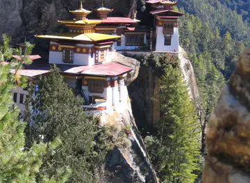
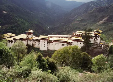
The closest regions to Southern Bhutan, if you have time for more than one.
-

-

-
-
-


Swipe for more regions
Explore more

Explore more of Bhutan
Experience the enchantment of Bhutan, a Himalayan paradise where tradition meets tranquility and Gross National Happiness reigns supreme.
Explore Bhutan