

Free Chirripó National Park Travel Guide & Mobile App
Explore Chirripó National Park with free travel guides. Discover regional history, expert tips, proposed trips, and audio guides on web or mobile app.


Chirripó National Park offers demanding high-altitude hikes, cloud forests, páramo landscapes and Costa Rica's highest summit above San Gerardo de Rivas.
Read more about Chirripó National Park
When is the best time to visit Chirripó National Park?
Best: February–April · 21–22°C| Month | High (°C) | Rainfall (mm) |
|---|---|---|
| January | 20 | 75 |
| February (best) | 21 | 60 |
| March (best) | 21 | 50 |
| April (best) | 22 | 75 |
| May | 22 | 150 |
| June | 23 | 200 |
| July | 23 | 200 |
| August | 22 | 200 |
| September | 22 | 250 |
| October | 21 | 250 |
| November | 21 | 200 |
| December | 20 | 150 |
Getting to and around Chirripó National Park
How to get there
Transportation
Best attractions in Chirripó National Park
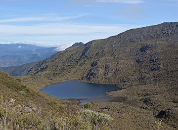
Chirripó National Park's principal attraction is its sequence of ecological zones rather than a collection of roadside sights. The trail from San Gerardo de Rivas climbs through humid forest and cloud forest before reaching high-elevation vegetation, open páramo and rocky terrain. The base at Crestones provides access to the distinctive rock formations that have become a visual emblem of the park, while Valle de las Morrenas and the surrounding upland valleys reveal the effects of ancient cold-climate processes. Cerro Chirripó is the central objective for experienced hikers, although clear summit views depend on weather. Wildlife encounters may include highland birds and forest species, but the park should not be approached as a guaranteed animal-viewing destination. The wider gateway area adds coffee landscapes, rural farms, river scenery and small-scale nature excursions at lower elevations. Guided trekking, porter support and multi-day mountain walking are the dominant visitor experiences; there are no public roads, town museums or conventional family attractions inside the park.
-
Park
Parque Nacional
Discover history and tranquility in the heart of San José at Parque Nacional, a cultural oasis.
-
Tourist attraction
Nauyaca Waterfall Nature Park
Discover the majestic Nauyaca Waterfalls in Costa Rica: twin cascades, refreshing pools, and lush rainforest trails await your adventure.
-
National park
Parque Nacional Chirripó
Experience the breathtaking landscapes and rich biodiversity of Parque Nacional Chirripó, Costa Rica's highest national park.
-
Nature preserve
Cloudbridge Nature Reserve
Explore Cloudbridge Nature Reserve, a lush haven in Costa Rica, where diverse ecosystems and breathtaking landscapes await nature lovers and adventure seekers.
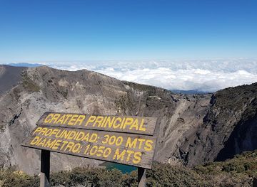
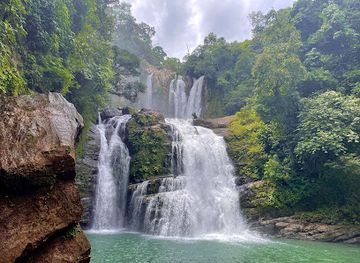
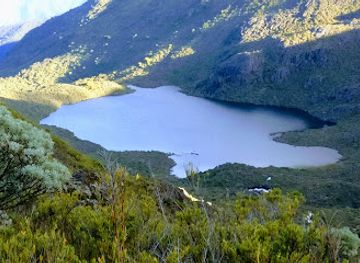
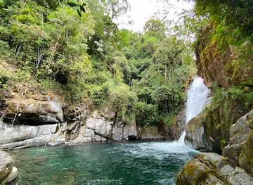
Best landmarks in Chirripó National Park
Cerro Chirripó is Costa Rica's defining mountain landmark and the highest point in the country, a summit whose significance is both geographical and symbolic. The Crestones, a group of tall, weathered rock formations near the high camp, provide the park's most recognisable visual feature and stand above the surrounding páramo. Valle de las Morrenas is notable for its stark high-altitude scenery and evidence of ancient glacial shaping, a marked contrast with the tropical forests lower on the route. The narrow ridges, exposed slopes and broad upland basins around the summit form a natural landscape of national importance rather than a built monument. At the gateway, the rural settlement of San Gerardo de Rivas represents the human landmark of the destination: its farms, lodges and trail services connect the inhabited valleys of Pérez Zeledón with one of Costa Rica's most remote protected mountain environments.
-
National park
Parque Nacional Manuel Antonio
Explore Costa Rica's iconic Manuel Antonio National Park: rainforests, beaches, and incredible wildlife await in this biodiverse paradise.
-
National park
Braulio Carrillo National Park
Explore Costa Rica's diverse ecosystems and abundant wildlife in Braulio Carrillo National Park, a natural gem easily accessible from San José.
-
National park
Parque Nacional Chirripó
Hike to Costa Rica's highest peak in Chirripó National Park, a land of diverse ecosystems and stunning panoramic views. Book your adventure today!
-
Nature preserve
Cloudbridge Nature Reserve
Discover Costa Rica's Cloud Forest: Hike scenic trails, witness stunning waterfalls, and support vital conservation at Cloudbridge Nature Reserve.
Explore Chirripó National Park on the map
Plan your trip on one map. See where the top cities, national parks and sights are, and book hotels and experiences in a few clicks.
Best hotels in Chirripó National Park
Best restaurants in Chirripó National Park
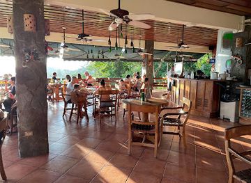
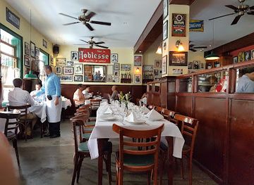
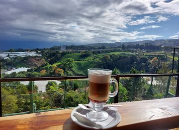
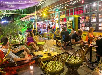
Dining around Chirripó is concentrated in San Gerardo de Rivas and the approach through Pérez Zeledón rather than inside the protected area. Family-run lodgings and small restaurants commonly provide practical meals suited to hikers, including rice-and-beans combinations, eggs, meat, soup, plantains, tortillas, fruit and coffee. Costa Rican staples such as gallo pinto and casado reflect national cuisine rather than an exclusively Chirripó tradition, while the surrounding agricultural district contributes coffee, dairy products and fresh tropical produce. Packed meals and trail provisions are normally arranged before entering the park, since the high camp is not a normal restaurant district and available food services depend on current park arrangements. In San Isidro, visitors find a broader choice of sodas, cafés, bakeries and restaurants representing Costa Rican and international cooking. Rural dining is generally informal, and advance communication with accommodation providers is useful when a trekking itinerary requires early breakfasts or prepared meals.
-
Restaurant
El Avion
Experience breathtaking views and exquisite cuisine at El Avion in Aguirre - where every meal is paired with stunning sunsets.
-
Argentinian
La Esquina de Buenos Aires
Discover the vibrant flavors of Argentina at La Esquina de Buenos Aires in San José, where every meal is a celebration of authentic cuisine.
-
Restaurant
Bocadito de cielo
Experience authentic Costa Rican flavors at Bocadito de Cielo in Cartago Province - a culinary gem waiting to be discovered by tourists.
-
Restaurant
El Patio de Café Milagro
Experience authentic Costa Rican cuisine at El Patio de Café Milagro in Quepos - where every dish tells a story.
Best bars in Chirripó National Park
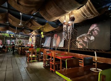
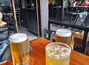
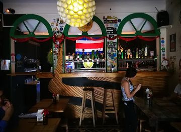
Chirripó National Park has no nightlife inside its protected interior and no conventional club scene in the mountain gateway. Evenings in San Gerardo de Rivas are generally quiet, centred on lodge dining rooms, small local establishments and conversation after a day of walking. The community's hospitality economy is organised around trekkers, so early starts, rest and weather preparation matter more than late opening hours. San Isidro de El General, outside the park and serving as the regional commercial centre, offers a wider selection of bars, restaurants and occasional live-music venues, although it is still a regional town rather than a major national nightlife destination. Visitors should avoid treating alcohol as part of a high-altitude trekking plan, particularly before an early ascent or summit attempt. Check current arrangements locally, as rural businesses and seasonal activity can vary.
-
Bar
KOKi Beach Restaurant & Bar
Discover the vibrant flavors and stunning ocean views at KOKi Beach Restaurant & Bar in Puerto Viejo de Talamanca.
-
Restaurant
República Casa Cervecera
Experience the fusion of local cuisine and craft beer at República Casa Cervecera, a premier brewery and gastropub in the heart of San José.
-
Bar
Moes Pub Rock
Discover vibrant nightlife at Moes Pub Rock, a lively bar and grill in Cartago, Costa Rica, offering delicious food, drinks, and live entertainment.
-
Pub
Stiefel Pub
Experience the vibrant nightlife of Escazú at Stiefel Pub, where great food and drinks come together in a friendly atmosphere.

Best nightclubs in Chirripó National Park
Chirripó National Park has no nightlife inside its protected interior and no conventional club scene in the mountain gateway. Evenings in San Gerardo de Rivas are generally quiet, centred on lodge dining rooms, small local establishments and conversation after a day of walking. The community's hospitality economy is organised around trekkers, so early starts, rest and weather preparation matter more than late opening hours. San Isidro de El General, outside the park and serving as the regional commercial centre, offers a wider selection of bars, restaurants and occasional live-music venues, although it is still a regional town rather than a major national nightlife destination. Visitors should avoid treating alcohol as part of a high-altitude trekking plan, particularly before an early ascent or summit attempt. Check current arrangements locally, as rural businesses and seasonal activity can vary.
-
Disco club
Pepper Disco Club
Discover the electric atmosphere of Pepper Disco Club, a premier destination for nightlife in San José, Costa Rica, where vibrant music and dance await!
-
Night club
La Chicha
Discover the vibrant nightlife of San José at La Chicha, where great music, affordable drinks, and an electric atmosphere await you.
-
Disco club
Cuban Republik Disco Lounge
Discover the vibrant rhythms and lively atmosphere of Cuban Republik Disco Lounge, the ultimate nightlife destination in Quepos, Costa Rica.
-
Disco club
Spectro Club
Discover the electrifying atmosphere of Spectro Club, a premier disco destination in San José, where vibrant music and exciting nightlife await.




Best shops in Chirripó National Park
Shopping is limited and practical in the Chirripó area. San Gerardo de Rivas has small local businesses and accommodation providers where visitors may arrange guides, porter assistance, packed meals and basic trekking supplies, but it is not a retail centre. San Isidro de El General, outside the park, is the principal place for buying food, clothing, fuel, cash and equipment before the ascent. The wider Pérez Zeledón area is associated with coffee, dairy products, tropical produce and rural enterprise, and locally produced food items can make more appropriate souvenirs than generic park merchandise. Small craft and gift selections may be available through lodges or community businesses, but stock varies and should not be assumed. Buy only what you can carry responsibly, avoid collecting natural material from the park and remember that all packaging and unused supplies must be managed carefully during the trek.
-
National park
Parque Nacional Chirripó
Explore Parque Nacional Chirripó, Costa Rica's highest peak, offering stunning landscapes, diverse wildlife, and unforgettable hiking adventures in nature's paradise.
-
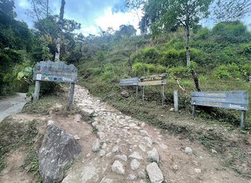
Park
Entrada al sendero Parque Nacional Chirripo
Discover the breathtaking landscapes and diverse ecosystems of Parque Nacional Chirripó, Costa Rica's highest national park, perfect for adventure seekers.
-
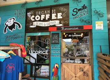
Gift shop
Fruity Monkey Poop Boutique
Explore the fun and eclectic offerings of Fruity Monkey Poop Boutique in Jacó, Costa Rica, where unique gifts and local flavors await.
-
Craft store
ArteCoVa
Explore the vibrant craftsmanship at ArteCoVa in Pejibaye—your gateway to unique, handcrafted treasures that capture the essence of Costa Rica.
Get your free copy of our complete guide to Chirripó National Park, delivered straight to you.
Everything on this page, from attractions and restaurants to essentials and local phrases, in one PDF you can read offline, print or share.
Already have an account? Sign in
Your Chirripó National Park guide is ready.
We'll send it to · Not you? Sign out

Getting your guide ready…
We are putting together a fresh copy of the Chirripó National Park guide. This can take up to a minute.
This can take a few moments. If your browser asks, choose Allow so the download can start. You'll find the guide in your Downloads folder.
Nothing happened? Download it again
Sorry, the guide is taking longer than usual. Please try again in a minute, or get it by email instead.
Chirripó National Park essentials
Currency and Payment
Safety
Emergency Situations
Do's and Don'ts
Local Tips
From Eve
Local phrases worth knowing
You don't need to get them perfect. A few words go a long way, and locals appreciate the effort.
Basics
| English | Local | Say it |
|---|---|---|
| Hello | Hola | [OH-lah] |
| Goodbye | Adiós | [ah-DYOS] |
| Yes | Sí | [SEE] |
| No | No | [NO] |
| Please/You're welcome | Por favor | [por fah-VOR] |
| Thank you | Gracias | [GRAH-syahs] |
| Excuse me/Sorry | Disculpe | [dis-KOOL-peh] |
| How are you? | ¿Cómo estás? | [KOH-moh es-TAS] |
| Fine. And you? | Bien. ¿Y tú? | [BYEN. ee TOO] |
| Do you speak English? | ¿Hablas inglés? | [AH-blas een-GLES] |
| I don't understand | No entiendo | [NO en-TYEN-doh] |
Eating & Drinking
| English | Local | Say it |
|---|---|---|
| I'd like to see the menu, please | Me gustaría ver el menú, por favor | [meh goos-tah-REE-ah BEHR el meh-NOO, por fah-VOR] |
| I don't eat meat | No como carne | [NO KOH-moh KARN-eh] |
| Cheers! | ¡Salud! | [sah-LOOD] |
| I would like to pay, please | Me gustaría pagar, por favor | [meh goos-tah-REE-ah pah-GAR, por fah-VOR] |
Emergencies
| English | Local | Say it |
|---|---|---|
| Help! | ¡Ayuda! | [ah-YOO-dah] |
| Go away! | ¡Vete! | [VEH-teh] |
| Call the Police! | ¡Llama a la policía! | [YAH-mah ah lah poh-lee-SEE-ah] |
| Call a doctor! | ¡Llama a un doctor! | [YAH-mah ah oon dok-TOR] |
| I'm lost | Estoy perdido | [es-TOY per-DEE-doh] |
| I'm ill | Estoy enfermo | [es-TOY en-FER-mo] |
Shopping
| English | Local | Say it |
|---|---|---|
| I'd like to buy... | Me gustaría comprar... | [meh goos-tah-REE-ah kom-PRAR] |
| I'm just looking | Solo estoy mirando | [SO-lo es-TOY mee-RAN-doh] |
| How much is it? | ¿Cuánto cuesta? | [KWAN-toh KWEST-ah] |
| That's too expensive | Eso es muy caro | [EH-so es MOO-ee KAH-roh] |
| Can you lower the price? | ¿Puedes bajar el precio? | [PWEH-des bah-HAR el PREH-see-oh] |
Time & Numbers
| English | Local | Say it |
|---|---|---|
| What time is it? | ¿Qué hora es? | [KEH OH-rah es] |
| It's one o'clock | Es la una | [es lah OO-nah] |
| Half past (10) | Y diez y media | [ee DYAS ee MEH-diah] |
| Morning | Mañana | [mah-NYAH-nah] |
| Afternoon | Tarde | [TAR-deh] |
| Evening | Noche | [NOH-cheh] |
| Yesterday | Ayer | [ah-YER] |
| Today | Hoy | [OY] |
| Tomorrow | Mañana | [mah-NYAH-nah] |
| 1 | Uno | [OO-no] |
| 2 | Dos | [DOS] |
| 3 | Tres | [TRES] |
| 4 | Cuatro | [KWA-tro] |
| 5 | Cinco | [SEEN-ko] |
| 6 | Seis | [SAYS] |
| 7 | Siete | [SYE-teh] |
| 8 | Ocho | [OH-cho] |
| 9 | Nueve | [NWEH-veh] |
| 10 | Diez | [DYAS] |
Transport & Directions
| English | Local | Say it |
|---|---|---|
| Where's a/the...? | ¿Dónde hay un/a...? | [DON-deh I un/a] |
| What's the address? | ¿Cuál es la dirección? | [KWAL es lah dee-rek-SYON] |
| Can you show me (on the map)? | ¿Me puedes mostrar (en el mapa)? | [meh PWEH-des mos-TRAR (en el MAH-pah)] |
| When's the next (bus)? | ¿Cuándo viene el próximo (bus)? | [KWAN-doh VYEH-neh el PROH-see-mo] |
| A ticket (to ....) | Un boleto (a....) | [OON boh-LEH-to (ah....)] |
History of Chirripó National Park
Indigenous Talamanca and Pre-Columbian Landscapes
The Talamanca mountains have long been part of the cultural and geographic world of Indigenous peoples, including communities associated with the broader Talamanca region. High passes, rivers and ridges connected lower valleys with upland environments used for travel, gathering and cultural activity. Archaeological evidence from southern Costa Rica shows complex societies with distinctive settlement and craft traditions, although the high summits themselves were not urban centres. Today, the importance of the range is both ecological and cultural, and visitors should understand that protected mountain landscapes exist within a wider history of Indigenous presence rather than being empty wilderness created only for modern recreation.
Spanish Colonial Expansion and the Southern Frontier
Spanish colonial control was weaker in the remote Talamanca mountains than in Costa Rica's central plateau. Rugged terrain, distance and Indigenous resistance limited sustained colonial settlement in the highlands. During the colonial and early republican periods, the area remained comparatively isolated, while nearby valleys gradually developed links to farming and cattle production. This frontier character helped preserve extensive forest and mountain ecosystems. The difficult geography that once restricted colonial administration later became one of the reasons the region retained a different landscape and settlement pattern from the more densely occupied central part of Costa Rica.
Agricultural Settlement in Pérez Zeledón
In the nineteenth and twentieth centuries, improved routes and migration encouraged the agricultural development of the valleys around modern Pérez Zeledón. Small farms, cattle holdings and later coffee production shaped communities south of the Talamanca range, including the settlements that now serve visitors to Chirripó. San Isidro de El General grew into the area's principal commercial centre, while San Gerardo de Rivas developed as a mountain gateway. Roads and rural services made the long approach more practical, but the park's interior remained accessible only by trail.
Scientific Exploration of Costa Rica's Highest Mountain
Cerro Chirripó became increasingly known to geographers, naturalists and mountaineers as Costa Rica's highest summit and as part of the country's exceptional chain of biological zones. Exploration and surveying helped document the changes from tropical forest to high-elevation páramo, while mountaineering interest brought greater attention to the range's exposed ridges and glacially shaped terrain. The name Chirripó is commonly associated with the region's Indigenous linguistic heritage, although interpretations of its precise meaning vary. The mountain's significance is therefore geographical, scientific and cultural rather than simply a matter of altitude.
Creation of Chirripó National Park in 1975
Chirripó National Park was established in 1975 to protect a major section of the Talamanca Range, including Cerro Chirripó and extensive forests, páramo and headwaters. Its creation formed part of Costa Rica's wider development of a national protected-area system during a period when conservation became central to national environmental policy. Protection placed limits on settlement, extraction and uncontrolled access while creating a framework for carefully managed recreation. The park's high ridges and watersheds now form part of an important conservation landscape linking with other protected areas in the Talamanca region.
Modern Trekking and Conservation Management
Chirripó's reputation as a demanding trekking destination grew as trails, refuges and visitor arrangements developed under the management of Costa Rica's protected-area authorities and local service providers. Regulations such as controlled entry, designated accommodation and limits on visitor numbers reflect the vulnerability of high-altitude vegetation and the difficulty of managing waste, water and rescue operations in remote terrain. Hiking remains economically important to gateway communities, but access is deliberately less intensive than at many lower-elevation attractions. The modern Chirripó experience is consequently shaped by the balance between public enjoyment, local livelihoods and conservation.
Chirripó National Park in Photos
Browse through our photo collection highlighting the charm and character of the destination.
Neighbouring regions of Chirripó National Park
The closest regions to Chirripó National Park, if you have time for more than one.
-

-

-

-

-


Swipe for more regions

