

Free Big Bend Travel Guide & Mobile App
Explore Big Bend with free travel guides. Discover regional history, expert tips, proposed trips, and audio guides on web or mobile app.


Explore Big Bend Florida for spring-fed rivers, tidal marshes, historic ports, wildlife, seafood and quiet Gulf Coast landscapes.
Read more about Big Bend
Getting to and around Big Bend
How to get there
Transportation
Top city travel guides in Big Bend
The cities of Big Bend, and the easiest places to base yourself.
-

-


Swipe for more cities
Destinations in Big Bend
Resorts, valleys and scenic spots worth a trip of their own.
-

-

-

-

-


Swipe for more destinations
Best attractions in Big Bend
Big Bend attractions are shaped by water, wildlife and distance rather than by a concentration of major urban museums. San Marcos de Apalache Historic State Park near St Marks explains the strategic history of a fortified river junction, while the St Marks National Wildlife Refuge protects extensive marshes, coastal habitat and important birding areas. Along the central coast, small fishing communities such as Carrabelle, Steinhatchee and Cedar Key provide working harbours, boat excursions and access to shallow Gulf waters. Inland, the Suwannee and its tributaries offer opportunities for canoeing, kayaking, swimming at suitable spring sites and observing wildlife from the water. State parks and conservation areas add boardwalks, woodland trails and interpretive displays, although facilities vary considerably. The region is particularly rewarding for anglers, paddlers, birdwatchers, photographers and visitors interested in traditional Gulf livelihoods. Seasonal scalloping, manatee viewing and fishing trips should be arranged with operators familiar with current regulations and local conditions.
-
State park
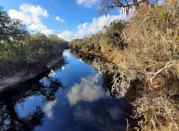
Suwannee River State Park
Explore the beauty and adventure of Suwannee River State Park, Florida's natural haven for outdoor enthusiasts and wildlife lovers.
-
Nature preserve
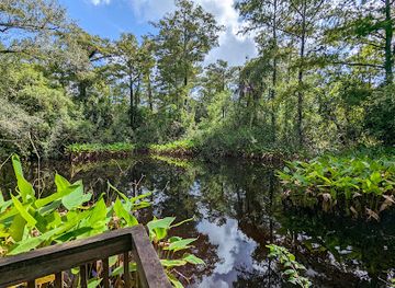
Big Cypress Bend Boardwalk
Explore Big Cypress Bend Boardwalk, a hidden gem in Florida's Everglades, showcasing stunning wildlife and lush subtropical vegetation.
-
Tourist attraction
Natural Bridge Battlefield Historic State Park
Explore a Civil War battlefield where history and nature intertwine, offering a serene escape with unique geological features and abundant wildlife near Tallahassee.
-
Wildlife refuge
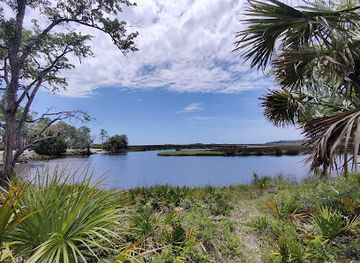
Big Bend Wildlife Management Area - Tide Swamp Unit
Discover the serene landscapes and rich biodiversity of Big Bend Wildlife Management Area - Tide Swamp Unit, a nature lover's paradise in Florida.

Best landmarks in Big Bend
San Marcos de Apalache Historic State Park is one of the Big Bend’s most important built landmarks, occupying a strategic point where the St Marks and Wakulla rivers meet and preserving the memory of successive Spanish, British, American and Confederate occupations. Cedar Key’s historic waterfront and compact island-town streets represent the region’s maritime past, when rail transport, fishing, shellfish and Gulf shipping sustained the community. The Cedar Keys National Wildlife Refuge, spread across low islands offshore, is a significant natural landmark associated with bird habitat and the shallow coastal environment. The Suwannee River is another defining feature: its broad, dark-water channels and limestone springs express the geological relationship between inland Florida and the Gulf. Around St Marks, the refuge’s marshes, lighthouse setting and open coastal views create a landscape landmark rather than a single monument. Historic cemeteries, old port structures and modest civic buildings across the small towns add quieter evidence of the region’s agricultural, timber and fishing history.
-
Shopping mall
The Village at Gulfstream Park
Explore The Village at Gulfstream Park, where shopping meets entertainment in Hallandale Beach, featuring dining, events, and vibrant nightlife.
-
State park
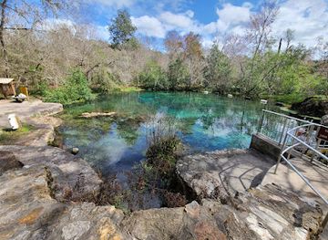
Ichetucknee Springs State Park
Explore the breathtaking beauty of Ichetucknee Springs State Park, where crystal-clear waters and lush landscapes await your adventure in the heart of Florida.
-
Botanical garden
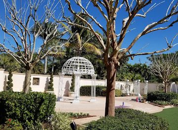
Florida Botanical Gardens
Explore the stunning landscapes and diverse plant life at Florida Botanical Gardens, a tranquil escape in Largo, perfect for nature lovers and families.
-
Fortress
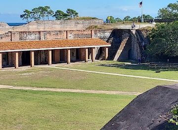
Fort Pickens
Explore Fort Pickens: A historic fortress on Pensacola Beach, blending military history with stunning coastal views and natural beauty.
Explore Big Bend on the map
Plan your trip on one map. See where the top cities, national parks and sights are, and book hotels and experiences in a few clicks.
Best hotels in Big Bend
Best restaurants in Big Bend
Dining in Big Bend is informal, local and closely tied to the Gulf, rivers and farming country. Waterfront restaurants and modest seafood establishments in places such as Cedar Key, Steinhatchee, St Marks and other coastal communities commonly focus on locally familiar preparations of fish, shrimp, oysters and crab, although availability depends on season, weather and regulation. Cedar Key is particularly associated with clam farming and shellfish, while inland towns provide diners with Southern comfort food, barbecue, country breakfasts and straightforward cafés. Seafood shacks, fish markets, rural restaurants and traditional pubs are often more representative of the region than formal dining rooms. Farmers’ markets and small food producers may offer citrus, vegetables, baked goods, honey and preserves, but schedules vary by town and season. Menus can change frequently, so asking where a catch or produce comes from is often more useful than relying on a fixed list of regional specialities.
-
Restaurant
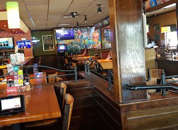
Applebee's Grill + Bar
Discover the lively atmosphere of Applebee's Grill + Bar in Riverview, where delicious American cuisine meets family-friendly fun.
-
Grill
The River's Edge Bar & Grill
Discover delicious dining at The River's Edge Bar & Grill in Gibsonton - where great food meets stunning views.
-
Breakfast
Village Inn
Experience the comfort of American dining at Village Inn in Riverview - where delicious breakfasts meet family-friendly service.
-
Chicken Wings
Buffalo Wild Wings
Experience the ultimate sports bar atmosphere at Buffalo Wild Wings in Riverview, where delicious chicken wings meet thrilling game day excitement.

Best bars in Big Bend
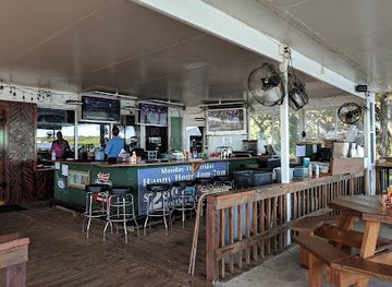
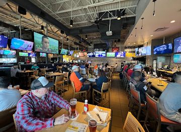
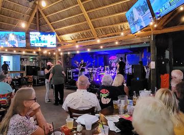
Nightlife in Big Bend is generally quiet and community-based rather than club-oriented. Coastal towns offer casual seafood restaurants, waterfront bars, traditional pubs and places where visitors can have a drink after fishing, paddling or watching the sunset. Cedar Key has the region’s most recognisable evening concentration, while Steinhatchee, St Marks, Carrabelle and the larger inland communities provide smaller selections of bars and restaurants. Live music and local events may appear seasonally, but schedules and opening arrangements are variable. In rural areas, evening activity often ends early and accommodation may be some distance from a dining or drinking venue, making a planned drive home important. The appeal lies in relaxed conversation, harbour views and local food rather than a large nightclub scene.
-
Bar
Flora-Bama
Flora-Bama: A vibrant beach bar and live music venue where fun and relaxation meet the beautiful Gulf Coast.
-
American
Whiskey Joe's | Tampa
Discover the vibrant flavors and stunning views of Whiskey Joe's, Tampa's premier waterfront restaurant and tiki bar, celebrating American and Caribbean cuisine.
-
American
Woody's River Roo
Experience the best of American cuisine and lively entertainment at Woody's River Roo in Ellenton, Florida.
-
Restaurant
Tiki Docks Riverview
Experience the vibrant flavors and tropical vibes at Tiki Docks Riverview, a top dining destination in Florida's Riverview.

Best nightclubs in Big Bend
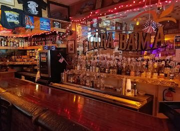
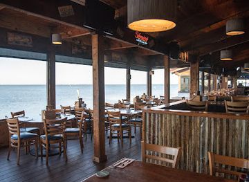
Nightlife in Big Bend is generally quiet and community-based rather than club-oriented. Coastal towns offer casual seafood restaurants, waterfront bars, traditional pubs and places where visitors can have a drink after fishing, paddling or watching the sunset. Cedar Key has the region’s most recognisable evening concentration, while Steinhatchee, St Marks, Carrabelle and the larger inland communities provide smaller selections of bars and restaurants. Live music and local events may appear seasonally, but schedules and opening arrangements are variable. In rural areas, evening activity often ends early and accommodation may be some distance from a dining or drinking venue, making a planned drive home important. The appeal lies in relaxed conversation, harbour views and local food rather than a large nightclub scene.
-
Restaurant
Applebee's Grill + Bar
Discover the heart of American cuisine at Applebee's Grill + Bar, a family-friendly restaurant offering a diverse menu and vibrant atmosphere in Riverview.
-
Sports bar
Glory Days Grill
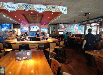
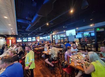
Experience the vibrancy of Glory Days Grill, a family-friendly sports bar in Riverview, Florida, where great food and fun meet.
Best shops in Big Bend
Shopping in Big Bend is centred on small-town high streets, marinas, galleries, farm stands, seafood markets and independent shops rather than large retail complexes. Cedar Key offers the broadest concentration of visitor-oriented shops, with local art, books, coastal gifts, shell-related products and food items reflecting its island setting. In other communities, practical supplies for boating and fishing sit alongside small galleries, craft outlets and locally produced preserves, honey, baked goods and seafood. Farmers’ markets and roadside stands appear in several parts of the region, but their days and seasonal availability should be checked locally. Visitors looking for meaningful souvenirs should consider regional artwork, photographs, pottery, preserves or responsibly sourced food products rather than collecting shells or natural materials from protected areas. Larger supermarkets and general shopping are more readily available in inland service towns such as Perry, Chiefland and Crawfordville.
-
Outlet mall
Tampa Premium Outlets
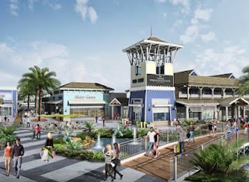
Discover unbeatable deals and a fantastic shopping experience at Tampa Premium Outlets, the premier outlet destination in Florida.
-
Department store
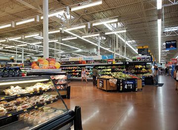
Walmart Supercenter
Discover the ultimate shopping experience at Walmart Supercenter in Gibsonton, Florida, where convenience meets affordability.
-
Breakfast
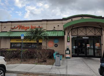
Village Inn
Discover the cozy charm of Village Inn in Riverview, Florida, serving delicious breakfasts and homemade pies in a family-friendly atmosphere.
-
Grocery store
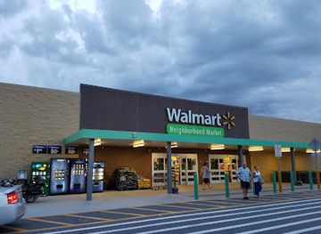
Walmart Neighborhood Market
Walmart Neighborhood Market in Riverview offers fresh groceries, baked goods, and household essentials at affordable prices for travelers and locals.
Get your free copy of our complete guide to Big Bend, delivered straight to you.
Everything on this page, from attractions and restaurants to essentials and local phrases, in one PDF you can read offline, print or share.
Already have an account? Sign in
Your Big Bend guide is ready.
We'll send it to · Not you? Sign out

Getting your guide ready…
We are putting together a fresh copy of the Big Bend guide. This can take up to a minute.
This can take a few moments. If your browser asks, choose Allow so the download can start. You'll find the guide in your Downloads folder.
Nothing happened? Download it again
Sorry, the guide is taking longer than usual. Please try again in a minute, or get it by email instead.
Big Bend essentials
Currency and Payment
Safety
Emergency Situations
Do's and Don'ts
Local Tips
From Eve
Local phrases worth knowing
You don't need to get them perfect. A few words go a long way, and locals appreciate the effort.
Basics
| English | Local | Say it |
|---|---|---|
| Hello | Howdy | [/haʊ.di/] |
| Goodbye | See ya | [/si jə/] |
| Yes | Yup | [/jʌp/] |
| No | Nah | [/nɑː/] |
| Please/You're welcome | No problem | [/noʊ ˈprɑːbləm/] |
| Thank you | Thanks | [/θæŋks/] |
| Excuse me/Sorry | Pardon me | [/ˈpɑːrdən mi/] |
| How are you? | How ya doin'? | [/haʊ jə ˈduː.ɪn/] |
| Fine. And you? | Good. You? | [/ɡʊd ju/] |
| Do you speak English? | Ya speakin' English? | [/jə ˈspiː.kɪn ˈɪŋ.ɡlɪʃ/] |
| I don't understand | I ain't gettin' it | [/aɪ eɪnt ˈɡɛt.ɪn ɪt/] |
Eating & Drinking
| English | Local | Say it |
|---|---|---|
| I'd like to see the menu, please | Can I see the menu, please? | [/kæn aɪ si ðə ˈmɛnjuː pliz/] |
| I don't eat meat | I don't do meat | [/aɪ doʊnt du mit/] |
| Cheers! | Cheers! | [/tʃɪrz/] |
| I would like to pay, please | Can I get the check, please? | [/kæn aɪ ɡɛt ðə tʃɛk pliz/] |
Emergencies
| English | Local | Say it |
|---|---|---|
| Help! | Help! | [/hɛlp/] |
| Go away! | Get lost! | [/ɡɛt lɔst/] |
| Call the Police! | Call the cops! | [/kɔl ðə kɑps/] |
| Call a doctor! | Get a doc! | [/ɡɛt ə dɑk/] |
| I'm lost | I’m turned around | [/aɪm tɜrnd əˈraʊnd/] |
| I'm ill | I ain't feelin' good | [/aɪ eɪnt ˈfiː.lɪn ɡʊd/] |
Shopping
| English | Local | Say it |
|---|---|---|
| I'd like to buy... | I wanna buy... | [/aɪ ˈwɑːnə baɪ/] |
| I'm just looking | Just browsing | [/dʒʌst ˈbraʊ.zɪŋ/] |
| How much is it? | What’s the price? | [/wʌts ðə praɪs/] |
| That's too expensive | That’s too pricey | [/ðæts tuː ˈpraɪ.si/] |
| Can you lower the price? | Can ya bring it down? | [/kæn jə brɪŋ ɪt daʊn/] |
Time & Numbers
| English | Local | Say it |
|---|---|---|
| What time is it? | What time is it? | [/wʌt taɪm ɪt/] |
| It's one o'clock | It's one o'clock | [/ɪts wʌn əˈklɑk/] |
| Half past (10) | Half past ten | [/hæf pæst tɛn/] |
| Morning | Mornin' | [/ˈmɔrnɪn/] |
| Afternoon | Afternoon | [/ˌæf.tərˈnun/] |
| Evening | Evenin' | [/ˈiv.nɪŋ/] |
| Yesterday | Yest'day | [/ˈjɛs.tə.deɪ/] |
| Today | Today | [/təˈdeɪ/] |
| Tomorrow | Tomorrah | [/təˈmɔrə/] |
| 1 | One | [/wʌn/] |
| 2 | Two | [/tuː/] |
| 3 | Three | [/θriː/] |
| 4 | Four | [/fɔr/] |
| 5 | Five | [/faɪv/] |
| 6 | Six | [/sɪks/] |
| 7 | Seven | [/ˈsɛv.ən/] |
| 8 | Eight | [/eɪt/] |
| 9 | Nine | [/naɪn/] |
| 10 | Ten | [/tɛn/] |
Transport & Directions
| English | Local | Say it |
|---|---|---|
| Where's a/the...? | Where's the...? | [/wɛrz ðə/] |
| What's the address? | What's the address? | [/wʌts ði ædˈrɛs/] |
| Can you show me (on the map)? | Can ya point it out? | [/kæn jə pɔɪnt ɪt aʊt/] |
| When's the next (bus)? | When's the next bus? | [/wɛn z ðə nɛkst bʌs/] |
| A ticket (to ....) | A ticket to... | [/ə ˈtɪk.ɪt tə/] |
History of Big Bend
Indigenous Coastal and River Communities
Long before European settlement, Indigenous peoples lived around the Big Bend’s rivers, springs, forests and Gulf estuaries. The region’s waterways supported fishing, shellfish gathering, hunting and trade, while inland routes connected the coast with north Florida. Different communities occupied or used different parts of the area over time, including peoples associated with the Apalachee, Timucua and later Seminole worlds. Archaeological evidence, shell middens and mound sites demonstrate the antiquity of coastal settlement, although many sites are fragile and not presented as conventional visitor attractions.
Spanish Missions and San Marcos de Apalache
Spanish influence reached the Big Bend during the colonial period through missions, military posts and trade routes linking the Gulf coast with settlements to the north. San Marcos de Apalache, at the meeting of the St Marks and Wakulla rivers, became a strategically important fortified settlement and trading point. The site changed hands and functions during the Spanish, British, American and Confederate eras. Today, San Marcos de Apalache Historic State Park interprets the layered history of the site and its importance to movement through the north Florida frontier.
Plantations, Timber and River Commerce
During the nineteenth century, parts of inland north Florida developed through cotton agriculture, while timber extraction and river transport became important across the wider Big Bend. The navigable St Marks and Suwannee systems connected plantations, sawmills and ports with Gulf shipping routes. Steamboats and later railways helped move agricultural and forest products, although the region never developed the dense urban network found elsewhere in Florida. The landscape of pine woods, rural roads, small settlements and former waterfront sites still reflects these overlapping economies.
Cedar Key and the Gulf Maritime Economy
Cedar Key grew as a Gulf port and transport centre during the nineteenth century, benefiting from its position among the shallow waters and islands of the Florida coast. Rail connections linked the community with inland markets, while fishing, shellfish, timber and shipping supported local livelihoods. Hurricanes and changing transport patterns repeatedly reshaped the town, but its maritime identity endured. Historic buildings, small museums and the working harbour provide clues to an economy based on water rather than large-scale tourism.
Civil War and Reconstruction on the Coast
The Big Bend’s ports and waterways mattered during the American Civil War because they connected inland resources with the Gulf and offered routes for blockade-running and coastal defence. Fortifications and military activity affected places including St Marks and Cedar Key, while the wider region experienced the disruption of wartime trade and the difficult transition into Reconstruction. The period did not create a single defining battlefield landscape across the region, but it altered shipping, agriculture and political life in communities that were already economically tied to the coast.
Railways, Fishing and Modern Conservation
In the late nineteenth and twentieth centuries, railways, highways, commercial fishing and timber continued to shape the Big Bend, even as many communities remained small and dispersed. Cedar Key, Steinhatchee and other coastal settlements developed reputations for fishing and shellfish, while inland springs and forests increasingly attracted visitors. State parks, wildlife refuges and marine protections now preserve significant wetlands, springs and wildlife habitat. Conservation has become central to the regional economy, alongside fishing, boating, agriculture and small-scale coastal tourism.
Big Bend in Photos
Browse through our photo collection highlighting the charm and character of the destination.
Neighbouring regions of Big Bend
The closest regions to Big Bend, if you have time for more than one.
-

-

-

-

-


Swipe for more regions
Explore more

Explore more of Florida
Discover Florida: A Sunshine State full of dazzling beaches, iconic theme parks, rich history, and stunning natural parks, offering endless adventures for every traveler.
Explore Florida