

Kreuzberg (Berlin) Travel Guide - Free
Explore Kreuzberg in Berlin with Evendo's free guide. Find the best shops, historic streets, restaurants, and gems on web or mobile.


Kreuzberg, Berlin blends canal walks, immigrant food traditions, street art, historic courtyards, independent shops and late-night neighbourhood culture.
Street Life and Local Character
Kreuzberg occupies a broad, varied part of Berlin south of the Spree, stretching from the Landwehrkanal and Potsdamer Platz area towards the former Görlitzer Bahnhof and the Neukölln boundary. Its character changes noticeably from one street to the next: grand Wilhelmine avenues give way to dense tenement blocks, leafy canal paths, post-industrial courtyards and lively commercial streets. Oranienstraße, Kottbusser Damm and Skalitzer Straße are among its best-known corridors, while the smaller streets around Bergmannkiez offer a more settled mixture of cafés, independent shops and residential architecture.Read more about Kreuzberg
History in the Urban Fabric
Canals, Parks and Culture
Best attractions in Kreuzberg
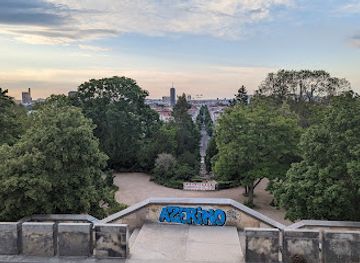
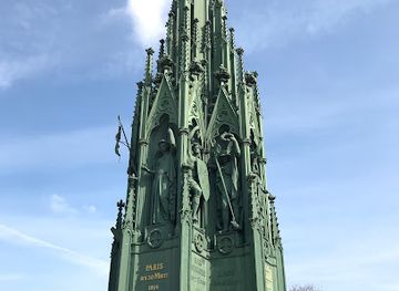
Kreuzberg's attractions are dispersed through a dense urban landscape rather than gathered around one monumental centre. Viktoriapark is the neighbourhood's principal green space, with wooded paths, a hillside waterfall and the National Monument on its summit. Along the Landwehrkanal, the route through Urbanhafen and across bridges such as Admiralbrücke offers a slower perspective on the surrounding tenements and public life. Markthalle Neun in Eisenbahnstraße is a major food and market venue, while the Berlinische Galerie presents modern art, photography and architecture in a former industrial setting near Alte Jakobstraße. The district's street art, especially around Oranienstraße, Skalitzer Straße and the SO36 area, is part of its visual identity, though works change and should be viewed respectfully. Görlitzer Park provides a large open space near the eastern side, with paths linking the neighbourhood towards the canal and former railway grounds.
-
Tourist attraction
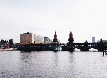
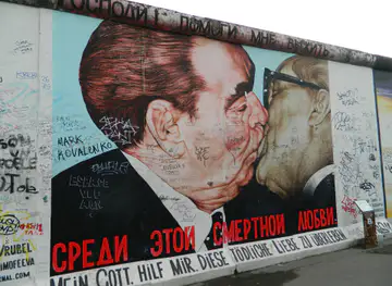
East Side Gallery
Explore the East Side Gallery, Berlin's iconic outdoor art gallery, where history and creativity collide on a preserved section of the Berlin Wall.
8 min drive · 2.6 km from neighbourhood centre
-
Tourist attraction
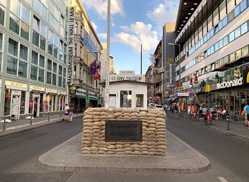
Checkpoint Charlie
Visit Checkpoint Charlie, the iconic Cold War border crossing in Berlin, and step back in time to experience the history of a divided city.
16 min walk · 1.3 km from neighbourhood centre
-
Tourist attraction
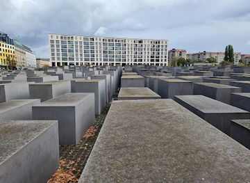
Memorial to the Murdered Jews of Europe
A powerful and moving Holocaust memorial in Berlin, inviting reflection on the past and serving as a constant reminder of the atrocities of the Nazi regime.
7 min drive · 2.3 km from neighbourhood centre
-
Tourist attraction
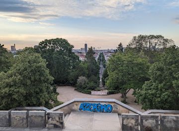
Viktoriapark
Discover a unique urban oasis in Berlin's Kreuzberg: waterfalls, history, panoramic views, and a tranquil escape await at Viktoriapark.
6 min drive · 2.0 km from neighbourhood centre
Best landmarks in Kreuzberg
Kreuzberg's most important landmarks reveal its layers of political, architectural and social history. The National Monument for the Wars of Liberation crowns Kreuzberg hill in Viktoriapark and gives the neighbourhood its name, while the park's artificial waterfall is an unusual piece of nineteenth-century landscape design. The dense tenement blocks and courtyards around Oranienstraße, Bergmannstraße and the former Luisenstadt provide the clearest architectural record of industrial-era expansion. Riehmers Hofgarten, a carefully planned residential complex near Yorckstraße, illustrates a more formal late-nineteenth-century approach to urban housing. The Landwehrkanal and its bridges remain essential infrastructure as well as public spaces, and the former Görlitzer Bahnhof grounds preserve the memory of a railway connection severed by war and division. Markthalle Neun continues the neighbourhood's long association with local commerce and food distribution in a purpose-built market hall.
-
Memorial
East Side Gallery
Experience history and art intertwined at the East Side Gallery, the world's largest open-air art gallery on the longest remaining section of the Berlin Wall, a symbol of freedom and unity.
8 min drive · 2.6 km from neighbourhood centre
-
Park
Viktoriapark
Discover panoramic views, a cascading waterfall, and historical monuments in Berlin's Viktoriapark, a vibrant urban oasis in the heart of Kreuzberg.
6 min drive · 2.0 km from neighbourhood centre
-
Monument
Prussian Monument for the Liberation Wars
Discover Prussian history and panoramic Berlin views at the iconic National Monument in Viktoriapark, a serene escape in the heart of vibrant Kreuzberg.
6 min drive · 1.9 km from neighbourhood centre
-
Monument
Peace Column
Discover Berlin's Peace Column in Mehringplatz: A historical monument commemorating peace and victory, offering a quiet escape in a vibrant urban setting.
9 min walk · 0.8 km from neighbourhood centre


Explore Kreuzberg on the map
A handpicked selection of must-see spots in Kreuzberg, mapped for you.
Best hotels in Kreuzberg
Best restaurants in Kreuzberg
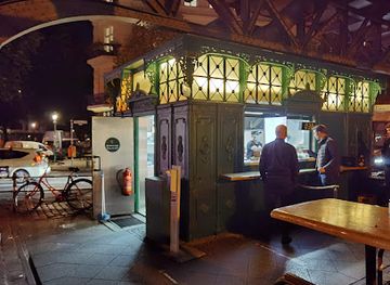
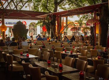
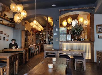
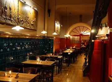
Kreuzberg's dining culture reflects its long-established migrant communities, alternative history and constant renewal. Turkish bakeries, döner counters, gözleme stalls and restaurants around Kottbusser Tor, Oranienstraße and Kottbusser Damm sit alongside Middle Eastern, South Asian, Vietnamese, Italian and contemporary plant-based cooking. Bergmannkiez offers cafés, bakeries and restaurants in a more residential setting, while Markthalle Neun provides a concentrated view of Berlin's craft-food and market culture, with its exact events varying by day. Independent venues range from straightforward neighbourhood eateries to more experimental kitchens, and many streets are better suited to casual grazing than formal dining. Vegetarian and vegan choices are widespread, but queues and limited seating are common at popular places. The best way to understand the scene is to follow the commercial streets and markets, where food traditions are closely tied to the neighbourhood's migration history and changing population.
-
Hamburger
Burgermeister Schlesisches Tor
Discover Burgermeister Schlesisches Tor: Where iconic burgers meet Berlin's vibrant street food culture under the U-Bahn.
8 min drive · 2.7 km from neighbourhood centre
-
Indian
AMRIT - Berlin Kreuzberg
Discover authentic Indian flavors at AMRIT - Berlin Kreuzberg, where every dish tells a story of tradition and spice.
18 min walk · 1.5 km from neighbourhood centre
-
Asian
Umami
Discover Berlin's Umami: A must-visit Asian restaurant offering vibrant flavors and exceptional dining experiences in Friedrichshain-Kreuzberg.
8 min drive · 2.7 km from neighbourhood centre
-
German
Max und Moritz
Discover Max und Moritz: A culinary gem in Berlin offering authentic German dishes and a cozy atmosphere perfect for all occasions.
11 min walk · 0.8 km from neighbourhood centre
Best bars in Kreuzberg
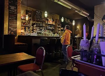
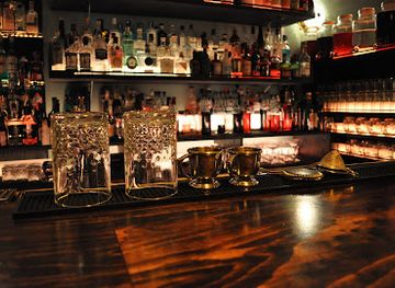
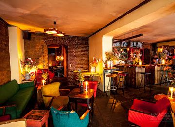
After dark, Kreuzberg combines long-established music venues, informal bars and late-opening cafés with a nightlife culture that remains highly street-oriented. Oranienstraße and the SO36 area are associated with alternative music, punk history and venues such as SO36 itself, while Skalitzer Straße and the roads around Kottbusser Tor provide a mixture of bars and casual drinking places. Lido, near the eastern side of the neighbourhood, hosts concerts and club nights in a former cinema setting. Along the canal, evening gatherings are more informal and can become crowded in warm weather. Kreuzberg's nightlife is not confined to conventional clubs: live music, small cultural venues, neighbourhood pubs and independent parties all contribute to the evening scene. Noise and door policies vary, so visitors should check current arrangements directly and remember that many of the surrounding buildings are residential.
-
Pub
Clash
Discover the vibrant nightlife at Clash in Berlin, where affordable drinks and great music create the perfect pub experience.
16 min walk · 1.2 km from neighbourhood centre
-
Bar
Bar39
Experience the vibrant nightlife of Kreuzberg at Bar39, where innovative cocktails meet a lively atmosphere, perfect for every night out in Berlin.
13 min walk · 1.0 km from neighbourhood centre
-
Cocktail bar
LIMONADIER Cocktailbar
Discover LIMONADIER Cocktailbar, where innovative cocktails and a vibrant atmosphere collide in the heart of Berlin's nightlife.
15 min walk · 1.2 km from neighbourhood centre
-
Bar
Lerchen&Eulen
Discover the cozy charm of Lerchen&Eulen, a beloved bar in Berlin's Friedrichshain-Kreuzberg, offering delightful cocktails and a vibrant ambiance.
6 min drive · 1.9 km from neighbourhood centre

Best nightclubs in Kreuzberg
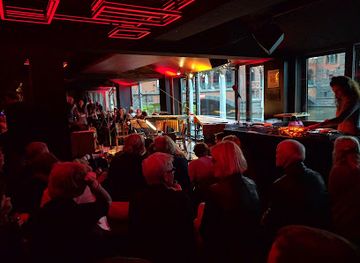
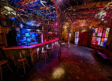
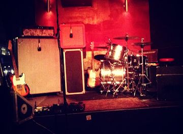
After dark, Kreuzberg combines long-established music venues, informal bars and late-opening cafés with a nightlife culture that remains highly street-oriented. Oranienstraße and the SO36 area are associated with alternative music, punk history and venues such as SO36 itself, while Skalitzer Straße and the roads around Kottbusser Tor provide a mixture of bars and casual drinking places. Lido, near the eastern side of the neighbourhood, hosts concerts and club nights in a former cinema setting. Along the canal, evening gatherings are more informal and can become crowded in warm weather. Kreuzberg's nightlife is not confined to conventional clubs: live music, small cultural venues, neighbourhood pubs and independent parties all contribute to the evening scene. Noise and door policies vary, so visitors should check current arrangements directly and remember that many of the surrounding buildings are residential.
-
Night club
Watergate
Discover electrifying nights at Watergate, Berlin's iconic nightclub with stunning river views and world-class electronic music.
9 min drive · 2.9 km from neighbourhood centre
-
Night club
Ritter Butzke
Discover the heart of Berlin's nightlife at Ritter Butzke, a night club where music and art unite for an unforgettable experience.
7 min walk · 0.5 km from neighbourhood centre
-
Night club
Monarch Bar
Discover Monarch Bar: Berlin's ultimate night club for live music, eclectic vibes, and affordable drinks in the heart of the city.
14 min walk · 1.1 km from neighbourhood centre
-
Night club
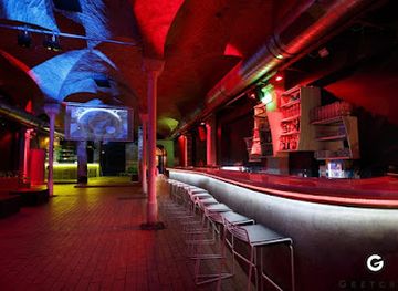
Gretchen
Experience the vibrant nightlife of Berlin at Gretchen, a top live music venue and night club known for its eclectic atmosphere and diverse music scene.
14 min walk · 1.1 km from neighbourhood centre
Best shops in Kreuzberg
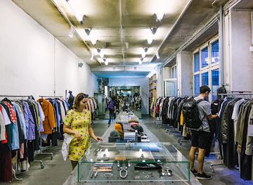
Shopping in Kreuzberg is strongest on its everyday commercial streets, where Turkish and international food shops stand beside independent fashion, design and second-hand businesses. Oranienstraße is the main browsing route, with small retailers, bookshops, cafés and long-established local businesses, while Bergmannstraße and the surrounding Bergmannkiez provide a more polished mix of specialist shops and food stores. Maybachufer's market, on the canal near the Neukölln boundary, is associated with fabrics, produce and inexpensive household goods, although its precise trading pattern should be checked locally. Around Kottbusser Damm and Kottbusser Tor, bakeries, grocers and delicatessen shops reflect Kreuzberg's migrant commercial history more directly than boutique retail does. The neighbourhood is not a single shopping district: its appeal lies in moving between practical local commerce, changing independent businesses and the informal retail culture of markets and smaller side streets.
-
Clothing store
Voo Store
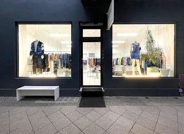
Discover Voo Store in Berlin: the perfect fusion of trendy fashion and artisanal coffee in a vibrant atmosphere.
16 min walk · 1.3 km from neighbourhood centre
-
Vintage clothing store
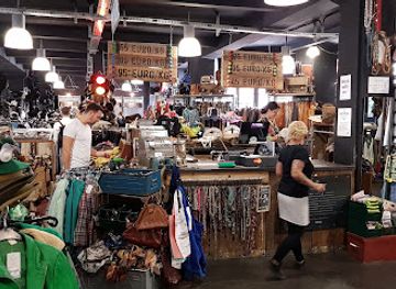
PICKNWEIGHT - VINTAGE KILO STORE
Explore Berlin's premier vintage kilo store for unique clothing finds, where fashion meets sustainability in a fun shopping experience.
17 min walk · 1.3 km from neighbourhood centre
-
Vintage clothing store
CALYPT Store
Explore the unique vintage clothing selection at CALYPT Store, a hidden gem in Berlin's Friedrichshain-Kreuzberg district, perfect for fashion enthusiasts.
9 min drive · 2.8 km from neighbourhood centre
-
Vintage clothing store
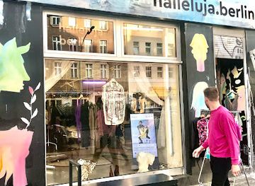
halleluja.berlin | Inhaber: Karasu & Wohlleber GbR
Discover unique vintage treasures at Halleluja Berlin, where eco-friendly fashion meets eclectic style in the heart of the city.
17 min walk · 1.3 km from neighbourhood centre
Kreuzberg essentials
Getting There
Getting Around
Safety
Emergency Situations
Do's and Don'ts
Local Tips

From Eve
Local phrases worth knowing
You don't need to get them perfect. A few words go a long way, and locals appreciate the effort.
Basics
| English | Local | Say it |
|---|---|---|
| Hello | Hallo | [ha-lo] |
| Goodbye | Auf Wiedersehen | [auf vee-der-sehn] |
| Yes | Ja | [ya] |
| No | Nein | [nine] |
| Please/You're welcome | Bitte | [bi-te] |
| Thank you | Danke | [dahn-ke] |
| Excuse me/Sorry | Entschuldigung | [ent-shool-di-gung] |
| How are you? | Wie geht es dir? | [vee geht es deer?] |
| Fine. And you? | Gut. Und dir? | [goot. oont deer?] |
| Do you speak English? | Sprichst du Englisch? | [shprikhst doo eng-lish?] |
| I don't understand | Ich verstehe nicht | [ikh fer-shtay-e nikht] |
Eating & Drinking
| English | Local | Say it |
|---|---|---|
| I'd like to see the menu, please | Ich möchte bitte die Speisekarte sehen | [ikh mehrkhte bi-te dee shpi-ze-kahr-te zay-en] |
| I don't eat meat | Ich esse kein Fleisch | [ikh es-se kine fli-sh] |
| Cheers! | Prost! | [prost] |
| I would like to pay, please | Ich möchte bitte zahlen | [ikh mehrkhte bi-te tsah-len] |
Emergencies
| English | Local | Say it |
|---|---|---|
| Help! | Hilfe! | [hil-fe] |
| Go away! | Geh weg! | [gey vehg] |
| Call the Police! | Ruf die Polizei! | [roof dee po-lee-tsai] |
| Call a doctor! | Ruf einen Arzt! | [roof i-nen ahrts] |
| I'm lost | Ich habe mich verirrt | [ikh hah-be mish feh-rit] |
| I'm ill | Ich bin krank | [ikh been krank] |
Shopping
| English | Local | Say it |
|---|---|---|
| I'd like to buy... | Ich möchte kaufen... | [ikh mehrkhte kow-fen] |
| I'm just looking | Ich schaue nur | [ikh shau-e noor] |
| How much is it? | Wie viel kostet das? | [vee feel kos-tet das] |
| That's too expensive | Das ist zu teuer | [das ist tso too-er] |
| Can you lower the price? | Kannst du den Preis senken? | [kahnst doo den prees zen-ken] |
Time & Numbers
| English | Local | Say it |
|---|---|---|
| What time is it? | Wie spät ist es? | [vee spet ist es] |
| It's one o'clock | Es ist ein Uhr | [es ist iyn oor] |
| Half past (10) | Halb zehn | [halb tsayn] |
| Morning | Morgen | [mohr-ghen] |
| Afternoon | Nachmittag | [nahkh-mit-tahg] |
| Evening | Abend | [ah-bent] |
| Yesterday | Gestern | [gey-stern] |
| Today | Heute | [hoi-te] |
| Tomorrow | Morgen | [mohr-ghen] |
| 1 | Eins | [iyns] |
| 2 | Zwei | [tsvai] |
| 3 | Drei | [dray] |
| 4 | Vier | [feer] |
| 5 | Fünf | [fuhnf] |
| 6 | Sechs | [zeks] |
| 7 | Sieben | [zee-ben] |
| 8 | Acht | [ahkt] |
| 9 | Neun | [noyn] |
| 10 | Zehn | [tsayn] |
Transport & Directions
| English | Local | Say it |
|---|---|---|
| Where's a/the...? | Wo ist ein/der...? | [vo ist iyn/dehr] |
| What's the address? | Wie lautet die Adresse? | [vee lau-tet dee ah-dreh-suh] |
| Can you show me (on the map)? | Kannst du mir das zeigen (auf der Karte)? | [kahnst doo meer das tsee-gen (owf dehr kar-te)] |
| When's the next (bus)? | Wann kommt der nächste (Bus)? | [vahn komt dehr nikh-ste (boos)] |
| A ticket (to ....) | Eine Fahrkarte (nach ...) | [i-ne fahr-kahr-te (nakh)] |
History of Kreuzberg
From Rural Land to Suburb
Before Berlin's nineteenth-century growth reached the area, the land south of the historic city was a mixture of fields, gardens and small settlements. The name Kreuzberg refers to the hill now dominated by Karl Friedrich Schinkel's National Monument, completed in 1821. Urban expansion accelerated after the removal of Berlin's customs wall in the 1860s, and the future Kreuzberg became part of a rapidly developing southern suburb. New roads, tenement construction and industrial premises connected the area more closely to the expanding capital, replacing much of its earlier semi-rural character.
Tenements and Industrial Growth
During the late nineteenth and early twentieth centuries, Kreuzberg filled with dense Mietskasernen, or large rental blocks, built to house Berlin's growing workforce. Streets around Kottbusser Tor, Moritzplatz and the former Luisenstadt developed a mixture of courtyards, workshops, factories and small businesses. The Landwehrkanal supported transport and industrial activity, while railway infrastructure and nearby market facilities reinforced the district's practical, working identity. The resulting buildings, often arranged around successive courtyards, still define much of Kreuzberg's streetscape even where individual blocks were damaged or rebuilt.
War, Division and the Wall
The Second World War caused extensive damage in parts of Kreuzberg, leaving vacant sites among the surviving nineteenth-century blocks. After 1945, the neighbourhood lay in West Berlin, directly beside the Soviet sector and later the Berlin Wall. Its eastern edge was cut off from neighbouring districts, while the area around Görlitzer Bahnhof lost its railway function and became an unusual open space. The isolated position, relatively low rents and large amount of damaged or underused housing helped attract students, artists, political groups and migrant families, particularly during the post-war decades.
Migration, Protest and Reunification
From the 1960s onwards, Kreuzberg became strongly associated with Turkish migration, alternative housing projects, squatting and protest movements. The area around Kottbusser Tor and Oranienstraße developed a lasting Turkish and international commercial culture, while the districts of SO36 and Kreuzberg 61 acquired distinct social and political identities. Reunification removed the physical border and brought new investment, cultural projects and rising property pressure. The contemporary neighbourhood reflects these overlapping histories: established migrant businesses, protected and renovated tenements, creative industries, nightlife venues and new development now share streets once divided by the Wall.
Kreuzberg in Photos
Browse through our photo collection highlighting the charm and character of the destination.
Neighbourhoods near Kreuzberg
The closest neighbourhoods to Kreuzberg, if you have time for more than one stop.
-
-
-

-


Swipe for more neighbourhoods
Explore more

Explore more of Berlin
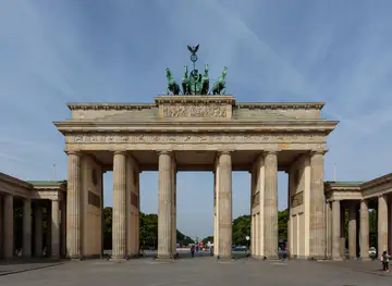
Berlin blends Prussian grandeur, Cold War history, world-class museums, creative neighbourhoods and memorable urban culture across Germany’s lively capital.
Explore Berlin