

Free Southeast Iowa Travel Guide & Mobile App
Explore Southeast Iowa with free travel guides. Discover regional history, expert tips, proposed trips, and audio guides on web or mobile app.


Explore Southeast Iowa for Mississippi River towns, historic villages, prairie roads, heritage museums, local food and unhurried outdoor journeys.
Read more about Southeast Iowa
When is the best time to visit Southeast Iowa?
Best: May, September–October · 18–24°C| Month | High (°C) | Rainfall (mm) |
|---|---|---|
| January | 1 | 29 |
| February | 3 | 31 |
| March | 10 | 51 |
| April | 18 | 78 |
| May (best) | 23 | 99 |
| June | 28 | 114 |
| July | 30 | 105 |
| August | 29 | 95 |
| September (best) | 24 | 81 |
| October (best) | 18 | 65 |
| November | 11 | 44 |
| December | 3 | 30 |
Getting to and around Southeast Iowa
How to get there
Transportation
Top city travel guides in Southeast Iowa
The cities of Southeast Iowa, and the easiest places to base yourself.
-

-

-
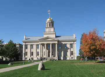
-


Swipe for more cities
Best attractions in Southeast Iowa
Southeast Iowa's attractions are strongest when experienced as a combination of heritage, landscape and small-town culture. Along the Mississippi, Burlington offers historic streets, riverfront views and the sharply sloping Snake Alley, while Fort Madison combines a reconstructed nineteenth-century military post with a preserved downtown and river setting. Keokuk's position at the confluence of the Mississippi and Des Moines rivers adds historical and engineering interest, and Muscatine's National Pearl Button Museum explains the region's unusual shell-button industry. Inland, the Villages of Van Buren bring together historic river villages, old mills, bridges and wooded valley roads. Ottumwa provides museums, civic heritage and access to the wider Des Moines River region, while Fairfield adds galleries, cultural venues and a distinctive modern spiritual and educational presence. Mount Pleasant is home to Midwest Old Threshers, where agricultural machinery and rural technology form the focus of a major heritage complex and annual gathering. State parks, wildlife areas, river trails, farm roads and prairie remnants provide opportunities for walking, fishing, paddling and birdwatching, although conditions and access vary seasonally.
-
State park
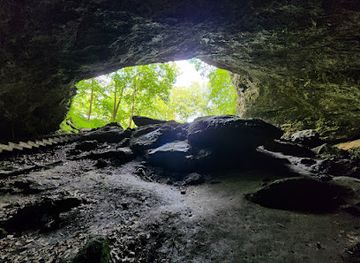
Maquoketa Caves State Park
Discover the captivating limestone caves and scenic trails of Maquoketa Caves State Park, an outdoor paradise in Iowa for nature lovers and adventure seekers.
-
Tourist attraction
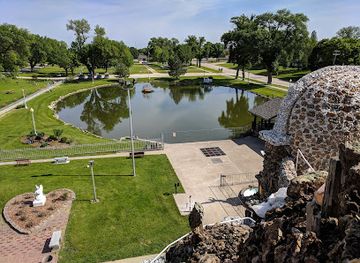
Shrine of the Grotto of the Redemption
Discover the serene beauty of the Shrine of the Grotto of the Redemption in West Bend, Iowa, a unique blend of spirituality, art, and nature.
-
State park
Pikes Peak State Park
Discover breathtaking views, historic Native American mounds, and scenic trails at Iowa's Pikes Peak State Park, a natural escape on the Mississippi River.
-
Park
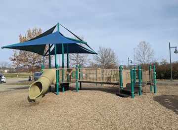
Raccoon River Park
Explore nature and recreation at Raccoon River Park in West Des Moines, offering a lake, trails, sports, and family fun.

Best landmarks in Southeast Iowa
The Mississippi River is Southeast Iowa's defining natural landmark, shaping the location, economy and appearance of communities from Muscatine southwards. Burlington's Snake Alley is one of the region's most recognisable built features, a steep, tightly curving historic street that illustrates the town's hilly river bluff setting. Fort Madison's reconstructed fort marks the early United States military presence on the upper Mississippi, while its historic downtown preserves the scale of a nineteenth-century commercial river town. Keokuk's river confluence and lock-and-dam landscape demonstrate the continuing importance of navigation and water control. In the Villages of Van Buren, the Des Moines River valley, historic bridges, timber buildings and old mill sites provide a more intimate landmark vocabulary. Mount Pleasant's Midwest Old Threshers grounds represent the agricultural technology that shaped much of the surrounding countryside. Courthouses, churches, depots, warehouses and brick commercial blocks across the region are also significant, not for monumental size but for the way they reveal the development of Iowa's river and farm communities.
-
Market
The District: Czech Village & New Bohemia
Explore Czech Village & New Bohemia: A vibrant Cedar Rapids district with culture, dining, unique shops, and historical charm.
-
Tourist attraction
Shrine of the Grotto of the Redemption
Discover the world's largest grotto in West Bend, Iowa: a breathtaking shrine of faith, art, and geological wonder, open 24/7.
-
Visitor center
Amana Colonies
Discover the Amana Colonies: A unique blend of German heritage, craftsmanship, and communal history in the heart of Iowa.
-
Historical landmark
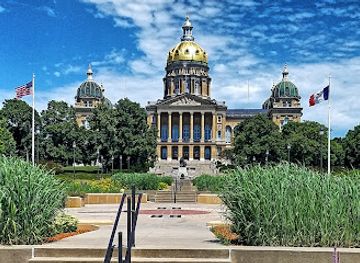
Iowa State Capitol
Discover Iowa's Golden-Domed Capitol: A historic landmark offering free tours, stunning architecture, and panoramic city views in Des Moines.

Explore Southeast Iowa on the map
Plan your trip on one map. See where the top cities, national parks and sights are, and book hotels and experiences in a few clicks.
Best hotels in Southeast Iowa
Best restaurants in Southeast Iowa
Dining in Southeast Iowa reflects the region's agricultural economy, river towns and practical Midwestern traditions. Independent cafés, bakeries, family restaurants and traditional diners are common in the larger communities, often serving breakfasts, sandwiches, burgers, soups and locally familiar comfort food. Farm stands and seasonal markets provide fruit, vegetables, baked goods and other produce, while county fairs and community events bring regional specialities into a social setting. Mississippi towns may offer river-oriented menus and contemporary restaurants alongside long-established taverns, while inland communities tend to combine cafés, family dining and pub food with a growing selection of international and modern options. Iowa pork, beef, sweet corn and other farm products are widely represented, though menus vary by season and town. Local breweries, wineries and craft-drink producers can be found in parts of the region, but rural opening patterns differ, so checking current arrangements before making a special journey is sensible.
-
Hamburger
Zombie Burger + Drink Lab
Discover gourmet burgers and playful horror-themed dining at Zombie Burger + Drink Lab in Des Moines – where every bite is an adventure!
-
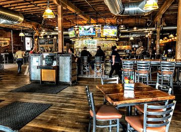
Restaurant
The Iowa Taproom
Experience the best of Iowa's craft beer at The Iowa Taproom in Des Moines, featuring over 100 taps of local brews and delicious American cuisine.
-
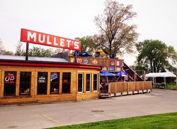
Breakfast
Mullets Restaurant
Experience delectable breakfasts and lively atmosphere at Mullets Restaurant in Little Italy, Des Moines – a must-visit culinary spot.
-
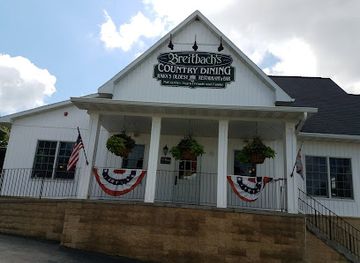
American
Breitbach's Country Dining
Experience authentic American cuisine in a charming setting at Breitbach's Country Dining - a family tradition that delights every palate.
Best bars in Southeast Iowa
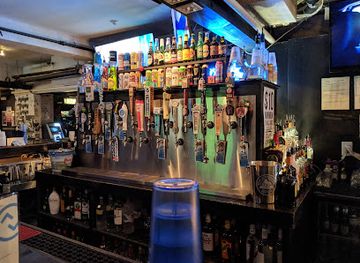
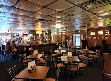
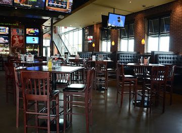
Evening life in Southeast Iowa is centred more on pubs, restaurants, live music, community events and historic social venues than on a large nightclub scene. Burlington, Ottumwa, Fairfield, Muscatine and Mount Pleasant generally offer the broadest choice of bars and evening cafés, with river towns adding a relaxed waterfront dimension in warmer months. Traditional taverns remain important meeting places, while newer breweries, cocktail-focused venues and restaurants provide alternatives to a conventional bar night. Fairfield's cultural and international communities contribute to a more varied arts and evening programme than might be expected from its size, although events change frequently. In smaller villages, evening options are limited and may depend on local festivals, performances or the opening days of individual establishments. Transport planning matters in rural areas, particularly if drinking alcohol, as distances between communities can be considerable and public transport is limited.
-
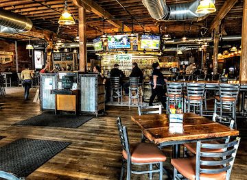
Bar
The Iowa Taproom
Discover the best of Iowa's craft beer scene and delicious American cuisine at The Iowa Taproom in the heart of Des Moines.
-
Bar
Up-Down DSM
Experience the ultimate fusion of cocktail culture and arcade fun at Up-Down DSM in Des Moines, where nostalgia meets nightlife in a vibrant atmosphere.
-
Bar
The High Life Lounge
Discover the charm of The High Life Lounge, where American cuisine meets a vibrant bar atmosphere in Downtown Des Moines.
-
Grill
Wellman's Pub & Rooftop
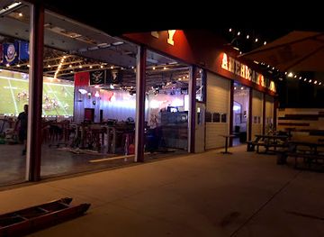
Discover the vibrant atmosphere of Wellman's Pub & Rooftop — a premier grill and night club in West Des Moines with stunning views and delicious food.
Best nightclubs in Southeast Iowa
Evening life in Southeast Iowa is centred more on pubs, restaurants, live music, community events and historic social venues than on a large nightclub scene. Burlington, Ottumwa, Fairfield, Muscatine and Mount Pleasant generally offer the broadest choice of bars and evening cafés, with river towns adding a relaxed waterfront dimension in warmer months. Traditional taverns remain important meeting places, while newer breweries, cocktail-focused venues and restaurants provide alternatives to a conventional bar night. Fairfield's cultural and international communities contribute to a more varied arts and evening programme than might be expected from its size, although events change frequently. In smaller villages, evening options are limited and may depend on local festivals, performances or the opening days of individual establishments. Transport planning matters in rural areas, particularly if drinking alcohol, as distances between communities can be considerable and public transport is limited.
-
Gay bar
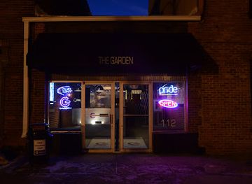
The Garden Nightclub
Discover the vibrant nightlife at The Garden Nightclub in Des Moines, a welcoming space for entertainment, dancing, and unforgettable moments.
-
Bar
Miss Kitty’s Country Bar Dance Nightclub and Honky Tonk
Discover Clive's vibrant nightlife at Miss Kitty's Country Bar, where live music, dancing, and delicious drinks create unforgettable experiences.
-
Bar
Hazzard County American Saloon
Discover the vibrant nightlife of Cedar Rapids at Hazzard County American Saloon, where music, drinks, and fun come together for an unforgettable experience.
-
Night club
Woodys Show Club
Discover the thrill of Cedar Rapids' nightlife at Woodys Show Club, where adult entertainment meets vibrant bar culture for an unforgettable experience.

Best shops in Southeast Iowa
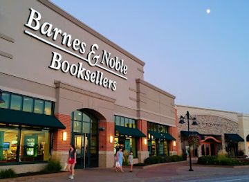
Shopping in Southeast Iowa is focused on independent high streets, practical local commerce, antiques, craft work and seasonal produce rather than large-scale luxury retail. Burlington, Ottumwa, Fairfield, Muscatine, Mount Pleasant, Fort Madison and Keokuk each provide the broadest selection of shops, cafés and services, while smaller historic villages are better suited to browsing galleries, antique outlets and occasional artisan businesses. Farmers' markets and farm stands are useful for Iowa-grown produce, baked goods, preserves and locally made items, with availability changing through the growing season. Visitors may also find pottery, woodworking, textiles, paintings, books and handmade gifts in galleries and independent shops, particularly in communities with established arts scenes. Regional food products make practical souvenirs, but some rural businesses operate limited hours or accept cash only. Historic downtowns are often more rewarding for character and local browsing than out-of-town retail strips, and seasonal fairs can provide additional craft and produce stalls.
-
Shopping mall
Coral Ridge Mall
Discover shopping, dining, and entertainment at Coral Ridge Mall in Coralville, Iowa - a vibrant destination for all visitors.
-
Outlet mall
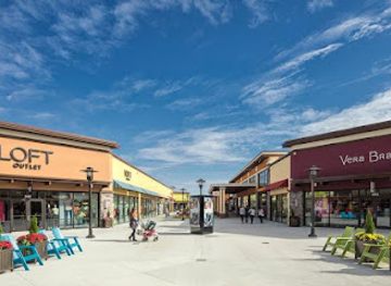
Outlets of Des Moines
Discover unbeatable deals at Outlets of Des Moines, where stylish shopping meets outdoor charm in Altoona, Iowa.
-
Gift shop
Brass Armadillo Antique Mall - Des Moines
Explore the Brass Armadillo Antique Mall in Des Moines for a unique blend of antiques, collectibles, and vintage treasures in a charming atmosphere.
-
Shopping mall
Old Capitol Town Center
Explore Old Capitol Town Center: A vibrant shopping mall in Iowa City filled with unique local shops, restaurants, and cultural experiences for every tourist.
Get your free copy of our complete guide to Southeast Iowa, delivered straight to you.
Everything on this page, from attractions and restaurants to essentials and local phrases, in one PDF you can read offline, print or share.
Already have an account? Sign in
Your Southeast Iowa guide is ready.
We'll send it to · Not you? Sign out

Getting your guide ready…
We are putting together a fresh copy of the Southeast Iowa guide. This can take up to a minute.
This can take a few moments. If your browser asks, choose Allow so the download can start. You'll find the guide in your Downloads folder.
Nothing happened? Download it again
Sorry, the guide is taking longer than usual. Please try again in a minute, or get it by email instead.
Southeast Iowa essentials
Currency and Payment
Safety
Emergency Situations
Do's and Don'ts
Local Tips
From Eve
Local phrases worth knowing
You don't need to get them perfect. A few words go a long way, and locals appreciate the effort.
Basics
| English | Local | Say it |
|---|---|---|
| Hello | Howdy | [Haud-ee] |
| Goodbye | See ya | [See yah] |
| Yes | Yup | [Yup] |
| No | Nope | [Nope] |
| Please/You're welcome | Sure thing | [Shur thing] |
| Thank you | Thanks a lot | [Thanks uh lot] |
| Excuse me/Sorry | Pardon me | [Pardon me] |
| How are you? | How ya doin'? | [How yah doin'?] |
| Fine. And you? | Good. And you? | [Good. And you?] |
| Do you speak English? | You speakin' English? | [You speakin' English?] |
| I don't understand | I ain't followin' you | [I ain't followin' you] |
Eating & Drinking
| English | Local | Say it |
|---|---|---|
| I'd like to see the menu, please | Can I see the menu, please? | [Can I see the menu, please?] |
| I don't eat meat | I don't do meat | [I don't do meat] |
| Cheers! | Cheers! | [Cheers!] |
| I would like to pay, please | Can I get the check, please? | [Can I get the check, please?] |
Emergencies
| English | Local | Say it |
|---|---|---|
| Help! | Help! | [Help!] |
| Go away! | Get lost! | [Get lost!] |
| Call the Police! | Call the cops! | [Call the cops!] |
| Call a doctor! | Get a doctor! | [Get a doctor!] |
| I'm lost | I’m turned around | [I’m turned around] |
| I'm ill | I'm not feelin' good | [I'm not feelin' good] |
Shopping
| English | Local | Say it |
|---|---|---|
| I'd like to buy... | I wanna buy... | [I wanna buy...] |
| I'm just looking | Just lookin' | [Just lookin'] |
| How much is it? | What’s it cost? | [What’s it cost?] |
| That's too expensive | That's way too pricey | [That's way too pricey] |
| Can you lower the price? | Can you knock down the price? | [Can you knock down the price?] |
Time & Numbers
| English | Local | Say it |
|---|---|---|
| What time is it? | What time you got? | [What time you got?] |
| It's one o'clock | It's one o'clock | [It's one o'clock] |
| Half past (10) | Half past ten | [Half past ten] |
| Morning | Mornin' | [Mornin'] |
| Afternoon | Afternoon | [Afternoon] |
| Evening | Evenin' | [Evenin'] |
| Yesterday | Yesterday | [Yesterday] |
| Today | Today | [Today] |
| Tomorrow | Tomorrow | [Tomorrow] |
| 1 | One | [One] |
| 2 | Two | [Two] |
| 3 | Three | [Three] |
| 4 | Four | [Four] |
| 5 | Five | [Five] |
| 6 | Six | [Six] |
| 7 | Seven | [Seven] |
| 8 | Eight | [Eight] |
| 9 | Nine | [Nine] |
| 10 | Ten | [Ten] |
Transport & Directions
| English | Local | Say it |
|---|---|---|
| Where's a/the...? | Where's a...? | [Where's a...?] |
| What's the address? | What’s the address? | [What’s the address?] |
| Can you show me (on the map)? | Can you point it out on the map? | [Can you point it out on the map?] |
| When's the next (bus)? | When's the next bus? | [When's the next bus?] |
| A ticket (to ....) | A ticket to... | [A ticket to...] |
History of Southeast Iowa
Indigenous Mississippi and Des Moines River Landscapes
Long before American settlement, the Mississippi River, Des Moines River and their tributaries supported Indigenous travel, trade, hunting and diplomacy. The Sauk and Meskwaki were among the peoples with important connections to the region, alongside earlier cultures whose archaeological remains are found across the wider Midwest. River corridors were not empty wilderness but established cultural landscapes. Later United States treaties and the forced removal of Indigenous communities profoundly altered ownership and settlement patterns, a history that should be understood alongside the region's later town-building and agricultural development.
American Settlement and the Black Hawk War Era
Following the expansion of United States control west of the Mississippi, surveyed land was opened to incoming settlers, traders and speculators. The Black Hawk War of 1832 was part of the larger conflict surrounding Indigenous dispossession in the upper Mississippi Valley. New communities developed at river crossings and landings, while military posts and commercial routes strengthened federal authority. Fort Madison, established earlier on the Mississippi, represents this period of contested frontier power and remains one of the region's most tangible connections with the early nineteenth century.
Burlington and the Iowa Territorial Capital
Burlington became Iowa's first territorial capital in 1838, shortly after the creation of the Iowa Territory. Its position on the Mississippi made it a natural centre for administration, shipping and commerce, although the capital later moved to Iowa City and ultimately to Des Moines. The period established Burlington as one of Southeast Iowa's leading urban communities. Historic streets, older commercial buildings and river-oriented development still reflect the importance of the town during Iowa's transition from frontier territory to organised state.
River Commerce, Religious Migration and Early Towns
Throughout the nineteenth century, steamboats and later railways connected Southeast Iowa with St Louis, the upper Mississippi Valley and inland agricultural districts. Towns such as Keokuk, Fort Madison and Muscatine prospered as transfer points for grain, timber, livestock and manufactured goods. The region also lay along routes used by religious migrants travelling west, including members of the Church of Jesus Christ of Latter-day Saints who crossed Iowa during the 1840s. Their movements form part of the wider story of migration through the state, even where major associated settlements lay beyond Southeast Iowa.
Railroads, Coal and Agricultural Industrialisation
Railroads changed the scale and direction of regional trade from the mid-nineteenth century onwards. They linked river ports to inland farms, encouraged the growth of depots and warehouses, and helped towns such as Ottumwa become important commercial and industrial centres. Coal mining also developed around Ottumwa and other parts of southern Iowa, supplying railways, homes and factories before the industry declined. Agriculture remained fundamental, but processing, machinery, banking and transport meant that Southeast Iowa's economy was never solely rural.
Muscatine's Pearl Button Industry
Muscatine became internationally associated with pearl buttons made from freshwater mussel shells gathered in the Mississippi. The industry expanded during the late nineteenth and early twentieth centuries, creating specialised processing, cutting and finishing work and drawing labour to the river town. Its environmental costs and eventual decline followed changes in fashion, materials and mussel availability. The National Pearl Button Museum preserves this distinctive industrial heritage and explains how a natural river resource shaped manufacturing, employment and civic identity.
Modern Heritage and Cultural Renewal
The twentieth and twenty-first centuries brought changes in farming, manufacturing, transport and population, but communities across the region have continued to preserve local history through museums, restored commercial districts, historic houses and annual events. Mount Pleasant's Midwest Old Threshers heritage reflects the continuing cultural importance of agricultural technology, while Fairfield developed a nationally recognised association with meditation education and alternative wellness communities. Today, Southeast Iowa presents its past through both formal preservation and the ongoing life of its river towns, farms and market centres.
Southeast Iowa in Photos
Browse through our photo collection highlighting the charm and character of the destination.
Neighbouring regions of Southeast Iowa
The closest regions to Southeast Iowa, if you have time for more than one.
-

-

-
-

-


Swipe for more regions
Explore more

Explore more of Iowa
Explore Iowa: The American Heartland with its blend of rural charm, vibrant cities, rich cultural experiences, and natural beauty, perfect for nature lovers and cultural enthusiasts.
Explore Iowa