

Free The Red Clay Hills Travel Guide & Mobile App
Explore The Red Clay Hills with free travel guides. Discover regional history, expert tips, proposed trips, and audio guides on web or mobile app.


Explore Mississippi’s Red Clay Hills for rolling uplands, Chickasaw heritage, Tupelo history, scenic parkland, cycling trails and Southern food.
Read more about The Red Clay Hills
Getting to and around The Red Clay Hills
How to get there
Transportation
Top city travel guides in The Red Clay Hills
The cities of The Red Clay Hills, and the easiest places to base yourself.
-

-

-

-

-

-


Swipe for more cities
Destinations in The Red Clay Hills
Resorts, valleys and scenic spots worth a trip of their own.
-

-

-
-

-
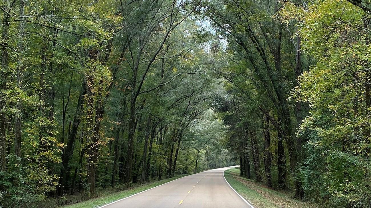 Natchez Trace Parkway
Explore the scenic, historic, and cultural wonders of the Natchez Trace Parkway, a 444-mile journey through the heart of the American South.
-


Swipe for more destinations
Best attractions in The Red Clay Hills
The Red Clay Hills offers a varied but relatively dispersed collection of attractions. Tupelo’s Elvis Presley Birthplace complex interprets the singer’s early life and the modest surroundings that shaped part of his public story, while the city also provides museums, parks and a useful base for exploring the uplands. The Natchez Trace Parkway is an attraction in its own right, combining woodland scenery, overlooks, archaeological traces, historic narratives and opportunities for walking and cycling. Pontotoc contributes local history and a traditional county-seat setting, while New Albany is the main gateway to sections of the Tanglefoot Trail, a rail-trail extending through wooded and agricultural landscapes. Tishomingo State Park brings a different physical character, with trails, streams, rock outcrops and opportunities for boating and fishing. Around these better-known sites are small museums, historic cemeteries, churches, farm landscapes and locally run cultural venues. The appeal lies less in a dense sequence of headline sights than in the combination of upland scenery, transport history, Native heritage, music history and outdoor areas connected by road.
-
Casino
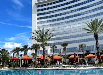
Hard Rock Hotel & Casino Biloxi
Discover the ultimate entertainment and luxury at Hard Rock Hotel & Casino Biloxi, where the excitement of gaming meets world-class hospitality.
-
Historical place museum
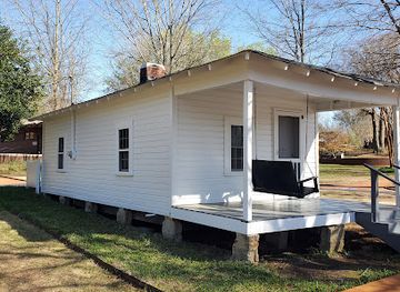
Elvis Presley Birthplace
Explore the Elvis Presley Birthplace in Tupelo, MS, a tribute to the King of Rock 'n' Roll and his humble beginnings that shaped music history.
-
National reserve
Vicksburg National Military Park
Discover Vicksburg National Military Park, a historic site that preserves the legacy of the Civil War with stunning landscapes, monuments, and educational experiences.
-
Science museum
INFINITY Science Center
Discover the marvels of science at INFINITY Science Center, a hands-on museum where curiosity meets learning in Mississippi.


Best landmarks in The Red Clay Hills
The defining landmarks of the Red Clay Hills include both built structures and the landscape itself. Tupelo’s Elvis Presley Birthplace is significant not only as a music-history site but also as a tangible reminder of the modest rural and working-class settings from which a global cultural figure emerged. The Natchez Trace Parkway is the region’s great linear landmark, following a historic route through forest, fields and archaeological landscapes; its bridges, mileposts, interpretive stops and preserved sections make the old corridor legible to modern travellers. In Pontotoc, the historic town centre and county-seat architecture reflect the civic development of an established north Mississippi community. Tishomingo State Park provides the area’s most distinctive natural landmarking, with exposed rock formations and wooded waterways that contrast with the smoother clay hills elsewhere. The Tanglefoot Trail, laid along a former railway corridor, is a more recent cultural landmark: its bridges, cuttings and linear route preserve the memory of regional rail transport while creating a public landscape for cycling and walking. Together these places express the region’s geological, Indigenous, transport, musical and civic histories.
-
Museum
Jimmie Rodgers Museum
Celebrate the legacy of Jimmie Rodgers, the 'Father of Country Music,' with exhibits showcasing his life, music, and railroad heritage in Meridian, MS.

Explore The Red Clay Hills on the map
Plan your trip on one map. See where the top cities, national parks and sights are, and book hotels and experiences in a few clicks.
Best hotels in The Red Clay Hills
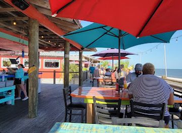
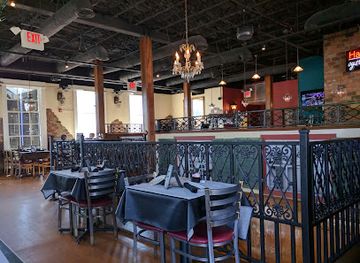
Best restaurants in The Red Clay Hills
Dining in the Red Clay Hills reflects the broader food traditions of Mississippi while retaining a distinctly local, small-town character. Tupelo and the larger communities offer the widest choice, from cafés serving breakfast plates and biscuits to barbecue restaurants, catfish kitchens, burger counters and contemporary Southern dining rooms. Regional menus commonly draw on cornmeal, poultry, pork, seasonal vegetables, greens, beans and baked goods, with sweet tea and traditional desserts appearing alongside modern drinks and dishes. Rural cafés and family-run restaurants can be as important to the experience as more polished establishments, although opening days and hours may be limited. Farmers’ markets and farm stands, when operating, provide opportunities to find locally grown produce, baked items and preserves. Visitors should distinguish Mississippi-wide staples from dishes genuinely specific to the Red Clay Hills: the region’s culinary identity is best understood through its ingredients, hospitality businesses and agricultural setting rather than through one signature dish.
-
Seafood
The Reef
Experience coastal dining at The Reef in Biloxi—where fresh seafood meets vibrant atmosphere and stunning ocean views.
-
Seafood
Half Shell Oyster House
Savor fresh Gulf Coast seafood at Half Shell Oyster House in Biloxi – where every bite is a taste of local tradition.
-
American
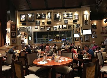
Hard Rock Cafe
Discover delicious American cuisine amidst iconic rock 'n' roll memorabilia at Hard Rock Cafe Biloxi.
-
Seafood
Mary Mahoney's Old French House
Discover the flavors of Biloxi at Mary Mahoney's Old French House - where seafood meets history in an exquisite dining experience.

Best bars in The Red Clay Hills
Evening entertainment in the Red Clay Hills is concentrated in Tupelo and the larger county towns rather than spread across the countryside. Visitors will find traditional pubs, casual bars, restaurants with evening service, live music and occasional performance events, while nightlife in smaller communities is generally quieter and more community-oriented. Tupelo has the broadest selection of places for drinks, music and late meals, but it does not operate on the scale of a major American entertainment district. Breweries and contemporary bars may sit alongside long-established local venues, while the region’s musical associations give live performance particular cultural relevance. In rural areas, an evening is more likely to centre on a restaurant, inn, community event or porch gathering than a nightclub. Opening arrangements vary, and visitors should check current information rather than assume late service. Responsible drinking and a designated driver are especially important where accommodation and venues are separated by rural roads.
-
Blues club
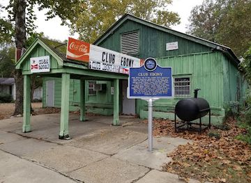
Club Ebony
Experience the soul of Mississippi at Club Ebony, where live blues music and Southern hospitality create unforgettable nights.
Best nightclubs in The Red Clay Hills
Evening entertainment in the Red Clay Hills is concentrated in Tupelo and the larger county towns rather than spread across the countryside. Visitors will find traditional pubs, casual bars, restaurants with evening service, live music and occasional performance events, while nightlife in smaller communities is generally quieter and more community-oriented. Tupelo has the broadest selection of places for drinks, music and late meals, but it does not operate on the scale of a major American entertainment district. Breweries and contemporary bars may sit alongside long-established local venues, while the region’s musical associations give live performance particular cultural relevance. In rural areas, an evening is more likely to centre on a restaurant, inn, community event or porch gathering than a nightclub. Opening arrangements vary, and visitors should check current information rather than assume late service. Responsible drinking and a designated driver are especially important where accommodation and venues are separated by rural roads.
-
Bar
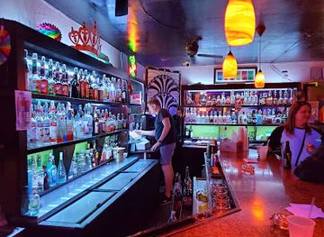
Just Us Lounge
Experience the vibrant nightlife of Biloxi at Just Us Lounge, where music, dancing, and inclusivity come together for an unforgettable evening.
-
Live Music
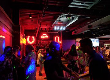
Neon Moon
Experience the vibrant nightlife at Neon Moon, Ocean Springs' premier destination for live music, dancing, and a smoke-free atmosphere.
-
Night club
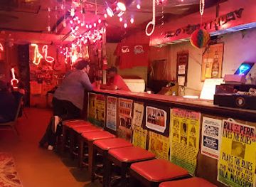
Red's
Dive into the heart of Clarksdale's nightlife at Red's, where music, drinks, and good vibes await in an unforgettable atmosphere.
-
Night club
HIDEAWAY
Experience the pulsating nightlife of Hideaway in Jackson, Mississippi, where electrifying dance floors and live music create unforgettable memories.

Best shops in The Red Clay Hills
Shopping in the Red Clay Hills is focused on practical town centres, independent businesses and locally made or locally sourced goods rather than large luxury districts. Tupelo has the broadest retail choice, including national stores, independent boutiques, galleries, antiques and food shops, while Pontotoc, New Albany and smaller communities offer traditional high streets with more specialised local character. Farmers’ markets and seasonal produce stalls can be good places to look for vegetables, baked goods, jams, preserves and other Mississippi products, although schedules vary throughout the year. Visitors interested in crafts may find regional artwork, pottery, woodwork, textiles, books and music-related souvenirs in independent shops and galleries. Tanglefoot Trail communities also provide occasional opportunities to combine cycling with cafés, antiques and small-town retail. For a durable memento, locally produced food, a book about Chickasaw or Mississippi history, or work by a regional artist is generally more representative than a generic souvenir.
-
Outlet mall
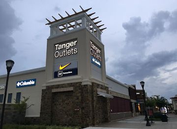
Tanger Outlets Southaven
Experience unbeatable shopping deals and a vibrant atmosphere at Tanger Outlets Southaven, your ultimate outlet mall destination in Mississippi.
-
Outlet mall
Gulfport Premium Outlets
Discover unbeatable deals and a vibrant shopping experience at Gulfport Premium Outlets, where fashion meets affordability in the heart of Mississippi.
-
Souvenir store
Sharkheads
Discover unique gifts and local treasures at Sharkheads, Biloxi's favorite souvenir store, featuring airbrushing services and delicious chocolates.
-
Shopping mall
The Promenade
Explore The Promenade in D'Iberville, Mississippi—your one-stop shopping, dining, and entertainment destination.

Get your free copy of our complete guide to The Red Clay Hills, delivered straight to you.
Everything on this page, from attractions and restaurants to essentials and local phrases, in one PDF you can read offline, print or share.
Already have an account? Sign in
Your The Red Clay Hills guide is ready.
We'll send it to · Not you? Sign out

Getting your guide ready…
We are putting together a fresh copy of the The Red Clay Hills guide. This can take up to a minute.
This can take a few moments. If your browser asks, choose Allow so the download can start. You'll find the guide in your Downloads folder.
Nothing happened? Download it again
Sorry, the guide is taking longer than usual. Please try again in a minute, or get it by email instead.
The Red Clay Hills essentials
Currency and Payment
Safety
Emergency Situations
Do's and Don'ts
Local Tips
From Eve
Local phrases worth knowing
You don't need to get them perfect. A few words go a long way, and locals appreciate the effort.
Basics
| English | Local | Say it |
|---|---|---|
| Hello | Howdy | [hau-dee] |
| Goodbye | See ya | [see yah] |
| Yes | Uh-huh | [uh-huh] |
| No | Naw | [naw] |
| Please/You're welcome | Please/No problem | [pleez/no prob-lum] |
| Thank you | Thank ya | [thank yah] |
| Excuse me/Sorry | Excuse me/Sorry 'bout that | [ex-kyoos mee/saw-ree bout that] |
| How are you? | How ya doin'? | [how yah doin'?] |
| Fine. And you? | I'm good. And you? | [I'm guhd. And you?] |
| Do you speak English? | You speakin' English? | [you speekin' ing-glish?] |
| I don't understand | I ain't gettin' it | [I ain't gettin' it] |
Eating & Drinking
| English | Local | Say it |
|---|---|---|
| I'd like to see the menu, please | Can I see the menu, please? | [can I see the men-yoo, pleez?] |
| I don't eat meat | I don't eat no meat | [I don't eet no meet] |
| Cheers! | Cheers! | [cheerz] |
| I would like to pay, please | Can I pay now, please? | [can I pay now, pleez?] |
Emergencies
| English | Local | Say it |
|---|---|---|
| Help! | Help! | [help] |
| Go away! | Get on outta here! | [get on outta here!] |
| Call the Police! | Call the cops! | [call the cops] |
| Call a doctor! | Get a doctor! | [get a doctah] |
| I'm lost | I'm lost | [I'm lost] |
| I'm ill | I ain't feelin' too good | [I ain't feelin' too good] |
Shopping
| English | Local | Say it |
|---|---|---|
| I'd like to buy... | I wanna buy... | [I wanna buy...] |
| I'm just looking | Just lookin' | [just lookin'] |
| How much is it? | How much is that? | [how much is that?] |
| That's too expensive | That ain't worth it | [that ain't wurth it] |
| Can you lower the price? | Can ya bring down the price? | [can yah bring down the price?] |
Time & Numbers
| English | Local | Say it |
|---|---|---|
| What time is it? | What time is it? | [what time is it?] |
| It's one o'clock | It's one o'clock | [it's one o'clock] |
| Half past (10) | Half past ten | [half past ten] |
| Morning | Mornin' | [mornin'] |
| Afternoon | Afternoon | [afternoon] |
| Evening | Evenin' | [evenin'] |
| Yesterday | Yestiddy | [yes-tid-ee] |
| Today | Today | [today] |
| Tomorrow | Tomorra | [to-mor-rah] |
| 1 | One | [wun] |
| 2 | Two | [too] |
| 3 | Three | [three] |
| 4 | Four | [fohr] |
| 5 | Five | [fahiv] |
| 6 | Six | [siks] |
| 7 | Seven | [sev-uhn] |
| 8 | Eight | [ate] |
| 9 | Nine | [nain] |
| 10 | Ten | [ten] |
Transport & Directions
| English | Local | Say it |
|---|---|---|
| Where's a/the...? | Where's the...? | [where's the...?] |
| What's the address? | What's the address? | [what's the ad-dress?] |
| Can you show me (on the map)? | Can ya show me (on the map)? | [can yah show me (on the map)?] |
| When's the next (bus)? | When's the next bus? | [when's the next bus?] |
| A ticket (to ....) | A ticket to... | [a tick-it to...] |
History of The Red Clay Hills
Chickasaw Homeland Before European Settlement
The uplands of north-eastern Mississippi formed part of the historic homeland of the Chickasaw people, whose communities, agricultural practices, trade networks and political relationships shaped the region long before the arrival of the United States. Archaeological evidence and surviving cultural knowledge provide a deeper context for the landscape than later courthouse towns and roads alone. Visitors should understand the area’s Native history as an enduring presence rather than simply a prelude to American settlement.
The Natchez Trace and Early Inland Travel
The Natchez Trace developed from older Indigenous paths into an important route between the lower Mississippi Valley and the interior South. Travellers, traders and boatmen used sections of the corridor in the late eighteenth and early nineteenth centuries, particularly when returning overland from Natchez after floating goods down the Mississippi River. Its route through north-eastern Mississippi helped connect upland communities with wider commercial networks, and parts of the modern Natchez Trace Parkway preserve that historical alignment.
Treaties, Removal and American Settlement
During the nineteenth century, United States expansion brought severe pressure on the Chickasaw nation. Treaties, land cessions and the forced removal of Chickasaw people to Indian Territory transformed ownership and settlement across northern Mississippi. American farms, roads and county towns expanded across the uplands, while cotton agriculture and related trade became increasingly important. The period left a complex legacy of economic development, dispossession and continuing Chickasaw claims to historical and cultural recognition.
Railways, Agriculture and the Growth of Towns
Railway construction in the nineteenth century changed the scale and direction of commerce in the Red Clay Hills. Towns including Tupelo and Pontotoc became collection and trading points for surrounding farms, while rail connections supported the movement of cotton, timber, livestock and manufactured goods. The railway corridor later used by the Tanglefoot Trail is a reminder of this transition. Improved transport encouraged urban growth but did not erase the region’s dispersed rural settlement pattern.
The Civil War and the Battle of Tupelo
The American Civil War reached the region through campaigns aimed at protecting Union rail and supply lines in northern Mississippi. The Battle of Tupelo, fought in July 1864 near the town, formed part of the wider struggle over the important Memphis and Charleston Railroad. Although the battlefield landscape has changed substantially, the conflict remains central to local interpretation of the period. Civil War memory in the region sits alongside the broader history of emancipation, Reconstruction and post-war economic adjustment.
Manufacturing, Highways and Modern Mississippi
During the twentieth century, north-eastern Mississippi moved beyond an economy based chiefly on agriculture and timber. Manufacturing, furniture production, distribution and regional services became important, especially around Tupelo and other larger towns. New highways altered travel patterns, while the preservation of the Natchez Trace provided a counterpoint to commercial development. The region’s modern identity also includes the cultural reach of Tupelo-born Elvis Presley, whose life connects a local town to the international history of popular music.
The Red Clay Hills in Photos
Browse through our photo collection highlighting the charm and character of the destination.
Neighbouring regions of The Red Clay Hills
The closest regions to The Red Clay Hills, if you have time for more than one.
-
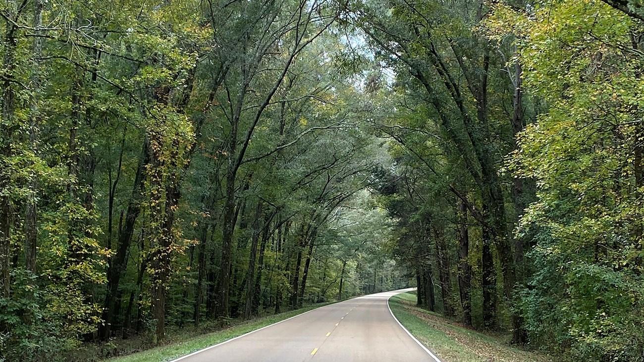 The North Central Hills
Explore Mississippi’s North Central Hills for Oxford’s literary heritage, rolling woodland, historic towns, local food and the Tanglefoot Trail.
-

-

-

-


Swipe for more regions
Explore more

Explore more of Mississippi
Discover Mississippi: A treasure trove of Southern culture, blues music heritage, and stunning natural landscapes perfect for every kind of traveler.
Explore Mississippi