

Free Little Dixie Travel Guide & Mobile App
Explore Little Dixie with free travel guides. Discover regional history, expert tips, proposed trips, and audio guides on web or mobile app.


Explore Little Dixie, Missouri, for Missouri River towns, Katy Trail cycling, historic architecture, university culture and southern-influenced foodways.
Read more about Little Dixie
Getting to and around Little Dixie
How to get there
Transportation
Top city travel guides in Little Dixie
The cities of Little Dixie, and the easiest places to base yourself.
-

-

-

-

-
-


Swipe for more cities
Destinations in Little Dixie
Resorts, valleys and scenic spots worth a trip of their own.
-

-


Swipe for more destinations
Best attractions in Little Dixie
Little Dixie’s attractions range from town museums and historic houses to river landscapes, university culture and long-distance trails. Columbia provides the broadest cultural programme, with the University of Missouri, museums, galleries, live performance and nearby access to parks and conservation areas. Boonville combines historic streets with Missouri River history, while Fulton, Fayette and Glasgow offer college traditions, civic architecture and museums that illuminate the region’s settlement and political past. Arrow Rock, west of the central river towns, is among Missouri’s best-preserved historic communities, with buildings and interpretation connected to the Santa Fe Trail and nineteenth-century life. The Katy Trail is the region’s leading outdoor attraction, following a former railway route through wooded river bluffs, farmland and small communities; Rocheport is one of its most recognisable access points. State parks and conservation areas provide walking, birdwatching, fishing and seasonal wildlife viewing, although facilities vary considerably. Visitors should distinguish preserved heritage sites from private property and allow driving time between attractions, since Little Dixie is a historic landscape spread across several counties rather than a compact sightseeing district.
-
Historical place
Mastodon State Historic Site
Explore the Ice Age at Mastodon State Historic Site, a captivating blend of history, nature, and archaeological discovery in Imperial, Missouri.
-
State park
Mark Twain State Park
Discover the enchanting landscapes and rich literary history of Mark Twain State Park, a natural paradise for outdoor enthusiasts and families in Missouri.
-
Park
Little Dixie Lake Conservation Area
Explore the natural beauty and outdoor adventures awaiting at Little Dixie Lake Conservation Area in Missouri, a perfect retreat for nature lovers and families.
-
Historical landmark
Devil's Elbow Bridge
Discover the captivating Devil's Elbow Bridge, a historic landmark in Missouri that enchants visitors with its stunning views and rich heritage along the Big Piney River.
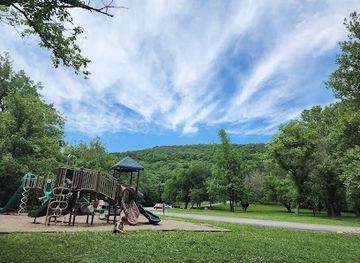
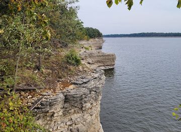


Best landmarks in Little Dixie
-
State park
Ha Ha Tonka State Park
Discover castle ruins, natural springs, and stunning karst landscapes at Ha Ha Tonka State Park on the Lake of the Ozarks in Camdenton, Missouri.
-
American
Tater Patch
Experience the heart of American cuisine and lively entertainment at Tater Patch in Rolla, Missouri, where every meal is a celebration.
-
State park
Lake of the Ozarks State Park
Explore Missouri's largest state park with scenic lake views, historic sites, diverse trails, and water activities for an unforgettable outdoor adventure.
-
Outdoor activity organiser
Mark Twain Cave
Explore the cave that inspired Tom Sawyer's adventures! Discover history, mystery, and natural beauty at Missouri's oldest show cave.
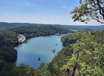


Explore Little Dixie on the map
Plan your trip on one map. See where the top cities, national parks and sights are, and book hotels and experiences in a few clicks.
Best hotels in Little Dixie
Best restaurants in Little Dixie
Dining in Little Dixie reflects central Missouri’s agricultural setting and the influence of broader Midwestern and Upper Southern foodways. Columbia has the region’s most varied restaurant scene, including international cooking, cafés, bakeries, breweries and contemporary American menus, while smaller towns tend to centre on diners, family restaurants, traditional pubs and locally focused kitchens. Barbecue, fried catfish, burgers, biscuits, pies and other forms of country cooking are common regional reference points, though none should be treated as an exclusive Little Dixie invention. Farmers’ markets and seasonal stands are useful for Missouri-grown fruit, vegetables, honey and baked goods, and rural areas may offer farm-based products according to the season. Missouri wine and locally produced beer appear on menus and in tasting rooms around the wider central Missouri countryside. In historic river towns, dining is often best combined with a walking visit, while trail users should plan ahead because food and replenishment points are not evenly distributed along the Katy Trail.
-
Restaurant
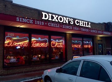
Dixon's Famous Chili Parlor
Discover the heartwarming flavors of Dixon's Famous Chili Parlor in Independence, MO – where every bowl tells a story.
-
American
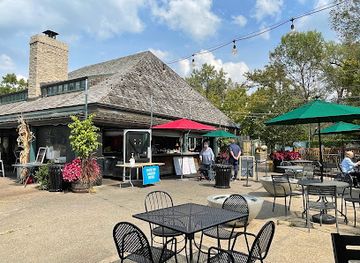
Boathouse at Forest Park
Discover exquisite American dining amidst stunning natural beauty at Boathouse at Forest Park in St. Louis.
-
Restaurant
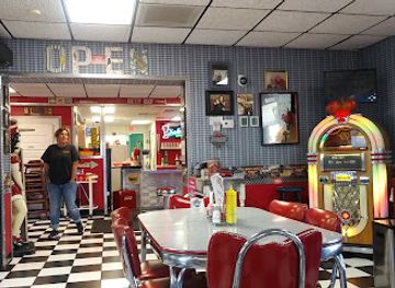
Billy Bob's Dairy Land
Experience classic American comfort food at Billy Bob's Dairy Land in Branson – where delicious meals meet delightful desserts.
-
Steak
Twisted Tree Steakhouse
Experience exquisite steaks and fresh seafood at Twisted Tree Steakhouse in St. Louis - where culinary excellence meets exceptional service.
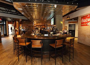
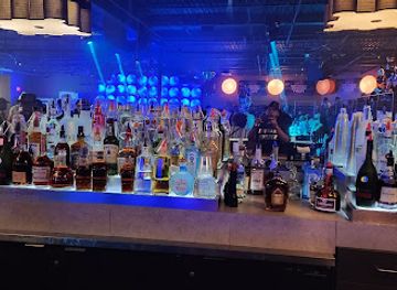
Best bars in Little Dixie
Evening life in Little Dixie is concentrated in Columbia, where the University of Missouri supports a substantial choice of pubs, breweries, cocktail bars, cafés with late hours, live-music venues and seasonal events. The atmosphere changes outside the university city: Boonville, Fulton, Fayette and other county-seat towns generally favour traditional bars, historic inns, restaurants and occasional live entertainment rather than a large nightclub scene. Local breweries and Missouri wines provide alternatives to the standard bar circuit, while community festivals and performances can bring liveliness to otherwise quiet evenings. Rural nightlife is usually destination-based, so visitors should arrange transport and check current opening arrangements rather than expect frequent late public transport. Drinking is not necessary to participate in the region’s evening culture; theatre, music, campus events, heritage programmes and relaxed dinners are also important ways to spend the night.
-
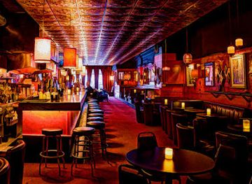
Cocktail bar
Green Lady Lounge
Experience Kansas City's vibrant nightlife at Green Lady Lounge, where exquisite cocktails meet live jazz in a cozy setting.
-
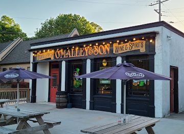
Pub
O'Malley's Pub
Experience authentic Irish cuisine and vibrant live music at O'Malley's Pub in Weston, a perfect blend of tradition and hospitality.
-
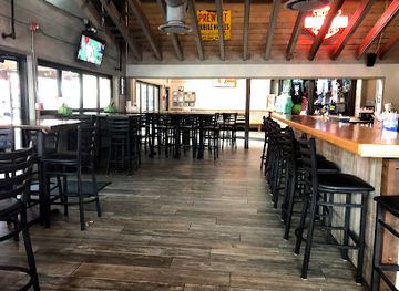
Grill
Backwater Jacks
Discover the charm of Backwater Jacks, a premier grill and bar in Osage Beach, offering delicious American cuisine and a lively atmosphere.
-
Distillery
Tom's Town Distilling Co.
Experience handcrafted cocktails and the art of distillation at Tom's Town Distilling Co. in downtown Kansas City, a speakeasy-inspired gem.

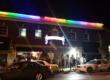
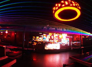
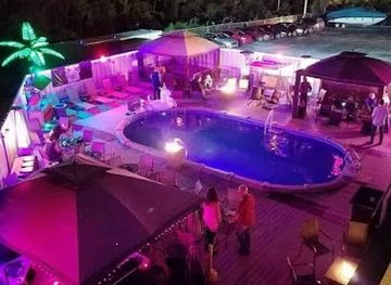
Best nightclubs in Little Dixie
Evening life in Little Dixie is concentrated in Columbia, where the University of Missouri supports a substantial choice of pubs, breweries, cocktail bars, cafés with late hours, live-music venues and seasonal events. The atmosphere changes outside the university city: Boonville, Fulton, Fayette and other county-seat towns generally favour traditional bars, historic inns, restaurants and occasional live entertainment rather than a large nightclub scene. Local breweries and Missouri wines provide alternatives to the standard bar circuit, while community festivals and performances can bring liveliness to otherwise quiet evenings. Rural nightlife is usually destination-based, so visitors should arrange transport and check current opening arrangements rather than expect frequent late public transport. Drinking is not necessary to participate in the region’s evening culture; theatre, music, campus events, heritage programmes and relaxed dinners are also important ways to spend the night.
-
Night club
Missie B's
Unleash your spirit at Missie B's, Kansas City's top nightlife destination, where dance, diversity, and delightful drinks await.
-
Night club
Aura
Experience the vibrant nightlife at Aura, Kansas City's premier night club, offering electrifying music and an unforgettable atmosphere.
-
Night club
Virtue Night Club
Dive into the electrifying nightlife at Virtue Night Club in Grandview, where great music, strong drinks, and a vibrant atmosphere await.
-
Night club
The SPOTT Night Club
Discover Kansas City's nightlife at The SPOTT Night Club, where the music, dance, and energy create unforgettable experiences.
Best shops in Little Dixie
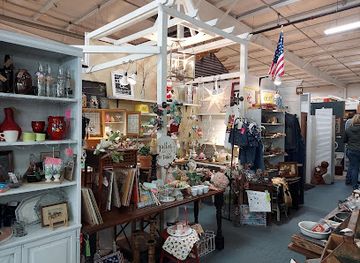
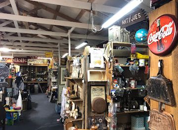
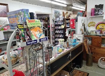
Shopping in Little Dixie is strongest in Columbia, where independent retailers, bookshops, galleries, vintage stores, specialist food shops and the university population create the region’s broadest choice. Historic downtown Boonville, Fulton and Fayette offer smaller collections of antiques, gifts, books, crafts and locally oriented businesses, often combined with cafés and heritage streets. Farmers’ markets are valuable for seasonal produce, honey, preserves, baked goods and other Missouri-made foods, although market days and seasonal operations vary. Around the Katy Trail, visitors may find practical cycling supplies, locally made products and small-town shops rather than a continuous retail strip, so plan provisions before entering quieter sections. Regional purchases can include Missouri wine, craft beer, pottery, artwork, quilts and pantry goods, but product availability differs between communities. Respect the distinction between genuine local work and generic souvenirs, and remember that many small businesses operate limited hours, particularly outside Columbia and during winter.
-
Antique store
Brass Armadillo Antique Mall - Kansas City
Discover unique antiques and collectibles at Brass Armadillo Antique Mall in Kansas City, where history meets charm in an unforgettable shopping experience.
-
Toy store
Disney Store
Discover the enchanting Disney Store in Branson, offering toys, clothing, and collectibles for every Disney fan's dream shopping experience.
-
Antique store
Half-Crocked Antiques
Discover unique antiques and vintage treasures at Half-Crocked Antiques in Bourbon, Missouri – a must-visit for treasure hunters and history lovers.
-
Antique store
Dragonfly Antiques
Explore the rich history and unique treasures at Dragonfly Antiques in Warrenton, MO, the perfect destination for antique lovers and treasure seekers.

Get your free copy of our complete guide to Little Dixie, delivered straight to you.
Everything on this page, from attractions and restaurants to essentials and local phrases, in one PDF you can read offline, print or share.
Already have an account? Sign in
Your Little Dixie guide is ready.
We'll send it to · Not you? Sign out

Getting your guide ready…
We are putting together a fresh copy of the Little Dixie guide. This can take up to a minute.
This can take a few moments. If your browser asks, choose Allow so the download can start. You'll find the guide in your Downloads folder.
Nothing happened? Download it again
Sorry, the guide is taking longer than usual. Please try again in a minute, or get it by email instead.
Little Dixie essentials
Currency and Payment
Safety
Emergency Situations
Do's and Don'ts
Local Tips
From Eve
Local phrases worth knowing
You don't need to get them perfect. A few words go a long way, and locals appreciate the effort.
Basics
| English | Local | Say it |
|---|---|---|
| Hello | Howdy | [HAW-dee] |
| Goodbye | See ya | [SEE yah] |
| Yes | Yep | [YEP] |
| No | Nope | [NOPE] |
| Please/You're welcome | Please | [PLEEZ] |
| Thank you | Thank ya | [THANG yah] |
| Excuse me/Sorry | Pardon me | [PAR-dun mee] |
| How are you? | How ya doin'? | [HOW yah DOO-in] |
| Fine. And you? | I'm good. How 'bout you? | [AHM good. HOW bout YOU?] |
| Do you speak English? | Do ya speak English? | [DO yah SPEEK ING-glish?] |
| I don't understand | I ain't gettin' it | [AHY aint GET-in it] |
Eating & Drinking
| English | Local | Say it |
|---|---|---|
| I'd like to see the menu, please | Can I see the menu, please? | [CAN I SEE the MEN-yoo, PLEEZE?] |
| I don't eat meat | I don't eat no meat | [AHY dont EAT no MEAT] |
| Cheers! | Cheers! | [CHEERS] |
| I would like to pay, please | I'd like to settle up, please | [AHYD LIKE to SETTLE up, PLEEZE] |
Emergencies
| English | Local | Say it |
|---|---|---|
| Help! | Help! | [HELP] |
| Go away! | Get lost! | [GET lost] |
| Call the Police! | Call the cops! | [CALL the COPS] |
| Call a doctor! | Get a doc! | [GET a DOC] |
| I'm lost | I ain't know where I'm at | [AHY aint KNOW where AHYM AT] |
| I'm ill | I'm feelin' sick | [AHY FEEL-in SICK] |
Shopping
| English | Local | Say it |
|---|---|---|
| I'd like to buy... | I want to buy... | [AHY WANT to BUY...] |
| I'm just looking | Just lookin' | [JUST LOOK-in] |
| How much is it? | How much's it gonna set me back? | [HOW much's it GON-na SET me BACK?] |
| That's too expensive | That costs too much | [THAT costs TOO much] |
| Can you lower the price? | Can ya drop the price? | [CAN ya DROP the PRICE?] |
Time & Numbers
| English | Local | Say it |
|---|---|---|
| What time is it? | What time ya got? | [WHAT time ya GOT?] |
| It's one o'clock | It's one o'clock | [ITS one uh-CLOCK] |
| Half past (10) | Half past ten | [HAFF past TEN] |
| Morning | Mornin' | [MORN-in] |
| Afternoon | Afternoon | [AF-ter-NOON] |
| Evening | Evenin' | [EVE-nin] |
| Yesterday | Yest'day | [YES-t'dAY] |
| Today | Today | [TO-day] |
| Tomorrow | Tomorra' | [TO-mor-rah] |
| 1 | One | [WUN] |
| 2 | Two | [TOO] |
| 3 | Three | [THREE] |
| 4 | Four | [FOUR] |
| 5 | Five | [FIVE] |
| 6 | Six | [SIX] |
| 7 | Seven | [SEV-en] |
| 8 | Eight | [ATE] |
| 9 | Nine | [NINE] |
| 10 | Ten | [TEN] |
Transport & Directions
| English | Local | Say it |
|---|---|---|
| Where's a/the...? | Where's the...? | [WHERE'S the...?] |
| What's the address? | What's the address? | [WHAT'S the AD-dress?] |
| Can you show me (on the map)? | Can you point it out? | [CAN ya POINT it OUT?] |
| When's the next (bus)? | When's the next bus? | [WHEN'S the NEXT bus?] |
| A ticket (to ....) | A ticket to ... | [A TICK-it to ...] |
History of Little Dixie
Indigenous Landscapes and River Settlements
Long before American settlement, the Missouri River and its tributaries supported Indigenous communities, travel routes and trading networks. The wider central Missouri landscape contains evidence of earlier Native societies, including archaeological earthworks and village sites, while historic peoples such as the Osage maintained important connections across the region. European American settlement later altered these landscapes through land surveys, farms and towns, but the river valleys, prairie remnants and place names still reflect a much older human geography.
Boone’s Lick and the Early American Frontier
After the United States acquired Missouri through the Louisiana Purchase, settlers moved west from older states and established communities along the Missouri River. The Boone’s Lick Road, named for the salt-making works associated with Daniel Boone’s sons, connected St Charles with settlements farther west and helped make central Missouri a major corridor of migration. Towns such as Franklin, Boonville and Fayette emerged from this early period of roads, ferries, river transport and land speculation, linking Little Dixie to the developing state and to the national movement westward.
Southern Migration and the Making of Little Dixie
During the early and mid-nineteenth century, many settlers arrived from Virginia, Kentucky, Tennessee and other Upper South states. Their influence shaped the region’s speech, politics, agricultural practices, religious life and domestic architecture, giving rise to the name Little Dixie. Tobacco, hemp, livestock and grain were among the important products, and enslaved African Americans were forced to labour on farms, in households and in towns. The region’s historic houses and institutions therefore embody both the ambitions of white settlers and the suppressed lives and contributions of Black Missourians.
River Commerce, the Santa Fe Trail and Town Development
The Missouri River was the region’s principal commercial artery before railways and modern highways. Boonville and Franklin were associated with river landings and the Santa Fe trade, while other communities served as county seats, ferry points and agricultural exchange centres. Steamboats, warehouses, inns and workshops tied local producers to St Louis and markets farther west. Repeated flooding and the river’s changing channel affected settlement, but the surviving town plans, commercial buildings and transport corridors preserve the importance of this formative era.
Slavery, Secession and the Civil War
Little Dixie was a politically influential slaveholding area in a border state deeply divided over the Union. The Missouri Compromise, the violence known as Bleeding Kansas and the secession crisis intensified local conflict. During the Civil War, guerrilla warfare, military occupation and divided loyalties disrupted communities across central Missouri. Enslaved people sought freedom through flight and wartime emancipation policies, while the state’s gradual move towards emancipation culminated in the abolition of slavery in Missouri in 1865. Museums, cemeteries and historic sites continue to interpret this unsettled period.
Railways, Agriculture and the Changing River Economy
Railways reduced the Missouri River’s dominance as a transport route and encouraged the growth of inland commercial centres. Agricultural production became more closely connected to national markets, while county-seat towns developed courthouses, banks, schools and brick business districts. Later, highways, mechanised farming and rural depopulation changed the scale of the countryside. The former rail corridor now followed by the Katy Trail represents this transition particularly clearly: a route once used for freight and passengers has become one of the region’s most important recreational landscapes.
Universities, Preservation and Contemporary Regional Identity
Twentieth- and twenty-first-century Little Dixie has combined agricultural continuity with education, heritage preservation and cultural tourism. Columbia expanded around the University of Missouri into a major regional centre, while Fulton, Fayette and other towns retained important colleges and historic institutions. State parks, conservation areas, museums and protected townscapes have helped preserve river, prairie and architectural heritage. Contemporary interpretation increasingly includes African American history, Indigenous presence, labour and the environmental consequences of settlement, broadening the story beyond the region’s romantic antebellum image.
Little Dixie in Photos
Browse through our photo collection highlighting the charm and character of the destination.
Neighbouring regions of Little Dixie
The closest regions to Little Dixie, if you have time for more than one.
-
-

-

-

-


Swipe for more regions
Explore more

Explore more of Missouri
Experience the diverse landscapes, rich history, and vibrant culture of Missouri, the heart of America, offering everything from bustling cities to serene natural escapes.
Explore Missouri