

Free Platte River Valley Travel Guide & Mobile App
Explore Platte River Valley with free travel guides. Discover regional history, expert tips, proposed trips, and audio guides on web or mobile app.


Explore Nebraska’s Platte River Valley for pioneer trails, railway towns, crane migration, prairie landscapes, museums and riverside recreation.
Read more about Platte River Valley
When is the best time to visit Platte River Valley?
Best: May–June, September · 23–28°C| Month | High (°C) | Rainfall (mm) |
|---|---|---|
| January | 1 | 20 |
| February | 3 | 25 |
| March | 10 | 40 |
| April | 18 | 55 |
| May (best) | 23 | 70 |
| June (best) | 28 | 80 |
| July | 31 | 90 |
| August | 30 | 80 |
| September (best) | 25 | 60 |
| October | 18 | 50 |
| November | 11 | 30 |
| December | 2 | 25 |
Getting to and around Platte River Valley
How to get there
Transportation
Top city travel guides in Platte River Valley
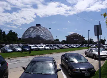
The cities of Platte River Valley, and the easiest places to base yourself.
-

-

-
-

-

-


Swipe for more cities
Destinations in Platte River Valley
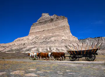
Resorts, valleys and scenic spots worth a trip of their own.
-

-


Swipe for more destinations
Best attractions in Platte River Valley
The Platte River Valley’s attractions are spread along a long east-west corridor rather than concentrated in one city. In North Platte, Buffalo Bill Ranch State Historical Park explores the life, ranch and public career of William F. Cody, while the city’s railway heritage reflects the importance of the Union Pacific. Near Gothenburg, the reconstructed Sam Machette Station interprets the short-lived Pony Express. Kearney is the main historical hub, with the Great Platte River Road Archway presenting the story of Indigenous travel, emigrant trails, railways and highway travel, and nearby Fort Kearny State Historical Park preserving the setting of the former military post. Around Gibbon and Grand Island, wildlife experiences take precedence: Rowe Sanctuary and the Crane Trust protect habitat used by migrating sandhill cranes, particularly during spring. The Stuhr Museum of the Prairie Pioneer in Grand Island offers a substantial look at settlement and rural life. East of the central cities, recreation areas along the Platte provide camping, walking, fishing and boating opportunities, while Two Rivers State Recreation Area and Platte River State Park are useful for outdoor visits in the lower valley. The region rewards travellers who allow time for interpretation, seasonal wildlife and changing river landscapes rather than treating it as a series of roadside stops.
-
Tourist attraction
Stolley Park
Explore Stolley Park, an urban oasis in Grand Island, NE, perfect for outdoor activities, picnics, and enjoying nature's beauty.
-
Nature preserve
Platte River Prairies
Experience the untouched beauty of Nebraska at Platte River Prairies, a nature preserve perfect for hiking, bird watching, and relaxation.


Best landmarks in Platte River Valley
The Great Platte River Road Archway near Kearney is the valley’s most recognisable modern landmark, spanning the interstate and interpreting the succession of trails, railways and highways that used this natural corridor. Fort Kearny State Historical Park preserves the site of the 1848 frontier post, whose position beside the overland routes made it an important reference point for emigrants and soldiers. In Gothenburg, the reconstructed Sam Machette Pony Express Station recalls the brief but famous express-mail service of 1860–61. North Platte’s Buffalo Bill Ranch State Historical Park links a historic ranch setting with the national mythology surrounding William F. Cody, while the city’s railway landscape expresses the continuing importance of freight movement through the valley. The Platte itself is a landmark in a different sense: its broad, shifting channels, cottonwood-lined islands and open floodplain define the region’s geography. Near Gibbon and Grand Island, protected river habitat is nationally recognised among bird-watchers because it supports the annual concentration of migrating sandhill cranes. In the lower valley, the river’s wooded banks and recreation areas provide a more intimate landscape, contrasting with the wide agricultural views around central Nebraska.
-
Historical landmark
Grand Island Historical Marker
Explore Nebraska's rich history at the Grand Island Historical Marker in Doniphan, a serene landmark celebrating local heritage.
-
Custom home builder
Fast Track Buildings & Construction LLC
Discover excellence in custom home building with Fast Track Buildings & Construction, where your dream home awaits transformation into reality.


Explore Platte River Valley on the map
Plan your trip on one map. See where the top cities, national parks and sights are, and book hotels and experiences in a few clicks.
Best hotels in Platte River Valley
Best restaurants in Platte River Valley
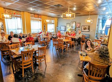
Dining in the Platte River Valley reflects Nebraska’s agricultural economy, Midwestern comfort food and the practical needs of communities serving travellers on Interstate 80. North Platte, Kearney and Grand Island offer the widest choice, from cafés and independent restaurants to steakhouses, casual diners and international cuisines shaped by changing local populations. Across the smaller towns, traditional American breakfasts, burgers, sandwiches, fried chicken and barbecue are common, while restaurants and cafés make use of the wider state’s beef, pork, maize and seasonal produce. Farmers’ markets and farm shops provide opportunities to buy fruit, vegetables, baked goods and locally produced food when operating seasonally. German, Czech and other Central European influences are part of Nebraska’s broader settlement history and may appear in community cooking and bakery traditions, although no single cuisine defines the entire valley. Country pubs, family restaurants and roadside stops are often more significant to local dining culture than formal culinary destinations. Visitors travelling during crane season should remember that wildlife areas may be remote from evening services, making it sensible to eat in nearby towns or check arrangements ahead rather than relying on late-night rural options.
-
Restaurant
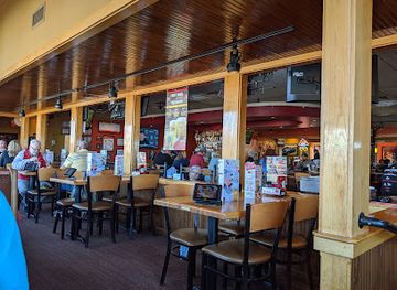
Applebee's Grill + Bar
Experience delicious American cuisine at Applebee's Grill + Bar in North Platte - perfect for families and friends seeking comfort food.
-
American
Carmela's Bistro
Discover the perfect blend of American and Italian cuisine at Carmela's Bistro in Lincoln - where every meal is a celebration.
-
Restaurant
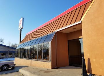
Burger King
Experience the classic taste of flame-grilled burgers at Burger King in Nebraska City – perfect for tourists craving quick comfort food.
Best bars in Platte River Valley
Evening life in the Platte River Valley is centred on pubs, breweries, restaurants, cafés and live entertainment rather than a large metropolitan club scene. Kearney and Grand Island have the broadest range of bars and places aimed at students, residents and visitors, while North Platte offers an established small-city evening scene linked to its railway and regional service economy. In smaller communities, taverns, American-style bars and community events provide the main social settings, with closing times and availability varying by town. Local breweries and taprooms are part of Nebraska’s wider craft-beer culture, but visitors should check current operating arrangements rather than assume that every community has one. Music, theatre and seasonal festivals can add activity, particularly in the larger towns, while crane-viewing trips generally begin before dawn and lend the central valley a quieter evening rhythm. Designated drivers, taxis and accommodation-based transport should be planned in advance when travelling between rural sites and town centres.
-
Bar
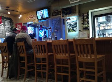
Platte Valley Taphouse
Experience the best local craft beers in a cozy atmosphere at Platte Valley Taphouse in Kearney, Nebraska.
-
Bar
Glass Bar
Discover lively nights and affordable drinks at Glass Bar, Grand Island's go-to destination for a fun and vibrant atmosphere.

Best nightclubs in Platte River Valley
Evening life in the Platte River Valley is centred on pubs, breweries, restaurants, cafés and live entertainment rather than a large metropolitan club scene. Kearney and Grand Island have the broadest range of bars and places aimed at students, residents and visitors, while North Platte offers an established small-city evening scene linked to its railway and regional service economy. In smaller communities, taverns, American-style bars and community events provide the main social settings, with closing times and availability varying by town. Local breweries and taprooms are part of Nebraska’s wider craft-beer culture, but visitors should check current operating arrangements rather than assume that every community has one. Music, theatre and seasonal festivals can add activity, particularly in the larger towns, while crane-viewing trips generally begin before dawn and lend the central valley a quieter evening rhythm. Designated drivers, taxis and accommodation-based transport should be planned in advance when travelling between rural sites and town centres.
-
River
Platte River
Explore the breathtaking Platte River in Nebraska, a haven for outdoor activities, wildlife watching, and serene natural beauty.
-
Bar
Independent Club
Discover the vibrant nightlife at Independent Club in Central City, Nebraska, where great drinks and good times await every visitor.


Best shops in Platte River Valley
Shopping in the Platte River Valley is primarily local and practical, with the largest concentration of choices in North Platte, Kearney and Grand Island. Their commercial districts and retail areas provide everyday goods, outdoor equipment, clothing, books, gifts and food supplies for travellers, while smaller towns retain independent shops, antique stores and locally oriented high streets. Farmers’ markets, when operating in season, are useful for Nebraska produce, baked goods, preserves and other regional foods, although their dates and locations vary. Museum shops at places such as the Great Platte River Road Archway, Buffalo Bill Ranch and the Stuhr Museum offer history-related books, educational material and craft-focused souvenirs. Western and prairie themes are common in local gift shops, but visitors should distinguish locally made goods from generic interstate merchandise. Gallery and craft shopping is more likely in the larger communities or at seasonal events than in remote rural areas. For a practical road journey, stock up in the main towns before heading to wildlife sanctuaries or recreation areas, where retail facilities may be limited.
-
Department store
Walmart Supercenter
Explore Walmart Supercenter in North Platte – your ultimate shopping destination for groceries, clothing, electronics, and more.
-
Antique store
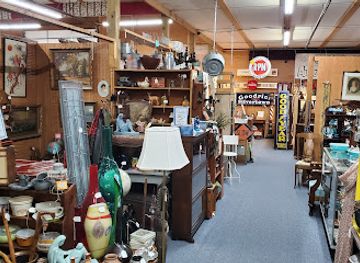
Platte Valley Antique Mall, Cafe & Pub
Explore vintage finds and savor delicious meals at Platte Valley Antique Mall, Cafe & Pub, a unique destination in Greenwood, Nebraska.
-
Variety store
Five Below
Explore Five Below in North Platte for a unique shopping adventure filled with toys, candy, and trendy accessories, all under $5!

Get your free copy of our complete guide to Platte River Valley, delivered straight to you.
Everything on this page, from attractions and restaurants to essentials and local phrases, in one PDF you can read offline, print or share.
Already have an account? Sign in
Your Platte River Valley guide is ready.
We'll send it to · Not you? Sign out

Getting your guide ready…
We are putting together a fresh copy of the Platte River Valley guide. This can take up to a minute.
This can take a few moments. If your browser asks, choose Allow so the download can start. You'll find the guide in your Downloads folder.
Nothing happened? Download it again
Sorry, the guide is taking longer than usual. Please try again in a minute, or get it by email instead.
Platte River Valley essentials
Currency and Payment
Safety
Emergency Situations
Do's and Don'ts
Local Tips
From Eve
Local phrases worth knowing
You don't need to get them perfect. A few words go a long way, and locals appreciate the effort.
Basics
| English | Local | Say it |
|---|---|---|
| Hello | Howdy | [Hau-dee] |
| Goodbye | See ya | [See ya] |
| Yes | Yep | [Yep] |
| No | Nope | [Nope] |
| Please/You're welcome | Please/No problem | [Pleez/No prob-lem] |
| Thank you | Thanks a lot | [Thangs a lot] |
| Excuse me/Sorry | Excuse me/Sorry 'bout that | [Ex-cuse mee/Sorry 'bout that] |
| How are you? | How ya doin'? | [How ya do-in?] |
| Fine. And you? | Good. And you? | [Good. And you?] |
| Do you speak English? | You speakin' English? | [Yoo speak-in' Ing-lish?] |
| I don't understand | I ain't followin' | [I ain't fol-low-in'] |
Eating & Drinking
| English | Local | Say it |
|---|---|---|
| I'd like to see the menu, please | Can I see the menu, please? | [Can I see the men-you, pleez?] |
| I don't eat meat | I ain't eatin' meat | [I ain't eat-in' meet] |
| Cheers! | Cheers! | [Cheers!] |
| I would like to pay, please | I'd like to settle up, please | [I'd like to set-tle up, pleez] |
Emergencies
| English | Local | Say it |
|---|---|---|
| Help! | Help! | [Help!] |
| Go away! | Get lost! | [Get lost!] |
| Call the Police! | Call the cops! | [Call the cops!] |
| Call a doctor! | Get a doctor! | [Get a doc-tor!] |
| I'm lost | I’m lost | [I'm lost] |
| I'm ill | I'm feelin' sick | [I'm feel-in' sick] |
Shopping
| English | Local | Say it |
|---|---|---|
| I'd like to buy... | I wanna buy... | [I wanna buy...] |
| I'm just looking | Just browsin' | [Just brow-zin'] |
| How much is it? | What’s the price? | [What's the price?] |
| That's too expensive | That’s way too high | [That’s way too high] |
| Can you lower the price? | Can ya drop the price? | [Can ya drop the price?] |
Time & Numbers
| English | Local | Say it |
|---|---|---|
| What time is it? | What time ya got? | [What time ya got?] |
| It's one o'clock | It's one | [It's one] |
| Half past (10) | Half past ten | [Half past ten] |
| Morning | Mornin' | [Morn-in'] |
| Afternoon | Afternoon | [Af-ter-noon] |
| Evening | Evenin' | [Eve-nin'] |
| Yesterday | Yest'day | [Yes-t'day] |
| Today | Today | [To-day] |
| Tomorrow | Tomorra' | [To-mor-ra'] |
| 1 | One | [One] |
| 2 | Two | [Two] |
| 3 | Three | [Three] |
| 4 | Four | [Four] |
| 5 | Five | [Five] |
| 6 | Six | [Six] |
| 7 | Seven | [Seven] |
| 8 | Eight | [Eight] |
| 9 | Nine | [Nine] |
| 10 | Ten | [Ten] |
Transport & Directions
| English | Local | Say it |
|---|---|---|
| Where's a/the...? | Where's the...? | [Where's the...?] |
| What's the address? | What’s the address? | [What’s the ad-dress?] |
| Can you show me (on the map)? | Can ya point it out? | [Can ya point it out?] |
| When's the next (bus)? | When's the next bus? | [When's the next bus?] |
| A ticket (to ....) | One ticket to... | [One tick-et to...] |
History of Platte River Valley
Indigenous Peoples and the River Corridor
Long before Euro-American settlement, the Platte Valley was used by Indigenous peoples for travel, hunting, trade and seasonal activities. Pawnee communities lived in central Nebraska, while Otoe-Missouria, Omaha and other peoples maintained relationships with the wider river and prairie environment. The Platte’s shallow, braided channels were difficult for boats but formed a natural east-west route across the Great Plains. Later emigrant accounts often described the landscape as empty, obscuring the established communities and cultural landscapes that preceded the United States’ expansion into the region.
The Great Emigrant Trails, 1840s–1860s
The Platte Valley became a principal route for overland migration to the American West. Travellers on the Oregon, California and Mormon trails followed the river because it offered relatively accessible terrain, water and grazing, although conditions were demanding and supplies were limited. The route passed through the present-day communities of North Platte, Gothenburg, Kearney and Grand Island. Ruts, markers, interpretive sites and surviving river landscapes preserve aspects of this migration, while the Great Platte River Road Archway presents the wider story of movement across Nebraska.
Fort Kearny and Frontier Administration
Established in 1848 near present-day Kearney, Fort Kearny supported and monitored traffic on the overland trails. It served as a military post, supply point and communications centre during a period of rapid United States expansion. The fort was never a large permanent settlement, but its position made it significant in the history of westward migration and frontier administration. Fort Kearny State Historical Park now interprets the site through reconstructed structures, trails and historical displays, helping visitors understand the practical realities of travel along the Platte.
Telegraph, Pony Express and the Overland Route
The valley’s established transport corridor also supported faster communication. The Pony Express operated briefly in 1860 and 1861, using a chain of stations across the Great Plains before the telegraph made the service obsolete. The Sam Machette Station near Gothenburg is a reconstructed Pony Express station associated with this period. Although the Pony Express lasted less than two years, it became a lasting symbol of the effort to connect the eastern United States with western territories before railway and telegraph networks were fully established.
Railways and the Union Pacific
Railway construction transformed the Platte Valley after the Union Pacific reached Nebraska during the 1860s. Towns such as North Platte, Kearney and Grand Island grew as railway stations, service centres and agricultural markets, while settlement patterns shifted away from the older trail system. The railway accelerated migration, freight movement and access to national markets. North Platte later became especially associated with rail operations, and the Bailey Yard remains an important reminder of the region’s continuing connection with freight transportation, though it is an active working facility rather than a conventional museum.
Irrigation, Agriculture and Settlement
The valley’s sandy soils, alluvial groundwater and dependable transport links encouraged agriculture, but farming also depended on managing the relatively dry Great Plains climate. Irrigation expanded during the late nineteenth and twentieth centuries, supporting crops including maize, soybeans, alfalfa and other feed and grain production. Towns became centres for agricultural processing, education and commerce, while the river itself was increasingly shaped by water management, bridges, reservoirs and land-use decisions. Modern agricultural landscapes therefore reflect both natural river processes and extensive human engineering.
Crane Migration and Conservation
The Platte River’s shallow channels and wooded islands provide an important stopover for migrating sandhill cranes and other birds. Scientific research and habitat protection expanded during the twentieth century as conservationists recognised the international significance of the migration corridor. The Crane Trust and Rowe Sanctuary near Gibbon are among the best-known organisations working to protect river habitat and educate visitors. Crane viewing has become an important seasonal form of tourism, but it also highlights the pressures created by reduced flows, habitat loss, disturbance and competing demands for water.
Platte River Valley in Photos
Browse through our photo collection highlighting the charm and character of the destination.
Neighbouring regions of Platte River Valley
The closest regions to Platte River Valley, if you have time for more than one.
-

-
-

-

-


Swipe for more regions
Explore more

Explore more of Nebraska
Discover Nebraska: A blend of rich history, diverse landscapes, and unique attractions in the heartland of America.
Explore Nebraska