

Free Niobrara River Valley Travel Guide & Mobile App
Explore Niobrara River Valley with free travel guides. Discover regional history, expert tips, proposed trips, and audio guides on web or mobile app.


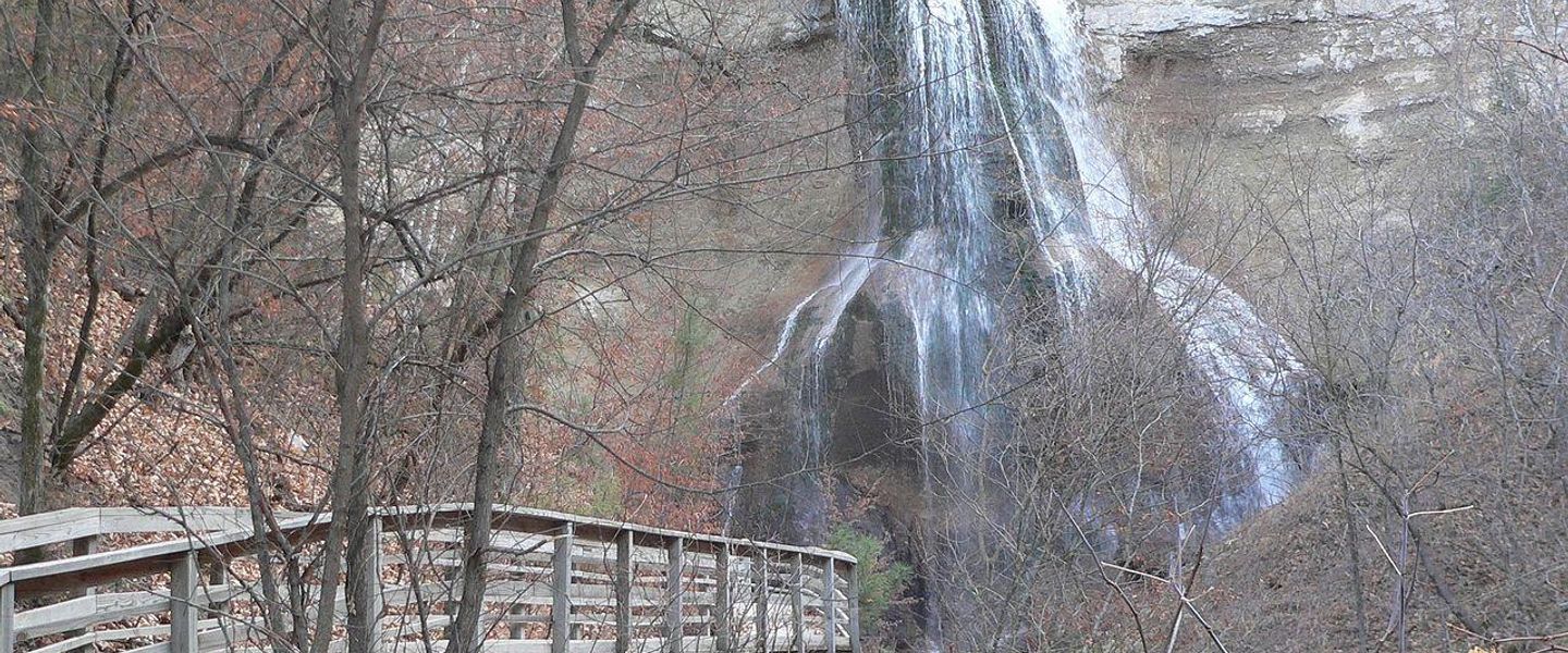


Explore Nebraska’s Niobrara River Valley for spring-fed waters, Sandhills scenery, waterfalls, wildlife, paddling and wide-open prairie.
Read more about Niobrara River Valley
Getting to and around Niobrara River Valley
How to get there
Transportation
Best attractions in Niobrara River Valley
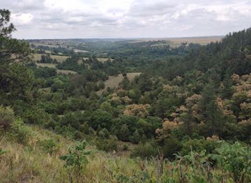
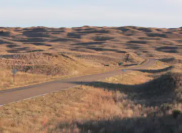
The Niobrara River Valley’s attractions centre on its river, public lands and unusually varied Great Plains ecology. The Niobrara National Scenic River supports canoeing, kayaking, tubing, fishing and riverside exploration, with outfitters around the Valentine area helping visitors organise suitable sections and shuttles. Smith Falls State Park protects the river’s best-known waterfall and offers a short walk to the falls, while nearby segments of the valley reveal springs, wooded canyons and exposed geological layers. Fort Niobrara National Wildlife Refuge combines prairie, river habitat and woodland, with opportunities for wildlife viewing and birdwatching; bison and elk are managed wildlife rather than tame viewing subjects. The refuge’s neighbouring public landscapes provide a deeper sense of the Sandhills’ scale. Hiking ranges from brief developed walks to remote routes requiring navigation, water and weather awareness. Valentine National Wildlife Refuge, near the town of Valentine, adds wetland and prairie habitat to the area’s outdoor offering. In the wider valley, working ranch country, dark skies and quiet gravel roads are attractions in their own right, though visitors should distinguish public access from private land. The region is best experienced through a combination of water, wildlife, geology and open-country travel rather than a dense programme of indoor sights.
-
State park
Smith Falls State Park
Experience the awe-inspiring beauty of Smith Falls State Park, home to Nebraska's tallest waterfall and a paradise for outdoor enthusiasts.
-
State park
Niobrara State Park
Discover the stunning landscapes and outdoor adventures at Niobrara State Park, a premier destination for nature lovers in Nebraska.
-
Wildlife refuge
Fort Niobrara National Wildlife Refuge
Explore the natural beauty and diverse wildlife of Fort Niobrara National Wildlife Refuge, a hidden gem in Nebraska's stunning landscapes.
-
Waterfall
Smith Falls
Experience the awe-inspiring beauty of Smith Falls, Nebraska's tallest waterfall, surrounded by nature's tranquility and adventure.

Best landmarks in Niobrara River Valley
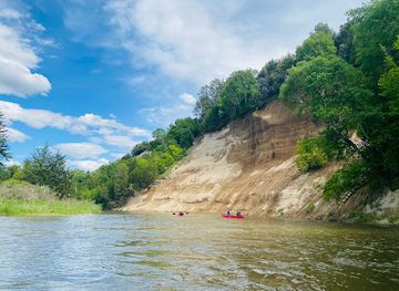
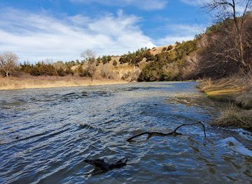
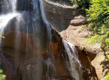
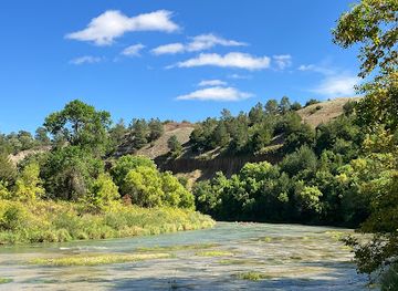
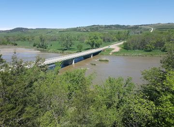
Smith Falls is the Niobrara valley’s most recognisable natural landmark and is notable as Nebraska’s highest waterfall, where spring-fed water drops through a wooded section of the river. The Niobrara itself is the defining geographic landmark: its clear channel, steep breaks, springs, waterfalls and contrasting vegetation create a distinct corridor through the Sandhills. The former Fort Niobrara site, now within Fort Niobrara National Wildlife Refuge, represents the military and settlement history of northern Nebraska, while the surrounding prairie and river habitats show how the landscape has been redirected towards conservation. Valentine National Wildlife Refuge adds a different visual setting of wetlands and open grassland near the town. Elsewhere, the valley’s exposed canyon walls, cedar- and pine-covered slopes, cottonwood bottoms and broad grasslands form a sequence of natural landmarks rather than a single monumental structure. Historic ranch landscapes, bridges and small-town civic buildings are quieter reminders of the region’s working history. Because many notable views occur on public land beside private ranches, visitors should use signed access points and avoid treating unmarked riverbanks, fields or tracks as open land.
-
Wildlife refuge
Fort Niobrara National Wildlife Refuge
Explore the serene landscapes and diverse wildlife of Fort Niobrara National Wildlife Refuge, an oasis of nature in Nebraska.
-
Visitor center
Niobrara National Scenic River Visitor Center
Discover the natural wonders and rich history of Nebraska at the Niobrara National Scenic River Visitor Center, your gateway to adventure.
Explore Niobrara River Valley on the map
Plan your trip on one map. See where the top cities, national parks and sights are, and book hotels and experiences in a few clicks.
Best hotels in Niobrara River Valley
Best restaurants in Niobrara River Valley
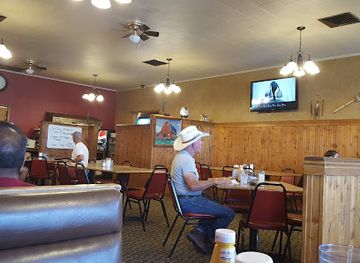
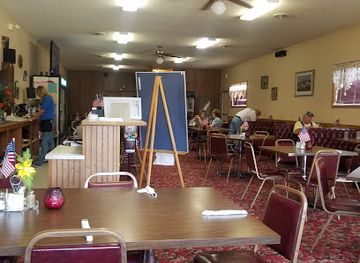
Dining in the Niobrara River Valley is practical, informal and concentrated in small communities, especially Valentine, rather than organised around a large restaurant scene. Cafés, family-run eateries, diners and traditional American restaurants provide breakfast, burgers, sandwiches, steaks and other filling meals suited to days on the river or road. Local cattle ranching gives beef a strong place in regional food culture, while nearby agricultural communities contribute seasonal produce and baked goods. Visitors should not expect every rural stop to offer extensive evening service, so stocking food and water in Valentine is sensible before heading to remote campgrounds or river access points. Grocery shops and convenience stores are useful for picnic supplies, and some accommodation providers cater for self-catering. Farmers' markets and seasonal local-produce sales may appear in the summer, but dates and availability vary. The most distinctive dining experience is often a simple meal after a day outdoors, with local businesses reflecting the valley’s role as a working ranch and recreation region rather than a formal culinary destination.
-
Steak
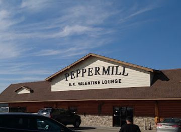
Peppermill Restaurant & EKV Lounge
Experience mouthwatering steaks and American classics at Peppermill Restaurant & EKV Lounge in Valentine, Nebraska—a must-visit culinary gem.
-
Fast Food
McDonald's
Discover McDonald's in Valentine: Your go-to spot for fast food favorites anytime during your travels in Nebraska.
-
Traditional American
Country Cafe
Experience traditional American flavors at Country Cafe in Niobrara – where hearty meals meet warm hospitality.
-
Restaurant
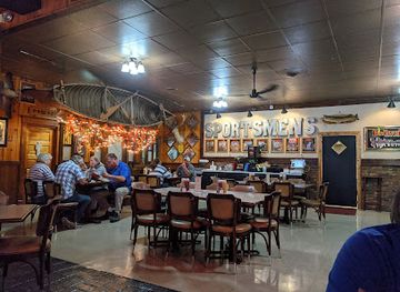
Sportsmen's Bar and Two Rivers Coffee
Experience local flavors at Sportsmen's Bar and Two Rivers Coffee in Niobrara – where delicious meals meet a warm atmosphere.

Best bars in Niobrara River Valley
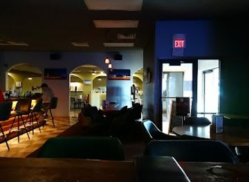
Nightlife in the Niobrara River Valley is small-scale and focused on local pubs, casual bars, restaurants and community gathering places, particularly in Valentine. There is no major club district, and evening options become sparse outside the principal service town. Visitors are more likely to spend the night around a campsite, lodge or motel, enjoying the quiet and exceptionally dark skies, than moving between venues. Some establishments may offer televised sport, music or informal social events, but schedules and opening arrangements change and should be checked locally. Alcohol is available in licensed businesses, while responsible drinking is especially important when driving long distances or participating in river activities the following day. Rural evenings can be early, particularly outside the summer season. The valley’s evening character is best understood as relaxed and community-based, with a meal, a drink or stargazing providing a natural conclusion to a day of paddling, wildlife observation or hiking.
-
Bar
Peppermill Restaurant & EKV Lounge
Discover the perfect blend of American cuisine and vibrant nightlife at Peppermill Restaurant & EKV Lounge in Valentine, Nebraska.
-
American
Bunkhouse Restaurant & Saloon
Experience the heart of American dining at Bunkhouse Restaurant & Saloon in Valentine, Nebraska, where flavor meets friendly hospitality.
-
American
Coachlight Cafe
Discover the taste of America at Coachlight Cafe, where comfort food and friendly service meet in the heart of Valentine, Nebraska.
-
Restaurant
Old Mill Bulk Foods & Deli
Discover the flavors of Nebraska at Old Mill Bulk Foods & Deli, your one-stop destination for fresh meals, baked goods, and unique local gifts.
Best shops in Niobrara River Valley
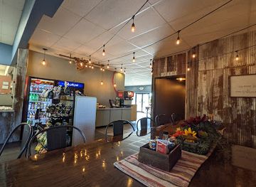
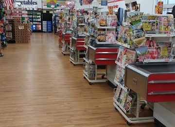
Shopping in the Niobrara River Valley is concentrated in Valentine and serves both local residents and outdoor travellers. Main-street businesses and general stores provide practical supplies, clothing, food, fishing items and basic equipment, while small galleries, gift shops and craft outlets may offer regional artwork, photography, books, Native-inspired or Great Plains-themed products, and souvenirs connected with the river and wildlife. Selection is limited compared with a city, so specialist outdoor gear and prescription items should be obtained before travelling into the valley. Grocery shopping in Valentine is useful for paddling lunches, campsite provisions and extra water. Local food products, Western-style goods and ranch-related items can make more meaningful purchases than generic souvenirs, although stock varies by season. Occasional farmers' markets and community sales may offer baked goods, produce or crafts, but visitors should confirm dates locally rather than rely on a permanent market schedule. The shopping experience is modest, practical and tied to small-town commerce, outdoor recreation and the identity of a working Sandhills region.
-
Gift shop
Old Mill Bulk Foods & Deli
Experience the flavors of Nebraska at Old Mill Bulk Foods & Deli, a delightful spot for fresh food, unique gifts, and local charm in Valentine.
-
Grocery store
Henderson's IGA Store
Discover Henderson's IGA Store in Valentine, NE: A friendly grocery store filled with fresh produce, local goods, and small-town charm.
-
Wildlife refuge
Fort Niobrara National Wildlife Refuge
Discover the breathtaking wildlife and scenic beauty of Fort Niobrara National Wildlife Refuge in Nebraska, a paradise for nature lovers.
-
Grocery store
Scotty's Ranchland Foods
Discover the flavors of Nebraska at Scotty's Ranchland Foods, a grocery store offering local products and essential goods in Valentine.
Get your free copy of our complete guide to Niobrara River Valley, delivered straight to you.
Everything on this page, from attractions and restaurants to essentials and local phrases, in one PDF you can read offline, print or share.
Already have an account? Sign in
Your Niobrara River Valley guide is ready.
We'll send it to · Not you? Sign out

Getting your guide ready…
We are putting together a fresh copy of the Niobrara River Valley guide. This can take up to a minute.
This can take a few moments. If your browser asks, choose Allow so the download can start. You'll find the guide in your Downloads folder.
Nothing happened? Download it again
Sorry, the guide is taking longer than usual. Please try again in a minute, or get it by email instead.
Niobrara River Valley essentials
Currency and Payment
Safety
Emergency Situations
Do's and Don'ts
Local Tips
From Eve
Local phrases worth knowing
You don't need to get them perfect. A few words go a long way, and locals appreciate the effort.
Basics
| English | Local | Say it |
|---|---|---|
| Hello | Howdy | [Hau-dee] |
| Goodbye | See ya | [See yah] |
| Yes | Yep | [Yep] |
| No | Nope | [Nope] |
| Please/You're welcome | Sure thing | [Shur thing] |
| Thank you | Thanks a bunch | [Thangs a bunch] |
| Excuse me/Sorry | Pardon me | [Pardon me] |
| How are you? | How ya doin'? | [How ya doin'?] |
| Fine. And you? | Good, and you? | [Good, and you?] |
| Do you speak English? | Do ya speak English? | [Do ya speak English?] |
| I don't understand | I ain't followin' | [I ain't followin'] |
Eating & Drinking
| English | Local | Say it |
|---|---|---|
| I'd like to see the menu, please | Can I see the menu? | [Can I see the men-you?] |
| I don't eat meat | I don't do meat | [I don't do meat] |
| Cheers! | Cheers! | [Cheers!] |
| I would like to pay, please | Can I get the check? | [Can I get the check?] |
Emergencies
| English | Local | Say it |
|---|---|---|
| Help! | Help! | [Help!] |
| Go away! | Get lost! | [Get lost!] |
| Call the Police! | Call the cops! | [Call the cops!] |
| Call a doctor! | Get a doctor! | [Get a doctor!] |
| I'm lost | I'm turned around | [I'm turned around] |
| I'm ill | I'm not feelin' good | [I'm not feelin' good] |
Shopping
| English | Local | Say it |
|---|---|---|
| I'd like to buy... | I wanna buy... | [I wanna buy...] |
| I'm just looking | Just lookin' | [Just lookin'] |
| How much is it? | What’s the price? | [What’s the price?] |
| That's too expensive | That's a bit steep | [That's a bit steep] |
| Can you lower the price? | Can ya drop the price? | [Can ya drop the price?] |
Time & Numbers
| English | Local | Say it |
|---|---|---|
| What time is it? | What time ya got? | [What time ya got?] |
| It's one o'clock | It's one | [It's one] |
| Half past (10) | Half past ten | [Half past ten] |
| Morning | Mornin' | [Mornin'] |
| Afternoon | Afternoon | [Afternoon] |
| Evening | Evenin' | [Evenin'] |
| Yesterday | Yesterday | [Yesterday] |
| Today | Today | [Today] |
| Tomorrow | Tomorrow | [Tomorrow] |
| 1 | One | [One] |
| 2 | Two | [Two] |
| 3 | Three | [Three] |
| 4 | Four | [Four] |
| 5 | Five | [Five] |
| 6 | Six | [Six] |
| 7 | Seven | [Seven] |
| 8 | Eight | [Eight] |
| 9 | Nine | [Nine] |
| 10 | Ten | [Ten] |
Transport & Directions
| English | Local | Say it |
|---|---|---|
| Where's a/the...? | Where's the...? | [Where's the...?] |
| What's the address? | What’s the address? | [What’s the address?] |
| Can you show me (on the map)? | Can you point it out? | [Can you point it out?] |
| When's the next (bus)? | When's the next bus? | [When's the next bus?] |
| A ticket (to ....) | A ticket to... | [A ticket to...] |
History of Niobrara River Valley
Indigenous River Corridors and Ancient Landscapes
The Niobrara valley has been used by Indigenous peoples for thousands of years as a route through the northern Great Plains. Water, woodland, wildlife and sheltered valley slopes made the river an important setting for seasonal movement, hunting and settlement. The Omaha, Ponca, Lakota and other peoples have historical connections with the wider region, though their histories should not be reduced to the later military and ranching narratives often associated with Nebraska. Archaeological evidence and continuing Indigenous presence place the Niobrara within a much longer history than the arrival of Euro-American settlers.
Fur Trade and Early Euro-American Exploration
During the nineteenth century, the Niobrara formed part of the changing network of travel, trade and exploration across the Great Plains. Fur traders, military parties, missionaries and emigrants used rivers and established trails as they moved through the region. Their arrival brought new commercial and political pressures, as well as disease, conflict and the displacement of Indigenous communities. The valley’s river crossings and wooded corridors made it strategically useful even though its terrain and distance from major eastern settlements limited large-scale development.
Fort Niobrara and the Frontier Military Era
Fort Niobrara was established by the United States Army near present-day Valentine in 1880 and remained active until 1906. It formed part of the federal military presence in northern Nebraska during a period of intense change on the Plains. The post supported patrols, communications and regional administration, while its presence affected nearby Indigenous nations and settler communities. Today, the former fort area is incorporated into Fort Niobrara National Wildlife Refuge, where the landscape preserves physical and environmental reminders of this frontier period.
Ranching, Homesteading and Rail Connections
Late nineteenth- and early twentieth-century settlement brought ranching, homesteading and transport infrastructure to the Niobrara country. The Sandhills were poorly suited to intensive cultivation in many places, but their native grasses supported cattle ranching, which remains central to the regional economy. The arrival of railways helped connect communities such as Valentine to wider markets and supplies. Small towns developed as service centres, while ranch headquarters, windbreaks, bridges and working pastures created a cultural landscape still visible beyond the river corridor.
Fort Niobrara National Wildlife Refuge
The federal government established Fort Niobrara National Wildlife Refuge in 1912, transforming the former military reservation into a protected landscape. Its river valley, prairie, woodland and wetland habitats support a notable variety of Great Plains wildlife. Bison and elk were later reintroduced, becoming especially recognisable inhabitants of the refuge. The refuge represents an important shift from military occupation and expanding settlement towards organised conservation, while continuing to accommodate carefully managed public access, wildlife observation and environmental education.
The Niobrara National Scenic River
In 1991, Congress designated approximately 76 miles of the Niobrara as the Niobrara National Scenic River, protecting one of the country’s most ecologically diverse free-flowing river corridors. The designation recognised the river’s waterfalls, canyons, springs, geological formations, wildlife habitat and recreational value. Management is shared across public agencies and private land interests, so visitors encounter a mixture of protected lands and working ranch country. The scenic-river designation has helped make paddling, hiking and conservation central to the valley’s modern identity.
Contemporary Conservation and Outdoor Tourism
In recent decades, the Niobrara valley has become known for low-impact outdoor recreation alongside ranching and wildlife conservation. Canoeing, kayaking, tubing, hiking, birdwatching and dark-sky appreciation bring visitors to a region whose economy remains based on small communities and rural land use. Conservation work continues to balance public access with protection of water quality, wildlife, private property and the river’s relatively undeveloped character. The valley’s appeal depends substantially on maintaining that balance rather than converting the river into a densely built resort corridor.
Niobrara River Valley in Photos
Browse through our photo collection highlighting the charm and character of the destination.
Neighbouring regions of Niobrara River Valley
The closest regions to Niobrara River Valley, if you have time for more than one.
-
-

-

-

-


Swipe for more regions
Explore more

Explore more of Nebraska
Discover Nebraska: A blend of rich history, diverse landscapes, and unique attractions in the heartland of America.
Explore Nebraska