

Free Koshi Zone Travel Guide & Mobile App
Explore Koshi Zone with free travel guides. Discover regional history, expert tips, proposed trips, and audio guides on web or mobile app.


Explore Koshi Zone in eastern Nepal for Terai wetlands, hill towns, Kirat culture, river valleys and Himalayan gateways around Makalu-Barun.
Read more about Koshi Zone
When is the best time to visit Koshi Zone?
Best: March–April, October · 24–28°C| Month | High (°C) | Rainfall (mm) |
|---|---|---|
| January | 17 | 25 |
| February | 19 | 30 |
| March (best) | 24 | 35 |
| April (best) | 28 | 45 |
| May | 32 | 60 |
| June | 34 | 200 |
| July | 34 | 250 |
| August | 33 | 230 |
| September | 31 | 200 |
| October (best) | 27 | 60 |
| November | 20 | 30 |
| December | 17 | 20 |
Getting to and around Koshi Zone
How to get there
Transportation
Top city travel guides in Koshi Zone
The cities of Koshi Zone, and the easiest places to base yourself.

Swipe for more cities
Destinations in Koshi Zone
Resorts, valleys and scenic spots worth a trip of their own.
-

-


Swipe for more destinations
Best attractions in Koshi Zone
Koshi Zone's attractions follow its dramatic altitudinal range. In the eastern Terai, Koshi Tappu Wildlife Reserve offers wetlands, grasslands and river channels associated with wild water buffalo and rich birdlife; visitors should arrange local guiding and observe that the reserve extends beyond the former zone's boundary in neighbouring districts. Dharan provides access to the eastern foothills and is a convenient urban base for cultural and religious excursions. Farther north, Dhankuta and Hile combine hill scenery, terraced farms and cooler climates, while Bhojpur and Tehrathum offer quieter routes through market towns and ridge villages. Sankhuwasabha is the principal setting for approaches to Makalu-Barun National Park, where trekking landscapes rise from subtropical forest towards glaciated Himalayan terrain. River valleys around the Arun and Koshi add opportunities for rafting or riverside travel where local operators and conditions permit. The region's appeal lies less in a concentration of monumental attractions than in its changing environments, living cultures and demanding journeys between plains, hills and mountains.
-
Amusement park
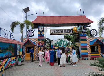
Happyland Funpark
Experience the thrills and joys of Happyland Funpark in Kankai, an amusement park filled with exciting rides, games, and family-friendly attractions.
-
Hindu temple
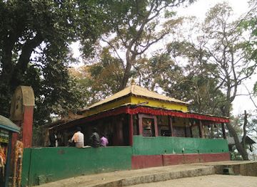
Budhasubba Temple
Experience spiritual tranquility and cultural richness at Budhasubba Temple in the heart of Dharan, Nepal, a must-visit destination for all travelers.
-
Park
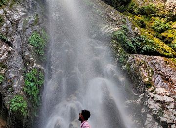
Namaste Waterfall Parking Lot
Explore the serene Namaste Waterfall Parking Lot in Bhedetar, Nepal, offering breathtaking views and a tranquil escape into nature.
-
Water park
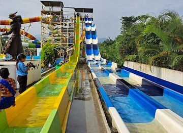
Yippee Land Amusement & Water Park
Experience the ultimate fun at Yippee Land Amusement & Water Park in Itahari, Nepal, where excitement meets relaxation for the whole family.
Best landmarks in Koshi Zone
The Koshi River and its broad floodplain are the region's defining natural landmarks, marking the transition from the eastern Terai's agricultural landscape to the hill country beyond. Koshi Tappu's wetlands are significant not only for their scenery but also for the conservation of wild water buffalo and migratory birds. In the north, the Arun River valley forms one of the great geographical corridors of eastern Nepal, cutting through increasingly elevated country on the way towards Makalu-Barun. Makalu itself lies within the protected mountain landscape of the former zone's Sankhuwasabha district and is the most imposing natural symbol of its Himalayan edge. Dharan's Dantakali Temple and the hilltop religious complex at Baraha Kshetra in Sunsari represent important Hindu sacred sites, while the older market-town landscapes of Dhankuta and Hile express the region's hill history through terraces, ridges and traditional settlement patterns. These landmarks are valued as living places, ecological systems and travel corridors as much as for visual drama.
-
Plaza
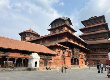
Kathmandu Durbar Square
Discover the enchanting Kathmandu Durbar Square, a UNESCO World Heritage Site filled with stunning temples, rich history, and vibrant local culture.
-
Buddhist temple
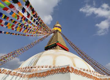
Buddha Stupa
Explore the serene beauty and rich heritage of Boudhanath Stupa, a UNESCO World Heritage Site and a spiritual haven in Kathmandu, Nepal.
-
River
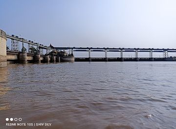
Koshi River
Experience the breathtaking beauty and adventure of Koshi River, one of Nepal's longest rivers, where nature and culture intertwine seamlessly.
-
Hindu temple
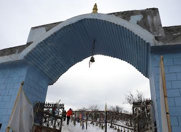
Pathibhara Devi Temple
Discover the spiritual essence of Pathibhara Devi Temple, a sacred haven in Nepal offering breathtaking views and a rich cultural experience.
Explore Koshi Zone on the map
Plan your trip on one map. See where the top cities, national parks and sights are, and book hotels and experiences in a few clicks.
Best hotels in Koshi Zone
Best restaurants in Koshi Zone
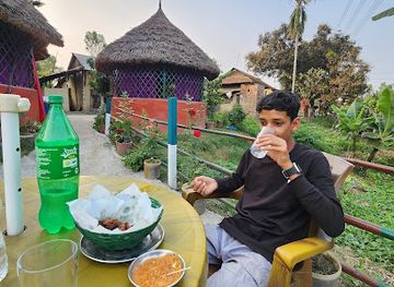
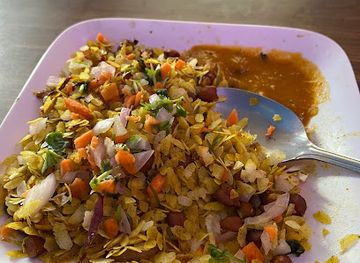
Dining in Koshi Zone changes markedly between the Terai, the hill towns and remote mountain settlements. Biratnagar, Itahari and Dharan have the broadest choice, including Nepali, Indian and regional South Asian food alongside familiar urban dishes. Local staples include dal bhat with seasonal vegetables, tarkari, achar, sel roti and varieties of momo; hill communities also contribute distinctive preparations based on millet, maize, fermented greens and locally available herbs. In the Terai, rice-based meals, lentils, fish and vegetable dishes reflect the warmer agricultural plains and close connections with northern India. Tea-growing areas around Dhankuta and Hile provide locally produced tea, while rural markets are useful for seasonal fruit, greens and snacks. Small eateries and family-run lodges are often more dependable than formal dining outside the main towns. Food hygiene standards vary, so choose busy establishments, drink treated water and take care with raw foods when travelling into remote districts.
-
Grill
Feel Good Bar & Grill
Discover delicious grilled cuisine at Feel Good Bar & Grill in Biratnagar – where flavor meets a vibrant atmosphere!
-
Restaurant
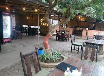
Olive Cafe
Discover delightful flavors at Olive Cafe in Biratnagar - where local meets global in a cozy atmosphere perfect for all travelers.
-
Restaurant
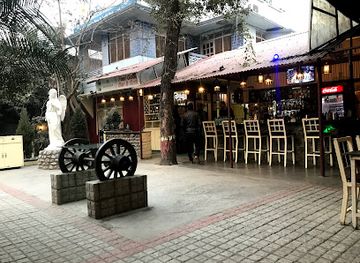
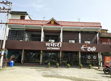
Majheri Restaurant,Cafe & Bakery
Discover authentic Nepali flavors at Majheri Restaurant, Cafe & Bakery in Itahari – a perfect spot for family gatherings and culinary delights.
-
Restaurant
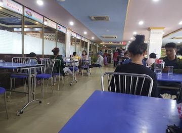
Gorkha Kitchen, Itahari
Discover the essence of Nepali and Indian cuisine at Gorkha Kitchen - where every dish tells a story.
Best bars in Koshi Zone
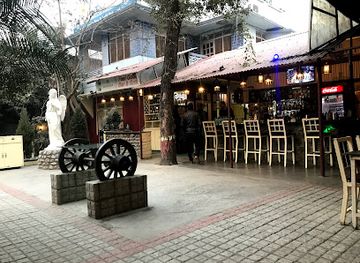
Nightlife in Koshi Zone is concentrated in Biratnagar, Itahari and Dharan, where restaurants, cafés, hotel bars and small live-music venues provide the main evening options. Dharan has a particularly active urban restaurant and café culture relative to the hill districts, while Biratnagar's long-established commercial character supports a wider range of places to eat and meet. Outside these centres, evenings generally revolve around tea shops, family restaurants, local gatherings and hotel dining rather than dedicated clubs. Some larger towns have modern lounges and occasional live entertainment, but opening arrangements and venue status can change. In rural areas and near protected landscapes, quiet evenings are the norm; visitors should respect community customs, avoid excessive noise and arrange transport before going out. Alcohol availability varies by establishment and community, and drinking is not necessary to participate in local social life.
-
Grill
Feel Good Bar & Grill
Experience the best of local and international cuisine at Feel Good Bar & Grill, a must-visit dining spot in Biratnagar.
-
Bar
Khusi hotel
Discover the inviting atmosphere of Khusi Hotel, a perfect bar in Ramdhuni Bhasi offering local flavors and a cozy ambiance for tourists.
-
Bar
Its homies cafe & cottage
Experience the vibrant culture and cozy atmosphere at Its Homies Cafe & Cottage in Sundar Dulari, the perfect retreat for travelers.
-
Sports bar
Durghadevi Dulal Sports Gram
Join the excitement at Durghadevi Dulal Sports Gram, the ultimate sports bar in Koshi Haraicha for fans and fun seekers alike.
Best nightclubs in Koshi Zone
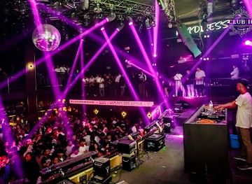
Nightlife in Koshi Zone is concentrated in Biratnagar, Itahari and Dharan, where restaurants, cafés, hotel bars and small live-music venues provide the main evening options. Dharan has a particularly active urban restaurant and café culture relative to the hill districts, while Biratnagar's long-established commercial character supports a wider range of places to eat and meet. Outside these centres, evenings generally revolve around tea shops, family restaurants, local gatherings and hotel dining rather than dedicated clubs. Some larger towns have modern lounges and occasional live entertainment, but opening arrangements and venue status can change. In rural areas and near protected landscapes, quiet evenings are the norm; visitors should respect community customs, avoid excessive noise and arrange transport before going out. Alcohol availability varies by establishment and community, and drinking is not necessary to participate in local social life.
-
Night club
LOD - Lord of the Drinks
Dive into Bhaktapur's nightlife at Lord of the Drinks, a premier club with electrifying music and an extensive drink selection for an unforgettable experience.
-
Night club
Club Catwalk
Discover the lively nightlife at Club Catwalk in Pokhara, offering a blend of vibrant music, delicious food, and unforgettable dance experiences.
-
Night club
Club Sixteen
Vibrant nightlife awaits at Club Sixteen in Pokhara, where electrifying beats and a lively atmosphere create unforgettable nights out.
-
Night club
Vintage Cafe, Lounge & Bar
Dive into the vibrant nightlife at Vintage Cafe, Lounge & Bar in Dharan, where great music, tasty food, and an inviting ambiance await.



Best shops in Koshi Zone
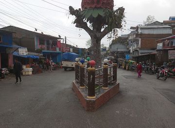
Shopping is most varied in Biratnagar, Itahari and Dharan, where busy bazaars and commercial streets sell clothing, household goods, electronics, Indian imports and everyday Nepali products. Dhankuta, Hile, Bhojpur and other hill markets have a more local character, with seasonal produce, woven goods, traditional foods and practical supplies for surrounding villages. Tea from the eastern hills is a useful regional purchase, while small producers and market stalls may offer orthodox and local-style teas, spices, pickles, honey and dried foods. Handicrafts, textiles and goods associated with Rai, Limbu and other communities should be bought respectfully and with attention to provenance rather than treated as generic souvenirs. In rural bazaars, cash remains important and bargaining can be expected for some goods but not all. The strongest shopping experience is often the market itself, where agricultural products from the hills and plains meet imported goods moving through the border economy.
-
 Clothing store
R Square Collection Boutique
Explore the fashion-forward styles at R Square Collection Boutique in Dharan, where local culture meets contemporary design.
-
Electronics store
Tinjure Electronics
Explore the latest in technology at Tinjure Electronics in Basantapur, where quality meets variety in gadgets and tech products.
-
Jewelry store
SN Gifts & Jewellery House
Discover the exquisite craftsmanship of Nepalese jewelry at SN Gifts & Jewellery House in Dharan, where tradition meets elegance.
-
Clothing store
Pashupati Vastralaya
Explore the vibrant heritage of Nepal through exquisite traditional clothing at Pashupati Vastralaya in Parewadin.


Get your free copy of our complete guide to Koshi Zone, delivered straight to you.
Everything on this page, from attractions and restaurants to essentials and local phrases, in one PDF you can read offline, print or share.
Already have an account? Sign in
Your Koshi Zone guide is ready.
We'll send it to · Not you? Sign out

Getting your guide ready…
We are putting together a fresh copy of the Koshi Zone guide. This can take up to a minute.
This can take a few moments. If your browser asks, choose Allow so the download can start. You'll find the guide in your Downloads folder.
Nothing happened? Download it again
Sorry, the guide is taking longer than usual. Please try again in a minute, or get it by email instead.
Koshi Zone essentials
Currency and Payment
Safety
Emergency Situations
Do's and Don'ts
Local Tips
From Eve
Local phrases worth knowing
You don't need to get them perfect. A few words go a long way, and locals appreciate the effort.
Basics
| English | Local | Say it |
|---|---|---|
| Hello | नमस्ते | [Namaste] |
| Goodbye | अलविदा | [Alvida] |
| Yes | हो | [Ho] |
| No | होइन | [Hoin] |
| Please/You're welcome | कृपया / स्वागत छ | [Kripaya / Swagat cha] |
| Thank you | धन्यवाद | [Dhanyabad] |
| Excuse me/Sorry | माफ गर्नुहोस् | [Maaf garnuhos] |
| How are you? | तिमीलाई कस्तो छ? | [Timilai kasto cha?] |
| Fine. And you? | ठिक छ। र तिमी? | [Thik cha. Ra timi?] |
| Do you speak English? | के तपाईं अंग्रेजी बोल्न सक्नुहुन्छ? | [Ke tapaai angrezi bolna saknuhunchha?] |
| I don't understand | म बुझ्दिन | [Ma bujhdina] |
Eating & Drinking
| English | Local | Say it |
|---|---|---|
| I'd like to see the menu, please | कृपया म मेनु देख्न चाहन्छु | [Kripaya ma menu dekhna chahanchhu] |
| I don't eat meat | म मासु खाँदैन | [Ma maasu khandaina] |
| Cheers! | Cheers! | [Cheers!] |
| I would like to pay, please | कृपया म भुक्तान गर्न चाहन्छु | [Kripaya ma bhuktan garna chahanchhu] |
Emergencies
| English | Local | Say it |
|---|---|---|
| Help! | सहायता! | [Sahayata!] |
| Go away! | फर्कनुहोस्! | [Pharkanu hos!] |
| Call the Police! | पुलिसलाई फोन गर्नुहोस्! | [Pulislai phone garnuhos!] |
| Call a doctor! | डाक्टरलाई फोन गर्नुहोस्! | [Daktar lai phone garnuhos!] |
| I'm lost | म हराएँ | [Ma harayen] |
| I'm ill | म बिरामी छु | [Ma birami chu] |
Shopping
| English | Local | Say it |
|---|---|---|
| I'd like to buy... | म ... किन्न चाहन्छु | [Ma ... kinna chahanchhu] |
| I'm just looking | म केवल हेरिरहेको छु | [Ma keval herirahi ko chu] |
| How much is it? | यसको मूल्य कति हो? | [Yasko muly kati ho?] |
| That's too expensive | त्यो धेरै महँगो हो | [Tyo dherai mahango ho] |
| Can you lower the price? | के तपाईं मूल्य घटाउन सक्नुहुन्छ? | [Ke tapaai muly ghataun saknuhunchha?] |
Time & Numbers
| English | Local | Say it |
|---|---|---|
| What time is it? | कति बजेको छ? | [Kati bajeko cha?] |
| It's one o'clock | यो एक बजेको छ | [Yo ek bajeko cha] |
| Half past (10) | साढे (१०) | [Saadhe (10)] |
| Morning | बिहान | [Bihan] |
| Afternoon | मध्याह्न | [Madhyahn] |
| Evening | बेलुका | [Beluka] |
| Yesterday | हिजो | [Hijo] |
| Today | आज | [Aaj] |
| Tomorrow | भोलि | [Bholi] |
| 1 | १ | [1] |
| 2 | २ | [2] |
| 3 | ३ | [3] |
| 4 | ४ | [4] |
| 5 | ५ | [5] |
| 6 | ६ | [6] |
| 7 | ७ | [7] |
| 8 | ८ | [8] |
| 9 | ९ | [9] |
| 10 | १० | [10] |
Transport & Directions
| English | Local | Say it |
|---|---|---|
| Where's a/the...? | कहाँ छ ...? | [Kahaan cha ...?] |
| What's the address? | ठेगाना के हो? | [Thegana ke ho?] |
| Can you show me (on the map)? | के तपाईं मलाई देखाउन सक्नुहुन्छ (नक्सामा)? | [Ke tapaai malai dekhau na saknuhunchha (naksamaa)?] |
| When's the next (bus)? | अर्को (बस) कहिले छ? | [Arko (bus) kahile cha?] |
| A ticket (to ....) | एक टिकट (....को लागि) | [Ek ticket (....ko lagi)] |
History of Koshi Zone
Early Kirat and Himalayan Cultural Landscapes
The eastern hills of Koshi Zone have long been associated with Kirat peoples, particularly Rai and Limbu communities, whose histories, oral traditions and sacred landscapes remain important across the region. Settlement developed around forested ridges, river valleys and terraced agriculture rather than a single urban centre. Kirat religious practice, often connected with ancestors, nature and distinctive ritual specialists, continues to influence local identity alongside Hinduism and Buddhism. The Arun, Tamor and Koshi river systems helped shape routes between the hills and the plains, while trade and migration connected the area to wider Himalayan networks.
Hill Principalities and the Gorkha Expansion
Before the consolidation of modern Nepal, eastern Nepal was divided among numerous small principalities and local political territories. The Gorkha state expanded eastwards during the eighteenth century, gradually bringing the hill districts and adjoining plains into a larger Himalayan kingdom. This process altered systems of taxation, administration and military recruitment while leaving local languages, customary practices and landholding traditions in place. Fortified ridges, old routes and settlements around present-day Dhankuta, Bhojpur and the eastern hills reflect the strategic value of the region, which linked the central kingdom with the far eastern mountains and the Indian plains.
The Anglo-Nepalese War and the Sugauli Settlement
The Anglo-Nepalese War of 1814–1816 affected Nepal's eastern frontier and its relationship with the British East India Company. The conflict ended with the Treaty of Sugauli, through which Nepal ceded substantial territory, including areas east and south of the later Koshi Zone. The settlement fixed a political boundary that encouraged continuing trade and movement across the Terai while placing the Himalayan hills within the expanding Nepali state. The region's later importance as a corridor towards Sikkim, Darjeeling and northern Bihar was shaped partly by this new border geography.
Biratnagar and the Growth of Modern Industry
Biratnagar became one of Nepal's leading industrial and commercial centres during the twentieth century. Its position near the Indian border, connection with surrounding agricultural districts and access to road and rail networks across the frontier encouraged the development of mills, factories and trading houses. The city was also associated with the labour movement and political activism that challenged the Rana regime. The growth of Biratnagar marked a significant contrast with the subsistence farming and market-town economies of the hills, creating an enduring economic relationship between the eastern Terai and upland districts.
Democratic Movements and Political Change
Eastern Nepal played an important role in the country's modern political history. Biratnagar's industrial workforce and political organisations were prominent in the democratic movement of 1950–51, which ended the Rana oligarchy and restored the monarchy to a more constitutional framework. The region later experienced the wider political changes that brought the Panchayat system, the restoration of multiparty democracy in 1990, the civil conflict and the republican transition of 2008. These changes affected local government, land relations, migration and expectations of representation among the many ethnic and linguistic communities of the eastern hills and plains.
Koshi Tappu and the Conservation Era
The establishment of Koshi Tappu Wildlife Reserve in 1976 created a protected area around important wetlands and grasslands on the Koshi floodplain. Its principal conservation significance includes habitat for wild water buffalo, locally known as arna, and a wide range of resident and migratory birds. In the north, Makalu-Barun National Park, established in 1992, protected an exceptionally broad altitudinal range from tropical forests to high Himalayan landscapes. Together these protected areas represent a modern shift from seeing the Koshi basin mainly as an agricultural and transport corridor to recognising its international ecological importance.
Federal Nepal and the End of the Zone System
Nepal's 2015 Constitution replaced the former system of development regions, zones and districts as the main framework for federal government, creating seven provinces and new local structures. The six districts formerly grouped in Koshi Zone now form part of present-day Koshi Province, although districts remain important for administration and travel planning. The change explains why older maps and guidebooks may use Koshi Zone while current signs and official documents use provincial terminology. For visitors, the former zone remains a coherent geographical idea because its landscapes, roads and economic links run from the eastern Terai through the hill country towards Makalu.
Koshi Zone in Photos
Browse through our photo collection highlighting the charm and character of the destination.
Neighbouring regions of Koshi Zone
The closest regions to Koshi Zone, if you have time for more than one.
-

-

-

-

-


Swipe for more regions

