

Free Eastern Development Region Travel Guide & Mobile App
Explore Eastern Development Region with free travel guides. Discover regional history, expert tips, proposed trips, and audio guides on web or mobile app.


Explore Nepal’s Eastern Development Region for Everest and Kanchenjunga treks, Ilam tea hills, river valleys, wildlife and diverse local cultures.
Read more about Eastern Development Region
When is the best time to visit Eastern Development Region?
Best: March–April, November · 22–28°C| Month | High (°C) | Rainfall (mm) |
|---|---|---|
| January | 17 | 20 |
| February | 19 | 30 |
| March (best) | 24 | 40 |
| April (best) | 28 | 50 |
| May | 31 | 60 |
| June | 32 | 200 |
| July | 32 | 300 |
| August | 31 | 300 |
| September | 30 | 250 |
| October | 27 | 100 |
| November (best) | 22 | 50 |
| December | 18 | 20 |
Getting to and around Eastern Development Region
How to get there
Transportation
Top city travel guides in Eastern Development Region
The cities of Eastern Development Region, and the easiest places to base yourself.
-

-

-

-

-


Swipe for more cities
Destinations in Eastern Development Region
Resorts, valleys and scenic spots worth a trip of their own.
-

-

-

-

-

-


Swipe for more destinations
Best attractions in Eastern Development Region
The Eastern Development Region offers an unusually wide range of landscapes within one historic travel area. The Khumbu is the region’s best-known attraction, with trekking routes through Namche Bazaar, Tengboche and the Sagarmatha National Park towards Everest viewpoints and high passes. Farther east, the Kanchenjunga and Makalu areas provide demanding trails through remote valleys, alpine terrain and protected forests, while Tumlingtar and the Arun valley form a practical approach to Makalu country. The middle hills bring a gentler style of travel: Ilam’s tea gardens, Dhankuta’s ridge scenery, Hile’s market setting and Taplejung’s approach to Pathibhara are suited to walking, landscape viewing and cultural exploration. In the Terai, Koshi Tappu Wildlife Reserve is important for wetland habitats and birdwatching, with guided excursions shaped by water levels and seasonal wildlife activity. Religious journeys may focus on Barahachhetra and Halesi, while Dharan offers access to temples, foothill walks and local cultural sites. Because distances are large and roads are variable, the region is better experienced through carefully chosen bases than through a single rushed circuit.
-
Tourist attraction
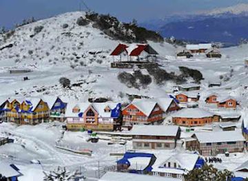
Kalinchowk Bhagawati Temple
Explore Kalinchowk Bhagawati Temple, a serene Hindu pilgrimage site in Nepal, offering stunning views and rich cultural experiences amidst the Himalayas.
-
Tourist attraction
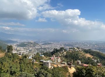
Switzerland Park
Explore the serene beauty of Switzerland Park in Chandragiri, a perfect getaway for nature lovers and adventure seekers alike.
-
Tourist attraction
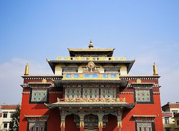
Shechen Monastery
Experience the spiritual serenity of Shechen Monastery, a stunning Tibetan Buddhist temple in the heart of Kathmandu, Nepal.
-
National park
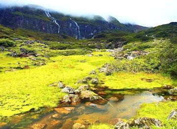
Makalu Barun National Park
Discover the breathtaking beauty and biodiversity of Makalu Barun National Park, a hidden gem in the heart of the Himalayas.
Best landmarks in Eastern Development Region
The region’s most recognisable landmarks range from Himalayan destinations to religious and civic sites in the hills and plains. Mount Everest defines the northern skyline of the Khumbu, while Namche Bazaar’s amphitheatre of steep slopes and the monastery at Tengboche are enduring symbols of the trekking route. Kanchenjunga and Makalu dominate separate eastern mountain landscapes, though access to their base-camp areas is through demanding trails rather than conventional sightseeing roads. In the middle hills, Pathibhara Temple above Taplejung is an important pilgrimage landmark, and the tea-covered ridges around Ilam give the town a distinctive agricultural setting. Barahachhetra, at the meeting of the Saptakoshi river system, is one of eastern Nepal’s significant Hindu pilgrimage places. Halesi, in Khotang, is revered by both Hindu and Buddhist communities for its cave and temple complex. Dharan’s Budha Subba and Dantakali sites express the religious importance of the foothills, while Biratnagar’s broad streets, industrial legacy and commercial buildings represent the region’s modern lowland economy.
-
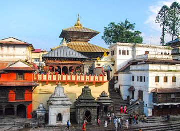
Hindu temple
Pashupatinath Temple
Explore the spiritual heart of Nepal at Pashupatinath Temple, where vibrant rituals meet stunning architecture along the sacred Bagmati River.
-
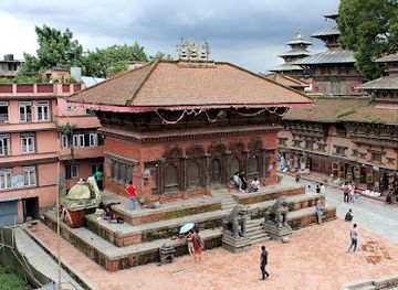
Plaza
Kathmandu Durbar Square
Explore the historic charm and architectural splendor of Kathmandu Durbar Square, a UNESCO World Heritage gem in the heart of Nepal.
-
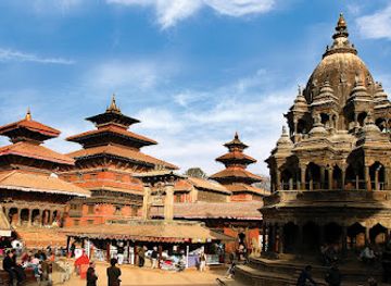
Historical landmark
Patan Darbar Square
Explore the exquisite artistry and historical significance of Patan Darbar Square, a UNESCO World Heritage Site in Lalitpur, Nepal.
-
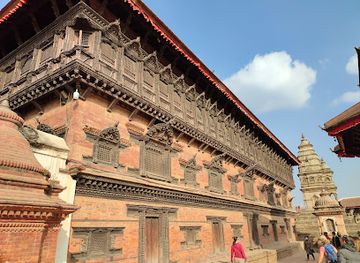
Tourist attraction
Bhaktapur Durbar Square
Explore the architectural marvels and vibrant culture of Bhaktapur Durbar Square, a UNESCO World Heritage site that showcases Nepal's rich history.
Explore Eastern Development Region on the map
Plan your trip on one map. See where the top cities, national parks and sights are, and book hotels and experiences in a few clicks.
Best hotels in Eastern Development Region
Best restaurants in Eastern Development Region
Eating in the Eastern Development Region reflects the meeting of Himalayan, hill and Terai traditions. Biratnagar, Dharan and other larger towns offer Nepalese staples alongside Indian-influenced dishes, while roadside eateries and family restaurants provide dal bhat, vegetable tarkari, momo, thukpa and snacks such as sel roti. In Limbu and Rai areas, visitors may encounter kinema, a fermented soybean food, local greens, millet-based preparations and regionally produced dairy, although availability varies by household and season. Ilam is associated with tea cultivation, and tea gardens and town cafés provide opportunities to taste locally grown leaves; eastern hills are also important for cardamom, ginger and other crops. Along trekking routes, menus become practical and lodge-based, with familiar energy-rich meals rather than elaborate regional specialities. Markets in the Terai and hill towns are useful for seasonal fruit, sweets, pickles and snacks, but visitors should choose busy establishments with good food turnover and take extra care with untreated water.
-
Steak
Kathmandu Steak House Restaurant
Discover the best steakhouse experience in Kathmandu offering halal options and authentic Nepalese cuisine in a welcoming atmosphere.
-
Nepalese
Nepalaya Rooftop Restaurant
Experience breathtaking views and authentic flavors at Nepalaya Rooftop Restaurant in Kathmandu's lively Thamel district.
-
Restaurant
HighCamp Cafe
Discover culinary delights at HighCamp Cafe in Namche Bazar—your gateway to delicious food amidst stunning Himalayan views.
-
Restaurant
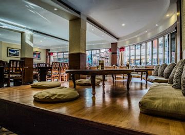
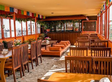
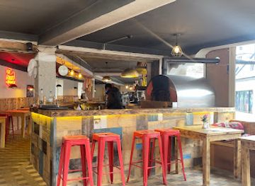
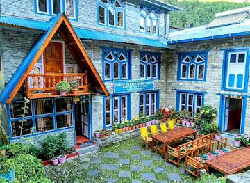
Green Village Guest House &Restaurant
Experience authentic Nepali cuisine and warm hospitality at Green Village Guest House & Restaurant in Phakding.
Best bars in Eastern Development Region
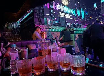
Evening life is most substantial in Biratnagar, Dharan and other larger eastern towns, where restaurants, cafés, modern lounges and occasional live-music venues attract local residents and visitors. Dharan in particular has a broad selection of casual eating and social spaces, while Biratnagar’s commercial character supports hotel bars and urban dining. In Ilam, Dhankuta and smaller hill settlements, nightlife is quieter and generally centres on tea shops, restaurants, local gatherings and modest family-run bars rather than dedicated clubs. Trekking villages offer lodges where guests share meals and conversation, but late-night services are limited and may be affected by electricity, weather or seasonal demand. Alcoholic drinks are available in some restaurants and hotels, yet evening culture is not dependent on drinking; cafés, food stalls, religious observances and early starts are equally characteristic of life across the region.
-
Bar
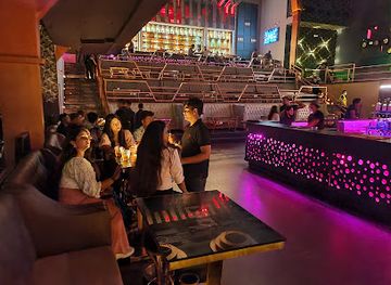
Purple Haze Rock Bar
Discover Kathmandu's vibrant nightlife at Purple Haze Rock Bar, where live music, great drinks, and a lively atmosphere await you.
-
Restaurant
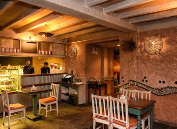
Roadhouse Cafe, Pulchowk
Discover the inviting Roadhouse Cafe in Pulchowk, where local flavors meet global cuisine in a cozy setting perfect for every traveler.
-
Bar
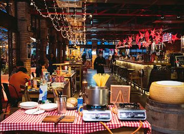
Mezze by Roadhouse
Experience the vibrant flavors of Mezze by Roadhouse in Kathmandu, where exquisite cuisine and a lively ambiance come together for an unforgettable dining experience.
-
Night club
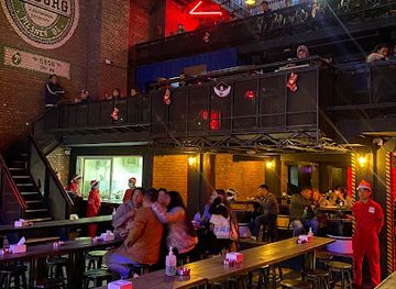
LOD - Lord of the Drinks
Discover the vibrant nightlife of Kathmandu at LOD - Lord of the Drinks, where music and cocktails create unforgettable experiences.
Best nightclubs in Eastern Development Region
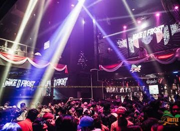
Evening life is most substantial in Biratnagar, Dharan and other larger eastern towns, where restaurants, cafés, modern lounges and occasional live-music venues attract local residents and visitors. Dharan in particular has a broad selection of casual eating and social spaces, while Biratnagar’s commercial character supports hotel bars and urban dining. In Ilam, Dhankuta and smaller hill settlements, nightlife is quieter and generally centres on tea shops, restaurants, local gatherings and modest family-run bars rather than dedicated clubs. Trekking villages offer lodges where guests share meals and conversation, but late-night services are limited and may be affected by electricity, weather or seasonal demand. Alcoholic drinks are available in some restaurants and hotels, yet evening culture is not dependent on drinking; cafés, food stalls, religious observances and early starts are equally characteristic of life across the region.
-
Night club
LOD - Lord of the Drinks
Discover the thrilling nightlife at Lord of the Drinks, a premier night club in Thamel, Bhagwatisthan, offering great music, drinks, and an unforgettable atmosphere.
-
Night club
Club Catwalk
Discover the pulsating nightlife of Pokhara at Club Catwalk, where vibrant music, tantalizing cuisine, and unforgettable memories await.
-
Night club
Turtle Lounge & Club
Discover the vibrant nightlife of Kathmandu at Turtle Lounge & Club, where dancing, drinks, and unforgettable memories await.
-
Night club
Club Sixteen
Discover the pulsating nightlife of Pokhara at Club Sixteen, where music, drinks, and dance come together for an unforgettable evening.


Best shops in Eastern Development Region
Shopping varies sharply between the industrial Terai, hill market towns and trekking settlements. Biratnagar offers the broadest urban retail choice, including clothing, household goods, Indian-influenced food products and practical travel supplies, while Dharan combines a busy commercial centre with cafés, clothing shops and food markets. Ilam is the principal place to look for packaged eastern Nepal tea, and hill markets also trade cardamom, ginger, honey, pickles and seasonal produce; check labelling and buy from established cooperatives or producers when possible. Dhankuta and Hile are useful for browsing local agricultural goods and everyday crafts rather than luxury retail. In Himalayan villages, shops mainly stock trekking necessities, snacks, woven items and small souvenirs, often at higher prices because of transport costs. Nepalese textiles, handmade paper, woollen goods, carved objects and religious items can be found across the region, but visitors should avoid buying antiquities or anything that may have been removed from a sacred site.
-
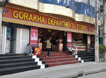
Department store
Gorakha Department Store
Explore the vibrant Gorakha Department Store in Itahari for a unique shopping experience offering a blend of local goods and cultural treasures.
-
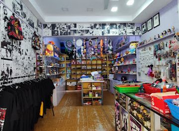
Gift shop
Friendshop
Explore Friendshop in Itahari for unique souvenirs and local crafts, celebrating the rich culture of Nepal with every purchase.
-
 Book store
Rappit Nepal || Best Online Book Shopping for Dharan Nepal || Find Books & Stationery Products
Discover Rappit Nepal in Dharan, the ultimate destination for book lovers and stationery enthusiasts, offering a treasure trove of literature and creativity.
-
Cosmetics store
Soraya's Luxurious Cosmetics
Explore the luxurious world of cosmetics at Soraya's in Dharan, where beauty meets elegance and quality products await.

Get your free copy of our complete guide to Eastern Development Region, delivered straight to you.
Everything on this page, from attractions and restaurants to essentials and local phrases, in one PDF you can read offline, print or share.
Already have an account? Sign in
Your Eastern Development Region guide is ready.
We'll send it to · Not you? Sign out

Getting your guide ready…
We are putting together a fresh copy of the Eastern Development Region guide. This can take up to a minute.
This can take a few moments. If your browser asks, choose Allow so the download can start. You'll find the guide in your Downloads folder.
Nothing happened? Download it again
Sorry, the guide is taking longer than usual. Please try again in a minute, or get it by email instead.
Eastern Development Region essentials
Currency and Payment
Safety
Emergency Situations
Do's and Don'ts
Local Tips
From Eve
Local phrases worth knowing
You don't need to get them perfect. A few words go a long way, and locals appreciate the effort.
Basics
| English | Local | Say it |
|---|---|---|
| Hello | नमस्ते | [Namaste] |
| Goodbye | बिदा | [Bida] |
| Yes | हो | [Ho] |
| No | होइन | [Hoin] |
| Please/You're welcome | कृपया/स्वागत छ | [Kripaya/Swagat cha] |
| Thank you | धन्यवाद | [Dhanyabad] |
| Excuse me/Sorry | माफ गर्नुहोस् | [Maaf garnuhos] |
| How are you? | तपाईंलाई कस्तो छ? | [Tapainlai kasto cha?] |
| Fine. And you? | ठिकै। र तपाई? | [Thikai. Ra tapai?] |
| Do you speak English? | के तपाईलाई अंग्रेजी बोल्न आउँछ? | [Ke tapainlai angreji bolna aunchha?] |
| I don't understand | म बुझ्दिन | [Ma bujhdina] |
Eating & Drinking
| English | Local | Say it |
|---|---|---|
| I'd like to see the menu, please | म मेनु देख्न चाहन्छु, कृपया | [Ma menu dekhna chahanchu, kripaya] |
| I don't eat meat | म मासु खाँदिन | [Ma masu khadina] |
| Cheers! | स salud! | [Salu!] |
| I would like to pay, please | म तिर्न चाहन्छु, कृपया | [Ma tirna chahanchu, kripaya] |
Emergencies
| English | Local | Say it |
|---|---|---|
| Help! | मद्दत गर्नुहोस्! | [Maddat garnuhos!] |
| Go away! | फिर्ता जानुहोस्! | [Phirta jaanuhos!] |
| Call the Police! | पुलिसलाई बोलाउनुहोस्! | [Pulislai bolaunuhos!] |
| Call a doctor! | डॉक्टरलाई बोलाउनुहोस्! | [Doctorlai bolaunuhos!] |
| I'm lost | म हराएको छु | [Ma harayeko chu] |
| I'm ill | म बिरामी छु | [Ma birami chu] |
Shopping
| English | Local | Say it |
|---|---|---|
| I'd like to buy... | म किन्न चाहन्छु... | [Ma kinna chahanchu...] |
| I'm just looking | म मात्र हेर्दैछु | [Ma matra herdaichu] |
| How much is it? | यो कति हो? | [Yo kati ho?] |
| That's too expensive | यो धेरै महँगो छ | [Yo dherai mahango cha] |
| Can you lower the price? | के तपाईं मूल्य घटाउन सक्नुहुन्छ? | [Ke tapaai moolya ghatauna saknuhunchha?] |
Time & Numbers
| English | Local | Say it |
|---|---|---|
| What time is it? | यो कति बजे हो? | [Yo kati baje ho?] |
| It's one o'clock | यो एक बजे हो | [Yo ek baje ho] |
| Half past (10) | साढे (१०) | [Saadhe (10)] |
| Morning | बिहान | [Bihan] |
| Afternoon | दिउँसो | [Diunsou] |
| Evening | साँझ | [Sanjh] |
| Yesterday | हिजो | [Hijo] |
| Today | आज | [Aaj] |
| Tomorrow | भोली | [Bholi] |
| 1 | १ | [1] |
| 2 | २ | [2] |
| 3 | ३ | [3] |
| 4 | ४ | [4] |
| 5 | ५ | [5] |
| 6 | ६ | [6] |
| 7 | ७ | [7] |
| 8 | ८ | [8] |
| 9 | ९ | [9] |
| 10 | १० | [10] |
Transport & Directions
| English | Local | Say it |
|---|---|---|
| Where's a/the...? | एक/त्यो... कहाँ छ? | [Ek/Tyo... kahaan cha?] |
| What's the address? | ठेगाना के हो? | [Thegana ke ho?] |
| Can you show me (on the map)? | के तपाई मलाई देखाउन सक्नुहुन्छ (नक्सामा)? | [Ke tapaai malai dekhna saknuhunchha (naksama)?] |
| When's the next (bus)? | अर्को (बस) कहिले आउँछ? | [Arko (bus) kahile aunchha?] |
| A ticket (to ....) | एक टिकट (.... तिर) | [Ek ticket (... tira)] |
History of Eastern Development Region
Early Kirat and Himalayan Cultures
Eastern Nepal has long been associated with Kirat peoples, particularly Rai and Limbu communities whose histories, oral traditions and customary institutions remain important in the hills. Archaeological evidence and long-established settlement patterns point to movement and exchange between the Himalayan foothills, middle hills and the plains. Religious practice developed through overlapping indigenous traditions, Hinduism and Buddhism rather than a single uniform system. In the higher valleys, trading and pastoral routes connected communities across mountain passes, while the southern plains remained linked to wider networks reaching into northern India.
Medieval Hill Kingdoms and Trade Routes
Before the formation of modern Nepal, eastern hill territories were divided among local principalities and often influenced by the wider political worlds of the Kathmandu Valley, Mithila and Tibet. Trading paths carried salt, wool, grain and other goods through the mountain corridors, while religious centres grew at sites including Barahachhetra and Halesi. Small courts, monasteries, temples and market settlements shaped the region’s cultural geography. The legacy survives in historic pilgrimage places, Newar mercantile communities and the distinctive architecture of older hill towns.
Gorkha Expansion and the Making of Nepal
The eastward expansion of the Gorkha state in the eighteenth century brought many eastern principalities into the political structure that became modern Nepal. Campaigns and negotiated settlements altered local arrangements of power, taxation and landholding, while communities retained considerable linguistic and cultural diversity. The resulting state connected the Terai, middle hills and Himalayan frontier under a single monarchy, though travel and administration remained difficult across the region’s steep terrain and river barriers.
The Anglo-Nepalese War and the Sugauli Settlement
The Anglo-Nepalese War of 1814–1816 affected Nepal’s eastern frontier and wider relations with the British East India Company. The Sugauli Treaty reduced Nepal’s territorial extent and established a new political relationship with British India. Eastern Nepal subsequently became closely connected to trade and military recruitment networks spanning the borderlands. Biratnagar and other southern settlements later grew in importance as roads, rail-linked markets in India and industrial activity strengthened economic links between the hills and the Terai.
Industrialisation and the Growth of Biratnagar
Biratnagar developed into one of Nepal’s principal industrial centres during the twentieth century, with jute processing, mills, trade and organised labour playing major roles in its modern history. Its growth helped connect the eastern Terai with Indian markets and with the hill districts to the north. The city also became associated with political activism and the wider democratic movement. Although industry and commerce have changed over time, Biratnagar remains a significant economic gateway to eastern Nepal.
Tea, Cardamom and Changing Hill Economies
Commercial tea cultivation transformed parts of the eastern hills, especially around Ilam, where plantations and processing facilities became central to the local economy and landscape. Large cardamom, ginger, dairy farming and other highland products added further links between rural producers and domestic or international markets. These industries brought income and new roads but also exposed communities to fluctuating prices, climate pressures and labour migration. Today, tea gardens, markets and agricultural terraces form an important part of the region’s contemporary identity.
Conservation and Himalayan Trekking
The establishment and expansion of protected areas changed how the region’s high mountains and wetlands were managed. Sagarmatha National Park, Makalu-Barun National Park and Conservation Area, Kanchenjunga Conservation Area and Koshi Tappu Wildlife Reserve each protect distinctive environments, from alpine peaks and forests to floodplain wetlands. Trekking, mountaineering and wildlife tourism have created new livelihoods and infrastructure, while also raising questions about waste, trail pressure, road building and equitable benefits for remote communities.
Eastern Development Region in Photos
Browse through our photo collection highlighting the charm and character of the destination.
Neighbouring regions of Eastern Development Region
The closest regions to Eastern Development Region, if you have time for more than one.
-

-

-

-

-


Swipe for more regions
Explore more

Explore more of Nepal
Discover Nepal: A land of towering peaks, spiritual harmony, and vibrant culture, offering endless adventures and serene escapes for every traveler.
Explore Nepal