

Kanchenjunga Base Camp Travel Guide - Free Web & App
Your ultimate guide to Kanchenjunga Base Camp. Discover top landmarks, proposed trips, and local tips. Free on the web or via the Evendo companion app.


Kanchenjunga Base Camp in Nepal offers remote Himalayan trekking, glacier views, high-altitude villages, and access to the world’s third-highest mountain.
A Wilderness Beyond the Main Himalayan Routes
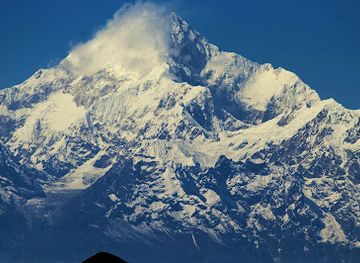
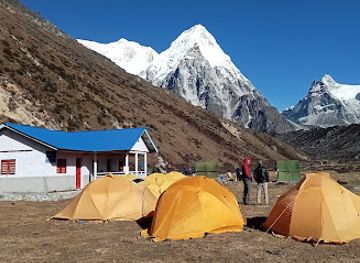
Kanchenjunga Base Camp refers to two high-altitude trekking destinations in eastern Nepal: Pangpema, the northern base camp, and Oktang, the southern base camp. Both lie within the Kanchenjunga Conservation Area, a remote mountain landscape extending towards the borders of India and Tibet. The region is dominated by Mount Kanchenjunga, whose 8,586-metre summit makes it the world’s third-highest mountain, together with immense glaciers, deep valleys, forested ridges and high passes.Read more about Kanchenjunga Base Camp
Villages, Forests and High Mountain Valleys
Glaciers, Wildlife and Mountain Views
When is the best time to visit Kanchenjunga Base Camp?
Best: June–August · 13–18°C| Month | High (°C) | Rainfall (mm) |
|---|---|---|
| January | -6 | 13 |
| February | -4 | 12 |
| March | -3 | 9 |
| April | 4 | 5 |
| May | 8 | 2 |
| June (best) | 13 | 1 |
| July (best) | 18 | 0 |
| August (best) | 17 | 1 |
| September | 13 | 2 |
| October | 6 | 6 |
| November | 0 | 10 |
| December | -4 | 12 |
Getting to and around Kanchenjunga Base Camp
How to get there
Transportation
Best attractions in Kanchenjunga Base Camp
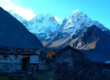
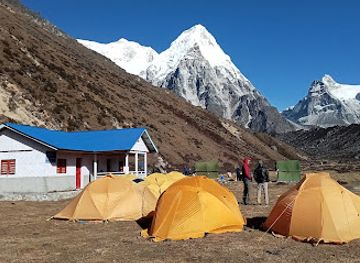
The principal attractions are the two contrasting approaches to Kanchenjunga. The northern trek leads through Ghunsa and the high valley towards Pangpema, where the mountain’s north face, glaciers and surrounding peaks form the centrepiece. The southern route passes through forested valleys, Tseram and the high terrain around the Yalung Glacier before reaching Oktang, with views towards Kanchenjunga’s southern faces. Lower sections offer changing vegetation, terraced hillsides, waterfalls and traditional villages rather than a concentration of built visitor sights. Ghunsa is especially important for its high-altitude settlement character and position on the northern route, while the valleys around Yamphudin and Khebang reveal the cultural landscape of eastern Nepal. The journey itself is the attraction: forests give way to alpine meadows, moraine and glacial terrain as the trails approach the massif.
-
Mountain peak
Kangchenjunga
Explore the breathtaking beauty of Kangchenjunga, the third highest mountain in the world, a paradise for trekkers and nature lovers alike.
-
National park
Khangchendzonga National Park
Discover the unparalleled beauty of Khangchendzonga National Park, a UNESCO World Heritage site perfect for trekking, wildlife watching, and immersing in nature.
-
Tourist attraction
Kanchenjunga Falls
Experience the breathtaking beauty of Kanchenjunga Falls, a serene escape nestled in the heart of Sikkim's stunning landscapes.
-
National park
Barsey Rhododendron Sanctuary
Discover the enchanting Barsey Rhododendron Sanctuary, a national park in Sikkim, where vibrant blooms and breathtaking views await.
Best landmarks in Kanchenjunga Base Camp
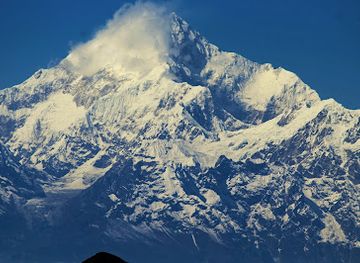
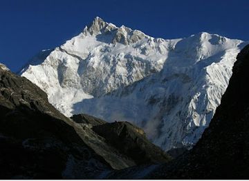
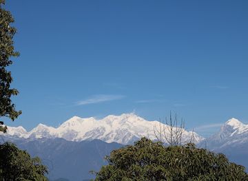
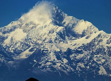
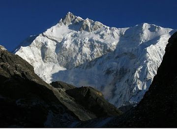
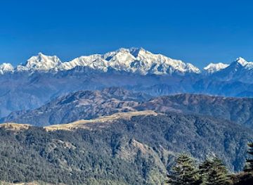
Mount Kanchenjunga is the defining landmark, rising to 8,586 metres within a massif whose major summits are traditionally associated with five treasures of the high snow. Pangpema provides a northern perspective towards the mountain’s immense face and glaciated surroundings, while Oktang and the Yalung Glacier offer a southern viewpoint into another dramatic side of the range. The Kanchenjunga Conservation Area itself is an important protected landscape, linking subtropical forest, rhododendron woodland, alpine pasture and high Himalayan ice. Ghunsa is a cultural landmark of the northern route because of its location, Buddhist influences and role as a high mountain settlement. The narrow valleys, moraines and glacier systems are as significant to the destination’s identity as any monument, reflecting the relationship between Himalayan geology, local communities and conservation.
-
Mountain peak
Kangchenjunga
Discover the breathtaking beauty and adventure of Kangchenjunga, the majestic crown of the Himalayas, perfect for trekkers and nature enthusiasts.
-
National park
Khangchendzonga National Park
Explore the breathtaking landscapes and rich biodiversity of Khangchendzonga National Park, a UNESCO World Heritage site in Sikkim, India.
-
Mountain peak
Phalut
Explore the breathtaking vistas of Phalut in West Bengal, a mountain peak offering stunning views of Kanchenjunga and Everest amidst serene natural beauty.
-
National park
Barsey Rhododendron Sanctuary
Explore the breathtaking Barsey Rhododendron Sanctuary, a national park in Sikkim known for its vibrant rhododendron blooms and diverse wildlife.
Explore Kanchenjunga Base Camp on the map
Plan your trip on one map. See where the top attractions, landmarks, restaurants and hotels are, and book hotels and experiences in a few clicks.
Best hotels in Kanchenjunga Base Camp
Best bars in Kanchenjunga Base Camp
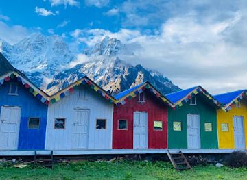
Kanchenjunga Base Camp has no conventional nightlife, and evenings are shaped by darkness, cold, early starts and the limited facilities of remote mountain settlements. In Taplejung, visitors may find modest teahouses and local drinking venues, but the atmosphere is local and low-key rather than designed as a tourist entertainment district. Along the trails, socialising generally takes place in dining rooms or communal lodge spaces, where trekkers, guides and porters share tea and conversation. Some villages may serve local alcoholic drinks, but availability varies and alcohol is unwise during strenuous acclimatisation. The most characteristic evening experience is quiet mountain hospitality, with time spent preparing for the next walking stage rather than seeking bars or clubs.
-
Mountain peak
Kangchenjunga
Discover the breathtaking beauty of Kangchenjunga, the third highest mountain in the world, and embark on an unforgettable adventure in the heart of the Himalayas.
-
National reserve
Kanchenjunga Conservation Area
Explore the breathtaking Kanchenjunga Conservation Area, a trekking paradise with wild landscapes and rich cultural heritage in the heart of the Himalayas.
-
Guest house
Kanchenjunga White House
Discover the ultimate retreat at Kanchenjunga White House, where luxury meets nature in the heart of the Himalayas.
-
Tourist attraction
Kanchenjunga Base Camp Trek
Experience the breathtaking beauty and adventure of the Kanchenjunga Base Camp Trek in the heart of the Himalayas, perfect for nature lovers and adventure seekers alike.
Best shops in Kanchenjunga Base Camp
Shopping is limited and practical, with the greatest choice found in Taplejung and other lower-elevation settlements on the approach rather than at either base camp. Small local shops may supply snacks, batteries, toiletries, basic clothing and trekking necessities, but stock is variable and specialist equipment should be obtained before travelling into eastern Nepal. Visitors may encounter locally made woven goods, baskets, textiles or simple handicrafts influenced by the region’s Limbu, Rai, Sherpa and Tibetan cultural traditions, although there is no extensive craft-shopping district. Tea, packaged food and small locally produced items can support village economies when purchased responsibly. Avoid buying ancient-looking religious objects, wildlife products or anything presented as removed from the conservation area.
-
Tourist attraction
Kanchenjunga Base Camp Trek
Experience the breathtaking beauty and cultural richness of the Kanchenjunga Base Camp Trek in the heart of the Himalayas.
-
 Bakery
Mitlung
Explore the flavors of Phungling at Mitlung, a charming bakery offering artisanal breads and pastries in a cozy setting.
Get your free copy of our complete guide to Kanchenjunga Base Camp, delivered straight to you.
Everything on this page, from attractions and restaurants to essentials and local phrases, in one PDF you can read offline, print or share.
Already have an account? Sign in
Your Kanchenjunga Base Camp guide is ready.
We'll send it to · Not you? Sign out

Getting your guide ready…
We are putting together a fresh copy of the Kanchenjunga Base Camp guide. This can take up to a minute.
This can take a few moments. If your browser asks, choose Allow so the download can start. You'll find the guide in your Downloads folder.
Nothing happened? Download it again
Sorry, the guide is taking longer than usual. Please try again in a minute, or get it by email instead.
Kanchenjunga Base Camp essentials
Currency and Payment
Safety
Emergency Situations
Do's and Don'ts
Local Tips
From Eve
Local phrases worth knowing
You don't need to get them perfect. A few words go a long way, and locals appreciate the effort.
Basics
| English | Local | Say it |
|---|---|---|
| Hello | नमस्ते | [Namaste] |
| Goodbye | फेरि भेटौं | [Feri bhetou] |
| Yes | हो | [Ho] |
| No | होइन | [Hoin] |
| Please/You're welcome | कृपया | [Kripaya] |
| Thank you | धन्यवाद | [Dhanyabad] |
| Excuse me/Sorry | माफ गर्नुहोस् | [Maf garnuhos] |
| How are you? | तपाईंलाई कस्तो छ? | [Tapailai kasto chha?] |
| Fine. And you? | राम्रो छ। तिमीलाई? | [Ramro chha. Timilai?] |
| Do you speak English? | तिमी अंग्रेजी बोल्नुहुन्छ? | [Timi angreji bolnuhunchha?] |
| I don't understand | मैले सम्झिन | [Maile samjhin] |
Eating & Drinking
| English | Local | Say it |
|---|---|---|
| I'd like to see the menu, please | कृपया मेनु हेर्न चाहन्छु | [Kripaya menu herne chahanchu] |
| I don't eat meat | म मासु हाम्थैन | [Ma masu hamthain] |
| Cheers! | चियर्स! | [Cheers!] |
| I would like to pay, please | कृपया भुक्तानी गर्न चाहन्छु | [Kripaya bhuktani garn chahanchu] |
Emergencies
| English | Local | Say it |
|---|---|---|
| Help! | मदद गर! | [Madad gar!] |
| Go away! | दूर हिँड | [Dur hinda] |
| Call the Police! | पुलिसलाई डाइल गर! | [Police lai dial gar!] |
| Call a doctor! | डाक्टरलाई डाइल गर! | [Doctor lai dial gar!] |
| I'm lost | म गुम्दा गयेको छु | [Ma gumda gayeko chu] |
| I'm ill | म बिमार छु | [Ma bimar chu] |
Shopping
| English | Local | Say it |
|---|---|---|
| I'd like to buy... | म खरिद गर्न चाहन्छु... | [Ma kharid garn chahanchu...] |
| I'm just looking | म सिर्जना गरिरहेको छु | [Ma sirjana gari raheko chu] |
| How much is it? | यो कति हो? | [Yo kati ho?] |
| That's too expensive | यो धेरै महँगो छ | [Yo dherai mahango chha] |
| Can you lower the price? | के तपाईं मूल्य कम गर्न सक्छ? | [Ke tapai mulya kam garn sakchha?] |
Time & Numbers
| English | Local | Say it |
|---|---|---|
| What time is it? | कति बज्यो? | [Kati bajyo?] |
| It's one o'clock | एक बजेको छ | [Ek bajeko chha] |
| Half past (10) | दस बजे अर्ध समय | [Das baje ardha samaya] |
| Morning | बिहान | [Bihan] |
| Afternoon | दिउँसो | [Diunso] |
| Evening | साँझ | [Sanjh] |
| Yesterday | हिजो | [Hijo] |
| Today | आज | [Aaj] |
| Tomorrow | भोलि | [Bholi] |
| 1 | एक | [Ek] |
| 2 | दुई | [Dui] |
| 3 | तीन | [Teen] |
| 4 | चार | [Char] |
| 5 | पाँच | [Paanch] |
| 6 | छ | [Chh] |
| 7 | सात | [Saath] |
| 8 | आठ | [Aath] |
| 9 | नौ | [Nau] |
| 10 | दस | [Das] |
Transport & Directions
| English | Local | Say it |
|---|---|---|
| Where's a/the...? | ... कहाँ छ? | [... Kaha chha?] |
| What's the address? | ठेगाना के हो? | [Thegana ke ho?] |
| Can you show me (on the map)? | तपाईंले मलाई देखाउन सक्छिनुहुन्छ? | [Tapainle malai dekhau skhinchha?] |
| When's the next (bus)? | अर्को (बस) कहिले छ? | [Arko (bas) kahile chha?] |
| A ticket (to ....) | (....) को टिकट | [(....) Ko ticket] |
History of Kanchenjunga Base Camp
The Formation of the Kanchenjunga Massif
Kanchenjunga belongs to the eastern Himalaya, a mountain system formed by the continuing collision of the Indian and Eurasian tectonic plates. Uplift, erosion and glacial activity have shaped the steep valleys, ridges and ice fields encountered on the approaches to base camp. The mountain is not a single isolated peak but part of a complex massif with several high summits, glaciers and subsidiary ridges. These geological processes remain visible in the immense valley walls, debris-covered ice and changing terrain along both the northern and southern trekking routes.
Limbu Homelands and Mountain Communities
The lower and middle valleys around Taplejung are closely associated with the Limbu people, while Rai, Sherpa and Tibetan cultural influences are also present across the wider eastern Himalayan region. Communities developed livelihoods around terraced cultivation, livestock, forest resources and trade along mountain paths. Villages on the Kanchenjunga approaches historically connected local settlements rather than serving mass tourism, and their religious landscapes reflect the interaction of indigenous traditions with Buddhist practice. The difficult terrain encouraged dispersed settlement and made seasonal movement important for farming and herding.
Early Mapping and Mountaineering Interest
Kanchenjunga entered European geographical awareness through nineteenth-century mapping and exploration of the eastern Himalaya, although local communities had long known and revered the mountain. Its position near the Nepal–Sikkim frontier and the difficulty of approaching it delayed climbing attempts. The mountain’s name is commonly interpreted from a Tibetan-derived expression meaning the five treasures of the high snow, referring to the principal summits of the massif. Local reverence remains significant, and mountaineering tradition has generally respected the summit as a sacred place.
The First Ascent in 1955
The first successful ascent of Kanchenjunga took place in 1955 by a British expedition led by Joe Brown and George Band, climbing from the Sikkim side. The climbers stopped just short of the summit in accordance with an undertaking made to the Chogyal of Sikkim and local religious authorities that the summit would remain inviolate. This detail remains an important part of the mountain’s mountaineering history. Later expeditions established additional routes, but Kanchenjunga has retained a reputation for remoteness, technical difficulty and serious high-altitude conditions.
Conservation and Controlled Trekking
The Kanchenjunga Conservation Area was established in 1997 to protect the region’s forests, alpine habitats, wildlife and cultural landscapes while supporting local communities. Conservation management has developed alongside a carefully regulated trekking economy, particularly because the area is remote and includes restricted border regions. Tourism has brought demand for teahouses, porters, guides and camping services, but the routes remain far less built-up than Nepal’s major trekking corridors. Current access requirements, conservation permits and restricted-area rules should be confirmed before travel, as regulations can change.
Kanchenjunga Base Camp in Photos
Browse through our photo collection highlighting the charm and character of the destination.
Neighbouring destination travel guides
The closest destinations to Kanchenjunga Base Camp, if you have time for more than one.
-

-

-

-

-


Swipe for more destinations
Explore more

Explore more of Mechi Zone
Explore Mechi Zone in eastern Nepal for tea gardens, Limbu heritage, Terai markets and trekking routes towards Kanchenjunga.
Explore Mechi Zone
Explore more of Nepal
Discover Nepal: A land of towering peaks, spiritual harmony, and vibrant culture, offering endless adventures and serene escapes for every traveler.
Explore Nepal