

Poon Hill Travel Guide - Free Web & App
Your ultimate guide to Poon Hill. Discover top landmarks, proposed trips, and local tips. Free on the web or via the Evendo companion app.


Poon Hill, Nepal, offers a classic Himalayan trek from Pokhara, with sunrise over Annapurna and Dhaulagiri, rhododendron forests and Gurung villages.
A Viewpoint in the Annapurna Hills
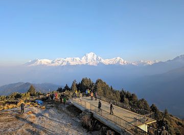
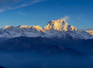
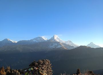
Poon Hill is one of Nepal’s most accessible Himalayan viewpoints, rising to approximately 3,210 metres above sea level near the village of Ghorepani in the Annapurna region. It is not a town or a separate mountain range, but a celebrated ridge-top lookout reached on foot through the lower Annapurna foothills. At dawn, the broad panorama includes Dhaulagiri, Annapurna South, Annapurna I, Hiunchuli, Machhapuchhre and Nilgiri, with changing light revealing the scale and depth of the surrounding massif.Read more about Poon Hill
Forests, Villages and Mountain Trails
Gateway to a Wider Trekking Region
When is the best time to visit Poon Hill?
Best: January–March · 5–9°C| Month | High (°C) | Rainfall (mm) |
|---|---|---|
| January (best) | 5 | 23 |
| February (best) | 5 | 35 |
| March (best) | 9 | 75 |
| April | 12 | 162 |
| May | 16 | 235 |
| June | 21 | 321 |
| July | 22 | 407 |
| August | 21 | 364 |
| September | 18 | 267 |
| October | 14 | 205 |
| November | 7 | 75 |
| December | 5 | 28 |
Getting to and around Poon Hill
How to get there
Transportation
Best attractions in Poon Hill
The principal attraction is the Poon Hill viewpoint, reached by a steep early-morning climb from Ghorepani for a wide Himalayan panorama that includes Dhaulagiri, Annapurna South, Hiunchuli, Machhapuchhre and Nilgiri when conditions are clear. The approach itself is part of the experience, passing through rhododendron woodland, mossy forest and stone-paved village paths. Ghorepani provides the main trekking base, while nearby Ulleri is known for its long stone stairway and traditional hillside setting. Routes continuing towards Tadapani and Ghandruk add forest walking, terraced fields and views across villages inhabited largely by Gurung communities. Lower sections around Birethanti and the Modi Khola corridor connect the trek with warmer valleys and established trail settlements. The area’s appeal comes from the close succession of landscapes rather than a dense collection of built attractions: wooded ridges, mountain viewpoints, cultivated slopes and living villages form the central sightseeing experience.
-
Hindu temple
Kalika Bhagwati Temple, Nepal
Explore the divine beauty and cultural richness of Kalika Bhagwati Temple in Baglung, Nepal – a must-visit destination for spiritual seekers and travelers.
-
Tourist attraction
Ghorepani
Experience the breathtaking views and rich culture of Ghorepani, the gateway to the Annapurna region's stunning treks and Poon Hill's iconic sunrise.
-
Tourist attraction
Ghode Pani Bazaar
Explore Ghode Pani Bazaar, the gateway to Poon Hill, where vibrant markets meet breathtaking Himalayan views.
-
Tourist attraction
Narchyang Waterfalls
Discover the serene beauty of Narchyang Waterfalls, a stunning natural attraction in Nepal, perfect for adventure seekers and nature lovers.


Best landmarks in Poon Hill
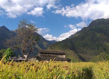
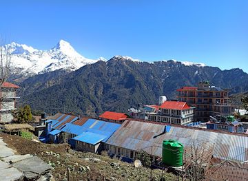
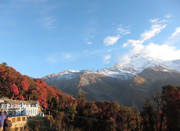
Poon Hill itself is the defining natural landmark, a high ridge-top viewpoint whose elevation and open position reveal the relationship between the lower Annapurna foothills and the greater Himalayan ranges. Dhaulagiri dominates the west, while Annapurna South, Hiunchuli, Machhapuchhre and Nilgiri form parts of the wider mountain wall visible from the route. Ghorepani’s forested ridge and stone-built settlement are important cultural landscape landmarks, as are the long stairways and terraced slopes leading through Ulleri and neighbouring villages. Ghandruk, on routes commonly combined with Poon Hill, is recognised for its Gurung heritage and mountain setting, although it is a separate village destination rather than part of the viewpoint itself. Rhododendron forests are also significant landscape features, linking the area’s scenery with its conservation value within the Annapurna Conservation Area.
-
Tourist attraction
Ghorepani
Explore the stunning landscapes and rich culture of Ghorepani, a gateway to the majestic Annapurna mountain range in Nepal.
-
Tourist attraction
Ghode Pani Bazaar
Explore Ghode Pani Bazaar, the charming gateway to the mesmerizing Poon Hill trek, where adventure meets authentic Nepali culture amidst stunning landscapes.
-
Hiking area
Ghorepani Poon Hill Trek
Discover the breathtaking beauty of the Himalayas on the Ghorepani Poon Hill Trek, a perfect blend of adventure and cultural immersion.
-
Tourist attraction
Poon Hill View Point
Discover the mesmerizing Poon Hill View Point for breathtaking Himalayan views, stunning sunrises, and unforgettable trekking experiences in Nepal.

Explore Poon Hill on the map
Plan your trip on one map. See where the top attractions, landmarks, restaurants and hotels are, and book hotels and experiences in a few clicks.
Best hotels in Poon Hill
Best restaurants in Poon Hill
Poon Hill has no separate restaurant district; food is served mainly in family-run teahouses and trekking lodges in Ghorepani, Tadapani, Ghandruk and other settlements along the route. Menus commonly centre on dal bhat, Nepal’s staple combination of rice, lentils and accompanying vegetables, alongside noodle soups, Tibetan-influenced dishes, fried rice, eggs, simple breads and hot drinks. Meals are shaped by what can be transported and stored in mountain villages, so choice is narrower than in Pokhara and prices generally reflect the difficulty of supply. Visitors can also encounter local pickles, seasonal vegetables and home-style preparations connected with Gurung and Magar communities, although availability varies by lodge. Pokhara is the main place for broader Nepalese, regional and international dining before or after the trek, while trail food is best understood as practical lodge cooking rather than a destination restaurant scene.
-
Restaurant
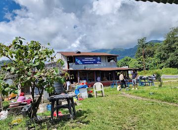
Hamro Bhandari Restaurant & Khaja Ghar
Experience authentic Nepali cuisine at Hamro Bhandari Restaurant & Khaja Ghar along the scenic Pokhara - Baglung Highway.
-
Restaurant
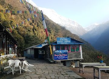
Sinuwa Lodge & Restaurant
Experience authentic Nepali cuisine with breathtaking views at Sinuwa Lodge & Restaurant in Ghandruk - A must-visit culinary destination.
-
Restaurant
Sharma's unique Restaurant
Discover authentic Nepalese flavors at Sharma's Unique Restaurant in Pokhara - a culinary treasure showcasing local ingredients and warm hospitality.
-
Nepalese
K C Khaja ghar
Discover the rich flavors of Nepalese cuisine at K C Khaja Ghar in Lumle – a must-visit dining destination for every traveler.
Best bars in Poon Hill
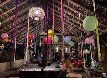
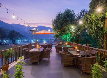
Poon Hill is a trekking landscape rather than a nightlife destination, and evenings in Ghorepani, Tadapani and the surrounding villages are generally quiet. Lodge dining rooms and communal rooms may provide a sociable setting for trekkers, with tea, coffee and occasionally locally available alcoholic drinks, but visitors should not expect nightclubs, late-night bars or a regular entertainment programme. Darkness, cold weather and early starts for the viewpoint shape the evening rhythm, while mountain communities maintain their own everyday social life away from commercial tourism. Pokhara, outside the Poon Hill trekking area, offers the region’s broadest choice of bars, live music and evening hospitality, making it the practical place for a more developed nightlife experience before or after walking.
-
Bar
Busy Bee Cafe
Discover the lively atmosphere of Busy Bee Cafe in Pokhara, where delicious food meets vibrant nightlife and live music.
-
Bar
Krazy Gecko
Discover the vibrant atmosphere and delicious menu at Krazy Gecko, Pokhara's premier bar and restaurant for an unforgettable dining experience.
-
Bar
Paradiso Pokhara
Experience vibrant nightlife and delicious cuisine at Paradiso Pokhara, your go-to bar and restaurant in the heart of Lakeside.
-
Pub
Irish Pub
Discover the lively Irish Pub in Pokhara – a perfect blend of delicious food, drinks, and vibrant nightlife amidst breathtaking lakeside views.


Best nightclubs in Poon Hill
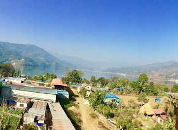
Poon Hill is a trekking landscape rather than a nightlife destination, and evenings in Ghorepani, Tadapani and the surrounding villages are generally quiet. Lodge dining rooms and communal rooms may provide a sociable setting for trekkers, with tea, coffee and occasionally locally available alcoholic drinks, but visitors should not expect nightclubs, late-night bars or a regular entertainment programme. Darkness, cold weather and early starts for the viewpoint shape the evening rhythm, while mountain communities maintain their own everyday social life away from commercial tourism. Pokhara, outside the Poon Hill trekking area, offers the region’s broadest choice of bars, live music and evening hospitality, making it the practical place for a more developed nightlife experience before or after walking.
-
Night club
Club Catwalk
Discover the electrifying nightlife at Club Catwalk in Pokhara, where great food meets unforgettable dance experiences in a vibrant setting.
-
Night club
The Treasure Lounge
Experience the electrifying nightlife of Pokhara at The Treasure Lounge, where local music meets a vibrant dance scene in a stunning setting.
-
Night club
Club Sixteen
Experience the vibrant nightlife of Pokhara at Club Sixteen, where music, dance, and unforgettable moments come together.
-
Night club
Matrix Arena
Discover the ultimate nightlife experience at Matrix Arena in Pokhara, where electrifying music and vibrant energy come together for unforgettable nights.



Best shops in Poon Hill
Shopping around Poon Hill is modest and concentrated in teahouses, small village shops and lodge reception areas rather than permanent retail streets. Trekkers can usually find essentials such as snacks, bottled or treated water, batteries, basic toiletries, warm accessories and simple trekking supplies, although selection and availability vary considerably between settlements. Ghorepani and Ghandruk have more visitor-oriented trading activity than smaller trail villages, while Pokhara is the main regional centre for outdoor equipment, practical clothing, handicrafts, books and Nepalese food products. Textiles, woven goods, small handicrafts and locally made items may be sold in villages or through community businesses, but visitors should ask about origin rather than assuming every souvenir is locally produced. Responsible purchasing supports village economies without encouraging removal of plants, stones, religious objects or archaeological material from the landscape.
-
Antique store
Himalayan Singing Bowl
Explore the soothing world of handcrafted singing bowls in Pokhara, Nepal, at the Himalayan Singing Bowl antique store.
-
Mountain peak
Poon Hill
Experience breathtaking sunrises and mesmerizing views at Poon Hill, a top trekking destination in the majestic Himalayas of Nepal.
-
Department store
Saleways Departmental Stores
Explore Saleways Departmental Stores in Pokhara for a unique shopping experience blending local culture and diverse products.
-
Hiking area
Ghorepani Poon Hill Trek
Explore the breathtaking Ghorepani Poon Hill Trek, a mesmerizing hiking experience in the heart of Nepal's majestic Annapurna region.


Get your free copy of our complete guide to Poon Hill, delivered straight to you.
Everything on this page, from attractions and restaurants to essentials and local phrases, in one PDF you can read offline, print or share.
Already have an account? Sign in
Your Poon Hill guide is ready.
We'll send it to · Not you? Sign out

Getting your guide ready…
We are putting together a fresh copy of the Poon Hill guide. This can take up to a minute.
This can take a few moments. If your browser asks, choose Allow so the download can start. You'll find the guide in your Downloads folder.
Nothing happened? Download it again
Sorry, the guide is taking longer than usual. Please try again in a minute, or get it by email instead.
Poon Hill essentials
Currency and Payment
Safety
Emergency Situations
Do's and Don'ts
Local Tips
From Eve
Local phrases worth knowing
You don't need to get them perfect. A few words go a long way, and locals appreciate the effort.
Basics
| English | Local | Say it |
|---|---|---|
| Hello | नमस्ते | [namaste] |
| Goodbye | फेरि भेटौं | [feri bhetau] |
| Yes | हो | [ho] |
| No | होइन | [hoin] |
| Please/You're welcome | कृपया | [krupaya] |
| Thank you | धन्यवाद | [dhanyabad] |
| Excuse me/Sorry | माफ गर्नुहोस् | [maaf garnuhos] |
| How are you? | तिमीलाई कस्तो छ? | [timilai kasto cha?] |
| Fine. And you? | राम्रो छ। तिमीलाई? | [ramro cha. timilai?] |
| Do you speak English? | तिमी अंग्रेजी बोल्छौ? | [timi angreji bolchhau?] |
| I don't understand | मैले सम्झिन | [maile samjhin] |
Eating & Drinking
| English | Local | Say it |
|---|---|---|
| I'd like to see the menu, please | कृपया मेनु हेर्न चाहन्छु | [krupaya menu hern chahanchu] |
| I don't eat meat | म भांसाको खानछैन | [ma bhansako khanchain] |
| Cheers! | चियर्स! | [cheers!] |
| I would like to pay, please | कृपया भुक्तानी गर्न चाहन्छु | [krupaya bhuktani garna chahanchu] |
Emergencies
| English | Local | Say it |
|---|---|---|
| Help! | मदत गर्नुहोस्! | [madat garnuhos!] |
| Go away! | हट्नुहोस्! | [hatnuhos!] |
| Call the Police! | प्रहरीलाई बोलाउ! | [praharilai bolaau!] |
| Call a doctor! | डाक्टरलाई बोलाउ! | [daktarlai bolaau!] |
| I'm lost | म बिरामी छु | [ma birami chu] |
| I'm ill | म बिरामी छु | [ma birami chu] |
Shopping
| English | Local | Say it |
|---|---|---|
| I'd like to buy... | म किन्न चाहन्छु... | [ma kinna chahanchu...] |
| I'm just looking | म सिर्जना गरिरहेको छु | [ma sirjana gari raheko chu] |
| How much is it? | यो कति हो? | [yo kati ho?] |
| That's too expensive | यो धेरै महँगो छ | [yo dherai mahango cha] |
| Can you lower the price? | के तपाईं मुल्य कम गर्न सक्नुहुन्छ? | [ke tapai mulya kam garn saknuhunchha?] |
Time & Numbers
| English | Local | Say it |
|---|---|---|
| What time is it? | कति बजेको छ? | [kati bajeko cha?] |
| It's one o'clock | एक बजेको छ | [ek bajeko cha] |
| Half past (10) | दस बजे अर्को अर्धघन्टा | [das baje arko ardghanta] |
| Morning | बिहान | [bihan] |
| Afternoon | दिउँसो | [diunso] |
| Evening | साँझ | [sanh] |
| Yesterday | हिजो | [hijo] |
| Today | आज | [aaj] |
| Tomorrow | भोलि | [bholi] |
| 1 | एक | [ek] |
| 2 | दुई | [dui] |
| 3 | तीन | [tin] |
| 4 | चार | [char] |
| 5 | पाँच | [panch] |
| 6 | छ | [chh] |
| 7 | सात | [sat] |
| 8 | आठ | [aath] |
| 9 | नौ | [nau] |
| 10 | दस | [das] |
Transport & Directions
| English | Local | Say it |
|---|---|---|
| Where's a/the...? | यहाँ... कहाँ छ? | [yaha... kaha cha?] |
| What's the address? | पत्ता के हो? | [patta ke ho?] |
| Can you show me (on the map)? | के तपाईं मलाई देखाउन सक्छन् (नक्सामा)? | [ke tapai malai dekhaun sakchan (naksama)?] |
| When's the next (bus)? | अर्को (बस) कहिले छ? | [arko (bas) kahile cha?] |
| A ticket (to ....) | एक टिकट (...सम्म) | [ek tikat (...samma)] |
History of Poon Hill
A Himalayan Landscape in Formation
Poon Hill belongs to the rising Himalayan landscape created by the continuing collision of the Indian and Eurasian tectonic plates. The surrounding hills are deeply cut by river valleys and shaped by erosion, landslides, seasonal rainfall and repeated uplift. This geological setting explains the abrupt transition from lower, warmer valleys to high ridges with expansive views of the Annapurna and Dhaulagiri ranges. The viewpoint itself is valued primarily for its position along this natural mountain landscape rather than for a built monument or isolated geological formation.
Gurung and Magar Mountain Communities
The hills around Ghorepani, Ghandruk and the lower Annapurna trails have long been used by Gurung and Magar communities for settlement, cultivation and movement between valleys. Terraced fields, stone-built villages, forest paths and seasonal livestock practices reflect generations of adaptation to steep terrain. Local houses, community life and customary hospitality remain important parts of the trekking experience, although migration, education, changing employment and improved road access have also altered village economies. The trails are therefore both visitor routes and living connections between established Himalayan settlements.
From Local Footpaths to Trekking Route
The paths now associated with the Poon Hill trek developed from long-used links between villages and trading areas in the Annapurna foothills. International trekking gradually expanded in the region during the second half of the twentieth century, bringing lodges, teahouses, portering work and guiding into communities along the route. Poon Hill became especially well known because it offers a dramatic Himalayan panorama without requiring the length or altitude of a major high-pass expedition. Tourism has provided important income, while also increasing pressure on trails, forests, water supplies and waste management.
Conservation and the Annapurna Area
Poon Hill lies within the Annapurna Conservation Area, Nepal’s first and largest conservation area, established in 1985. The conservation model links protection of forests, wildlife and watersheds with the interests of villages and tourism-dependent communities. Rhododendron woodland, varied elevation zones and important mountain habitats are managed within a landscape where people continue to farm, travel and provide services. Conservation work and responsible trekking are significant to the area’s modern identity, particularly as rising visitor numbers, road construction and changing climate conditions affect the traditional mountain environment.
Poon Hill in Photos
Browse through our photo collection highlighting the charm and character of the destination.
Cities in Poon Hill
The towns and cities of Poon Hill, and the easiest places to base yourself.

Swipe for more cities
Neighbouring destination travel guides
The closest destinations to Poon Hill, if you have time for more than one.
-

-
-

-

-


Swipe for more destinations
Explore more

Explore more of Western Development Region
Explore Nepal’s Western Development Region for Pokhara’s lakes, Himalayan treks, Tansen’s heritage and the sacred plains of Lumbini.
Explore Western Development Region
Explore more of Nepal
Discover Nepal: A land of towering peaks, spiritual harmony, and vibrant culture, offering endless adventures and serene escapes for every traveler.
Explore Nepal