

Mount Charleston Travel Guide - Free Web & App
Your ultimate guide to Mount Charleston. Discover top landmarks, proposed trips, and local tips. Free on the web or via the Evendo companion app.


Mount Charleston, Nevada rises above the Mojave with alpine forests, hiking trails, winter snow, wildlife and panoramic views near Las Vegas.
Mountain Landscape
Rising abruptly from the Mojave Desert less than an hour's drive from Las Vegas, Mount Charleston is the best-known summit and recreational centre of Nevada's Spring Mountains. The destination lies within the Spring Mountains National Recreation Area of Humboldt-Toiyabe National Forest, where steep limestone ridges, forested ravines and alpine slopes create a striking contrast with the arid lowlands below. Charleston Peak reaches 11,916 feet and is the highest point in southern Nevada, though the mountain's appeal extends well beyond the summit. Kyle Canyon and Lee Canyon provide the principal approaches, with roads climbing through different belts of vegetation into cooler high-country terrain.Read more about Mount Charleston
Forests, Wildlife and Seasons
Outdoor Character
When is the best time to visit Mount Charleston?
Best: June–August · 21–26°C| Month | High (°C) | Rainfall (mm) |
|---|---|---|
| January | 3 | 51 |
| February | 4 | 48 |
| March | 8 | 43 |
| April | 11 | 31 |
| May | 17 | 25 |
| June (best) | 21 | 15 |
| July (best) | 26 | 33 |
| August (best) | 26 | 38 |
| September | 21 | 28 |
| October | 15 | 31 |
| November | 8 | 38 |
| December | 4 | 51 |
Getting to and around Mount Charleston
How to get there
Transportation
Best attractions in Mount Charleston
Mount Charleston's principal attraction is the rapid transition from Mojave Desert to high-elevation forest. Kyle Canyon provides access to wooded trails, mountain viewpoints and routes towards Charleston Peak, while Lee Canyon is the area's established centre for skiing, snowboarding and other winter recreation when conditions permit. Hiking options range from shorter walks through pine forest to strenuous routes on exposed ridges, including approaches towards Griffith Peak and Charleston Peak. Mary Jane Falls is a well-known canyon walk, although water flow and trail conditions vary seasonally. Higher slopes offer bristlecone pines and broad views across southern Nevada, while lower woodland provides opportunities for birdwatching and quiet picnicking. The small Mount Charleston community adds a rural mountain setting, but the destination is primarily a landscape for outdoor exploration rather than a collection of built attractions. Access, parking, fire restrictions and trail conditions should be checked before setting out.
-
Tourist attraction
Lee Canyon
Discover the year-round beauty of Lee Canyon, a premier outdoor destination near Las Vegas for skiing, hiking, and breathtaking landscapes.
-
Tourist attraction
Desert View Overlook
Discover stunning desert vistas at Desert View Overlook, a breathtaking tourist attraction near Las Vegas, perfect for hiking and photography.
-
Tourist attraction
Mary Jane Falls Trailhead
Explore the beauty of nature at Mary Jane Falls Trailhead, a scenic hiking destination in Mt. Charleston, Nevada, offering stunning views and peaceful trails.
-
Hiking area
Fletcher Canyon Trailhead
Experience the breathtaking landscapes and diverse trails at Fletcher Canyon Trailhead in Mt. Charleston, Nevada, a must-visit for outdoor enthusiasts.


Best landmarks in Mount Charleston
Charleston Peak is Mount Charleston's defining natural landmark, rising to 11,916 feet as the highest summit in southern Nevada and forming the high point of a dramatic limestone mountain block above the Mojave. The forested walls of Kyle Canyon and Lee Canyon mark the principal gateways into the range, while high ridges reveal the unusual ecological contrast between desert floor and alpine environment. Bristlecone pine stands are among the most distinctive living features at elevation, their contorted forms reflecting cold, wind and long lifespans. Griffith Peak is another prominent summit on the high ridge, though routes towards it require preparation for steep and exposed mountain terrain. Mary Jane Falls is a recognised seasonal feature of Kyle Canyon, with flow depending on snowmelt and rainfall. The surrounding Spring Mountains National Recreation Area is itself an important conservation landmark, protecting isolated habitats and a landscape closely connected with the identity of southern Nevada.
-
Historical landmark
Silent Heroes Of The Cold War National Memorial
Explore the Silent Heroes of the Cold War National Memorial, a serene tribute to the valor and sacrifices of military personnel in a pivotal historical era.

Explore Mount Charleston on the map
Plan your trip on one map. See where the top attractions, landmarks, restaurants and hotels are, and book hotels and experiences in a few clicks.
Best hotels in Mount Charleston
Best bars in Mount Charleston
Mount Charleston has no substantial nightlife district and is not a destination for late-night clubbing. Evening life is generally quiet, centred on the atmosphere of mountain accommodation, meals, conversation and clear-sky stargazing rather than bars or live entertainment. Visitors seeking a wider choice of pubs, cocktail venues, music, theatre and nightclubs need to return to Las Vegas, which lies at the foot of the approach routes but is outside the mountain destination. Conditions on the roads can become more difficult after dark, particularly during winter weather, so evening travel should be planned around visibility, temperature and current road information. Seasonal recreation or community events may occasionally add activity, but they should not be assumed to operate on a regular schedule.
-
American
Canyon Restaurant & Tavern Bar
Discover Canyon Restaurant & Tavern Bar: A perfect blend of American cuisine and stunning mountain views in Mt. Charleston.
-
Bar
“The Cliffhanger Bar” at the Retreat on Charleston Peak.
Experience breathtaking views and lively ambiance at The Cliffhanger Bar in Mt. Charleston, a perfect retreat for relaxation and entertainment.
-
Bar
Bristlecone Bar
Discover Bristlecone Bar in Lee Canyon: your relaxing escape with stunning views, refreshing drinks, and inviting atmosphere in the heart of nature.


Best shops in Mount Charleston
Shopping within Mount Charleston is very limited and focused on practical visitor needs rather than retail tourism. Small-scale purchases may be available through operating recreation or accommodation facilities, but visitors should not expect a shopping street, permanent craft market or broad selection of outdoor equipment in the mountains. Las Vegas and its surrounding communities are the main places to buy groceries, fuel, hiking equipment, winter clothing and other supplies before travelling into the Spring Mountains. The wider southern Nevada region offers art, Native American-inspired contemporary work and food products, but visitors should distinguish respectfully between authentic local businesses and generic souvenirs. Buying only what is permitted, avoiding the removal of rocks or plants, and supporting established local enterprises are more appropriate ways to engage with the destination's landscape than treating the protected area as a source of collectable goods.
-
 Hotel
The Retreat on Charleston Peak
Discover the perfect mountain escape at The Retreat on Charleston Peak, where stunning views and cozy comfort meet outdoor adventure.
-
Visitor center
Spring Mountains Visitor Gateway
Explore the breathtaking Spring Mountains Visitor Gateway, your starting point for adventure, nature, and unforgettable memories in Nevada.
-
Mountain peak
Charleston Peak
Explore Charleston Peak: A Mountaineer's Haven in Nevada with Breathtaking Scenery and Outdoor Adventures Awaiting You.
-
Picnic ground
Kyle Canyon Picnic Area
Experience the tranquil beauty of Kyle Canyon Picnic Area, an idyllic picnic spot in Mt. Charleston, NV, surrounded by stunning natural landscapes.


Get your free copy of our complete guide to Mount Charleston, delivered straight to you.
Everything on this page, from attractions and restaurants to essentials and local phrases, in one PDF you can read offline, print or share.
Already have an account? Sign in
Your Mount Charleston guide is ready.
We'll send it to · Not you? Sign out

Getting your guide ready…
We are putting together a fresh copy of the Mount Charleston guide. This can take up to a minute.
This can take a few moments. If your browser asks, choose Allow so the download can start. You'll find the guide in your Downloads folder.
Nothing happened? Download it again
Sorry, the guide is taking longer than usual. Please try again in a minute, or get it by email instead.
Mount Charleston essentials
Currency and Payment
Safety
Emergency Situations
Do's and Don'ts
Local Tips
From Eve
Local phrases worth knowing
You don't need to get them perfect. A few words go a long way, and locals appreciate the effort.
Basics
| English | Local | Say it |
|---|---|---|
| Hello | Howdy | [haw-dee] |
| Goodbye | See ya | [see yuh] |
| Yes | Yep | [yep] |
| No | Nah | [nah] |
| Please/You're welcome | Please/No problem | [pleez/no problem] |
| Thank you | Thanks | [thanks] |
| Excuse me/Sorry | Pardon me/My bad | [par-dun me/my bad] |
| How are you? | How's it goin'? | [hows it goin] |
| Fine. And you? | Just fine. How 'bout you? | [just fine. how bout yuh] |
| Do you speak English? | Ya speak English? | [ya speak english] |
| I don't understand | I ain't gettin' it | [I aint gettin it] |
Eating & Drinking
| English | Local | Say it |
|---|---|---|
| I'd like to see the menu, please | Can I take a look at the menu? | [can I take a look at the menu] |
| I don't eat meat | I don't do meat | [I dont do meat] |
| Cheers! | Bottoms up! | [bottoms up] |
| I would like to pay, please | Can I settle up, please | [can I settle up please] |
Emergencies
| English | Local | Say it |
|---|---|---|
| Help! | SOS! | [SOS] |
| Go away! | Get lost! | [get lost] |
| Call the Police! | Ring up the cops! | [ring up the cops] |
| Call a doctor! | Get a doc on the line! | [get a doc on the line] |
| I'm lost | I'm all turned around | [im all turned around] |
| I'm ill | I'm feelin' under the weather | [im feelin under the weather] |
Shopping
| English | Local | Say it |
|---|---|---|
| I'd like to buy... | I'm lookin' to purchase... | [Im lookin to purchase] |
| I'm just looking | Just browsin' | [just browsin] |
| How much is it? | What's the damage? | [whats the damage] |
| That's too expensive | That's a bit steep | [thats a bit steep] |
| Can you lower the price? | Can ya knock somethin' off? | [can ya knock somethin off] |
Time & Numbers
| English | Local | Say it |
|---|---|---|
| What time is it? | What's the time? | [whats the time] |
| It's one o'clock | It's one | [its one] |
| Half past (10) | Ten thirty | [ten thirty] |
| Morning | Mornin' | [mornin] |
| Afternoon | Afternoon | [afternoon] |
| Evening | Evenin' | [evenin] |
| Yesterday | Yest'day | [yestday] |
| Today | Today | [today] |
| Tomorrow | Tomorrah | [tomorrah] |
| 1 | One | [one] |
| 2 | Two | [two] |
| 3 | Three | [three] |
| 4 | Four | [four] |
| 5 | Five | [five] |
| 6 | Six | [six] |
| 7 | Seven | [seven] |
| 8 | Eight | [eight] |
| 9 | Nine | [nine] |
| 10 | Ten | [ten] |
Transport & Directions
| English | Local | Say it |
|---|---|---|
| Where's a/the...? | Where's the...? | [wheres the] |
| What's the address? | What's the addy? | [whats the addy] |
| Can you show me (on the map)? | Can you point it out (on the map)? | [can you point it out on the map] |
| When's the next (bus)? | When's the next (bus) comin'? | [whens the next bus comin] |
| A ticket (to ....) | A ticket (to ....) | [a ticket to] |
History of Mount Charleston
An Isolated Mountain Range
The Spring Mountains are part of the complex Basin and Range landscape of the Great Basin, where faulting has lifted mountain blocks above intervening desert valleys. Limestone and other sedimentary rocks record ancient marine environments, while later uplift, erosion and climatic change shaped the steep canyons and ridges seen today. Mount Charleston's high elevation gives the range a cooler climate than the surrounding Mojave and permits forests and alpine habitats to survive as ecological islands above the desert.
Southern Paiute Connections
The Spring Mountains lie within the traditional homeland of Southern Paiute peoples, often referred to in their own cultural context as Nuwuvi. Mountain springs, plants, animals and seasonal landscapes formed part of a wider system of knowledge and movement across the region. Indigenous history is not confined to archaeological traces: Southern Paiute communities remain present in southern Nevada, and the landscape continues to carry cultural significance. Visitors should treat the mountains, wildlife and any cultural places with respect.
Mining, Ranching and Early Roads
During the nineteenth and early twentieth centuries, Euro-American activity in the wider Spring Mountains included prospecting, timber cutting, ranching and the development of routes linking isolated valleys. The mountains supplied resources to settlements in southern Nevada, although difficult terrain limited large-scale development. Roads later made the high country more accessible from Las Vegas, changing the area from a remote landscape into a place used for recreation, seasonal residence and outdoor tourism.
The Rise of Winter Recreation
Improved road access and the growth of Las Vegas created demand for a nearby mountain escape. Lee Canyon developed as a winter recreation area during the twentieth century and became associated with skiing and snow play, while summer visitors arrived for hiking, picnicking and cooler temperatures. The contrast between desert city and forested mountain helped define Mount Charleston as a regional outdoor destination rather than a densely built resort.
National Forest Conservation
The Spring Mountains are managed within Humboldt-Toiyabe National Forest and the Spring Mountains National Recreation Area, a designation created to protect the range's forests, watersheds, wildlife habitat and recreational landscapes. Management has increasingly had to balance public access with wildfire risk, erosion, limited water resources and the vulnerability of isolated mountain species. Modern conservation work also reflects the reality that heavy visitation from the Las Vegas region can place pressure on a relatively small and sensitive high-country environment.
Mount Charleston in Photos
Browse through our photo collection highlighting the charm and character of the destination.
Neighbouring destination travel guides
The closest destinations to Mount Charleston, if you have time for more than one.
-

-

-

-
-


Swipe for more destinations
Explore more
Explore more of Clark County
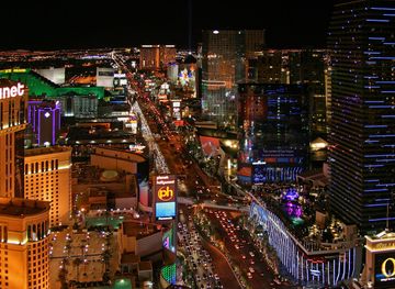
Explore Clark County, Nevada for Las Vegas entertainment, desert parks, Hoover Dam, Lake Mead, mountain scenery and distinctive Southwestern history.
Explore Clark County
Explore more of Nevada
Discover Nevada: From the bright lights of Las Vegas to the tranquil beauty of Lake Tahoe, Nevada offers a unique blend of excitement and natural wonder.
Explore Nevada