

Free Ohio River Valley Travel Guide & Mobile App
Explore Ohio River Valley with free travel guides. Discover regional history, expert tips, proposed trips, and audio guides on web or mobile app.


Explore Ohio's Ohio River Valley for historic river towns, wooded hills, scenic drives, museums and outdoor recreation along the state's southern and eastern border.
Read more about Ohio River Valley
When is the best time to visit Ohio River Valley?
Best: June, August–September · 24–28°C| Month | High (°C) | Rainfall (mm) |
|---|---|---|
| January | 4 | 70 |
| February | 6 | 65 |
| March | 11 | 80 |
| April | 17 | 85 |
| May | 22 | 100 |
| June (best) | 27 | 90 |
| July | 29 | 100 |
| August (best) | 28 | 90 |
| September (best) | 24 | 80 |
| October | 18 | 70 |
| November | 11 | 80 |
| December | 6 | 75 |
Getting to and around Ohio River Valley
How to get there
Transportation
Top city travel guides in Ohio River Valley
The cities of Ohio River Valley, and the easiest places to base yourself.
-

-

-

-


Swipe for more cities
Destinations in Ohio River Valley
Resorts, valleys and scenic spots worth a trip of their own.
-

-


Swipe for more destinations
Best attractions in Ohio River Valley
The Ohio River Valley's attractions are distributed among historic towns, river landscapes and the wooded country behind the waterfront. Marietta's early American streets, museums and river confluence provide a strong starting point, while Portsmouth is known for its floodwall murals and regional heritage interpretation. Gallipolis offers a historic town setting shaped by its French origins, and Steubenville reflects the upper valley's industrial and civic history. Smaller communities add churches, cemeteries, historic houses, local museums and former commercial districts that reward unhurried exploration. Outdoor attractions include public riverfront parks, boating and fishing access, birdwatching areas, tributary valleys and scenic driving routes. The Ohio River Scenic Byway is particularly useful for linking these experiences, though it should be approached as a leisurely multi-day route rather than a single attraction. Visitors interested in industrial history can trace the influence of railways, steel, coal, clay and river shipping, while those seeking countryside can follow roads into the surrounding hills and farmland. Seasonal festivals, community arts events and local markets contribute to the region's cultural life without replacing its central attraction: the relationship between settlement, transport and the river.
-
Stadium
Great American Ball Park
Discover the excitement of Great American Ball Park, home of the Cincinnati Reds, where sports history meets modern entertainment in a stunning riverfront setting.
-
Market
Findlay Market
Experience Ohio's oldest public market in the heart of Cincinnati, where local produce, artisanal goods, and cultural vibrancy unite.
-
Escape room center
The Escape Game Cincinnati
Experience thrilling adventures and challenge your wits at The Escape Game Cincinnati, the ultimate destination for escape room enthusiasts in Ohio.
-
Museum
Cincinnati Museum Center
Explore the Cincinnati Museum Center, a premier destination featuring science, history, and children's exhibits in a stunning Art Deco landmark.


Best landmarks in Ohio River Valley
The confluence of the Ohio and Muskingum rivers at Marietta is one of the valley's most meaningful geographical landmarks, marking the setting of Ohio's first permanent American settlement in the Northwest Territory. Marietta's historic streets, churches and civic buildings add architectural depth to the river landscape. In Portsmouth, the long sequence of floodwall murals is a highly recognisable public-art landmark, presenting local and regional history on the city's river edge. Gallipolis's historic core reflects the town's French settler origins, while the old streets and public buildings of river communities farther east and west show how commerce developed around landings, railways and bridges. Steubenville's historic civic and ecclesiastical architecture belongs to the architectural story of the upper industrial valley. The Ohio River itself is the region's principal natural landmark: broad, navigable and bordered by wooded hills, bridges, islands, ports and flood-control works. These places matter not only for appearance but because they express the valley's overlapping histories of Indigenous movement, settlement, immigration, industry, trade and adaptation to floods.
-
History museum
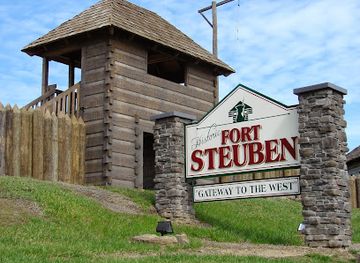
Historic Fort Steuben
Discover the rich military heritage of America at Historic Fort Steuben, a living museum that brings the past to life in beautiful Steubenville, Ohio.
-
Historical place museum
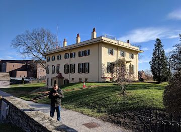
William Howard Taft National Historic Site
Explore the birthplace of President William Howard Taft, a historic site showcasing his life and contributions to American history in Cincinnati, Ohio.
-
Historical landmark
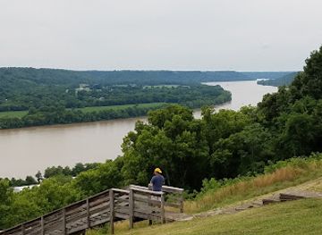
John Rankin House
Discover the John Rankin House, a historical landmark and museum in Ripley, Ohio, that played a pivotal role in the Underground Railroad.
-
Museum
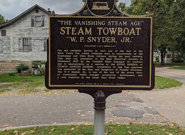
Ohio River Museum
Explore the Ohio River Museum in Marietta, Ohio, and uncover the rich history and natural beauty of the Ohio River, a top destination for tourists.
Explore Ohio River Valley on the map
Plan your trip on one map. See where the top cities, national parks and sights are, and book hotels and experiences in a few clicks.
Best hotels in Ohio River Valley
Best restaurants in Ohio River Valley
Dining in the Ohio River Valley is rooted in the informal food culture of small American cities, river towns and rural communities. Independent cafés, family restaurants, diners, taverns and bakeries are more characteristic than a concentrated fine-dining scene. Menus commonly draw on broad Ohio and Appalachian traditions, with burgers, sandwiches, fried fish, barbecue, soups, pies and other comfort foods appearing alongside contemporary American cooking. River counties also benefit from farms, orchards and market gardens, so seasonal produce, baked goods and preserves can be found at farmers' markets and community stalls. Marietta, Portsmouth, Steubenville, Gallipolis and other larger towns provide the widest range of cafés and restaurants, while smaller settlements may have limited opening days or evening choices. Visitors should distinguish genuinely local products from national brands, and ask about seasonal specialities rather than expecting one dish to represent the entire valley. Craft beer and locally focused menus appear in parts of the region, but the strongest culinary impression usually comes from straightforward cooking, generous portions and the social role of independent eating places.
-
Seafood
Pappadeaux Seafood Kitchen
Experience the rich flavors of Gulf Coast cuisine at Pappadeaux Seafood Kitchen in Springdale - where every dish tells a delicious story.
-
New American
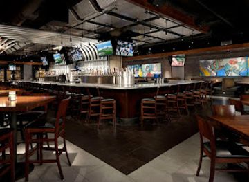
Yard House
Experience the best of New American cuisine at Yard House in Cincinnati, where delicious food meets a vibrant sports bar atmosphere.
-
Barbecue
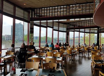
Montgomery Inn The Boathouse
Experience Cincinnati's finest barbecue at Montgomery Inn The Boathouse – where delicious food meets breathtaking riverside views.
-
American
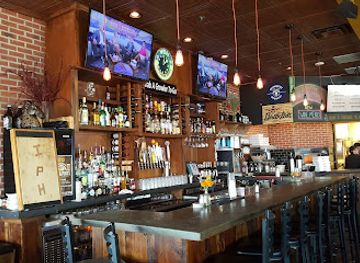
Incline Public House
Discover the flavors and breathtaking views at Incline Public House – Cincinnati's premier spot for American cuisine and drinks.

Best bars in Ohio River Valley
Evening life in the Ohio River Valley is generally low-key and town-centred rather than built around large nightclub districts. Traditional bars, taverns, pubs and casual restaurants form the main social venues, particularly in larger communities such as Marietta, Portsmouth and Steubenville. Some establishments offer live music, quiz nights or seasonal entertainment, while breweries and contemporary bars provide alternatives to older neighbourhood drinking places. Historic downtowns can be pleasant for an evening meal followed by a short walk, but rural areas may have few options after dinner and require a designated driver because distances and public transport are limited. College-related activity can influence the atmosphere in Marietta, home to Marietta College, though it does not define the whole town. Check current arrangements locally, as small venues and seasonal events can change. Respect age-verification and drinking-and-driving laws, and remember that the region's evening culture also includes cinemas, community performances, festivals and quiet riverfront walks rather than nightlife alone.
-
New American
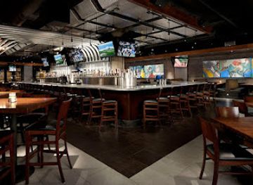
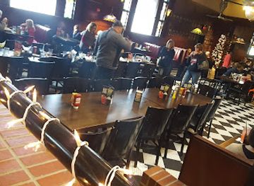
Yard House
Experience the best of New American cuisine at Yard House in Cincinnati, featuring a vibrant atmosphere, extensive menu, and a passion for craft beers.
-
American
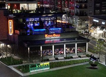
Kona Grill - Cincinnati
Savor the unique flavors of American cuisine and innovative cocktails at Kona Grill in Cincinnati's Liberty Township, a must-visit dining destination.
-
Restaurant
Dave & Buster's Hilliard
Experience the ultimate blend of dining and entertainment at Dave & Buster's Hilliard, where fun meets flavor in an exciting setting.
-
Restaurant
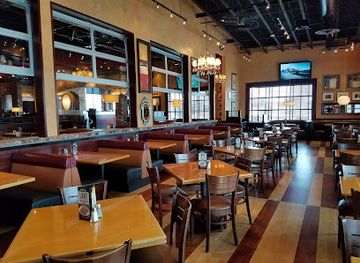
BJ's Restaurant & Brewhouse
Experience the vibrant flavors and craft brews at BJ's Restaurant & Brewhouse in Polaris, a top spot for dining and entertainment.
Best nightclubs in Ohio River Valley
Evening life in the Ohio River Valley is generally low-key and town-centred rather than built around large nightclub districts. Traditional bars, taverns, pubs and casual restaurants form the main social venues, particularly in larger communities such as Marietta, Portsmouth and Steubenville. Some establishments offer live music, quiz nights or seasonal entertainment, while breweries and contemporary bars provide alternatives to older neighbourhood drinking places. Historic downtowns can be pleasant for an evening meal followed by a short walk, but rural areas may have few options after dinner and require a designated driver because distances and public transport are limited. College-related activity can influence the atmosphere in Marietta, home to Marietta College, though it does not define the whole town. Check current arrangements locally, as small venues and seasonal events can change. Respect age-verification and drinking-and-driving laws, and remember that the region's evening culture also includes cinemas, community performances, festivals and quiet riverfront walks rather than nightlife alone.
-
Gay night club
Bloom OTR
Experience the vibrant nightlife and inclusive atmosphere at Bloom OTR, Cincinnati's premier gay nightclub in Over-The-Rhine.
-
Night club
Main Event Cincinnati
Discover the lively nightlife at Main Event Cincinnati, where vibrant music and affordable drinks create unforgettable experiences.
-
Night club
Tulua Nightclub and Cocktail Bar
Experience Cincinnati's nightlife at Tulua Nightclub and Cocktail Bar, where vibrant cocktails and pulsating music await you in the heart of the city.
-
Night club
LoVe on Fourth
Discover Cincinnati's nightlife at LoVe on Fourth, an upscale bar and club offering cocktails, events, and an unforgettable atmosphere in the city's Central Business District.




Best shops in Ohio River Valley
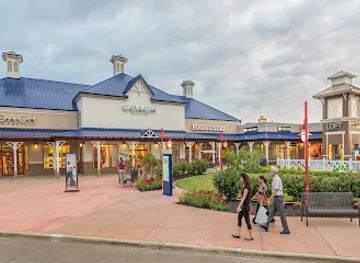
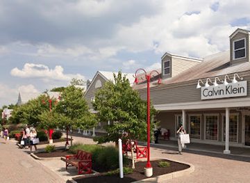
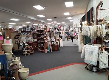
Shopping in the Ohio River Valley is focused on historic downtowns, independent retailers, antique shops, galleries, practical high-street businesses and seasonal markets rather than major luxury centres. Marietta offers the broadest concentration of independent shops in a walkable historic setting, with books, gifts, antiques, art and locally made items often more prominent than national fashion chains. Portsmouth, Gallipolis, Steubenville and smaller river towns provide additional opportunities to browse local businesses, though opening days and stock can vary. Farmers' markets are useful for Ohio produce, baked goods, preserves, honey and handmade products, especially in warmer months. Regional souvenirs may include river-themed art, pottery, crafts, locally produced food and items connected with local heritage, but buyers should check where products were made rather than assuming every market item is regional. Antiques and architectural salvage can reflect the valley's long-established communities, while galleries and craft outlets provide a more contemporary expression of local creativity.
-
Shopping mall
Newport on the Levee
Discover Newport on the Levee: A vibrant shopping and entertainment destination by the Ohio River, perfect for tourists seeking adventure and relaxation.
-
Shopping mall
Destination Outlets
Discover incredible deals at Destination Outlets, a shopping paradise in Jeffersonville, Ohio, featuring top brands and a fun atmosphere for everyone.
-
Outlet mall
Aurora Farms Premium Outlets
Discover unbeatable deals and a delightful shopping experience at Aurora Farms Premium Outlets in Aurora, Ohio, featuring top designer brands at irresistible prices.
-
Antique store
Ohio Valley Antique Mall
Explore the Ohio Valley Antique Mall: A treasure trove of antiques, collectibles, and vintage finds in Fairfield, Ohio, perfect for every treasure hunter.
Get your free copy of our complete guide to Ohio River Valley, delivered straight to you.
Everything on this page, from attractions and restaurants to essentials and local phrases, in one PDF you can read offline, print or share.
Already have an account? Sign in
Your Ohio River Valley guide is ready.
We'll send it to · Not you? Sign out

Getting your guide ready…
We are putting together a fresh copy of the Ohio River Valley guide. This can take up to a minute.
This can take a few moments. If your browser asks, choose Allow so the download can start. You'll find the guide in your Downloads folder.
Nothing happened? Download it again
Sorry, the guide is taking longer than usual. Please try again in a minute, or get it by email instead.
Ohio River Valley essentials
Currency and Payment
Safety
Emergency Situations
Do's and Don'ts
Local Tips
From Eve
Local phrases worth knowing
You don't need to get them perfect. A few words go a long way, and locals appreciate the effort.
Basics
| English | Local | Say it |
|---|---|---|
| Hello | Howdy | [Haudi] |
| Goodbye | See ya | [See ya] |
| Yes | Yep | [Yep] |
| No | Nah | [Nah] |
| Please/You're welcome | No problem | [No prahblum] |
| Thank you | Thanks a lot | [Thangs a lot] |
| Excuse me/Sorry | Pardon me | [Pardon me] |
| How are you? | How ya doin'? | [How ya doin'?] |
| Fine. And you? | Good. And you? | [Good. And you?] |
| Do you speak English? | Do ya speak English? | [Do ya speak English?] |
| I don't understand | I ain't gettin' it | [I ain't gettin' it] |
Eating & Drinking
| English | Local | Say it |
|---|---|---|
| I'd like to see the menu, please | Can I see the menu? | [Can I see the menu?] |
| I don't eat meat | I ain't eatin' meat | [I ain't eatin' meat] |
| Cheers! | Cheers! | [Cheers!] |
| I would like to pay, please | Can I get the check? | [Can I get the check?] |
Emergencies
| English | Local | Say it |
|---|---|---|
| Help! | Help! | [Help!] |
| Go away! | Leave me alone! | [Leave me alone!] |
| Call the Police! | Call the cops! | [Call the cops!] |
| Call a doctor! | Get a doctor! | [Get a doctor!] |
| I'm lost | I'm all turned around | [I'm all turned around] |
| I'm ill | I'm not feelin' good | [I'm not feelin' good] |
Shopping
| English | Local | Say it |
|---|---|---|
| I'd like to buy... | I wanna buy... | [I wanna buy...] |
| I'm just looking | Just browsin' | [Just browsin'] |
| How much is it? | How much's this? | [How much's this?] |
| That's too expensive | That's real pricey | [That's real pricey] |
| Can you lower the price? | Can ya drop the price? | [Can ya drop the price?] |
Time & Numbers
| English | Local | Say it |
|---|---|---|
| What time is it? | What time ya got? | [What time ya got?] |
| It's one o'clock | It's one o'clock | [It's one o'clock] |
| Half past (10) | Half past ten | [Half past ten] |
| Morning | Mornin' | [Mornin'] |
| Afternoon | Afternoon | [Afternoon] |
| Evening | Evenin' | [Evenin'] |
| Yesterday | Yesterday | [Yesterday] |
| Today | Today | [Today] |
| Tomorrow | Tomorrow | [Tomorrow] |
| 1 | One | [One] |
| 2 | Two | [Two] |
| 3 | Three | [Three] |
| 4 | Four | [Four] |
| 5 | Five | [Five] |
| 6 | Six | [Six] |
| 7 | Seven | [Seven] |
| 8 | Eight | [Eight] |
| 9 | Nine | [Nine] |
| 10 | Ten | [Ten] |
Transport & Directions
| English | Local | Say it |
|---|---|---|
| Where's a/the...? | Where's the...? | [Where's the...?] |
| What's the address? | What's the address? | [What's the address?] |
| Can you show me (on the map)? | Can ya point it out on the map? | [Can ya point it out on the map?] |
| When's the next (bus)? | When's the next bus? | [When's the next bus?] |
| A ticket (to ....) | A ticket to... | [A ticket to...] |
History of Ohio River Valley
Indigenous Ohio River Landscapes
Long before European settlement, Indigenous peoples used the Ohio River and its tributaries as routes for travel, exchange and seasonal activity. The wider region contains earthworks and archaeological evidence associated with earlier cultures, while later Indigenous nations maintained political, cultural and economic connections across the river corridor. European-American settlement did not take place on an empty landscape: it followed older paths and entered a region whose waterways already linked communities across what are now several states.
French and Early European Settlement
The Ohio River formed part of the contested interior of North America during the eighteenth century, as French, British and Indigenous interests competed for influence and trade. Gallipolis, founded in 1790 by French settlers under the Scioto Company scheme, is one of the clearest reminders of this period in Ohio's river country. Its origins reflect the ambitions and uncertainties of early land speculation and immigration as the United States expanded into the lands north of the river.
Marietta and the Northwest Territory
Marietta was founded in 1788 at the meeting of the Ohio and Muskingum rivers by migrants from New England, including veterans of the American Revolutionary War. It became the first permanent American settlement in the Northwest Territory and an important centre of territorial government. The town's street plan, historic buildings and connections to Ohio's early statehood preserve the political and cultural influence of the settlers who arrived by river and established institutions in the newly organised territory.
River Commerce and Steamboat Travel
During the nineteenth century, the Ohio River became a major commercial artery. Flatboats, keelboats and later steamboats carried agricultural goods, passengers and manufactured products between the interior and the Mississippi system. River landings encouraged the growth of towns such as Portsmouth, Gallipolis, Marietta and Steubenville, while canals, roads and railways extended their trading hinterlands. The river's economic importance also brought floods, fluctuating water levels and the practical demands of maintaining a working waterfront.
Canals, Railways and Industrial Growth
Transport improvements connected the valley to wider markets and helped transform its economy. The Muskingum River system linked Marietta with inland Ohio, while railways and later highways reached coalfields, farms and industrial cities. In the upper valley, Steubenville developed strong links with iron and steel production; elsewhere, timber, clay, salt, coal and manufacturing supported river communities. Industrial structures and altered riverfronts remain part of the landscape, even where heavy industry has declined.
The Civil War and Borderland Ohio
Although Ohio remained in the Union during the American Civil War, its southern and eastern river border placed it close to a divided and contested region. The Ohio River served as a strategic transport route and a boundary between Union Ohio and Confederate Kentucky and, after 1863, West Virginia. Local communities experienced troop movements, political tensions, wartime commerce and the movement of enslaved people seeking freedom. The Underground Railroad also operated through networks in Ohio, though routes and individual stories varied from town to town.
Flood Control and Twentieth-Century Change
Repeated floods shaped twentieth-century life along the Ohio. Federal flood-control projects, including dams and reservoirs elsewhere in the river system, altered navigation and reduced some risks, while towns raised infrastructure, rebuilt waterfronts or moved vulnerable facilities. At the same time, improved roads encouraged automobile travel and reduced the river's former dominance as a passenger route. Deindustrialisation, population change and the decline of some river trades left a mixed legacy of vacant industrial land, active ports, heritage projects and renewed interest in waterfront recreation.
Ohio River Valley in Photos
Browse through our photo collection highlighting the charm and character of the destination.
Neighbouring regions of Ohio River Valley
The closest regions to Ohio River Valley, if you have time for more than one.
-

-

-

-

-


Swipe for more regions
Explore more

Explore more of Ohio
Explore Ohio's vibrant cities, rich history, and stunning natural landscapes. From bustling urban centers to serene state parks, Ohio offers diverse attractions for every traveler.
Explore Ohio