

Free Great Plains Country Travel Guide & Mobile App
Explore Great Plains Country with free travel guides. Discover regional history, expert tips, proposed trips, and audio guides on web or mobile app.


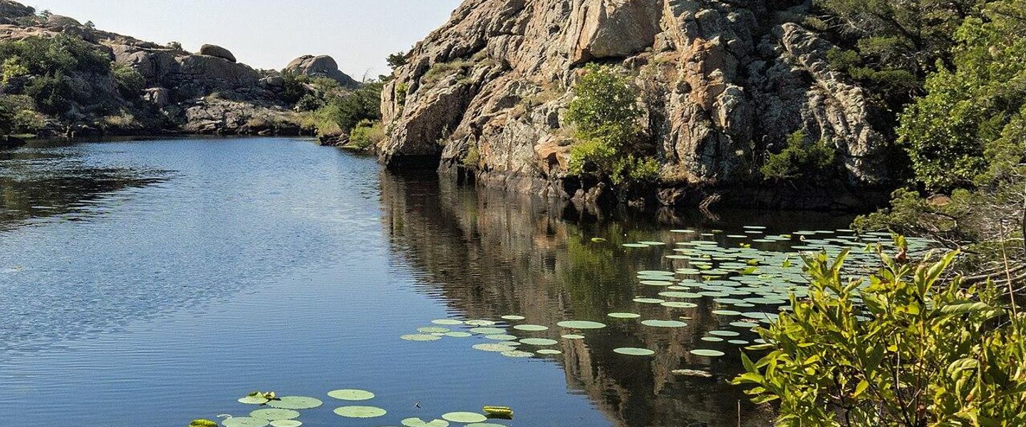


Great Plains Country in western Oklahoma offers salt flats, red mesas, Wichita Mountain scenery, Route 66 heritage and wide-open outdoor adventure.
Read more about Great Plains Country
When is the best time to visit Great Plains Country?
Best: April–May, October · 22–27°C| Month | High (°C) | Rainfall (mm) |
|---|---|---|
| January | 8 | 30 |
| February | 11 | 35 |
| March | 16 | 45 |
| April (best) | 22 | 55 |
| May (best) | 27 | 85 |
| June | 32 | 100 |
| July | 35 | 85 |
| August | 34 | 75 |
| September | 30 | 70 |
| October (best) | 24 | 60 |
| November | 15 | 50 |
| December | 10 | 40 |
Getting to and around Great Plains Country
How to get there
Transportation
Top city travel guides in Great Plains Country
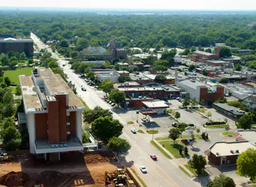
The cities of Great Plains Country, and the easiest places to base yourself.
-

-

-
-

-

-


Swipe for more cities
Destinations in Great Plains Country
Resorts, valleys and scenic spots worth a trip of their own.
-
-

-

-

-
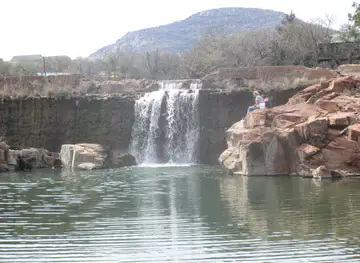
 Roman Nose State Park
 in Oklahoma combines gypsum hills, wooded canyons, spring-fed lakes, CCC heritage, trails, fishing and quiet stays near Watonga.
-


Swipe for more destinations
Best attractions in Great Plains Country
Great Plains Country’s attractions are distributed across a large landscape rather than concentrated in one city. In the north-west, Great Salt Plains State Park combines bird habitat, a shallow salt lake and an unusual selenite-crystal landscape, while Gloss Mountain State Park offers steep red and rust-coloured mesas above open prairie. Little Sahara State Park near Waynoka provides a rare Oklahoma setting of sizeable inland dunes, with permitted off-road recreation and quieter areas for viewing the terrain. The central and western stretches include Route 66 museums and roadside history in Clinton, Elk City, Sayre and Erick, alongside local museums explaining agriculture, settlement and the Dust Bowl. In the south, the Wichita Mountains provide the region’s most dramatic hiking, climbing, wildlife-watching and scenic-driving environment, with lakes, granite outcrops and free-ranging bison. Washita Battlefield National Historic Site near Cheyenne offers a thoughtful interpretation of the 1868 attack on a Southern Cheyenne village. Fort Sill and the Museum of the Great Plains in Lawton add military, Indigenous, archaeological and regional history. Visitors should allow for long drives, seasonal changes and differing management rules between state parks, federal sites and active military areas.
-
Museum
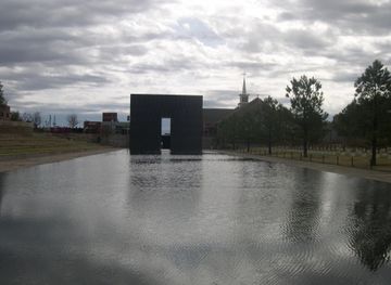
Oklahoma City National Memorial & Museum
Explore the Oklahoma City National Memorial & Museum, a powerful tribute to resilience, healing, and the importance of community in the face of tragedy.
-
Heritage museum
National Cowboy & Western Heritage Museum
Immerse yourself in the rich culture and history of the American West at the National Cowboy & Western Heritage Museum in Oklahoma City.
-
Wildlife refuge
Wichita Mountains National Wildlife Refuge
Discover the breathtaking landscapes and rich wildlife of Wichita Mountains National Wildlife Refuge in Oklahoma, a must-visit destination for nature lovers.
-
State park
Beavers Bend State Park and Nature Center
Discover the natural beauty, outdoor adventures, and serene landscapes at Beavers Bend State Park in Oklahoma—a perfect getaway for nature enthusiasts.


Best landmarks in Great Plains Country
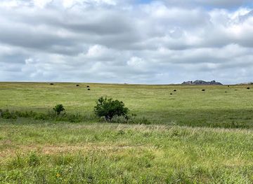
The Wichita Mountains are Great Plains Country’s most recognisable natural landmark, their weathered granite domes and ridges rising unexpectedly from the surrounding prairie. Near Lawton, Mount Scott is a prominent viewpoint within the wider mountain landscape, while Medicine Park is known for its distinctive cobblestone buildings and relationship with nearby waterways and recreation areas. In the north-west, the red mesas of Gloss Mountain form a memorable geological skyline, and the salt flats of Great Salt Plains are an unusual landscape created by mineral-rich groundwater and evaporation. Washita Battlefield near Cheyenne is both a physical landscape and a major historical landmark, marking the setting of the 1868 attack on a Southern Cheyenne village. Along the western Route 66 corridor, surviving road features, bridges, historic commercial buildings and the restored U-Drop Inn in Shamrock, Texas, lie outside Oklahoma and should not be confused with the region’s landmarks; within Great Plains Country, Clinton’s Route 66 Museum and Elk City’s National Route 66 Museum interpret the road’s local legacy. Fort Sill’s historic structures and cemeteries near Lawton are significant but remain subject to military access arrangements.
-
Tourist attraction
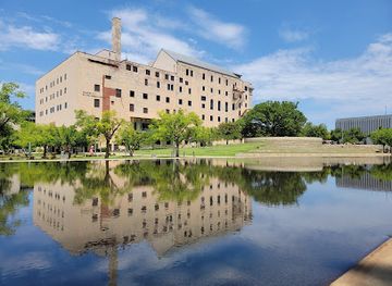
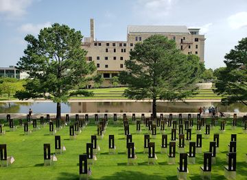
Oklahoma City National Memorial & Museum
Discover the Oklahoma City National Memorial & Museum, where history, remembrance, and resilience intertwine in a tribute to the lives lost in the 1995 bombing.
-
Tourist attraction
Wichita Mountains National Wildlife Refuge
Discover the enchanting beauty of Wichita Mountains National Wildlife Refuge, where stunning landscapes and diverse wildlife await your exploration.
-
State park
Beavers Bend State Park and Nature Center
Experience the breathtaking beauty and outdoor adventure at Beavers Bend State Park and Nature Center in the heart of Oklahoma's scenic landscapes.
-
Tourist attraction
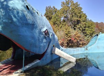
Blue Whale of Catoosa
Explore the enchanting Blue Whale of Catoosa, a captivating roadside attraction on Route 66, rich in history and whimsy.


Explore Great Plains Country on the map
Plan your trip on one map. See where the top cities, national parks and sights are, and book hotels and experiences in a few clicks.
Best hotels in Great Plains Country
Best restaurants in Great Plains Country
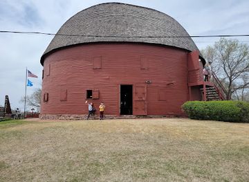
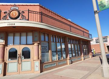
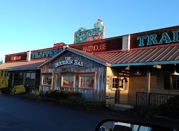
Dining in Great Plains Country reflects Oklahoma’s position within the wider southern and central Great Plains. Independent cafés, family restaurants and traditional diners are important in the region’s service towns, while barbecue, burgers, chicken-fried steak, fried catfish and hearty breakfast cooking are common fixtures. Wheat farming and ranching influence local menus, and beef, baked goods and comfort food are widely available. In larger communities such as Lawton, Guymon, Woodward and Clinton, visitors will also find Mexican, Asian and other international cuisines shaped by contemporary migration and regional workplaces. Rural cafés and small-town restaurants may have limited hours, so plan meals around the distance between settlements. Farmers’ markets and food shops can provide seasonal produce, baked goods and locally made products, although availability varies by town and season. Native American food traditions and Indigenous cultural institutions are part of the region’s broader heritage, but visitors should distinguish commercial offerings from community-specific traditions and seek permission where appropriate. Tipping is customary for table service, and displayed prices generally exclude sales tax.
-
American
Pops 66
Experience Americana at Pops 66 – where great food meets an incredible selection of sodas on Route 66.
-
Steak
Cattlemen's Steakhouse
Experience Oklahoma City's culinary heritage at Cattlemen's Steakhouse - renowned for its exceptional steaks and welcoming atmosphere.
-
Grill
Eischen's Bar
Discover Eischen's Bar in Okarche: where tradition meets flavor in every bite at this historic grill and bar.
-
Seafood
Trapper's Fishcamp & Grill
Discover Trapper's Fishcamp & Grill in Oklahoma City for an unforgettable seafood dining experience amidst lively ambiance and fresh flavors.

Best bars in Great Plains Country
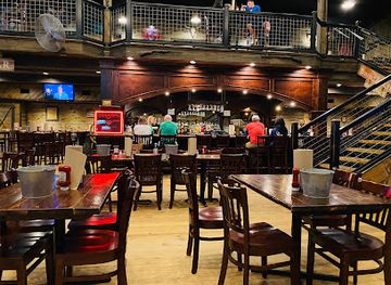
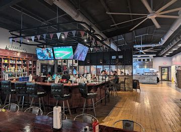
Evening life in Great Plains Country is centred on local bars, traditional pubs, restaurants, sporting events, live music and community gatherings rather than a large nightclub circuit. Lawton provides the broadest choice of bars, entertainment and late-opening venues within the region, while towns such as Clinton, Elk City, Woodward, Guymon and Altus offer smaller local scenes. Historic Route 66 communities may have roadside bars, cafés or music events, but arrangements and opening patterns change regularly. Breweries and taprooms, where available, tend to be social venues rather than destinations for an extensive club night. In rural districts, evening options can be limited and distances make drinking and driving particularly unsafe; arrange a designated driver or local transport in advance. Summer festivals, county fairs and live performances can add seasonal activity, while the Wichita Mountains and other remote areas are better suited to quiet sunset views and stargazing than organised nightlife.
-
Grill
Hochatown Saloon
Discover Hochatown Saloon: A grill, gift shop, and live music venue where delicious food meets vibrant local culture in Broken Bow, Oklahoma.
-
Brewpub
Mountain Fork Brewery
Experience the best craft beers and delicious American cuisine at Mountain Fork Brewery in Broken Bow, Oklahoma, a must-visit brewpub for every traveler.
-
Bar
JJ's Alley
Discover the vibrant atmosphere and delicious offerings of JJ's Alley, a beloved bar and grill in Oklahoma City's Bricktown.
-
Bar
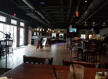
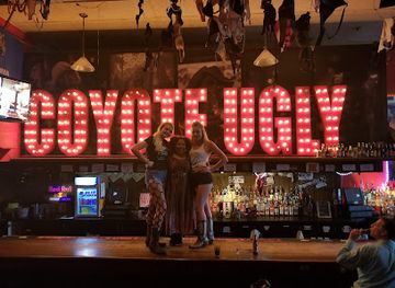
Coyote Ugly Saloon
Dive into the excitement at Coyote Ugly Saloon, where lively bartenders and delicious cocktails create an unforgettable nightlife experience in Oklahoma City.
Best nightclubs in Great Plains Country
Evening life in Great Plains Country is centred on local bars, traditional pubs, restaurants, sporting events, live music and community gatherings rather than a large nightclub circuit. Lawton provides the broadest choice of bars, entertainment and late-opening venues within the region, while towns such as Clinton, Elk City, Woodward, Guymon and Altus offer smaller local scenes. Historic Route 66 communities may have roadside bars, cafés or music events, but arrangements and opening patterns change regularly. Breweries and taprooms, where available, tend to be social venues rather than destinations for an extensive club night. In rural districts, evening options can be limited and distances make drinking and driving particularly unsafe; arrange a designated driver or local transport in advance. Summer festivals, county fairs and live performances can add seasonal activity, while the Wichita Mountains and other remote areas are better suited to quiet sunset views and stargazing than organised nightlife.
-
Night club
One15 Nightclub
Dive into the electric nightlife of One15 Nightclub in Oklahoma City's Bricktown, where unforgettable music and great vibes await every weekend.
-
Night club
Landing Zone- Dance & Night Club · Bar · Diner
Experience the vibrant nightlife at Landing Zone Dance & Night Club in Midwest City, where dancing, dining, and fun come together in perfect harmony.
-
Bar
Katt's Cove
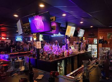
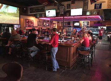
Experience the excitement of Katt's Cove, Oklahoma City's lively bar featuring karaoke, live music, and a welcoming atmosphere for an unforgettable night out.
-
Night club
ENZONE OKC
Experience the vibrant nightlife of Oklahoma City at ENZONE OKC, where dancing, dining, and drinks come together for an unforgettable evening.


Best shops in Great Plains Country
Shopping in Great Plains Country is primarily local and practical, with historic downtowns, independent retailers, western wear shops, antique stores, bookshops, art galleries and small food businesses serving dispersed communities. Lawton offers the widest general retail selection, while Clinton, Elk City, Woodward, Guymon and other market towns provide useful stopping points for groceries, clothing, gifts and regional products. Route 66-themed merchandise is common along the historic corridor, particularly in museums and specialist roadside shops, but quality and opening arrangements vary. Farmers’ markets and seasonal produce stalls may offer wheat-based baking, preserves, local honey and other Oklahoma products, although they are often seasonal rather than daily attractions. Visitors interested in Native American art, craft or jewellery should buy from reputable artists, tribal institutions or clearly identified retailers and ask about provenance. Western boots, hats, leather goods and ranch-related products suit the region’s working culture, while museum shops often provide more thoughtful historical souvenirs than generic roadside stores. Carrying supplies before visiting remote parks is sensible, as shopping opportunities can be very limited beyond the principal towns.
-
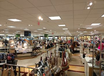
Shopping mall
Penn Square Mall
Discover Oklahoma City's vibrant shopping scene at Penn Square Mall, where retail therapy meets delicious dining and entertainment.
-
Shopping mall
Woodland Hills Mall
Explore Woodland Hills Mall: A premier shopping destination in Tulsa, Oklahoma, with diverse stores, dining, and entertainment for a memorable experience.
-
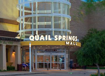
Shopping mall
Quail Springs Mall
Discover Quail Springs Mall in Oklahoma City, where shopping meets entertainment in a vibrant atmosphere filled with top brands and delicious dining options.
-
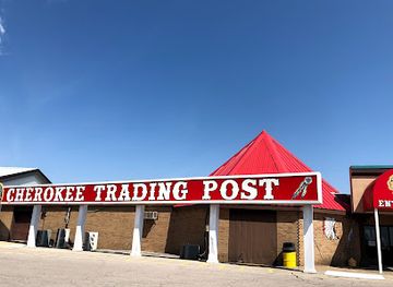
Gift shop
Cherokee Trading Post
Explore a unique shopping experience at the Cherokee Trading Post, where authentic Native American crafts meet rich cultural heritage.

Get your free copy of our complete guide to Great Plains Country, delivered straight to you.
Everything on this page, from attractions and restaurants to essentials and local phrases, in one PDF you can read offline, print or share.
Already have an account? Sign in
Your Great Plains Country guide is ready.
We'll send it to · Not you? Sign out

Getting your guide ready…
We are putting together a fresh copy of the Great Plains Country guide. This can take up to a minute.
This can take a few moments. If your browser asks, choose Allow so the download can start. You'll find the guide in your Downloads folder.
Nothing happened? Download it again
Sorry, the guide is taking longer than usual. Please try again in a minute, or get it by email instead.
Great Plains Country essentials
Currency and Payment
Safety
Emergency Situations
Do's and Don'ts
Local Tips
From Eve
Local phrases worth knowing
You don't need to get them perfect. A few words go a long way, and locals appreciate the effort.
Basics
| English | Local | Say it |
|---|---|---|
| Hello | Howdy | [Hau-dee] |
| Goodbye | See ya | [See yah] |
| Yes | Yup | [Yup] |
| No | Nope | [Nope] |
| Please/You're welcome | Please/No problem | [Pleez/No prob-lum] |
| Thank you | Thank ya | [Thank yah] |
| Excuse me/Sorry | Excuse me/Sorry 'bout that | [Ex-kyoos mee/Sor-ree bout that] |
| How are you? | How ya doin'? | [How yah doin'?] |
| Fine. And you? | I’m good. And you? | [I’m good. An' you?] |
| Do you speak English? | Ya speakin' English? | [Ya speakin' In-glish?] |
| I don't understand | I don’t get it | [I don’t git it] |
Eating & Drinking
| English | Local | Say it |
|---|---|---|
| I'd like to see the menu, please | Can I see the menu, please? | [Can I see thuh men-yoo, pleez?] |
| I don't eat meat | I ain't eatin' meat | [I ain't eatin' meet] |
| Cheers! | Cheers! | [Cheers!] |
| I would like to pay, please | I’d like to pay, please | [I’d like to pay, pleez] |
Emergencies
| English | Local | Say it |
|---|---|---|
| Help! | Help! | [Help!] |
| Go away! | Get away! | [Get away!] |
| Call the Police! | Call the cops! | [Call thuh cops!] |
| Call a doctor! | Call a doc! | [Call a doc!] |
| I'm lost | I’m lost | [I’m lost] |
| I'm ill | I ain't feelin' good | [I ain't feelin' good] |
Shopping
| English | Local | Say it |
|---|---|---|
| I'd like to buy... | I wanna buy... | [I wanna bye...] |
| I'm just looking | Just lookin' | [Just lookin'] |
| How much is it? | How much is that? | [How much is that?] |
| That's too expensive | That’s too pricey | [That’s too pry-see] |
| Can you lower the price? | Can ya bring the price down? | [Can ya bring thuh pryce down?] |
Time & Numbers
| English | Local | Say it |
|---|---|---|
| What time is it? | What time is it? | [What time is it?] |
| It's one o'clock | It’s one o’clock | [It’s one o’clock] |
| Half past (10) | Half past ten | [Half past ten] |
| Morning | Mornin' | [Mornin'] |
| Afternoon | Afternoon | [Afternoon] |
| Evening | Evenin' | [Evenin'] |
| Yesterday | Yesterday | [Yesterday] |
| Today | Today | [Today] |
| Tomorrow | Tomorrow | [Tomorrow] |
| 1 | One | [One] |
| 2 | Two | [Two] |
| 3 | Three | [Three] |
| 4 | Four | [Four] |
| 5 | Five | [Five] |
| 6 | Six | [Six] |
| 7 | Seven | [Seven] |
| 8 | Eight | [Eight] |
| 9 | Nine | [Nine] |
| 10 | Ten | [Ten] |
Transport & Directions
| English | Local | Say it |
|---|---|---|
| Where's a/the...? | Where's the...? | [Where's thuh...?] |
| What's the address? | What’s the address? | [What’s thuh address?] |
| Can you show me (on the map)? | Can ya show me on the map? | [Can ya show me on thuh map?] |
| When's the next (bus)? | When's the next bus? | [When's thuh next bus?] |
| A ticket (to ....) | A ticket to... | [A ticket to...] |
History of Great Plains Country
Indigenous Plains Cultures Before American Settlement
The plains of western Oklahoma have long been home to Indigenous peoples, including the Kiowa, Comanche, Southern Cheyenne and Arapaho, as well as communities with older connections to the region. Their histories include seasonal movement, trade, diplomacy, warfare and deep relationships with the grasslands and mountains. The Wichita Mountains were particularly important within the wider cultural geography of the southern plains. Contemporary tribal nations and communities remain central to the region’s identity, and visitors should understand that many historic events described in museums and at battle sites had enduring consequences for Indigenous peoples.
Fort Sill and the Southern Plains, 1869 Onwards
Fort Sill was established in 1869 amid the United States government’s campaigns to move Indigenous nations onto reservations and impose federal control across the southern plains. The surrounding area became closely associated with the Kiowa, Comanche and Apache peoples, whose reservation histories are inseparable from the fort’s military history. Geronimo was held at Fort Sill in the final years of his life, and his grave is at the nearby Fort Sill Apache cemetery. The installation remains active, while its museums and historic sites interpret a complicated history of conflict, coercion and cultural survival.
The Washita Battlefield, 1868
On 27 November 1868, United States cavalry under Lieutenant Colonel George Armstrong Custer attacked a Southern Cheyenne village led by Black Kettle along the Washita River, near present-day Cheyenne. Black Kettle and many other residents were killed, and the event became a major episode in the United States military campaign against the southern Plains nations. Washita Battlefield National Historic Site preserves part of the landscape and presents the event from multiple perspectives, including the experiences of the Cheyenne community. The site is an important place for reflection rather than a simple military monument.
Opening of Western Oklahoma to Non-Indigenous Settlement
Much of present-day western Oklahoma was opened to non-Indigenous settlement through a series of federal land openings in the late nineteenth century, including the Cheyenne and Arapaho lands in 1892. Towns, railways, farms and ranches expanded rapidly, while Indigenous peoples were dispossessed from much of their land base. The resulting settlement pattern helps explain the region’s widely spaced communities, large agricultural holdings and dependence on rail and road connections. Local museums, courthouse squares and surviving commercial buildings preserve aspects of this difficult transformation.
Ranching, Wheat and the Growth of Regional Towns
During the late nineteenth and early twentieth centuries, cattle ranching and wheat farming became defining economic activities across the plains. Railways connected agricultural communities to markets, encouraged grain elevators and helped establish towns such as Woodward, Guymon, Clinton and Elk City as regional service centres. Agriculture depended heavily on rainfall, irrigation and access to transport, making both prosperity and hardship sensitive to weather and commodity prices. The region’s contemporary landscape of fields, stockyards, elevators and long highway approaches reflects this agricultural foundation.
Route 66 and Twentieth-Century Mobility
United States Route 66 crossed western Oklahoma from the 1920s, linking towns including Clinton, Elk City, Sayre and Erick with a nationally important road corridor between Chicago and Los Angeles. Service stations, cafés, motels and roadside businesses developed around motorists, while the highway later became a symbol of migration and automobile culture. Interstate highways eventually diverted most long-distance traffic, but museums, surviving bridges, alignments and commercial remnants continue to interpret the road’s role. In Great Plains Country, Route 66 history is especially visible as a chain of communities rather than a single urban attraction.
The Dust Bowl and Agricultural Crisis
Severe drought, high winds and extensive cultivation contributed to the Dust Bowl of the 1930s, which affected western Oklahoma and neighbouring Great Plains states. Soil erosion damaged farms, darkened skies with dust storms and intensified economic hardship during the Great Depression. Families left some communities in search of work, while others adapted through improved soil-conservation practices and changes in farming methods. The era remains part of regional memory and is interpreted through museums, oral histories and landscapes that show how environmental conditions can shape migration, agriculture and public policy.
Energy Development and Modern Regional Change
Oil, natural gas and related industries became important to many communities in western Oklahoma during the twentieth century, adding another layer to an economy already based on agriculture and ranching. Energy development brought employment and investment but also exposed towns to commodity cycles and environmental debates. Today the region combines these established industries with tourism, military activity, wind energy, manufacturing, retail and public services. Its modern character is therefore not simply a preserved frontier image: it is a working region adapting to changing technology, climate pressures and rural population patterns.
Great Plains Country in Photos
Browse through our photo collection highlighting the charm and character of the destination.
Neighbouring regions of Great Plains Country
The closest regions to Great Plains Country, if you have time for more than one.
-

-

-

-

-


Swipe for more regions
Explore more
Explore more of Oklahoma
Discover Oklahoma: Where the spirit of the Old West meets modern charm, offering a rich mix of history, nature, and vibrant culture in the heart of the United States.
Explore Oklahoma