Uinta Mountains · Travel guide · Updated 2026

The Majestic Uinta Mountains: Nature's Hidden Gem in Utah

Explore the Uinta Mountains in Utah: A serene escape with alpine lakes, lush meadows, and rich cultural history, perfect for hikers, campers, and nature enthusiasts.

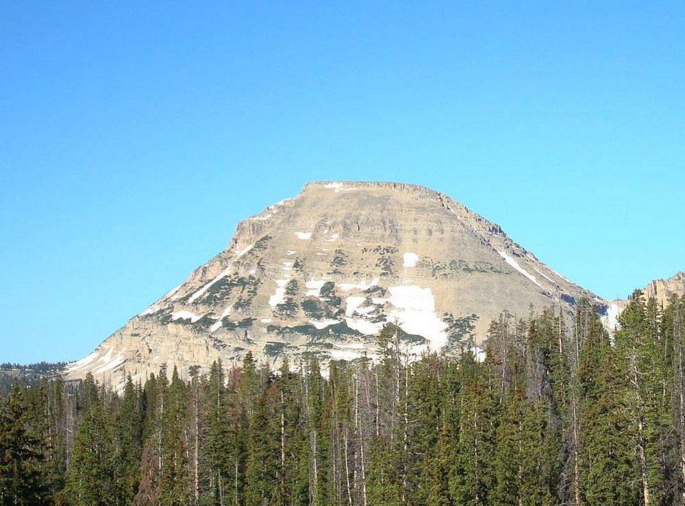
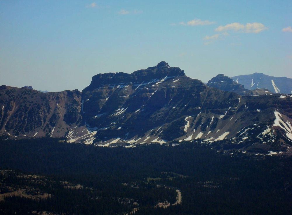
Nestled in northeastern Utah, the Uinta Mountains are a breathtaking range that offer a unique and serene escape for nature lovers. Unlike most mountain ranges in North America, the Uinta Mountains run east to west, boasting some of the highest peaks in Utah, including Kings Peak, which stands at a towering 13,528 feet. The landscape is dotted with alpine lakes, lush meadows, and dense forests, making it a paradise for hikers, campers, and anglers alike. 
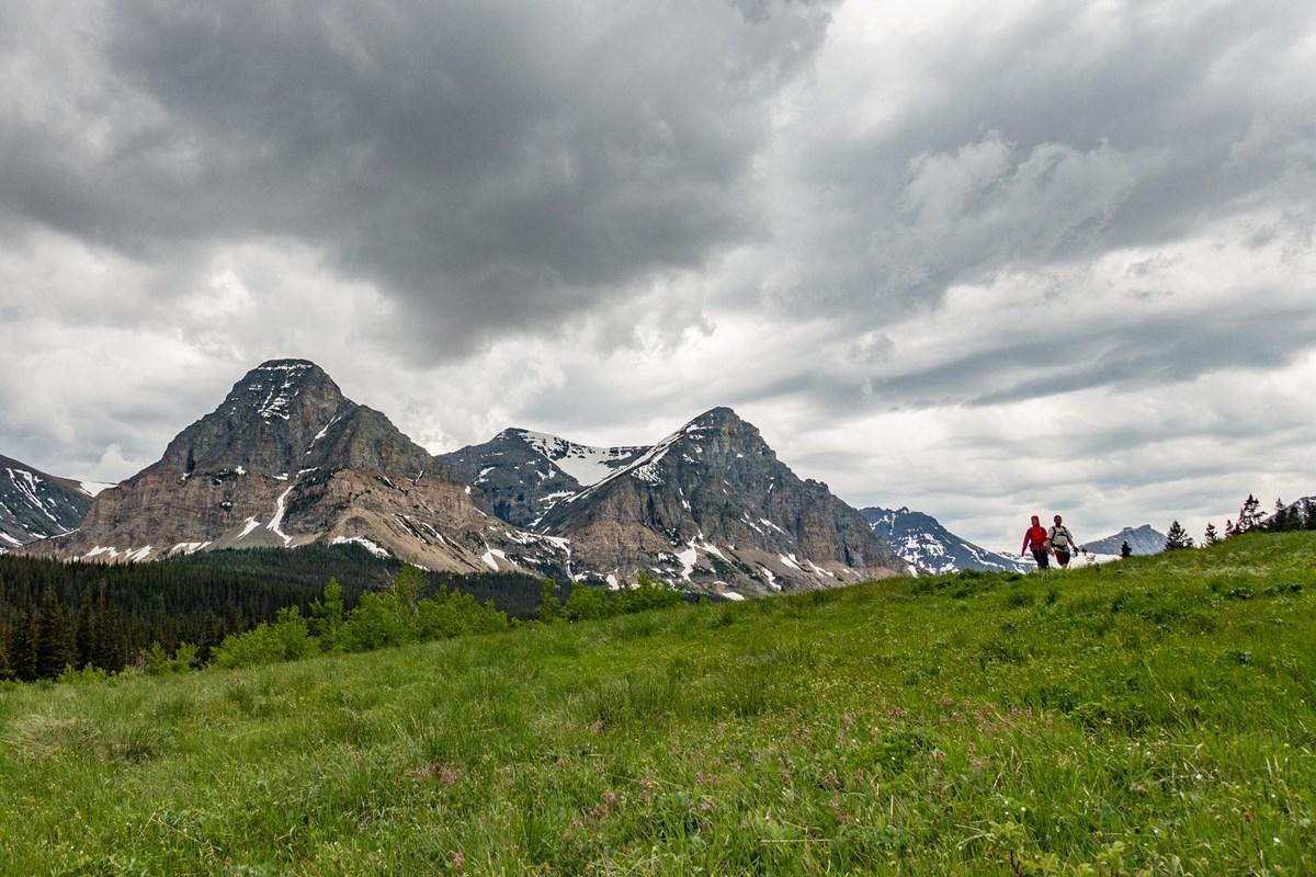
The Uinta Mountains are home to the High Uintas Wilderness, a protected area that spans over 450,000 acres. This wilderness offers a variety of outdoor activities, from challenging backpacking trails to more accessible day hikes. For those seeking solitude and a true backcountry experience, the Uinta Highline Trail is a must-do, stretching over 100 miles through some of the most remote and scenic parts of the range. Wildlife enthusiasts will also be thrilled, as the area is inhabited by elk, moose, black bears, and a diverse array of bird species. Aside from its natural beauty, the Uinta Mountains hold significant cultural and historical value. The region is rich in Native American history, with many ancient artifacts and petroglyphs found throughout the area. Visitors can explore these historical sites and gain a deeper understanding of the indigenous peoples who once called this land home. The Uinta Mountains are also known for their starry skies, making it an ideal destination for stargazing and astrophotography. Whether you're looking for adventure, relaxation, or a glimpse into the past, the Uinta Mountains provide an unforgettable experience.

When is the best time to go to Uinta Mountains?

Weather at a glance

Use the monthly temperature and precipitation trends to compare typical conditions across the year before planning countryside walks, town visits, and heritage days.

Temperature

°C

Precipitation

mm
Warmest months
Longest daylight
Driest period

Explore places in Uinta Mountains

    See all →
    Free Images : landscape, nature, scenic, usa, united states of america,  landmark, national park, geology, utah, badlands, bryce canyon, tourist  destination, landform, geographical feature, majesic, land formation  4256x2832 - - 1064970 - Free stock ...
    Destination guide

    More about Utah

    Explore Utah's stunning national parks, rich cultural heritage, and year-round outdoor adventures. Discover why this diverse state is a top destination for travelers.

    Tell me more about Utah
    Mobile App
    Get the app

    Your all‑in‑one travel companion app

    Explore expert travel guides, compare and book tours, experiences, hotels, and more—all from the palm of your hand. Download now for seamless trip planning wherever your wanderlust takes you.

    Explore Uinta Mountains in Photos

    A quick visual route through countryside views, towns, gardens, and regional day-trip atmosphere.

    File:Kings Peak, Uinta Mountains, Duchesne County, Utah, USA 02.jpg -  Wikimedia Commons
    File:Mount Hood reflected in Mirror Lake, Oregon.jpg - Wikipedia
    File:South Kings Peak, Uinta Mountains, Duchesne County, Utah, USA 02.jpg -  Wikimedia Commons
    File:Bald Mountain.JPG - Wikimedia Commons
    Red CastleRed Castle, Mountain Home | Free Photo - rawpixel
    File:Flaming Gorge National Recreational Area - 49217402982.jpg - Wikimedia  Commons
    File:Foothills of the Uintas South of Evanston, Wyoming.jpg - Wikipedia
    File:Kings Peak, Uinta Mountains, Duchesne County, Utah, USA 02.jpg -  Wikimedia Commons
    First-Come, First-Served Campgrounds - Glacier National Park (U.S. National  Park Service)
    File:Hayden Peak, Utah.JPG - Wikimedia Commons

    Select Currency

    Choose the currency you want prices to display in.