Uintah Basin · Travel guide · Updated 2026

Explore the Untamed Beauty of Uintah Basin

Discover the Uintah Basin: Utah's Hidden Gem of Natural Wonders, Rich History, and Vibrant Local Culture.

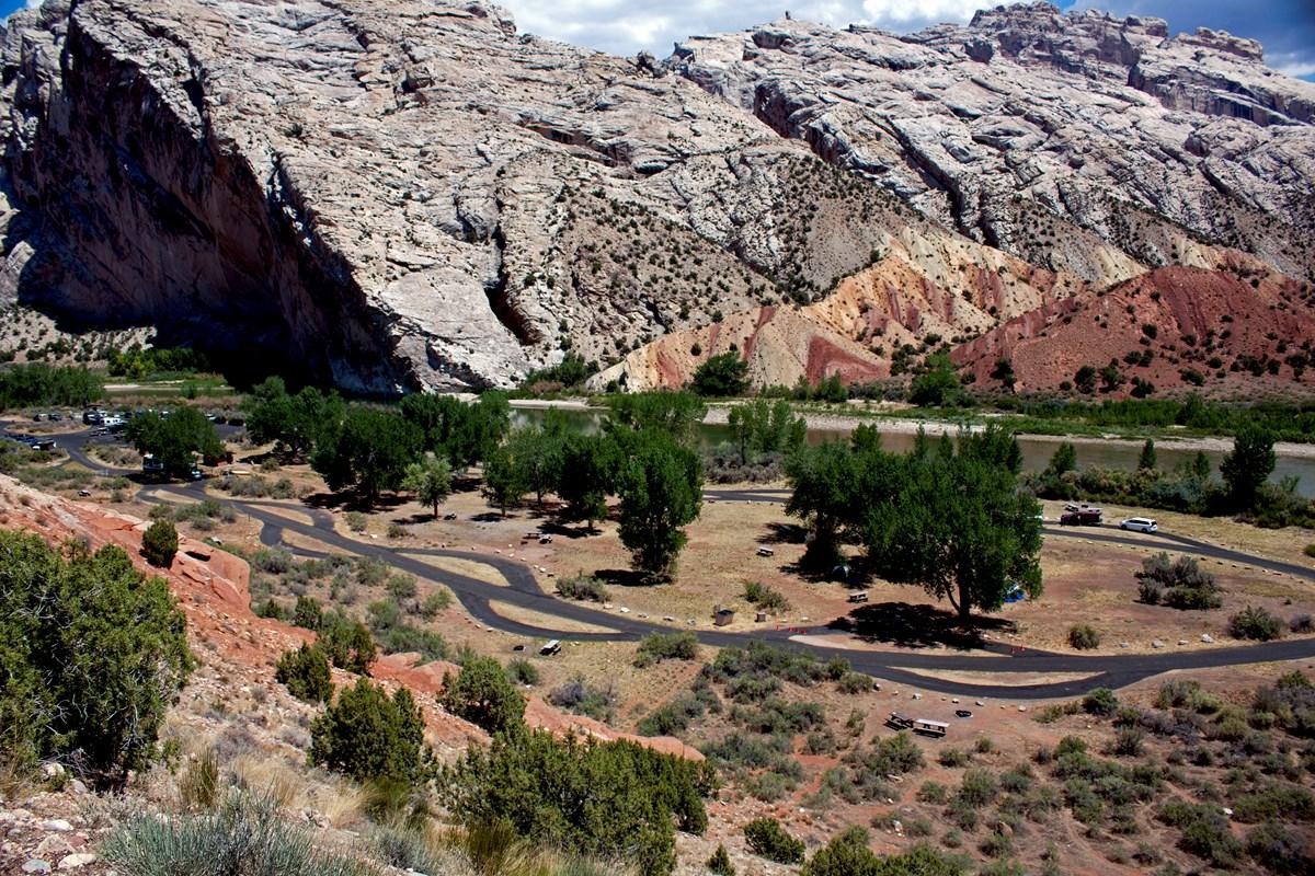
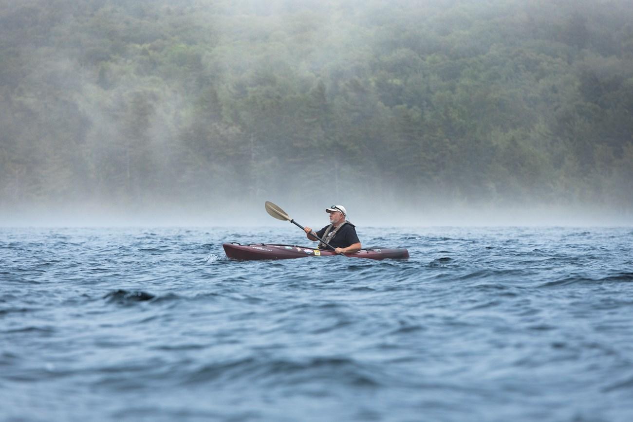
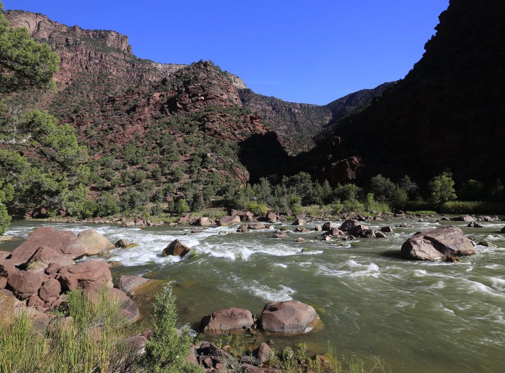
Nestled in northeastern Utah, the Uintah Basin is a hidden gem waiting to be discovered. Known for its stunning landscapes, this region offers a unique blend of natural beauty and rich history. The expansive basin is home to striking geological formations, lush forests, and pristine rivers, making it a paradise for outdoor enthusiasts. Whether you're hiking through the rugged terrain or fishing in the tranquil waters of the Green River, there's no shortage of activities to enjoy. 
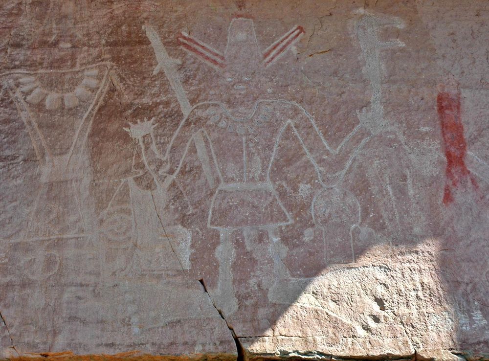
The Uintah Basin is also steeped in history and culture. Visitors can explore ancient Native American petroglyphs and learn about the region's indigenous tribes at the Uintah and Ouray Reservation. For those interested in paleontology, the Utah Field House of Natural History State Park Museum in Vernal showcases a fascinating collection of dinosaur fossils. The area's historical significance is further highlighted by the Fort Duchesne military post, which played a crucial role in the late 19th century. Beyond its natural and historical allure, the Uintah Basin boasts a vibrant local community. Small towns like Roosevelt and Vernal offer charming accommodations, local eateries, and unique shopping experiences. Whether you're looking for an adventurous getaway or a peaceful retreat, the Uintah Basin promises an unforgettable experience.

When is the best time to go to Uintah Basin?

Weather at a glance

Use the monthly temperature and precipitation trends to compare typical conditions across the year before planning countryside walks, town visits, and heritage days.

Temperature

°C

Precipitation

mm
Warmest months
Longest daylight
Driest period

Explore places in Uintah Basin

    See all →
    Free Images : landscape, nature, scenic, usa, united states of america,  landmark, national park, geology, utah, badlands, bryce canyon, tourist  destination, landform, geographical feature, majesic, land formation  4256x2832 - - 1064970 - Free stock ...
    Destination guide

    More about Utah

    Explore Utah's stunning national parks, rich cultural heritage, and year-round outdoor adventures. Discover why this diverse state is a top destination for travelers.

    Tell me more about Utah
    Mobile App
    Get the app

    Your all‑in‑one travel companion app

    Explore expert travel guides, compare and book tours, experiences, hotels, and more—all from the palm of your hand. Download now for seamless trip planning wherever your wanderlust takes you.

    Explore Uintah Basin in Photos

    A quick visual route through countryside views, towns, gardens, and regional day-trip atmosphere.

    Split Mountain Campground - Dinosaur National Monument (U.S. National Park  Service)
    File:Flaming Gorge (Utah) - Sheep Creek Overlook 23-9-2014 11-05-48.JPG -  Wikimedia Commons
    File:Uinta Highline Trail, Gabbro Pass, Uinta County, Utah, USA.jpg -  Wikimedia Commons
    Boating - Acadia National Park (U.S. National Park Service)
    File:Flaming Gorge-Uintas National Scenic Byway - Sign at Steinaker  Reservoir Overlook - NARA - 7718324.jpg - Wikimedia Commons
    File:Bigfoot petroglyph panel McConkie Ranch Vernal Utah.jpeg - Wikimedia  Commons
    File:Rocks in Fantasy Canyon, Utah.jpg - Wikimedia Commons
    File:Ashley National Forest in Utah.jpg - Wikimedia Commons
    File:Petroglyphs at Nine Mile Canyon 01.jpg - Wikimedia Commons
    6-27-24-Fatality-ID-Update - Dinosaur National Monument (U.S. National Park  Service)

    Planning another trip?

    Continue exploring nearby country regions around Uintah Basin, from connected city edges to neighbouring counties, coastlines, and countryside escapes.

    Select Currency

    Choose the currency you want prices to display in.