

Freycinet National Park Travel Guide - Free Web & App
Your ultimate guide to Freycinet National Park. Discover top landmarks, proposed trips, and local tips. Free on the web or via the Evendo companion app.


Freycinet National Park, Australia: explore Wineglass Bay, granite peaks, coastal walks, wildlife and Tasmania’s East Coast landscapes and beaches.
Granite Coast and Sheltered Bays
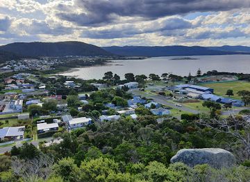
Freycinet National Park occupies much of the Freycinet Peninsula on Tasmania’s east coast, where a spine of pink granite mountains meets sheltered coves, long beaches and clear Tasman Sea waters. The park is best known for Wineglass Bay, a curved sweep of white sand framed by the Hazards, but its appeal extends across a varied landscape of rocky headlands, eucalypt forest, heathland, lagoons and offshore islands. Coles Bay, just beyond the park’s western boundary, is the principal gateway and a useful base for exploring the peninsula.Read more about Freycinet National Park
Walking, Wildlife and the Sea
East Coast Character
When is the best time to visit Freycinet National Park?
Best: February, November–December · 24–26°C| Month | High (°C) | Rainfall (mm) |
|---|---|---|
| January | 24 | 50 |
| February (best) | 24 | 46 |
| March | 23 | 48 |
| April | 22 | 55 |
| May | 21 | 63 |
| June | 18 | 71 |
| July | 18 | 72 |
| August | 19 | 67 |
| September | 21 | 56 |
| October | 24 | 52 |
| November (best) | 25 | 49 |
| December (best) | 26 | 48 |
Getting to and around Freycinet National Park
How to get there
Transportation
Best attractions in Freycinet National Park
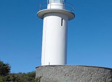
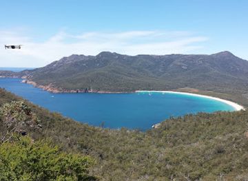
Wineglass Bay is Freycinet’s signature attraction, reached by a walking track to a celebrated lookout and, for those continuing, a beach backed by the Hazards range. The peninsula’s walking network also leads towards Hazards Beach and through coastal forest, while the steep Mount Amos track offers a high, weather-dependent view over the bay. At the northern end, Cape Tourville’s short circuit provides broad coastal perspectives and access to the lighthouse area. Honeymoon Bay is a sheltered cove near Coles Bay, and Friendly Beaches extends along the outer coast beyond the central visitor areas. Schouten Island, separated from the peninsula by protected waters, adds a wilder island dimension and is best experienced from the water or on permitted walks. Across these areas, visitors encounter granite headlands, heath, eucalypt forest, beaches, lagoons and wildlife habitats rather than a concentration of built attractions.
-
Tourist attraction
Bicheno Blowhole
Witness the raw power of nature at Bicheno Blowhole, a spectacular coastal fountain sculpted by millennia of waves. A must-see in Tasmania!
-
Tourist attraction
Cape Tourville Lighthouse and Lookout
Discover the breathtaking landscapes and wildlife of Freycinet National Park, a must-visit destination for nature lovers in Tasmania.
-
Cruise agency
Wineglass Bay Cruises
Experience the breathtaking beauty of Tasmania's Wineglass Bay with unforgettable cruises showcasing stunning landscapes and rich marine wildlife.
-
Park
Whalers Lookout Scenic reserve
Breathtaking coastal views and a glimpse into Bicheno's whaling past await at Whalers Lookout Scenic Reserve. A must-see Tasmanian East Coast destination.
Best landmarks in Freycinet National Park
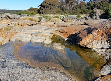
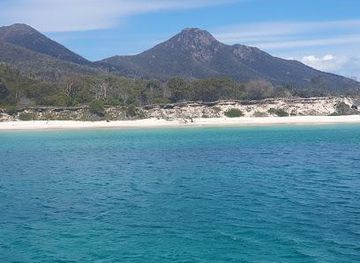
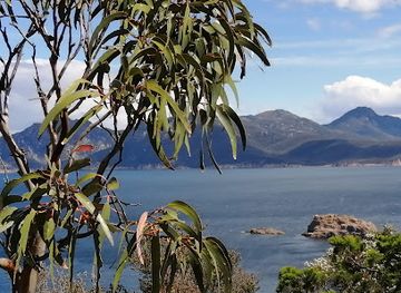
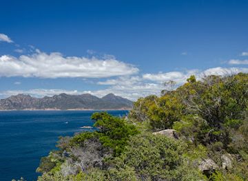
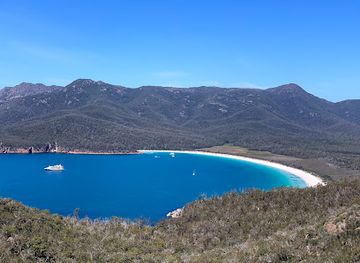
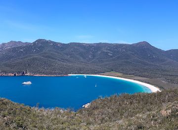
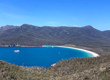
Wineglass Bay is Freycinet’s defining natural landmark, its bright arc of sand enclosed by the granite Hazards and the Tasman Sea. The Hazards themselves form the peninsula’s most recognisable geological feature, rising in weathered pink and grey masses above forest, beach and bay. Mount Amos is a prominent summit and viewpoint, while Cape Tourville marks the northern coast with a lighthouse and a broad outlook over surrounding waters. Schouten Island, at the southern end of the peninsula, is another major geographic feature within the national park. Historic maritime heritage is represented by the Cape Tourville lighthouse area, while the beaches, headlands and sheltered coves collectively express the coastline’s navigational, ecological and scenic importance.
-
Tourist attraction
Bicheno Blowhole
Experience the breathtaking natural wonder of the Bicheno Blowhole, where ocean waves meet granite cliffs in a stunning display of nature's power.
-
Seafood
Freycinet Marine Farm
Indulge in Tasmania's freshest seafood at Freycinet Marine Farm, where culinary delights meet stunning coastal views.
-
Scenic spot
Wineglass Bay Lookout
Experience breathtaking views at Wineglass Bay Lookout, a must-visit scenic spot in Freycinet National Park, Tasmania.
-
Tourist attraction
Cape Tourville Lighthouse and Lookout
Discover breathtaking coastal views and rich wildlife at Cape Tourville Lighthouse and Lookout in Freycinet National Park, Tasmania.

Explore Freycinet National Park on the map
Plan your trip on one map. See where the top attractions, landmarks, restaurants and hotels are, and book hotels and experiences in a few clicks.
Best hotels in Freycinet National Park
Best restaurants in Freycinet National Park
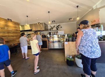
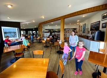
Dining around Freycinet is concentrated in Coles Bay and nearby East Coast settlements rather than within the national park itself. The region’s food identity is shaped by the sea and by Tasmania’s cool-climate agriculture, with oysters, other seafood, local wines, berries, cheeses and farm produce featuring in restaurants, cafés, general stores and seasonal food businesses. Coles Bay provides the most convenient base for meals after a day on the peninsula, while wider East Coast journeys may bring visitors to small-town pubs, bakeries and producers. Menus and opening patterns can be seasonal, especially outside peak holiday periods, so remote-area travellers should not assume that food is available at every park access point. Picnics and self-catering supplies are practical options, particularly for longer walks and early starts.
-
National park
Freycinet National Park
Discover breathtaking landscapes and vibrant wildlife at Freycinet National Park on Tasmania's stunning east coast.
-
Seafood
Lobster Shack Tasmania
Experience the freshest seafood at Lobster Shack Tasmania - where coastal charm meets culinary delight.
-
Seafood
Freycinet Marine Farm
Discover the freshest seafood delights at Freycinet Marine Farm - where Tasmania's ocean meets culinary excellence.
-
Scenic spot
Wineglass Bay Lookout
Experience breathtaking views at Wineglass Bay Lookout in Freycinet National Park – where nature's beauty meets adventure.


Best bars in Freycinet National Park
Freycinet is a quiet coastal nature destination rather than a nightlife centre. Evening options are mainly found in Coles Bay, where visitors may use accommodation dining rooms, cafés, licensed venues or the local pub-style hospitality available in the settlement, while nearby East Coast towns offer similarly relaxed evenings rather than clubs and late-night districts. The strongest after-dark experience is often environmental: a quiet beach, dark rural skies and the sound of the sea, provided visitors remain in safe, permitted areas and respect park rules. Seasonal festivals and community events may add occasional entertainment across the wider region, but these should be checked locally rather than assumed to operate throughout the year.
-
National park
Freycinet National Park
Explore the stunning landscapes and diverse wildlife of Freycinet National Park, a jewel of Tasmania's east coast, perfect for nature lovers and adventurers.
-
Seafood
Freycinet Marine Farm
Experience the freshest seafood at Freycinet Marine Farm, featuring local oysters and stunning coastal views in Tasmania.
-
Scenic spot
Wineglass Bay Lookout
Discover the unmatched beauty of Wineglass Bay Lookout, a scenic jewel in Tasmania's Freycinet National Park, offering breathtaking vistas and unforgettable hikes.
-
Bar
Bark Mill Tavern & Bakery
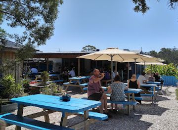
Experience local flavors at Bark Mill Tavern & Bakery in Swansea, Tasmania, where rustic charm meets culinary delights.

Best nightclubs in Freycinet National Park
Freycinet is a quiet coastal nature destination rather than a nightlife centre. Evening options are mainly found in Coles Bay, where visitors may use accommodation dining rooms, cafés, licensed venues or the local pub-style hospitality available in the settlement, while nearby East Coast towns offer similarly relaxed evenings rather than clubs and late-night districts. The strongest after-dark experience is often environmental: a quiet beach, dark rural skies and the sound of the sea, provided visitors remain in safe, permitted areas and respect park rules. Seasonal festivals and community events may add occasional entertainment across the wider region, but these should be checked locally rather than assumed to operate throughout the year.
-
Scenic spot
Wineglass Bay Lookout
Experience the breathtaking vistas of Wineglass Bay from the iconic lookout in Freycinet National Park, a must-visit for nature lovers.
-
Australian
Iluka Tavern
Discover the vibrant atmosphere and delicious Australian cuisine at Iluka Tavern, a must-visit dining destination in Coles Bay, Tasmania.
-
Cafe
Granite Freycinet
Experience the flavors of Tasmania at Granite Freycinet, a stunning café offering breakfast, pizza, and cocktails in Coles Bay.
-
Restaurant
Richardson's Bistro
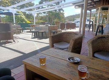
Discover the authentic taste of Tasmania at Richardson's Bistro, a cozy restaurant in Freycinet National Park, perfect for every food lover.
Best shops in Freycinet National Park
Shopping within Freycinet National Park is limited, with no extensive retail district inside the protected area. Coles Bay is the main place for practical supplies, food, outdoor necessities and locally produced goods, while larger selections may be found in East Coast towns beyond the park. Regional products commonly associated with the area include Tasmanian seafood, oysters, wine, cheese, preserves, berries and small-scale arts or crafts, depending on the season and individual business. Farm gates, cellar doors and local producers along the wider East Coast can provide a more direct connection with the region’s agricultural and maritime economy. Visitors heading into remote parts of the peninsula should obtain provisions before setting out rather than relying on park access points for shopping.
-
National park
Freycinet National Park
Explore the breathtaking Freycinet National Park, a natural wonder in Tasmania with stunning landscapes, pristine beaches, and diverse wildlife.
-
Scenic spot
Wineglass Bay Lookout
Experience the stunning vistas of Wineglass Bay Lookout in Tasmania's Freycinet National Park, a must-visit for nature lovers and photographers alike.
-
Shop
Freycinet Lodge
Experience luxury and nature at Freycinet Lodge, your gateway to Tasmania's stunning Freycinet National Park.
-
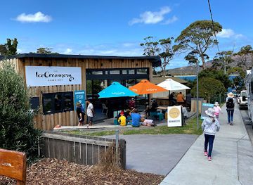
Ice Cream
Ice Creamery & Co.
Experience the sweet side of Tasmania at Ice Creamery & Co., where homemade ice cream meets breathtaking scenery in Coles Bay.

Get your free copy of our complete guide to Freycinet National Park, delivered straight to you.
Everything on this page, from attractions and restaurants to essentials and local phrases, in one PDF you can read offline, print or share.
Already have an account? Sign in
Your Freycinet National Park guide is ready.
We'll send it to · Not you? Sign out

Getting your guide ready…
We are putting together a fresh copy of the Freycinet National Park guide. This can take up to a minute.
This can take a few moments. If your browser asks, choose Allow so the download can start. You'll find the guide in your Downloads folder.
Nothing happened? Download it again
Sorry, the guide is taking longer than usual. Please try again in a minute, or get it by email instead.
Freycinet National Park essentials
Currency and Payment
Safety
Emergency Situations
Do's and Don'ts
Local Tips
From Eve
Local phrases worth knowing
You don't need to get them perfect. A few words go a long way, and locals appreciate the effort.
Basics
| English | Local | Say it |
|---|---|---|
| Hello | G'day | [g'day] |
| Goodbye | See ya | [see ya] |
| Yes | Yeah | [yeah] |
| No | Nah | [nah] |
| Please/You're welcome | Please/No worries | [please/no worries] |
| Thank you | Cheers | [cheers] |
| Excuse me/Sorry | Sorry | [sorry] |
| How are you? | How ya goin'? | [how ya goin'] |
| Fine. And you? | Good. How bout you? | [good. how 'bout you?] |
| Do you speak English? | Ya speak English? | [ya speak English?] |
| I don't understand | I'm lost | [I'm lost] |
Eating & Drinking
| English | Local | Say it |
|---|---|---|
| I'd like to see the menu, please | Can I have a squiz at the menu, mate? | [can I have a squiz at the menu, mate?] |
| I don't eat meat | I'm vego | [I'm vego] |
| Cheers! | Cheers! | [cheers!] |
| I would like to pay, please | Can I settle up, mate? | [can I settle up, mate?] |
Emergencies
| English | Local | Say it |
|---|---|---|
| Help! | Help! | [help!] |
| Go away! | Get lost! | [get lost!] |
| Call the Police! | Get the cops! | [get the cops!] |
| Call a doctor! | Get a doc! | [get a doc!] |
| I'm lost | I'm lost | [I'm lost] |
| I'm ill | I'm crook | [I'm crook] |
Shopping
| English | Local | Say it |
|---|---|---|
| I'd like to buy... | I wanna grab... | [I wanna grab...] |
| I'm just looking | Just havin' a squiz | [just havin' a squiz] |
| How much is it? | How much for that? | [how much for that?] |
| That's too expensive | That's a bit steep, mate | [that's a bit steep, mate] |
| Can you lower the price? | Any chance of a better price? | [any chance of a better price?] |
Time & Numbers
| English | Local | Say it |
|---|---|---|
| What time is it? | What's the time? | [what's the time?] |
| It's one o'clock | It's one | [it's one] |
| Half past (10) | Half ten | [half ten] |
| Morning | Mornin' | [mornin'] |
| Afternoon | Arvo | [arvo] |
| Evening | Evenin' | [evenin'] |
| Yesterday | Yesty | [yesty] |
| Today | Today | [today] |
| Tomorrow | Tomorra | [tomorra] |
| 1 | One | [one] |
| 2 | Two | [two] |
| 3 | Three | [three] |
| 4 | Four | [four] |
| 5 | Five | [five] |
| 6 | Six | [six] |
| 7 | Seven | [seven] |
| 8 | Eight | [eight] |
| 9 | Nine | [nine] |
| 10 | Ten | [ten] |
Transport & Directions
| English | Local | Say it |
|---|---|---|
| Where's a/the...? | Where's the...? | [where's the...?] |
| What's the address? | What's the addy? | [what's the addy?] |
| Can you show me (on the map)? | Can you point it out? | [can you point it out?] |
| When's the next (bus)? | When's the next bus? | [when's the next bus?] |
| A ticket (to ....) | A ticket to ... | [a ticket to ...] |
History of Freycinet National Park
Granite Peninsula and Coastal Formation
Freycinet’s defining mountains are formed largely from Devonian granite, exposed and shaped over geological time by weathering, erosion and coastal processes. The Hazards form the most recognisable range, their warm pink and grey surfaces contrasting with white beaches and blue water. Sand has accumulated in sheltered coastal settings such as Wineglass Bay, while reefs, headlands and offshore islands reflect the peninsula’s exposed position on Tasmania’s east coast. This geological foundation explains both the dramatic scenery and the distinctive plant communities that occupy the thin, often nutrient-poor soils.
Palawa Connection and Early Contact
The Freycinet Peninsula lies within the traditional country of Tasmanian Aboriginal people, including the Oyster Bay nation associated with the wider east coast. Palawa communities used the coast, lagoons, forests and waters for food, travel and cultural life long before European arrival. European contact brought surveying, sealing, whaling and other extractive activities that altered relationships with the region and had severe consequences for Aboriginal communities across Tasmania. Place names introduced by Europeans exist alongside a much older Aboriginal connection to the peninsula and its surrounding waters.
European Naming and Maritime Activity
The peninsula was named after Louis de Freycinet, the French navigator whose expedition visited the region in the early nineteenth century. European exploration was followed by maritime activity along the East Coast, including sealing and whaling, while pastoral and agricultural settlement developed in surrounding districts. The sheltered waters around the peninsula also formed part of local coastal routes. Cape Tourville’s lighthouse, established in the late nineteenth century and later replaced by the present structure, reflects the importance of guiding vessels along a coastline where reefs, headlands and changing weather presented navigational challenges.
From Working Coast to Protected Landscape
Freycinet National Park was proclaimed in 1916, making it one of Tasmania’s older national parks. Its creation helped shift the peninsula’s public identity from a working and maritime coast towards a landscape protected for scenery, recreation and conservation. Access remained relatively limited for much of the twentieth century, but roads and tourism infrastructure gradually made Coles Bay and Wineglass Bay more accessible. Even as visitation increased, much of the peninsula retained its remote character, with walking tracks concentrating visitors in particular corridors while larger areas remained lightly developed.
Conservation and Contemporary Tourism
Modern management balances recreation with the protection of coastal vegetation, wildlife habitat, Aboriginal heritage and sensitive shorelines. Freycinet forms part of Tasmania’s network of protected areas and is managed through regulations governing vehicles, fires, camping, dogs and other visitor activities. The park’s international profile rests heavily on Wineglass Bay, yet conservation work extends across the broader peninsula, including its beaches, forests, wetlands and marine setting. Tourism now supports Coles Bay and the wider East Coast economy, while responsible access remains central to preserving the landscape’s ecological and cultural values.
Freycinet National Park in Photos
Browse through our photo collection highlighting the charm and character of the destination.
Neighbouring destination travel guides
The closest destinations to Freycinet National Park, if you have time for more than one.
-

-

-

-

-


Swipe for more destinations
Explore more

Explore more of Tasmania
Discover Tasmania: Australia's island jewel, where pristine nature, rich history, and gourmet delights await you.
Explore Tasmania
Explore more of Australia
Discover the diverse landscapes, vibrant cities, and unique wildlife of Australia, a captivating destination offering endless adventures and unforgettable experiences.
Explore Australia