

The Grampians Travel Guide - Free Web & App
Your ultimate guide to The Grampians. Discover top landmarks, proposed trips, and local tips. Free on the web or via the Evendo companion app.


The Grampians (Gariwerd) in Australia pairs sandstone peaks, Aboriginal rock art, wildflowers, waterfalls and hikes around Halls Gap and western Victoria.
Mountains, Forests and Wildlife
The Grampians, known as Gariwerd by the Djab Wurrung and Jardwadjali Traditional Owners, form one of Victoria’s most distinctive inland landscapes. The national park lies in western Victoria, where a long chain of rugged sandstone ranges rises above open farmland, woodland and the small township of Halls Gap. Its dramatic escarpments, narrow valleys, rocky outcrops and seasonal waterfalls create a landscape shaped as much by erosion as by human history. Mount William, the highest point in the park, overlooks a broad sweep of western Victoria, while lookouts near Halls Gap reveal layered ridges and the wooded valley below.Read more about The Grampians
Gariwerd Cultural Landscape
Exploring the Ranges
When is the best time to visit The Grampians?
Best: May, August–September · 22–25°C| Month | High (°C) | Rainfall (mm) |
|---|---|---|
| January | 35 | 45 |
| February | 35 | 47 |
| March | 32 | 44 |
| April | 29 | 39 |
| May (best) | 25 | 35 |
| June | 21 | 32 |
| July | 20 | 33 |
| August (best) | 22 | 36 |
| September (best) | 24 | 41 |
| October | 28 | 45 |
| November | 30 | 48 |
| December | 34 | 49 |
Getting to and around The Grampians
How to get there
Transportation
Best attractions in The Grampians
The Grampians’ most visited attractions are concentrated around Halls Gap and the central ranges, where the Pinnacle walk leads to a celebrated rocky overlook above the valley. Reed Lookout and The Balconies provide elevated views across the sandstone country, while Mackenzie Falls is one of Victoria’s best-known inland waterfalls; access and walking conditions should be checked locally. Boroka Lookout faces east towards Halls Gap and Lake Fyans, and Mount William offers a high point reached by a road and walking route, subject to current access arrangements. Brambuk introduces the cultural and natural significance of Gariwerd, while Ngamadjidj and Gulgurn Manja shelters offer carefully managed encounters with Aboriginal rock art. The Grampians Peaks Trail provides a longer, staged journey through remote ridges and valleys, and shorter paths reveal wildflowers, woodland, seasonal streams and native wildlife across different parts of the park.
-
Tourist attraction
Pinnacle Lookout
Experience the stunning vistas and natural beauty of Pinnacle Lookout in Grampians National Park, a must-visit for all nature enthusiasts.
-
Reeds Lookout
Explore Reeds Lookout in the Grampians for breathtaking views and unforgettable hiking adventures amidst Victoria's stunning nature.
-
Tourist attraction
The Balconies
Discover the breathtaking views and serene beauty of The Balconies in Victoria's Grampians National Park, a true natural wonder for all travelers.
-
Tourist attraction
Venus Baths
Experience the breathtaking beauty of Venus Baths in Halls Gap, Victoria, where nature's tranquility meets adventure in stunning rock pools and scenic trails.



Best landmarks in The Grampians
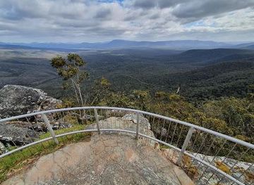
The sandstone escarpments and tilted ridgelines of Gariwerd are its defining natural landmarks, especially the rocky formations around the Pinnacle, Reed Lookout and The Balconies. Mackenzie Falls is a notable water landmark where seasonal flows descend through a steep forested setting, while Mount William marks the highest point of the range and provides broad views across western Victoria. The landscape’s cultural landmarks include Ngamadjidj Shelter and Gulgurn Manja Shelter, where Aboriginal rock art connects visitors with the long history of Djab Wurrung and Jardwadjali Country. Brambuk – The National Park and Cultural Centre is an important interpretive landmark in Halls Gap, linking the living culture of Traditional Owners with the park’s ecology. Together, these places show that Gariwerd’s significance lies in the relationship between geology, water, habitat, cultural inheritance and continuing custodianship.
-
National park
Grampians National Park
Explore the breathtaking beauty of Grampians National Park, where stunning landscapes meet rich cultural heritage in Victoria, Australia.
-
Tourist attraction
MacKenzie Falls
Explore the stunning MacKenzie Falls in the Grampians National Park, a breathtaking natural attraction perfect for adventure and tranquility.
-
Zoo
Halls Gap Zoo
Explore Halls Gap Zoo in Victoria, a captivating wildlife sanctuary nestled in the stunning Grampians, perfect for families and animal lovers.
-
Vista point
Boroka Lookout
Discover breathtaking vistas at Boroka Lookout, the perfect viewpoint in The Grampians National Park for nature lovers and adventure seekers.


Explore The Grampians on the map
Plan your trip on one map. See where the top attractions, landmarks, restaurants and hotels are, and book hotels and experiences in a few clicks.
Best hotels in The Grampians
Best restaurants in The Grampians
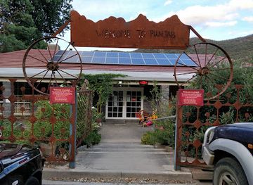
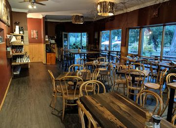
Dining in the Grampians is centred on Halls Gap, with additional cafés, pubs, bakeries and takeaway options in Stawell and Horsham outside the national park. The regional food character reflects western Victoria’s pastoral and agricultural setting, with Australian pub meals, locally sourced produce, baked goods, wine from the wider Grampians region and menus shaped by seasonal availability. Halls Gap is the practical place to arrange breakfast, provisions for a walk or an evening meal, although choice is more limited than in a large city and opening patterns can vary. Farm shops and cellar doors in the broader region may offer regional produce and wine, but they are dispersed and should not be confused with facilities inside the protected area. Visitors staying in cottages or self-catering accommodation often supplement local dining with provisions bought before entering the ranges.
-
Indian
Spirit of Punjab
Discover authentic Indian cuisine at Spirit of Punjab in Halls Gap—where exquisite flavors meet stunning natural beauty.
-
Cafe
Livefast Cafe
Discover Livefast Cafe: A charming spot in Halls Gap offering delicious breakfasts and expertly brewed coffee amidst stunning natural beauty.
-
Brewpub
Paper Scissors Rock Brew Co
Discover craft beer excellence at Paper Scissors Rock Brew Co in Halls Gap - where nature meets brewmaster artistry.
-
Pub
Halls Gap Hotel Restaurant
Experience delightful dining at Halls Gap Hotel Restaurant with local produce and stunning Grampians views.

Best bars in The Grampians
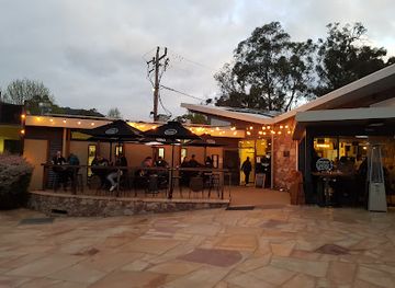
The Grampians do not have a conventional nightlife district or significant nightclub scene. Evening life is quiet and generally centred on the pubs, licensed restaurants and accommodation venues of Halls Gap, where visitors may enjoy a drink or meal after walking. Stawell and Horsham, outside the national park, offer a broader selection of pubs, clubs and community entertainment, but they are regional towns rather than late-night destinations. Evenings in Gariwerd are better suited to relaxed hospitality, dark-sky stargazing and listening to nocturnal wildlife than to organised nightlife. Visitors should check current venue arrangements locally, particularly outside peak periods, and should never drive after drinking on the rural roads surrounding the park.
-
Vista point
Boroka Lookout
Discover breathtaking views and hiking adventures at Boroka Lookout in the heart of Grampians National Park, a must-see for nature enthusiasts.
-
Indian
Spirit of Punjab
Experience authentic Indian cuisine in Halls Gap, where vibrant flavors and warm hospitality create a memorable dining adventure.
-
Vista point
Reeds Lookout
Experience the stunning vistas at Reeds Lookout, a must-visit destination in the Grampians National Park that showcases Victoria's natural beauty.
-
Cafe
Livefast Cafe
Discover the cozy charm of Livefast Cafe in Halls Gap, where delicious breakfasts and expertly brewed coffee await in a stunning natural setting.


Best nightclubs in The Grampians
The Grampians do not have a conventional nightlife district or significant nightclub scene. Evening life is quiet and generally centred on the pubs, licensed restaurants and accommodation venues of Halls Gap, where visitors may enjoy a drink or meal after walking. Stawell and Horsham, outside the national park, offer a broader selection of pubs, clubs and community entertainment, but they are regional towns rather than late-night destinations. Evenings in Gariwerd are better suited to relaxed hospitality, dark-sky stargazing and listening to nocturnal wildlife than to organised nightlife. Visitors should check current venue arrangements locally, particularly outside peak periods, and should never drive after drinking on the rural roads surrounding the park.
-
Indian
Spirit of Punjab
Discover the essence of Indian flavors at Spirit of Punjab, Halls Gap's premier destination for authentic Indian cuisine.
-
Brewpub
Paper Scissors Rock Brew Co
Experience the best of craft brewing in Victoria's Grampians at Paper Scissors Rock Brew Co, where nature meets flavor in every pint.
-
Pub
Halls Gap Hotel Restaurant
Experience the flavors of the Grampians at Halls Gap Hotel Restaurant, a vibrant pub and bistro with stunning views and live music.
-
Restaurant
Kookaburra Hotel
Discover the flavors of the Grampians at Kookaburra Hotel, an inviting restaurant and pub that combines local produce with stunning views.


Best shops in The Grampians
Shopping in the Grampians is modest and practical rather than extensive, with most opportunities concentrated in Halls Gap and the larger regional towns of Stawell and Horsham. Halls Gap shops supply groceries, walking essentials, souvenirs and locally themed gifts, while galleries and small businesses may present regional art, craft and produce. Visitors can also look for Grampians wines, honey, preserves and other agricultural products through businesses in the wider western Victorian region, including cellar doors and farm shops outside the national park. Stock up on food, fuel and specialist outdoor equipment in a larger town if a longer walk or remote itinerary is planned, because trailheads and lookouts do not form a retail network. Purchases connected with Aboriginal culture should be made through reputable sources that identify artists and permissions clearly.
-
Vista point
Boroka Lookout
Experience breathtaking views from Boroka Lookout, a stunning vista point in the heart of Grampians National Park, perfect for hiking and nature lovers.
-
Vista point
Reeds Lookout
Experience breathtaking views and serene hiking trails at Reeds Lookout, a premier vista point in the Grampians National Park, Victoria.
-
Cafe
Livefast Cafe
Discover Livefast Cafe in Halls Gap – where delightful breakfasts and exceptional coffee meet stunning views in the heart of the Grampians.
-
Vista point
The Balconies
Experience the breathtaking views and natural beauty of The Balconies in the Grampians National Park, a must-visit destination for all nature lovers.


Get your free copy of our complete guide to The Grampians, delivered straight to you.
Everything on this page, from attractions and restaurants to essentials and local phrases, in one PDF you can read offline, print or share.
Already have an account? Sign in
Your The Grampians guide is ready.
We'll send it to · Not you? Sign out

Getting your guide ready…
We are putting together a fresh copy of the The Grampians guide. This can take up to a minute.
This can take a few moments. If your browser asks, choose Allow so the download can start. You'll find the guide in your Downloads folder.
Nothing happened? Download it again
Sorry, the guide is taking longer than usual. Please try again in a minute, or get it by email instead.
The Grampians essentials
Currency and Payment
Safety
Emergency Situations
Do's and Don'ts
Local Tips
From Eve
Local phrases worth knowing
You don't need to get them perfect. A few words go a long way, and locals appreciate the effort.
Basics
| English | Local | Say it |
|---|---|---|
| Hello | G'day | ['g'day] |
| Goodbye | See ya | ['see ya] |
| Yes | Yeah | ['yeah] |
| No | Nah | ['nah] |
| Please/You're welcome | Please/No worries | [please/no 'worries] |
| Thank you | Cheers | ['cheers] |
| Excuse me/Sorry | Sorry | ['sorry] |
| How are you? | How ya goin'? | ['how ya 'goin] |
| Fine. And you? | Good. You? | ['good. 'you] |
| Do you speak English? | Ya speak English? | ['ya speak 'english] |
| I don't understand | I'm lost | ['i'm 'lost] |
Eating & Drinking
| English | Local | Say it |
|---|---|---|
| I'd like to see the menu, please | Menu, please | ['menu, 'please] |
| I don't eat meat | No meat | ['no 'meat] |
| Cheers! | Cheers! | ['cheers] |
| I would like to pay, please | Pay, please | ['pay, 'please] |
Emergencies
| English | Local | Say it |
|---|---|---|
| Help! | Help! | ['help] |
| Go away! | Bugger off! | ['bugger off] |
| Call the Police! | Police! | ['police] |
| Call a doctor! | Doc! | ['doc] |
| I'm lost | Lost | ['lost] |
| I'm ill | Sick | ['sick] |
Shopping
| English | Local | Say it |
|---|---|---|
| I'd like to buy... | I wanna buy... | ['i wanna 'buy] |
| I'm just looking | Just lookin' | ['just 'lookin] |
| How much is it? | How much? | ['how 'much] |
| That's too expensive | Too dear | ['too 'dear] |
| Can you lower the price? | Cheaper? | ['cheaper] |
Time & Numbers
| English | Local | Say it |
|---|---|---|
| What time is it? | What's the time? | ['what's the 'time] |
| It's one o'clock | It's one | ['it's 'one] |
| Half past (10) | Half ten | ['half 'ten] |
| Morning | Mornin' | ['mornin] |
| Afternoon | Arvo | ['arvo] |
| Evening | Evenin' | ['evenin] |
| Yesterday | Yest'day | ['yest'day] |
| Today | Today | ['today] |
| Tomorrow | Tomorrer | ['tomorrer] |
| 1 | One | ['one] |
| 2 | Two | ['two] |
| 3 | Three | ['three] |
| 4 | Four | ['four] |
| 5 | Five | ['five] |
| 6 | Six | ['six] |
| 7 | Seven | ['seven] |
| 8 | Eight | ['eight] |
| 9 | Nine | ['nine] |
| 10 | Ten | ['ten] |
Transport & Directions
| English | Local | Say it |
|---|---|---|
| Where's a/the...? | Where's the...? | ['where's the] |
| What's the address? | What's the addy? | ['what's the 'addy] |
| Can you show me (on the map)? | Show me | ['show me] |
| When's the next (bus)? | Next bus? | ['next 'bus] |
| A ticket (to ....) | Ticket | ['ticket] |
History of The Grampians
Sandstone Ranges and Ancient Landforms
The Grampians are formed mainly from quartz-rich sandstone that was deposited and later uplifted, tilted and eroded over geological time. Weathering has produced the park’s characteristic ridges, cliffs, tors and sheltered rock overhangs, while valleys and drainage lines have developed between the ranges. The landscape is part of the broader western Victorian highlands, but its sharply defined escarpments give Gariwerd a distinct identity. Geological processes continue to influence where water collects, where plants grow and how visitors experience the mountains, from broad forested slopes to narrow gorges and exposed lookouts.
Djab Wurrung and Jardwadjali Country
Gariwerd is Country of the Djab Wurrung and Jardwadjali peoples, whose connections with the ranges extend across thousands of years. Rock shelters and other cultural places record Aboriginal presence, knowledge and artistic traditions, while stories associated with the landscape remain important to Traditional Owners today. Sites including Ngamadjidj Shelter and Gulgurn Manja Shelter are protected cultural places rather than simply scenic attractions. Visitors are expected to follow access guidance, avoid touching rock art and understand that some locations may be closed or subject to changed arrangements for cultural and conservation reasons.
Pastoral Expansion and European Mapping
European pastoral expansion reached the western Victorian grasslands during the nineteenth century, bringing sheep stations and new patterns of land use around the ranges. Surveyors and explorers recorded the mountains using the name Grampians, which was adopted from the Grampian Mountains in Scotland. Pastoral settlement developed mainly on the surrounding plains and in nearby towns rather than within the more rugged parts of the ranges. The contrast between open agricultural country and the forested sandstone chain remains a defining feature of the regional approach to Gariwerd.
Tourism, Protection and National Park History
As roads and regional towns developed, the ranges became increasingly recognised for their scenery, waterfalls, wildflowers and walking opportunities. The area was progressively protected, and the Grampians National Park was established in 1984 through the consolidation of earlier reserves. Halls Gap grew as the principal tourism settlement, while facilities and interpretation developed around the park’s natural and cultural heritage. Brambuk – The National Park and Cultural Centre strengthened public understanding of Traditional Owner connections and the wider landscape, although visitors should recognise that cultural interpretation is part of a living heritage rather than only a historical record.
Fire, Conservation and Gariwerd Today
Bushfire has long been part of the ecology of western Victoria, shaping vegetation patterns and affecting communities, roads and visitor facilities. Modern park management balances fire planning, habitat protection, cultural heritage conservation and public access. The adoption of Gariwerd alongside Grampians reflects greater recognition of Traditional Owner identity and continuing cultural authority. Contemporary tourism is increasingly connected with longer-distance walking, responsible wildlife observation and cultural education, while track closures, restoration work and seasonal conditions remain a normal part of managing a large and fire-prone protected landscape.
The Grampians in Photos
Browse through our photo collection highlighting the charm and character of the destination.
Neighbouring destination travel guides
The closest destinations to The Grampians, if you have time for more than one.
-

-

-

-

-


Swipe for more destinations
Explore more

Explore more of Grampians
Discover the Grampians: Australia’s natural wonder featuring stunning landscapes, rich Aboriginal history, and diverse wildlife, perfect for adventurers and nature lovers.
Explore Grampians
Explore more of Australia
Discover the diverse landscapes, vibrant cities, and unique wildlife of Australia, a captivating destination offering endless adventures and unforgettable experiences.
Explore Australia