

Grossglockner Travel Guide - Free Web & App
Your ultimate guide to Grossglockner. Discover top landmarks, proposed trips, and local tips. Free on the web or via the Evendo companion app.


Grossglockner, Austria’s highest mountain, offers glacier views, alpine roads, Hohe Tauern walks and dramatic scenery between Salzburg and Carinthia.
Mountain and Glacier
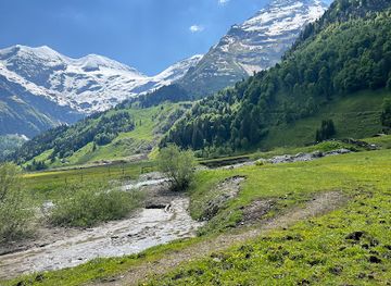
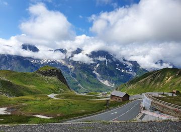
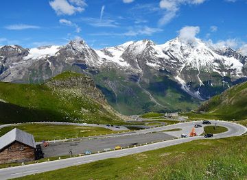
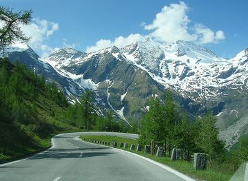
Grossglockner is Austria’s highest mountain, rising to 3,798 metres in the Hohe Tauern range on the border between Salzburg and Carinthia. The name is commonly used for the mountain itself, the surrounding high-alpine landscape and the celebrated Grossglockner High Alpine Road, which crosses the central Hohe Tauern between the northern gateway near Bruck an der Grossglocknerstrasse and the southern side at Heiligenblut. Its defining scenery includes the sharp summit of the Grossglockner, the Kleinglockner, high mountain passes, glaciated valleys and the Pasterze, Austria’s largest glacier, viewed from the Kaiser-Franz-Josefs-Höhe.Read more about Grossglockner
Exploring the High Alps
When is the best time to visit Grossglockner?
Best: June–August · 17–20°C| Month | High (°C) | Rainfall (mm) |
|---|---|---|
| January | 0 | 37 |
| February | 1 | 29 |
| March | 3 | 25 |
| April | 7 | 22 |
| May | 12 | 15 |
| June (best) | 17 | 8 |
| July (best) | 20 | 2 |
| August (best) | 19 | 0 |
| September | 15 | 0 |
| October | 8 | 0 |
| November | 3 | 0 |
| December | 1 | 0 |
Getting to and around Grossglockner
How to get there
Transportation
Best attractions in Grossglockner
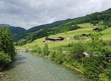
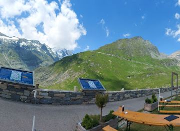
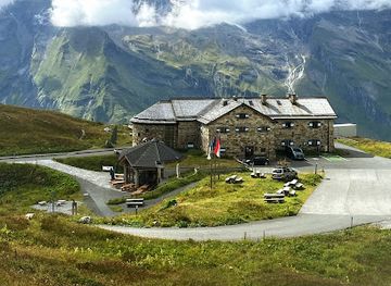
The Grossglockner High Alpine Road is the destination’s principal visitor attraction, crossing the Hohe Tauern between the Salzburg and Carinthian valleys through a sequence of high passes, hairpin bends and viewpoints. At Kaiser-Franz-Josefs-Höhe, visitors look across the valley towards the Grossglockner and the Pasterze glacier, with interpretation facilities explaining the mountain environment and glacial change. Hochtor, the road’s high crossing, links the modern route with older transalpine travel and offers access to the surrounding alpine scenery. The road’s side viewpoints reveal contrasting landscapes, from wooded lower slopes and flower-rich meadows to bare rock, snowfields and ice. Around Heiligenblut, the upper Möll valley provides a southern perspective on the massif, while the northern approach through Fusch and the Fuscher Törl presents broad views across the Salzburg Alps. Walking, wildlife observation and photography are possible at designated areas, but summit routes and glacier excursions belong to experienced mountaineers rather than casual sightseeing.
-
Tourist attraction
Wild & Adventure Park Ferleiten
Experience the thrill of nature at Wild & Adventure Park Ferleiten, where fun and wildlife come together in the heart of the Austrian Alps.
-
Tourist attraction
Jungfernsprung
Discover the breathtaking landscapes and exhilarating hiking experiences at Jungfernsprung in Heiligenblut am Großglockner, a must-visit natural attraction.
-
Tourist attraction
Glocknerhaus Kärnten
Experience the breathtaking beauty of the Austrian Alps at Glocknerhaus Kärnten, the ultimate mountain cabin destination for nature lovers and adventurers.
-
Museum
Haus Alpine Naturschau
Explore the captivating world of the Alpine ecosystem at Haus Alpine Naturschau, a unique museum experience in Fusch, Austria.
Best landmarks in Grossglockner
The Grossglockner is Austria’s highest mountain and the defining natural landmark of the Hohe Tauern, with its summit rising above the surrounding glaciers and ridges. The Kleinglockner forms part of the characteristic summit silhouette, while the Pasterze spreads below the massif in the upper Möll valley and is best viewed from Kaiser-Franz-Josefs-Höhe. Hochtor is both a physical landmark and a historic Alpine crossing, linking the modern High Alpine Road with earlier routes through the mountains. The road itself is a notable piece of twentieth-century engineering, marked by high passes, tunnels, galleries and engineered bends. Heiligenblut’s parish church, visible below the southern approach, is an important architectural landmark of the region, while the protected landscapes of the Hohe Tauern National Park give the mountain, glacier, forests and alpine meadows their wider ecological significance.
-
Tourist attraction
Großglockner Hochalpenstraße
Experience the breathtaking beauty of the Großglockner Hochalpenstraße, Austria's premier alpine road offering stunning views and outdoor adventures.
-
Animal park
Wild & Adventure Park Ferleiten
Experience the thrill of wildlife and adventure at Wild & Adventure Park Ferleiten, a perfect family getaway in the heart of the Austrian Alps.
-
Mountain pass
Grossglockner High Alpine Road
Experience the breathtaking beauty of the Grossglockner High Alpine Road, a stunning mountain pass in Austria that showcases nature's most awe-inspiring landscapes.
-
Tourist attraction
Jungfernsprung
Discover the breathtaking beauty of Jungfernsprung in Hohe Tauern National Park, a must-visit hiking area in the heart of the Austrian Alps.
Explore Grossglockner on the map
Plan your trip on one map. See where the top attractions, landmarks, restaurants and hotels are, and book hotels and experiences in a few clicks.
Best hotels in Grossglockner
Best restaurants in Grossglockner
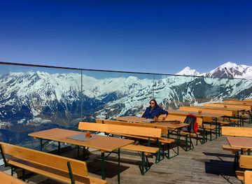
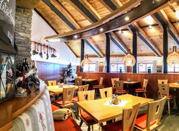
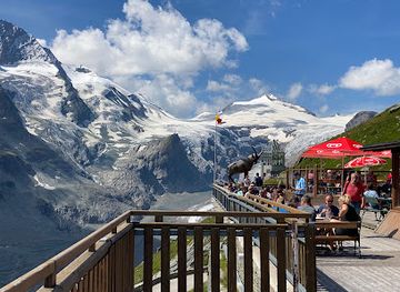
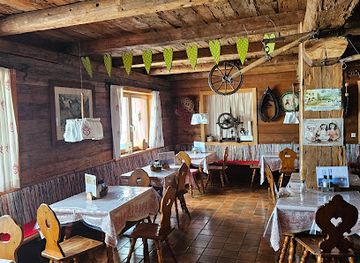
Dining around Grossglockner is concentrated in the valley settlements and seasonal facilities associated with the High Alpine Road rather than in a permanent mountain town. Inns, cafés and hotels in Fusch, Bruck, Zell am See and Heiligenblut provide the broadest choice, while refreshment stops along the road serve visitors during the operating season. Regional food reflects both Salzburg and Carinthian traditions, with dishes such as dumplings, soups, farmhouse bread, alpine cheese, cured meats and sweet pastries suited to the mountain climate. Menus may also feature locally sourced dairy products and seasonal ingredients, although availability varies by establishment. Traditional alpine huts and mountain restaurants, where operating, are valued for simple meals and warm drinks rather than elaborate dining. Travellers making a full road crossing should plan meals around the seasonal nature of high-altitude facilities and carry provisions if travelling outside the main settlements.
-
Restaurant
Adler Lounge
Experience exquisite dining at Adler Lounge in Kals am Großglockner, where local flavors meet modern cuisine amidst stunning alpine views.
-
Austrian
Bergrestaurant Gletschermühle
Experience authentic Austrian cuisine with breathtaking mountain views at Bergrestaurant Gletschermühle in Kitzsteinhorn.
-
Restaurant
Panoramarestaurant Kaiser Franz-Josefs-Höhe und Kaiser Franz-Josef-Haus
Experience exquisite regional cuisine with unparalleled views at Panoramarestaurant Kaiser Franz-Josefs-Höhe in Austria's stunning alpine landscape.
-
Restaurant
Restaurant Fuschertörl
Experience authentic Austrian cuisine with stunning alpine views at Restaurant Fuschertörl on your journey through the Grossglockner region.
Best bars in Grossglockner
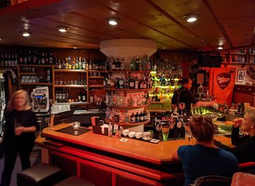
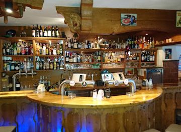
Grossglockner itself has no nightlife district and very limited evening entertainment once the High Alpine Road facilities close for the day. The typical evening atmosphere is quiet, with drinks and conversation available in traditional inns, hotel bars and village pubs in Fusch, Bruck, Heiligenblut and other valley settlements. Zell am See, outside the immediate mountain area, offers the region’s broader selection of bars and later evening venues, particularly for visitors staying around the lake and town centre. In the villages closest to Grossglockner, evening life is more closely connected with alpine hospitality, local events and seasonal traditions than with nightclubs. Visitors should expect opening patterns and entertainment to vary according to the season, weather and the small scale of the mountain communities.
-
Bar
GINHOUSE | Pub | Zell am See
Discover GINHOUSE, the lively pub in Zell am See, offering a unique blend of local brews, vibrant atmosphere, and unforgettable nightlife.
-
Bar
Café Bar Laterndl
Experience the warm ambiance and delightful beverages at Café Bar Laterndl, the perfect spot to unwind in Hof, Austria.
-
Bar
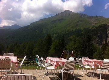
Figolalm auf 1777m
Experience the beauty and flavors of the Austrian Alps at Figolalm, a scenic bar and restaurant at 1777m, perfect for relaxation and dining.
-
Bar
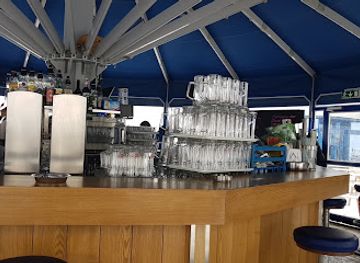
Parasol Apres Sky
Enjoy the perfect blend of stunning views and vibrant atmosphere at Parasol Apres Sky in Kaprun, Austria's premier après-ski bar.
Best nightclubs in Grossglockner
Grossglockner itself has no nightlife district and very limited evening entertainment once the High Alpine Road facilities close for the day. The typical evening atmosphere is quiet, with drinks and conversation available in traditional inns, hotel bars and village pubs in Fusch, Bruck, Heiligenblut and other valley settlements. Zell am See, outside the immediate mountain area, offers the region’s broader selection of bars and later evening venues, particularly for visitors staying around the lake and town centre. In the villages closest to Grossglockner, evening life is more closely connected with alpine hospitality, local events and seasonal traditions than with nightclubs. Visitors should expect opening patterns and entertainment to vary according to the season, weather and the small scale of the mountain communities.
-
Disco club
Pinzgauer Diele - Pizzeria - Disco - Apres Ski
Experience the vibrant atmosphere of Pinzgauer Diele, where delicious pizzas meet electrifying nightlife in Zell am See.
-
Disco club
King's Bar apres-ski Königsleiten
Discover the lively atmosphere of King's Bar Apres-Ski in Königsleiten, where unforgettable nights meet thrilling ski adventures in the heart of the Alps.
-
Disco club
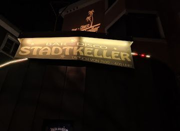
Stadtkeller Lienz
Experience the vibrant nightlife of Lienz at Stadtkeller, where music and dance come alive in a stunning disco atmosphere.
-
Bar
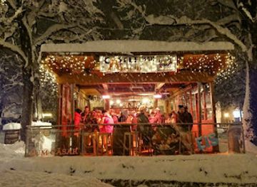
CastleBar
Experience the vibrant atmosphere of CastleBar in Zell am See, where delicious food meets stunning views in an unforgettable setting.
Best shops in Grossglockner
Shopping in the Grossglockner area is practical and locally focused rather than extensive. Visitors can find regional food, alpine cheese, bread, smoked products, confectionery and farm-made goods in village shops, farm outlets and specialist food businesses around Heiligenblut, Fusch, Bruck and Zell am See. These settlements also provide outdoor equipment, walking supplies and everyday provisions, which are more useful for a mountain journey than souvenir retail at high altitude. Crafts, woodwork, textiles and locally themed products appear in independent shops and seasonal visitor outlets, although the range varies between villages and tourist seasons. Facilities along the High Alpine Road are primarily oriented towards interpretation, refreshments and the needs of passing visitors, not full-scale shopping. Buying regional produce in an established shop or farm business offers a direct connection with the agricultural traditions of the valleys surrounding Grossglockner.
-
Sporting goods store
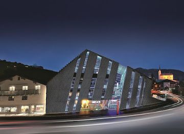
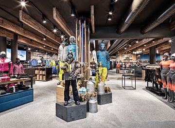
Bründl Sports Flagshipstore
Explore the Bründl Sports Flagshipstore in Kaprun for the best outdoor gear and expert advice for your alpine adventures.
-
Gift shop
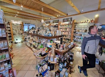
Teekorb & Tridor Zell am See specialty coffee roastery coffeeshop regionale Kaffeerösterei Cafe Kaffee tea
Discover the exquisite flavors of regional coffees and teas at Teekorb & Tridor in Zell am See, a specialty coffee roastery and café.
-
Supermarket
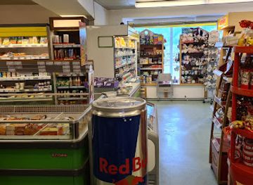
ADEG Ernst Pichler
Explore Hof's local flavors at ADEG Ernst Pichler, your one-stop supermarket for fresh produce and regional delicacies.
-
Ski rental service
Intersport Kitzsteinhorn Oberschneider
Discover the best ski rental services at Intersport Kitzsteinhorn Oberschneider, your ultimate winter sports destination in the heart of the Alps.
Get your free copy of our complete guide to Grossglockner, delivered straight to you.
Everything on this page, from attractions and restaurants to essentials and local phrases, in one PDF you can read offline, print or share.
Already have an account? Sign in
Your Grossglockner guide is ready.
We'll send it to · Not you? Sign out

Getting your guide ready…
We are putting together a fresh copy of the Grossglockner guide. This can take up to a minute.
This can take a few moments. If your browser asks, choose Allow so the download can start. You'll find the guide in your Downloads folder.
Nothing happened? Download it again
Sorry, the guide is taking longer than usual. Please try again in a minute, or get it by email instead.
Grossglockner essentials
Currency and Payment
Safety
Emergency Situations
Do's and Don'ts
Local Tips
From Eve
Local phrases worth knowing
You don't need to get them perfect. A few words go a long way, and locals appreciate the effort.
Basics
| English | Local | Say it |
|---|---|---|
| Hello | Griaß di | [Gree-ahss dee] |
| Goodbye | Servus | [Ser-voos] |
| Yes | Ja | [Yah] |
| No | Nein | [Nine] |
| Please/You're welcome | Bitte | [Bit-teh] |
| Thank you | Danke | [Dahn-keh] |
| Excuse me/Sorry | Entschuldigung | [Ent-shool-dee-gung] |
| How are you? | Wie geht es Ihnen? | [Vee gayt es een-en] |
| Fine. And you? | Gut. Und dir? | [Goot. Oond deer] |
| Do you speak English? | Sprechen Sie Englisch? | [Spreck-en zee Eng-leesh] |
| I don't understand | Ich verstehe nicht | [Ick fer-shtay-eh nikt] |
Eating & Drinking
| English | Local | Say it |
|---|---|---|
| I'd like to see the menu, please | Ich würde gerne die Speisekarte sehen, bitte | [Ick vur-deh geh-ren-eh dee Shpy-ze-car-teh zeh-en, bit-teh] |
| I don't eat meat | Ich esse kein Fleisch | [Ick ess-eh kine Fly-sh] |
| Cheers! | Prost! | [Prohst] |
| I would like to pay, please | Ich möchte bitte bezahlen | [Ick mehr-teh bit-teh beh-tzah-len] |
Emergencies
| English | Local | Say it |
|---|---|---|
| Help! | Hilfe! | [Hil-feh] |
| Go away! | Geh weg! | [Geh vehg] |
| Call the Police! | Rufen Sie die Polizei! | [Roo-fen zee dee Po-lee-tsey] |
| Call a doctor! | Rufen Sie einen Arzt! | [Roo-fen zee igh-nen Ahrts] |
| I'm lost | Ich habe mich verirrt | [Ick hah-beh meech fer-eert] |
| I'm ill | Ich bin krank | [Ick been krank] |
Shopping
| English | Local | Say it |
|---|---|---|
| I'd like to buy... | Ich möchte ... kaufen | [Ick mehr-teh ... cow-fen] |
| I'm just looking | Ich schaue nur | [Ick shou-eh noor] |
| How much is it? | Wie viel kostet es? | [Vee feel koss-teht es] |
| That's too expensive | Das ist zu teuer | [Dahs ist tsoo toy-er] |
| Can you lower the price? | Können Sie den Preis senken? | [Kern-en zee den prees zeng-ken] |
Time & Numbers
| English | Local | Say it |
|---|---|---|
| What time is it? | Wie spät ist es? | [Vee shpayt ist es] |
| It's one o'clock | Es ist ein Uhr | [Es ist ighn oor] |
| Half past (10) | Halb zehn | [Halb tsain] |
| Morning | Morgen | [Mor-gen] |
| Afternoon | Nachmittag | [Nahch-mit-tahg] |
| Evening | Abend | [Ah-bend] |
| Yesterday | Gestern | [Gehs-tern] |
| Today | Heute | [Hoy-teh] |
| Tomorrow | Morgen | [Mor-gen] |
| 1 | Eins | [I-ns] |
| 2 | Zwei | [Tsvi] |
| 3 | Drei | [Dry] |
| 4 | Vier | [Fier] |
| 5 | Fünf | [Foonf] |
| 6 | Sechs | [Zeks] |
| 7 | Sieben | [Zee-ben] |
| 8 | Acht | [Acht] |
| 9 | Neun | [Noy-n] |
| 10 | Zehn | [Tsayn] |
Transport & Directions
| English | Local | Say it |
|---|---|---|
| Where's a/the...? | Wo ist ein/der...? | [Voh ist iyn/dehr] |
| What's the address? | Was ist die Adresse? | [Vahs ist dee Ah-dreh-seh] |
| Can you show me (on the map)? | Können Sie mir zeigen (auf der Karte)? | [Kern-en zee meer tsy-gen (ouf dehr Kar-teh)] |
| When's the next (bus)? | Wann kommt der nächste (Bus)? | [Vahn kommt dehr naych-steh (Boos)] |
| A ticket (to ....) | Eine Fahrkarte (nach ....) | [Iy-neh Fahr-kar-teh (nahch)] |
History of Grossglockner
An Alpine Landscape Shaped by Ice
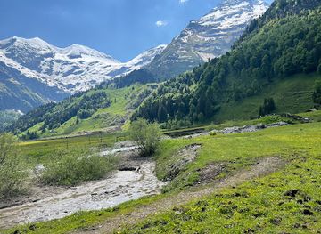
Grossglockner’s setting was formed by the long geological development of the Eastern Alps and subsequently remodelled by glacial erosion. The mountain rises within the Hohe Tauern, where valleys, ridges and cirques reflect the action of ice and water over immense timescales. The Pasterze occupies the upper Möll valley beneath the Grossglockner massif and remains one of the clearest visible expressions of the region’s glacial character. Its changing extent also demonstrates the continuing effects of a warming climate on alpine ice.
Early Alpine Passage and Settlement
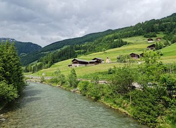
The valleys around Grossglockner were settled and used long before the area became a scenic destination. Climbers, traders, miners, farmers and seasonal herders all depended on routes through the Hohe Tauern, while the mountain passes connected communities on the northern and southern sides of the range. Hochtor, on the historic crossing beneath the present road, preserves evidence of the importance of transalpine movement. Alpine farming, cattle pasture and the management of meadows helped create the cultural landscape still visible below the high ridges.
The First Ascent and Mountaineering Era
The first recorded ascent of Grossglockner took place in 1800 during an expedition organised by the Bishopric of Gurk under the leadership of Franz Xaver von Salm-Reifferscheidt. The expedition marked an important moment in the development of organised Alpine exploration and established the mountain as a major objective for climbers. Later mountaineering concentrated on the summit ridge, glaciers and adjoining peaks, making the Grossglockner massif part of the wider history of Alpine guiding and scientific observation.
The High Alpine Road
The Grossglockner High Alpine Road was built in the 1930s as a major engineering and tourism project linking the Salzburg and Carinthian sides of the Hohe Tauern. Its route follows historic approaches across the high pass near Hochtor while providing access to viewpoints over the Pasterze and the central mountain group. The road transformed the area from a destination primarily reached by climbers and walkers into one accessible to visitors travelling through the Alps by car, coach and motorcycle.
National Park and Modern Conservation
Grossglockner lies within the Hohe Tauern National Park, established in stages from the 1980s onwards across parts of Salzburg, Tyrol and Carinthia. The protected landscape brings together glaciers, alpine grassland, forests, rivers and high peaks, while conservation management seeks to balance ecological protection with farming, mountaineering, walking and carefully managed tourism. Today the road, viewpoints and educational facilities provide access to a powerful mountain environment, but retreating glaciers and changing snow conditions have made climate change an increasingly visible part of the region’s story.
Grossglockner in Photos
Browse through our photo collection highlighting the charm and character of the destination.
Cities in Grossglockner
The towns and cities of Grossglockner, and the easiest places to base yourself.
-

-

-


Swipe for more cities
Neighbouring destination travel guides
The closest destinations to Grossglockner, if you have time for more than one.
-

-

-

-

-


Swipe for more destinations
Explore more
Explore more of Hohe Tauern
Explore Austria's Hohe Tauern National Park, a paradise of towering peaks, diverse wildlife, and rich cultural heritage, perfect for adventurers and nature lovers.
Explore Hohe Tauern
Explore more of Austria
Discover Austria's blend of alpine landscapes, rich cultural heritage, and culinary delights, from Vienna's historic charm to Tyrol's dramatic beauty.
Explore Austria