

Santa Barbara Waterfront (Santa Barbara) Travel Guide - Free
Explore Santa Barbara Waterfront in Santa Barbara with Evendo's free guide. Find the best shops, historic streets, restaurants, and gems on web or mobile.


Santa Barbara Waterfront blends Stearns Wharf, harbour walks, beaches, seafood, surf and Channel Islands views near downtown Santa Barbara, California.
Between Downtown and the Pacific
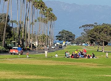
Santa Barbara Waterfront follows the shoreline south of the city centre, combining the working Santa Barbara Harbor, the long curve of West Beach and East Beach, Stearns Wharf, and Cabrillo Boulevard's palm-lined coastal route. The district is more open and recreational than the compact streets inland, with sailboats, fishing vessels, cyclists, volleyball courts and broad ocean views shaping its daily rhythm. On clear days, the Channel Islands form a distant silhouette beyond the water.Read more about Santa Barbara Waterfront
A Coast Shaped by Work and Leisure
Beach Walks and Harbour Life
Best attractions in Santa Barbara Waterfront
Stearns Wharf is Santa Barbara Waterfront's most recognisable attraction, extending into the Pacific with views back towards the mountains, beaches and city skyline. Its deck combines ocean outlooks with small visitor facilities, fishing activity and access to the Santa Barbara Museum of Natural History Sea Center, where marine life from the Santa Barbara Channel is interpreted. Nearby Santa Barbara Harbor has a working maritime atmosphere, boat-watching opportunities and the Santa Barbara Maritime Museum, which explores local fishing, surfing, diving and seafaring. West Beach and East Beach provide broad stretches of sand, while Shoreline Drive and Cabrillo Boulevard offer easy promenades and cycle routes. The waterfront also serves as a gateway to harbour-based excursions and coastal recreation, with the Channel Islands visible offshore in clear conditions.
-
Park
Shoreline Park
Explore the breathtaking landscapes and recreational offerings of Shoreline Park, a coastal gem in Santa Barbara, California.
12 min walk · 0.9 km from neighbourhood centre
Explore Santa Barbara Waterfront on the map
A handpicked selection of must-see spots in Santa Barbara Waterfront, mapped for you.
Best hotels in Santa Barbara Waterfront
Santa Barbara Waterfront essentials
Getting There
Getting Around
Safety
Emergency Situations
Do's and Don'ts
Local Tips

From Eve
Local phrases worth knowing
You don't need to get them perfect. A few words go a long way, and locals appreciate the effort.
Basics
| English | Local | Say it |
|---|---|---|
| Hello | Hola | [oh-lah] |
| Goodbye | Adiós | [ah-dee-ohs] |
| Yes | Sí | [see] |
| No | No | [no] |
| Please/You're welcome | Por favor/De nada | [por fah-vor/de nah-dah] |
| Thank you | Gracias | [grah-see-ahs] |
| Excuse me/Sorry | Perdón/Lo siento | [pair-dohn/loh see-en-toh] |
| How are you? | ¿Cómo estás? | [koh-moh ehs-tahs] |
| Fine. And you? | Bien. ¿Y tú? | [bee-ehn. ee too] |
| Do you speak English? | ¿Hablas inglés? | [ah-blahs een-glays] |
| I don't understand | No entiendo | [noh ehn-tee-ehn-doh] |
Eating & Drinking
| English | Local | Say it |
|---|---|---|
| I'd like to see the menu, please | Me gustaría ver el menú, por favor | [may goos-tah-ree-ah vehr ehl meh-noo, por fah-vor] |
| I don't eat meat | No como carne | [noh koh-moh kahr-neh] |
| Cheers! | ¡Salud! | [sah-lood] |
| I would like to pay, please | Me gustaría pagar, por favor | [may goos-tah-ree-ah pah-gar, por fah-vor] |
Emergencies
| English | Local | Say it |
|---|---|---|
| Help! | ¡Ayuda! | [ah-yoo-dah] |
| Go away! | ¡Vete! | [veh-teh] |
| Call the Police! | ¡Llama a la Policía! | [yah-mah ah lah poh-lee-see-ah] |
| Call a doctor! | ¡Llama a un médico! | [yah-mah ah oon meh-dee-koh] |
| I'm lost | Estoy perdido | [ehs-toy pair-dee-doh] |
| I'm ill | Estoy enfermo | [ehs-toy ehn-fehr-moh] |
Shopping
| English | Local | Say it |
|---|---|---|
| I'd like to buy... | Me gustaría comprar... | [may goos-tah-ree-ah kohm-prar] |
| I'm just looking | Solo estoy mirando | [soh-loh ehs-toy mee-rahn-doh] |
| How much is it? | ¿Cuánto cuesta? | [kwan-toh kwehs-tah] |
| That's too expensive | Eso es demasiado caro | [eh-soh ehs deh-mah-see-ah-doh kah-roh] |
| Can you lower the price? | ¿Puedes bajar el precio? | [pweh-dehs bah-har ehl preh-see-oh] |
Time & Numbers
| English | Local | Say it |
|---|---|---|
| What time is it? | ¿Qué hora es? | [keh oh-rah ehs] |
| It's one o'clock | Es la una | [ehs lah oo-nah] |
| Half past (10) | Media hora (10) | [meh-dee-ah oh-rah (deez)] |
| Morning | Mañana | [mah-nyah-nah] |
| Afternoon | Tarde | [tahr-deh] |
| Evening | Noche | [noh-cheh] |
| Yesterday | Ayer | [ah-yehr] |
| Today | Hoy | [oy] |
| Tomorrow | Mañana | [mah-nyah-nah] |
| 1 | Uno | [oo-noh] |
| 2 | Dos | [dohs] |
| 3 | Tres | [trehs] |
| 4 | Cuatro | [kwah-troh] |
| 5 | Cinco | [seen-koh] |
| 6 | Seis | [says] |
| 7 | Siete | [syeh-teh] |
| 8 | Ocho | [oh-choh] |
| 9 | Nueve | [nweh-veh] |
| 10 | Diez | [dyehs] |
Transport & Directions
| English | Local | Say it |
|---|---|---|
| Where's a/the...? | ¿Dónde está...? | [dohn-deh ehs-tah] |
| What's the address? | ¿Cuál es la dirección? | [kwal ehs lah dee-rehk-syon] |
| Can you show me (on the map)? | ¿Puedes mostrarme (en el mapa)? | [pweh-dehs mohs-trar-meh (ehn ehl mah-pah)] |
| When's the next (bus)? | ¿Cuándo es el próximo (autobús)? | [kwan-doh ehs ehl proh-ksee-moh (ow-toh-boos)] |
| A ticket (to ....) | Un boleto (a ...) | [oon boh-leh-toh (ah)] |
History of Santa Barbara Waterfront
Chumash Shores and Spanish Settlement
Long before the modern waterfront existed, the coast around Santa Barbara formed part of the homeland of the Chumash people, whose communities used the nearby shoreline and offshore waters for fishing, gathering and travel. Spanish settlement altered the area after the establishment of Mission Santa Barbara in 1786 and the Presidio of Santa Barbara in 1782, both inland from the immediate beach. The waterfront remained shaped by the meeting of land and sea rather than by a dense urban street plan, with Indigenous coastal knowledge continuing as an important context for understanding the region's maritime history.
Stearns Wharf and Coastal Commerce
The construction of Stearns Wharf in 1872 gave Santa Barbara a substantial structure for shipping and helped connect the coastal town with wider commercial networks. Lumber, agricultural goods and other cargo moved through the wharf, while fishing and maritime trades developed along the shore. The pier also became a public promenade and a recognisable civic landmark. Its later history included damage from storms and changing patterns of coastal commerce, but its continued survival reflects the importance of the waterfront both as working infrastructure and as a public face of Santa Barbara.
Railways, Roads and the Resort Coast
The arrival of rail connections in the late nineteenth century made Santa Barbara more accessible to visitors and strengthened the relationship between the town, its beaches and its wharf. As leisure travel expanded, the shoreline acquired bathing facilities, hotels, promenades and recreational spaces alongside maritime businesses. Cabrillo Boulevard and the waterfront parks gradually organised movement along the coast, while West Beach became particularly closely associated with access to downtown, the wharf and harbour. The result was a mixed waterfront rather than a purely industrial port.
A Maritime and Recreational Waterfront
During the twentieth century, Santa Barbara's waterfront continued to combine commercial fishing, boating and marine services with swimming, surfing, cycling and seaside recreation. The modern harbour consolidated many working-waterfront functions, while museums and public improvements gave the district a stronger interpretive and visitor role. The Santa Barbara Maritime Museum reflects this maritime identity, and the preserved wharf remains a link to the nineteenth-century port. Today, the shoreline's character depends on managing those overlapping uses: a living harbour, heavily used beaches, public access routes and a tourism economy exposed to storms and coastal change.
Santa Barbara Waterfront in Photos
Browse through our photo collection highlighting the charm and character of the destination.
Neighbourhoods near Santa Barbara Waterfront
The closest neighbourhoods to Santa Barbara Waterfront, if you have time for more than one stop.
-

-

-


Swipe for more neighbourhoods
Explore more
Explore more of Santa Barbara
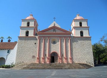
Santa Barbara blends Spanish Colonial architecture, Pacific beaches, Chumash heritage, wine-country flavours and refined California culture for sightseeing.
Explore Santa Barbara