

Free Santa Clarita Travel Guide & Mobile App
Plan your Santa Clarita trip with Evendo. Get free guides to top attractions, restaurants, hotels, and bars. Web access or download the mobile app.


Santa Clarita combines California film history, family attractions, canyon trails, western heritage and outdoor adventures near Los Angeles for curious travellers.
Valleys, Canyons and City Districts
Santa Clarita lies in the Santa Clarita Valley, north-west of Los Angeles, where the Santa Clara River passes between chaparral-covered hills and broad suburban neighbourhoods. Incorporated in 1987, the city brought together the historic communities of Newhall, Saugus, Valencia and Canyon Country, each retaining a distinct character. Valencia is known for its master-planned streets, landscaped paseos and shopping, while Newhall has a more layered western and cinematic identity. Saugus and Canyon Country provide access to open landscapes, trailheads and the dry hills that define the region.Read more about Santa Clarita
Western Heritage and Screen Landscapes
Outdoor Space and Family Attractions
When is the best time to visit Santa Clarita?
Best: May–June, October · 25–29°C| Month | High (°C) | Rainfall (mm) |
|---|---|---|
| January | 17 | 76 |
| February | 18 | 76 |
| March | 21 | 76 |
| April | 23 | 51 |
| May (best) | 26 | 25 |
| June (best) | 29 | 3 |
| July | 33 | 3 |
| August | 33 | 3 |
| September | 31 | 8 |
| October (best) | 25 | 25 |
| November | 20 | 51 |
| December | 17 | 76 |
Getting to and around Santa Clarita
How to get there
Transportation
Best attractions in Santa Clarita
Santa Clarita's attractions range from major family entertainment to heritage sites and open landscapes. Six Flags Magic Mountain in Valencia is the city's largest visitor draw, with a theme-park setting devoted to rides and entertainment. Old Town Newhall provides a cultural focus through public art, museums, community events and the area's western associations. At William S. Hart Park, the former home of silent-film star William S. Hart is presented alongside the surrounding parkland and a small animal area. Heritage Junction Historic Park gathers historic buildings rescued from across the valley, offering a more intimate view of earlier settlement. Placerita Canyon State Historic Park, on the city's eastern side, combines oak woodland, interpretive displays and walking trails, while Santa Clarita's extensive paths and municipal parks reveal the everyday landscape of the valley. Film enthusiasts will also recognise the surrounding hills and ranch country as long-used production settings.
-
Tourist attraction
Six Flags Magic Mountain
Experience the thrill of a lifetime at Six Flags Magic Mountain, California's premier theme park featuring thrilling rides, entertainment, and family fun.
28 min drive · 9.4 km from city centre
-
Tourist attraction
Six Flags Magic Mountain
Experience the thrill of a lifetime at Six Flags Magic Mountain in Valencia, California, the ultimate destination for amusement park enthusiasts and families.
28 min drive · 9.4 km from city centre
-
Tourist attraction
Six Flags Hurricane Harbor Los Angeles
Experience thrilling water slides, relaxing lazy rivers, and family-friendly fun at Los Angeles' ultimate water park destination.
28 min drive · 9.3 km from city centre
-
Tourist attraction
Placerita Canyon Nature Center
Explore the stunning landscapes and educational wonders of Placerita Canyon Nature Center, a top nature preserve in Newhall, California.
14 min drive · 4.7 km from city centre


Best landmarks in Santa Clarita
Santa Clarita's most meaningful landmarks express its connections with Indigenous history, ranching, railways, oil and film. William S. Hart's former residence at William S. Hart Park is the most distinctive surviving reminder of Newhall's silent-film era and western mythology. Heritage Junction Historic Park preserves a small collection of relocated historic buildings, including structures associated with the valley's settled communities and railway period. The Saugus Train Station, also preserved within Heritage Junction, recalls the Southern Pacific line that helped connect the valley with the wider region. In Newhall, the Melody Ranch Motion Picture Studio area represents the continuing relationship between local landscapes and film production, while the St Francis Dam disaster site in nearby San Francisquito Canyon is a solemn regional landmark linked to the 1928 catastrophe. Their significance lies less in monumental scale than in the stories they preserve.
-
Theme park
Six Flags Magic Mountain
Experience the ultimate thrill at Six Flags Magic Mountain in Valencia, CA, home to a record-breaking collection of world-class roller coasters and over 100 rides, games, and attractions for the entire family.
28 min drive · 9.4 km from city centre
-
Shopping mall
Valencia Town Center
Experience Valencia Town Center: A premier shopping, dining, and entertainment destination in Santa Clarita, offering a vibrant mix of retailers and community events for the whole family.
17 min drive · 5.8 km from city centre
-
Water park
Six Flags Hurricane Harbor Los Angeles
Experience thrilling water slides and a tropical paradise at Six Flags Hurricane Harbor Los Angeles, the ultimate water park destination for families and thrill-seekers in Southern California.
28 min drive · 9.3 km from city centre
-
Nature preserve
Placerita Canyon Nature Center
Discover California's gold rush history and natural beauty at Placerita Canyon Nature Center, offering hiking trails, educational programs, and a serene escape near Santa Clarita.
14 min drive · 4.7 km from city centre


Explore Santa Clarita on the map
Plan your Santa Clarita trip on one map. See where the top attractions, landmarks, restaurants, bars and hotels are, find what's near where you're staying, and book hotels and experiences in a few clicks.
Neighbourhoods in Santa Clarita

Swipe for more neighbourhoods
Best hotels in Santa Clarita
Best restaurants in Santa Clarita
Santa Clarita's dining scene reflects the varied population of suburban Los Angeles County rather than a single historic cuisine. Mexican food is especially prominent, from tacos, burritos and regional specialities to family-run restaurants and casual taquerias, while Asian, Mediterranean, Middle Eastern and American options are well represented around Valencia, Newhall and the larger shopping centres. Old Town Newhall combines eateries with an entertainment district atmosphere, and Valencia's commercial areas provide cafés, bakeries, polished restaurants and informal dining. Farmers' markets and seasonal community events may offer Californian produce, prepared foods and small-scale vendors, although stalls vary by day and location. The area's history also remains visible in western-themed dining rooms and longstanding local establishments, while newer restaurants tend to follow the broader culinary trends of the Los Angeles region.
-
Barbecue
Rattler's Bar B Que
Discover the ultimate barbecue experience at Rattler's Bar B Que in Santa Clarita – where smoky flavors meet American comfort food.
11 min walk · 0.9 km from city centre
-
Italian
Olive Garden Italian Restaurant
Discover authentic Italian cuisine at Olive Garden in Santa Clarita – perfect for families and travelers seeking delicious meals in a warm atmosphere.
19 min drive · 6.3 km from city centre
-
American
Stonefire Grill
Experience mouthwatering American barbecue at Stonefire Grill in Valencia - where flavor meets hospitality.
13 min drive · 4.5 km from city centre
-
American
Lazy Dog Restaurant & Bar
Discover a cozy American dining experience at Lazy Dog Restaurant & Bar in Valencia, where comfort food meets local charm.
17 min drive · 5.8 km from city centre


Best bars in Santa Clarita
Santa Clarita's evening life is relatively dispersed and generally more relaxed than that of central Los Angeles. Old Town Newhall is the principal cultural and entertainment quarter, with bars, restaurants, live performances, community events and venues associated with the city's western identity. Valencia adds hotel lounges, casual bars, cinema-going and dining-centre entertainment, while the Santa Clarita Performing Arts Center at College of the Canyons presents concerts, theatre and other programmed events rather than club nightlife. Local evenings often revolve around live music, comedy, public performances or social dining instead of a dense concentration of nightclubs. Travellers should plan transport between districts, as suburban distances and limited late-night public-transport options make driving under the influence particularly inappropriate; designated drivers or a booked car service are safer choices.
-
Bar
The Original Saugus Cafe
Experience the warmth and flavors of The Original Saugus Cafe, a beloved diner offering classic American comfort food in Santa Clarita.
13 min drive · 4.2 km from city centre
-
American
The LOCAL Pub & Grill
Experience the best of American cuisine at The LOCAL Pub & Grill, where comfort food meets a vibrant atmosphere in Valencia.
23 min drive · 7.7 km from city centre
-
Grill
Schooners Patio Grille II
Discover the flavors of America at Schooners Patio Grille II, where vibrant atmosphere meets delicious grill cuisine in Santa Clarita.
12 min drive · 4.0 km from city centre
-
Bar
Newhall Refinery
Discover the vibrant culinary scene at Newhall Refinery, where local flavors meet a lively atmosphere in Santa Clarita.
15 min drive · 5.0 km from city centre


Best nightclubs in Santa Clarita
Santa Clarita's evening life is relatively dispersed and generally more relaxed than that of central Los Angeles. Old Town Newhall is the principal cultural and entertainment quarter, with bars, restaurants, live performances, community events and venues associated with the city's western identity. Valencia adds hotel lounges, casual bars, cinema-going and dining-centre entertainment, while the Santa Clarita Performing Arts Center at College of the Canyons presents concerts, theatre and other programmed events rather than club nightlife. Local evenings often revolve around live music, comedy, public performances or social dining instead of a dense concentration of nightclubs. Travellers should plan transport between districts, as suburban distances and limited late-night public-transport options make driving under the influence particularly inappropriate; designated drivers or a booked car service are safer choices.
-
Night club
Shooters Bar & Billiards / Mechanical Bull.
Discover excitement and entertainment at Shooters Bar & Billiards, where great food meets thrilling activities in Santa Clarita.
22 min drive · 7.4 km from city centre
-
Sports bar
Full Throttle Sports Bar
Visit Full Throttle Sports Bar at Six Flags Magic Mountain for an unforgettable dining experience amidst thrilling rides and sports excitement.
28 min drive · 9.4 km from city centre
-
Sports bar
Marci's Sports Bar & Grill
Discover the ultimate sports bar experience at Marci's Sports Bar & Grill in Santa Clarita, where great food meets thrilling live sports.
13 min drive · 4.3 km from city centre
-
Bar
Mabel's Roadhouse
Discover Mabel's Roadhouse in Santa Clarita: A cozy bar with a lively atmosphere, great drinks, and friendly service for an unforgettable night out.
13 min drive · 4.3 km from city centre


Best shops in Santa Clarita
Shopping in Santa Clarita is centred on contemporary Californian retail, neighbourhood commercial strips and the more characterful businesses of Newhall. Westfield Valencia Town Center is the largest established shopping complex, with major retailers, restaurants and entertainment, while Valencia Marketplace and other commercial areas provide everyday stores and services. Old Town Newhall offers independent businesses, local food outlets, western-themed merchandise, gifts, art and occasional community markets in a more walkable setting. For distinctive purchases, visitors can look for Californian food products, locally made art, crafts and film-related souvenirs rather than expecting a single traditional handicraft associated with the city. Farmers' markets and seasonal events can add fresh produce, prepared food and artisan stalls, but their vendors and schedules change. Shopping districts are spread out, so combining retail with nearby attractions is usually more convenient than exploring them on foot as one continuous area.
-
Gift shop
Valencia Town Center
Shop, dine, and unwind at Valencia Town Center - a premier shopping destination in Valencia, California, offering diverse stores and delightful dining options.
17 min drive · 5.8 km from city centre
-
Shopping mall
Valencia Marketplace
Explore Valencia Marketplace: a premier shopping mall in California with diverse stores, dining options, and entertainment for every visitor.
23 min drive · 7.6 km from city centre
-
Shopping mall
The Plaza at Golden Valley
Explore shopping, dining, and entertainment at The Plaza at Golden Valley - a vibrant shopping mall in Santa Clarita, California.
11 min drive · 3.6 km from city centre
-
Shopping mall
Valencia Crossroads
Explore Valencia Crossroads, a lively shopping mall in California with diverse stores and dining options for every taste.
18 min drive · 5.9 km from city centre


Get your free copy of our complete guide to Santa Clarita, delivered straight to you.
Everything on this page, from attractions and restaurants to essentials and local phrases, in one PDF you can read offline, print or share.
Already have an account? Sign in
Your Santa Clarita guide is ready.
We'll send it to · Not you? Sign out

Getting your guide ready…
We are putting together a fresh copy of the Santa Clarita guide. This can take up to a minute.
This can take a few moments. If your browser asks, choose Allow so the download can start. You'll find the guide in your Downloads folder.
Nothing happened? Download it again
Sorry, the guide is taking longer than usual. Please try again in a minute, or get it by email instead.
Santa Clarita essentials
Currency and Payment
Safety
Emergency Situations
Do's and Don'ts
Local Tips
From Eve
Local phrases worth knowing
You don't need to get them perfect. A few words go a long way, and locals appreciate the effort.
Basics
| English | Local | Say it |
|---|---|---|
| Hello | Howdy | [haw-dee] |
| Goodbye | See ya | [see yah] |
| Yes | Yep | [yep] |
| No | Nope | [nohp] |
| Please/You're welcome | Sure thing | [shore thing] |
| Thank you | Thanks a bunch | [thanks uh bunch] |
| Excuse me/Sorry | Pardon me | [par-dun me] |
| How are you? | Howdy partner | [haw-dee parrt-ner] |
| Fine. And you? | Just dandy. You? | [just dan-dee. yoo?] |
| Do you speak English? | Y'all speak English? | [yawl speak ing-glish?] |
| I don't understand | I reckon I'm lost | [I reckon I'm lost] |
Eating & Drinking
| English | Local | Say it |
|---|---|---|
| I'd like to see the menu, please | Can I take a gander at the menu? | [can I take a gan-der at the menu?] |
| I don't eat meat | I'm a veggie | [I'm uh vej-ee] |
| Cheers! | Bottoms up! | [bot-ums up!] |
| I would like to pay, please | I reckon it's time to settle up | [I reckon it's time to set-tul up] |
Emergencies
| English | Local | Say it |
|---|---|---|
| Help! | SOS! | [SOS!] |
| Go away! | Git! | [git!] |
| Call the Police! | Ring up the fuzz! | [ring up the fuzz!] |
| Call a doctor! | Get me a doc! | [get me uh doc!] |
| I'm lost | I'm discombobulated | [I'm dis-com-bob-u-lated] |
| I'm ill | I'm feelin' under the weather | [I'm feel-in' under the weath-er] |
Shopping
| English | Local | Say it |
|---|---|---|
| I'd like to buy... | I'm fixin' to purchase... | [I'm fix-in to pur-chase...] |
| I'm just looking | I'm just browsin' | [I'm just brows-in'] |
| How much is it? | What's the damage? | [what's the dam-age?] |
| That's too expensive | That's a bit steep | [that's uh bit steep] |
| Can you lower the price? | Can you cut me a deal? | [can you cut me uh deal?] |
Time & Numbers
| English | Local | Say it |
|---|---|---|
| What time is it? | What's the time o' day? | [what's the time o' day?] |
| It's one o'clock | It's high noon | [It's high noon] |
| Half past (10) | Ten thirty | [ten thur-tee] |
| Morning | Mornin' | [morn-in'] |
| Afternoon | Afternoon | [after-noon] |
| Evening | Evenin' | [even-in'] |
| Yesterday | Yest'day | [yest'day] |
| Today | Today | [to-day] |
| Tomorrow | Morrow | [mor-row] |
| 1 | One | [wun] |
| 2 | Two | [too] |
| 3 | Three | [three] |
| 4 | Four | [four] |
| 5 | Five | [five] |
| 6 | Six | [six] |
| 7 | Seven | [seven] |
| 8 | Eight | [ate] |
| 9 | Nine | [nine] |
| 10 | Ten | [ten] |
Transport & Directions
| English | Local | Say it |
|---|---|---|
| Where's a/the...? | Where's the... | [where's the...] |
| What's the address? | What's the addy? | [what's the add-ee?] |
| Can you show me (on the map)? | Can you point it out (on the map)? | [can you point it out (on the map)?] |
| When's the next (bus)? | When's the next (bus)? | [when's the next (bus)?] |
| A ticket (to ....) | A ticket (to ....) | [A ticket (to ....)] |
History of Santa Clarita
Tataviam Homelands and Early Settlement
The Santa Clarita Valley forms part of the traditional homeland of the Tataviam people, an Indigenous community whose descendants remain connected with the region. The valley's river, oak woodlands and canyon routes supported movement and settlement long before European arrival. Spanish expeditions reached the wider area in the late eighteenth century, beginning a period of profound change through mission influence, introduced livestock, disease and disruption of Indigenous lifeways. Although much of the modern city is suburban, the surrounding landscape still reflects the environmental setting that shaped earlier settlement: a river corridor bordered by oak groves, grassland, chaparral and mountain passes.
Ranchos and the Mexican Period
Following Mexican independence from Spain in 1821, land administration shifted away from the mission system and large ranchos emerged across California. The Santa Clarita Valley became associated with cattle ranching and agricultural holdings, including lands connected with Rancho San Francisco. Adobe buildings, corrals and broad grazing areas defined the colonial and Mexican-era landscape, while travel through the valley linked the Los Angeles basin with northern routes. Much of this ranching world disappeared as settlement, railways and industry expanded, but the area's later western imagery and surviving historic structures draw heavily on this period.
Gold, Railways and Newhall
The discovery of gold in the Santa Clarita Valley during the 1840s created one of California's earliest gold-rush episodes, although it did not produce a settlement on the scale of the Sierra Nevada camps. More lasting changes followed with the arrival of the Southern Pacific Railroad in the nineteenth century. Newhall developed as a rail and commercial centre, and the valley gained stronger connections with Los Angeles and other Californian markets. The railway encouraged population growth, freight movement and the development of the communities that would later become part of Santa Clarita.
Oil, Industry and the St Francis Dam
Petroleum became an important force in the valley after oil production expanded around Newhall, which is often described as the birthplace of commercial oil production in California. Wells, refineries and associated businesses helped diversify an economy once dominated by ranching. The region also experienced one of the state's greatest engineering disasters when the St Francis Dam failed in 1928 in San Francisquito Canyon, sending floodwater through the Santa Clara River Valley and causing extensive loss of life. Memorials and surviving fragments in the surrounding area preserve the event's place in local history.
Western Films and William S. Hart
The Santa Clarita Valley became closely associated with the American film industry during the twentieth century, when its dry hills, ranches and accessible terrain provided convincing settings for westerns and other productions. Silent-film actor William S. Hart settled in Newhall and built a ranch house that is now preserved at William S. Hart Park. His presence helped strengthen Newhall's western identity, while the region's continuing use as a filming environment connected local history with the mythology of the American West. Film production remains a visible part of the area's cultural reputation.
From Valley Communities to Santa Clarita
After the Second World War, Los Angeles County's growth transformed the Santa Clarita Valley. Housing developments, roads, schools and commercial centres expanded around the older communities of Newhall, Saugus, Valencia and Canyon Country. Valencia, developed from the 1960s, introduced a planned suburban environment with landscaped paseos and carefully organised neighbourhoods. Residents voted to incorporate the City of Santa Clarita in 1987, creating a single municipal government for the valley's principal communities. Since then, the city has continued to grow while preserving selected historic sites, open-space corridors and a strong association with outdoor recreation and screen culture.
Santa Clarita in Photos
Browse through our photo collection highlighting the charm and character of the destination.
Cities near Santa Clarita
The closest cities to Santa Clarita, if you have time for more than one stop.
-

-

-

-

-


Swipe for more cities
Explore more
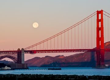
Explore more of California
Discover California: A land of diverse landscapes, iconic cities, and endless adventures, from sun-soaked beaches to towering redwoods and vibrant cultural experiences.
Explore California